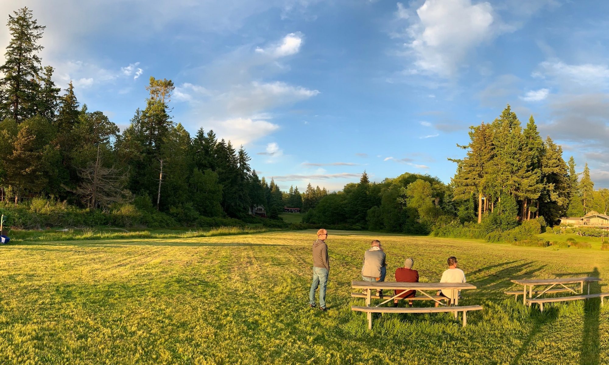
Three amigos and I went on a quick road trip to Leavenworth and Wenatchee on Sunday. We overnighted in Wenatchee.
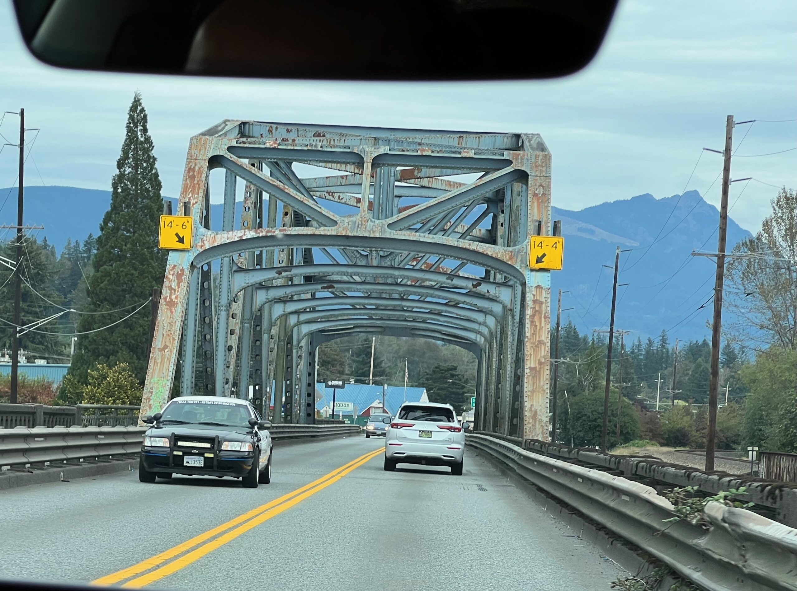
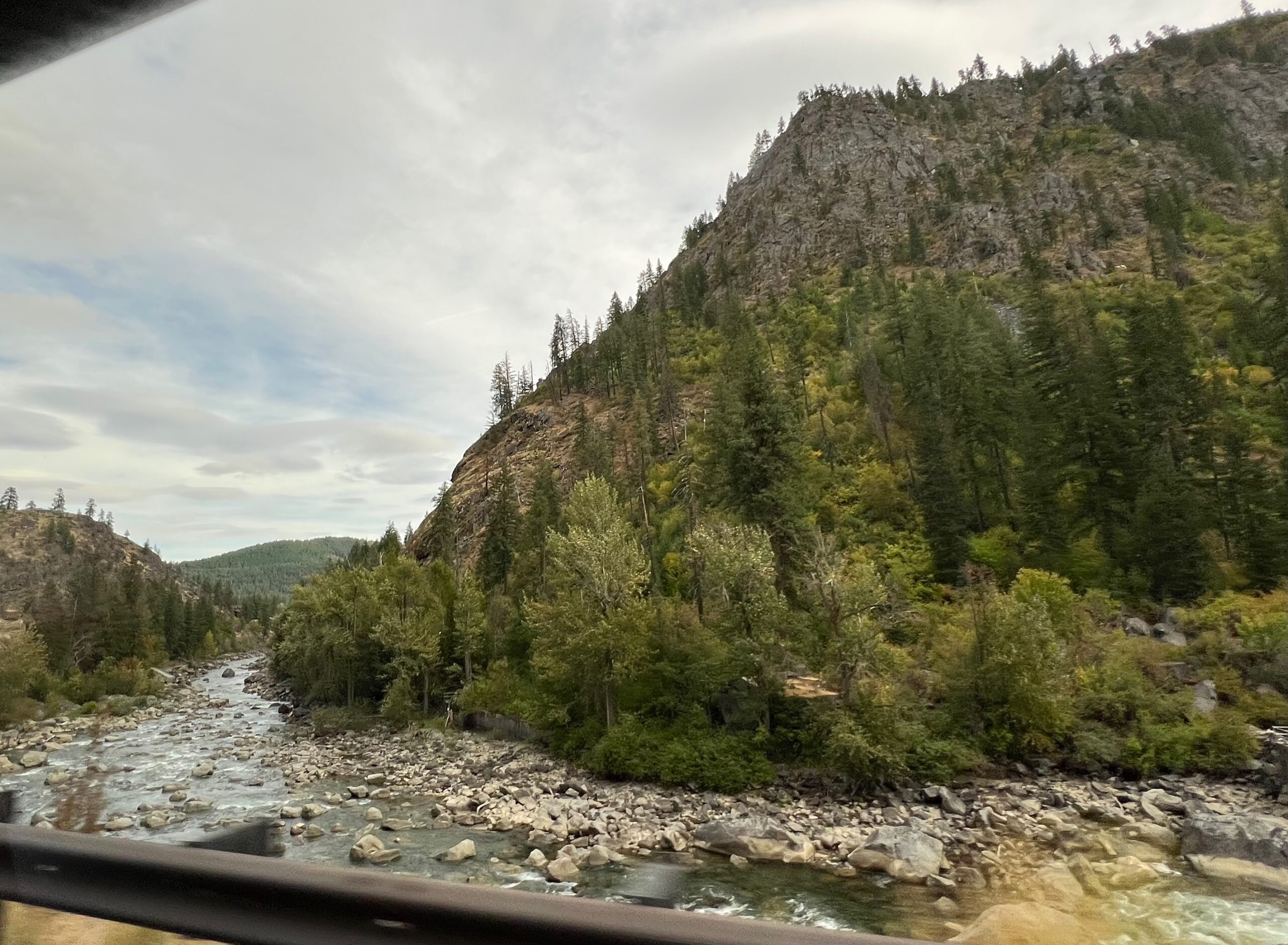
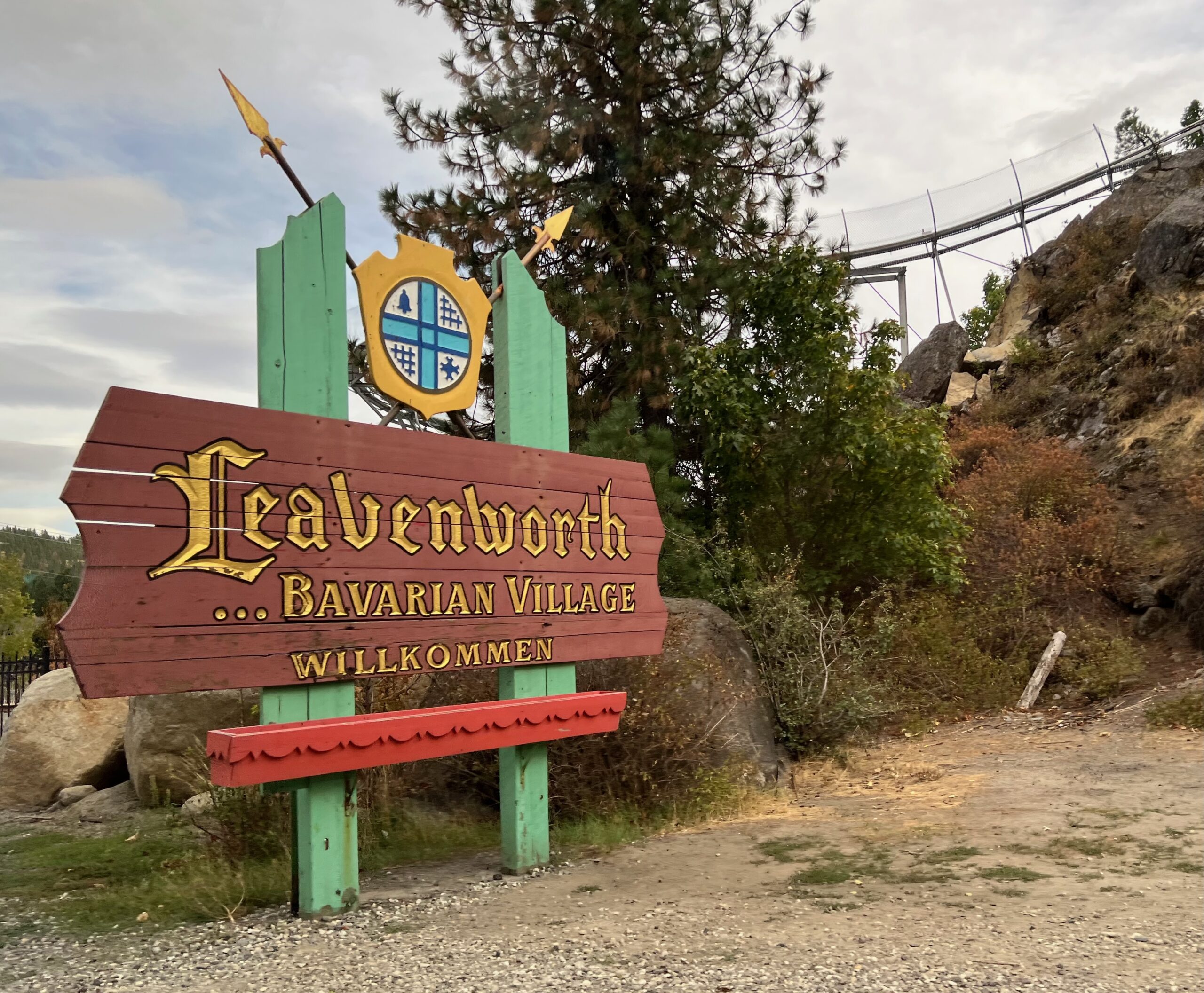
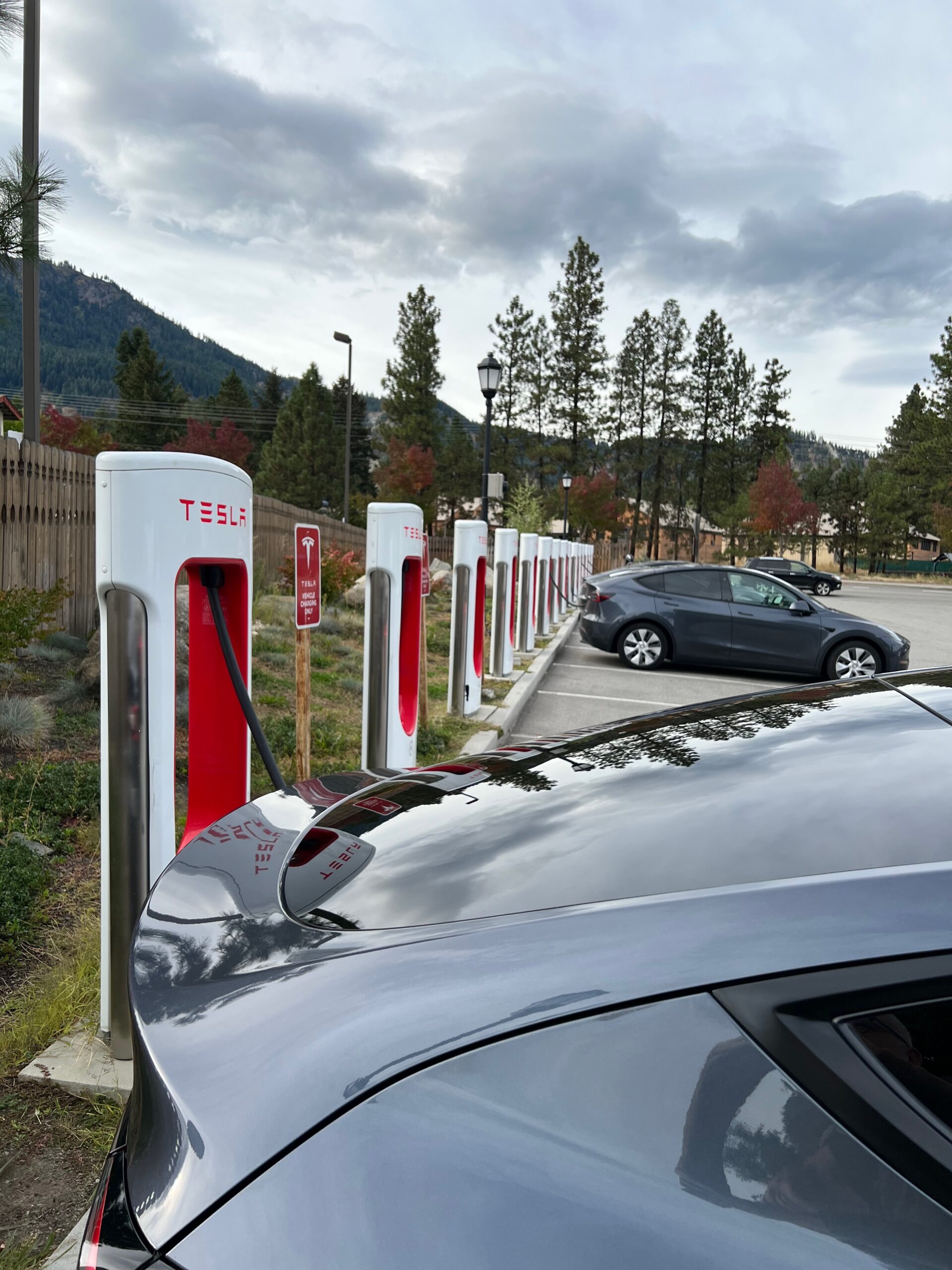
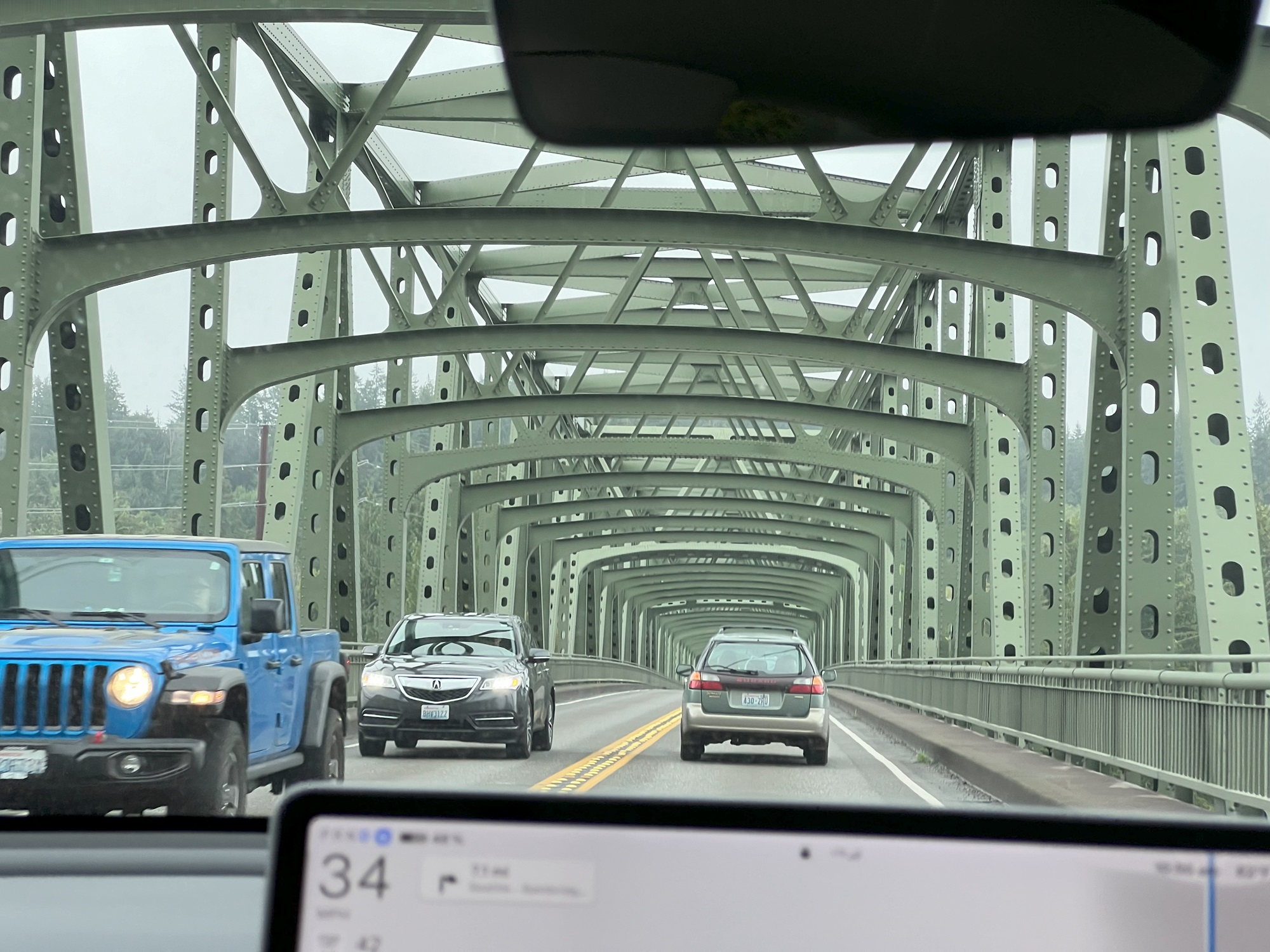
Three amigos picked up the fourth at the Edmonds train station, and from there we drove along Highway 2 (the Stevens Pass Highway) to Monroe, Gold Bar and Leavenworth to reach Wenatchee in Chelan County.We crossed a number of truss bridges on Highway 2. This one is just outside Sultan in Snohomish County, crossing the Skykomish River. It was constructed in 1932. Washington DOT categorizes it as Functionally Obsolete. (Functionally Obsolete: Bridges in this category are typically too narrow, has inadequate under-clearances, has insufficient load-carrying capacity, is poorly aligned with the roadway, and can no longer adequately service today’s traffic).Here is the Wenatchee River seen from Highway 2 as we were approaching Leavenworth from the west.The welcome sign to the Leavenworth Bavarian Village.Charging our Tesla Model Y a little at the supercharger by Dan’s Food Market in Leavenworth. There are16 Superchargers, available 24/7, charge rate up to 150kW.
Here are my pictures of a ride today on the new northbound extension of the Sound Transit light rail system to downtown Lynnwood.
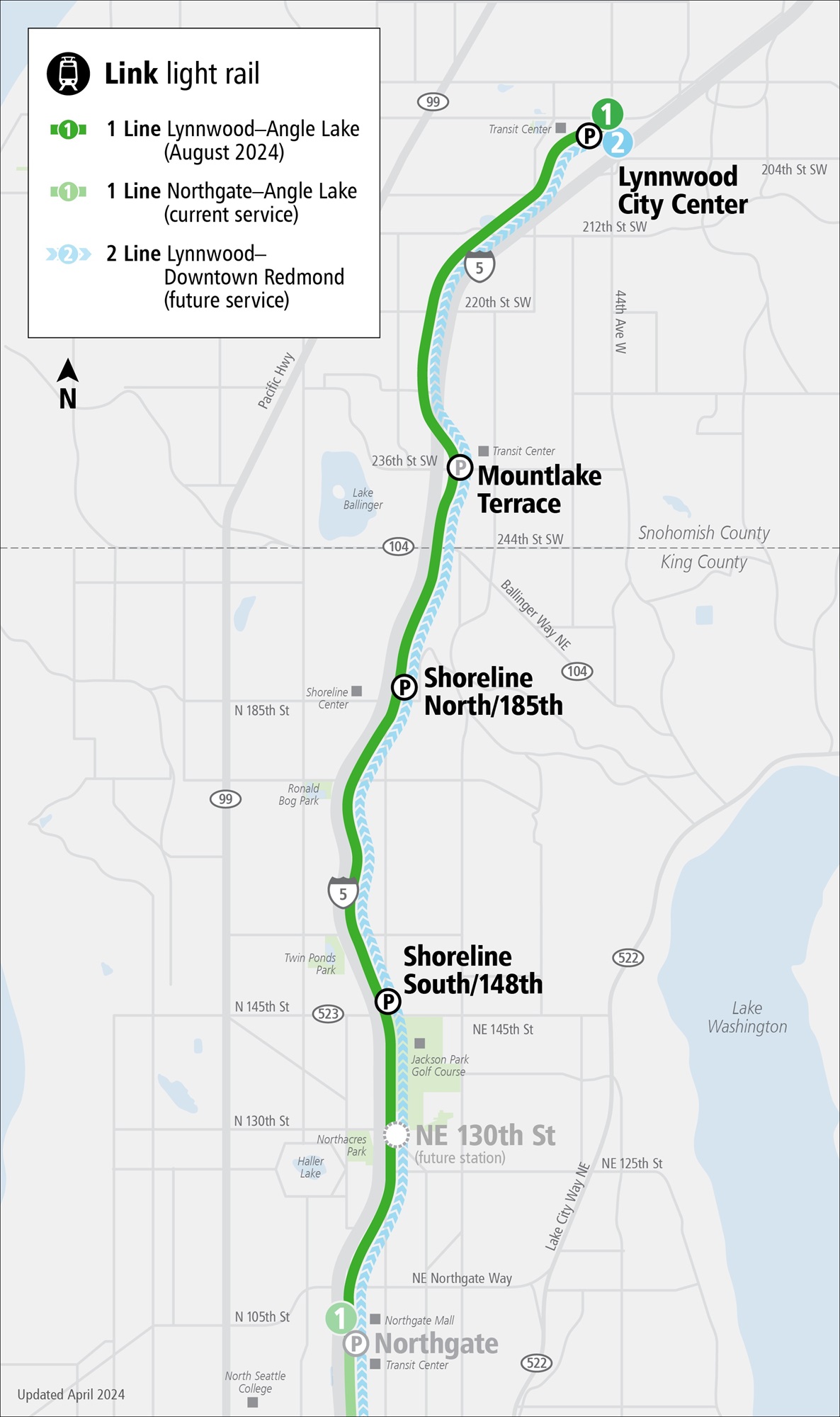
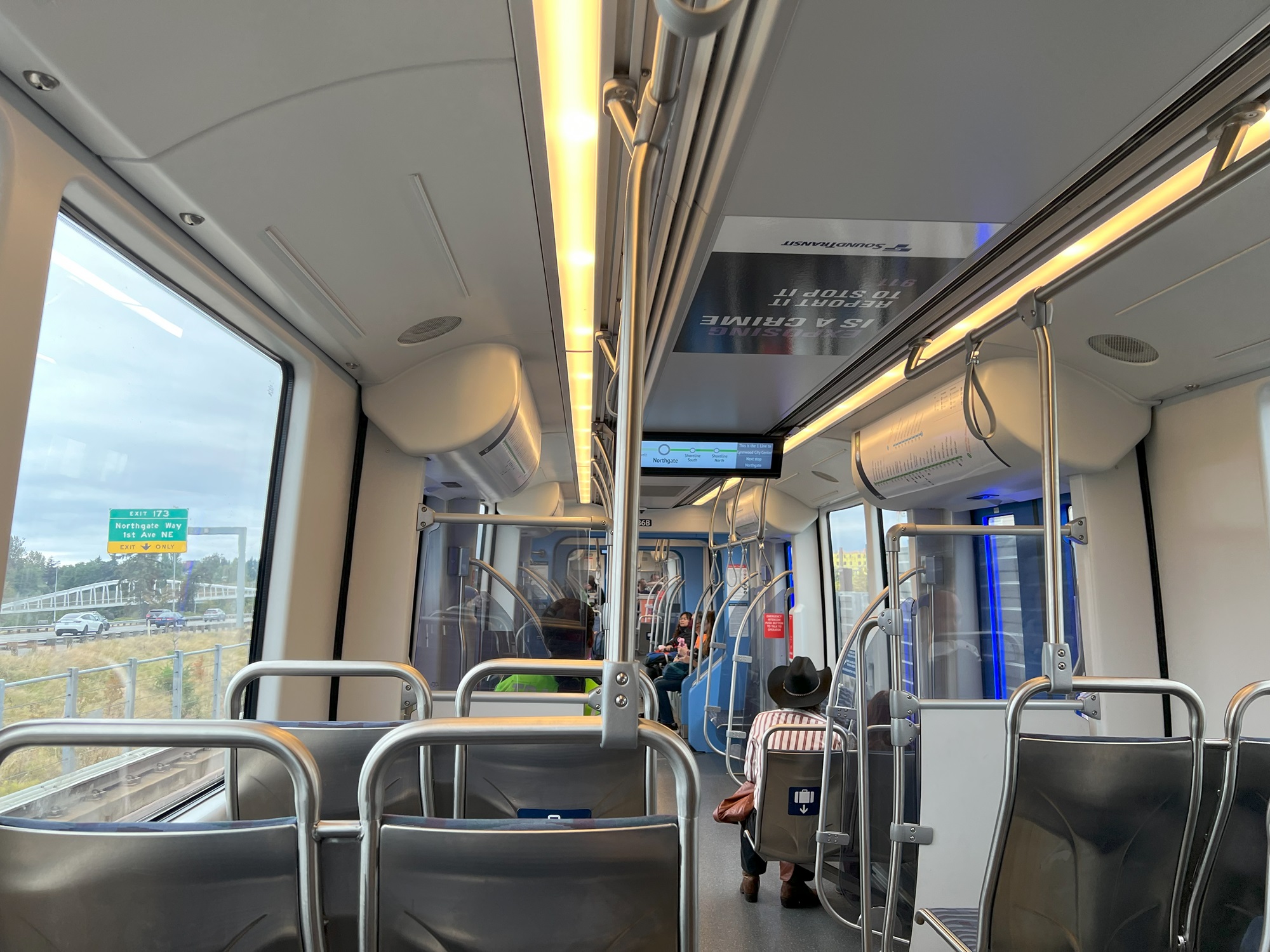
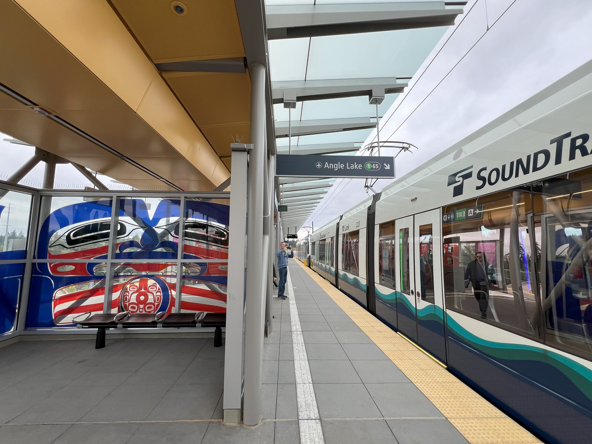
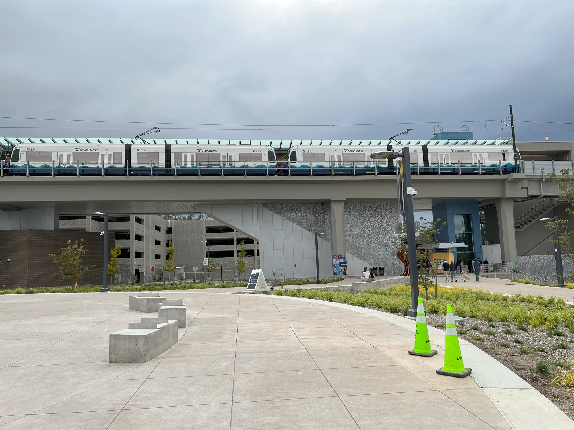
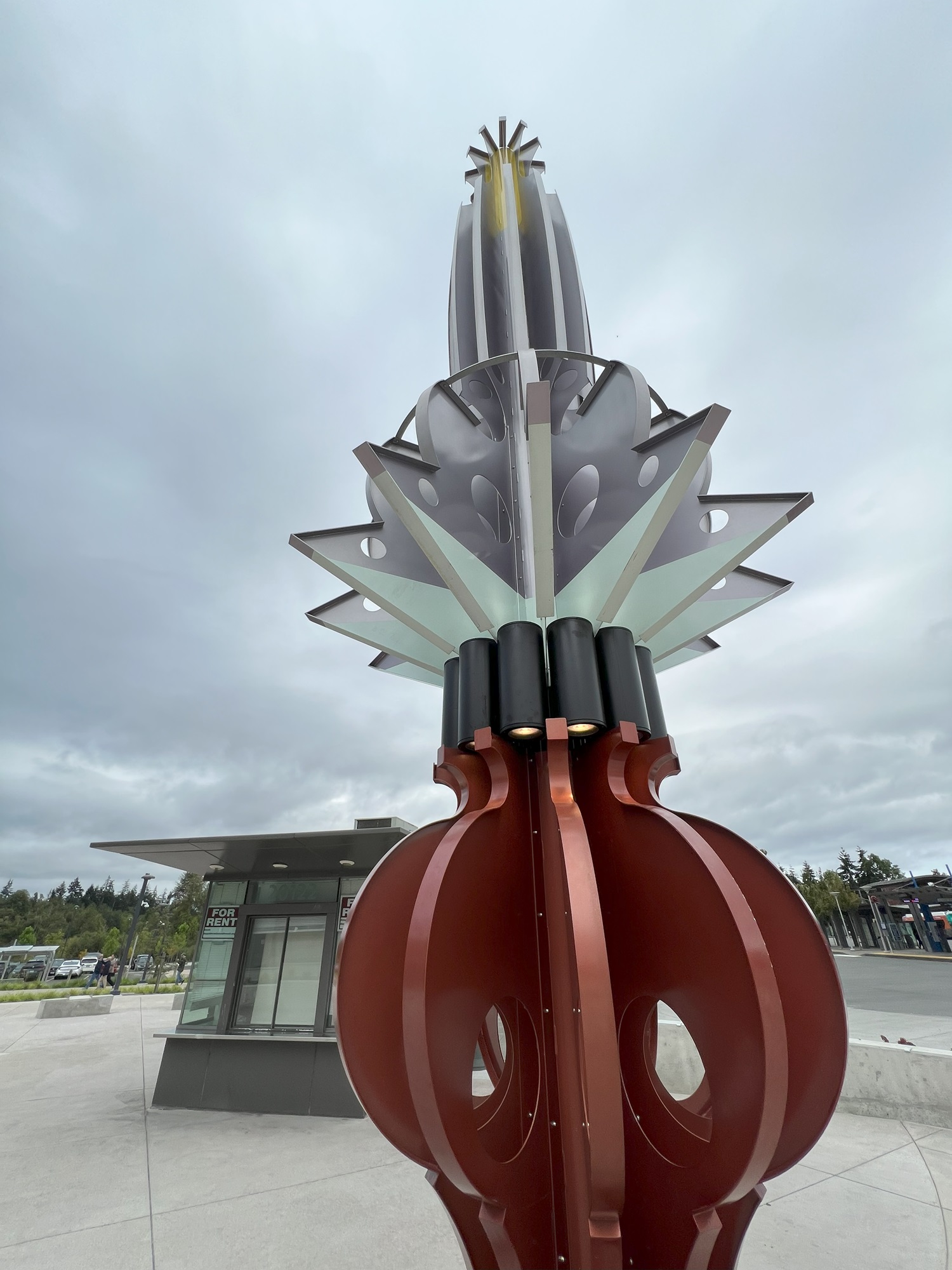
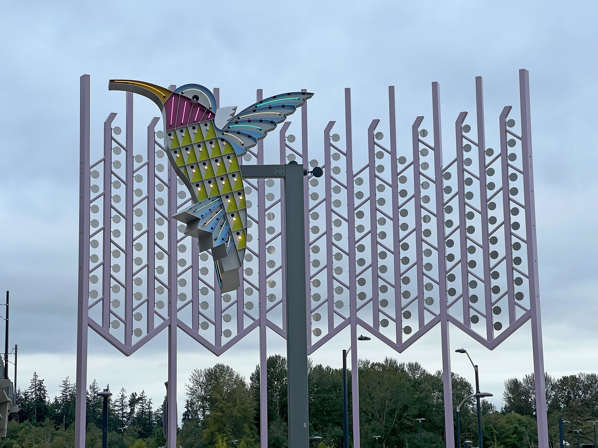
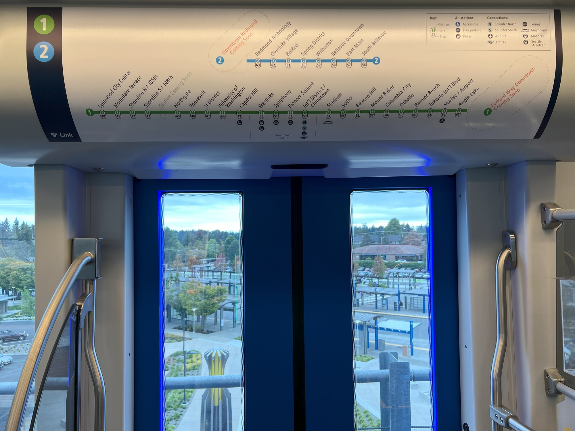
Here it is: the $3 billion extension from Northgate to Lynnwood with four new stations, 16 years in the making. Voters approved it with along with Obama’s election in 2008; planning was done from 2010-2016, design from 2016-2019, and construction from 2019-2024. The 1 Line extension hugs 8½ miles of Interstate 5 and crosses over it north of the Mountlake terrace station. A fifth station will open in 2026 at NE 130th Street. [Map from Sound Transit website]Northbound and approaching the existing Northgate station here. Interstate 5 traffic on the left. Much of the extension is elevated compared to Interstate 5, though, due to the uneven terrain there.Here is the view from the elevated rail and platform at the Lynnwood City Center station. There is a large parking garage at the back (not visible here), a parking lot on the left, and the canopies and bus stops of the Lynnwood Transit Center. Buses can be taken from here to Everett in the north, or to either of the ferry terminals at Edmonds and Mukilteo.Glass mural artwork on the boarding platform at the Lynnwood City Center station. The artist is Preston Singletary. The art was inspired by his Tlingit heritage and family, and influenced by his father’s recent death.Here’s the train at the Lynnwood City Center station, with the parking garage at the back of it.One of two identical sculptures called “Shift” down on the grounds below. The artist is Claudia Fitch and are a nod to the lamps from Lynnwood’s Interurban trolley system, which operated from 1910 to 1939.Here is Claudia Fitch’s “City Hummingbird” and “Kitchen Window Curtain” at Lynnwood City Center Station, to honor the history of neon road signs that once lined Highway 99 as well as the nature Pacific Northwesterners see in their own backyards. [Description of artwork and text from Seattle Times]Getting ready for the 30-minute ride back to Capitol Hill train station. The overhead graphic of the 2 Line (blue) and 1 Line (green) shows that more stations will open in the near future. Stations have numeric identifiers as well, which should make it easier for foreign language speakers and visitors to find the stations that they need to use.A peek into the future, looking at a little section of rail north of Lynnwood City Center station that has already been constructed. The next push north is scheduled for 2037 with stops at West Alderwood near the mall, Ash Way, Mariner, Highway 99 in South Everett (possibly) and Southwest Everett Industrial Center near Paine Field. Two final stations at Evergreen Way and downtown Everett are aimed for 2041, depending on funding.
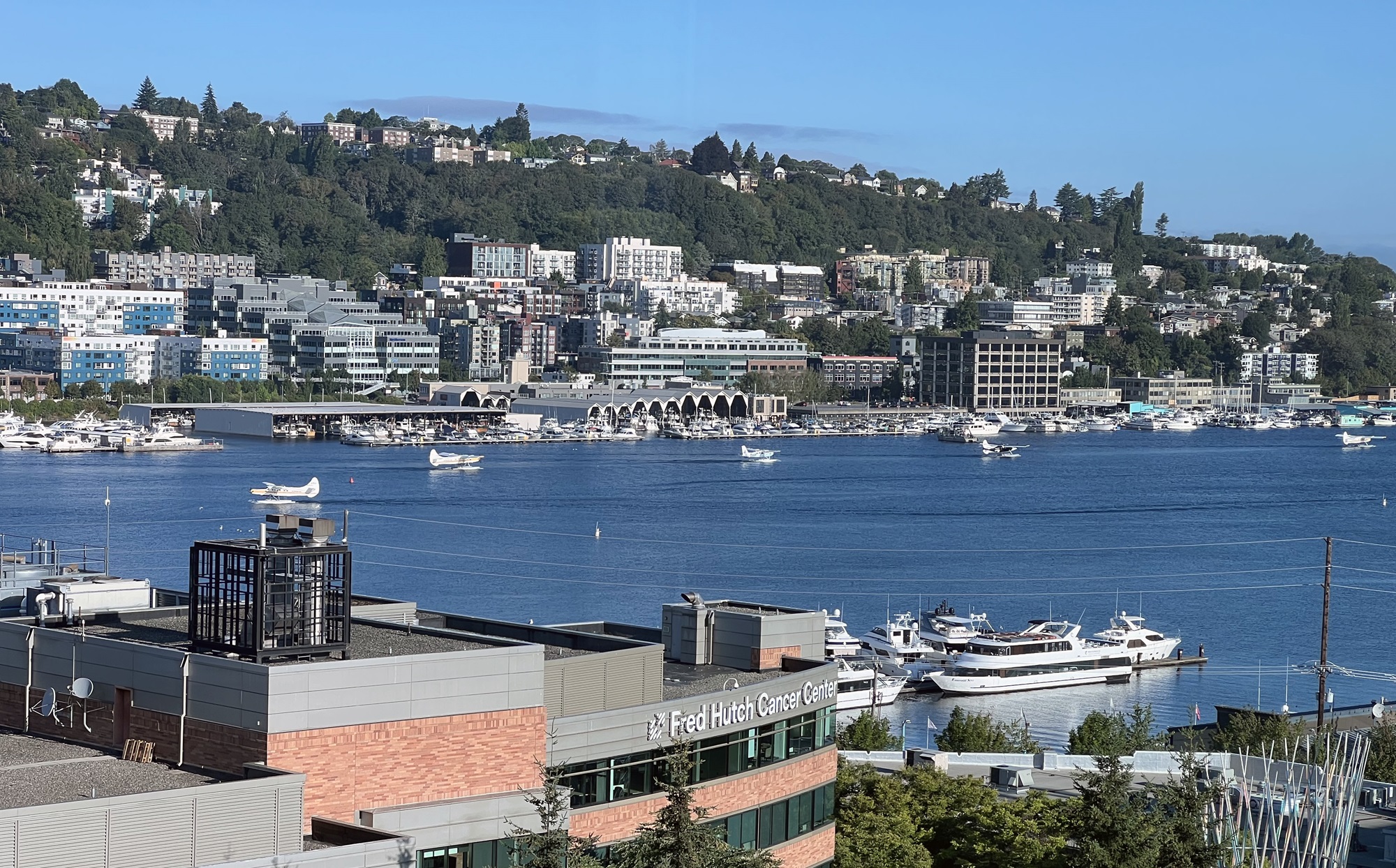
Here’s a beautiful view from this morning, of the south end of Lake Union.
I took the picture from the seventh floor of a building off Fairview Avenue North.
At about 8.15 am this morning, there was a line of five float planes getting ready to take off (four are in the picture), and one that had just come in. Those taking off could be heading the San Juan Islands, or even to Vancouver Island or British Columbia’s Inside Passage.
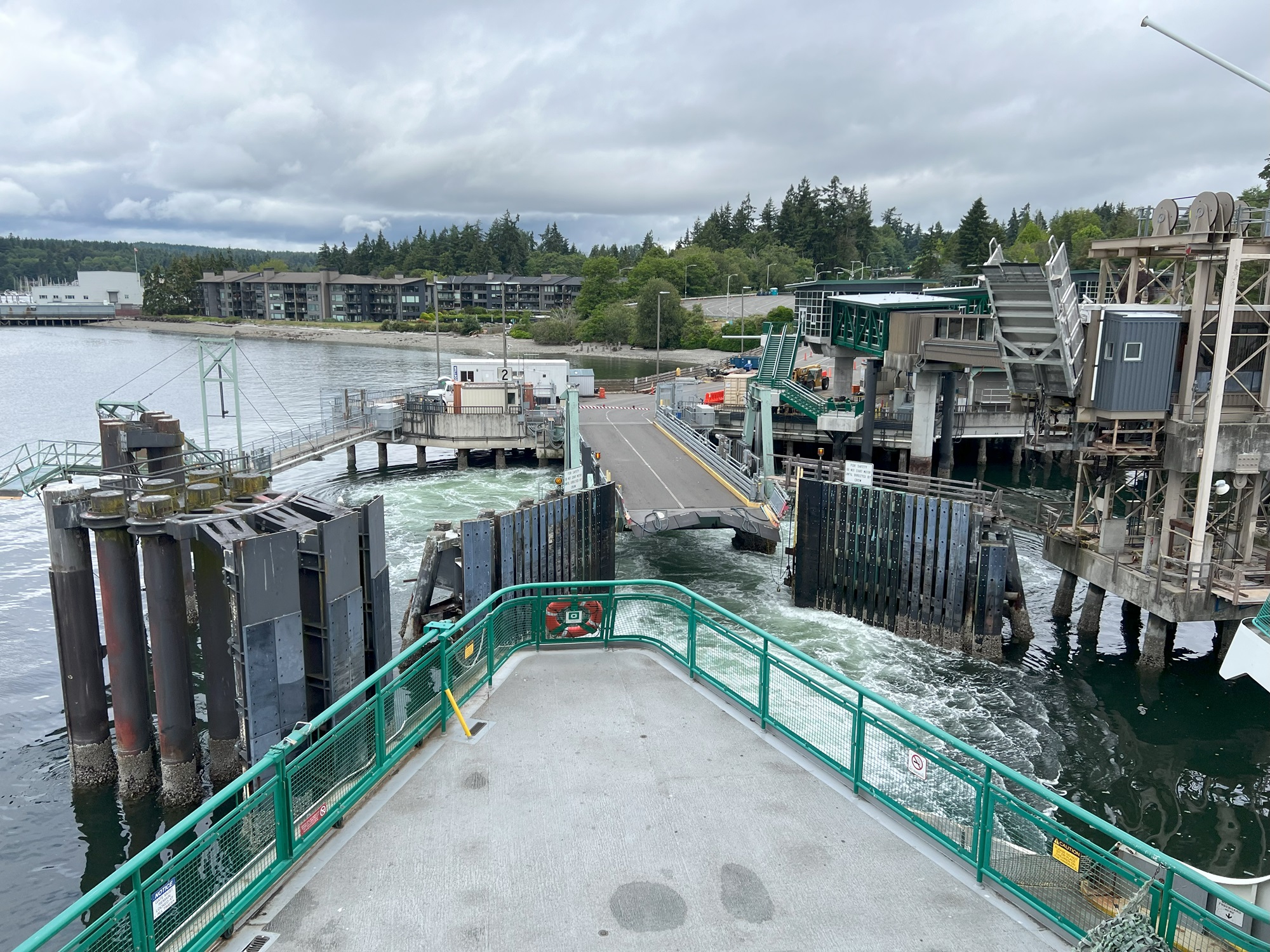
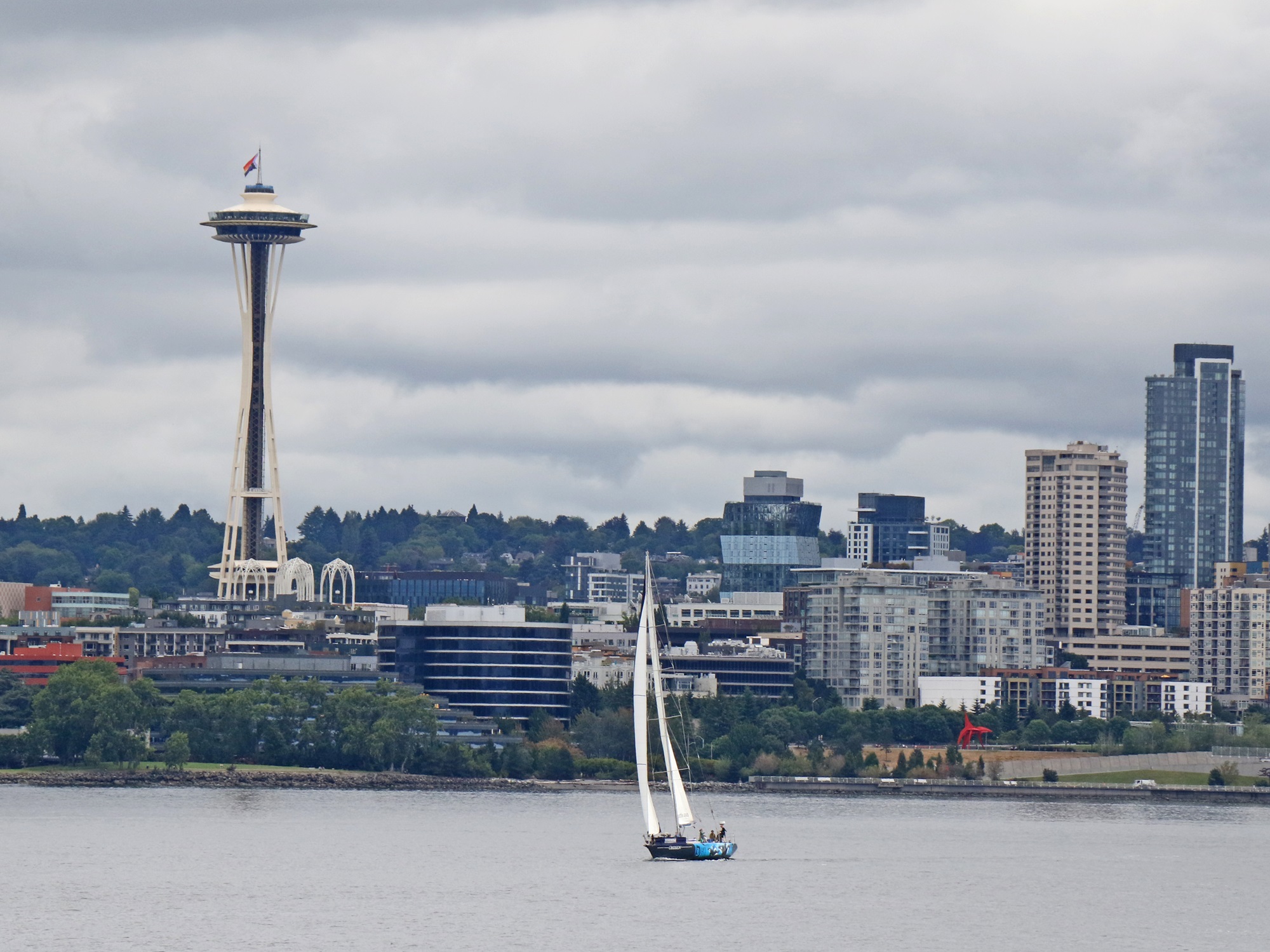
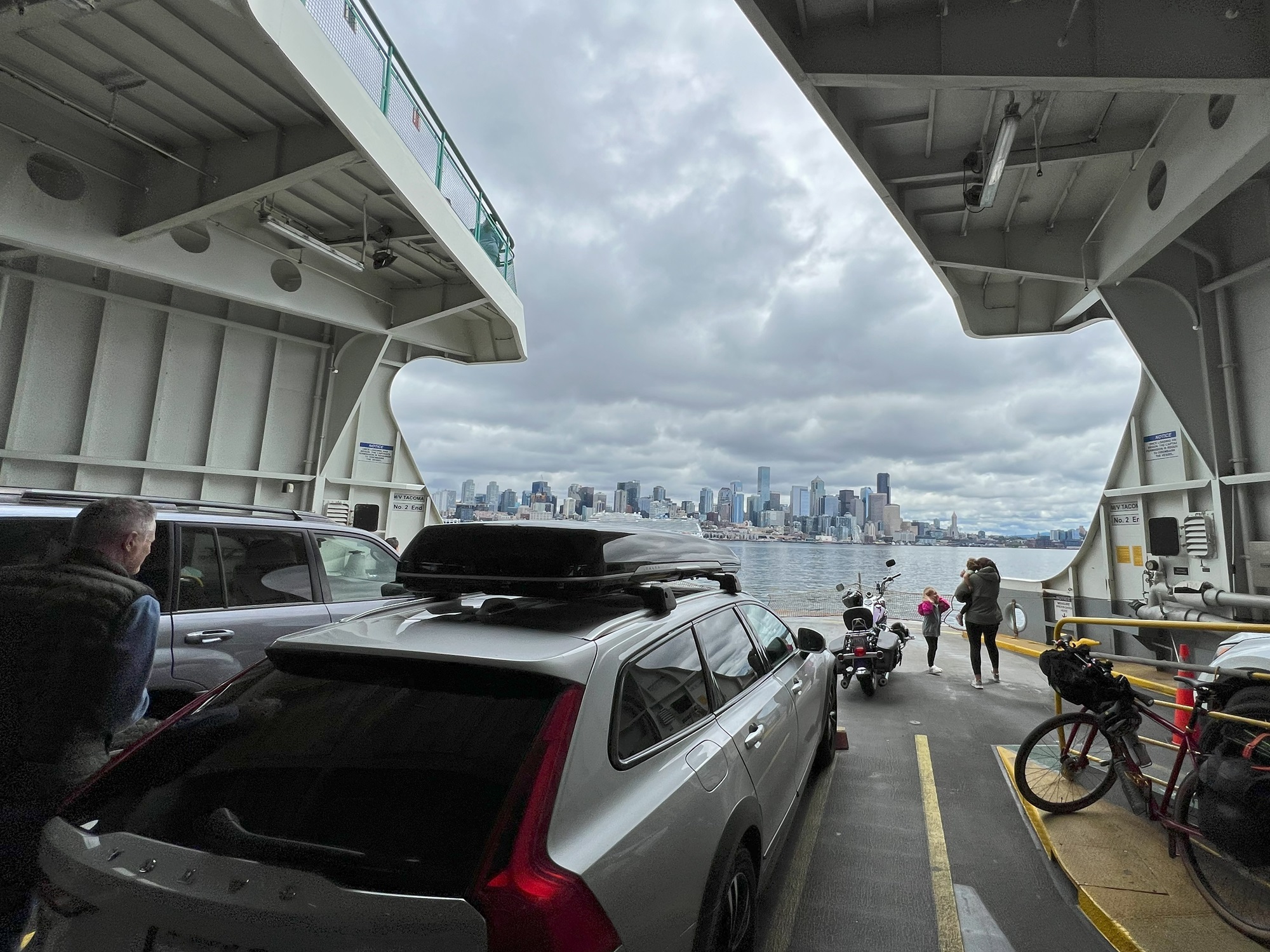
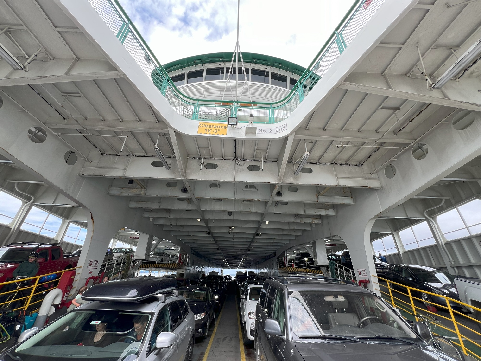
Our weekend on Kitsap Peninsula was over, and we took the Bainbridge-Seattle ferry to get back to the city late this morning.
The Agate Pass Bridge (steel truss bridge built in the 1950s) on Highway 305 connects Kitsap Peninsula with Bainbridge Island.Here is our departure from the Bainbridge Island Ferry Terminal. The new overhead pedestrian walkway for walk-on passengers (on the right, middle of picture) opened in February. The seismically safe steel-fortified walkway set on concrete and steel columns replaced a 50-year-old wood-supported walkway.We could see this seagull’s nest from the ferry (in one of the terminal pillars) but it was hard to see all of the spotted chick/s in the nest.Approaching the Emerald City and there is the rainbow flag on the Space Needle. The annual Pride Parade was underway in downtown as we arrived at the Seattle ferry terminal. This year is the 50th anniversary of the first Pride parade in Seattle in 1974. 🌈 Happy Pride!A view of the city skyline from the lower car-deck on the ferry.We sailed on Marine Vessel Tacoma. She is a Jumbo Mark II class ferry, constructed in 1997, and can accommodate 2,500 walk-on passengers and 202 vehicles.
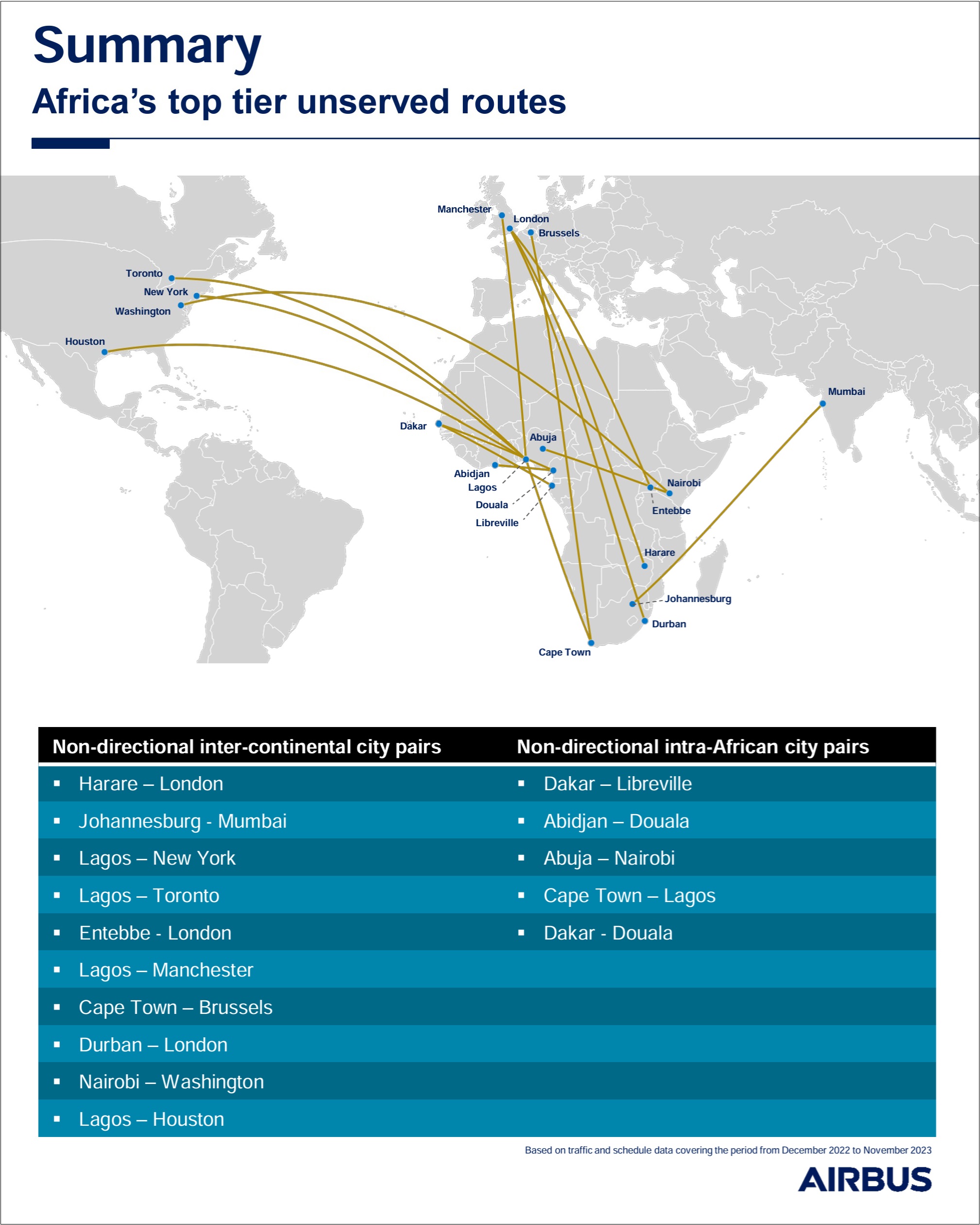
Airbus has released the results of a study that documents which air routes to African cities are underserved (extracts from the report below).
Factors at play are constraints on the number of flights due to bilateral agreements that are in place, challenges with capacity at airports, and economic variables such as the profitability of these routes.
Just in general, Airbus reports that the expectation is for air travel worldwide to increase by about 4.1% over the next 20 years, which would mean some 1,180 new aircraft need to be built, and 15,000 additional pilots would be needed.
It looks like Johannesburg is seen by Airbus to be adequately served by direct flights from Europe, but that a few more direct flights from Europe to Cape Town should be added. Is it technically possible to fly direct from Seattle to Cape Town (10,200 miles)? I’m not sure it is. Maybe. From cabinzero.com, as of Aug. 2023: At the moment, the world’s longest nonstop flight is the route between New York and Singapore. With a calculated distance of 15,349 km (9,537 miles) and almost 19 hours of flying, the route operated by Singapore Airlines is the longest in the world.
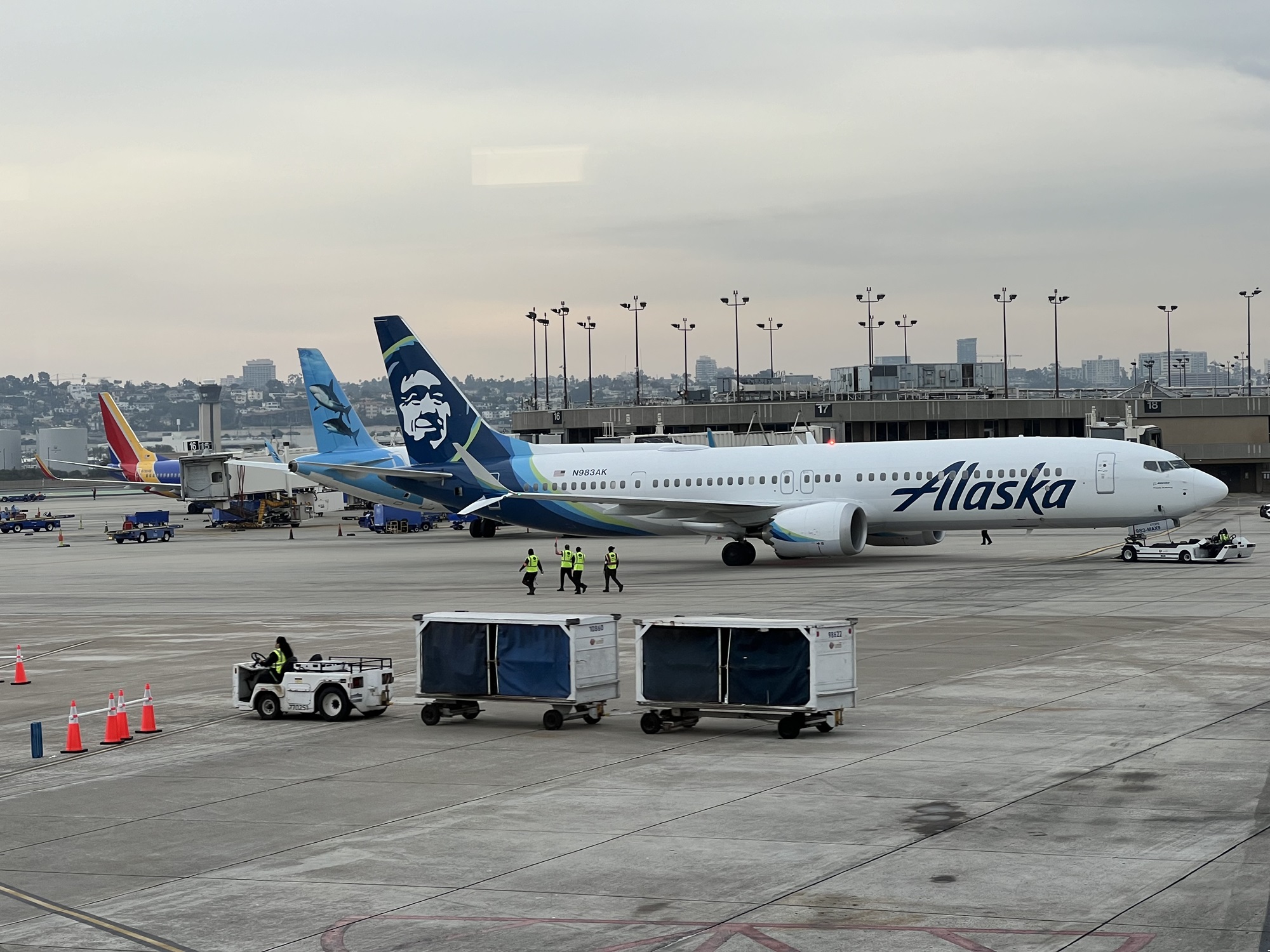
My weekend in San Diego and California was over on Monday morning, and I took Alaska Air back to Seattle.
Palm trees lining West Laurel Street, with San Diego International Airport coming up on the left.Looking out the window from inside Terminal 2. The Alaska Airlines aircraft with the smiling Inuit face on the tail is getting a pushback from the gate. It is heading out to Newark Liberty International airport, all the way to the East Coast in Newark, New Jersey (a 5 hour flight). Behind it, with two great white sharks on the tailfin, is a Frontier Airlines plane, and at the back the colors of a Southwest Airlines plane.
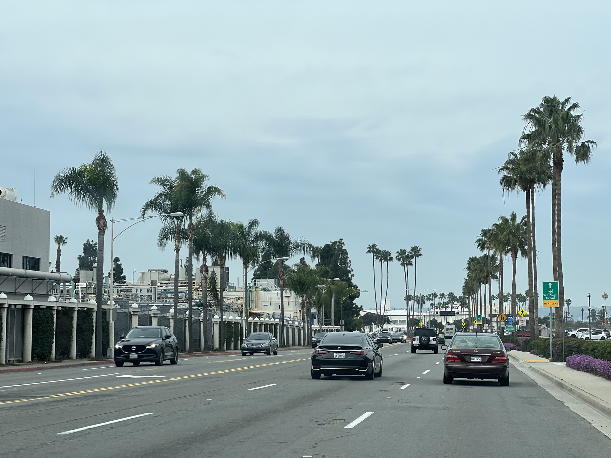
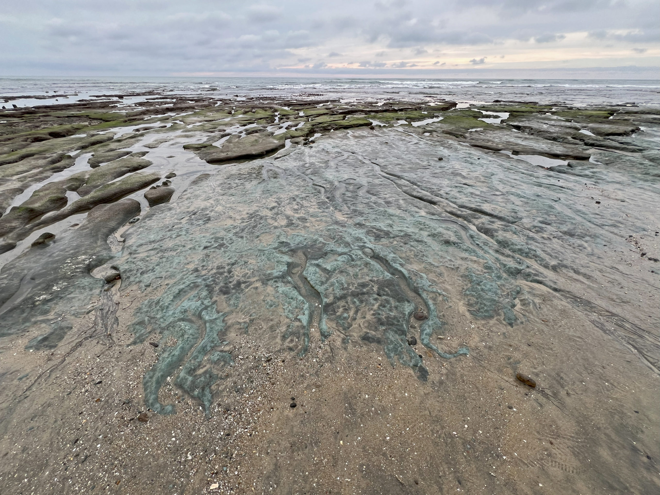
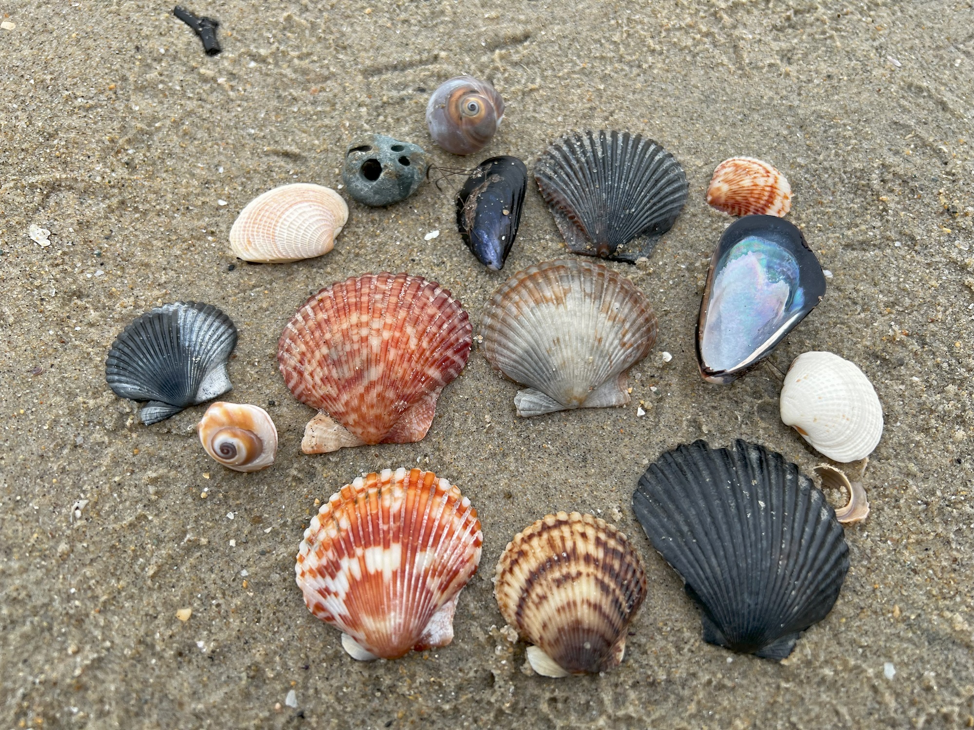
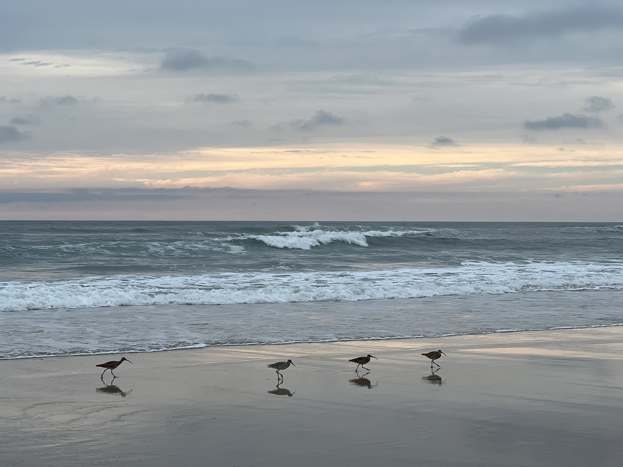
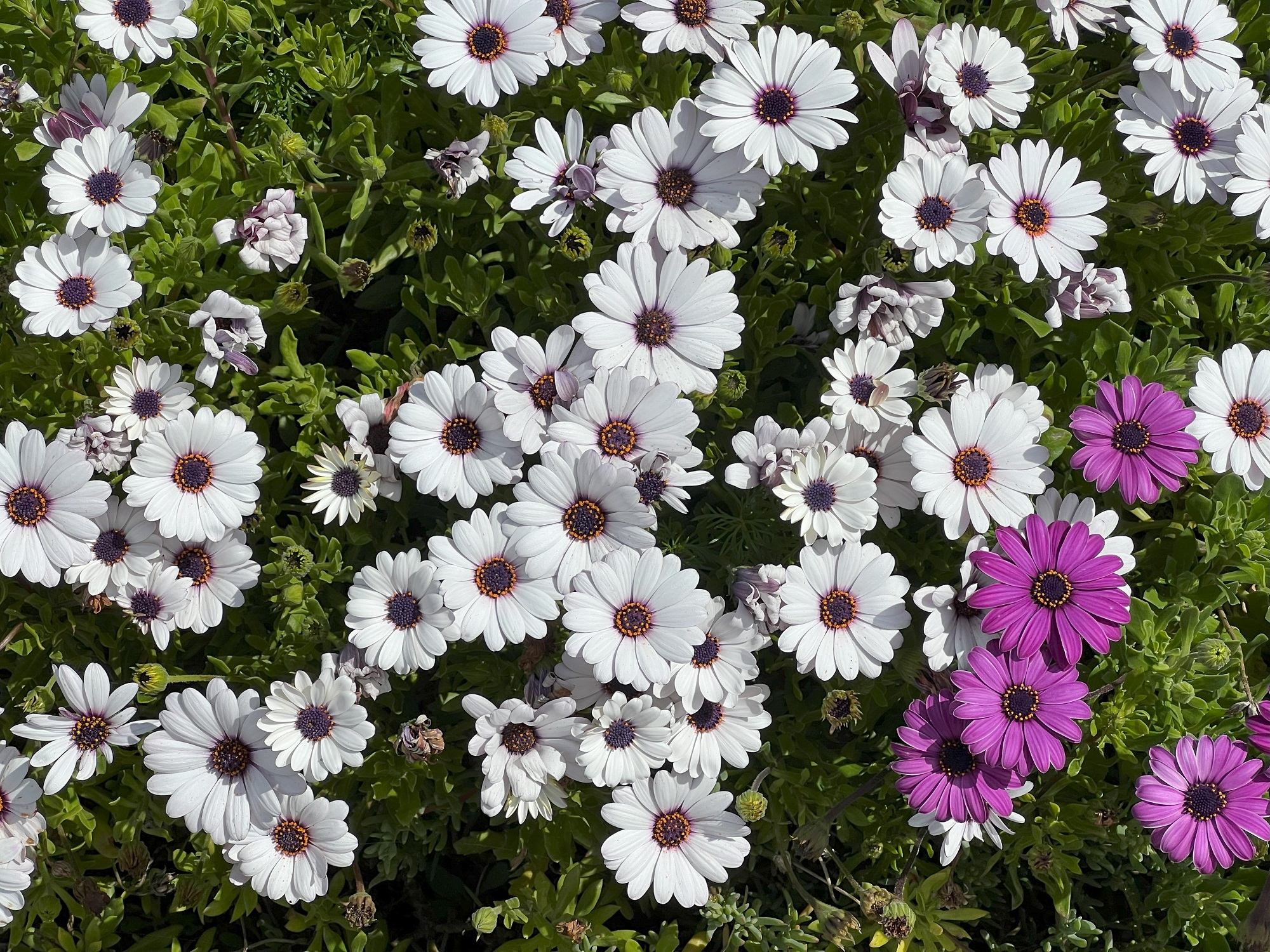
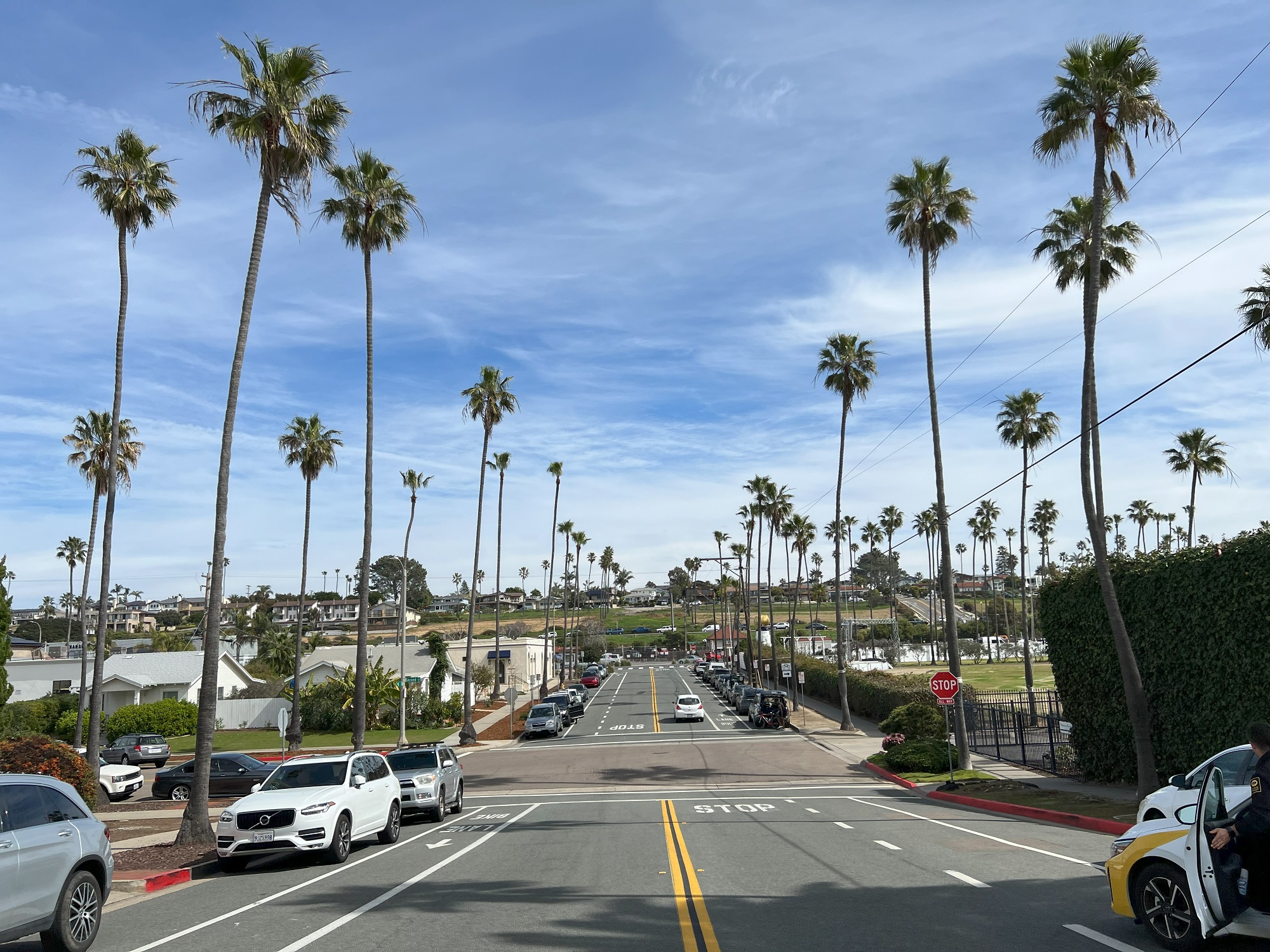
Here are today’s pictures— from the Del Mar area north of San Diego.
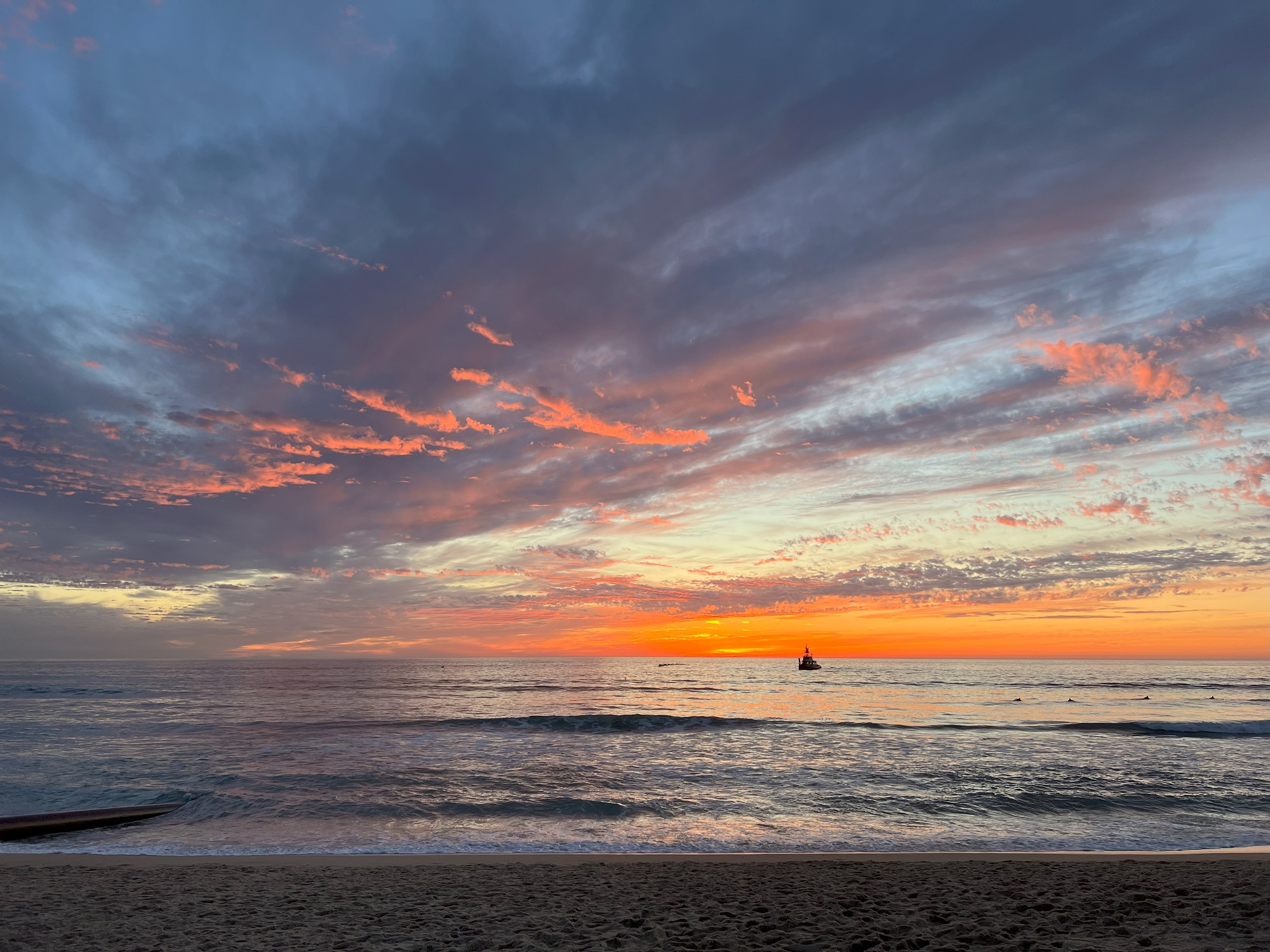
Nala the house cat posing for us since it is Caturday.Hawaiian Red Anthuriums at Swami Seaside Park in Encinitas.Daisies at Swami Seaside Park in Encinitas.Koi in the pond at Swami Seaside Park in Encinitas.Blue skies and palm trees outside Swami Seaside Park in Encinitas.It was a perfect day for surfing off the beaches at Encinitas.On the beach at Fletcher Cove State Park. The sand behind us has been moved there by a huge dredging and pumping operation, funded by money from the Biden Administration’s Bipartisan Infrastructure Law of 2023.And here is the sunset that we came to see, from the beach at Fletcher Cove State Park.
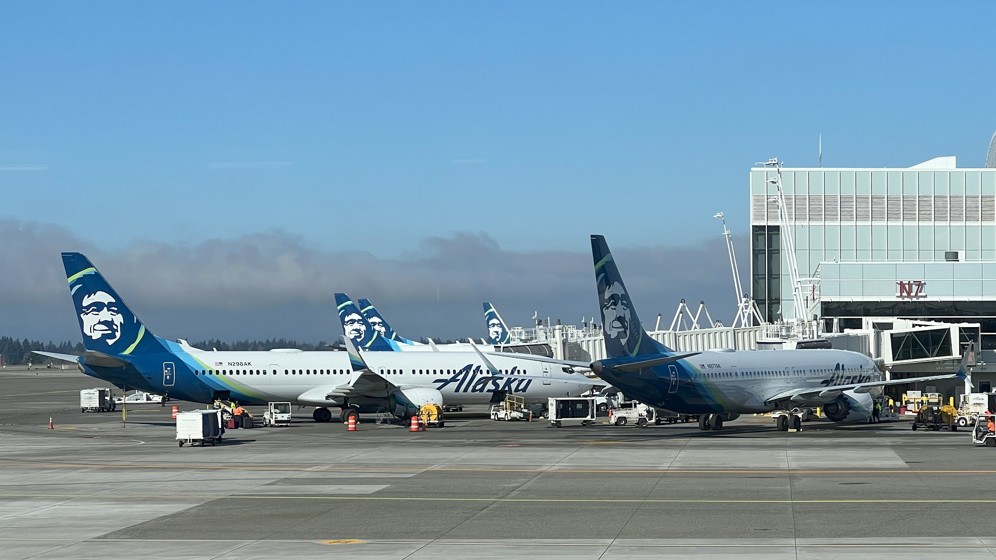
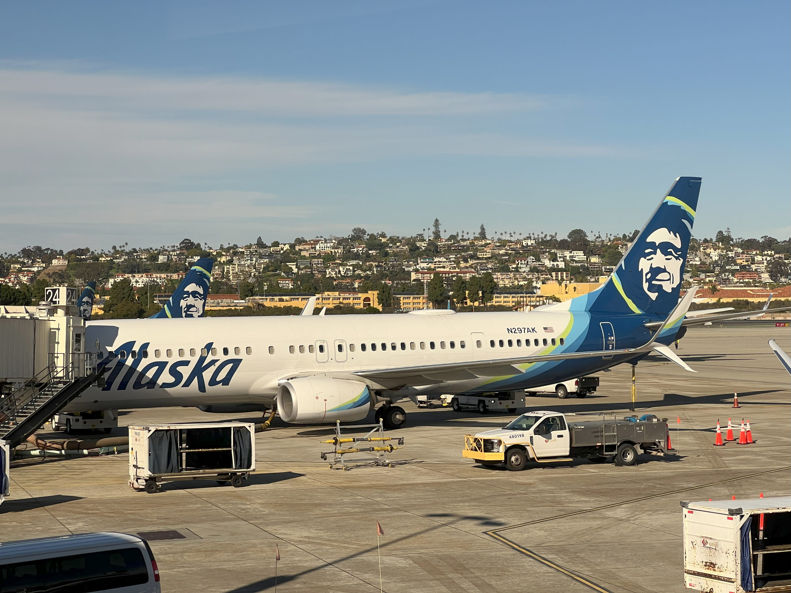
I am at Seattle-Tacoma airport, at the D gates, and looking at the Alaska Air tailfins at the North Terminal. The airport was shrouded in fog early on Friday morning, but by noon it was clear.At the gate in San Diego airport, after a 2 hr 43 min flight. Our magnificent flying machine was a Boeing 737-900 (twin-jet), and our flight went without incident. This aircraft was put in service in 2016, so it is 8 years old.
Happy Friday.
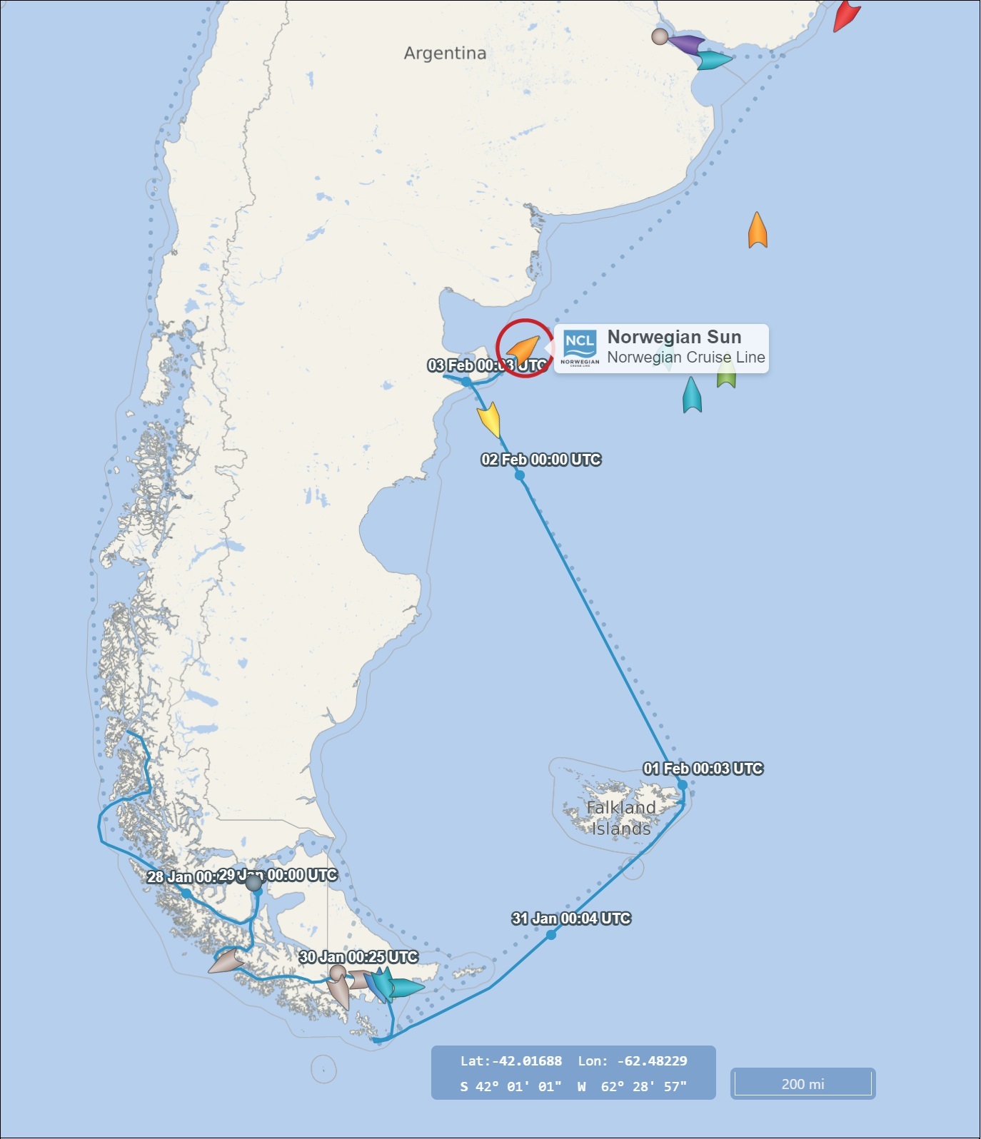
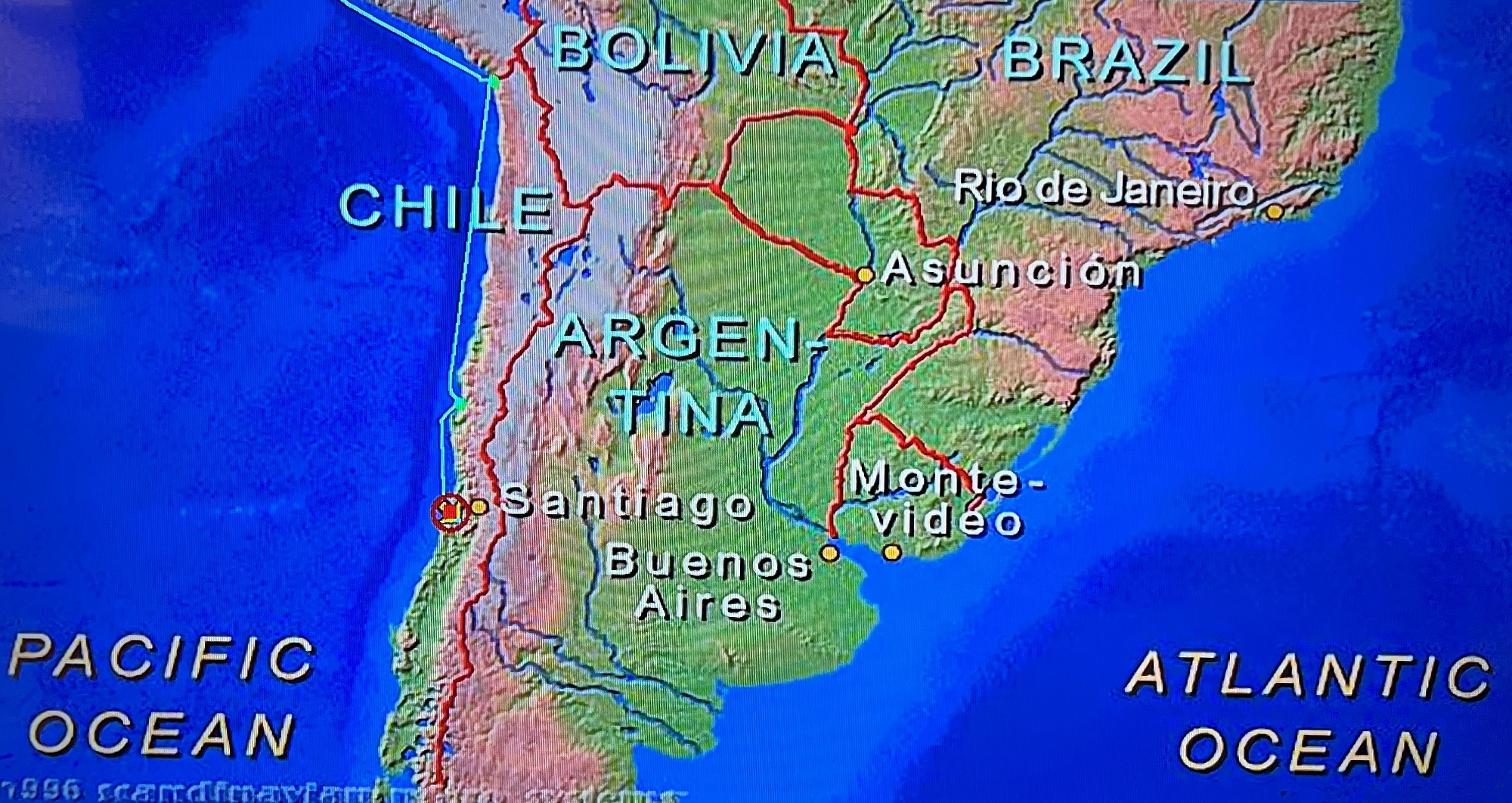
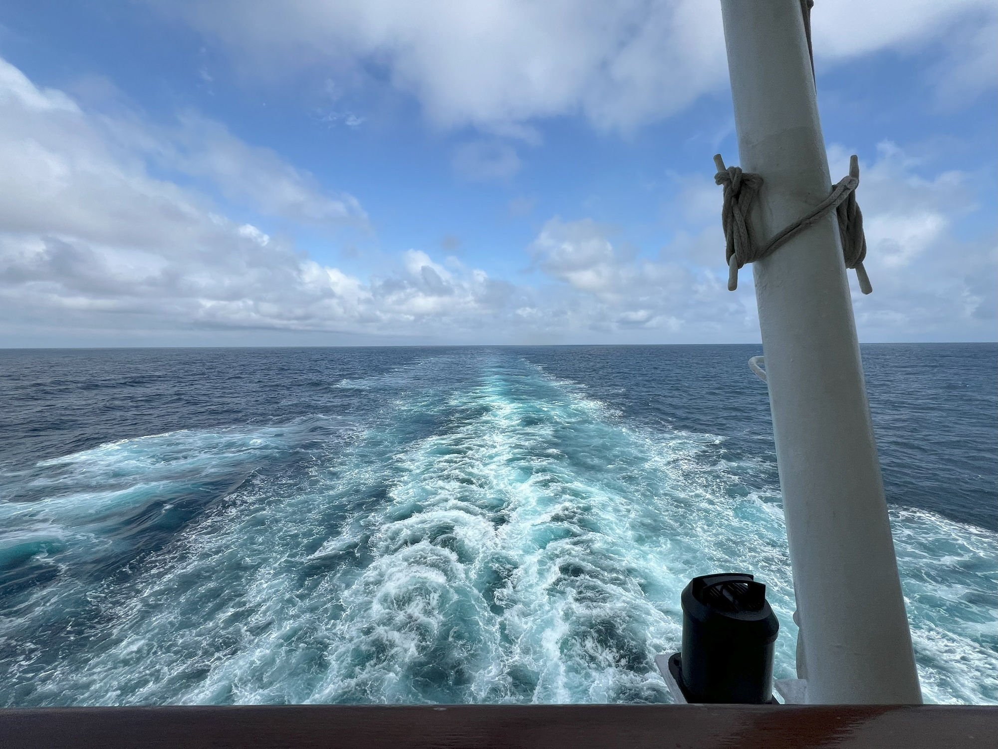
I have been keeping tabs on the Norwegian Sun every few days, ever since I had stepped off the ship eleven days ago.
She left the Falkland Islands yesterday and is headed for Punta del Este in Uruguay. She will arrive there on Sunday (the dotted line).
From there it is just over 90 nautical miles (about 100 miles) to the port of Buenos Aires in Argentina, for the completion of the 14-night sailing out of San Antonio, Chile.
Map and route of Norwegian Sun depicted by cruisemapper.com.
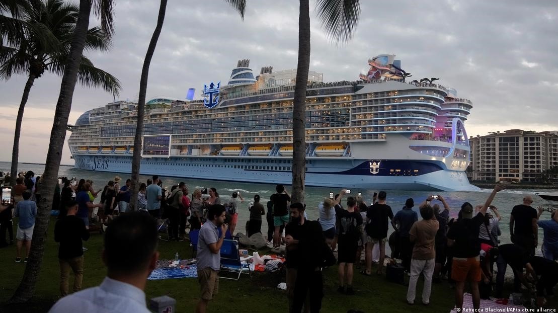
People film and wave from South Pointe Park, as Icon of the Seas, the world’s largest cruise ship, sails out of Port Miami on its first public cruise. [Image: Rebecca Blackwell/AP/picture alliance]The world’s largest cruise ship, Royal Caribbean’s Icon of the Seas, began its maiden journey on Saturday as it set sail from Port of Miami in the US. The vessel runs nearly 1,200 feet (365 meters) from bow to stern. The ship— which is embarking on a seven-day island-hopping tour through the tropics— was officially christened on Tuesday with help from soccer star Lionel Messi and his Inter Miami teammates.
The Icon was built over a period of 900 days at a shipyard in Turku, Finland. It comprises of 20 decks and can accommodate 7,600 passengers at maximum capacity and a crew of 2,350. There will be 50 musicians and comedians as well as a 16-piece orchestra on board as the ship goes on its sold-out inaugural voyage. The $2 billion (€1.84 billion) Icon features the latest technology and, despite its gigantic size, claims to be more eco-friendly than some smaller cruise ships. The Icon is powered by what the Royal Caribbean Group says is eco-friendly Liquefied Natural Gas (LNG). Some experts, however, say LNG systems can leak damaging amounts of methane gas into the atmosphere.
– Reporting by dw.com
The flights that brought us home to Seattle went without incident.
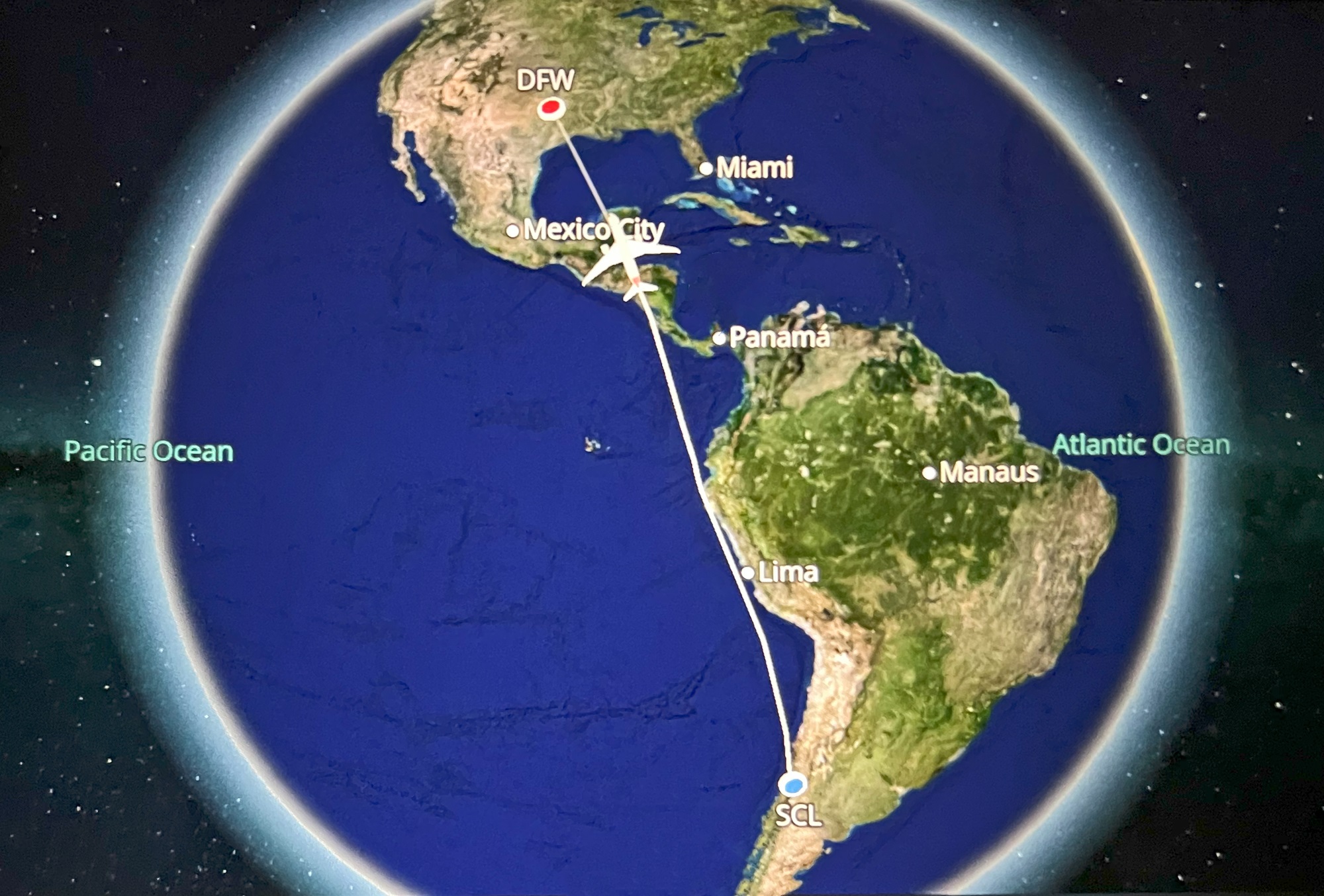
It was 10 hours from Santiago to Dallas-Fort Worth, and then some 4 hours to Seattle.
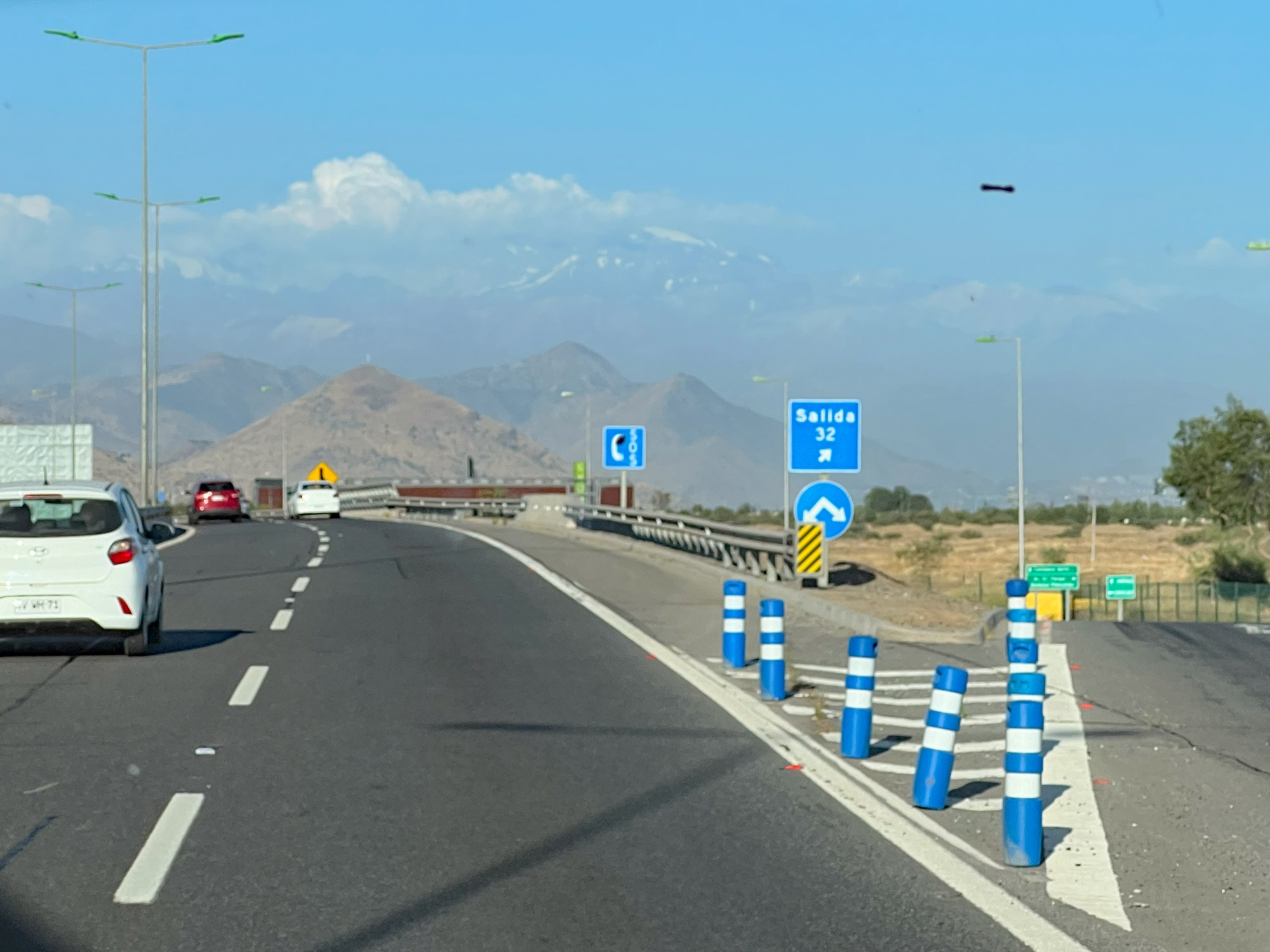
On the way to Santiago International airport, just about 10 miles away from here.
It’s summer at 33° South in the Southern Hemisphere, and only a little snow is visible on the Andes Mountain Range in the distance, only some 50 miles away across the border with Argentina. The Andes Mountains form the longest continental mountain range on the planet.
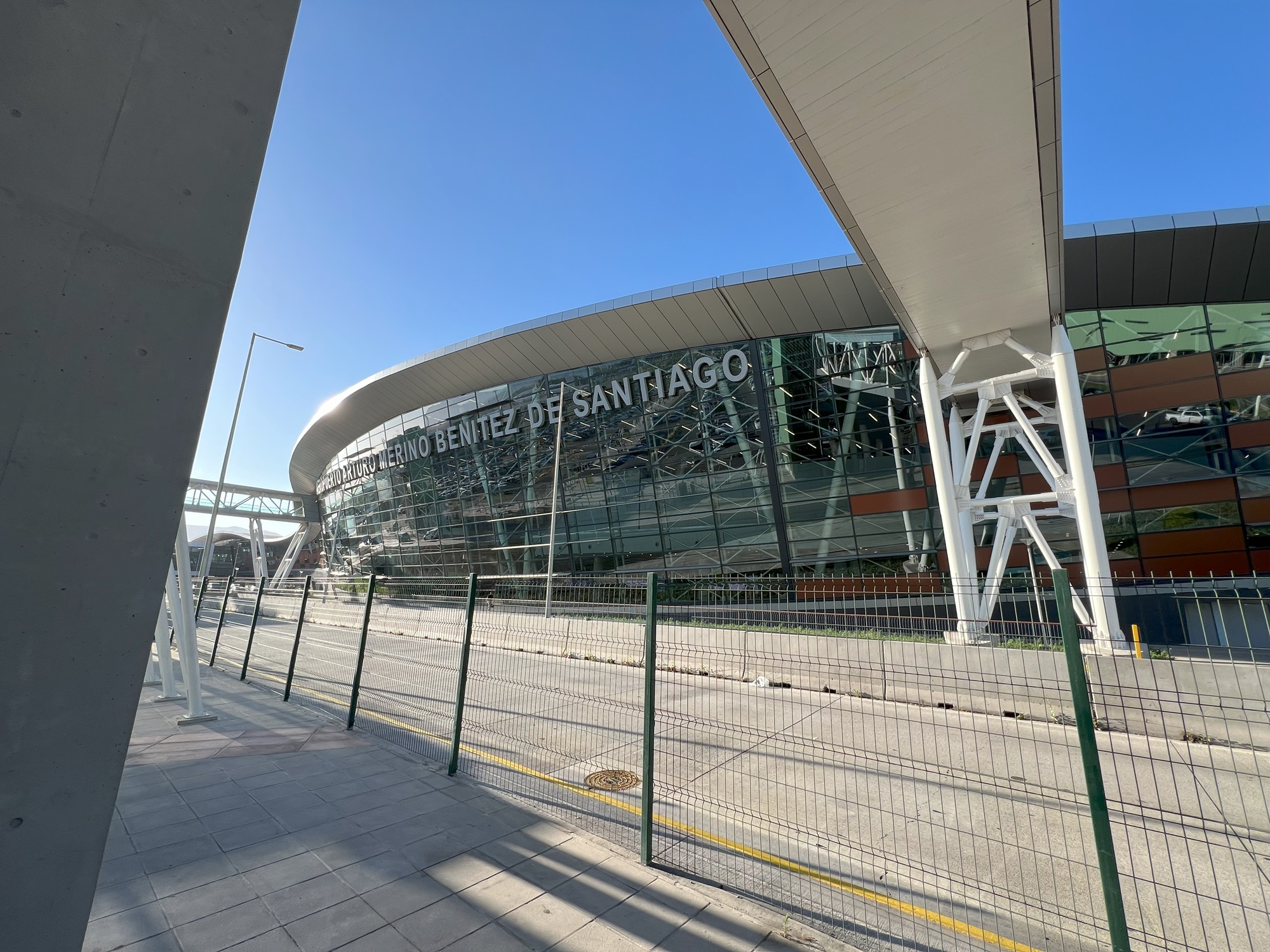
Santiago’s Arturo Merino Benítez International Airport has two terminals: a domestic one and an international one. Santiago International is the longest non-stop destination for most European carriers including Iberia, Air France, and British Airways from their respective hubs in Madrid–Barajas Airport, Paris–Charles de Gaulle, and London–Heathrow Airport.Our flight from Santiago International to Dallas Fort Worth took us by Lima, Peru, across Mexico’s Yucatan peninsula.
We were late off the ship this morning due to a delay with the crew processing our luggage.
So we had to scramble to find a replacement driver that could take us around the area before we head out to Santiago airport for our red-eye flight out to Dallas.
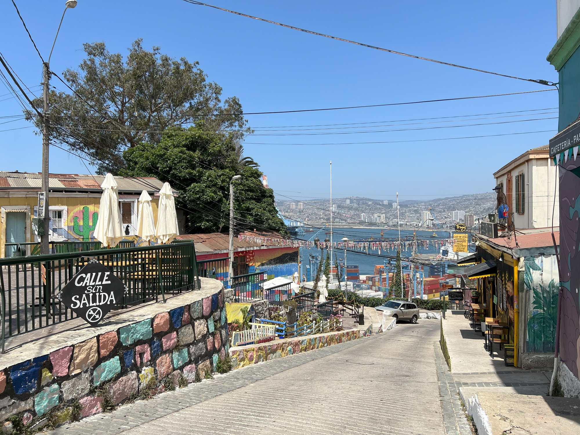
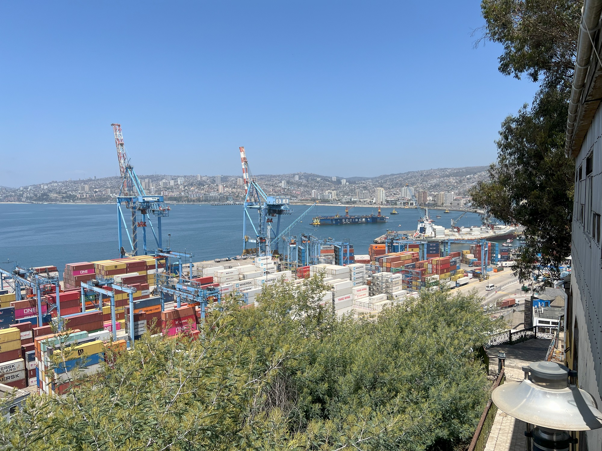
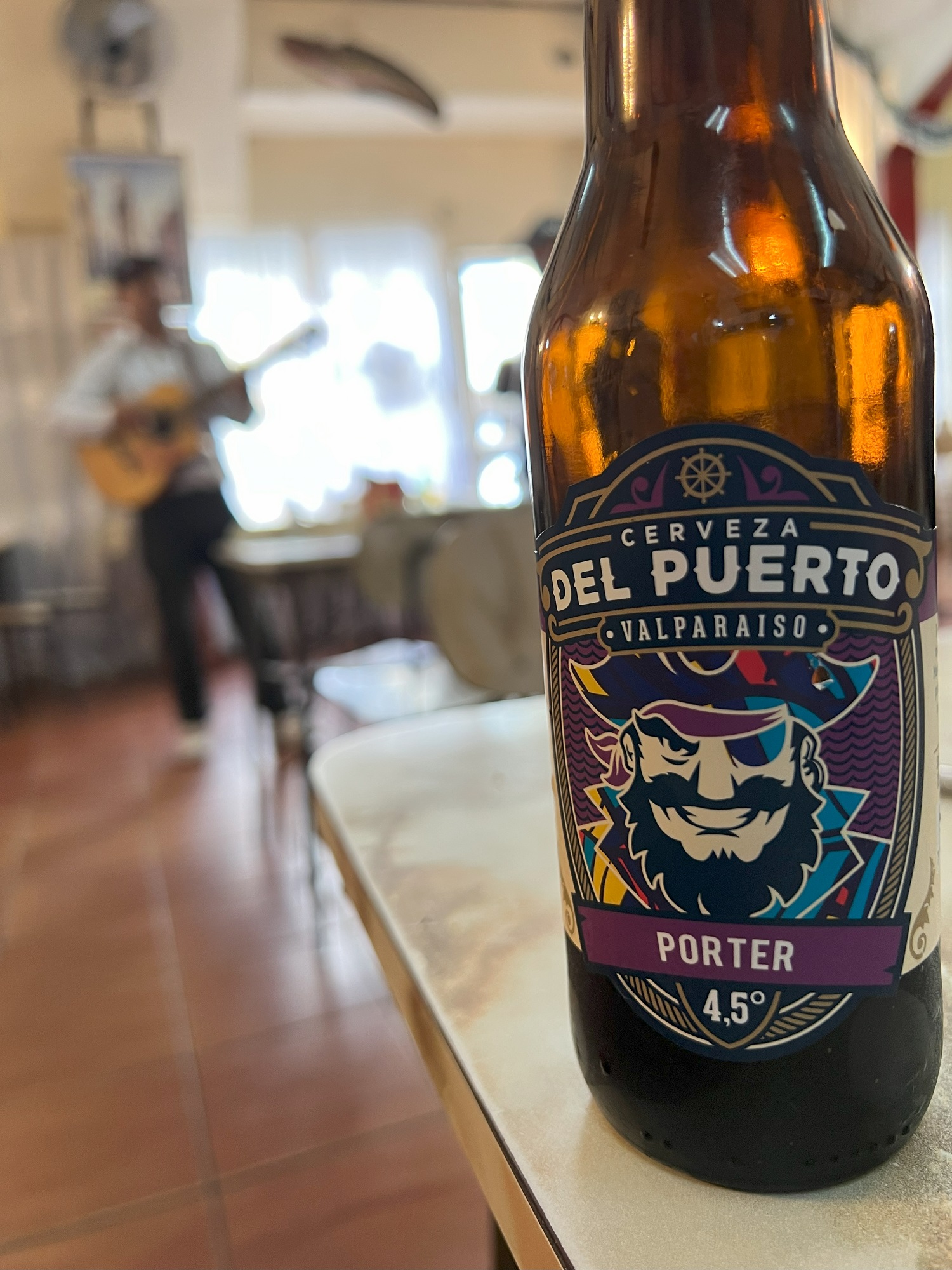
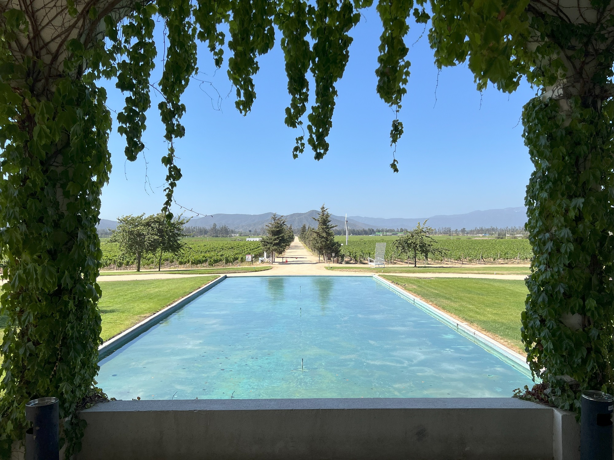
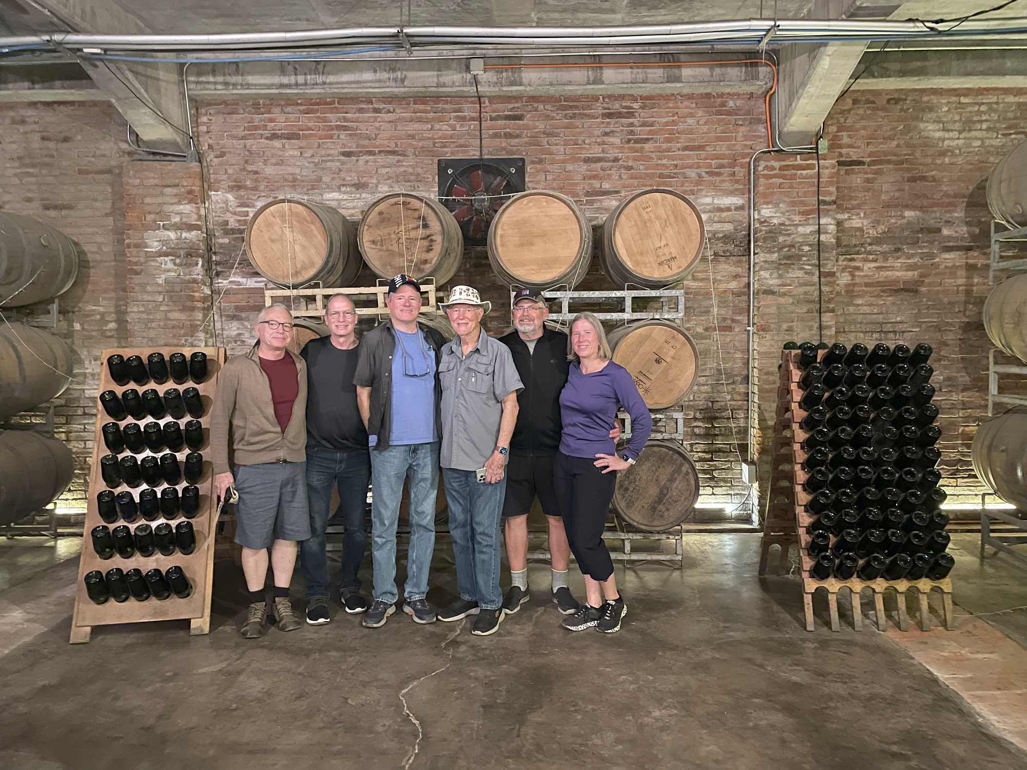
It all worked out— we did a whirlwind road trip out to Valparaiso, to a restaurant with live music for lunch, to wine farm, another stop for pisco and beers, before we headed out for the airport.
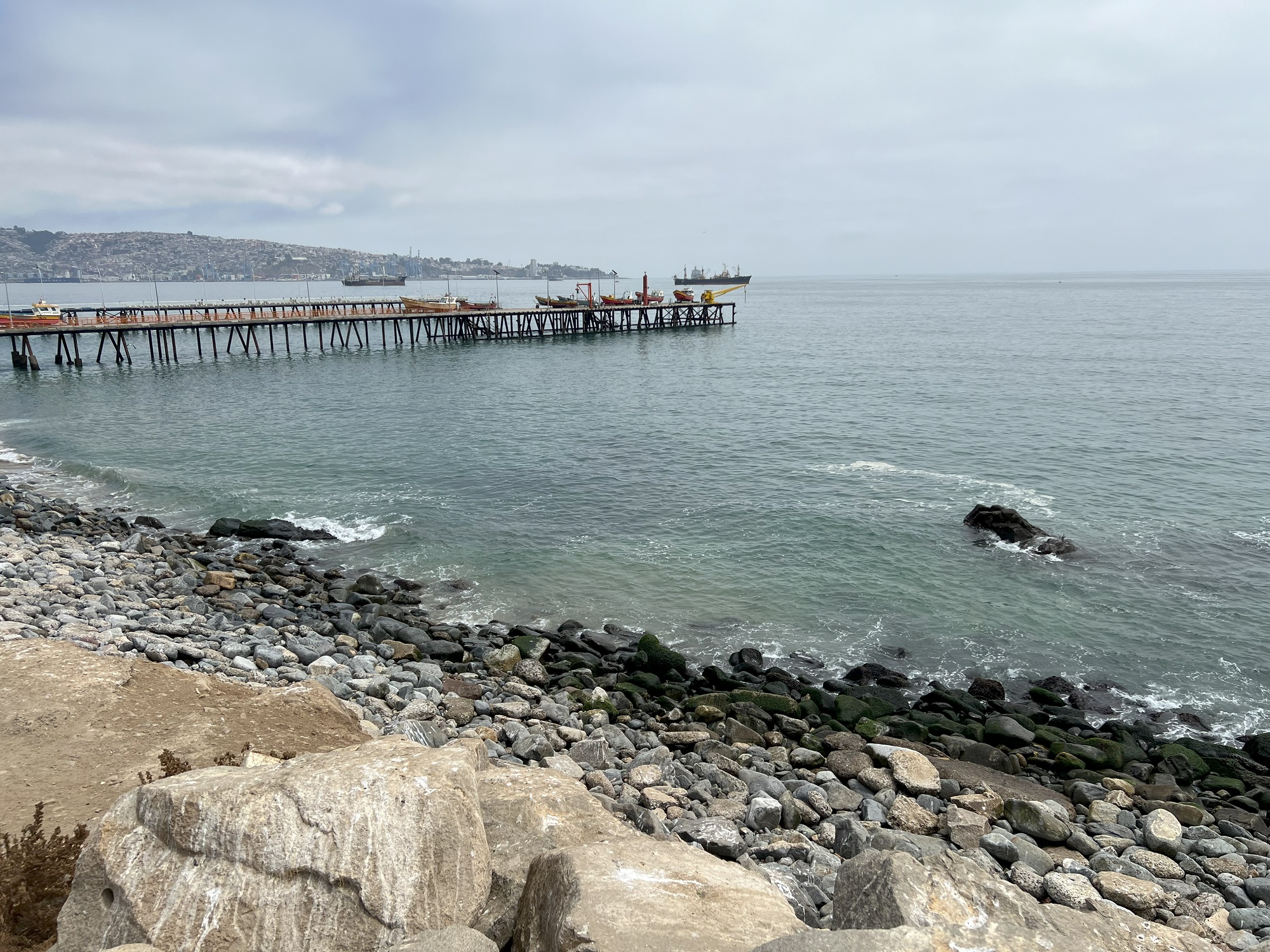
We have just arrived at San Antonio, a port city, commune, and the capital of the San Antonio Province in the Valparaíso Region.
Alas— our journey at sea and around South America has come to an end.
The Norwegian Sun has just arrived at the port of San Antonio and we will disembark shortly.
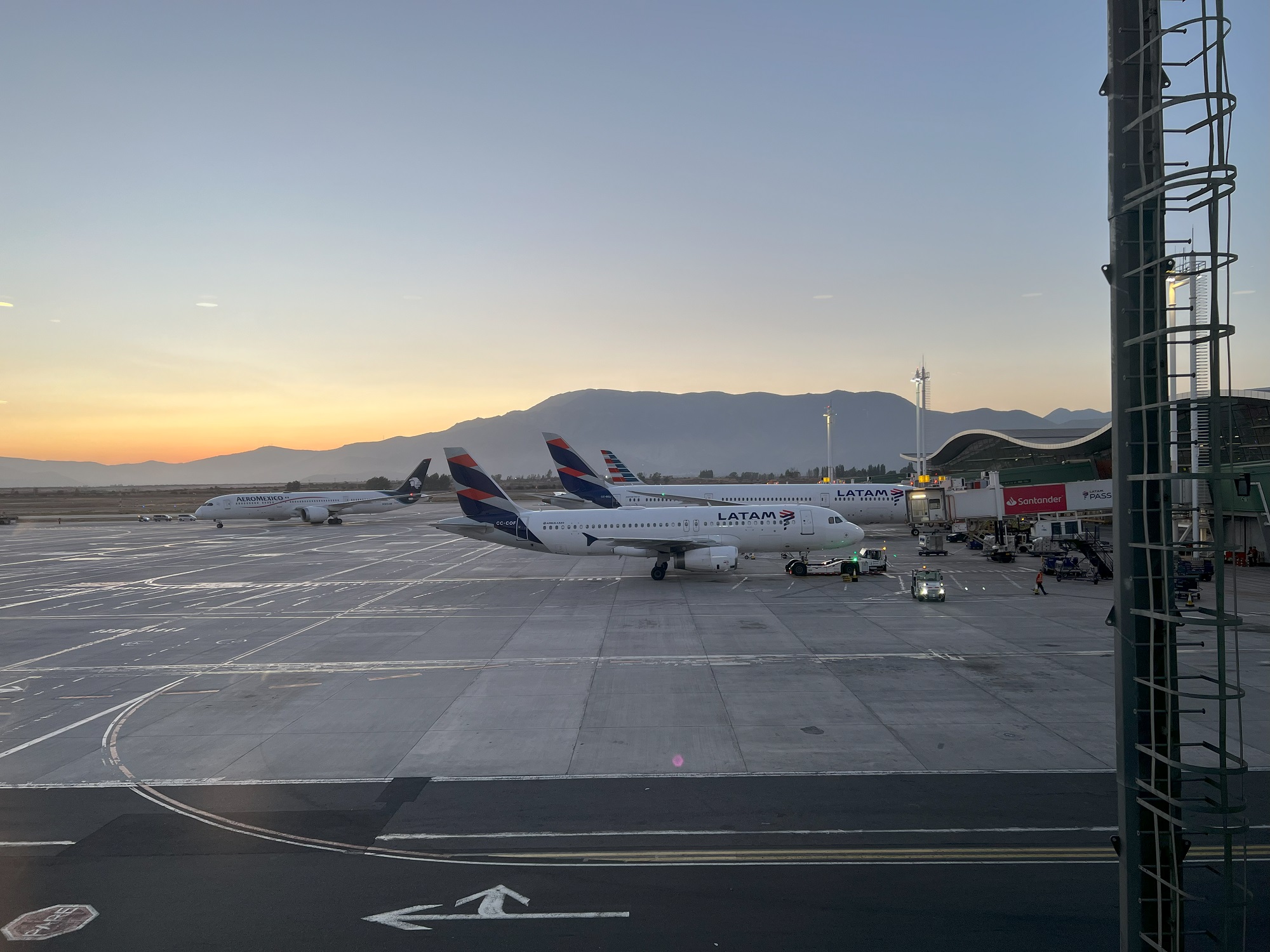
We will take a long-haul red-eye flight from Santiago to Dallas at midnight, to catch the flight that will take us home to Seattle on Tuesday morning.
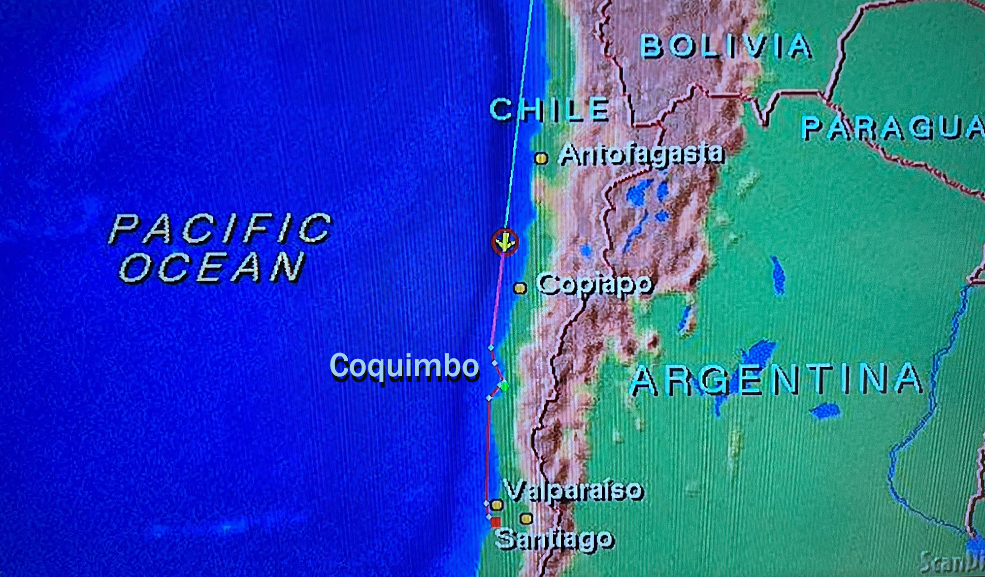
We arrived at the port city of Coquimbo this morning.
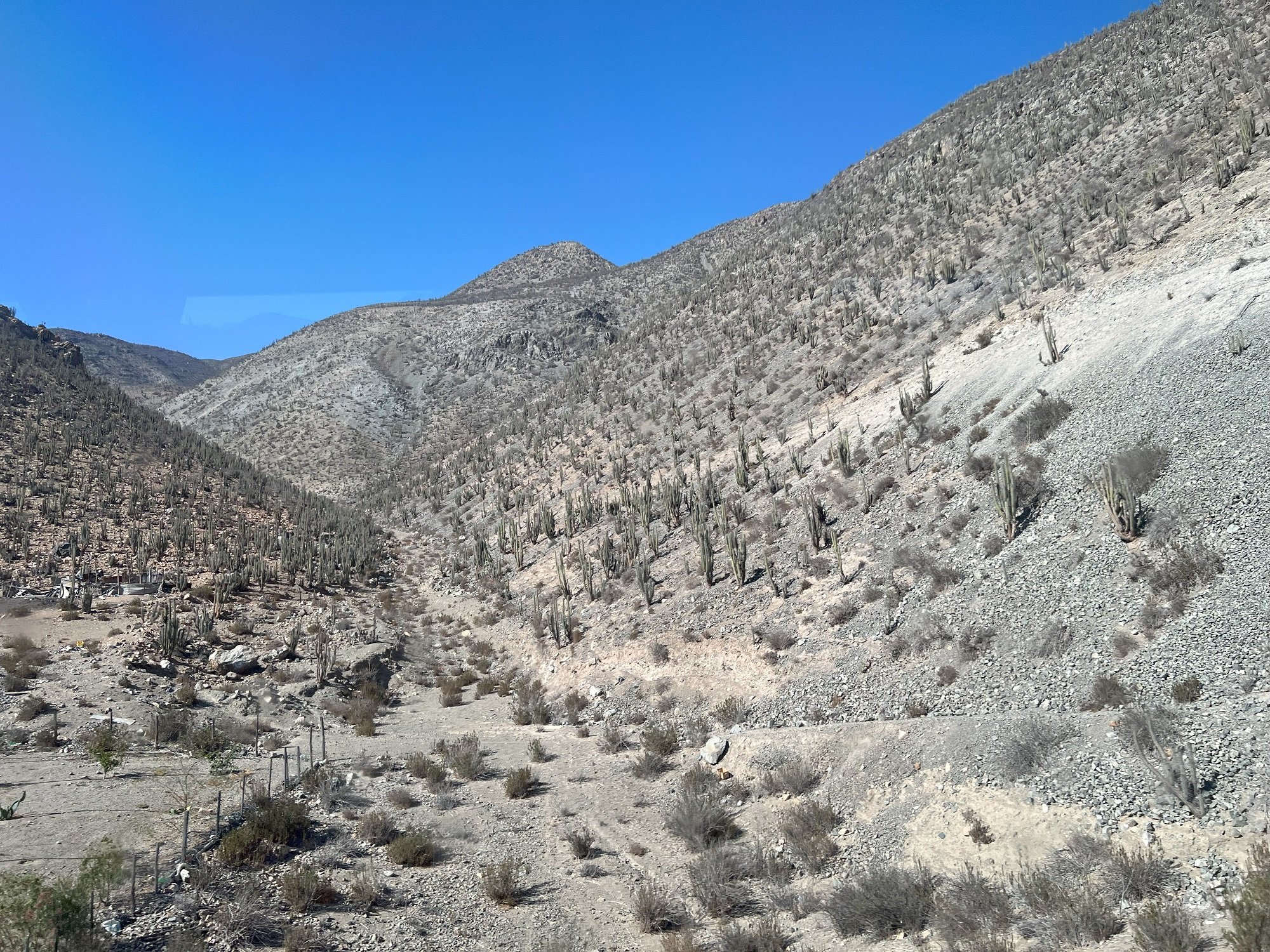
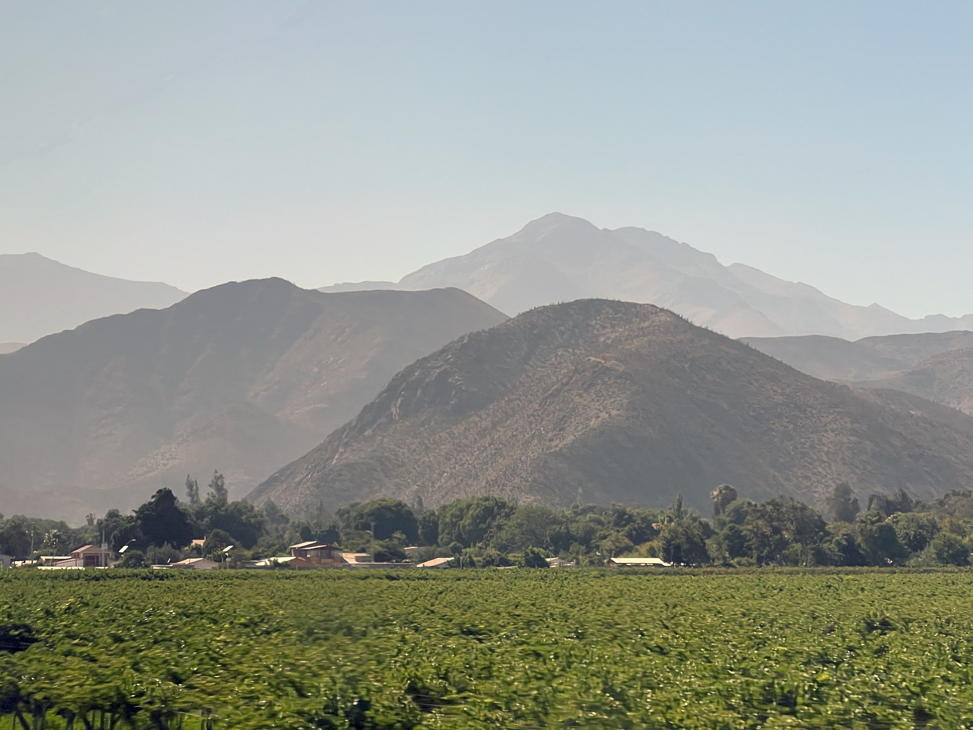
Our excursion today was a bus ride along the shoreline into the neighboring town of La Serena, followed by a drive inland to the commune of Vicuña (pop. 25,000).
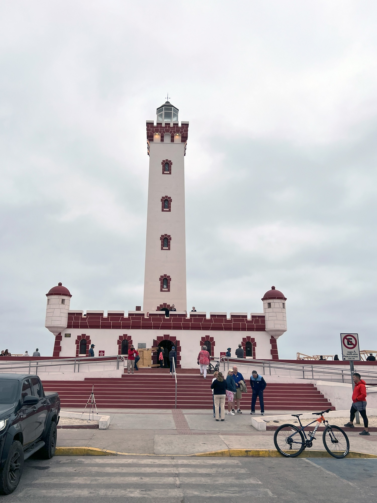
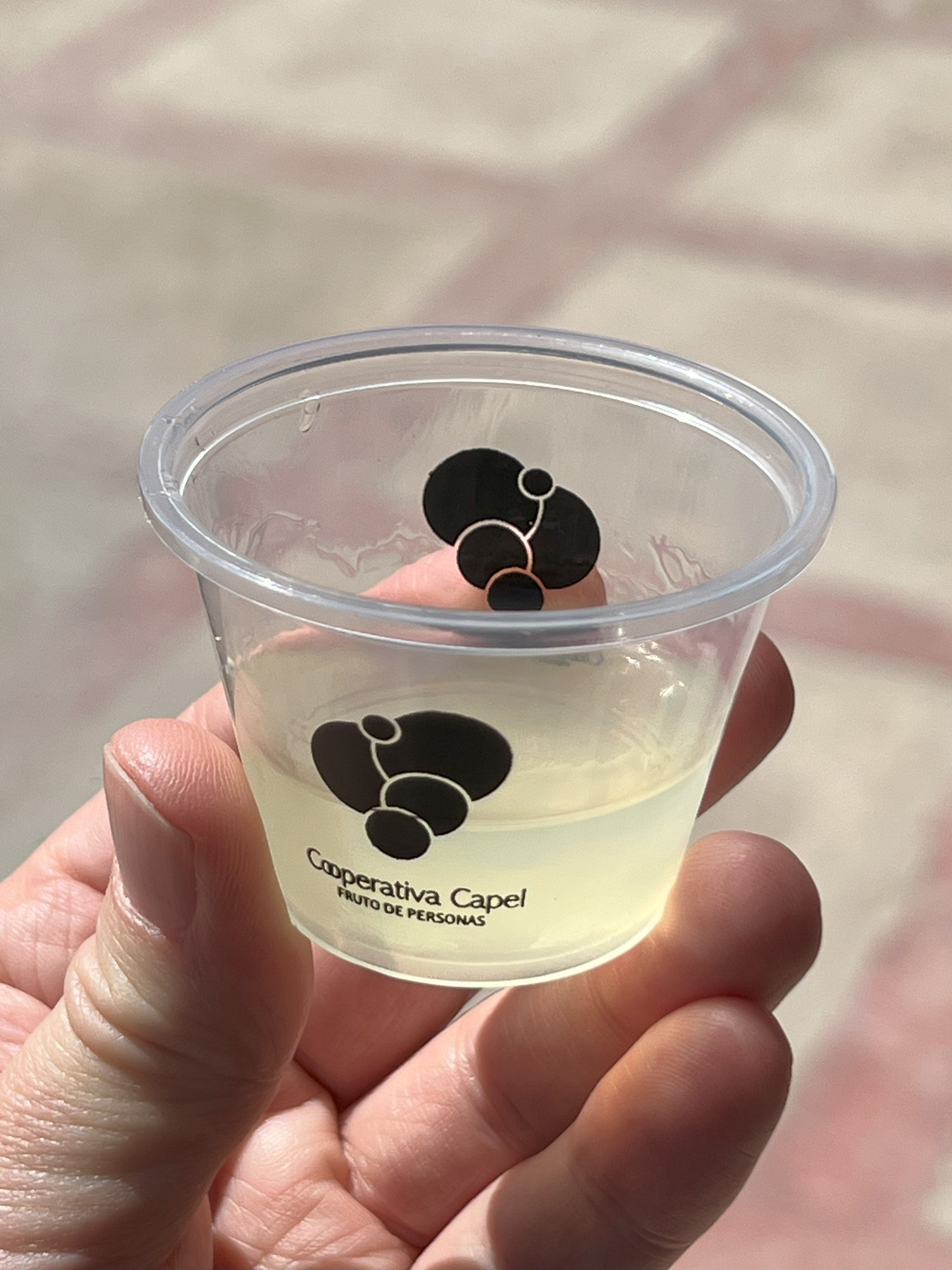
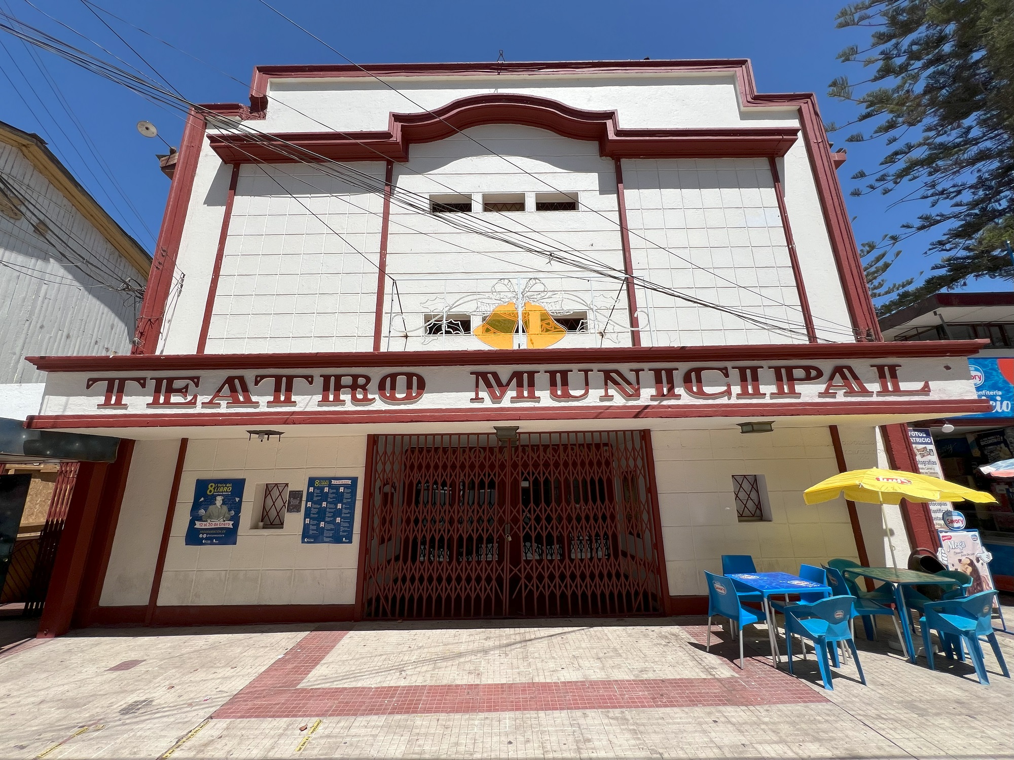
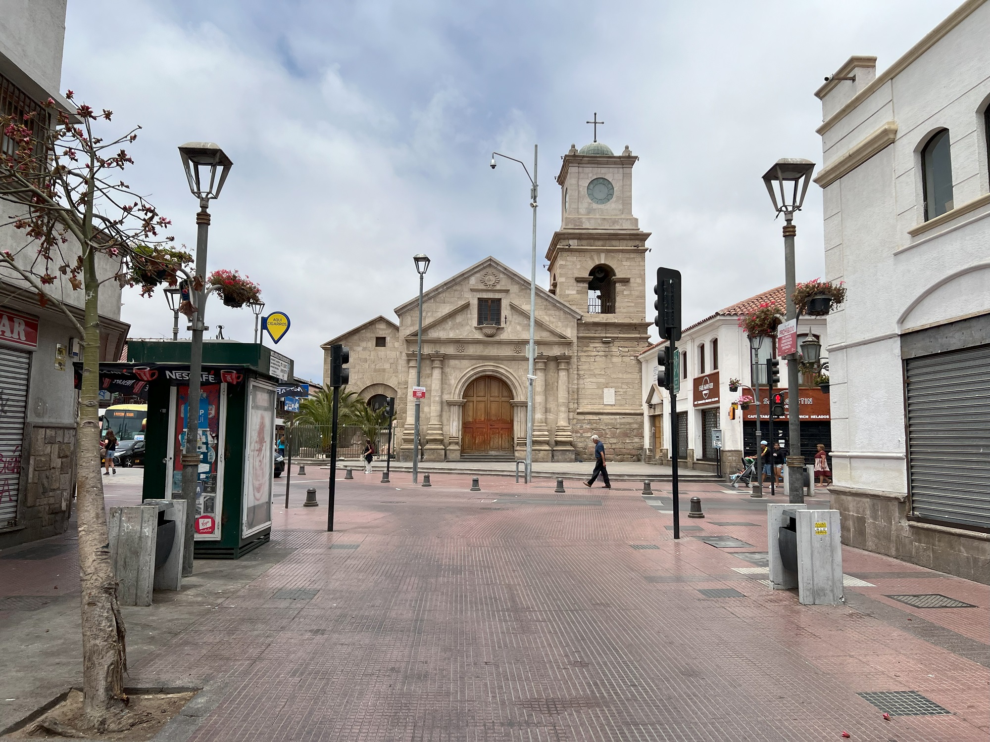
The Monumental Lighthouse of La Serena (Faro Monumental de La Serena) is located on the beach at the Avenida del Mar of La Serena. It was built between 1950 and 1951 at the request of President Gabriel González Videla.The beautiful, parched landscape and cactuses, as seen from our bus on Route 41 on the way to Vicuña.Lush green vineyards in the Elqui Valley.We stopped by a pisco distillery on the way to Vicuña . Here is my sample of pisco sour, made from distilled muscatel grapes and lemon juice. Pisco is the national drink of Peru, but a version of it is made in Chile as well.Here is the municipal theater house in Vicuña.We were one of four buses full of cruise ship tourists had lunch at this restaurant. We had an empanada appetizer, followed by a large steak with rice and tomato salad, and papaya for dessert. Oh, and they served pisco and original Coca-Cola for drinks.Back in Coquimbo, for our final stop at a little tourist market next to this church.
Our next-to-last stop tomorrow morning will be the port city of Coquimbo in Chile’s Elqui Province, and located on the Pan-American Highway.
Norwegian Sun is making her way down south along the Chilean coast, and we crossed the Tropic of Capricorn* today.
*The Tropic of Capricorn lies 23° 26′ 22″ (23.4394°) south of the Equator and marks the most southerly latitude at which the sun can appear directly overhead at noon.
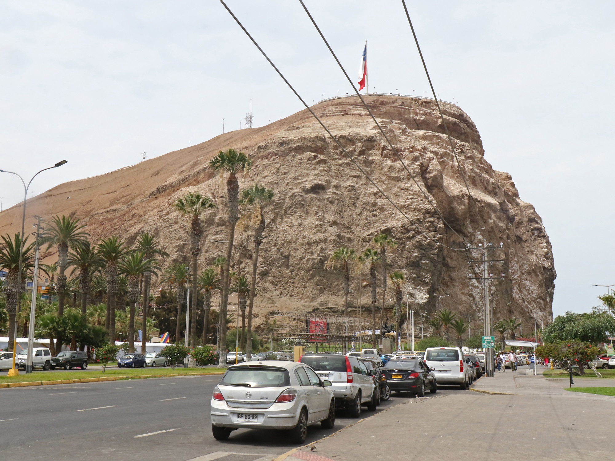
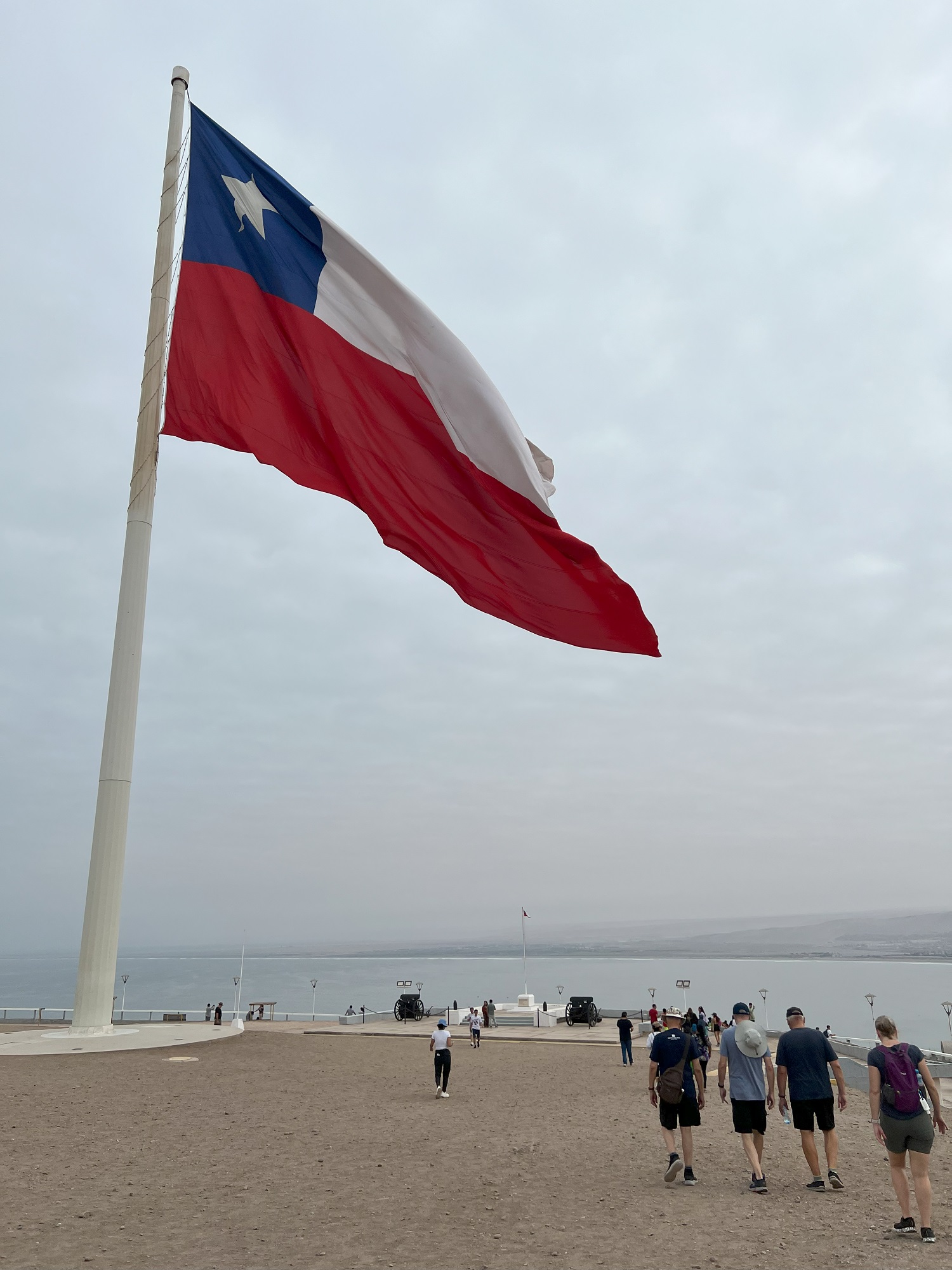
Our self-directed excursion into Arica this morning took us up the steep path to the top of the hill called Morro Arrica.
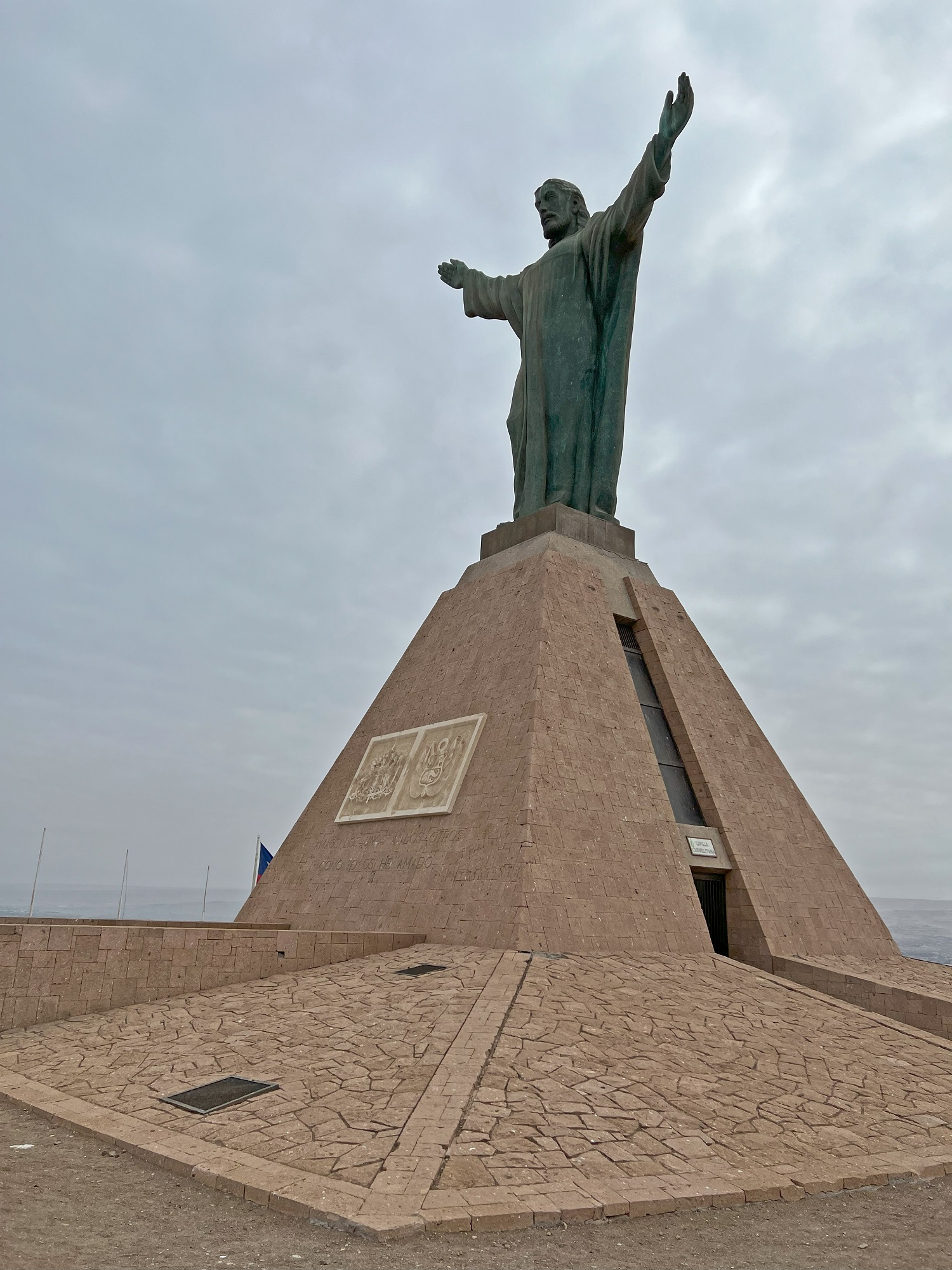
At the top there is an enormous Chilean flag, a museum and a statue called Christ of the Peace (a reference to the Treaty of Lima in 1929 that settled lingering territorial disputes between Peru and Chile).
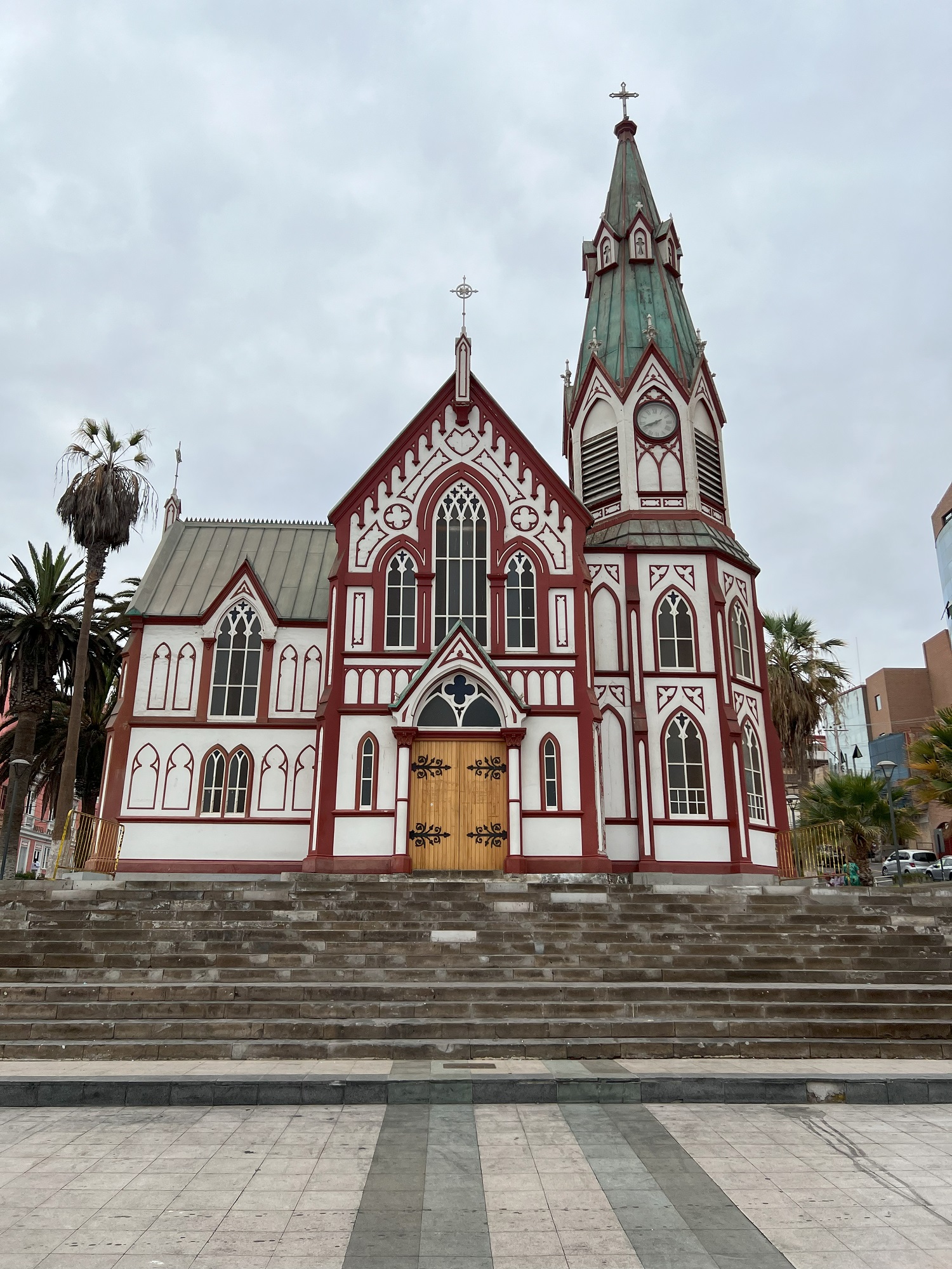
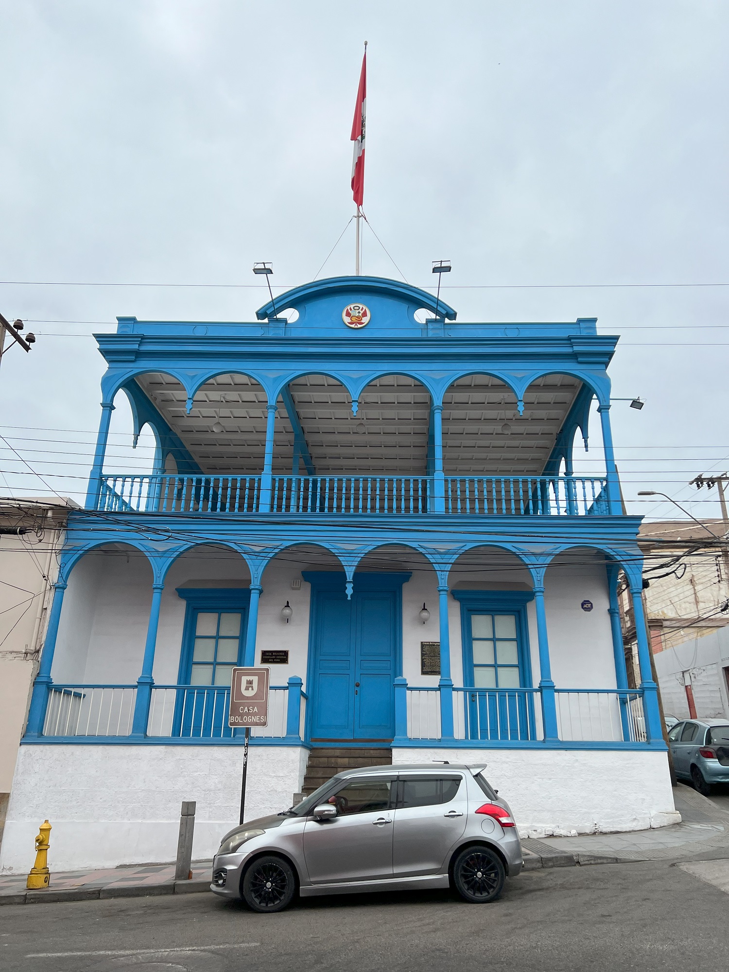
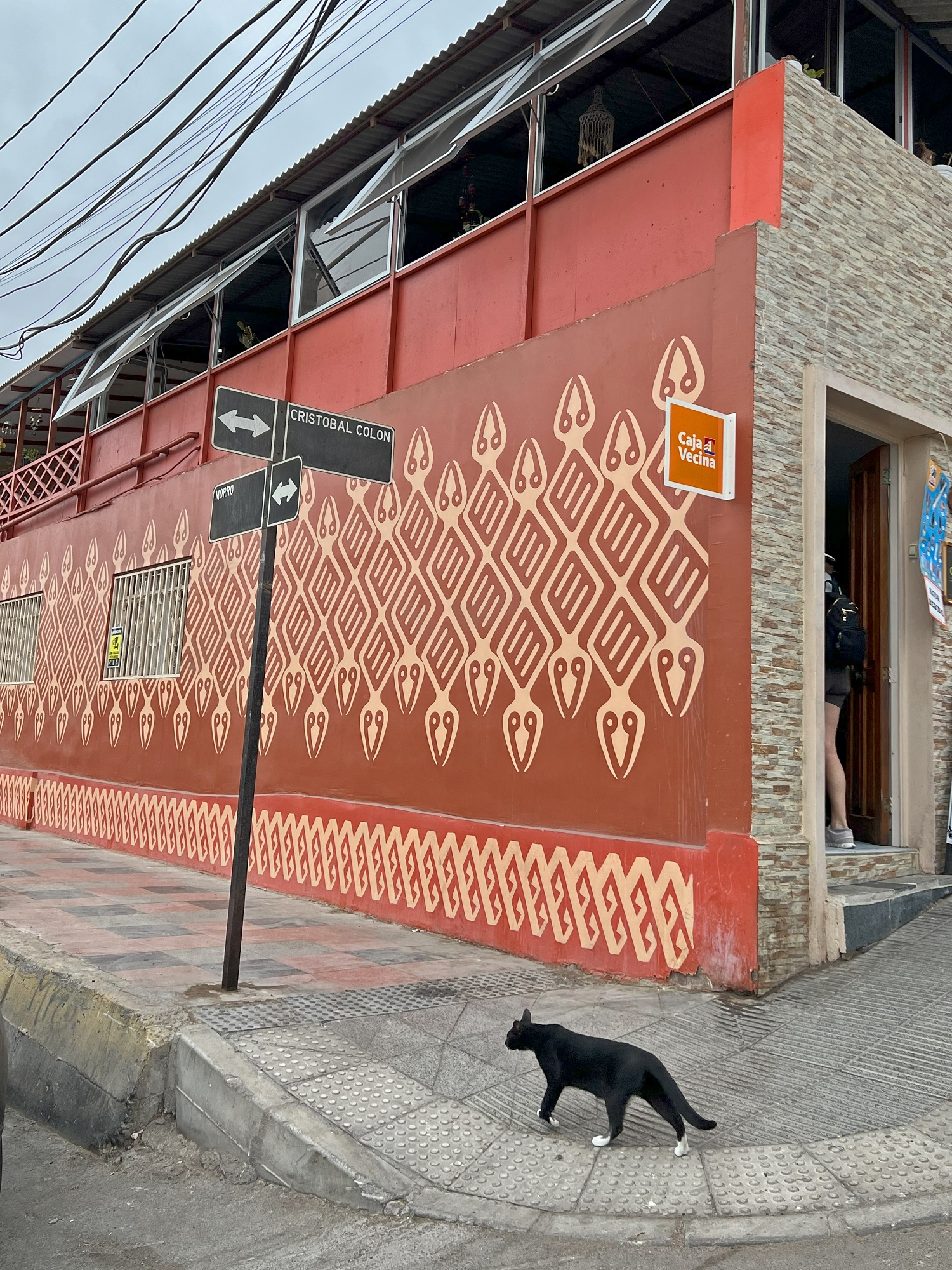
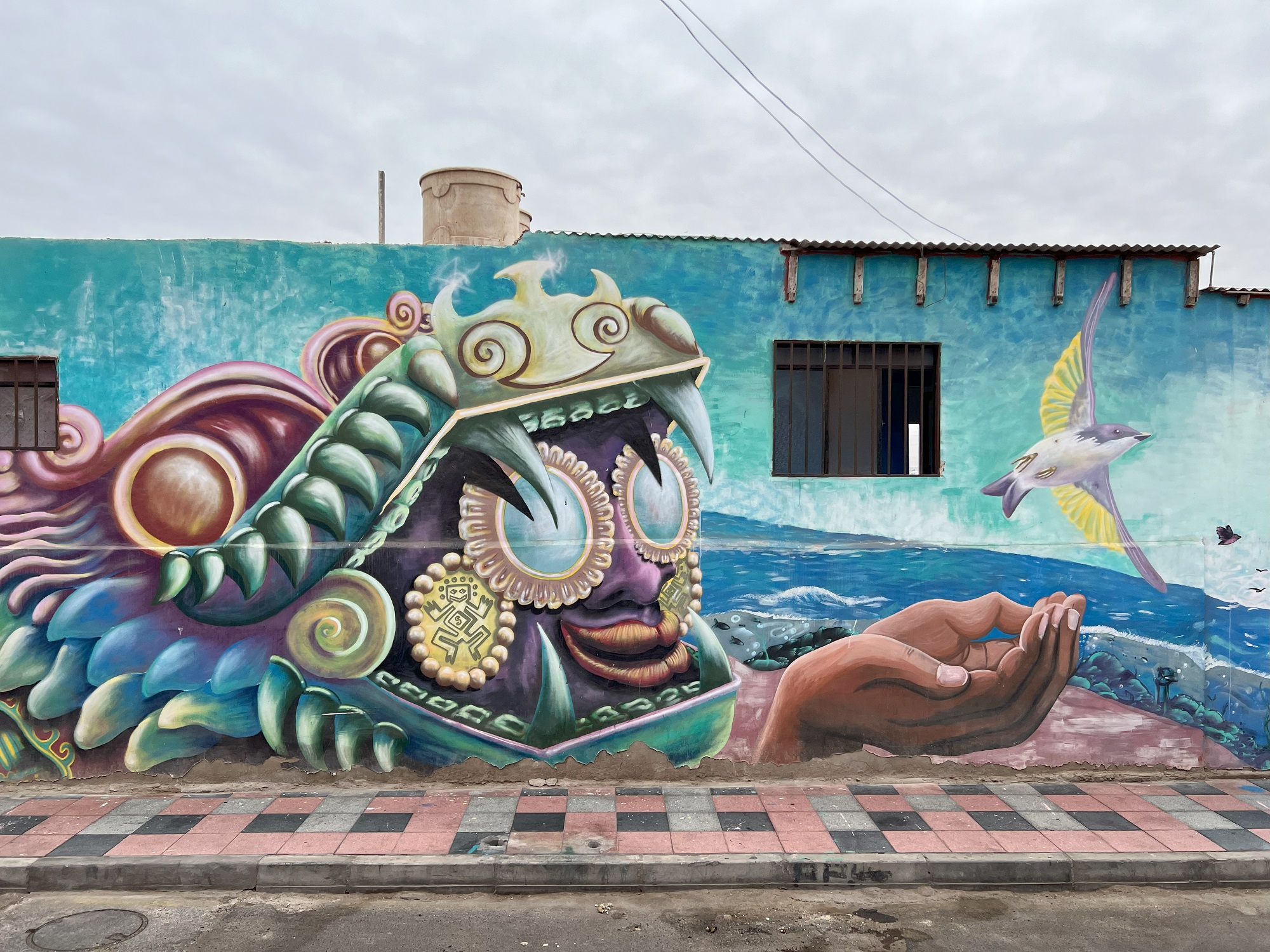
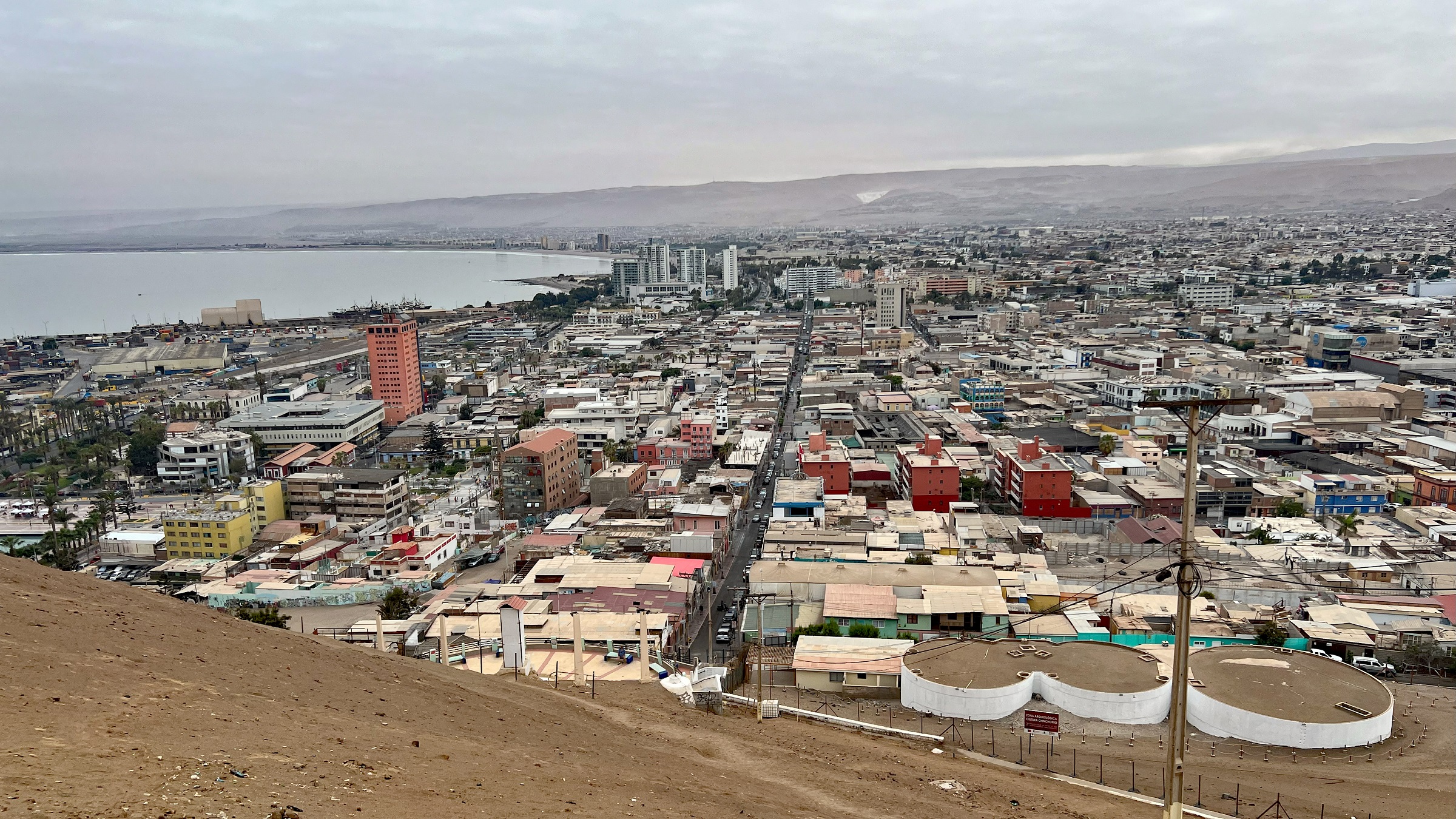
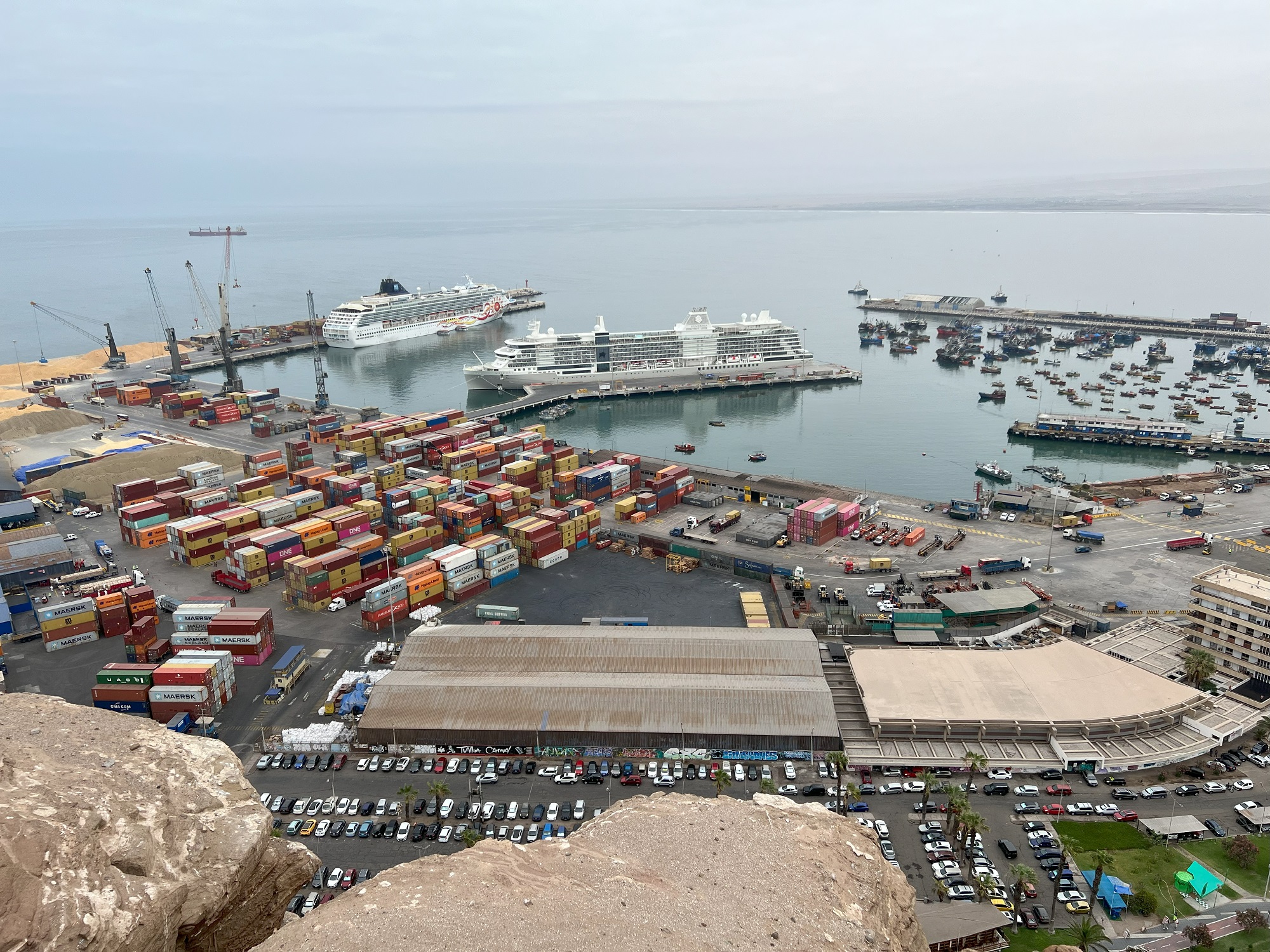
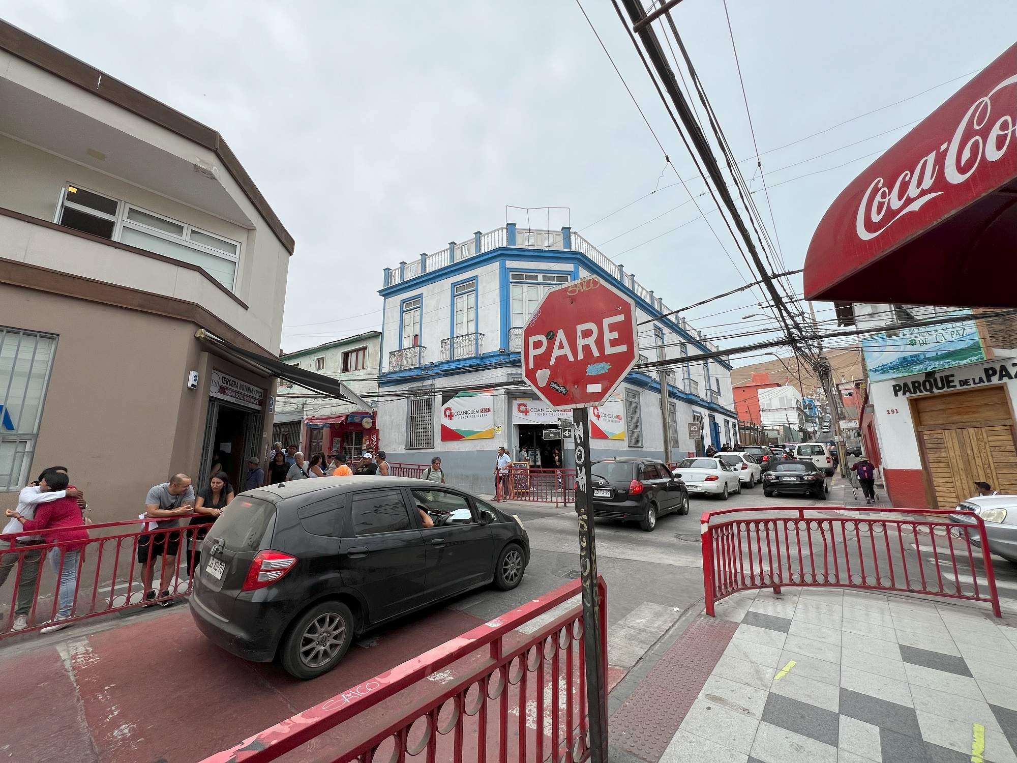
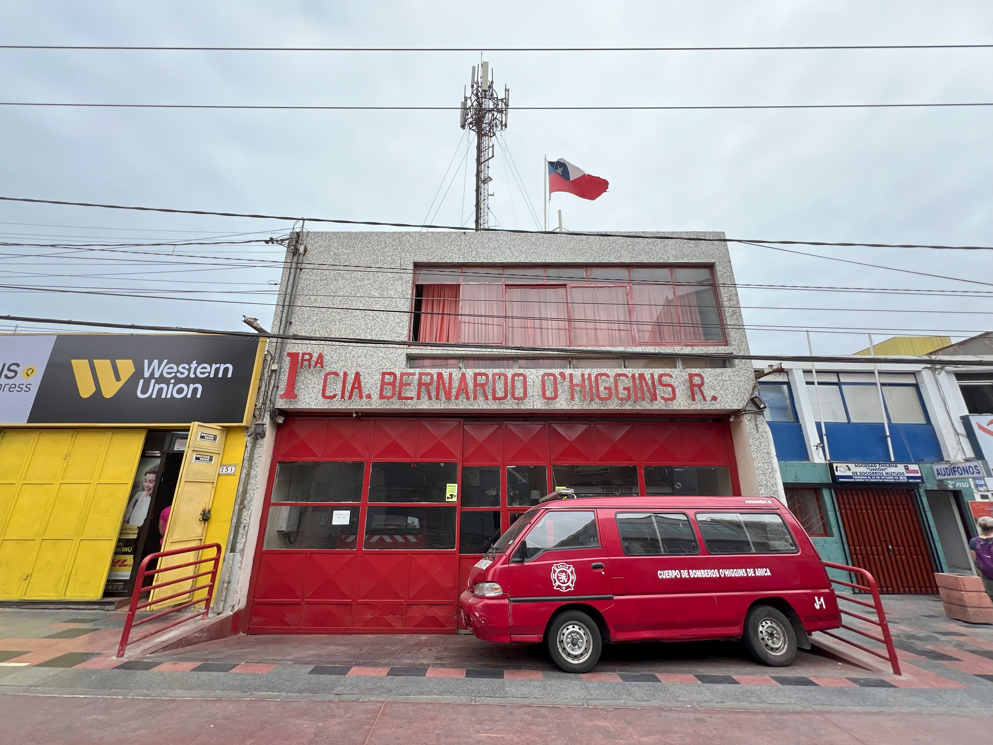
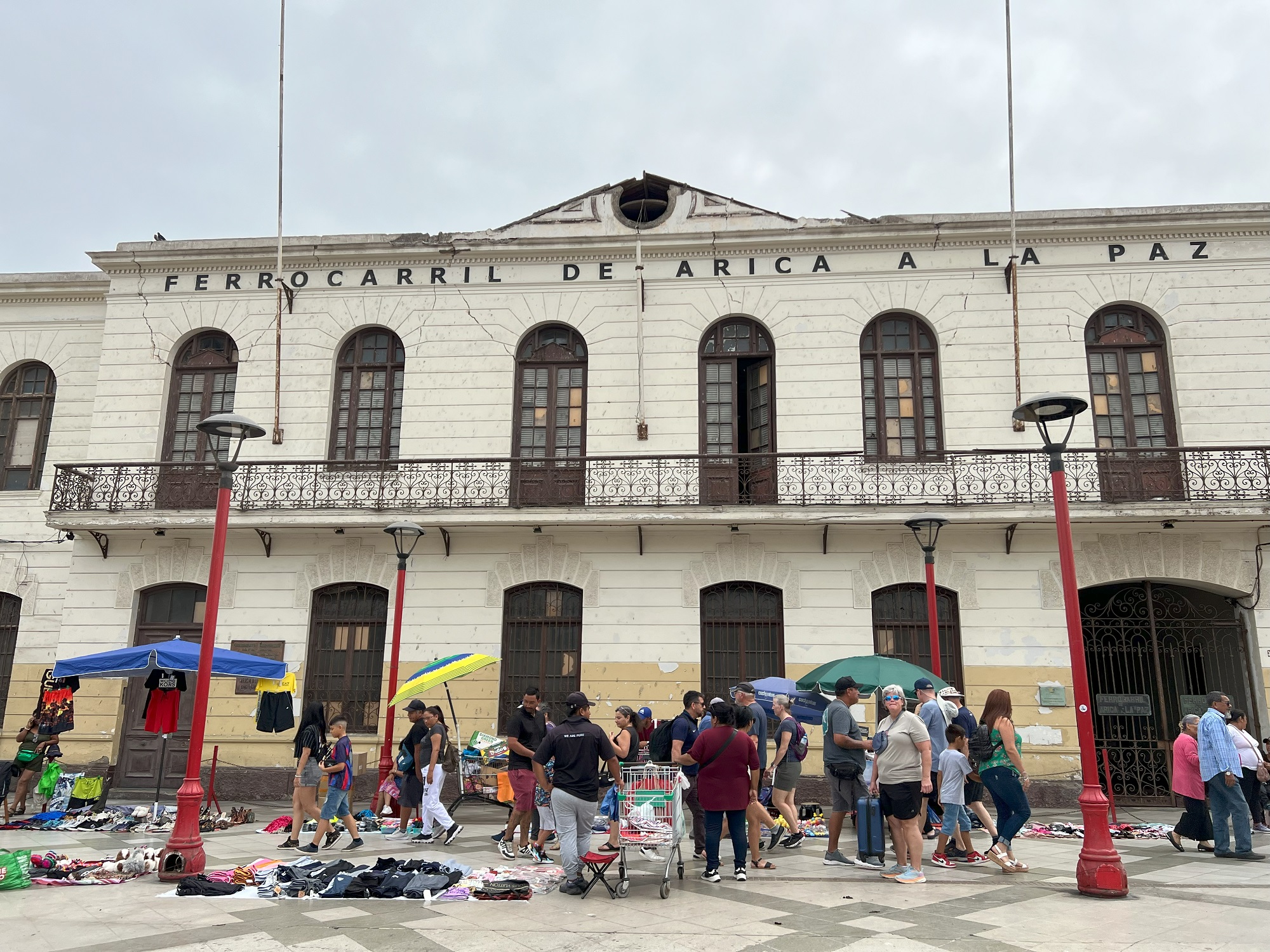
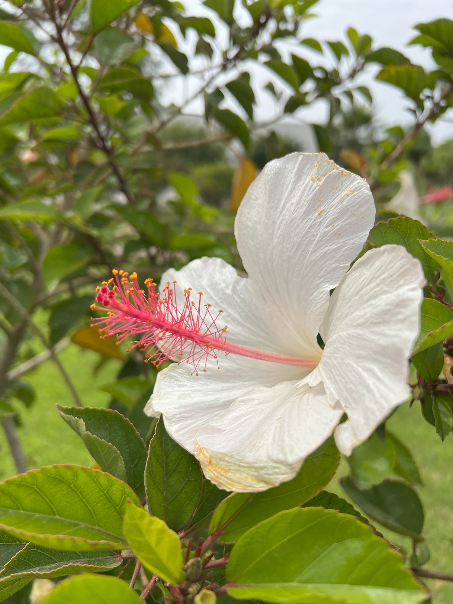
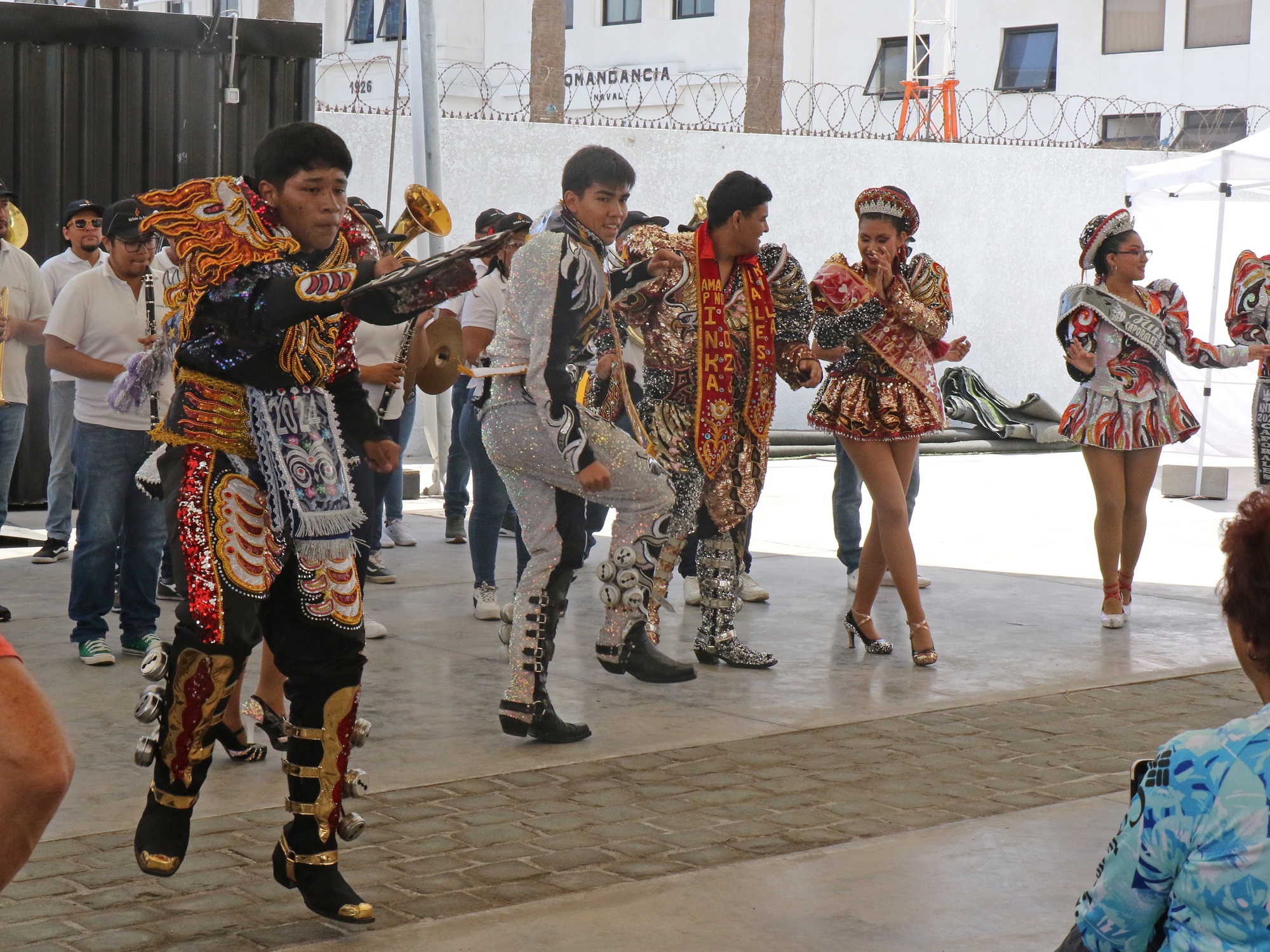
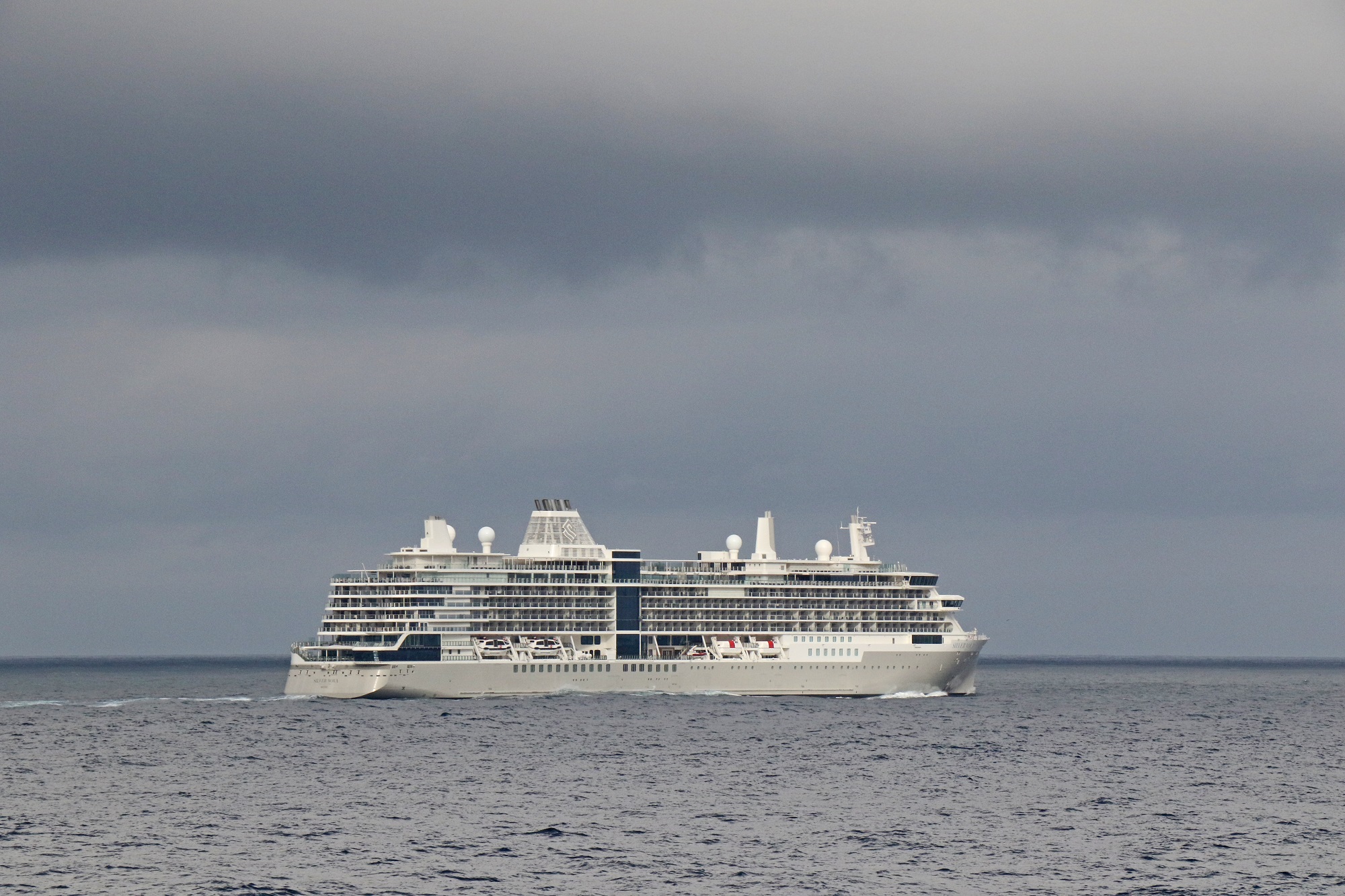
Morro de Arica is 139 m (459 ft) above sea level. It was the last bulwark of defense for the Peruvian troops who garrisoned the city during the War of the Pacific (1879–1883). Morro de Arica was assaulted and captured on June 7, 1880, by Chilean troops in the last part of the Tacna and Arica campaign.The Gothic San Marcos Cathedral dates from 1876 was designed by none other than the French architect Gustave Eiffel.We are now making our way up to the staircase that run op Morro de Arica. This is the consulate for Peru in Arica.Mural art at the corner of Cristobal Colon and Morro Street.More eye-catching mural art nearby.A view of the city from halfway up the staircase to the top of Morro de Arica.There is a giant Chilean flag at the top of Morro de Arica.Looking down at the cruise terminal with Norwegian Sun, Silver Nova and an assortment of fishing boats, presumably.Cristo de la Paz Statue at the top of Morro de Arica. Long after the War of the Pacific ended in 1883, the lingering territorial disputes between Peru and Chile were finally settled by the Treaty of Lima in 1929. In this Tacna-Arica compromise, the city of Arica officially became the northernmost point of Chile. As part of this sign of peace, the Cristo de la Paz statue was designed by Raul Valdivieso in 1987 and then erected in 1999 on Morro de Arica, the scene of the crushing Peruvian defeat in 1880. Also called the Cristo de la Concordia, this steel and bronze statue stands 36 feet on a concrete pedestal. The outstretched hands of Christ measure 33 ft across. [From encirclephotos.com]Downtown Arica.A compact fire station in downtown Arica.The administrative building of the Ferrocarril De Arica a La Paz railway was declared a national monument in 1990. There is a flea market of sorts on the promenade that runs in front of it.We found this white hibiscus in a park in downtown Arica.As we returned to the ship, there was live entertainment from a band and dancers— decked out in festive traditional Chilean costumes.
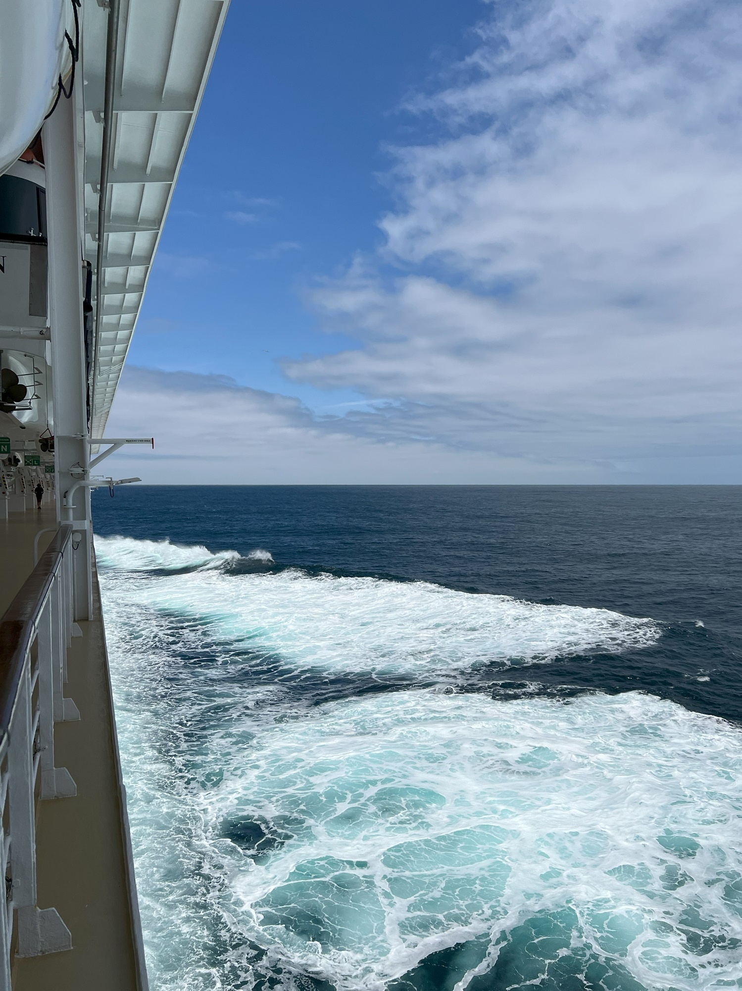
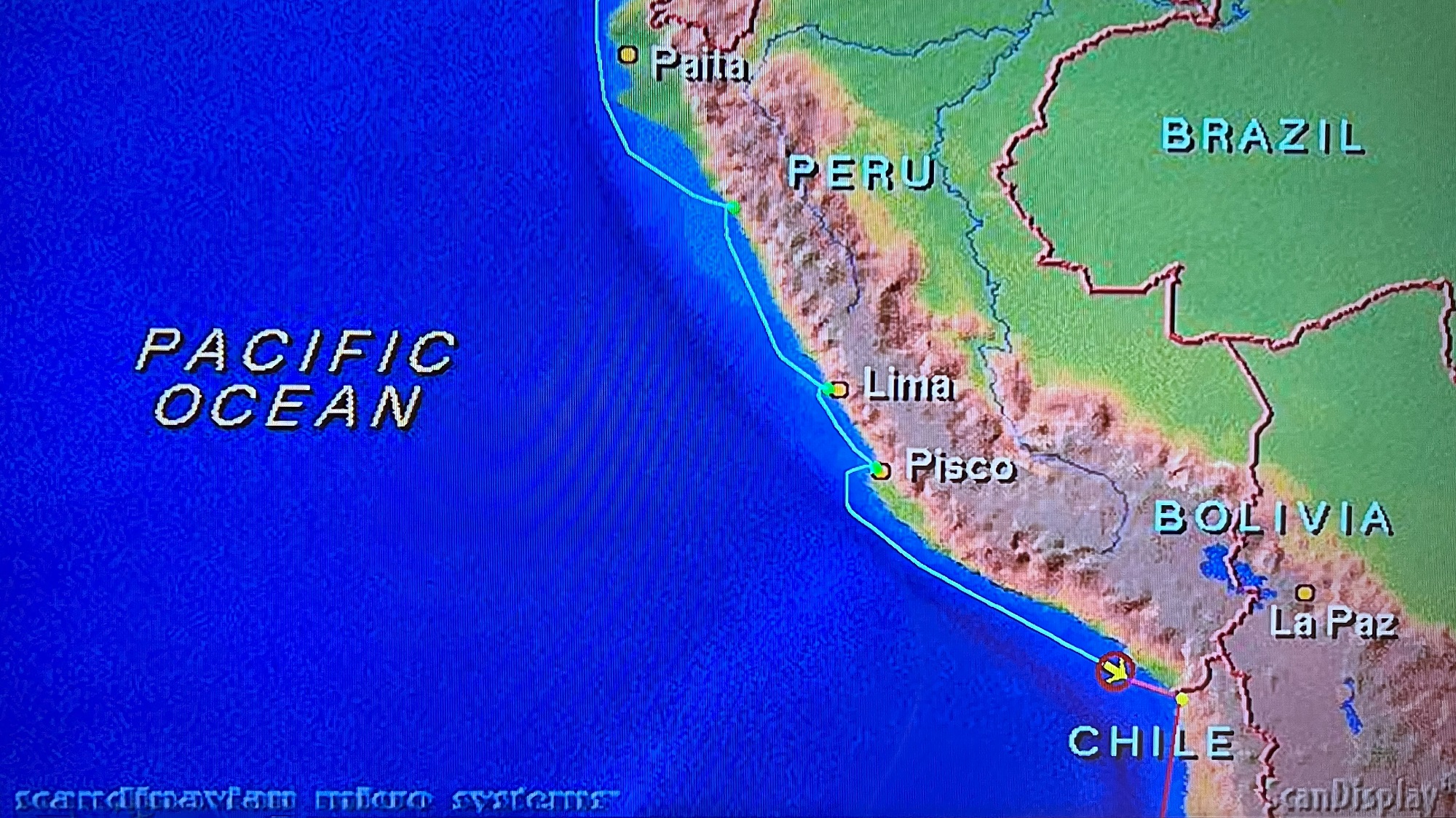
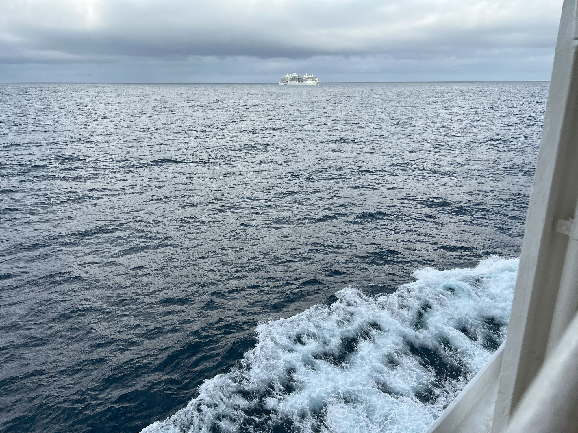
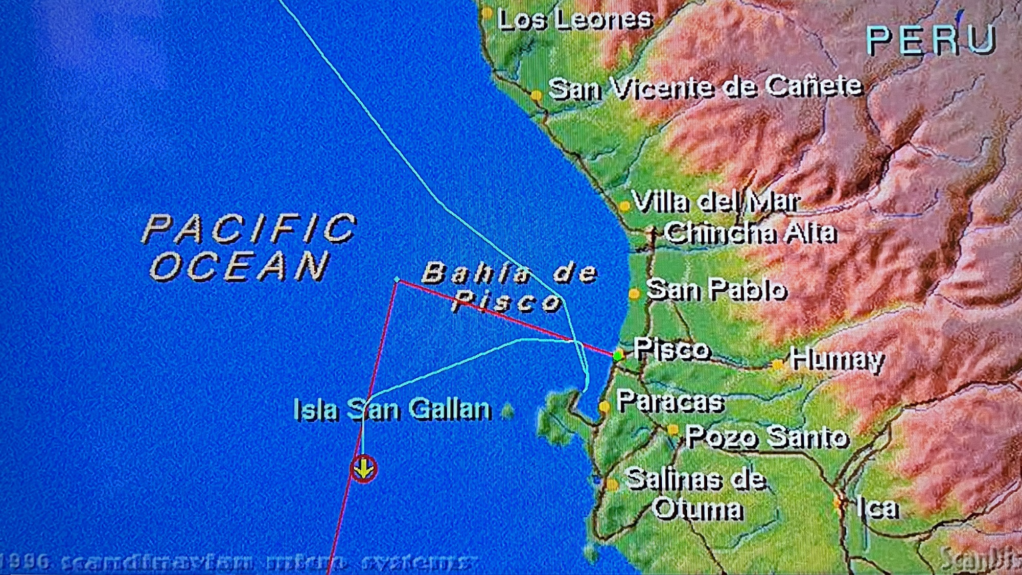
Norwegian Sun sailed further along the Peruvian coast today, heading for the port town of Arica in Chile.
The Norwegian Sun continued her journey along the Peruvian coast towards Chile today. That’s the Silver Nova from the Silversea luxury cruise line out at sea with us.
We should reach Arica— just south of the border with Peru— early in the morning.
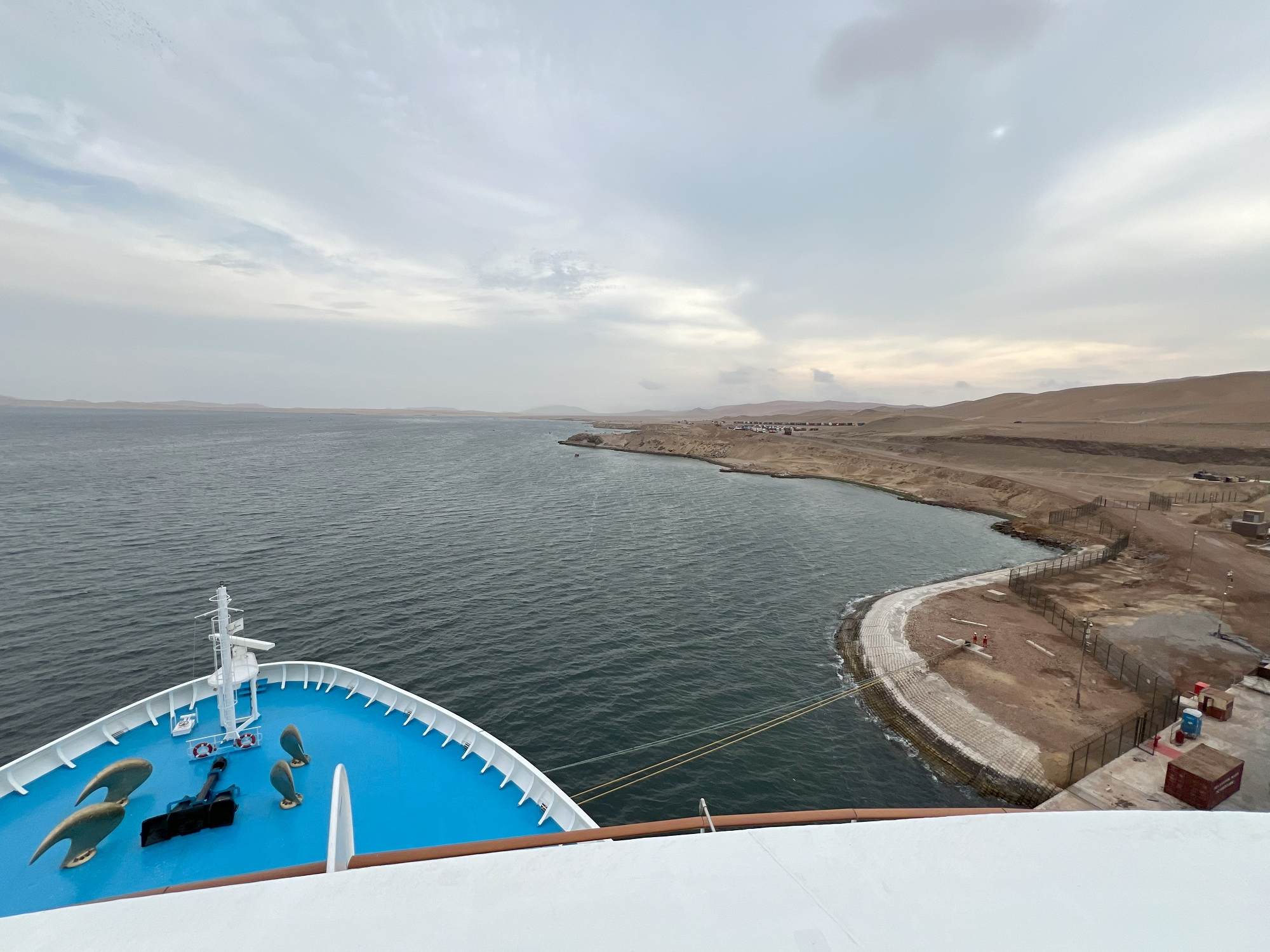
We arrived at the cruise terminal on the Paracas peninsula near Pisco this morning at 7 am.
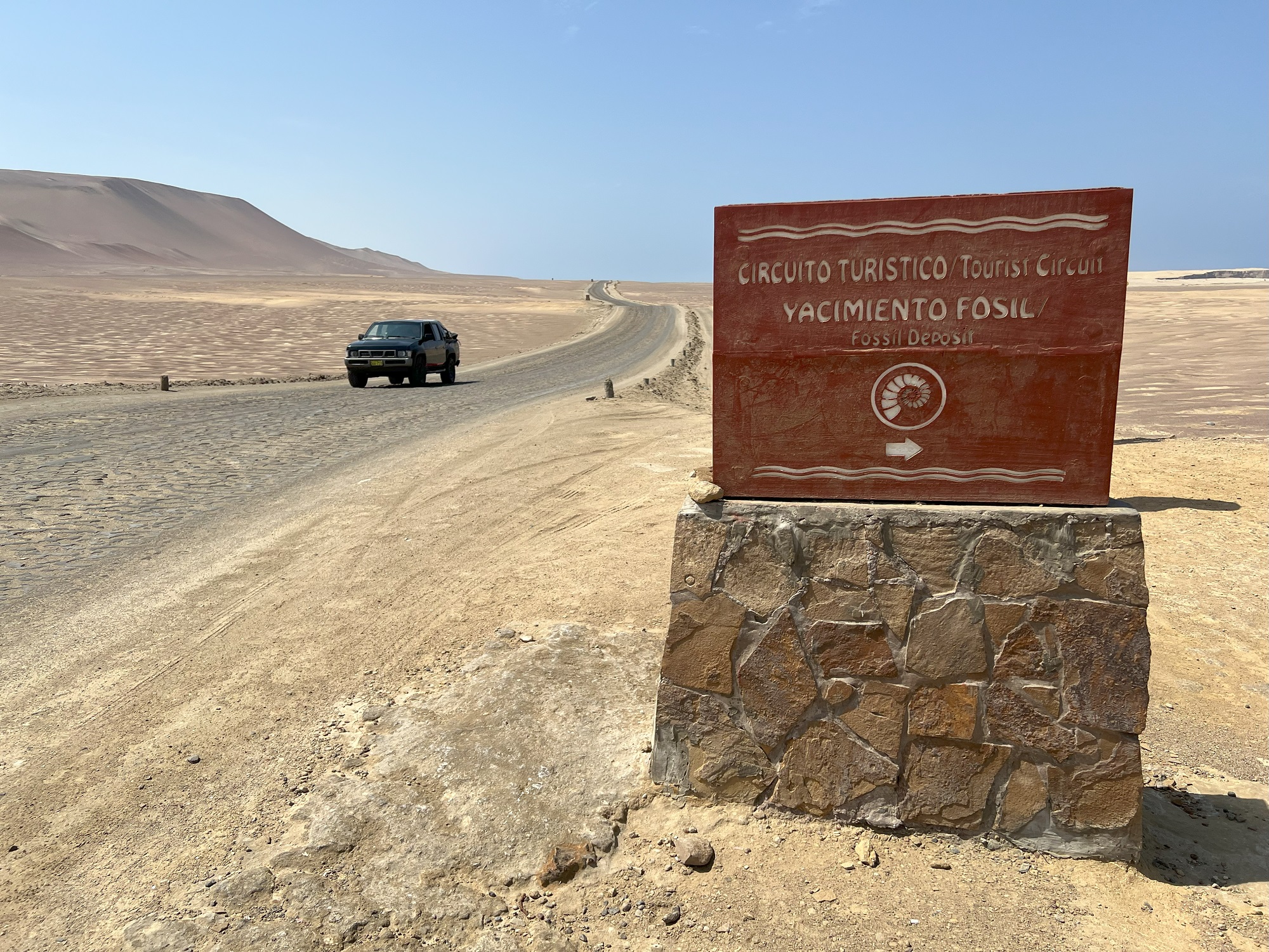
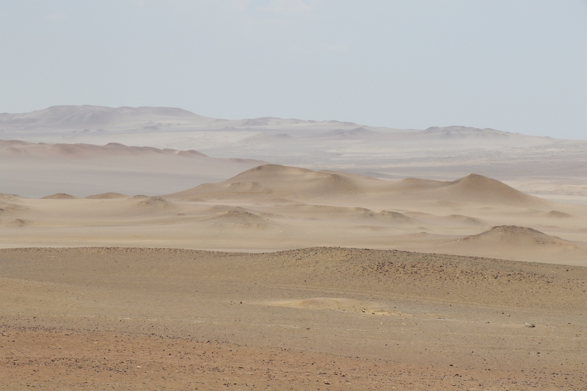
Our excursion was to nearby Paracas National Reserve, an area with protected desert and marine ecosystems.
Most of the area is a moonscape with no vegetation.
It is really part of the Atacama Desert— the driest nonpolar desert in the world.
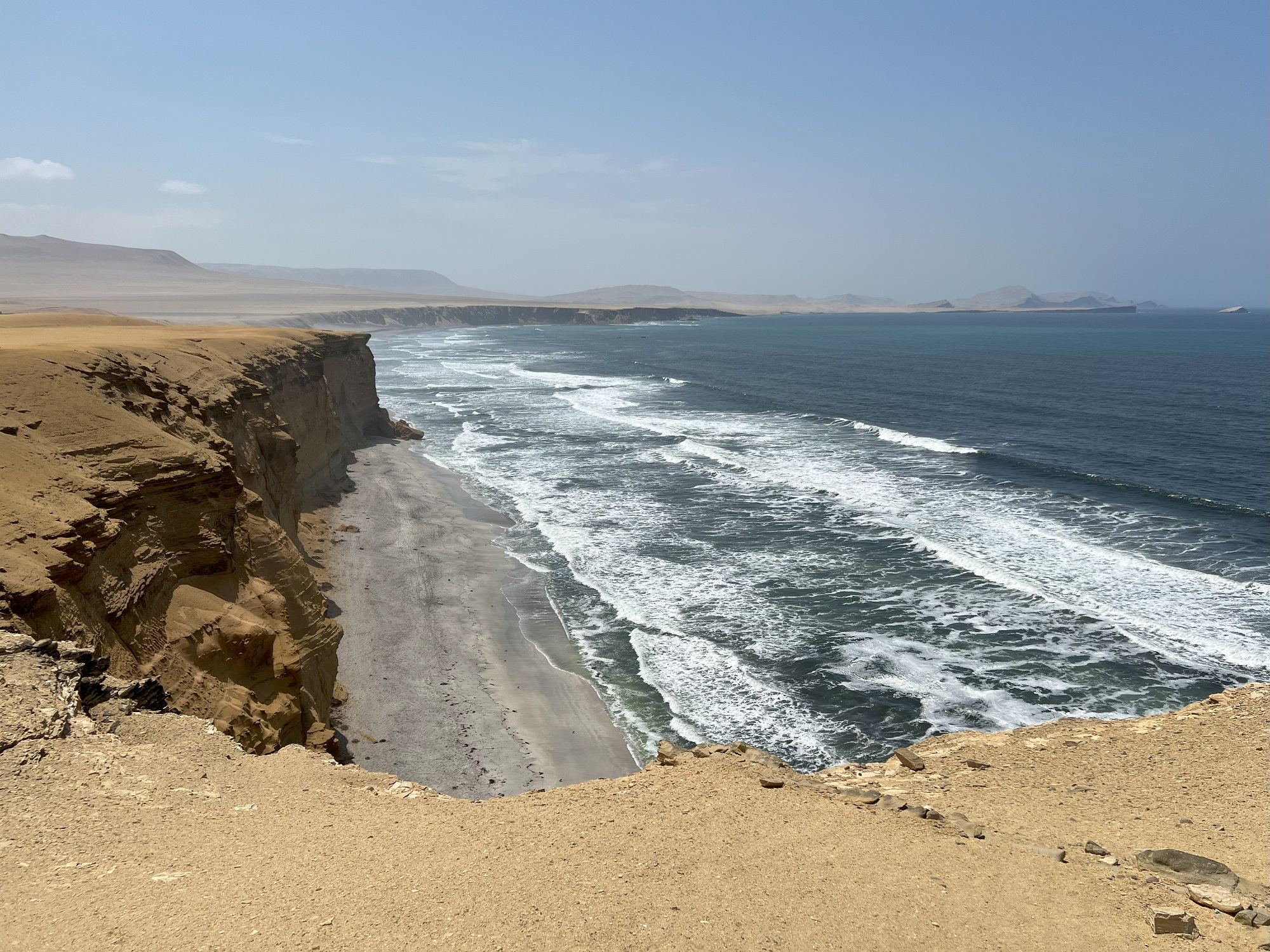
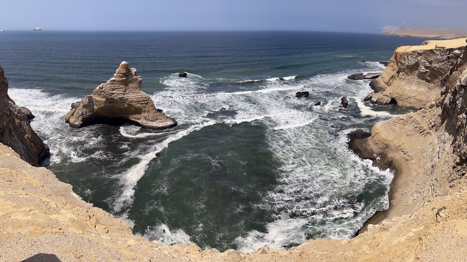
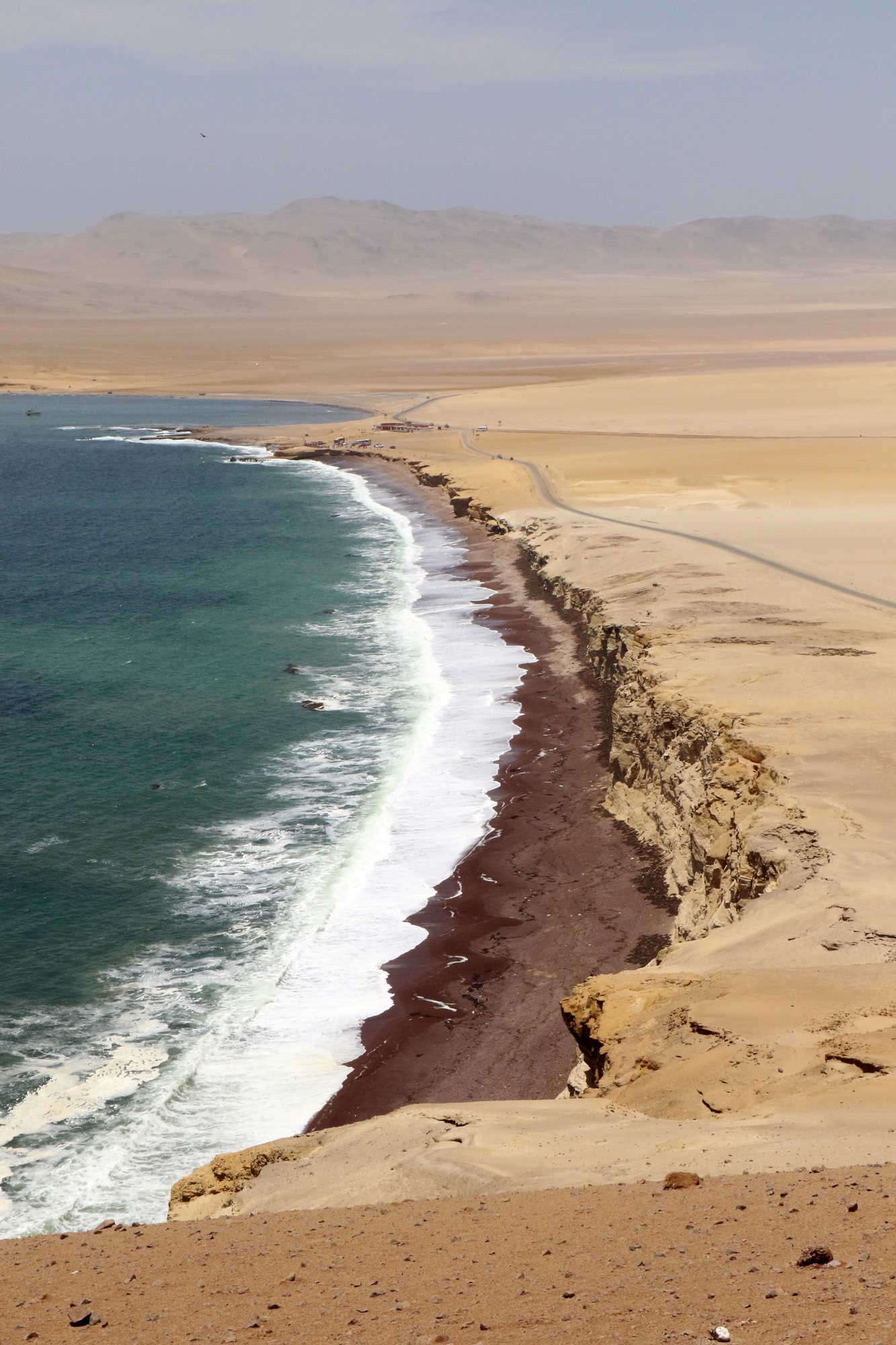
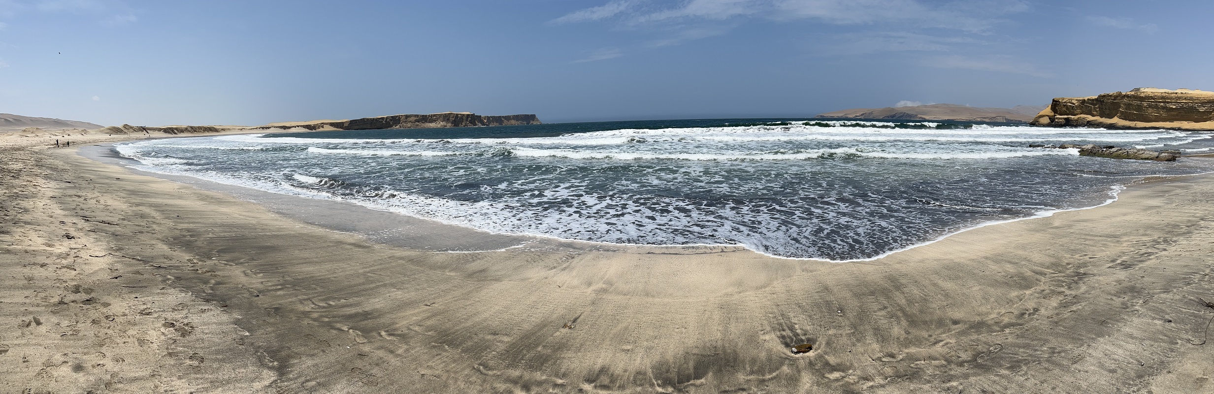
At our first stop there was a trail with an overlook to Supay Beach.Please do not collect fossils (of shells imbedded in stones).Here is Supay Beach.The rocky outcrop on the left full of seabirds and guano is called La Cátedral (The Cathedral).This stop in Paracas National Reserve provided a great view of Playa Roja (Red Beach).Looking in the other direction, one can see dunes and the soft pastel colors of the sand and the soil.This beach is called Playa La Mina Pisco.
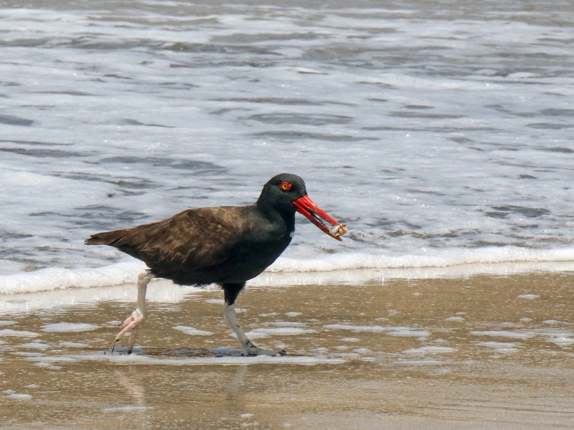
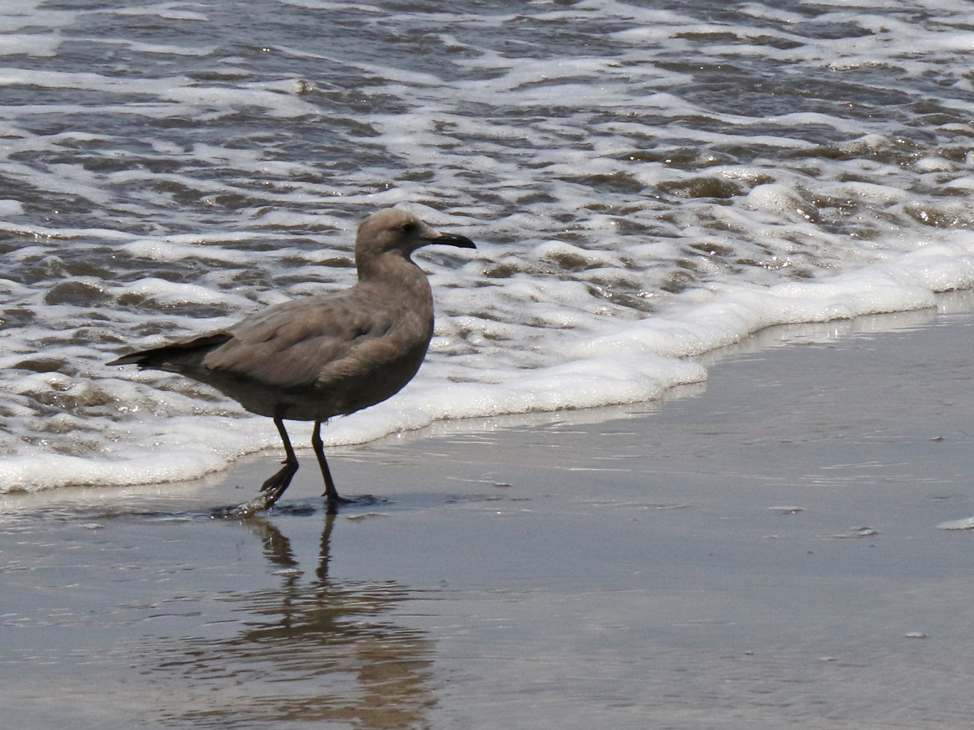
The blackish oystercatcher is a species of wading bird in the oystercatcher family Haematopodidae. It is found in Argentina, Chile, the Falkland Islands and Peru, and is a vagrant to Uruguay. [Wikipedia] I caught this one digging a little crab out of the sand at the edge of the surf.The grey gull, also known as garuma gull, is a medium-sized gull native to South America. Unusual among gulls, it breeds inland in the extremely dry Atacama Desert in northern Chile, although it is present as a non-breeding bird along much of the Pacific coast of South America. [Wikipedia]
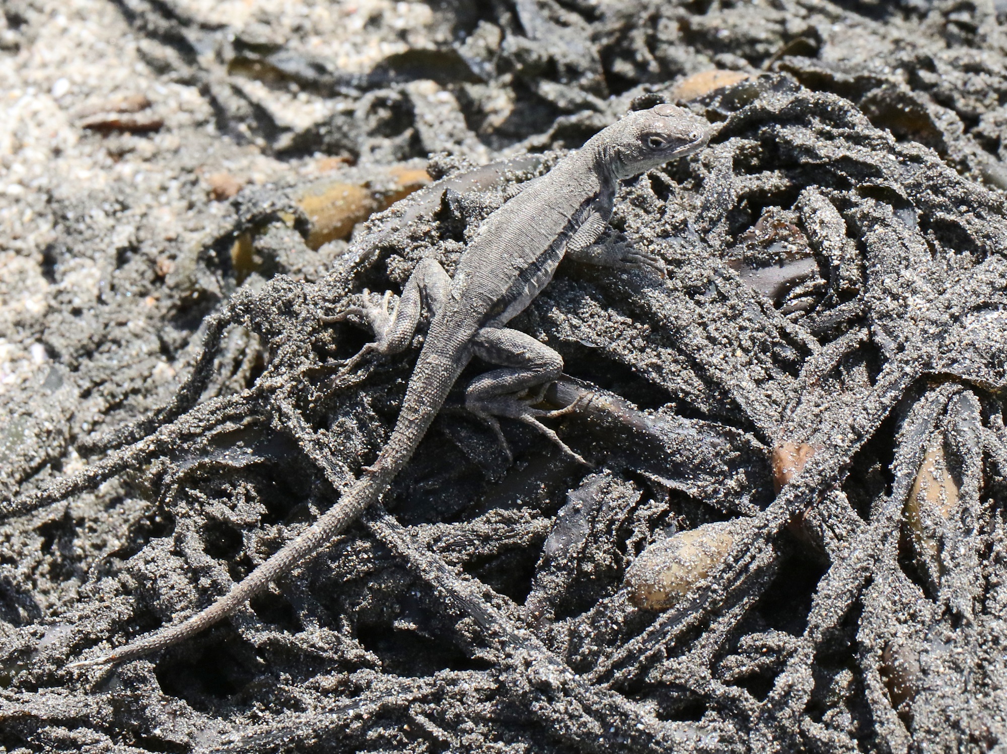
These little gray geckos scurry along on the dry seaweed. I have a little research to do to find out the name of the specie.Almost time to leave Pisco, at about 5 pm this afternoon. The anchoring ropes are still in place but the dock workers are standing by to loosen them. Here is where we were at about 8 o’clock tonight: leaving the shores of Peru behind and sailing south towards the coast of Chile.