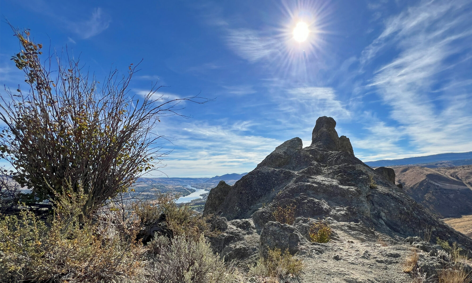
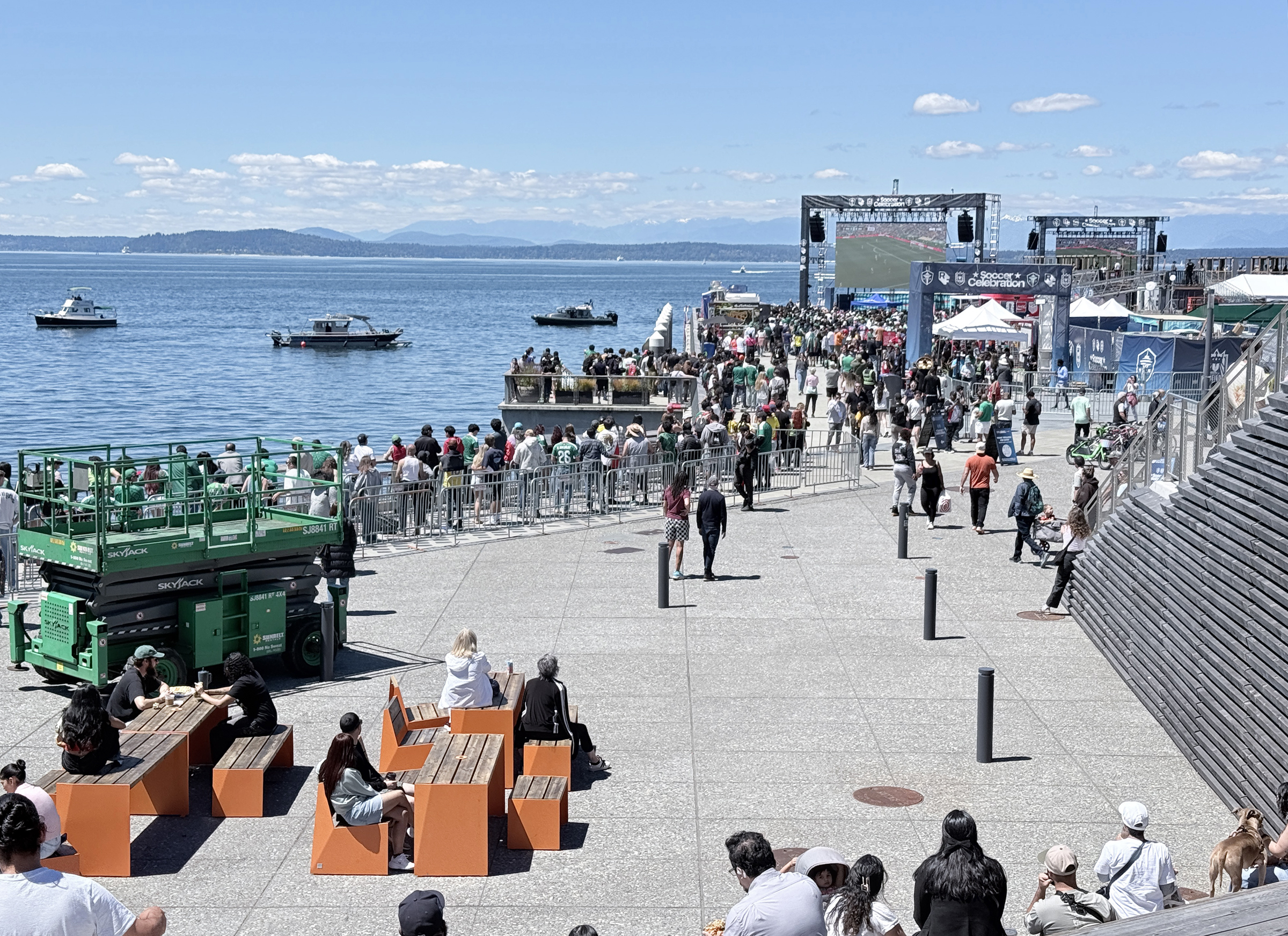
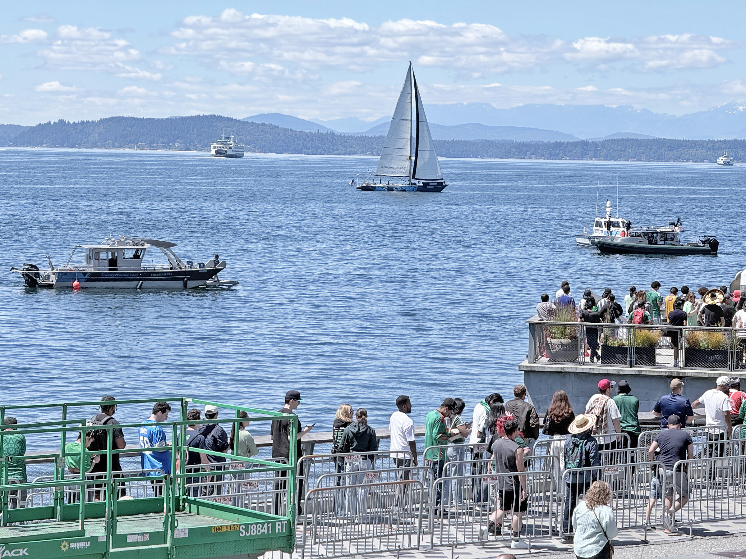
Two amigos and I went down to the Seattle waterfront at noon to check out the watch party for the first World Cup match— Mexico vs. South Africa.
Bafana Bafana* was up against it, playing in the home stadium of the Mexican team, and lost by two goals to nil.
*The South African team’s nickname, meaning ‘the boys, the boys’, from South Africa’s Nguni languages (Zulu and Xhosa).
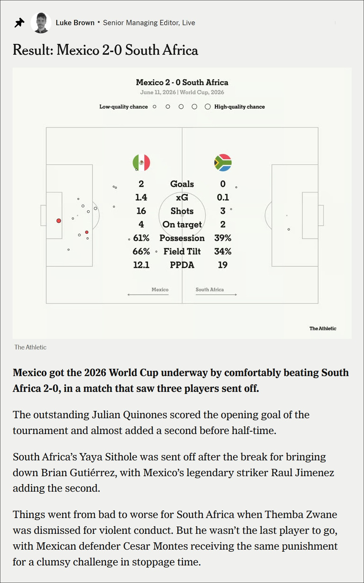
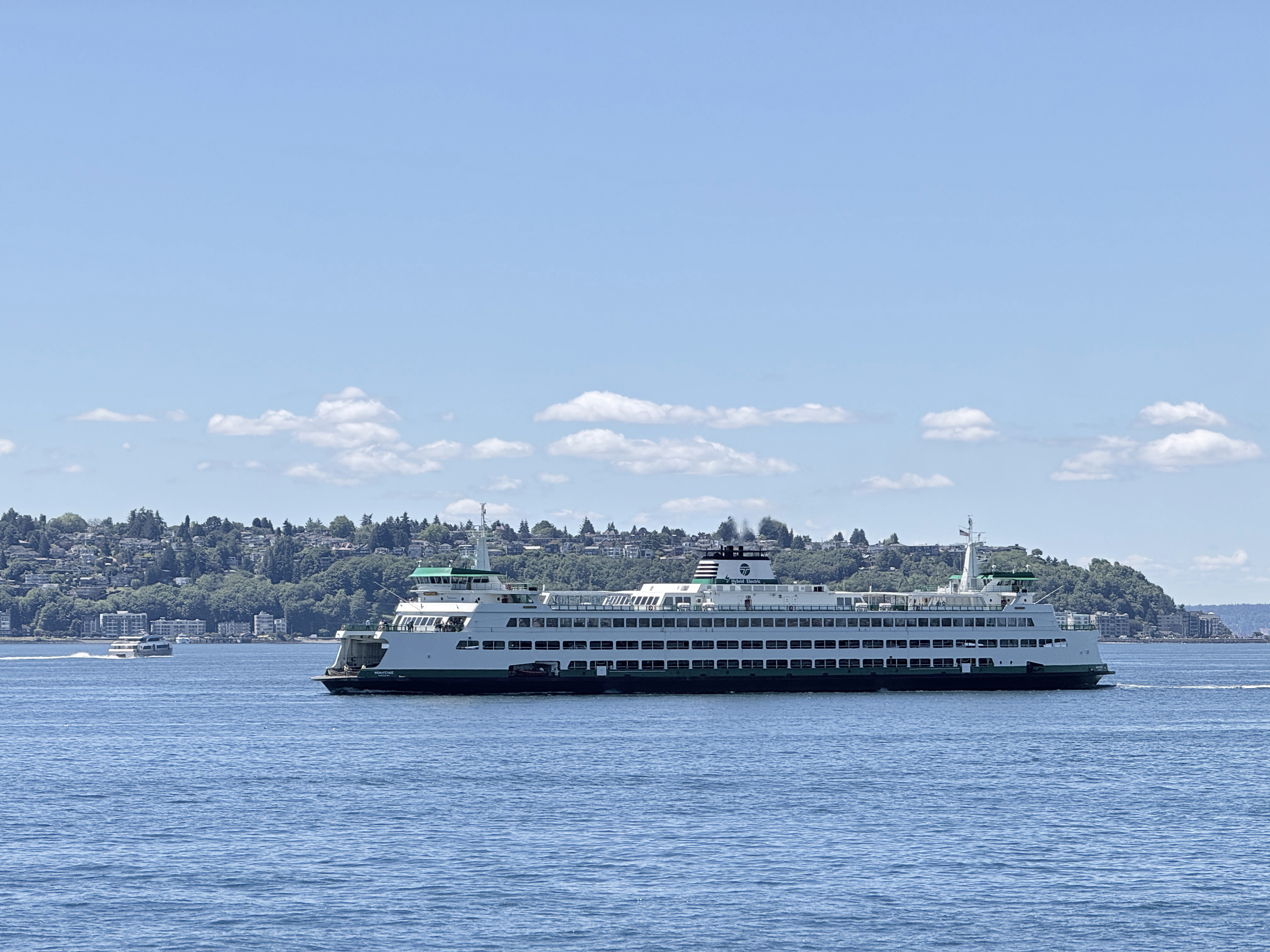
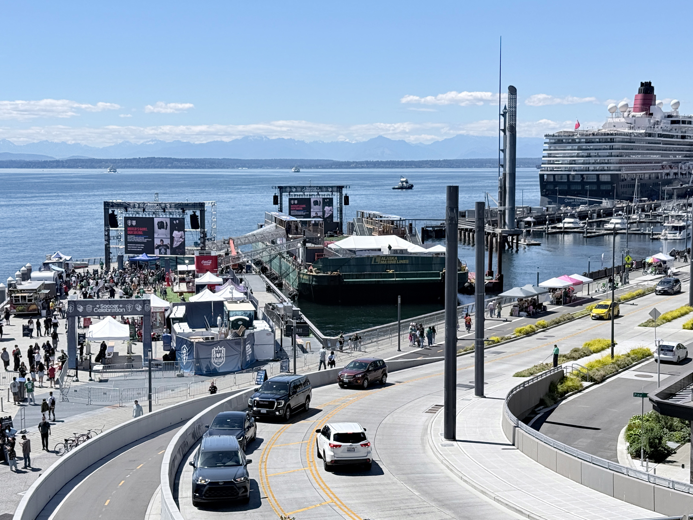
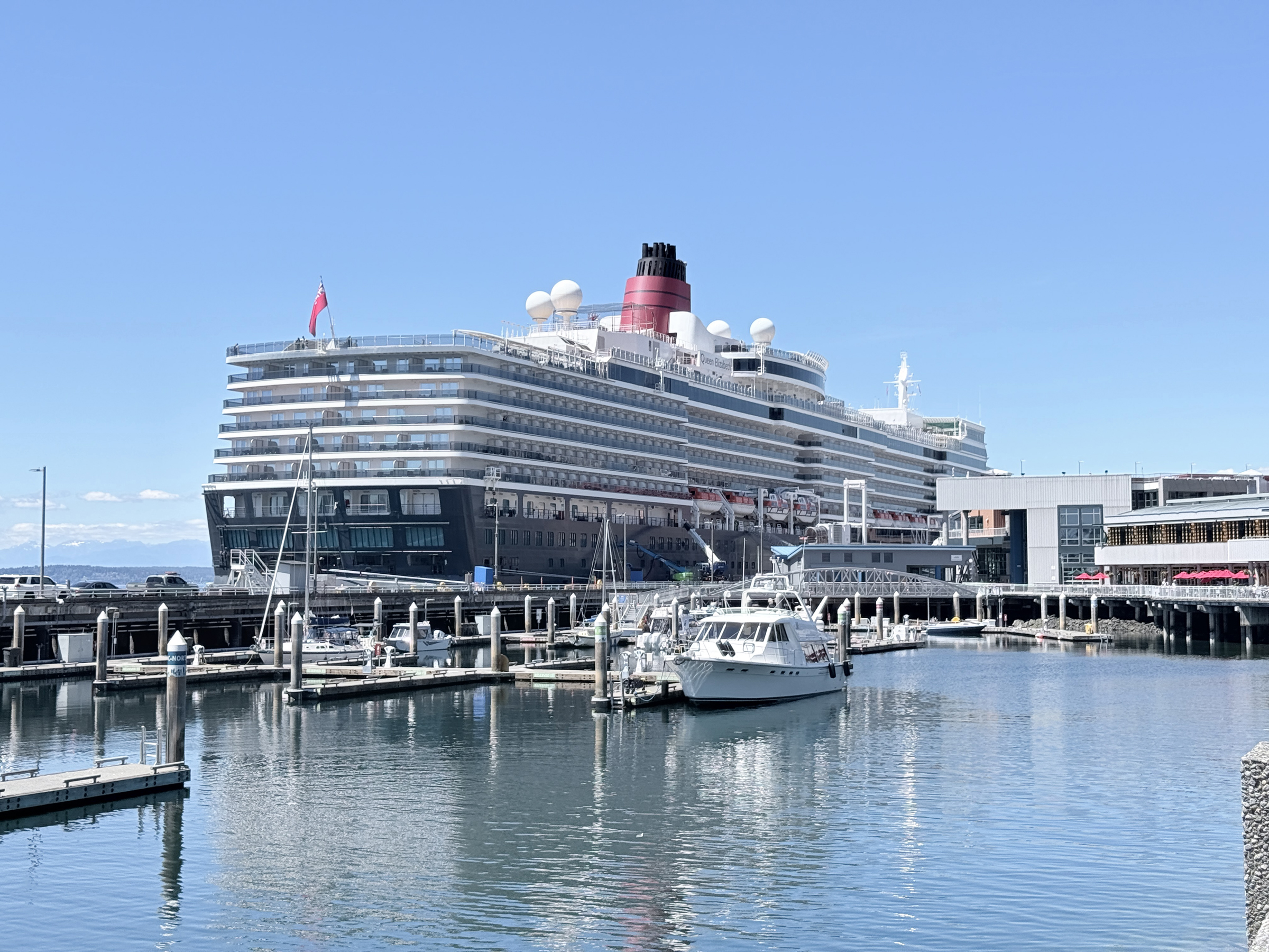
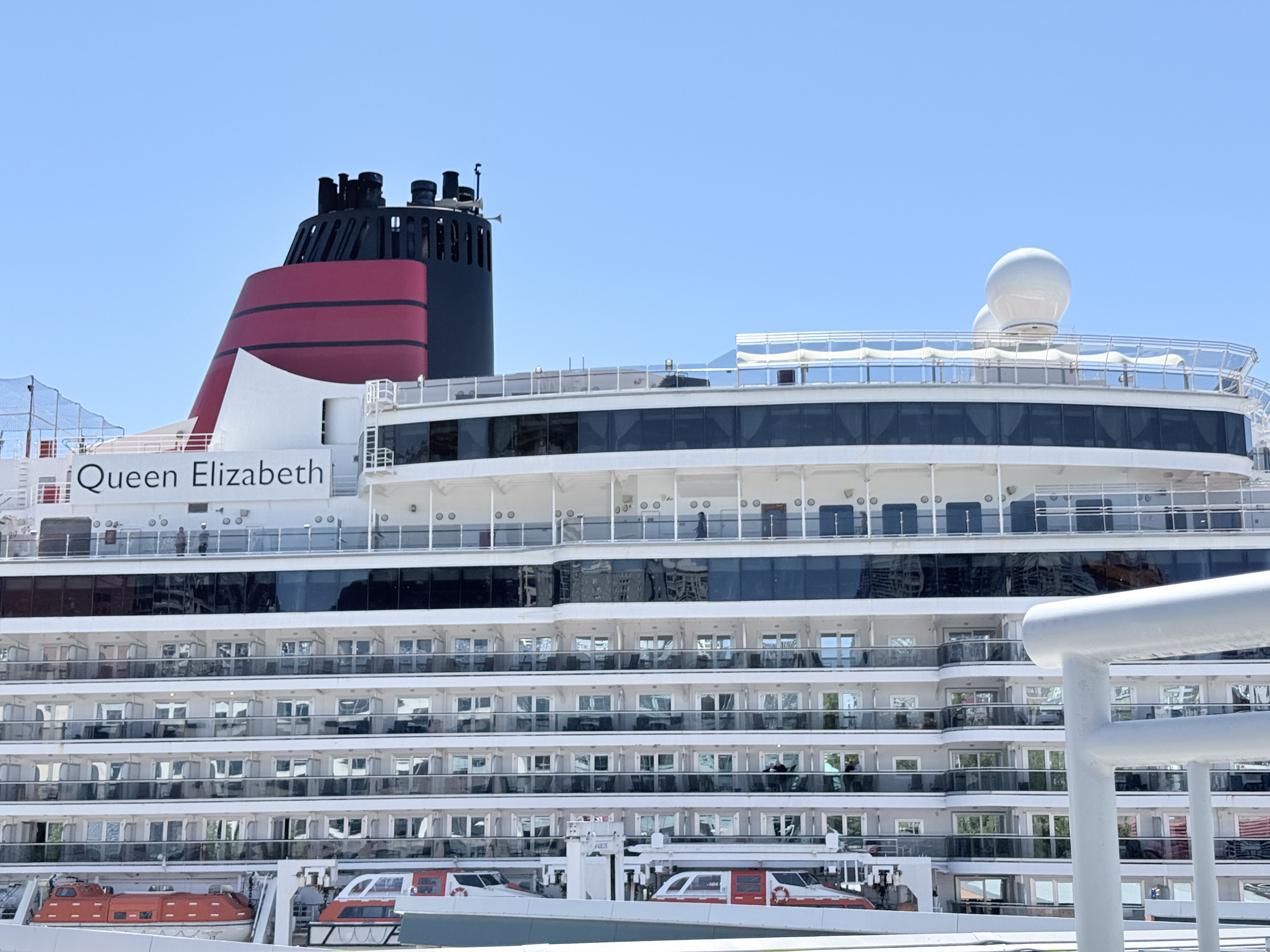
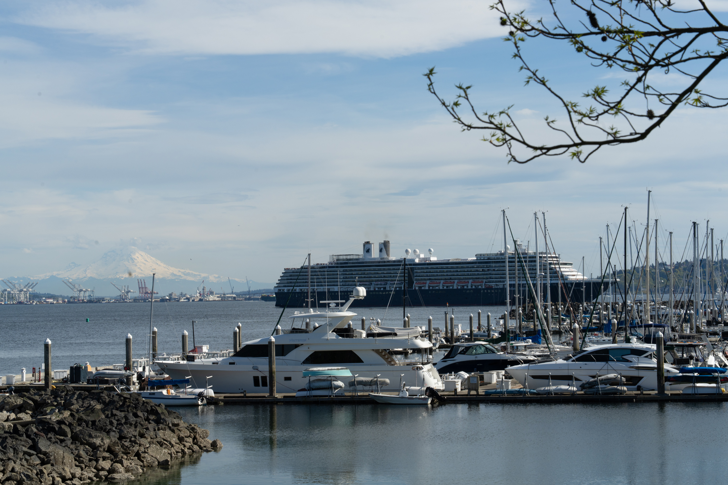
A summary of the game by Luke Brown from The Athletic in the New York Times. xG stands for Expected Goals. PPDA stands for Passes Per Defensive Action. It is a modern soccer analytics metric used to measure a team’s pressing intensity and aggressiveness.The view from the steps next to Seattle Aquarium. The screens could have been larger, we thought— but maybe the space on Pier 62 did not allow that. To the right of Pier 62 is a barge for more people ,with another screen.Ferries and sailboats on the water in Elliott Bay.Washington State’s ferry system celebrates its 75th anniversary this month. The ferry system began operation on June 1, 1951, after the state government acquired routes, vessels, and terminals from the Puget Sound Navigation Company, a private company that had a virtual monopoly on ferries in the region.A view of the barge by Pier 62 that allowed for another screen and watch party viewing area.The Cunard Line’s luxury cruise ship, Queen Elizabeth, is at Pier 66 today before setting sail for Ketchikan, Alaska. Launched in 2010 and refreshed in 2025, the ship accommodates up to 2,081 passengers and features a formal ambiance with elegant, Art Deco-inspired decor.A closer look.
I had a blast at the stamp show but it’s great to have made it home.
Ar Boston Logan airport, my checked bag weighed in at 48.5 lbs, 1.5 lbs shy of the weight limit. The medium size suitcase was stuffed with packs of stamp album pages and a giant binder to put them in, along with brochures and other papers.
These pictures are from yesterday, taken in and around Boston Common— the oldest city park in all of the United States.
The building with the iconic gold dome overlooking the Boston Common is the Massachusetts State House.
The next world stamp exhibition is in Prague, in the Czech Republic in March 2028.
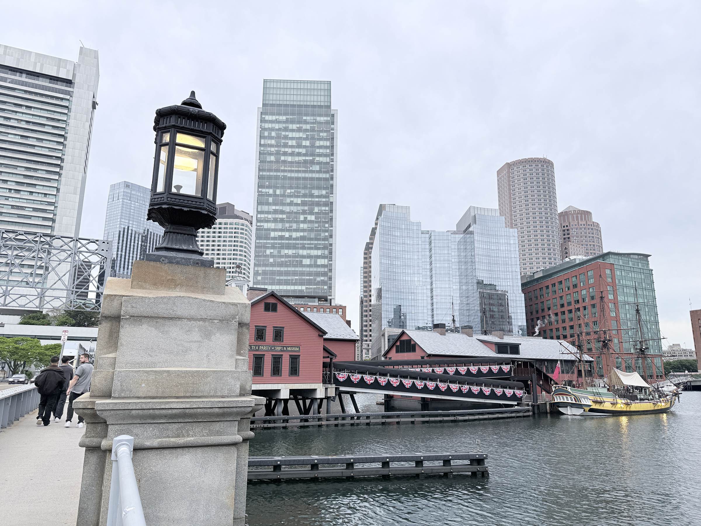
The site of the Boston Tea Party incident is a short walk from the Convention Center.
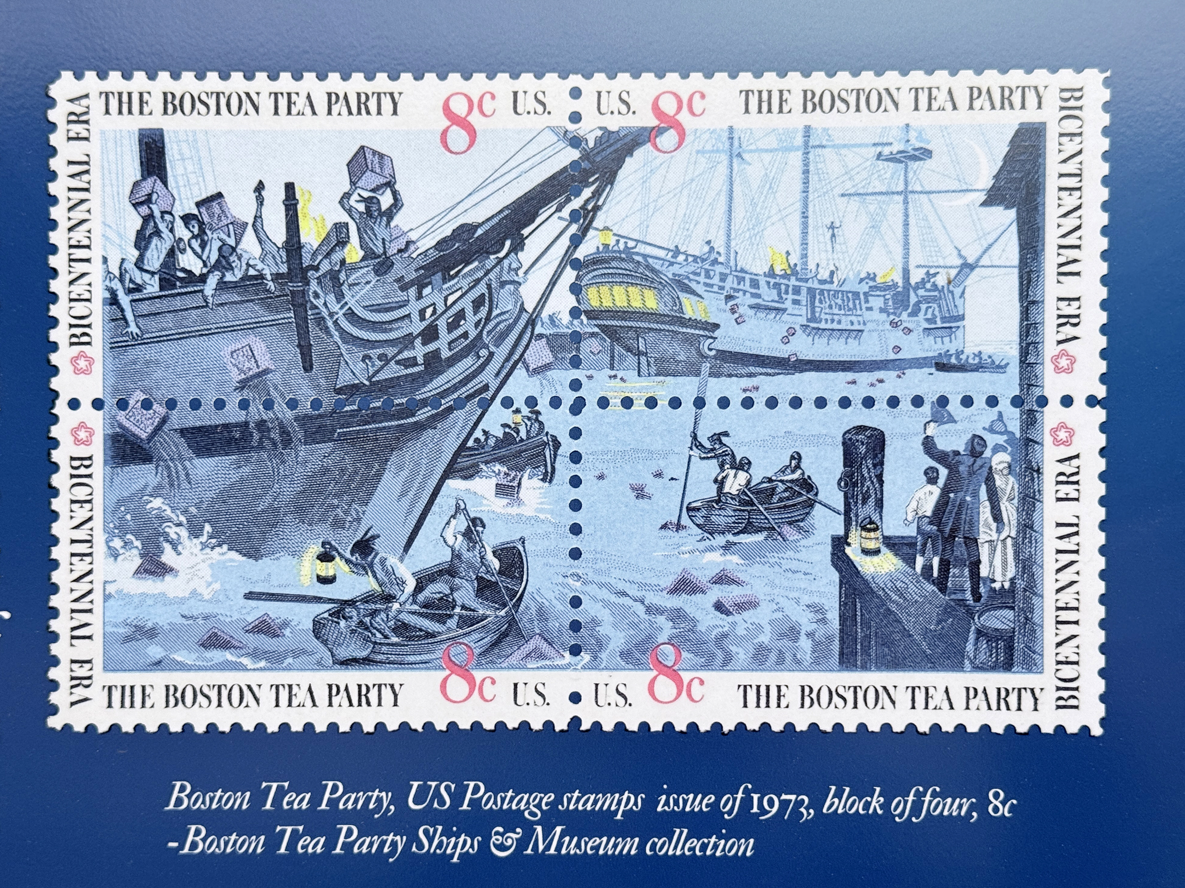
The Boston Tea Party was a political protest on December 16, 1773, where American colonists, frustrated by British “taxation without representation,” destroyed 342 chests of tea. Led by the Sons of Liberty and disguised as Mohawk warriors, the group dumped $1.7 million worth of British East India Company tea into Boston Harbor.
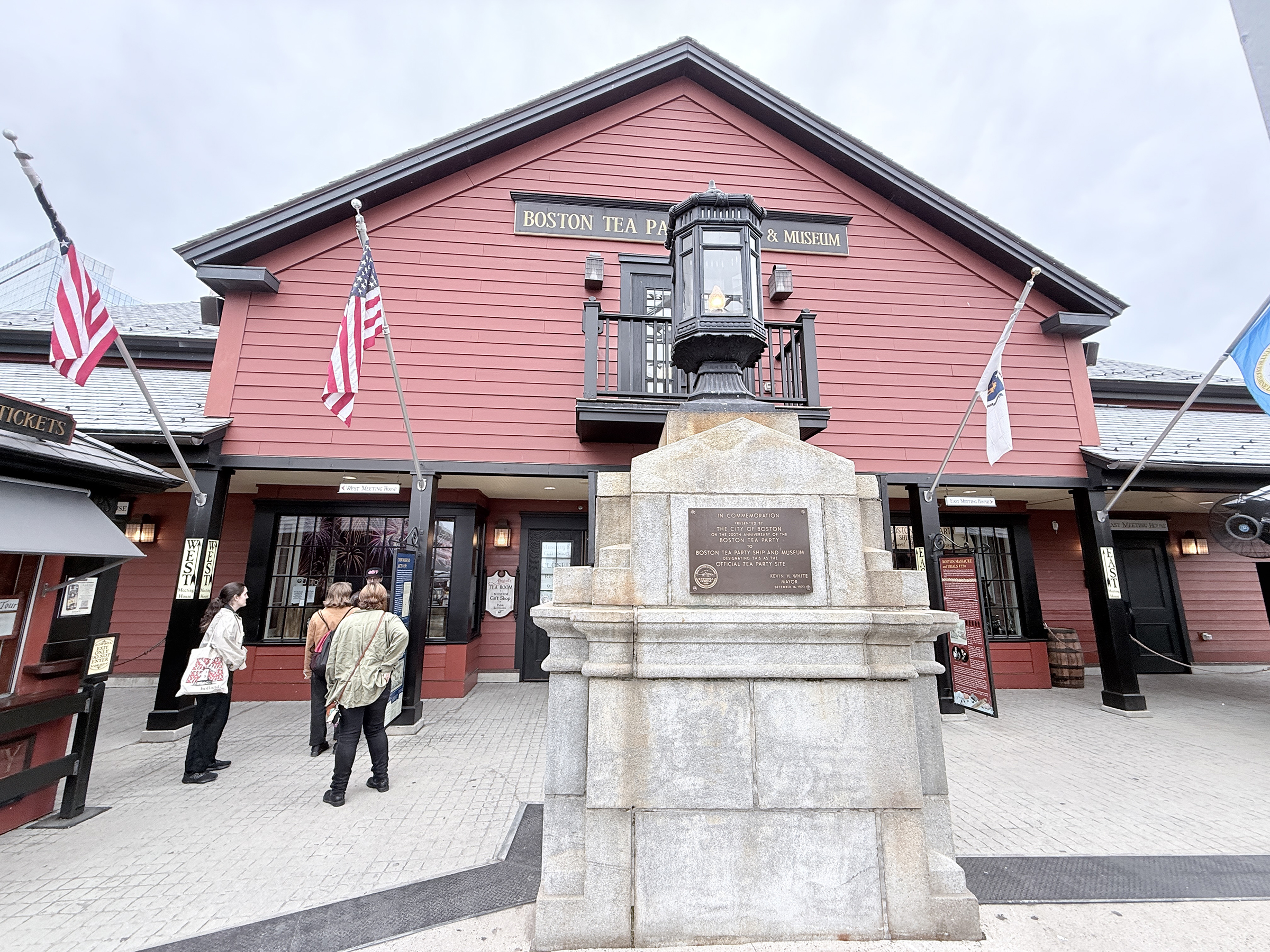
The Boston Tea Party Ships & Museum had already closed for the day when I got there last night.
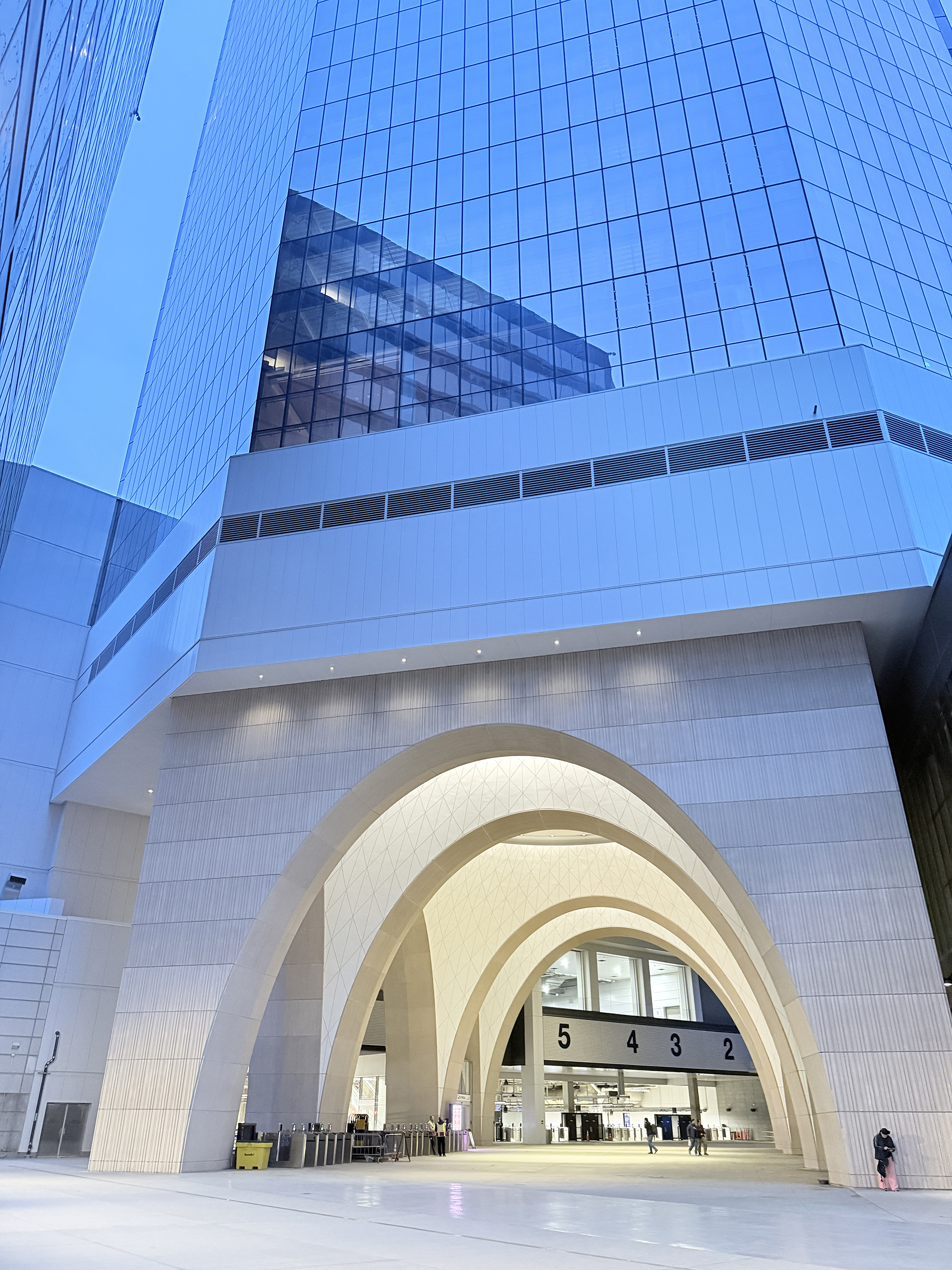
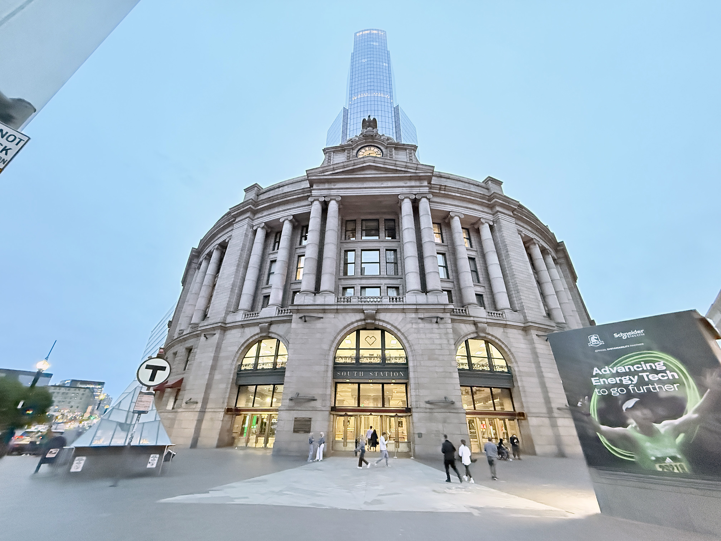
I took a few pictures and then walked to South Station at 700 Atlantic Avenue. It is a large train station that serves the MBTA Subway, bus lines and an Amtrak line.
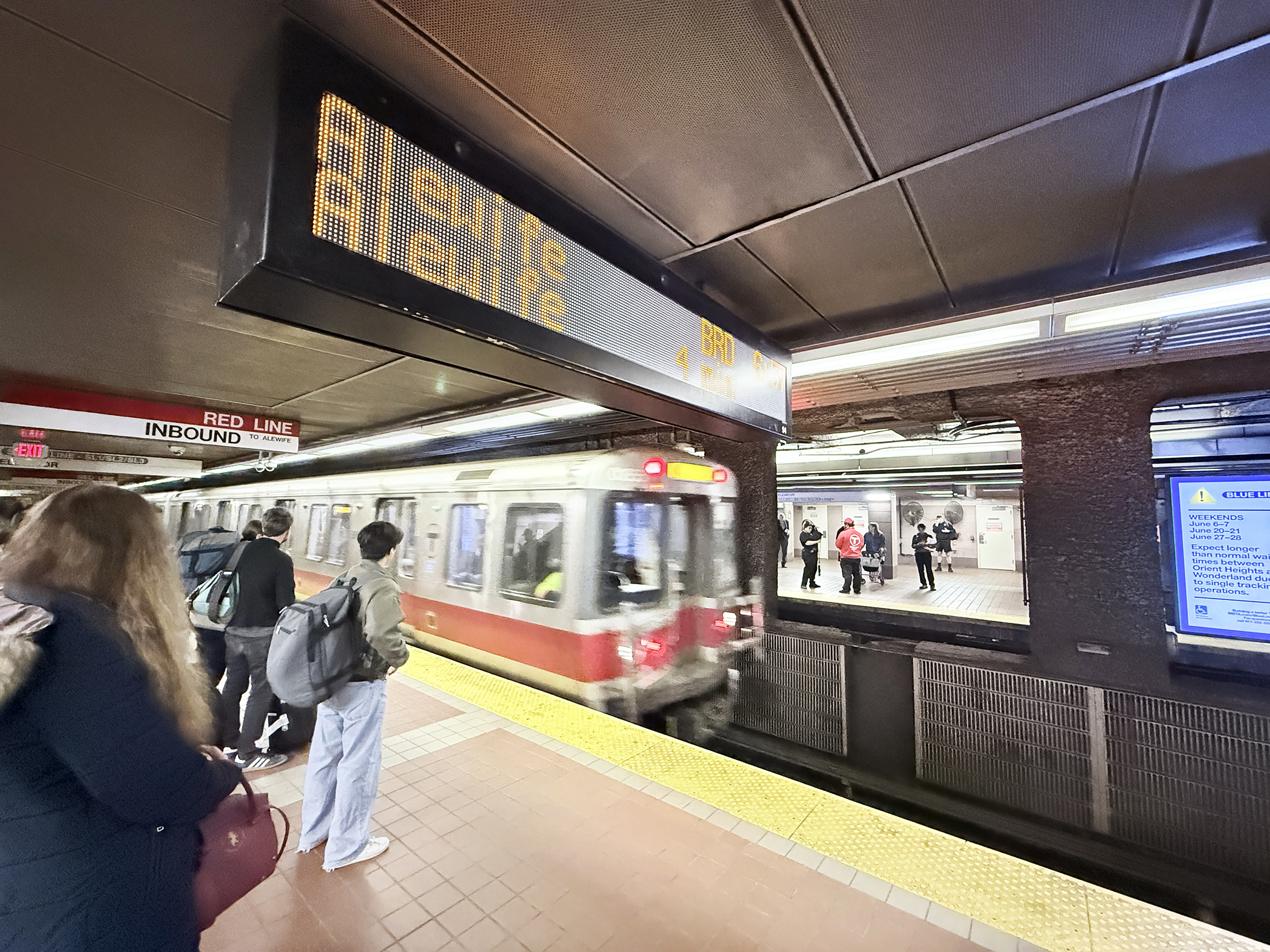
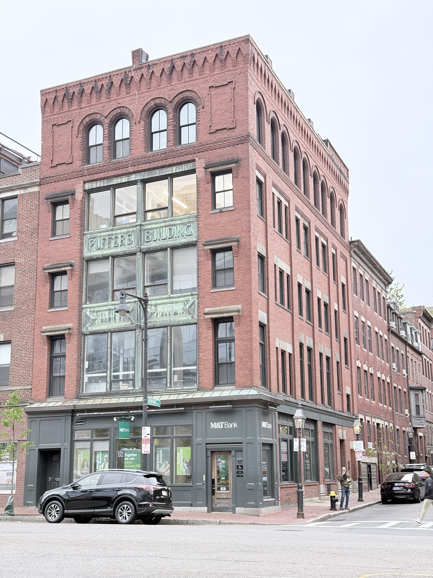
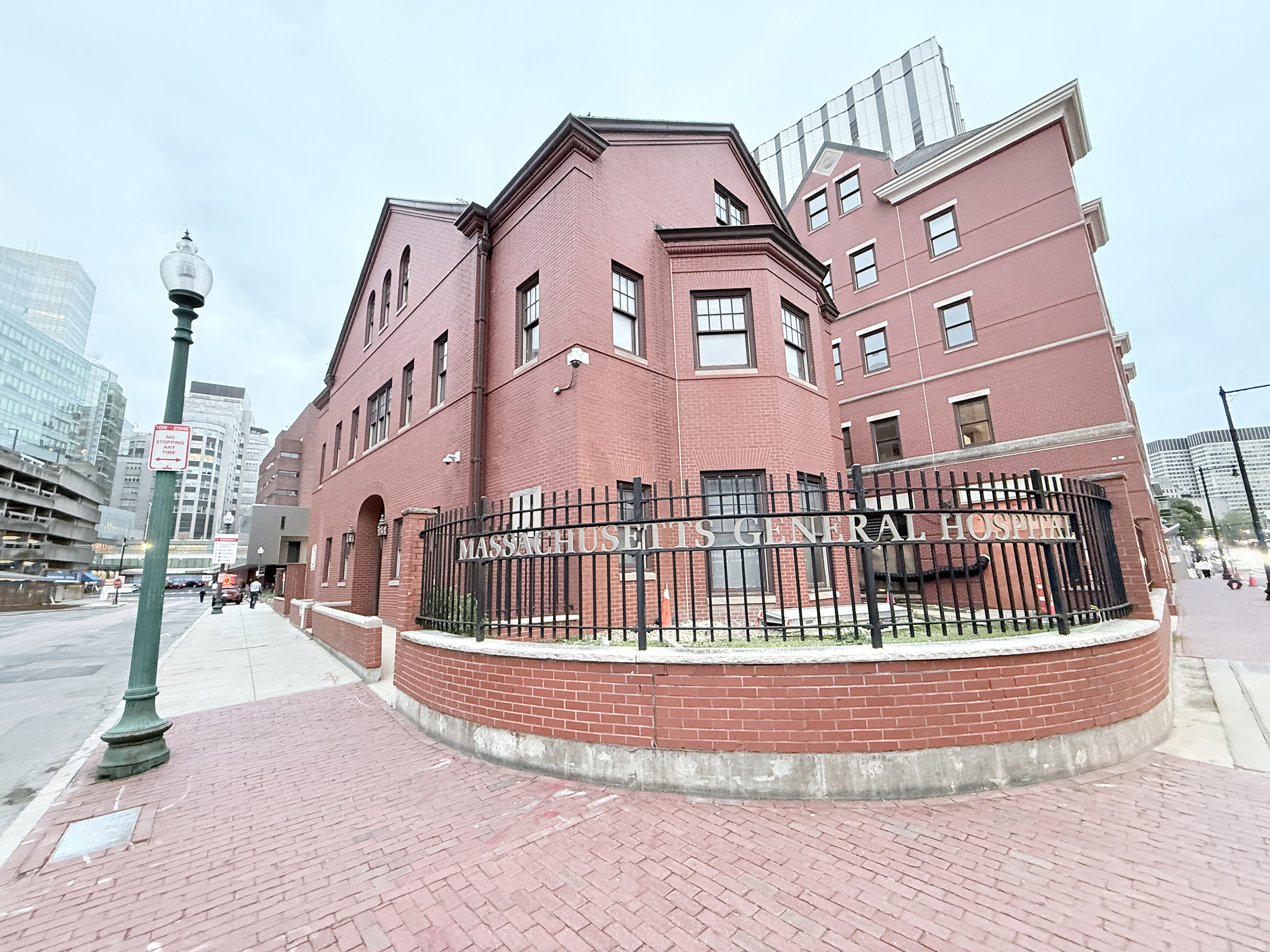
The site of the Boston Tea Party in Boston harbor.The Boston Tea Party Ships & Museum.A block of four 1973 stamps to commemorate the Boston Tea Party.A modern walkway and arches leading to South Station. The tall skyscraper above South Station is the South Station Tower. Standing at 690 feet tall with 51 stories, it is the sixth-tallest building in Boston.The main entrance into South Station, at the corner of Summer St and Atlantic Avenue.The main lobby inside South Station.I took the Red Line with three stops to Charles/ MGH* station. *Massachusetts General Hospital.The Puffers Building, located at 214-218 Cambridge Street in Boston’s Beacon Hill, is a historic Queen Anne-style brick building built in 1899. Financed by carbonated beverage magnate Alvin D. Puffer, the building originally functioned as sweatshops employing newly arrived immigrants in the West End’s cigar-making industry. – Google AI Overview/ Boston Women’s Heritage TrailAnd here is what must be one of the orginal Massachusetts General Hospital buildings. Founded in 1811, Massachusetts General Hospital (MGH) is the third-oldest general hospital in the United States and the original, largest teaching hospital for Harvard Medical School. Conceived to treat Boston’s sick and impoverished, MGH has grown into a world-renowned biomedical research and clinical care center.
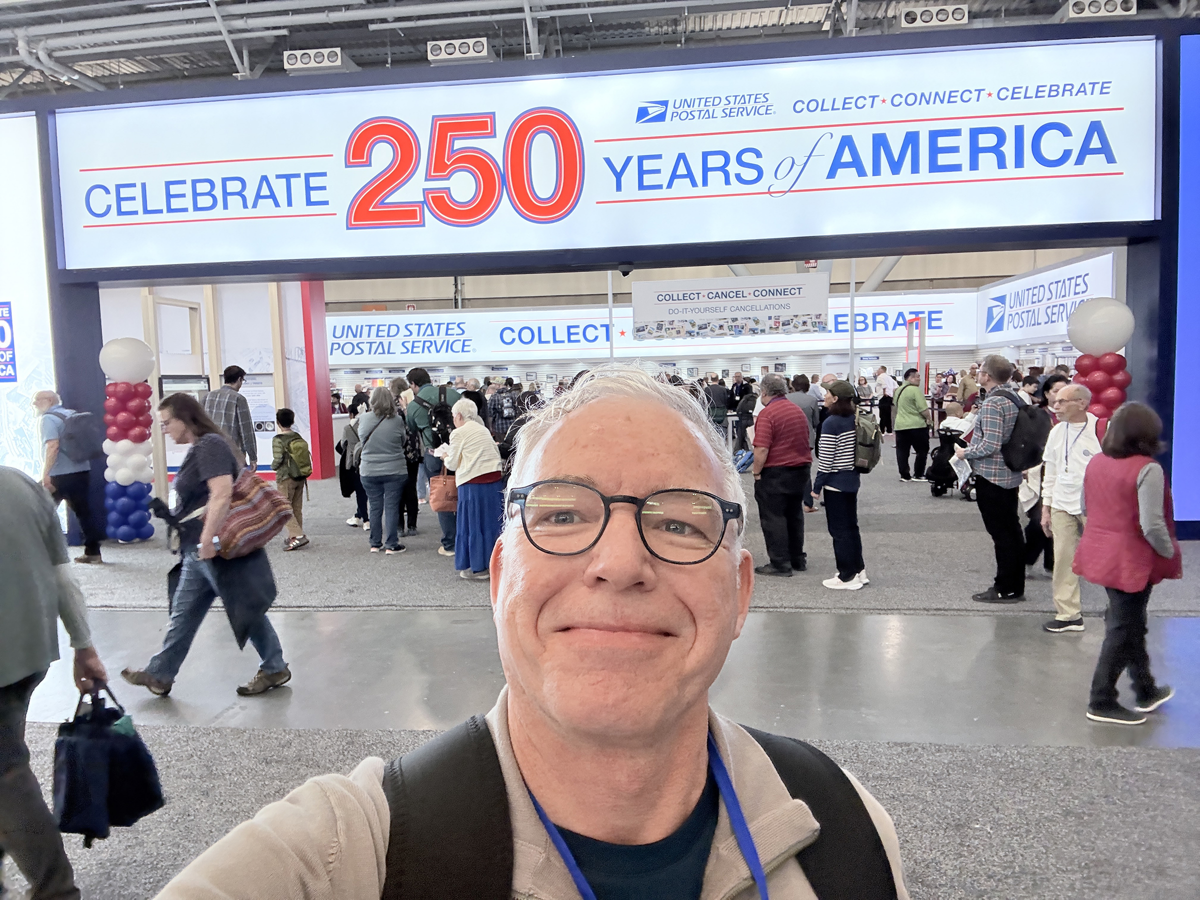
I attended the opening ceremony of the Boston 2026 World Expo stamp show, and spent the best part of the day looking at the displays, and checking out the offerings from the vendors. (And making a few acquisitions— nothing too extravagant).
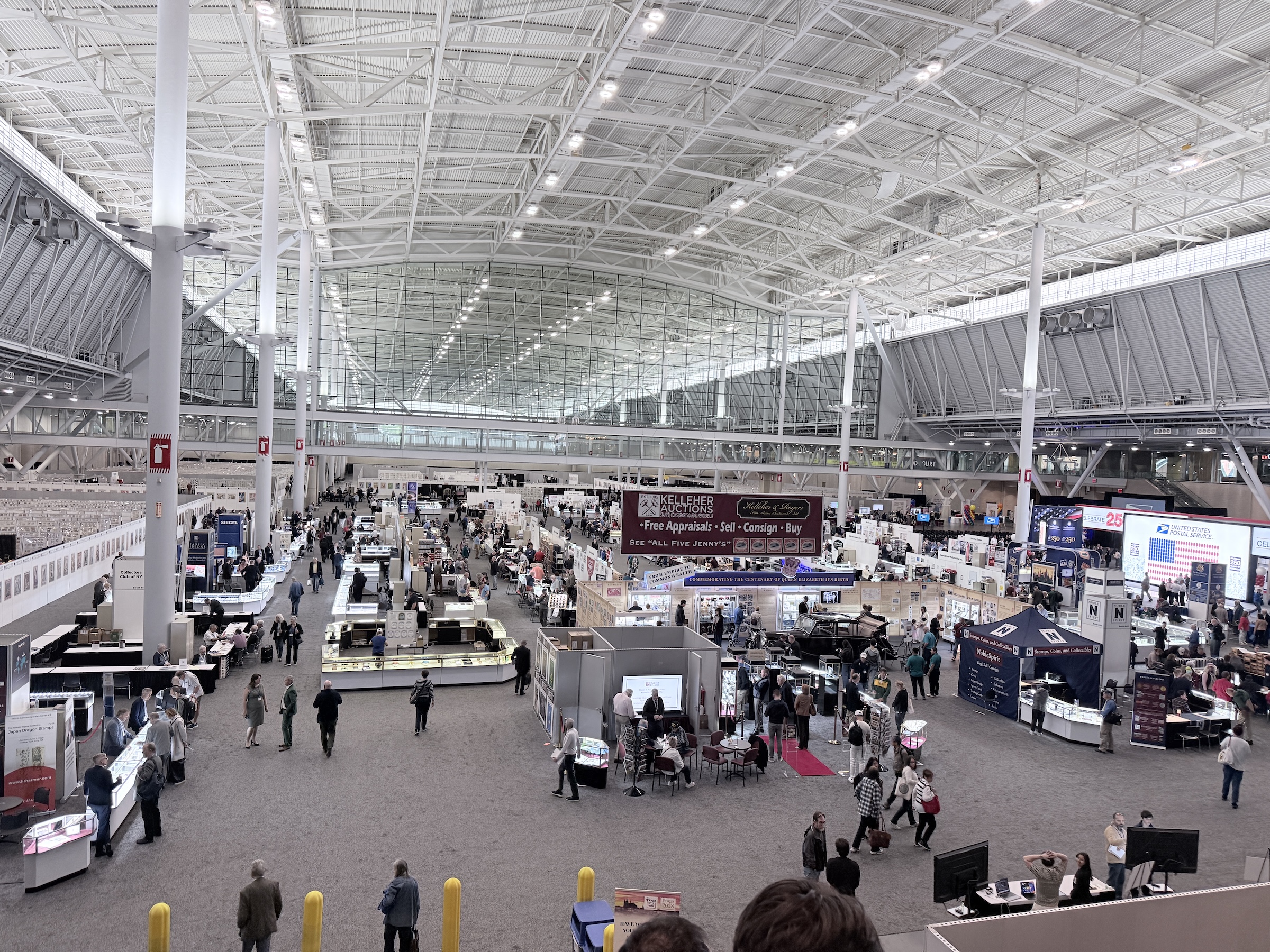
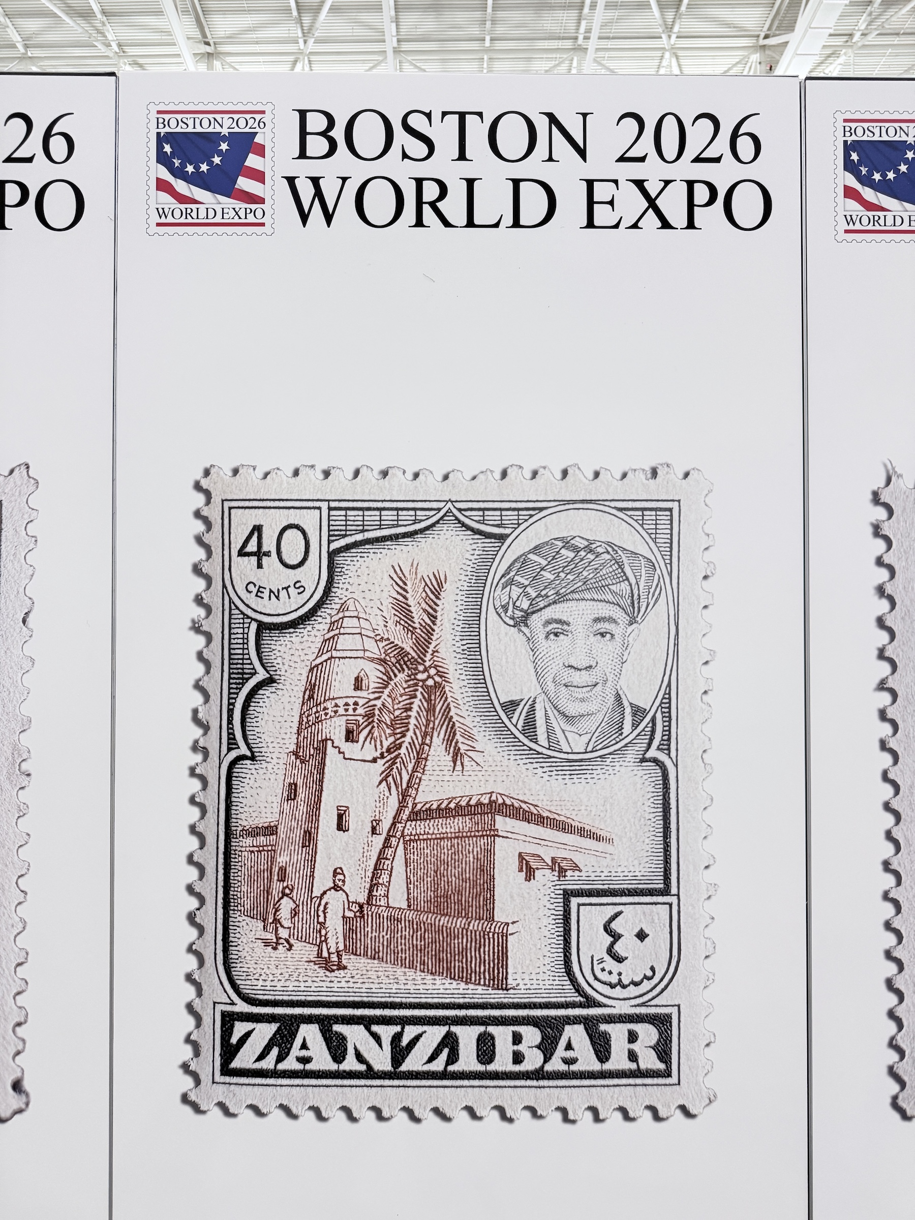
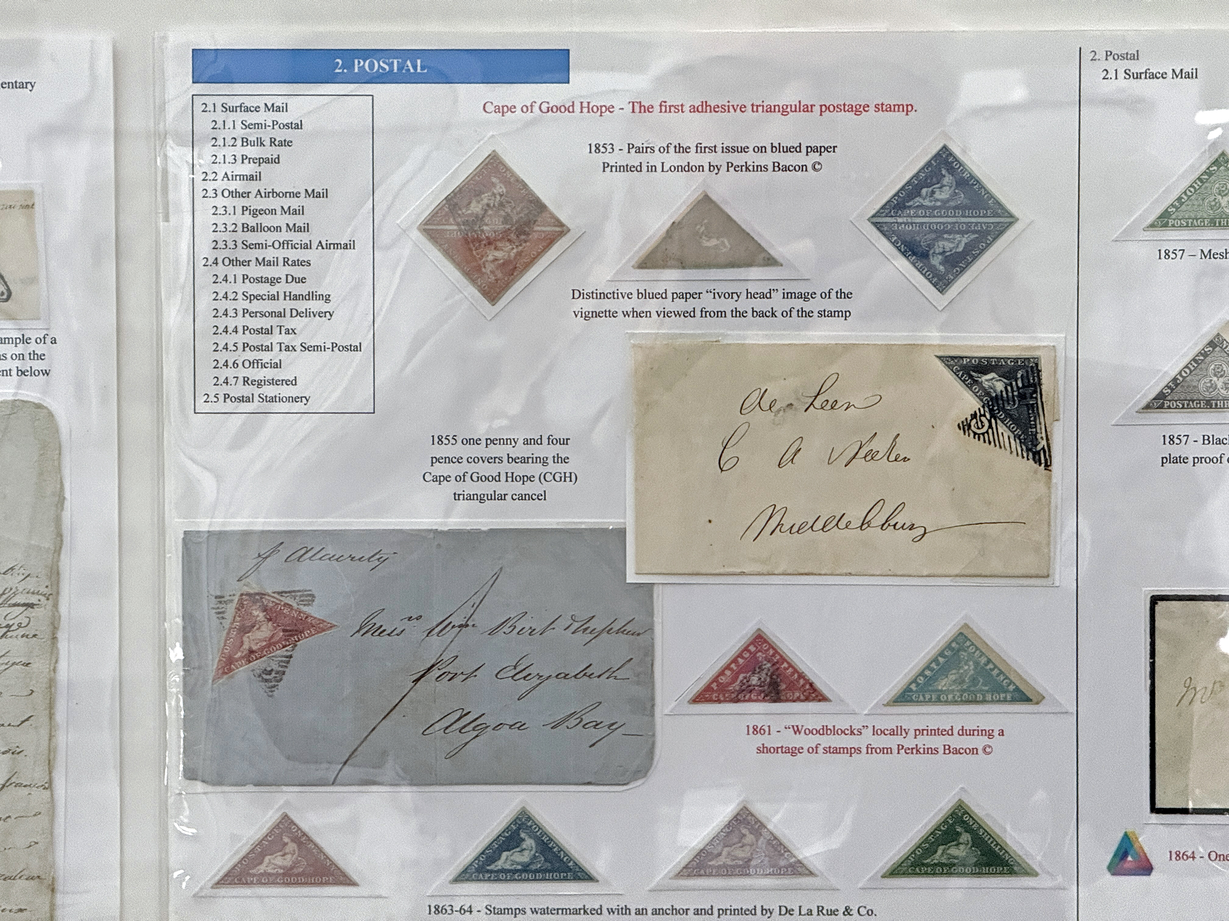
There was a little pomp and ceremony during the opening of the exhibition. A marching band called the Concord and Acton Minutemen came in. They performed the national anthem for us, and then marched out. Lexington is known for Lexington Common, or Battle Green, where the first shot of the American Revolutionary War was fired. This picture is from the end of the opening ceremony, with the unveiling of ten new stamps issued by the United States Postal Service, called Treasures of the Revolutionary Era. On the stage are several dignitaries of the Expo, of the USPS and the Lieutenant Governor of the Commonwealth of Massachusetts (The Honorable Kim Driscoll).A view of the main exhibition hall as one descends down the escalator from the main lobby. There are some 10,000 exhibits with a total of 4,000 frames, each with 16 pages, on display. An estimated inventory of some $10 million worth of stamps are for sale at the booths of the vendors and at the auctions that will be held.The USPS is a major sponsor of the show and there were long lines at the counters in the morning.Prints of about 2 ft x 3 ft of stamps of the world adorn the panels that form the spaces on the floor of the exhibition center. I still have to track down the ones depicting stamps from South Africa. (Do you know where in the world Zanzibar is?)An offering for serious collectors that also have deep pockets: a whole sheet of the 1918 issue of USA airmail stamps, 24c apiece, can be yours for $13,000.The 24c airmail stamp from the previous picture was printed in separate runs for the red link and blue ink. On one AND ONLY ONE SHEET, the Curtiss JN-4 “Jenny” biplane was accidentally printed upside down. These stamps are called the 1918 24¢ “Inverted Jenny”. When this single sheet of 100 Inverted Jenny stamps was purchased by William T. Robey in May 1918, it was quickly sold to stamp dealer Eugene Klein. Klein then sold the intact sheet to the eccentric multimillionaire collector Colonel Edward H. R. Green. Colonel Green instructed Kleinto break the sheet up into single stamps and smaller blocks. While most of the sheet was split into individual singles, Green deliberately kept the most important positional units intact. The Centerline Block of Four is shown in this picture: Taken from the exact center of the original sheet of 100, this block features the horizontal and vertical guide lines used by the printers. This unique centerline block survived intact and sold at a Spink auction in 2019 for $1,740,000.The famous Cape of Good Hope stamp from the Cape Colony in South Africa, issued 1853 to 1864. It was the world’s first triangular stamp. This panel is part of a thematic collection of triangular stamps of the world.And here is the stamp that started it all: the 1840 Penny Black issued in the United Kingdom. These were imperforate and cut apart with scissors. This is one has four full margins around the edges of the stamp. The display envelope with the stamp on goes for $295. So far I have resisted the temptation to buy one!
Happy Friday.
I landed in Boston at 6.23 pm local time.
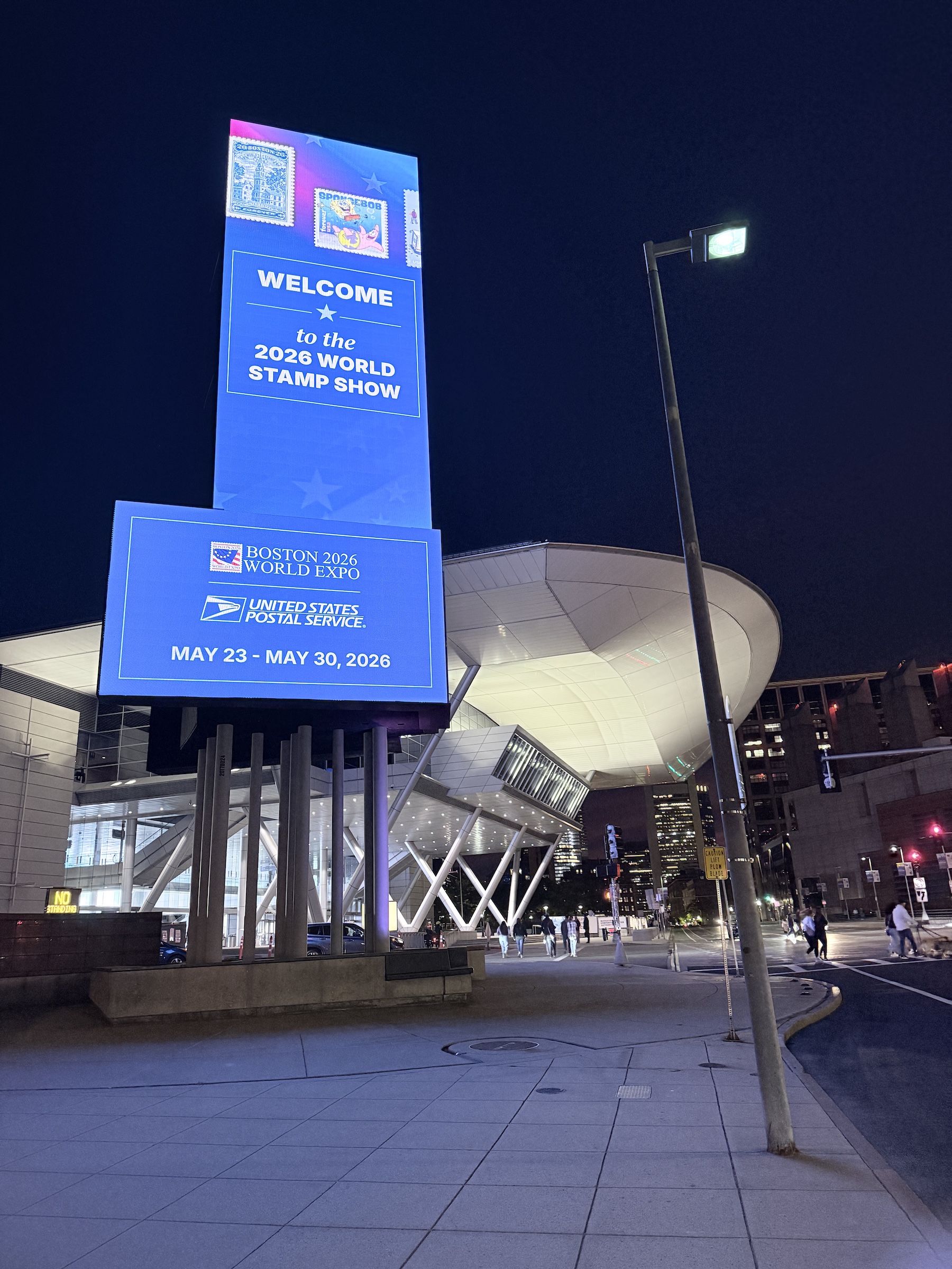
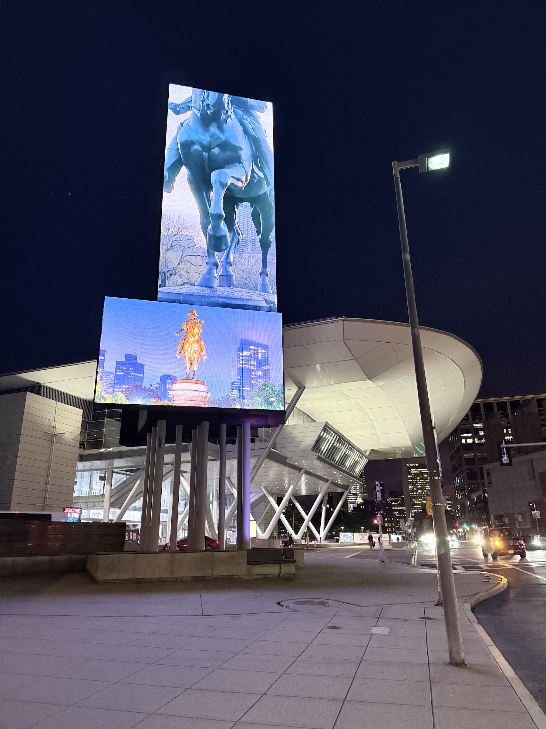
My hotel is right next to the Convention Center— the venue for the Boston 2026 World Stamp Show that starts tomorrow.
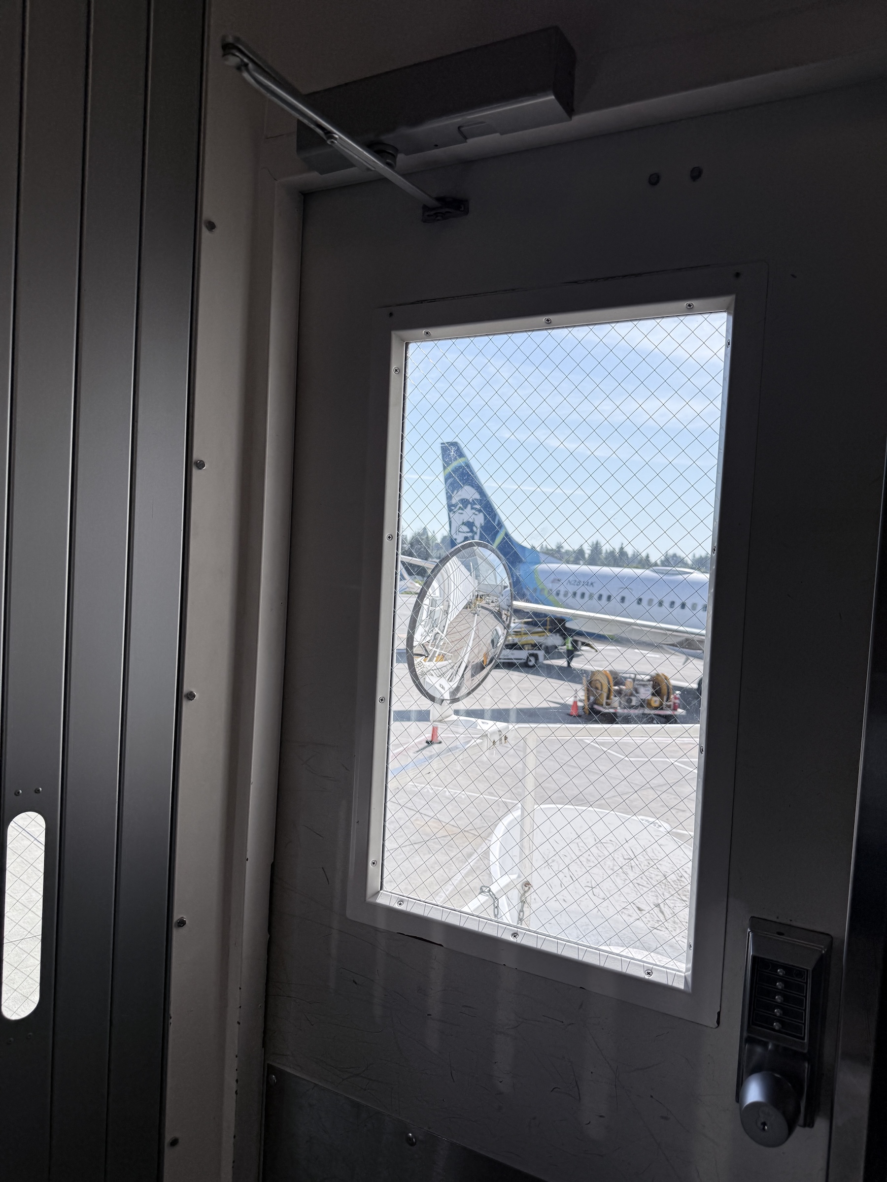
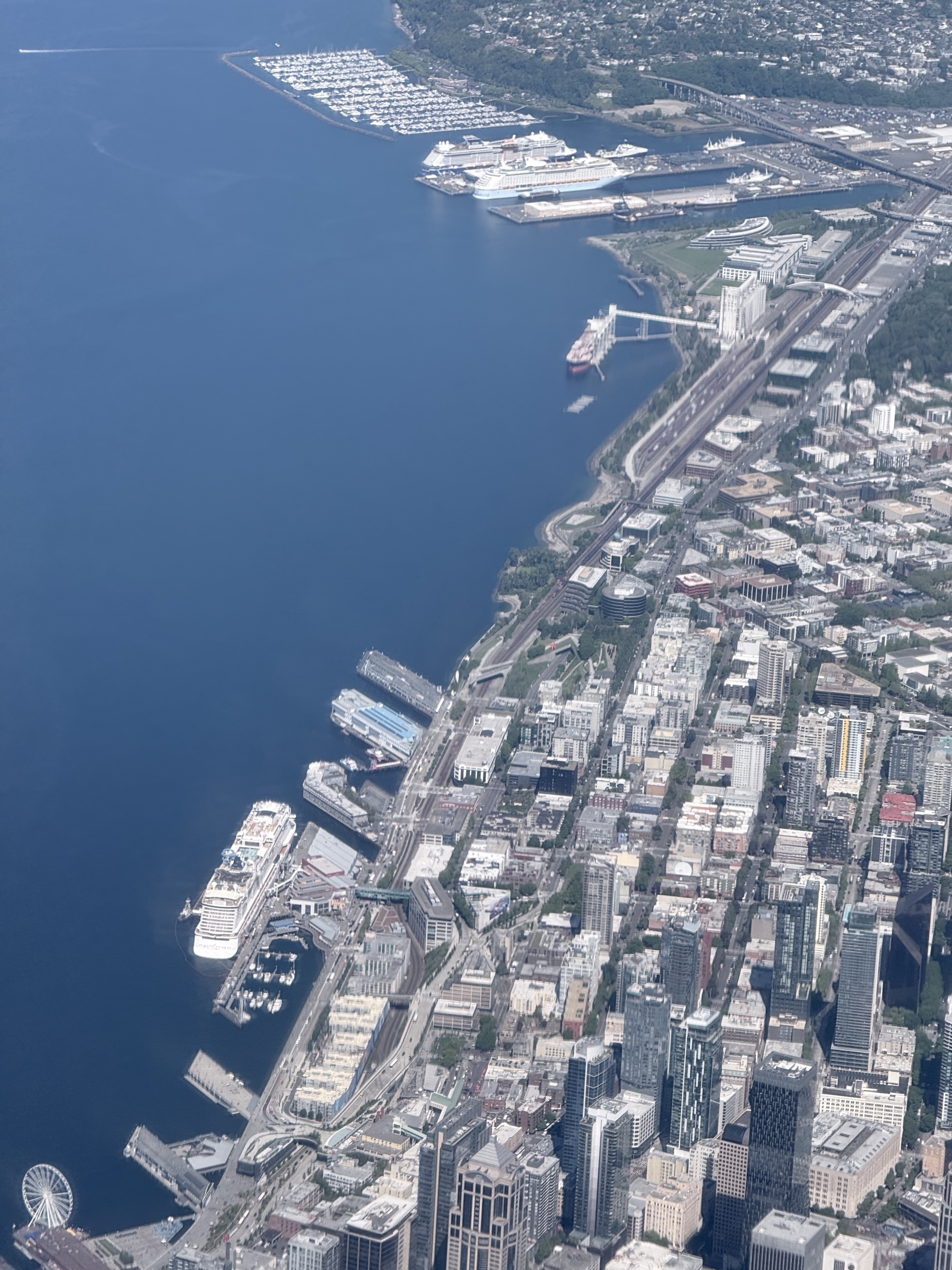
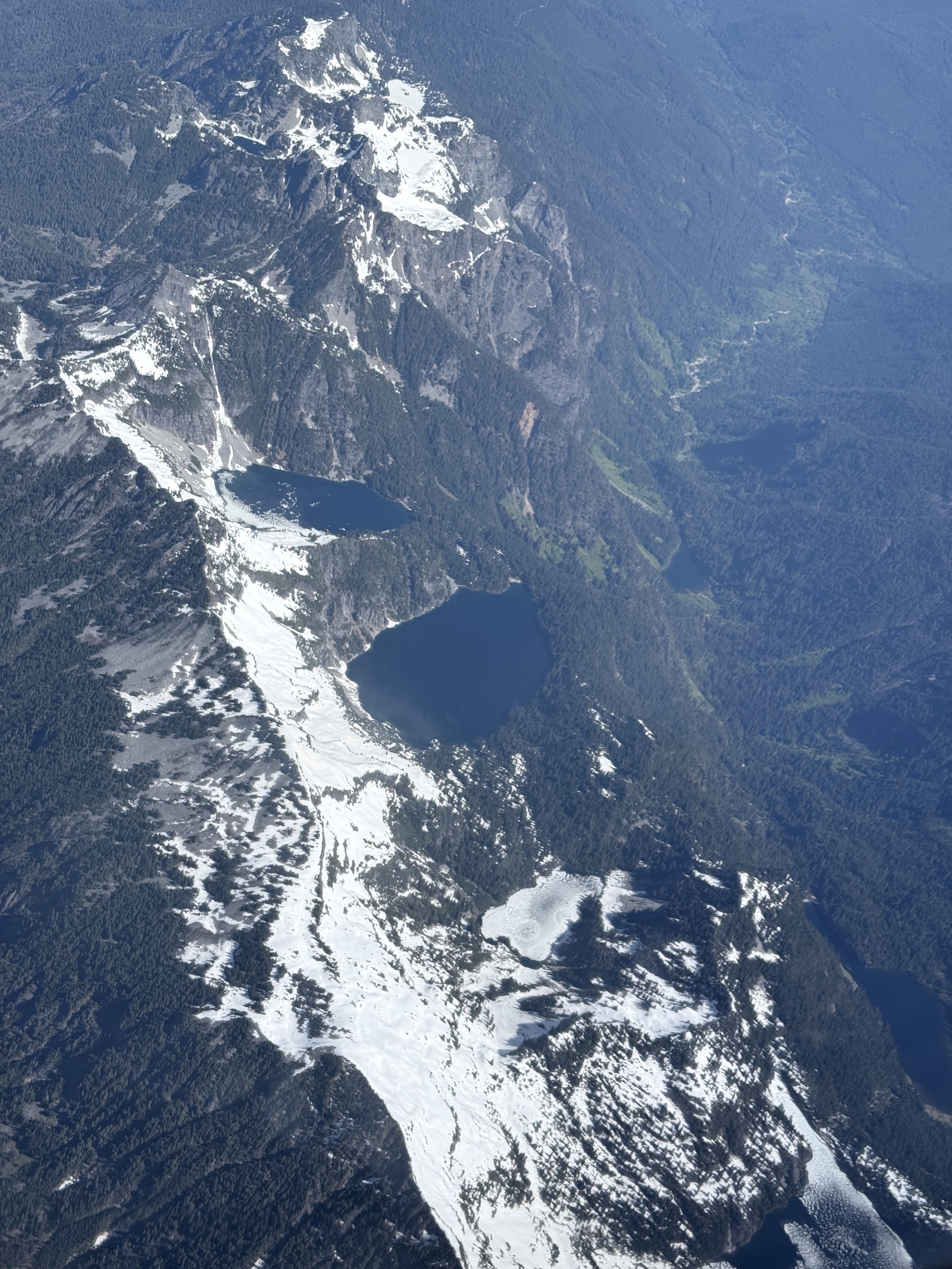
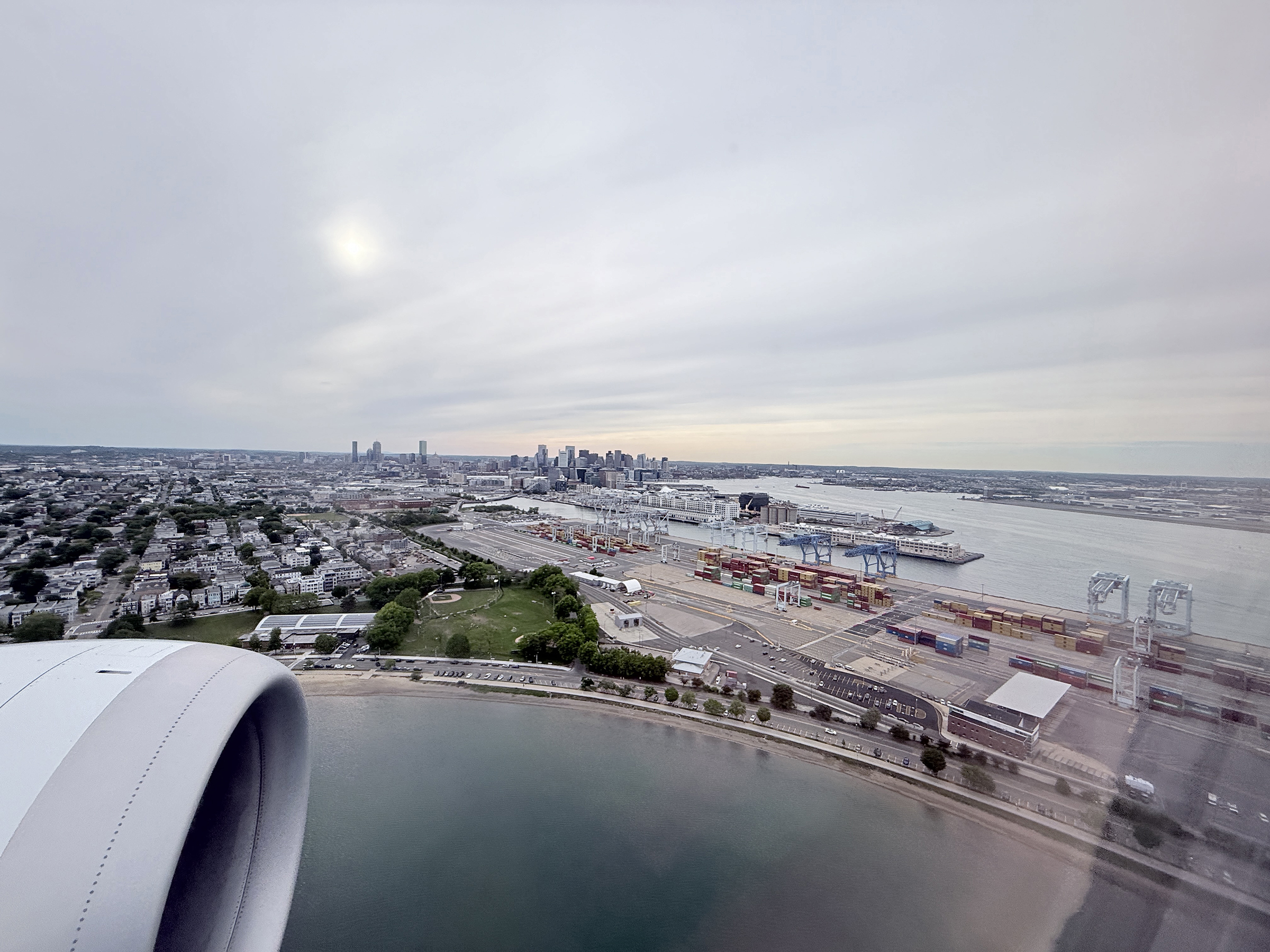
Pictures: Stepping on to the Boeing 737 MAX 9 at SEA airport’s North Terminal; Checking for cruise ships at the piers in Elliott Bay Boeing 737 MAX 9 (Norwegian Joy, Voyager of the Seas, Celebrity Edge); Alpine lakes in the mountains in northern Washington State (our flight path skirted the Canadian border to the south, all the way to Boston); Approaching Boston Logan airport now, with the Nahant peninsula, a one square mile residential community just north of Boston that is connected to the mainland with a narrow causeway called Nahant Road; Landing at Boston Logan airport; Baggage claim area ‘Welcome to Boston’ at Boston Logan airport; Display signs at the Thomas M. Menino Convention & Exhibition Center and the night scene across from the Convention Center.
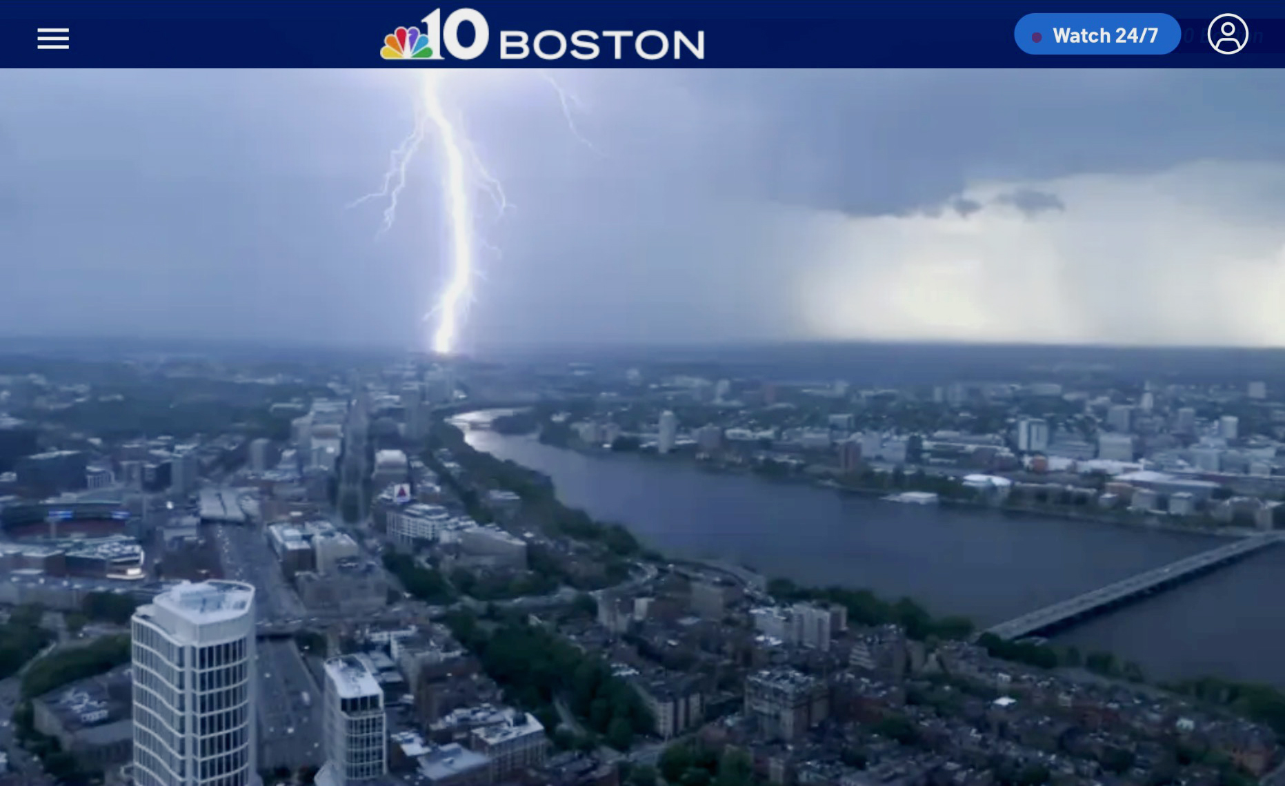
I have plans to travel to Boston on Friday*, and I see there was a severe thunderstorm over the city today.
Temperature highs had spiked up all the way to 96°F (36°C), a new record for May 19.
*A conference billed as the Boston 2026 World Expo starts there in the convention center on Saturday. It is the 12th international philatelic exhibition of the United States and serves as one of the world’s largest global stamp and history gatherings.
A lightning strike west of Boston, seen from the Prudential Center as a severe thunderstorm approached the city on Tuesday, May 19, 2026.
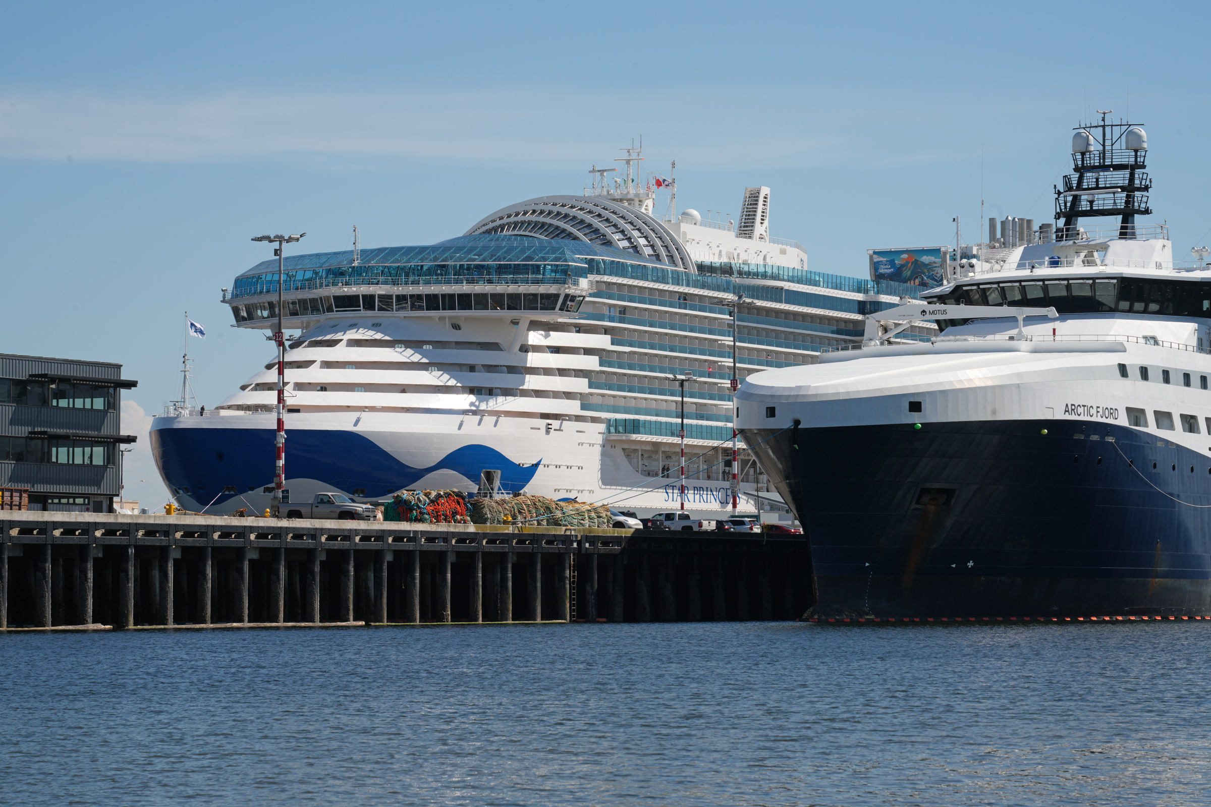
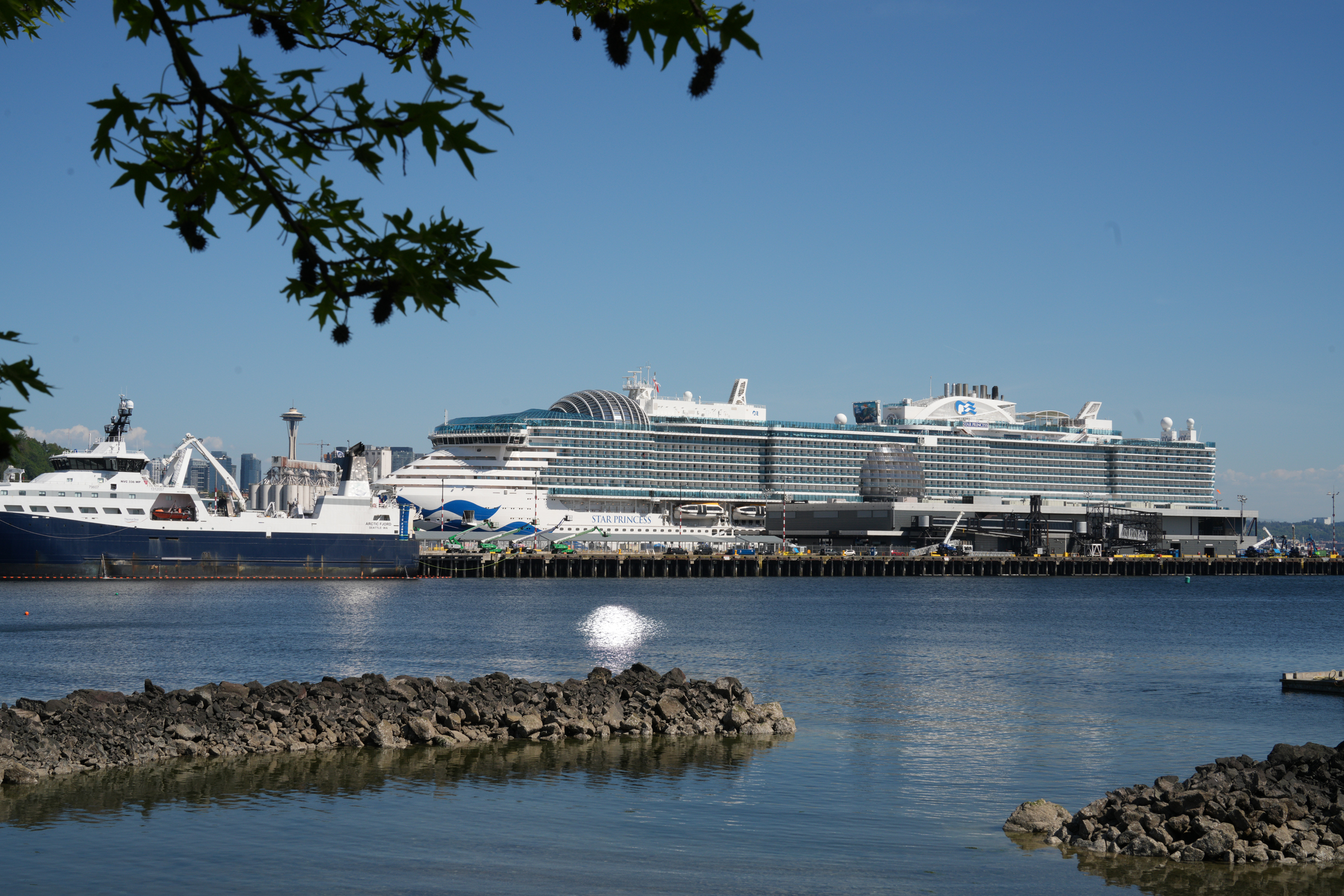
The newly built Star Princess made its maiden port of call in Seattle this weekend. She was constructed in 2025 by Fincantieri in Monfalcone, Italy, with a capacity for 4,300 passengers and a gross tonnage of 175,500. The Star Princess is the second Sphere-class vessel for Princess Cruises, a sister ship to the Sun Princess.
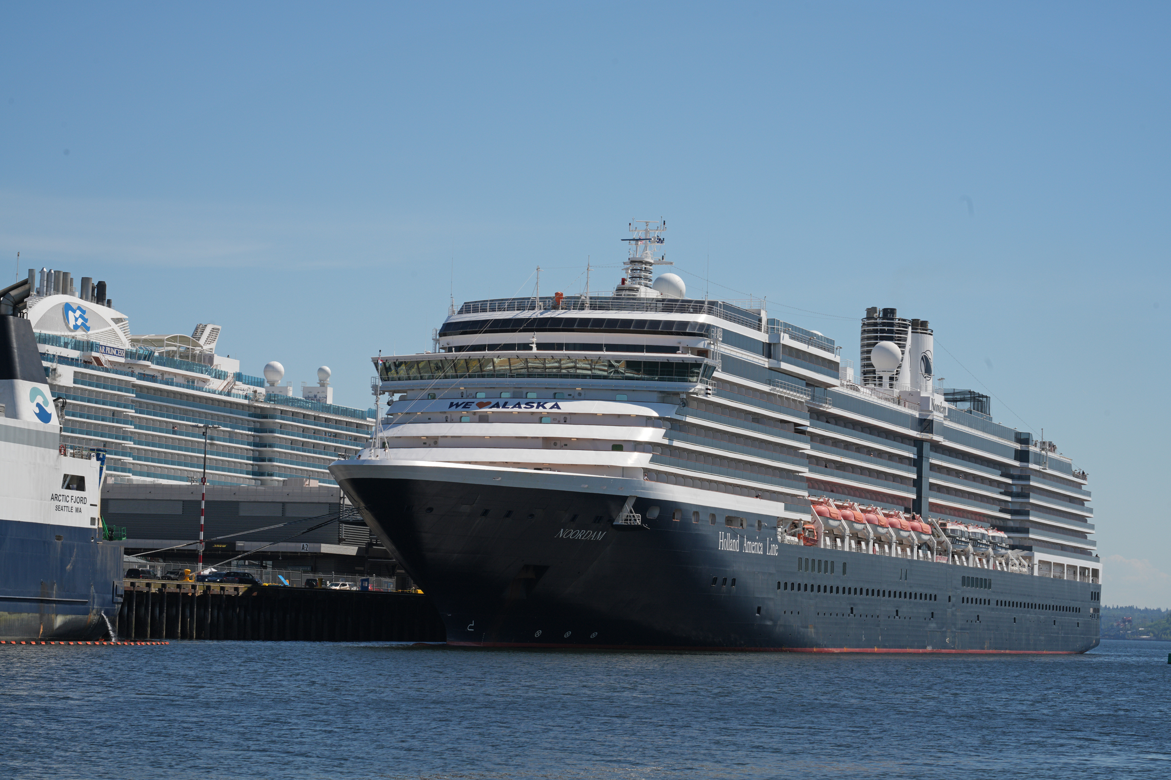
The Star Princess was at Pier 91 with MS Noordam on the opposite side of the pier, and was scheduled to depart this afternoon at 3 pm.
Instead, it was MS Noordam that sounded her horn three times, and departed shortly after 3 pm.
I waited until after 4 pm for Star Princess to depart, and then gave up.
(I saw later online that she had departed at 5.25 pm).
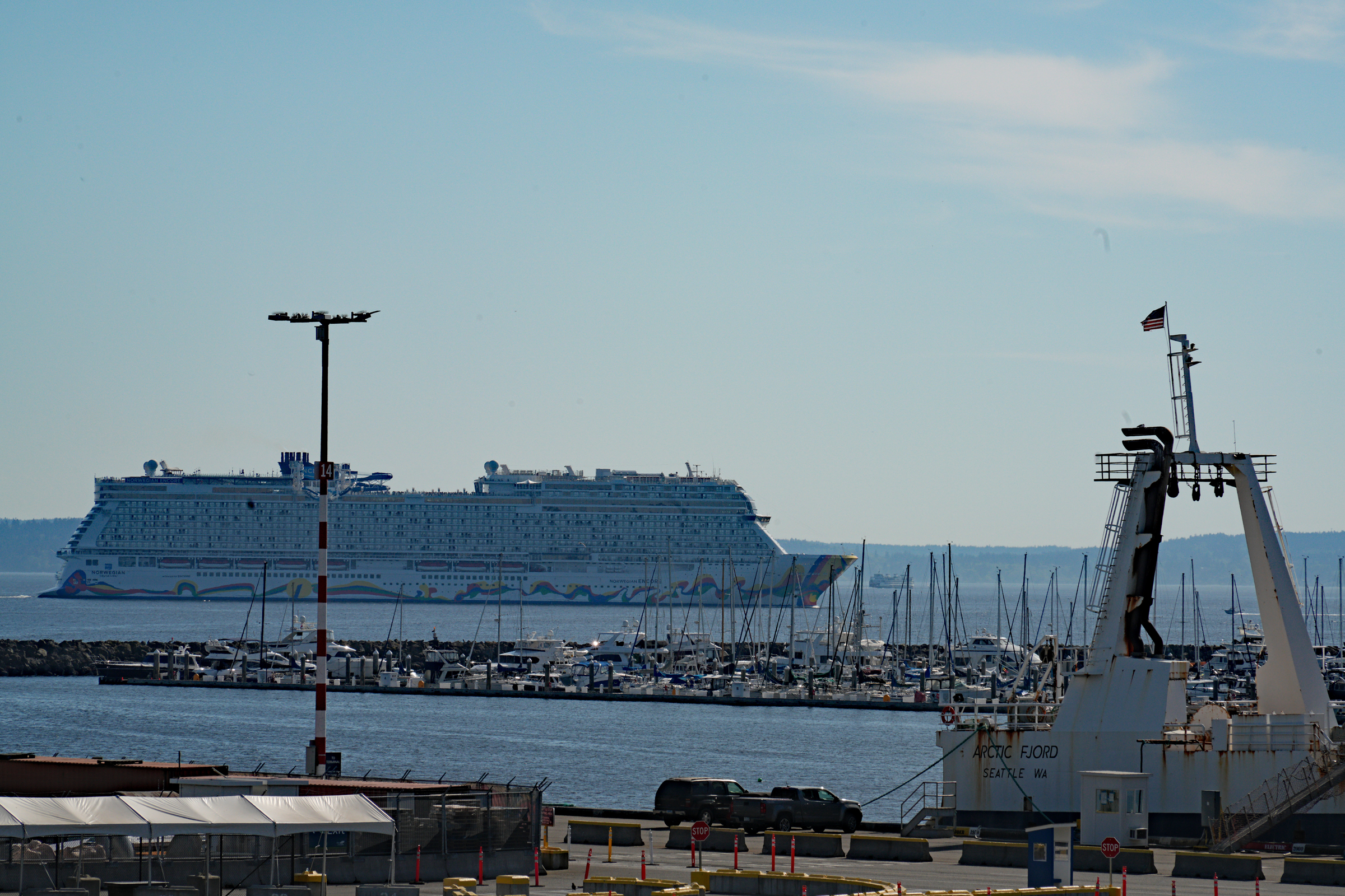
I walked up to the Magnolia Bridge to take another picture or two, and right then the Norwegian Encore came by in the distance.
She had been at Pier 66.
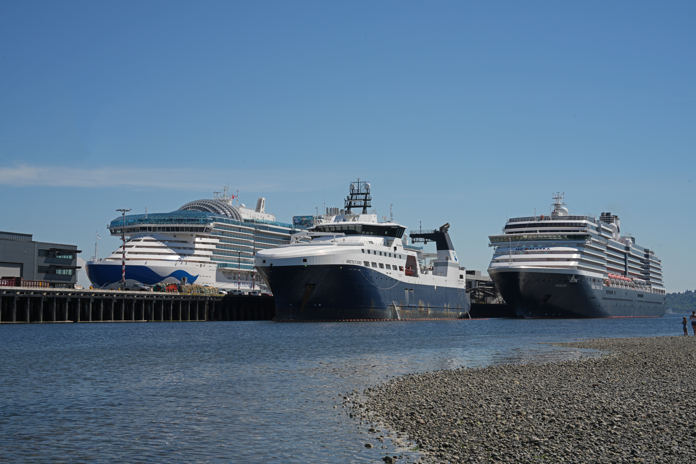
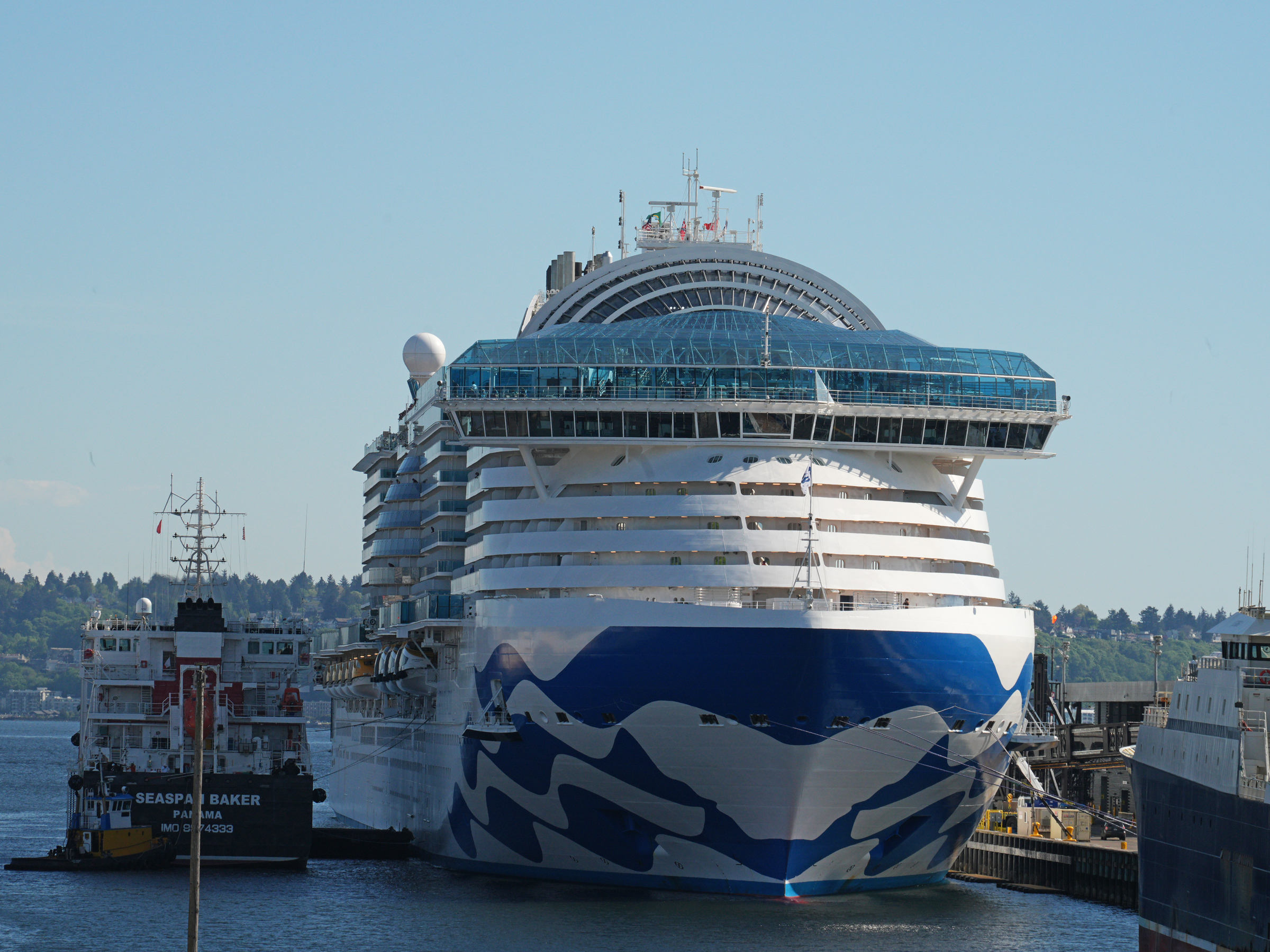
Port of Seattle’s Pier 91 this afternoon at 3 pm. From left to right: the Star Princess, the Arctic Fjord (a state-of-the-art, 325.8-foot/ 99-meter U.S.-built factory trawler designed for harvesting and processing Alaska pollock in the Bering Sea) and the MS Noordam. A closer look at the Star Princess. The dome at the top is a multi-level, glass-enclosed top-deck venue. The structure directly in front of the dome is a relaxing, forward-facing outdoor area known as the Sea View. The bridge is located at the very front of the ship, situated on Deck 15 (the Sun Deck).The MS Noordam, bound for Juneau, Alaska. The MS Noordam had sounded her horn three times, backed away from the pier, and turned north. In the foreground in Elliot Bay Marina. So now all of Star Princess is visible from my vantage point at Elliott Bay Marina. I am not 100% sure, but I believe this tugboat is using its water cannon to produce a ‘water salute’ to the Star Princess prior to her departure. Look at the Mountain looming in the distance, magnified by my telefoto lens. By about 4.20 pm at Elliott Bay Marina, I gave up to see Star Princess depart. Her mooring lines were still in place. I walked up the Magnolia Bridge to get this view of Pier 91 for a final picture or two. The vessel to the left of Star Princess is Seaspan Baker, a bunkering tanker. These are specialized vessels designed to supply fuel (bunker) directly to other ships for propulsion and energy. While I was on the Magnolia Bridge, the Norwegian Encore came by. She had been at Pier 66 and had a scheduled 4 pm departure. She was a little late departing as well (this picture taken at 4.35 pm).
It was a beautiful spring day here in the city (62°F / 17°C).
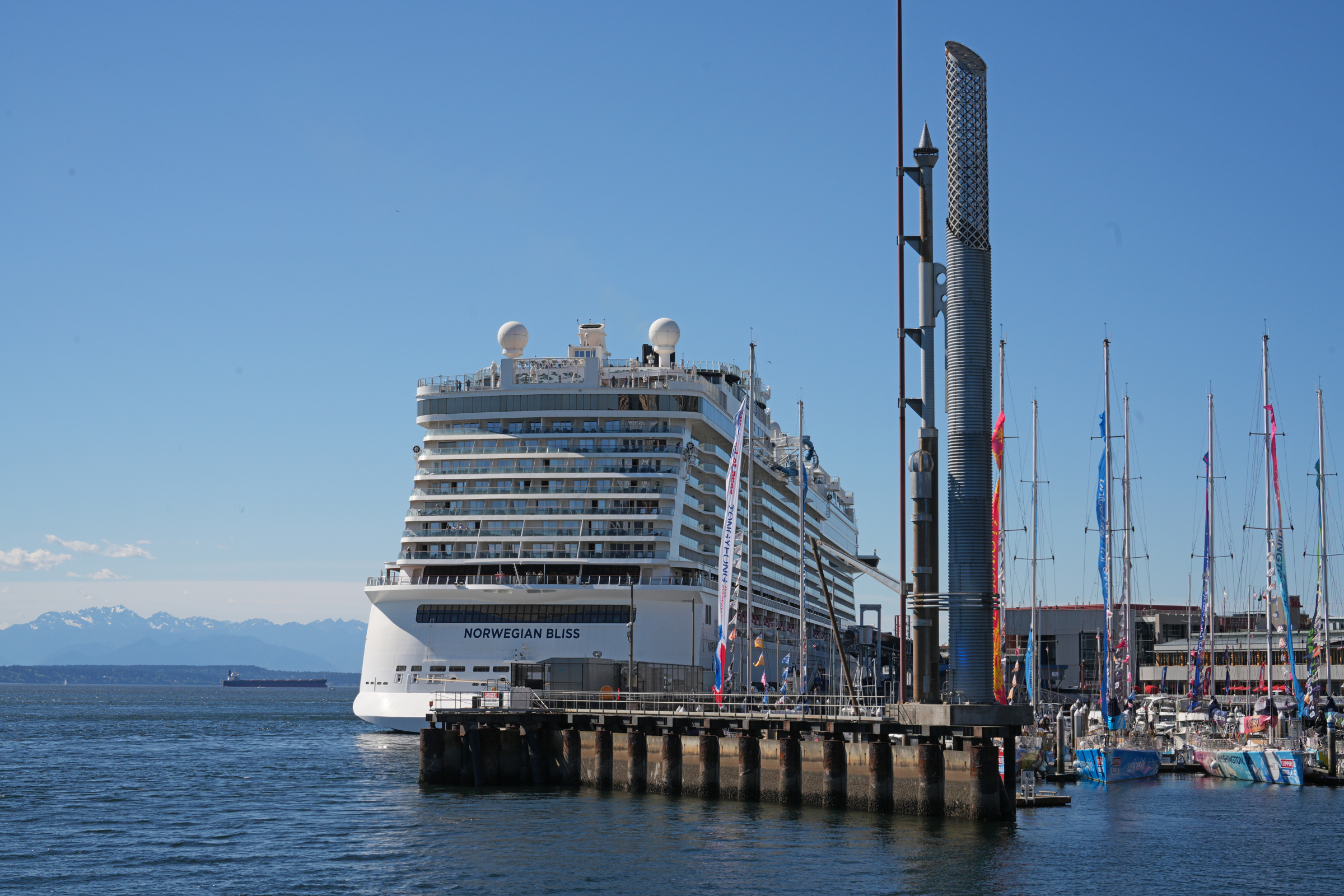
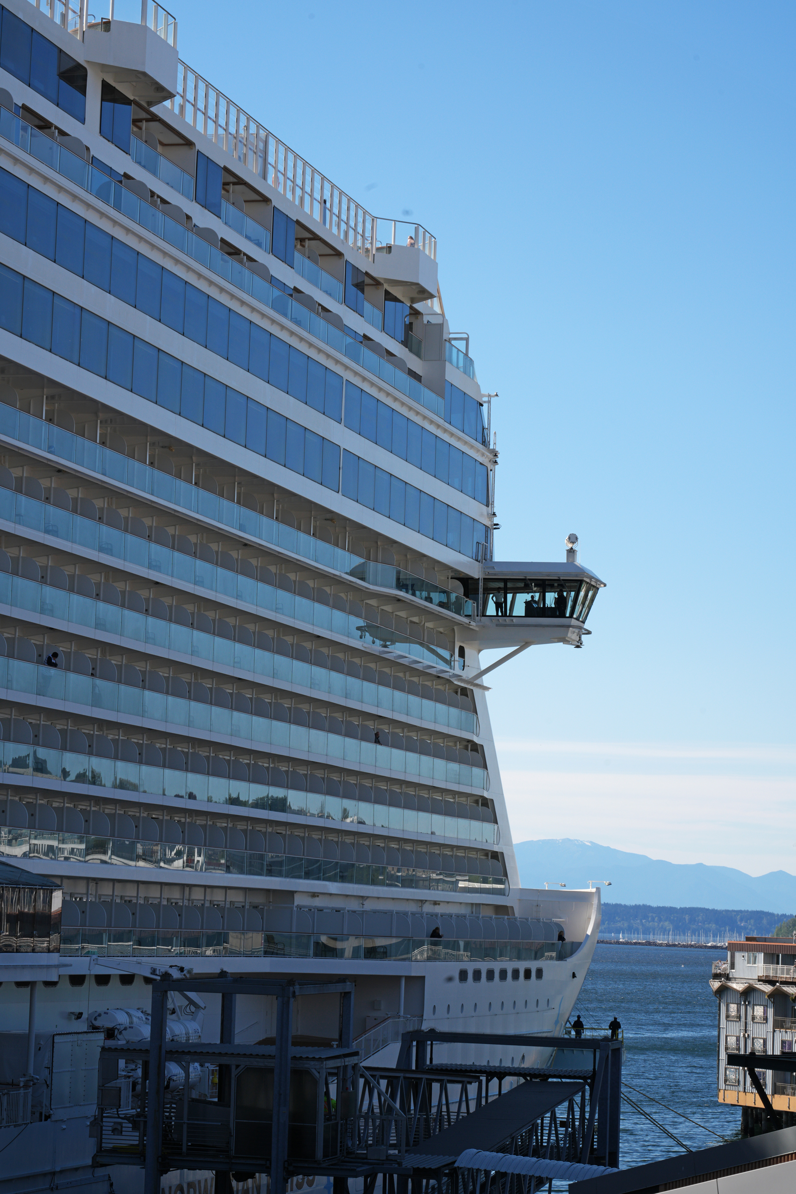
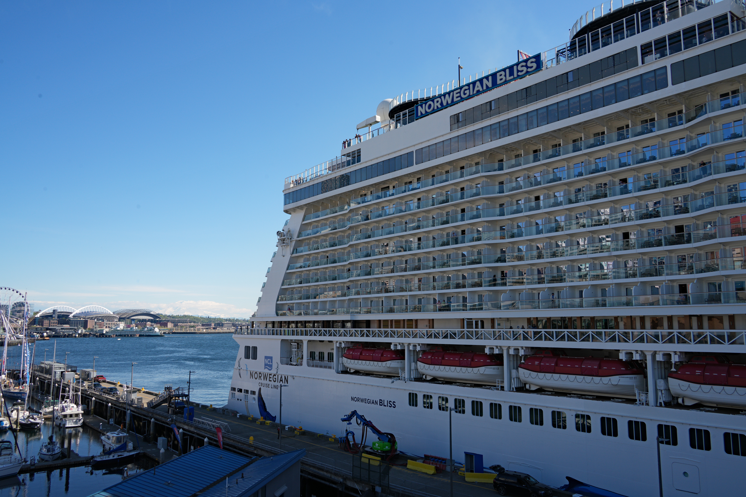
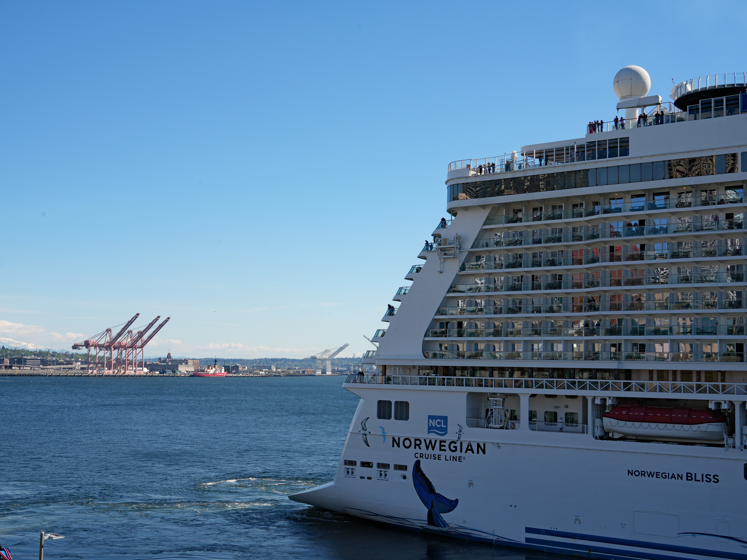
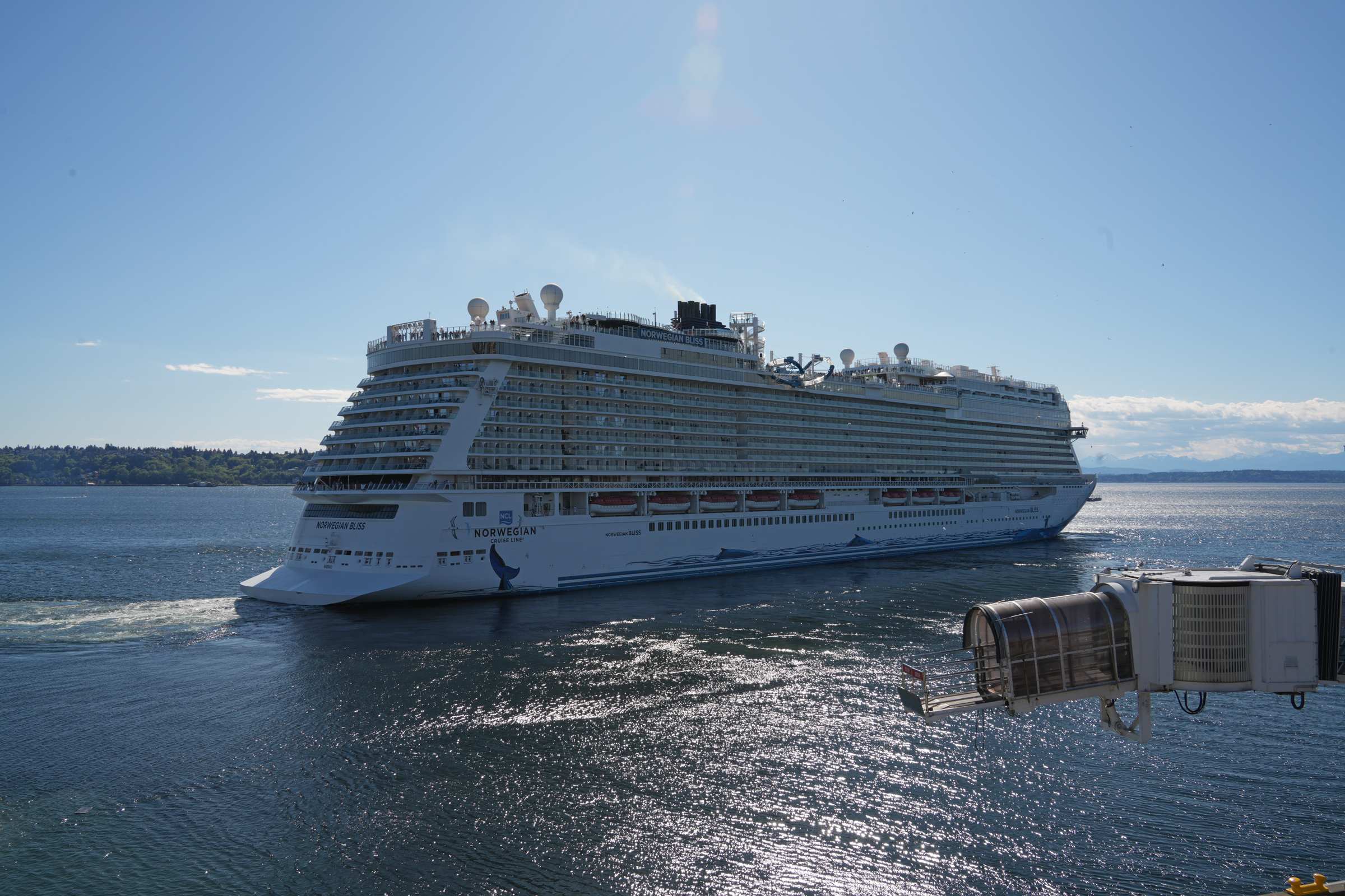
The Norwegian Bliss set sail for Sitka, Alaska shortly after 4 pm this afternoon, from Pier 66 here at the Seattle Waterfront.
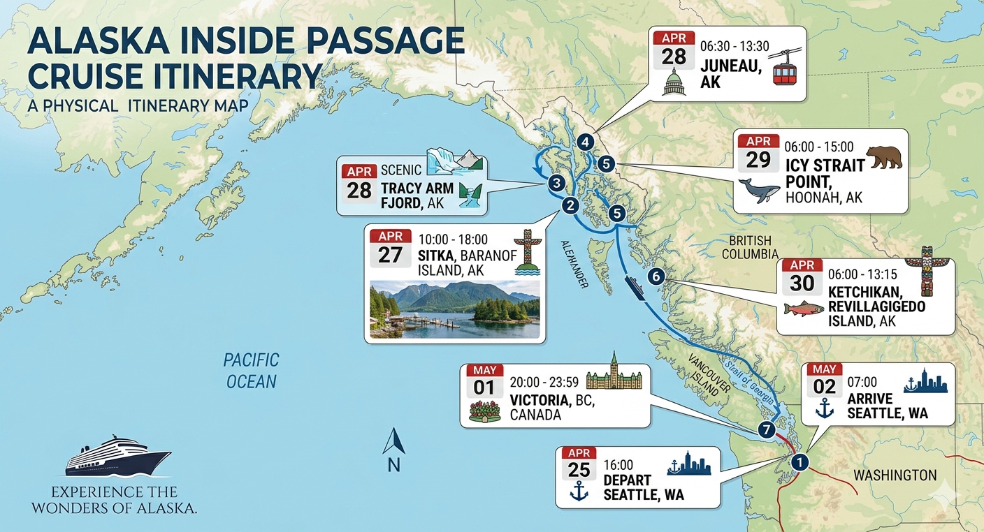
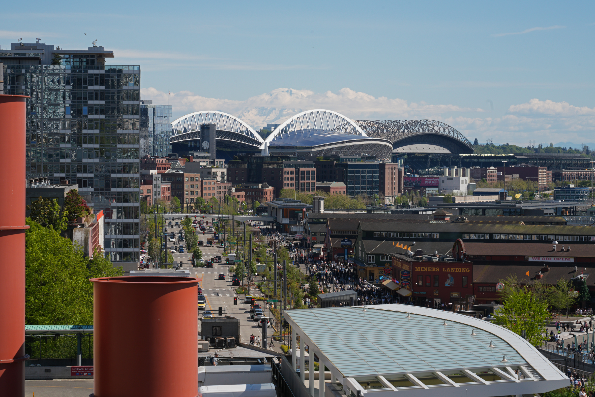
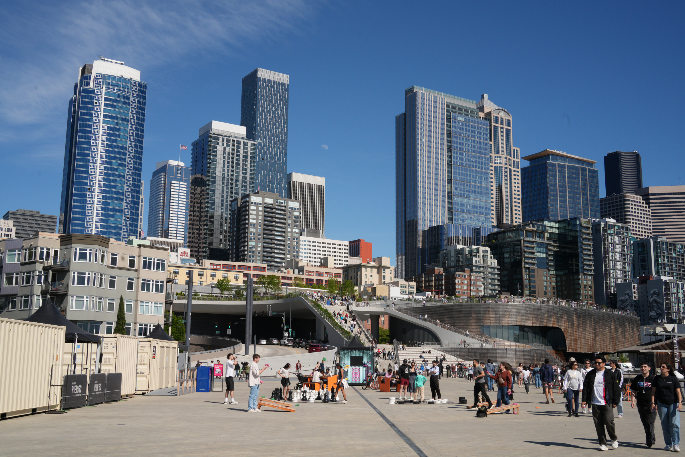
Norwegian Bliss will spend two days at sea to get to Sitka on Baranof Island. Then she will make her way back to Seattle along the Alaska Inside Passage (a network of sheltered waterways, fjords, and lush islands stretching from Washington State through the British Columbia coast to the Alaska panhandle). [Map generated from cruise itinerary with Nano Banana 2 by Google AI. The map is close but not 100% accurate. Icy Strait Point (5) is to the west of Juneau.]Is the mountain out? Yes. The view to the south from the top of Pike Place Market along Alaskan Way this afternoon. I walked as far as I could on Pier 62 for this picture. Norwegian Bliss is at Pier 66.There is a game of chess and several cornhole games in progress on Pier 62. The staircases are part of the pedestrian overpass to Pike Place Market and downtown. The expanded Seattle Aquarium is housed in the structure with the darkened wood shell on the right.I made my way to the cruise terminal building by Pier 66 and took the elevator up to the viewing deck on the fifth floor.The departure time of 4.00 pm has come and gone 5 minutes ago. The mooring lines have all been taken care of, though, and it can only be minutes to departure. There she goes, pulling away from the pier. There was no tugboat, and Norwegian Bliss did not sound her horn. Bon voyage!
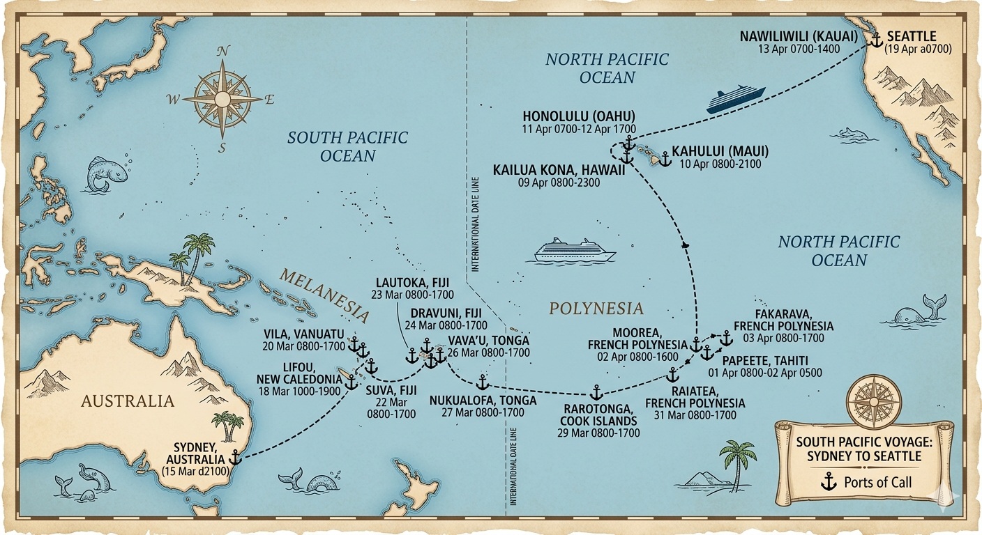
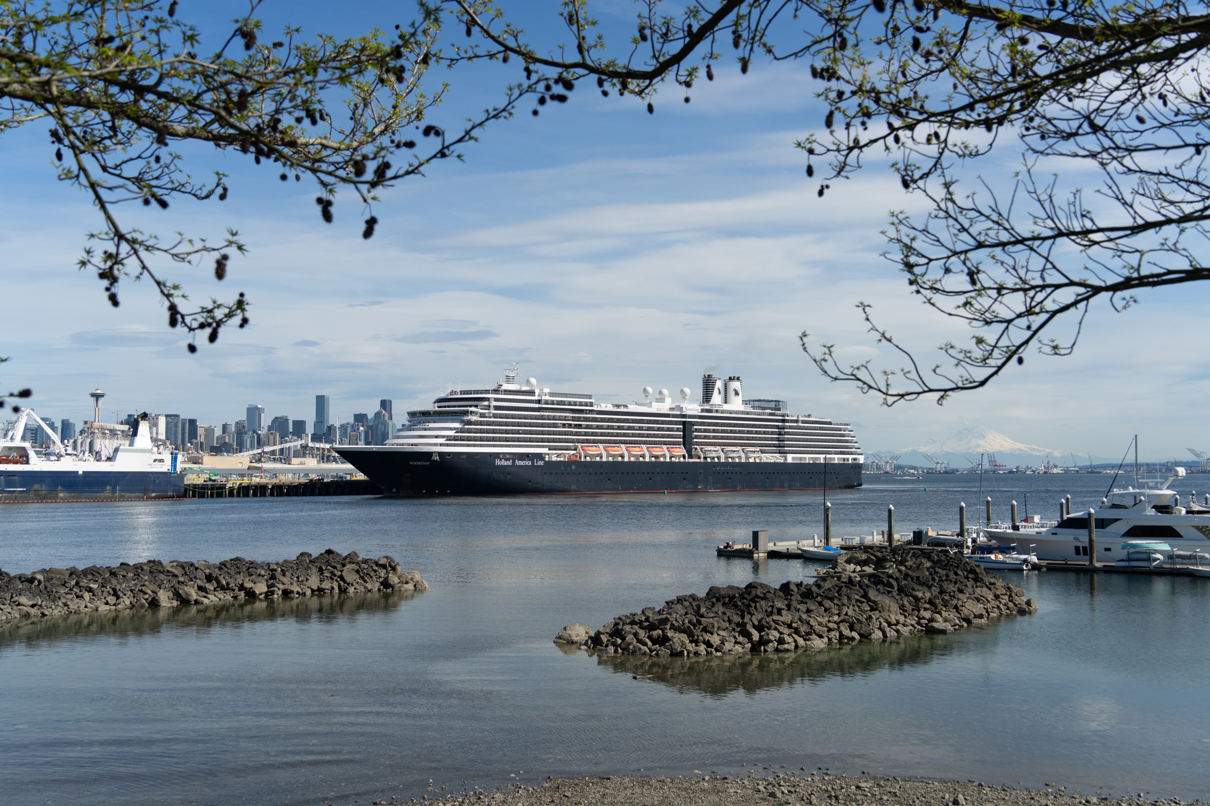
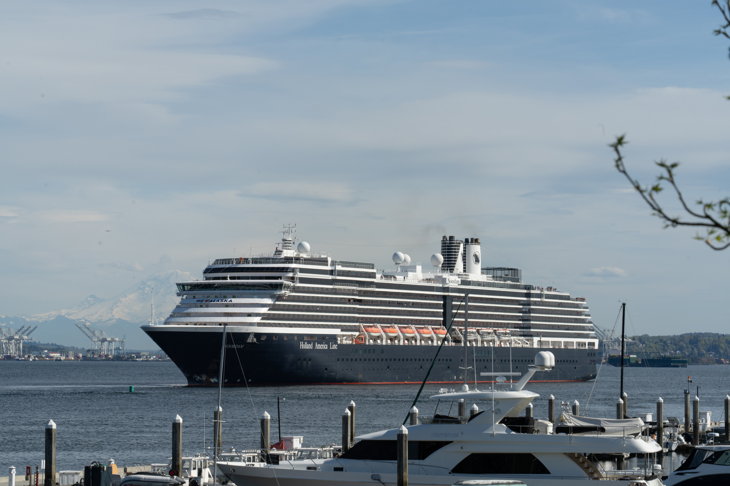
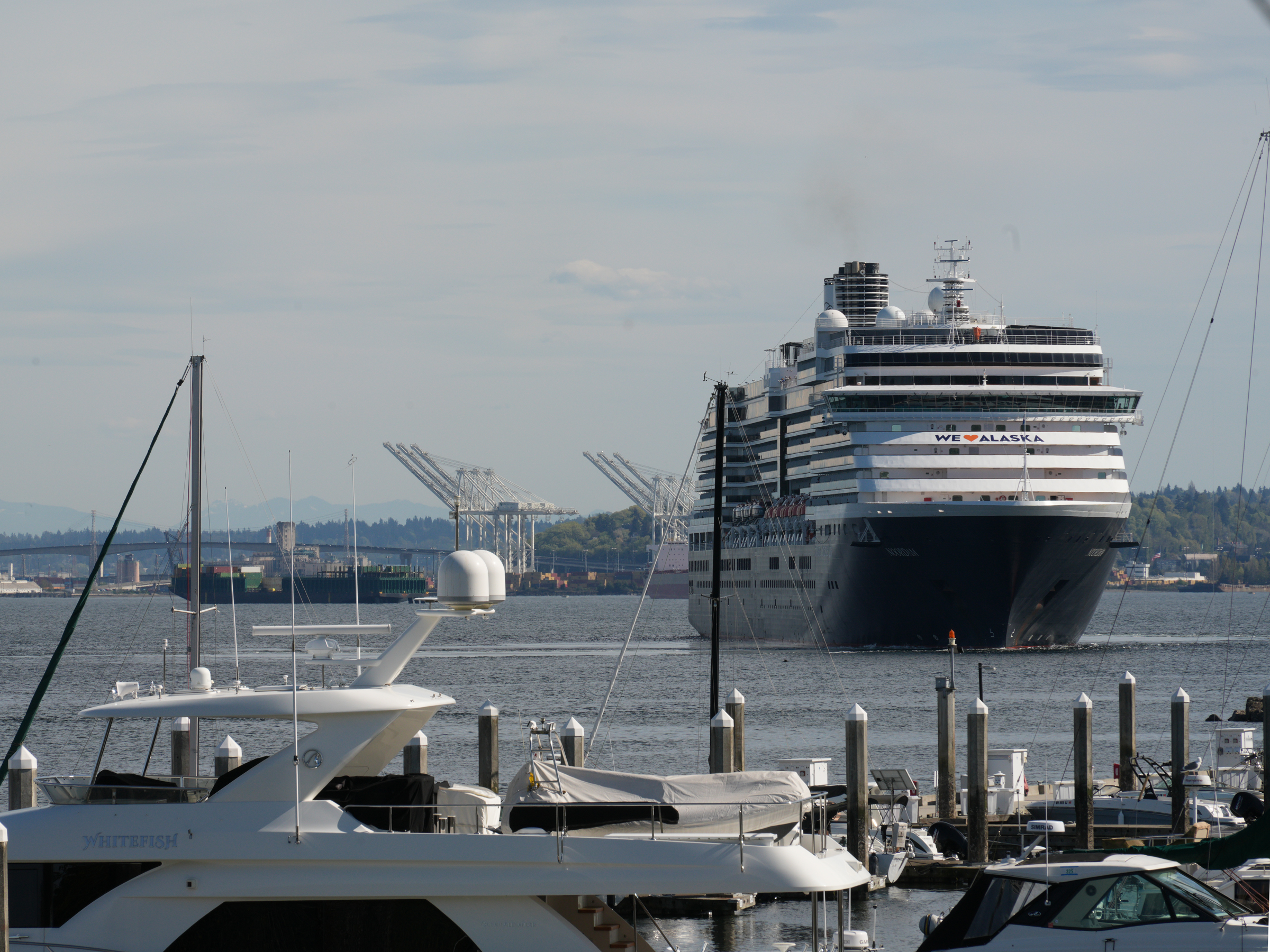
The MS Noordam from Holland America Line arrived at Pier 91 at the Port of Seattle at 7 am this morning, completing her 36-night crossing of the Pacific Ocean from Sydney, Australia.
She departed from Pier 91 at 4 pm this afternoon, for 7-day round trip to Ketchikan, Alaska.
So we will see her again next Sunday.
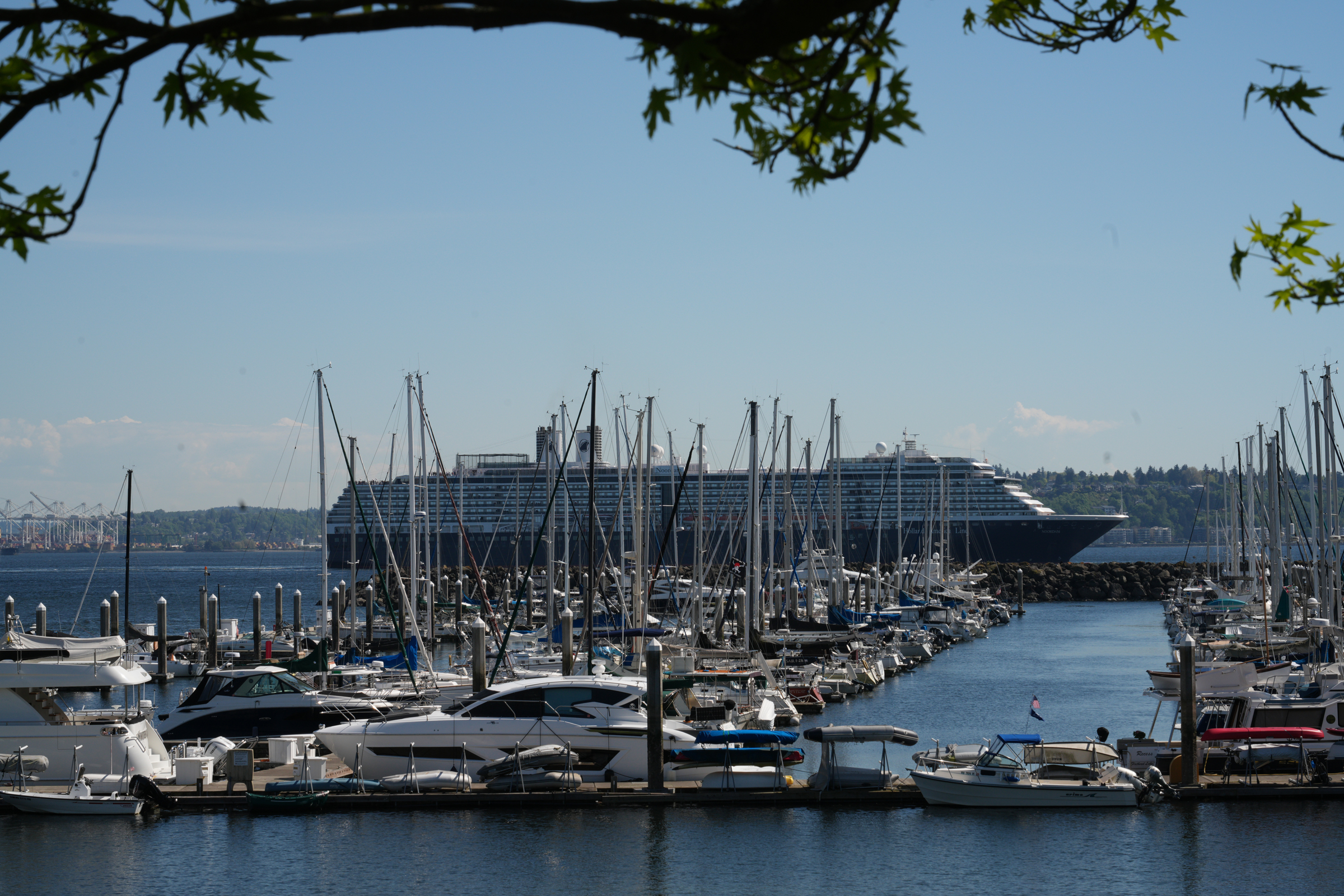
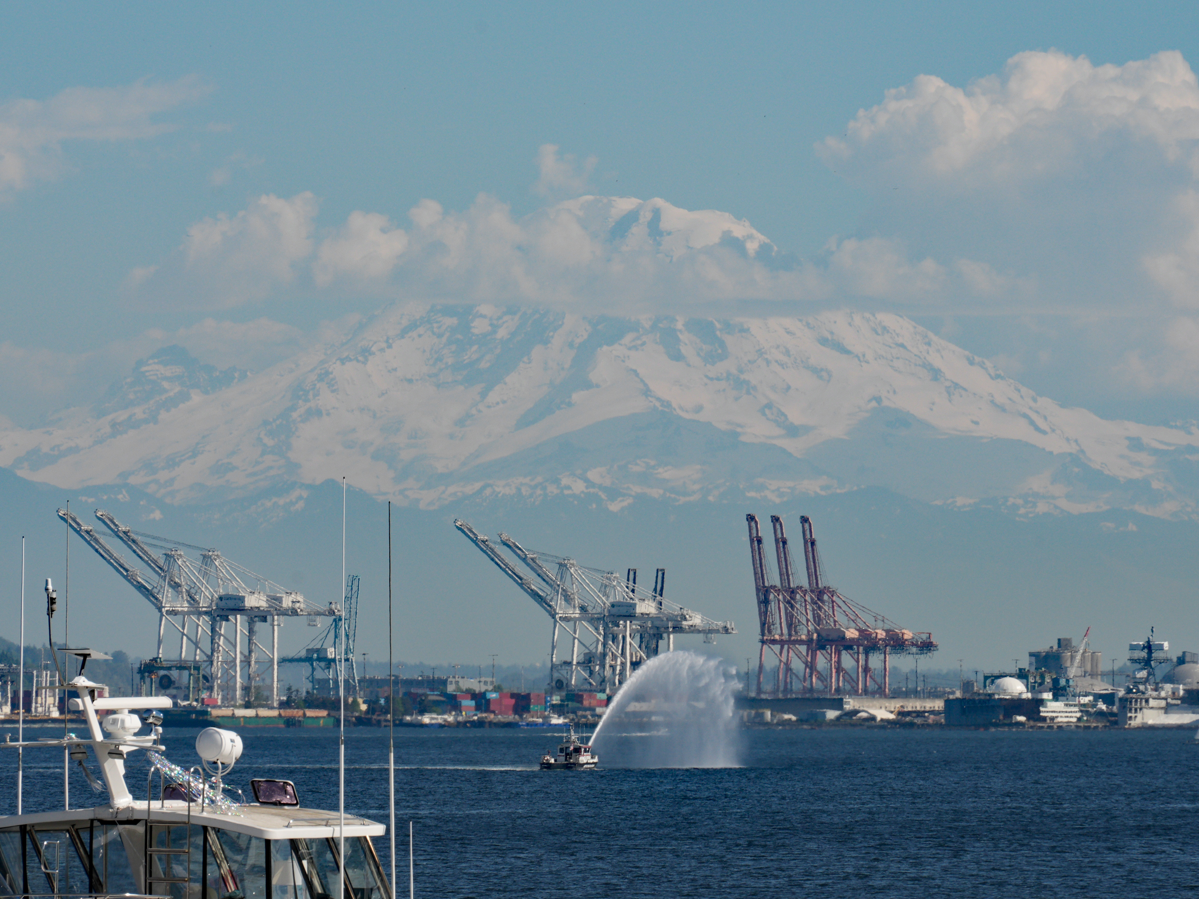
The itinerary of MS Noordam included Melanesia & Polynesia, French Polynesia, followed by a 5-day crossing to Hawaii, and then on to Seattle. [Map generated by Nano Banana 2 in Google AI Mode from the itinerary]Looking out at Pier 91 from the Elliott Bay Marina. Look for the Space Needle on the left, and for Mount Rainier, to the right of MS Noordam.At 4 o’clock MS Noordam sounded her horn three times, and pulled back from the pier. As far as I could tell there was no tug boat in attendance.Turning to head to the north of Puget Sound and the Strait of Juan de Fuca.Bon voyage!
Happy Friday. So the Strait of Hormuz is open— sort of. Iran demands that ships use the route in the strait that runs close to its coastline, and the U.S. blockade is still in place. (The U.S. Navy is actively intercepting and restricting ships entering or leaving Iranian ports to cut off Tehran’s revenue.)
Late afternoon, I went down to the Seattle waterfront to see the first cruise ship of the season set sail.
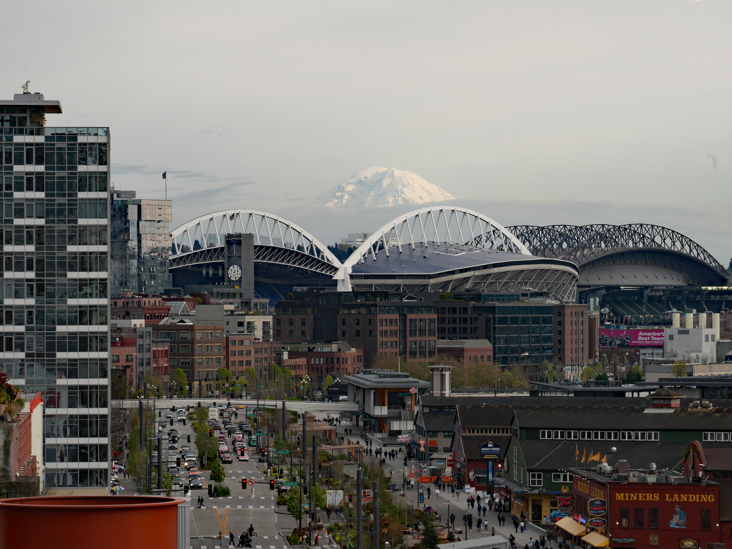
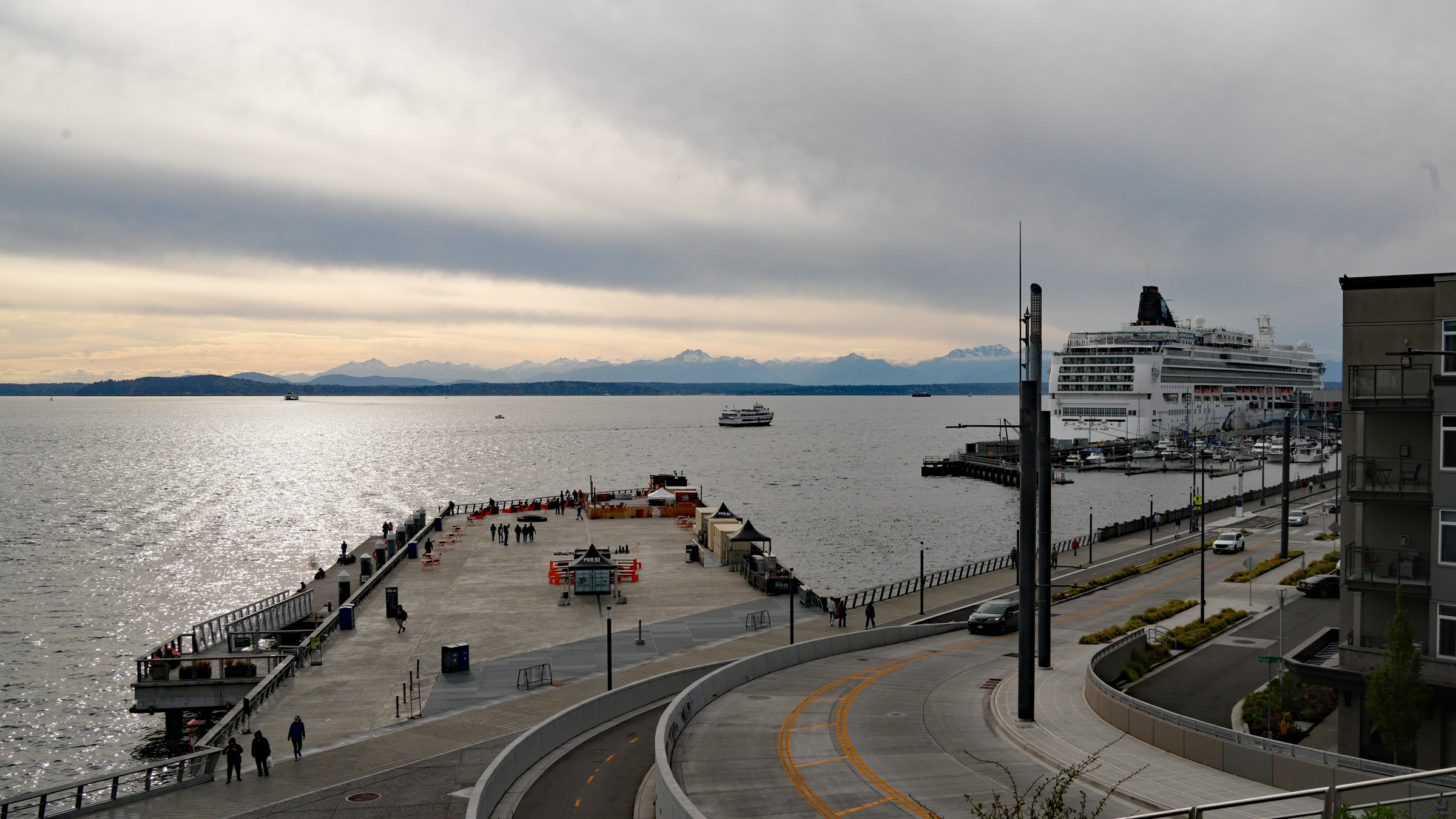
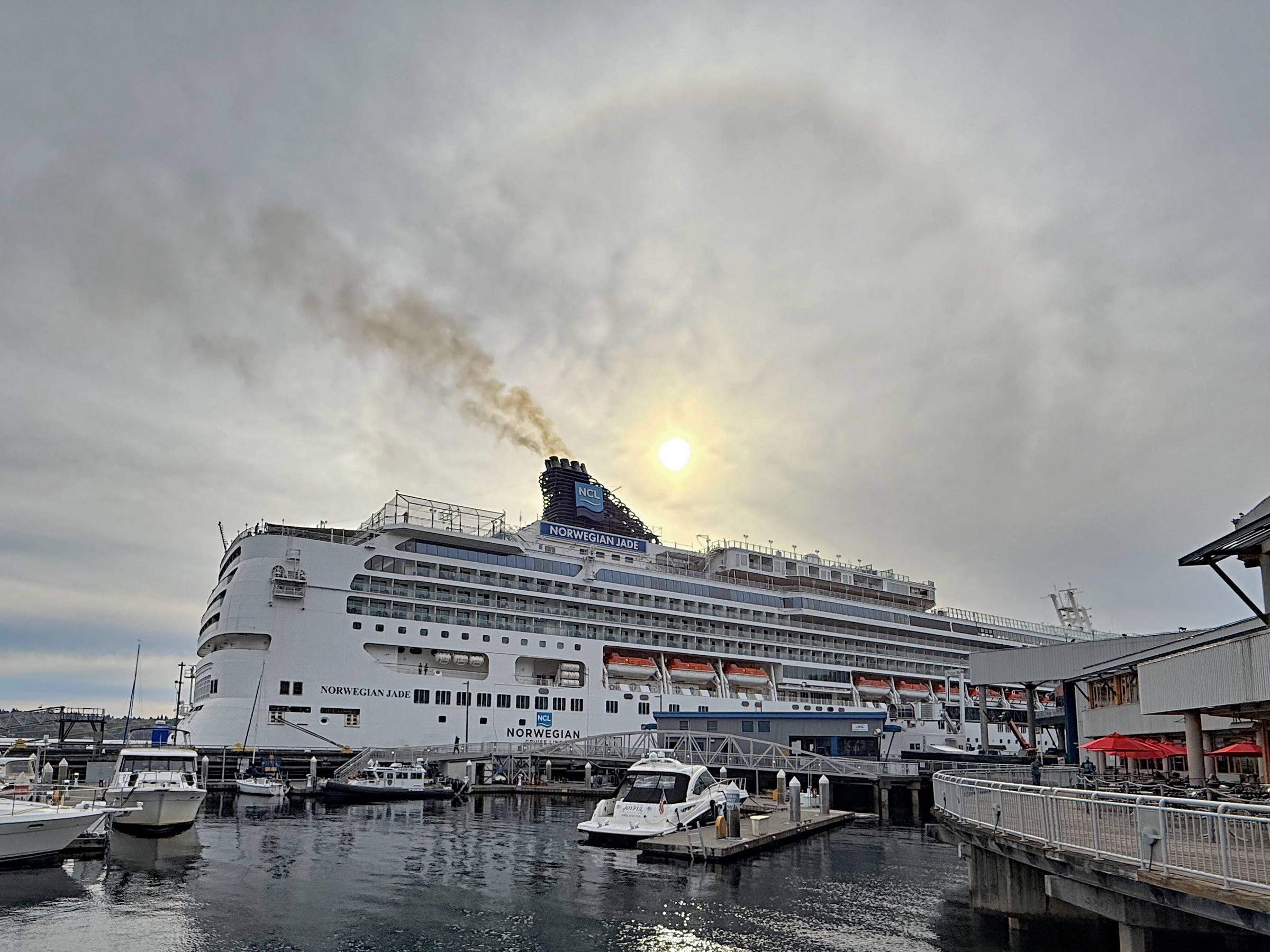
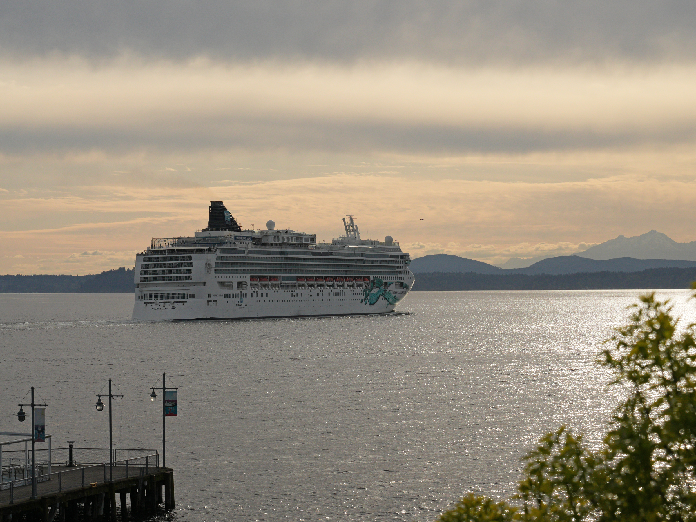
The Mountain was out today. (Mount Rainier, seen from the top of Pike Place Market and looking south along Alaskan Way. That’s Lumen Field Stadium’s roof with the white (home of the Seahawks football team) and T-Mobile Park to its right with the black roof (home of the Seattle Mariners baseball team).Making my way down to the water’s edge, using the overpass and stairs from Pike Place Market. That’s Pier 62 straight ahead. The Norwegian Jade is the first cruise ship to arrive at the Port of Seattle this year and she is at Pier 66.It is almost 6 pm. The engines are running and the Norwegian Jade is about to set sail for Vancouver. She started out in San Diego on an eight-day cruise. There is a solar halo in the sky, made by sunlight refracting in the ice crystals inside high-altitude cirrus clouds.There she goes, leaving Elliott Bay to get to the north end of Puget Sound and into the Strait of Juan de Fuca, the passage to the Pacific Ocean. There is a ‘mosquito’ in the sky at the Norwegian Jade’s bow: a seaplane.
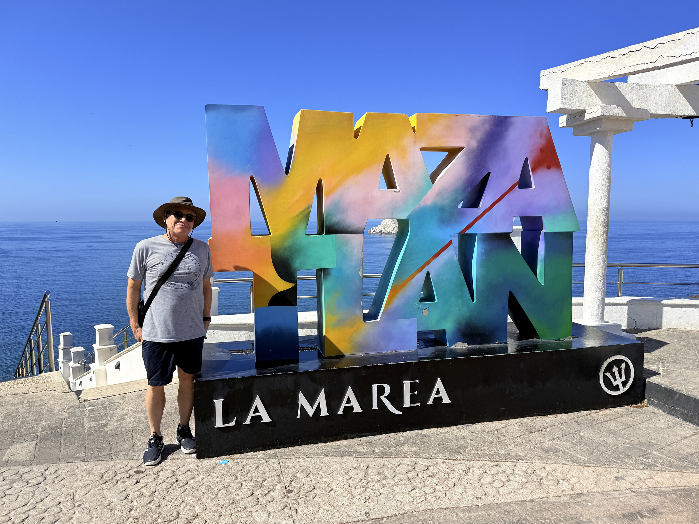
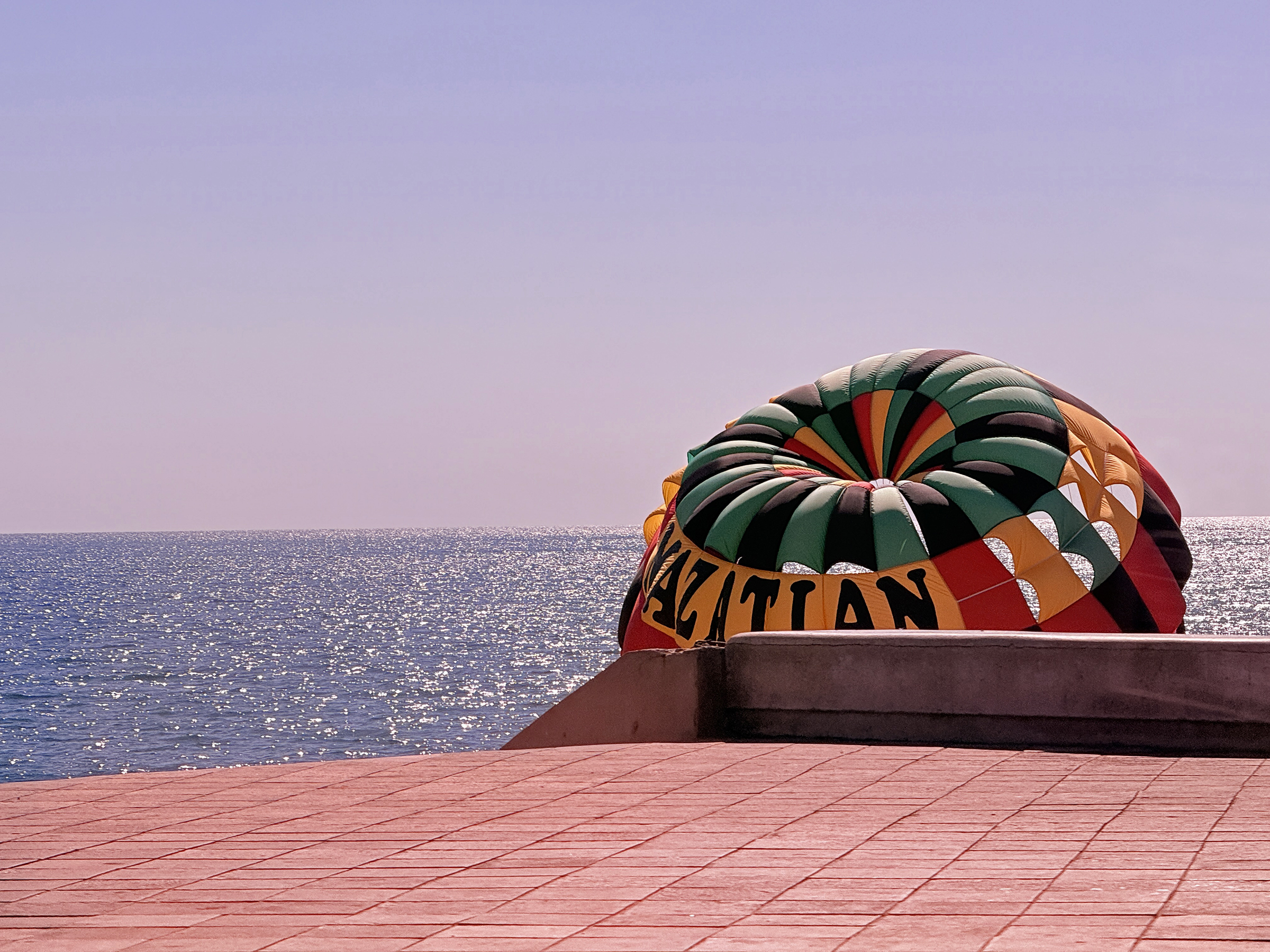
My time in Mazatlán was over on Friday morning 😢.
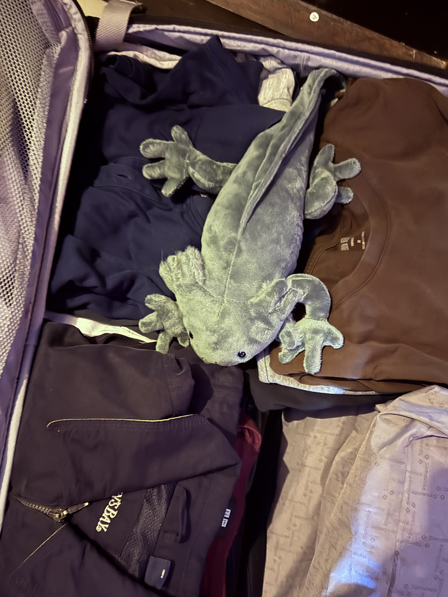
My stuffed axolotl from the Gran Acuario Mazatlán gift shop went into the suitcase with my clothes, and now I am at Mazatlán airport.
I will try to get a few airplane pictures before we board.
Update at Sat 12.30 am:
I made it home.
That connection to Seattle for international arrivals into LAX is quite something.
We arrived at the gate at LAX at 5.55 pm.
The flight to Seattle was going to leave at 7.40 pm.
First, there is a very long walk through a labyrinth of walkways and hallways to get to the US Customs and Border Control point. I said to a friendly official that they need to put more signs up for us, to which she replied – oh, but you should ‘just look for open doors’ if you don’t know where to go next.
(The problem was that I had no crowd to follow. A group of people in front of me on the airplane took so long to disembark, that the rest had disappeared completely out of sight by the time I stepped off.
Where did everyone go? 😱)
Anyway, there was no Global Entry kiosk open at Customs and Border Control (they are part of the partial government shutdown that still has not been resolved). So instead, there was a facial recognition photo check for everyone, regardless if you had Global Entry credentials or not. The camera did not recognize everyone and those were then directed to an official for a manual passport check.
Now I still had to pick up my bag from the international arrivals carousel for rechecking it for the flight to Seattle. That took a very long time as well, after which you get ejected into the public area at Terminal 6.
So now you go up the escalator, to go through the standard domestic flight security check again— which ate up the remaining time I had for the connection.
My flight to Seattle was already into boarding Group E by the time I had gone to the restroom and taken a few bites out of a sandwich and banana that I had bought hastily.
There were puffy white clouds in the view of the Pacific Ocean by Olas Altas beach this morning. From Wikipedia: The axolotl (Ambystoma mexicanum) is a species of paedomorphic mole salamander. They mature into the terrestrial adult form without undergoing metamorphosis; the adults remain fully aquatic with obvious external gills. This trait, although somewhat unusual among the majority of amphibians, is not unique. Axolotls originally inhabited a system of interconnected wetlands and lakes in the Mexican highlands. They were known to inhabit the smaller lakes of Xochimilco and Chalco, and are also presumed to have inhabited the larger lakes of Texcoco and Zumpango. These waterways were mostly drained by Spanish settlers after the conquest of the Aztec Empire, leading to the destruction of much of the axolotl’s natural habitat, which is now largely occupied by Mexico City. Despite this, they remained abundant enough to form part of the staple in the diet of native Mexica during the colonial era. Today, due to continued urbanization in Mexico City, which causes water pollution in the remaining waterways, as well as the introduction of invasive species such as tilapia and carp, the axolotls are now near extinction. The species has been listed as critically endangered in the wild, with a decreasing population of around 50 to 1,000 adult individuals. A large captive population of axolotls currently exists, though, with the specimens being used extensively in scientific research for their remarkable ability to regenerate parts of their body, including limbs, gills and parts of their eyes and brains.
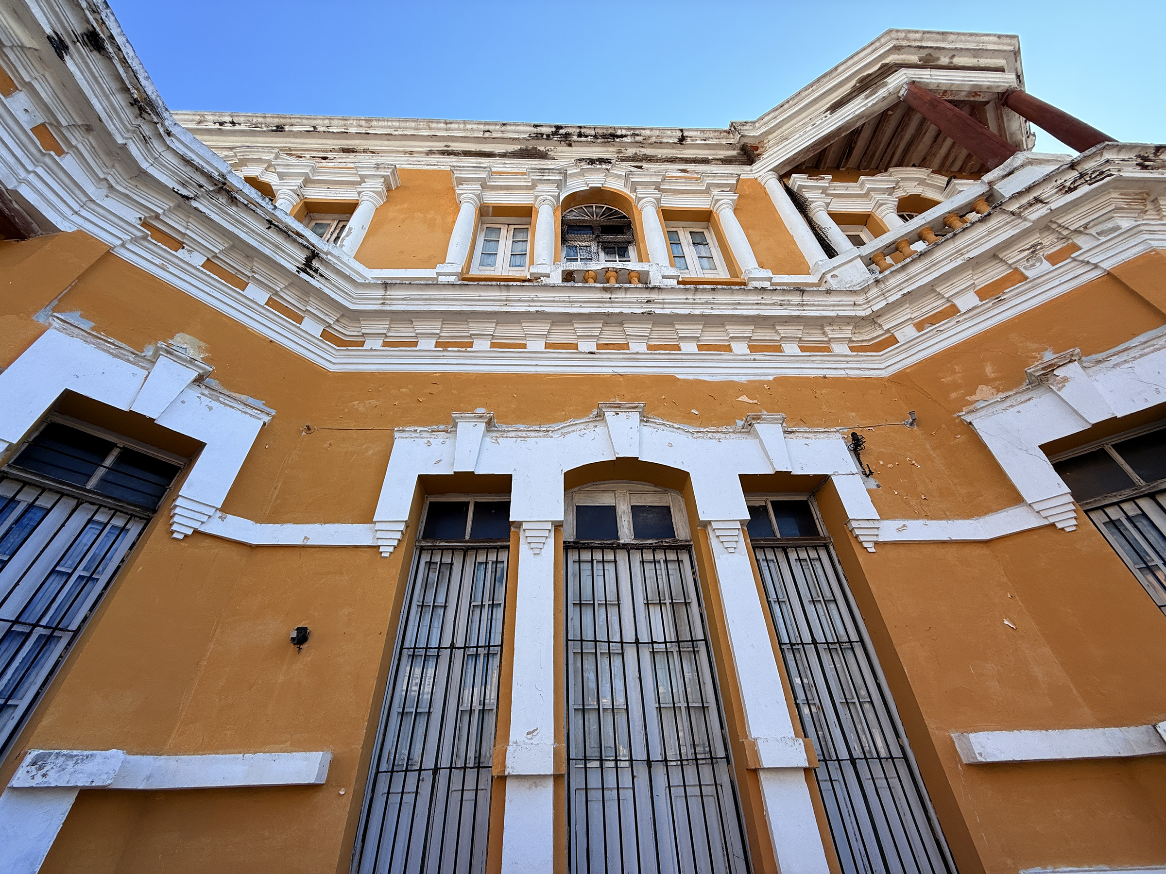
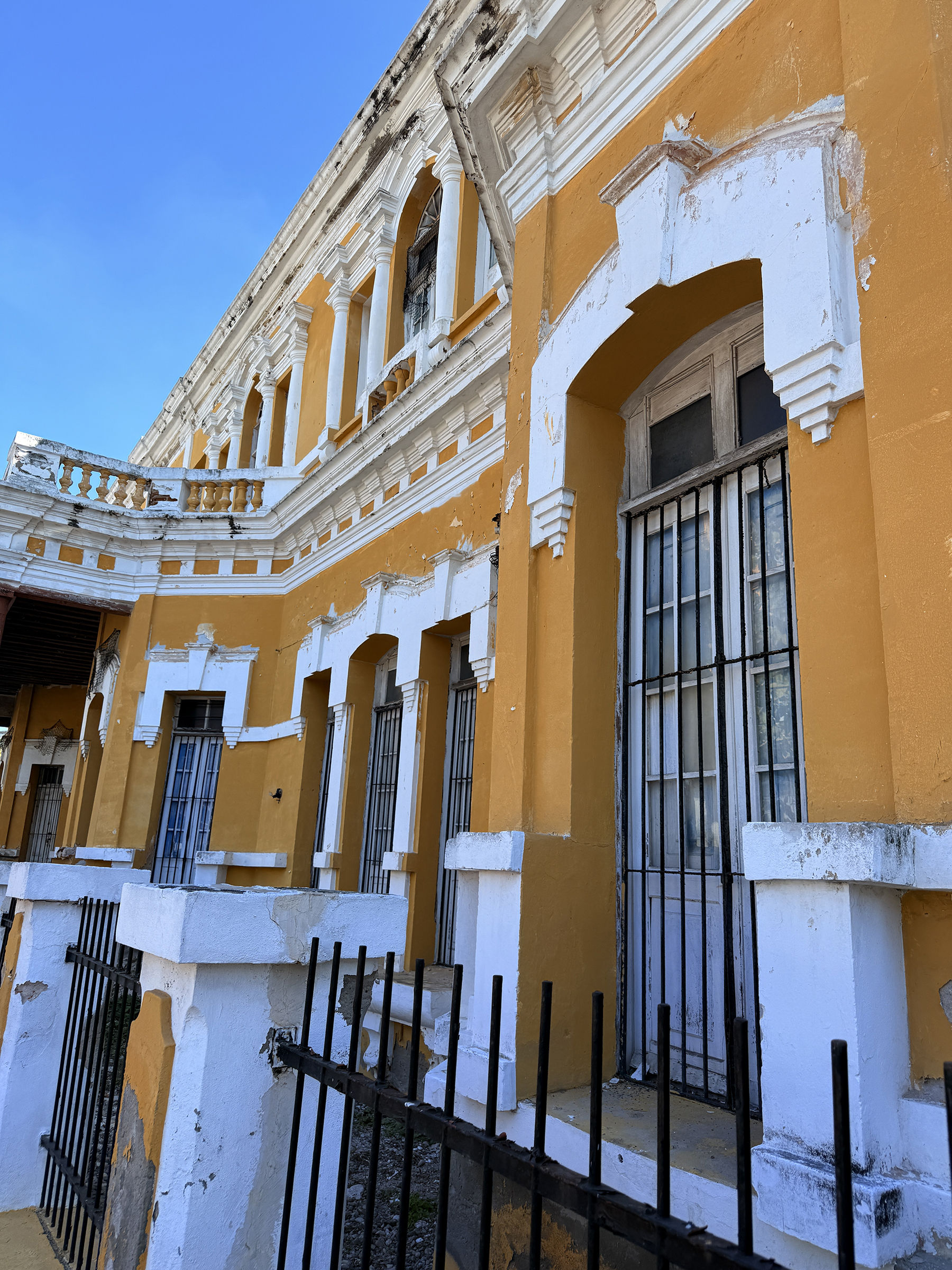
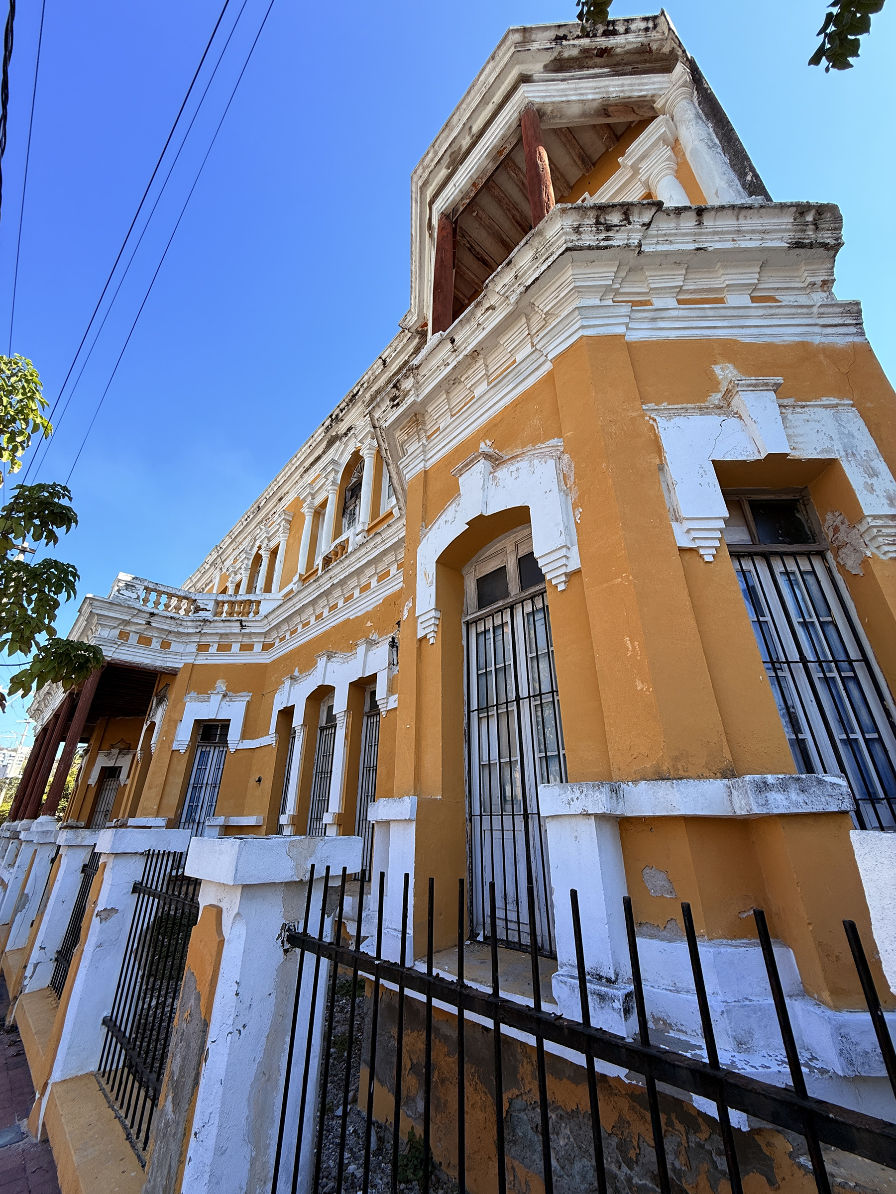
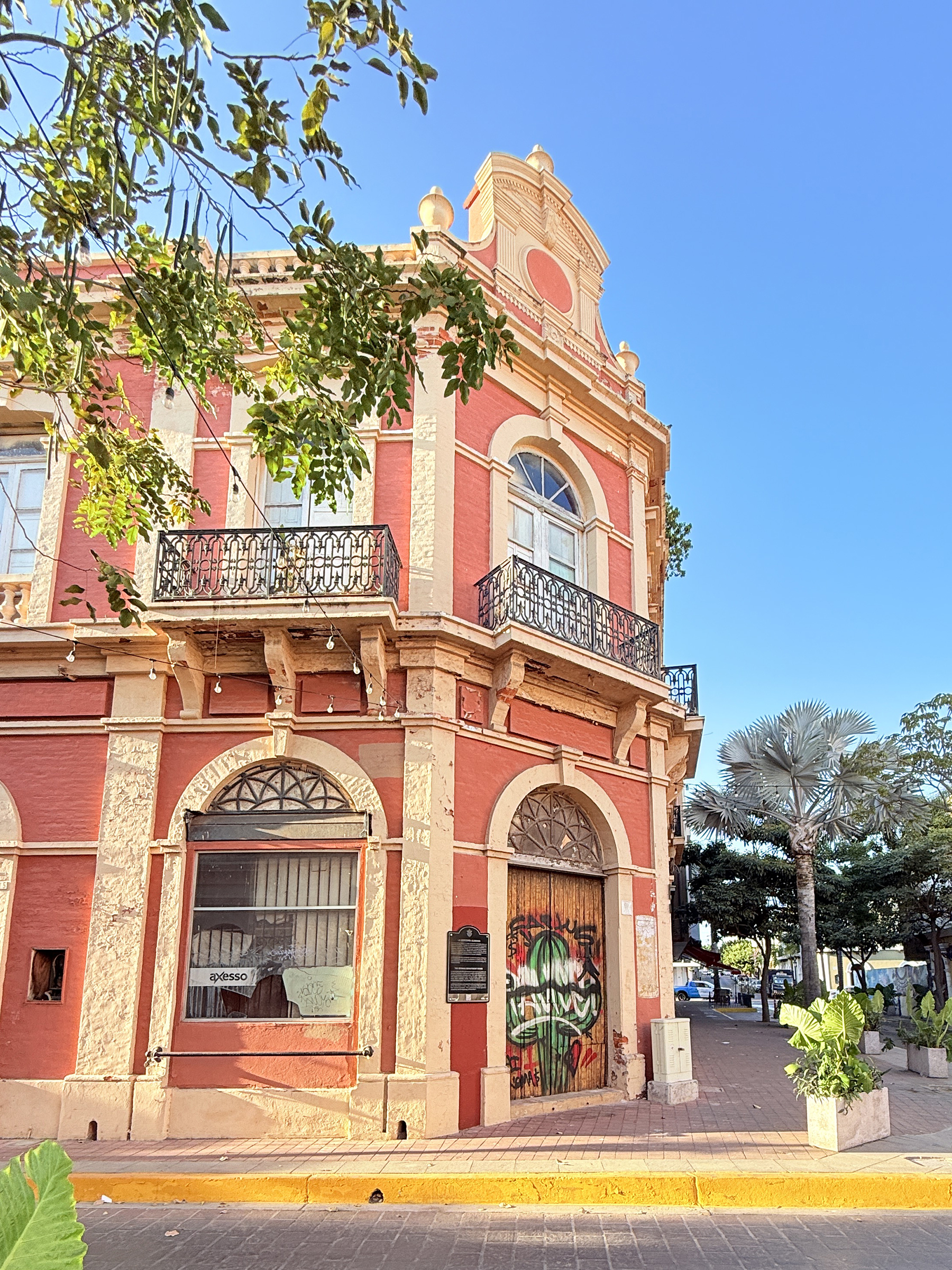
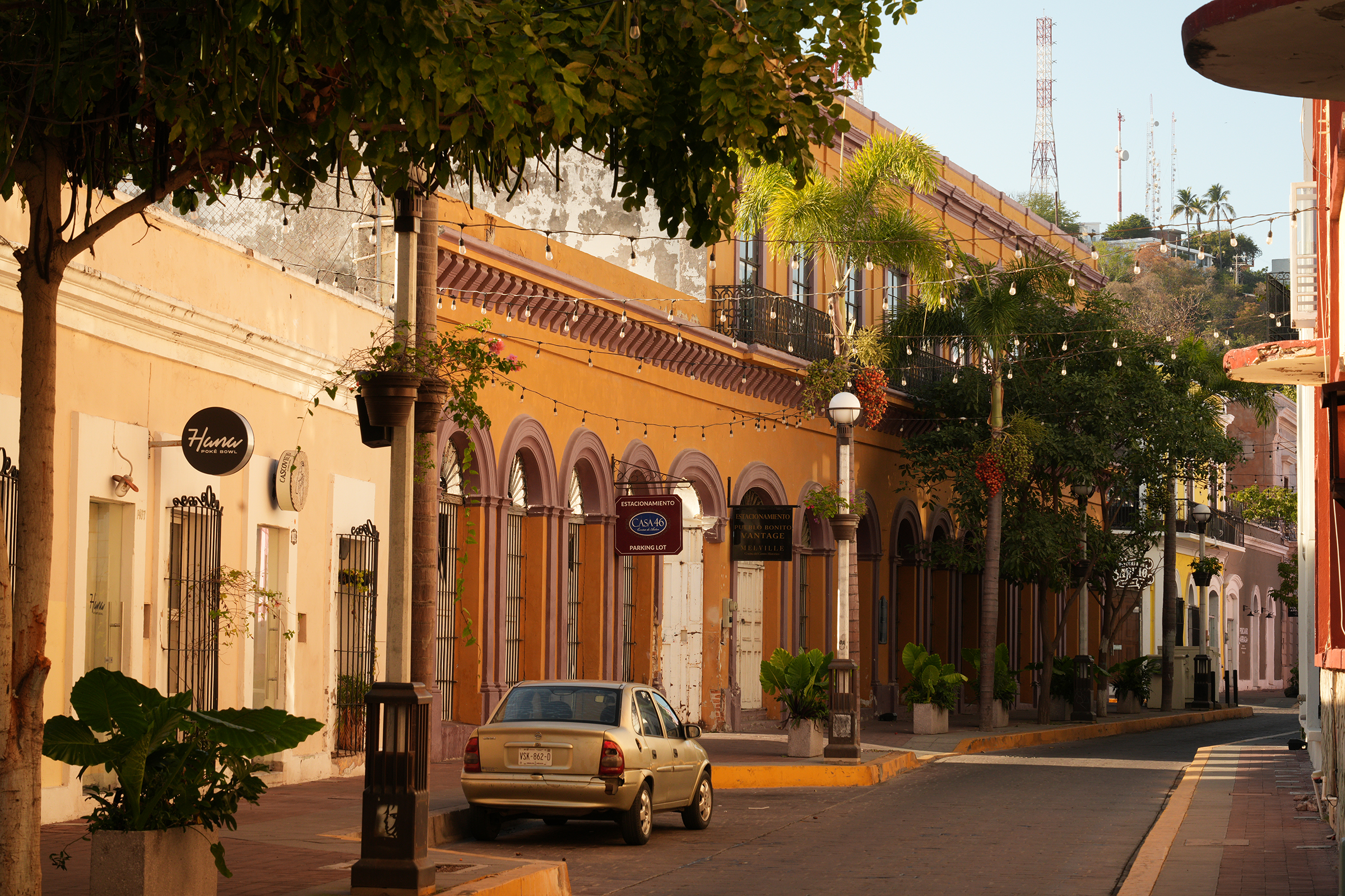
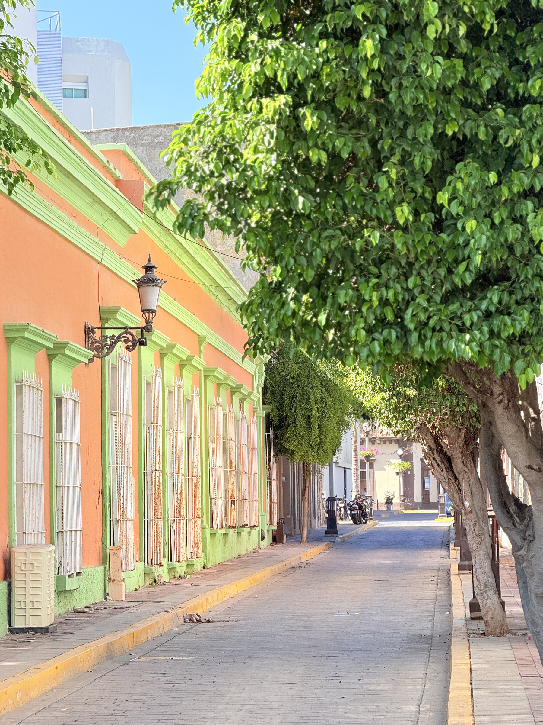
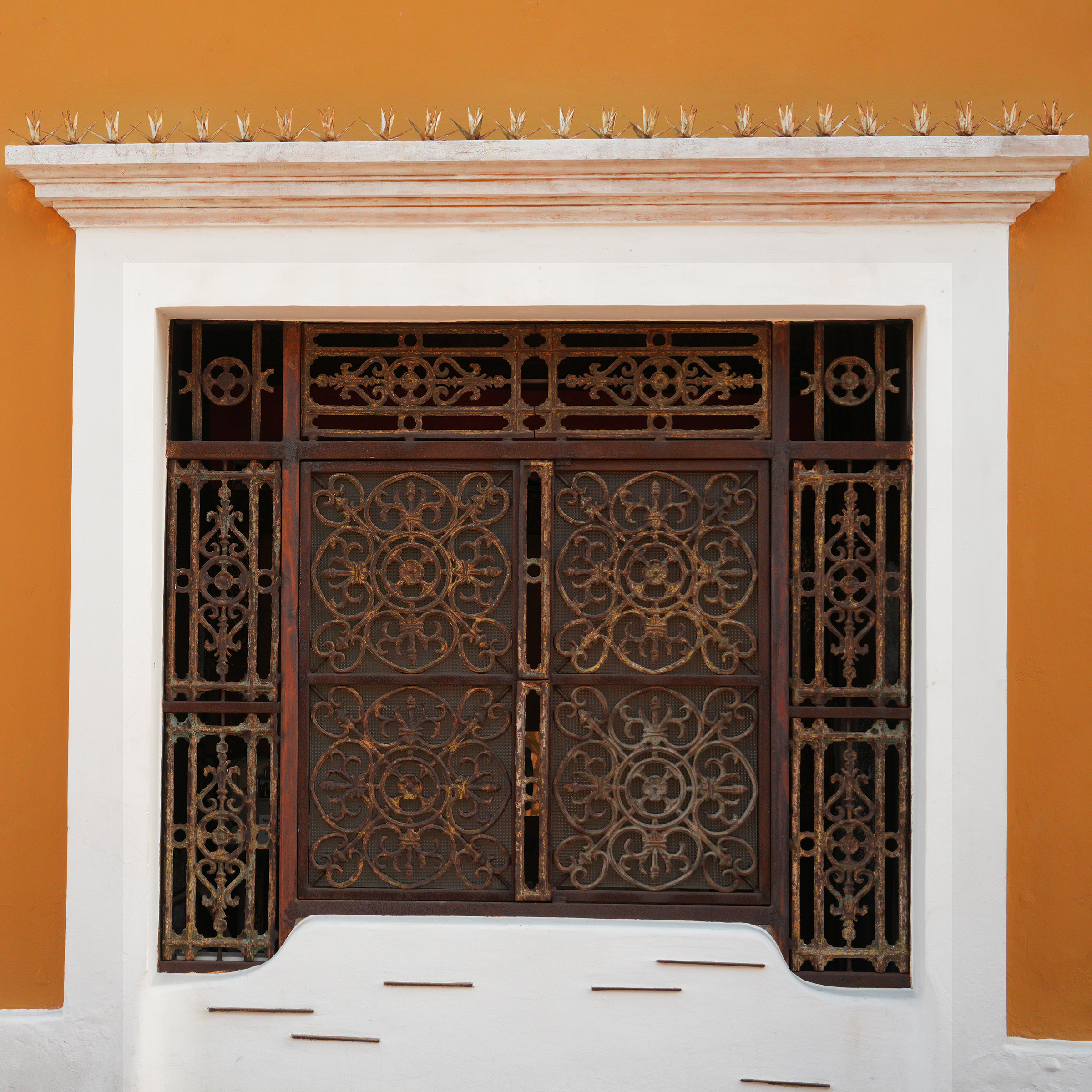
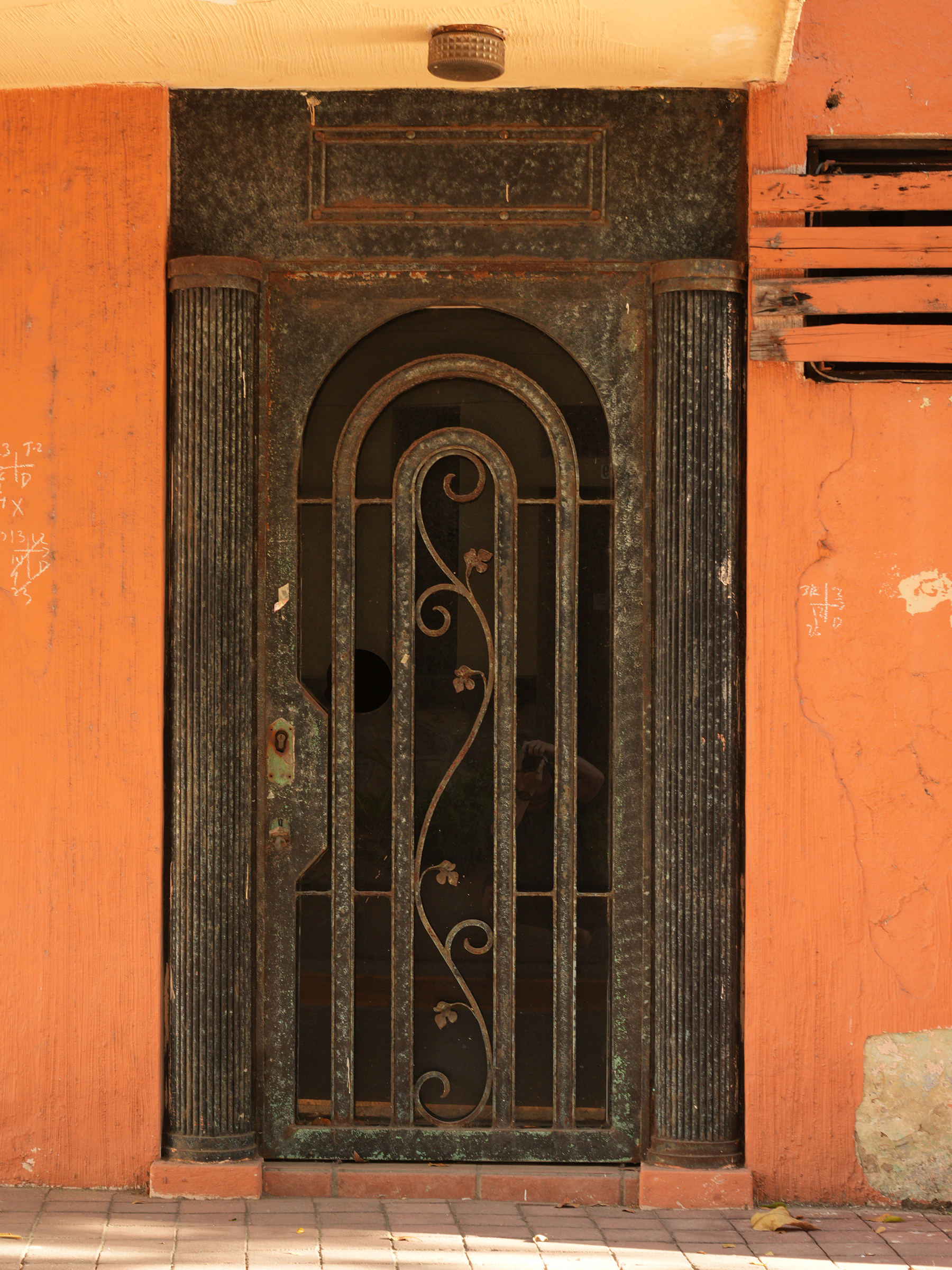
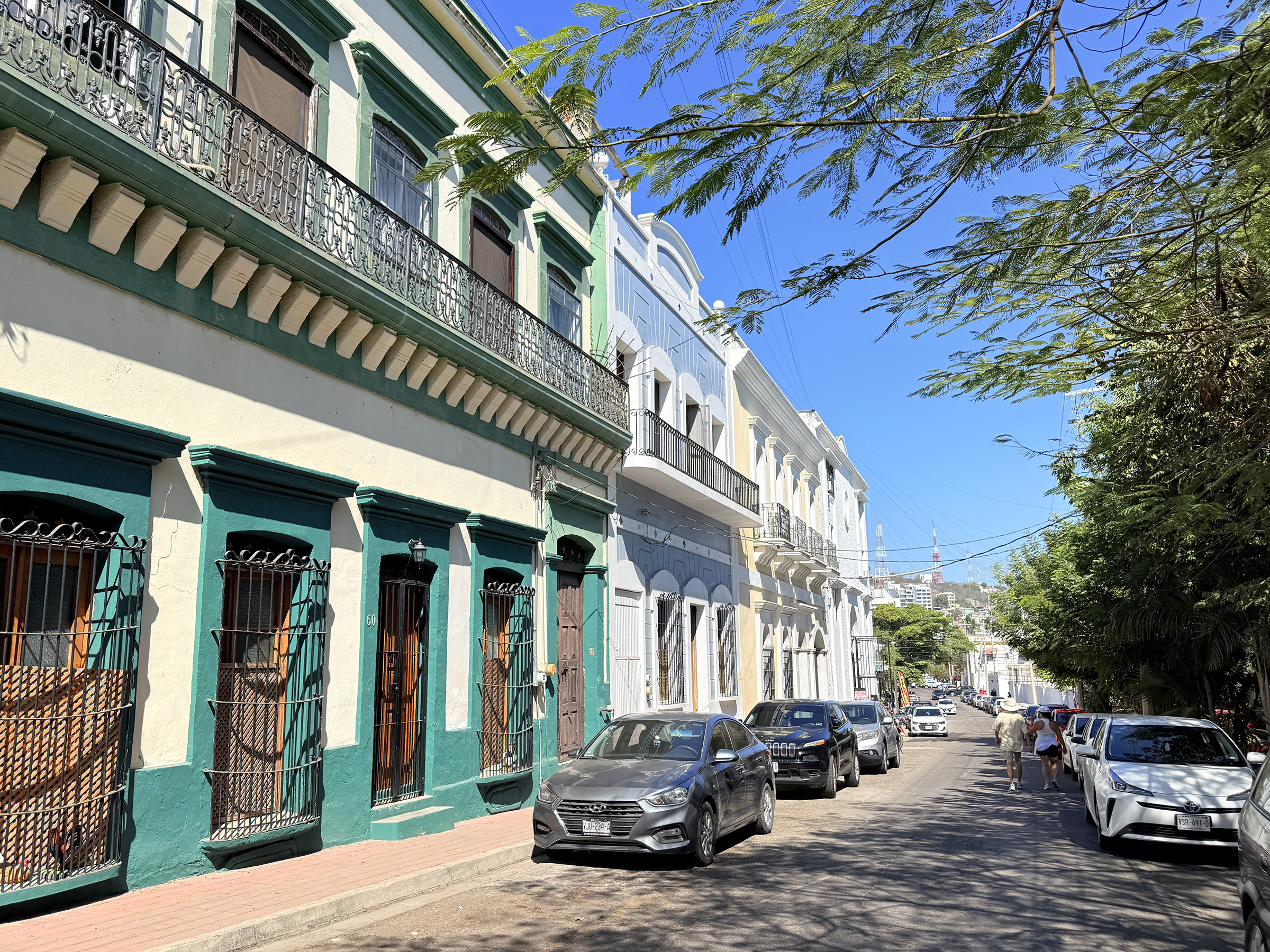
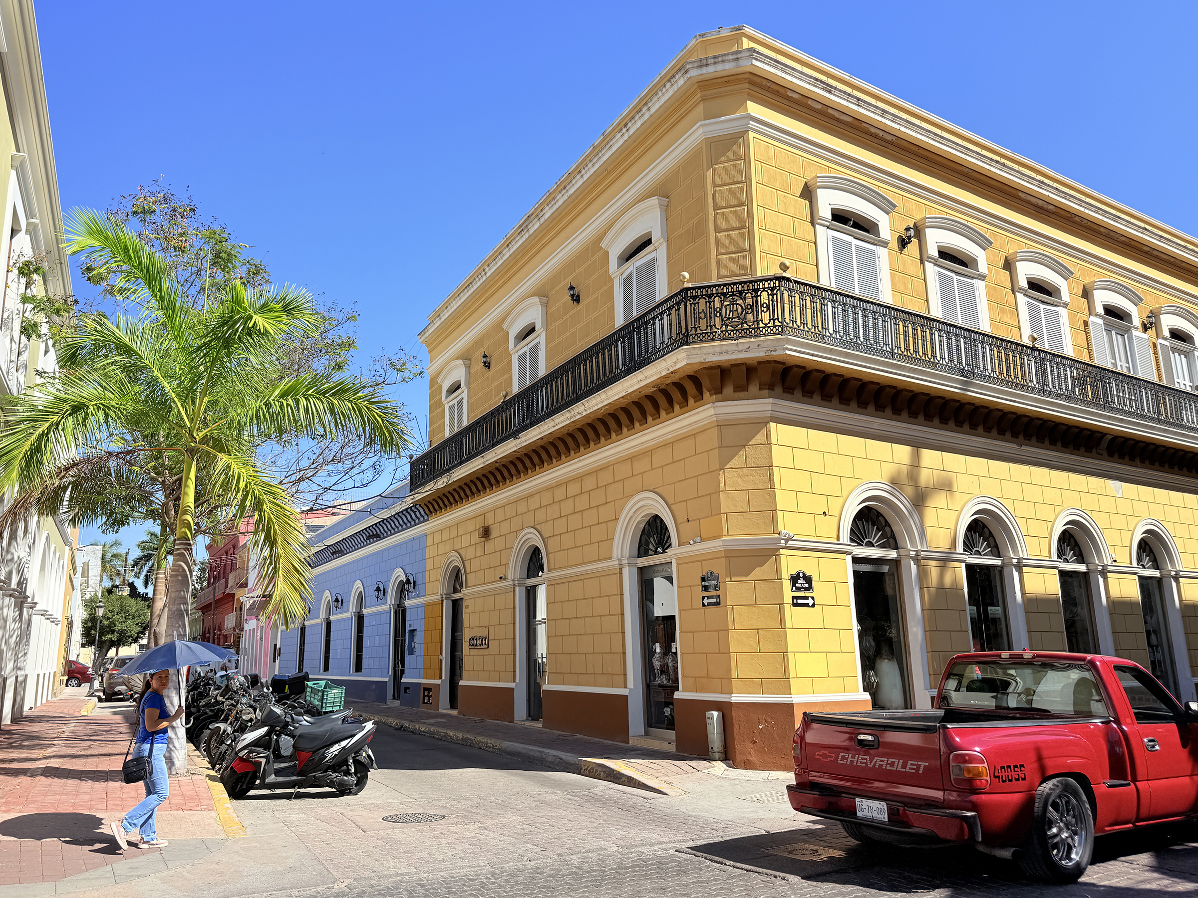
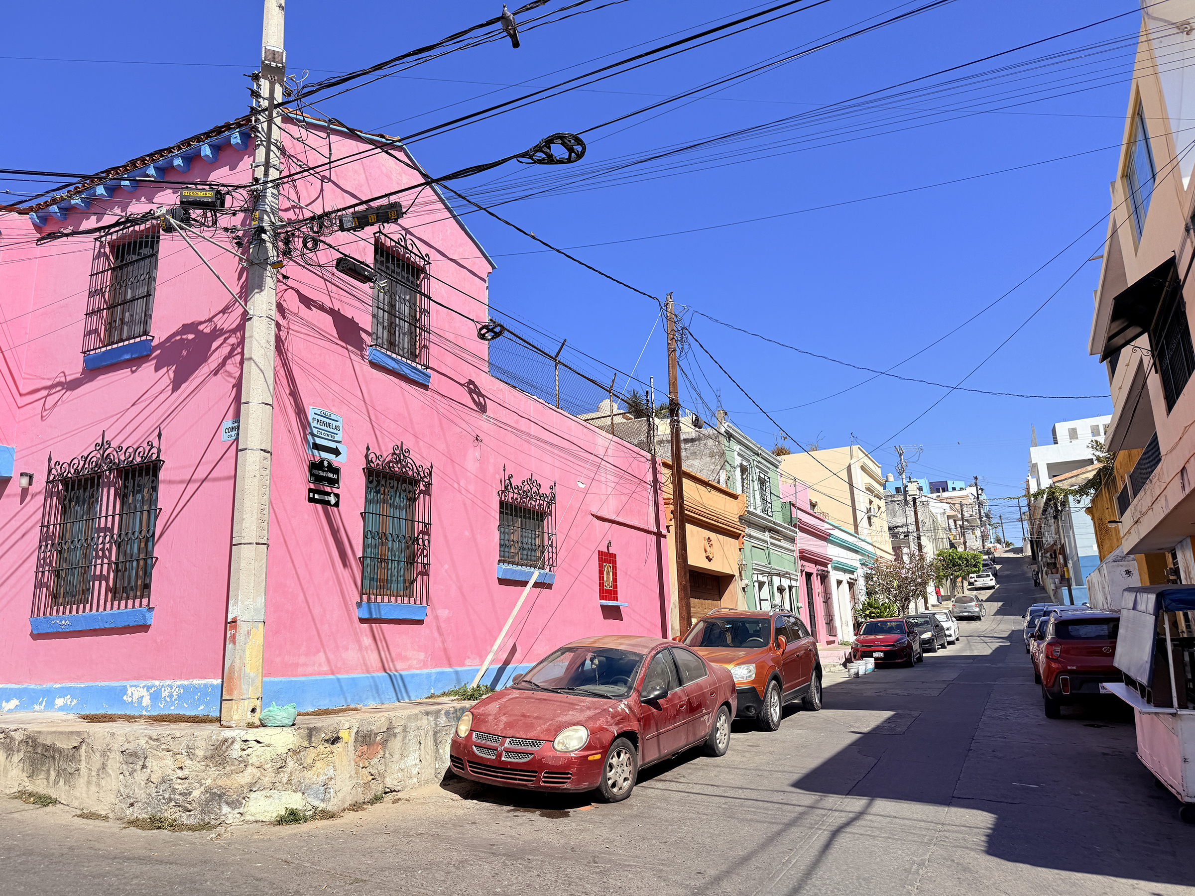
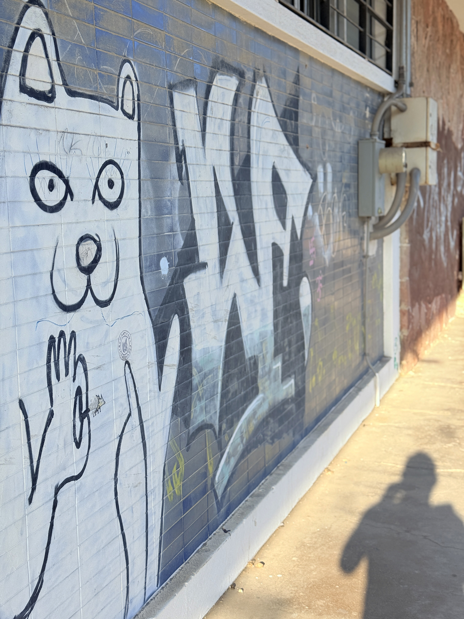
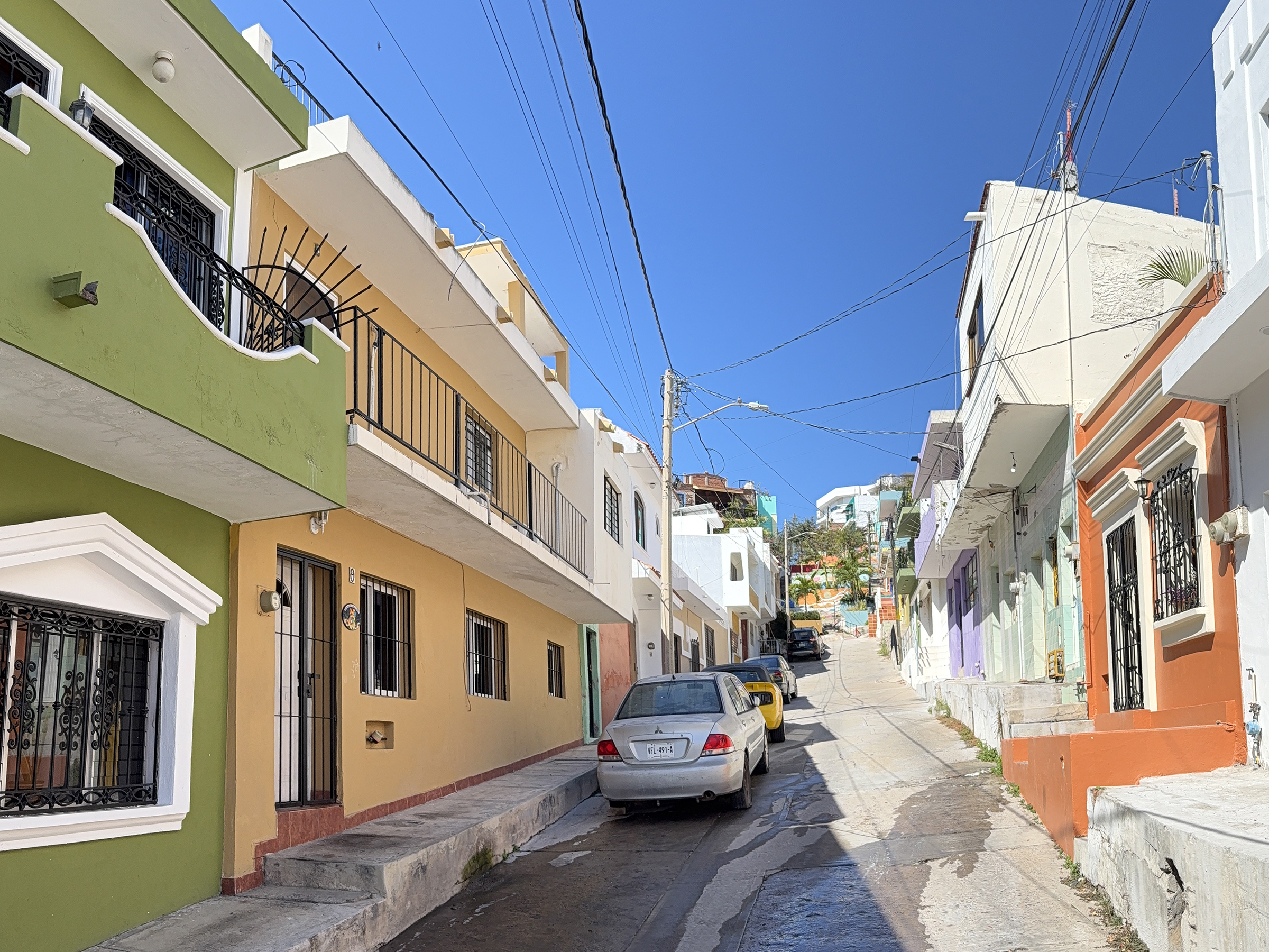
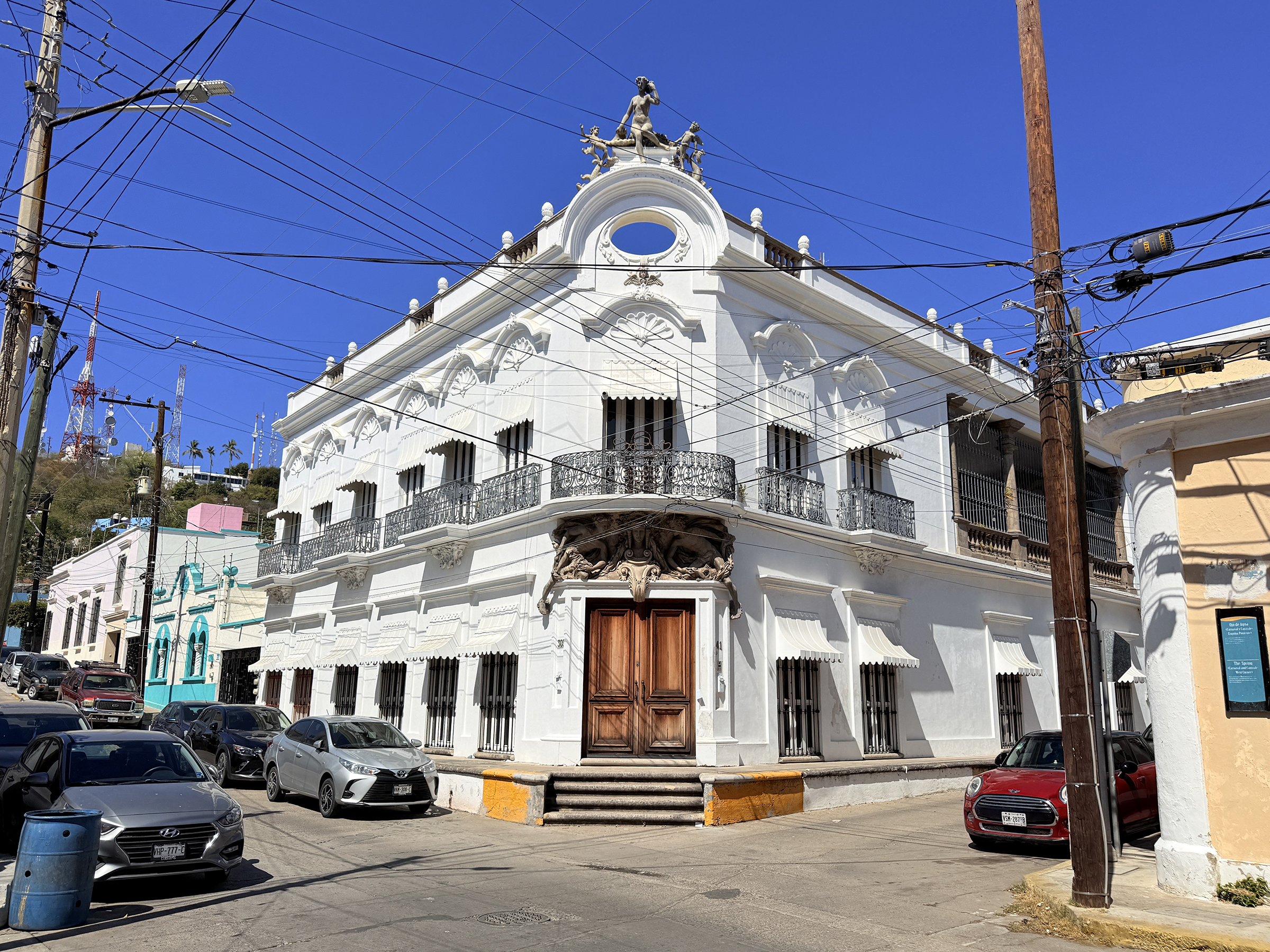
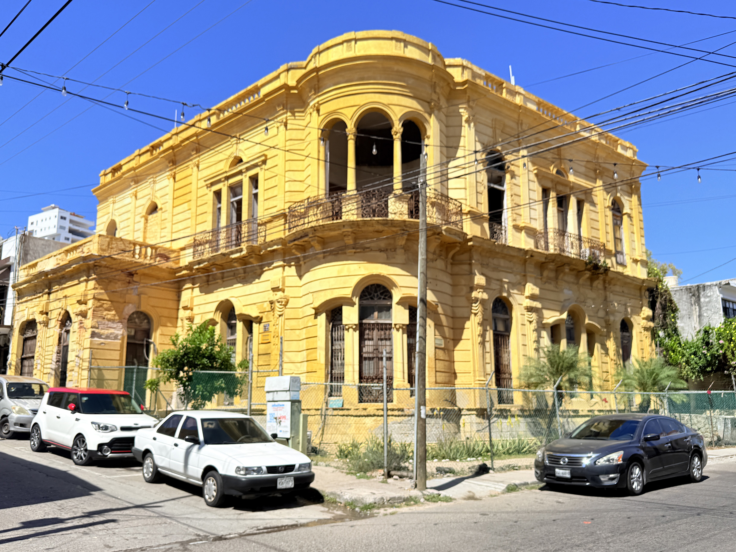
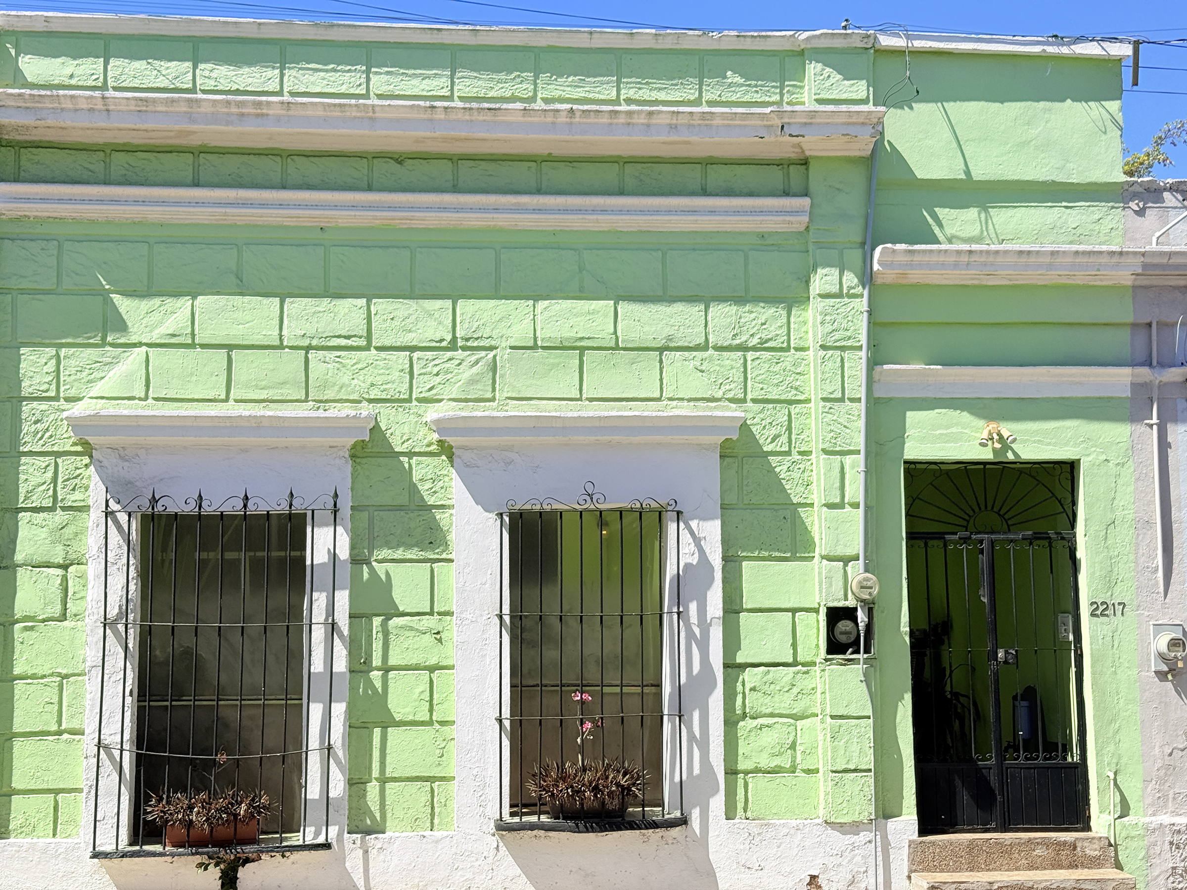
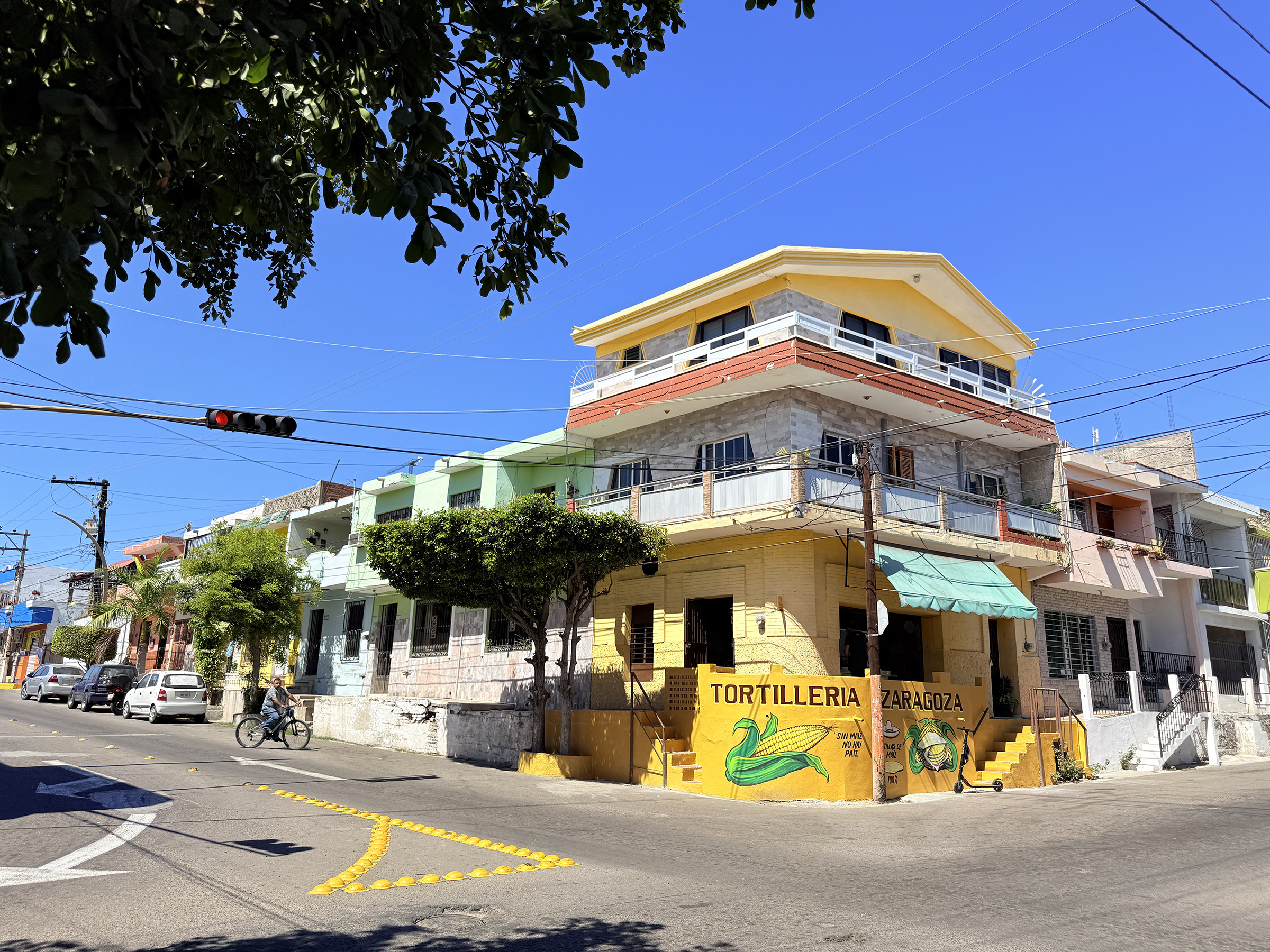
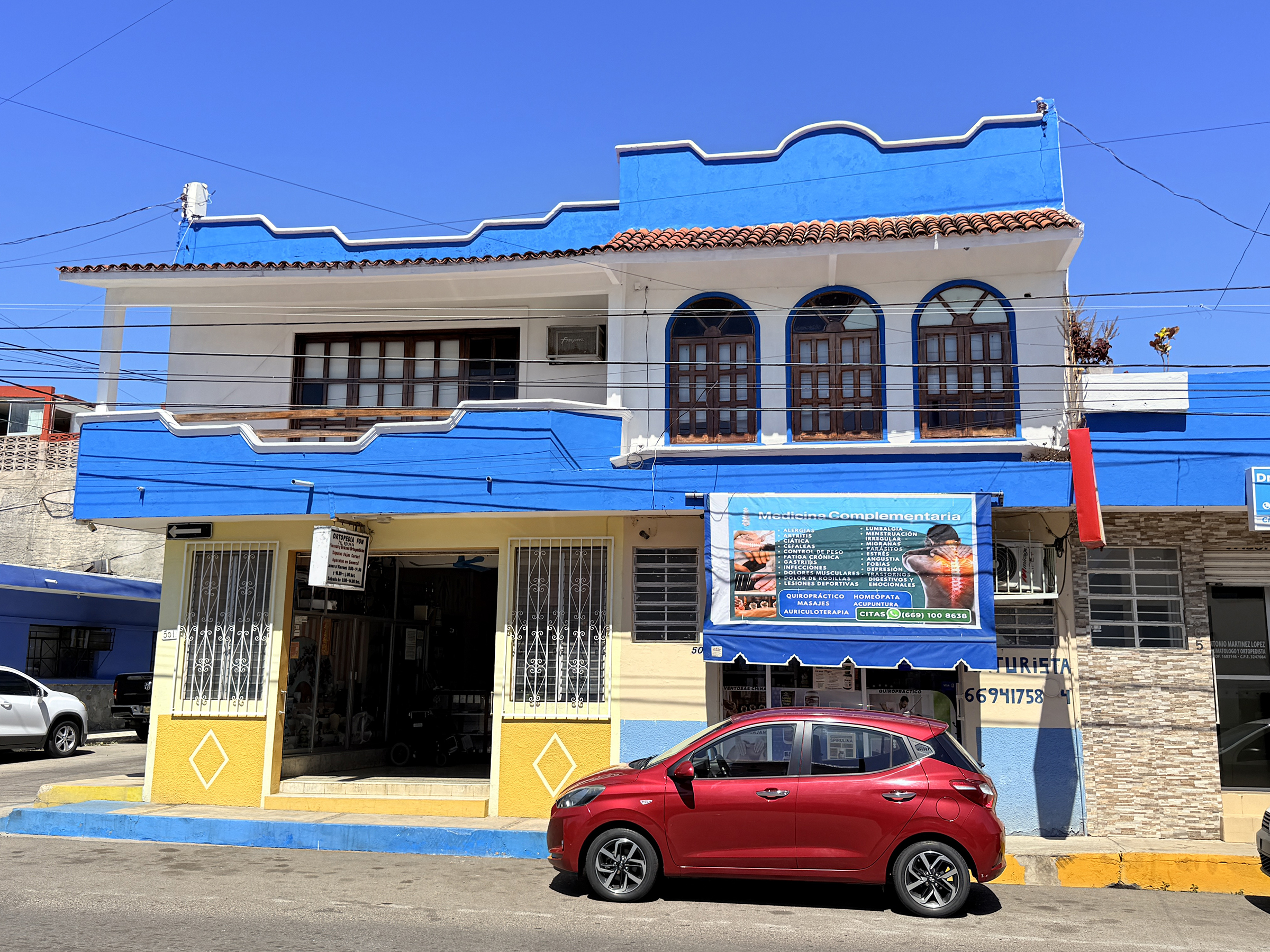
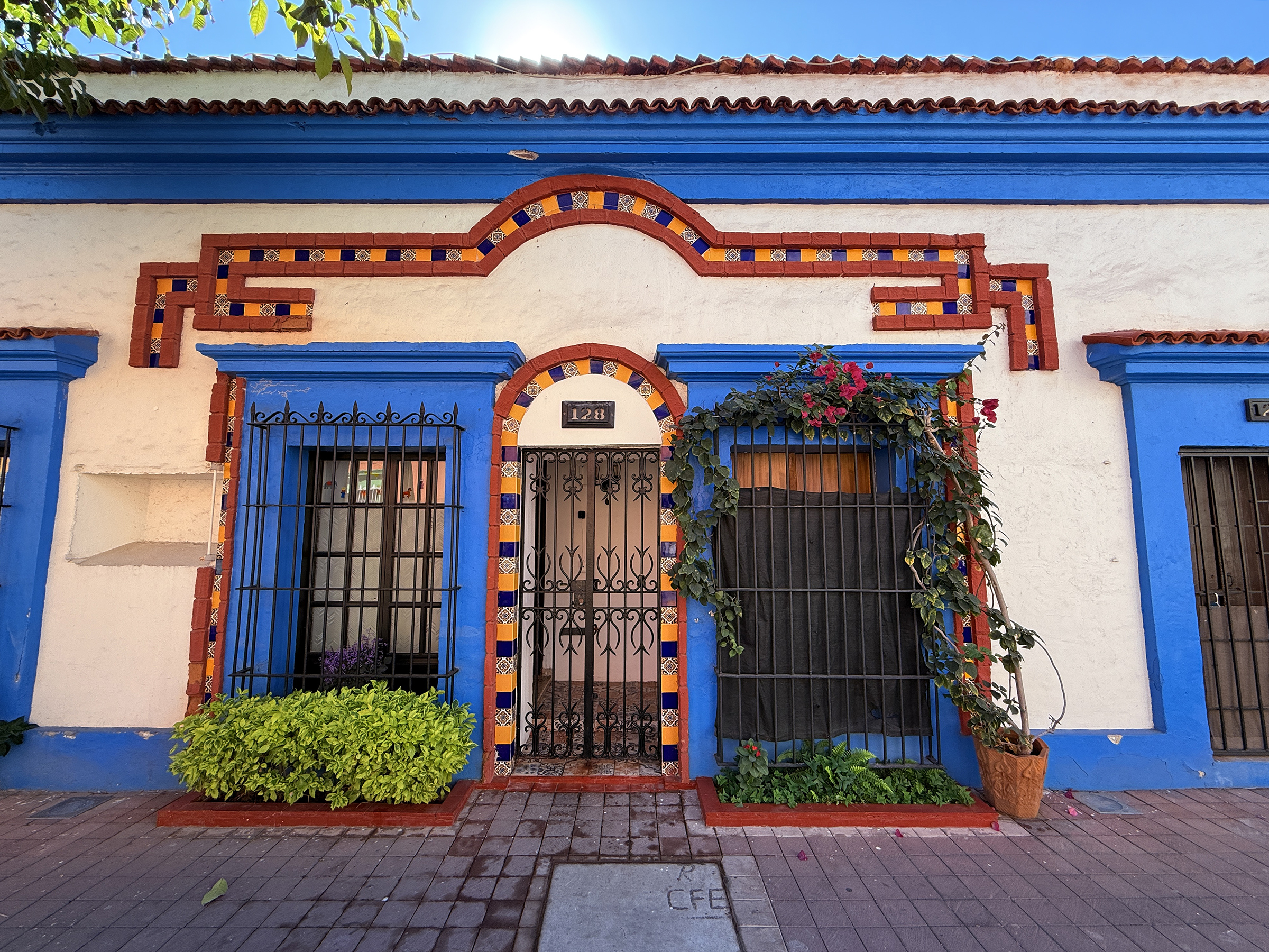
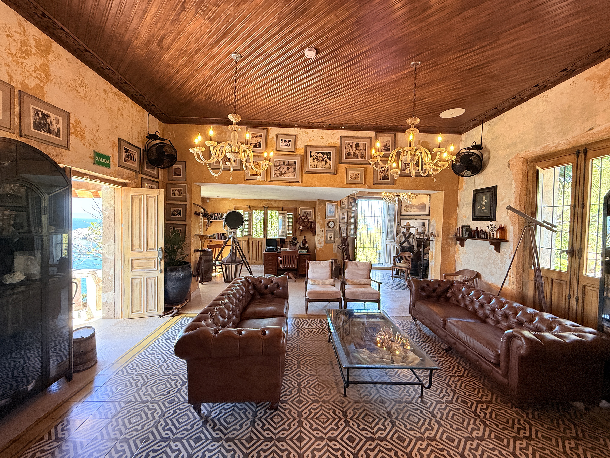
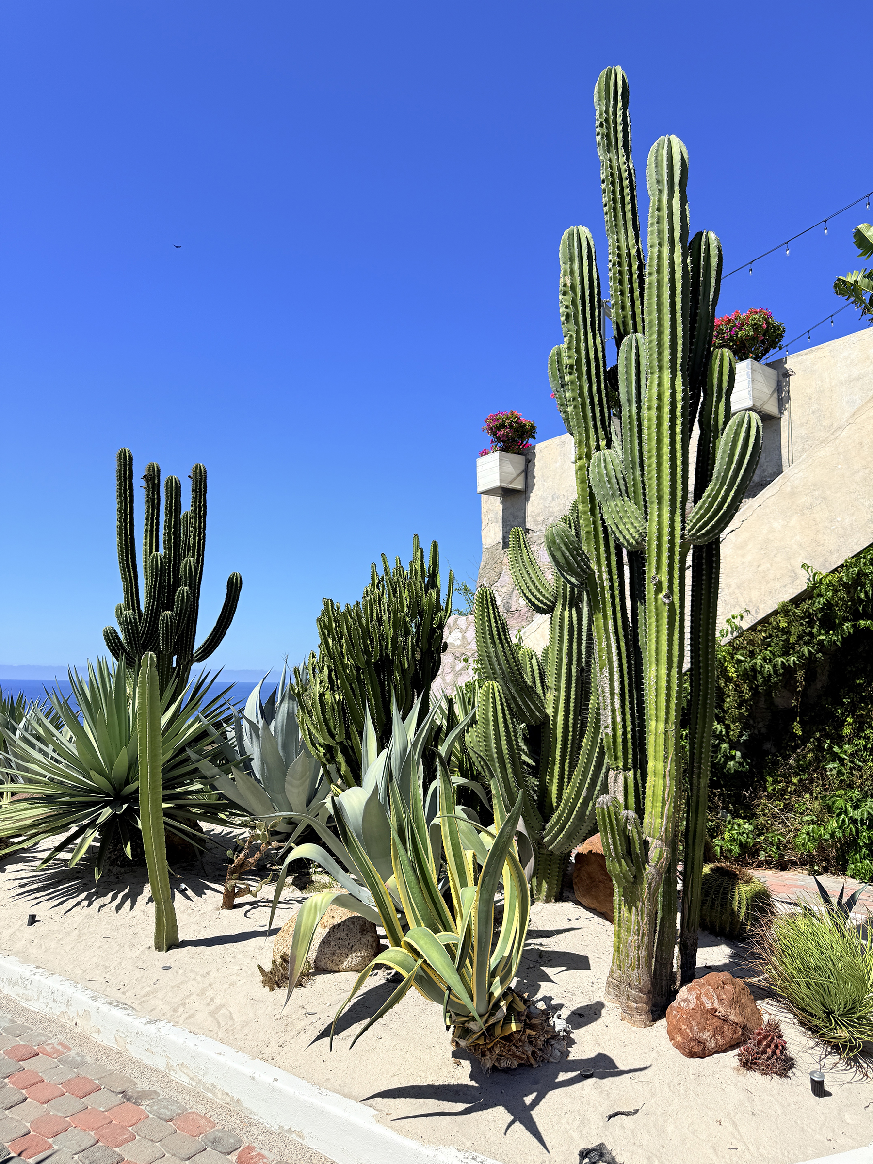
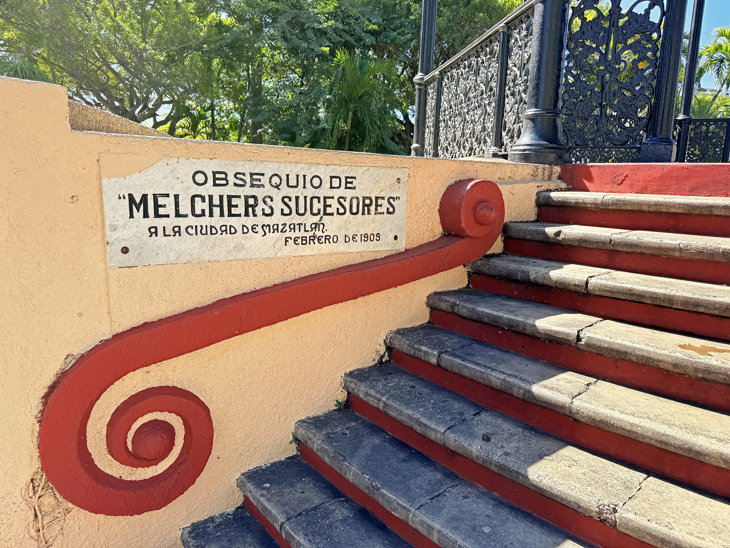
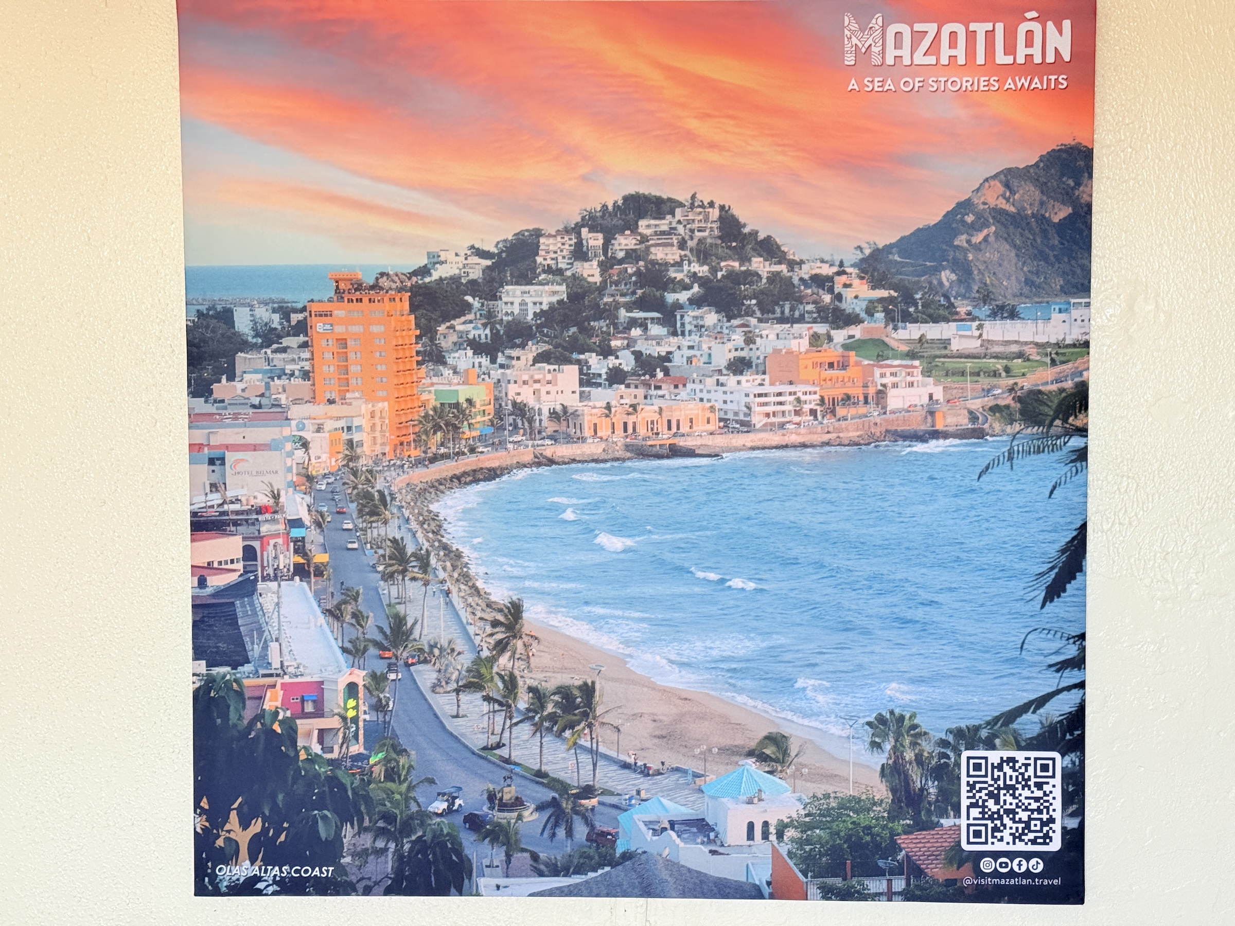
Here is a sample of beautiful architecture that had caught my eye the last few days as I walked around Centro de Mazatlán (the old center of Mazatlán).
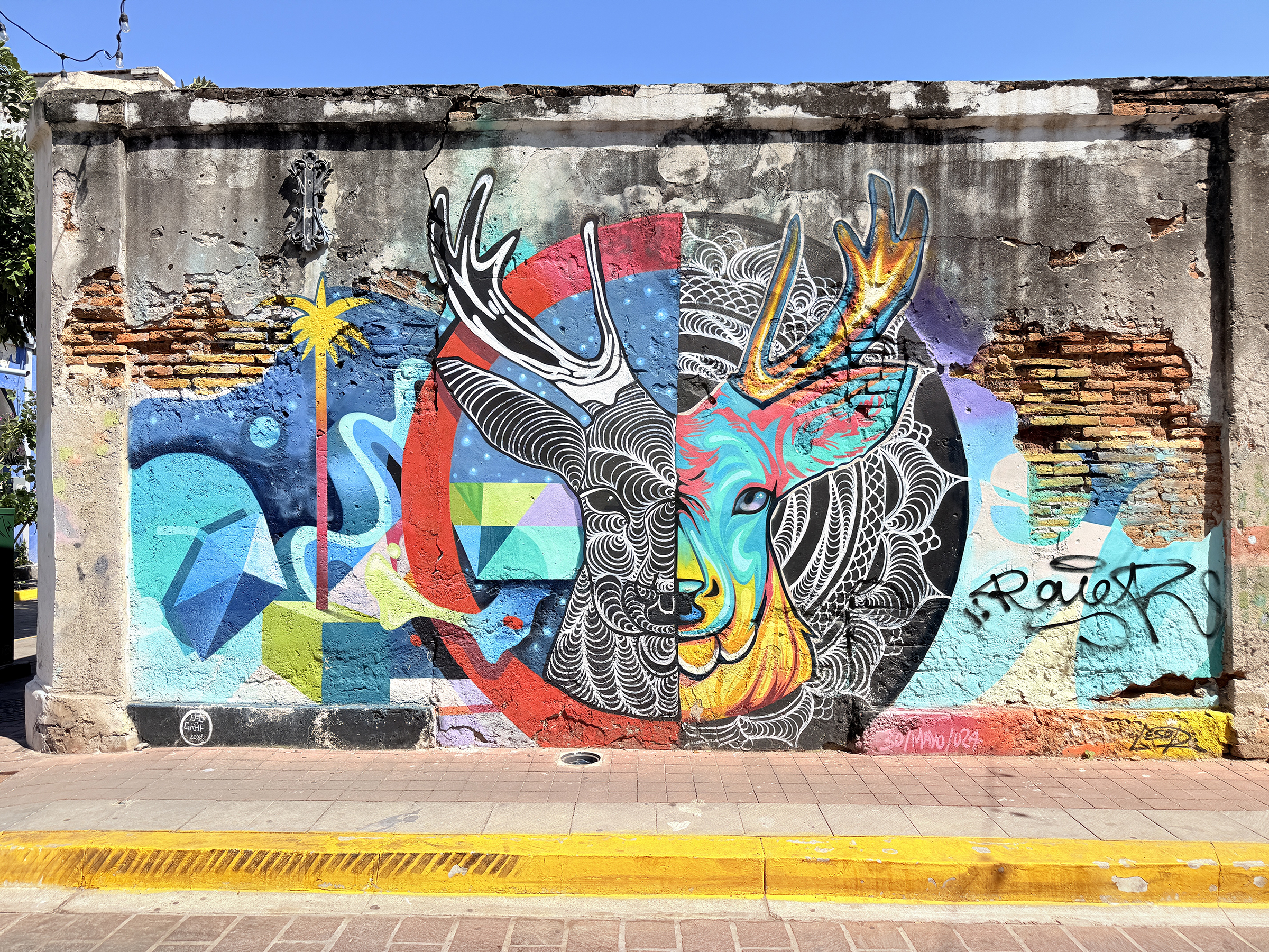
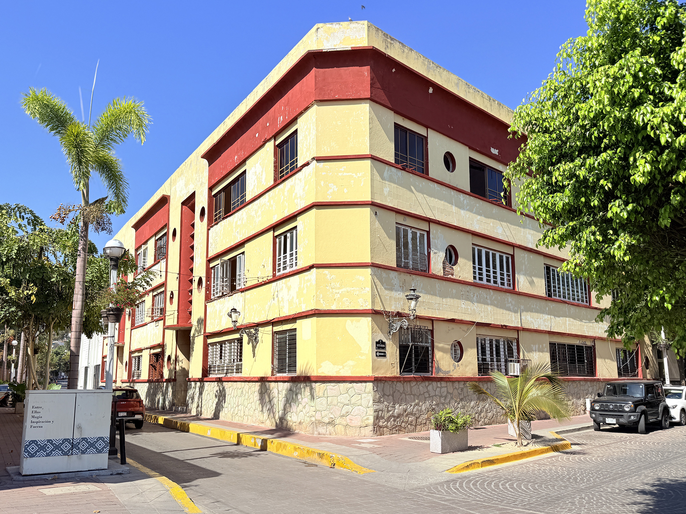
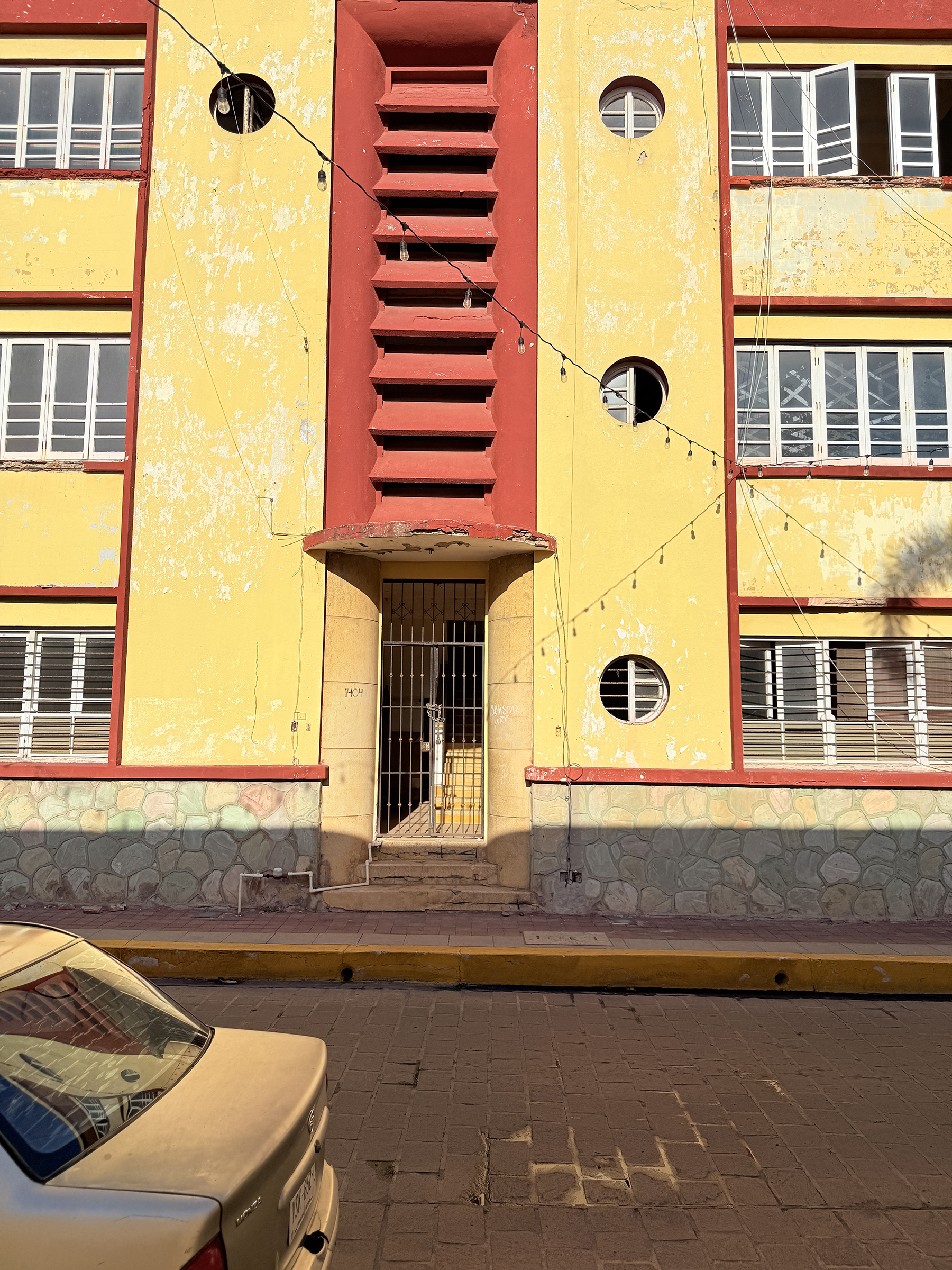
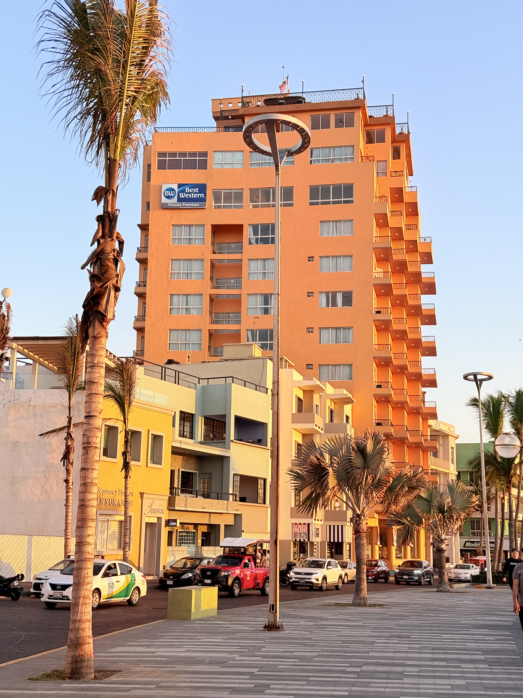
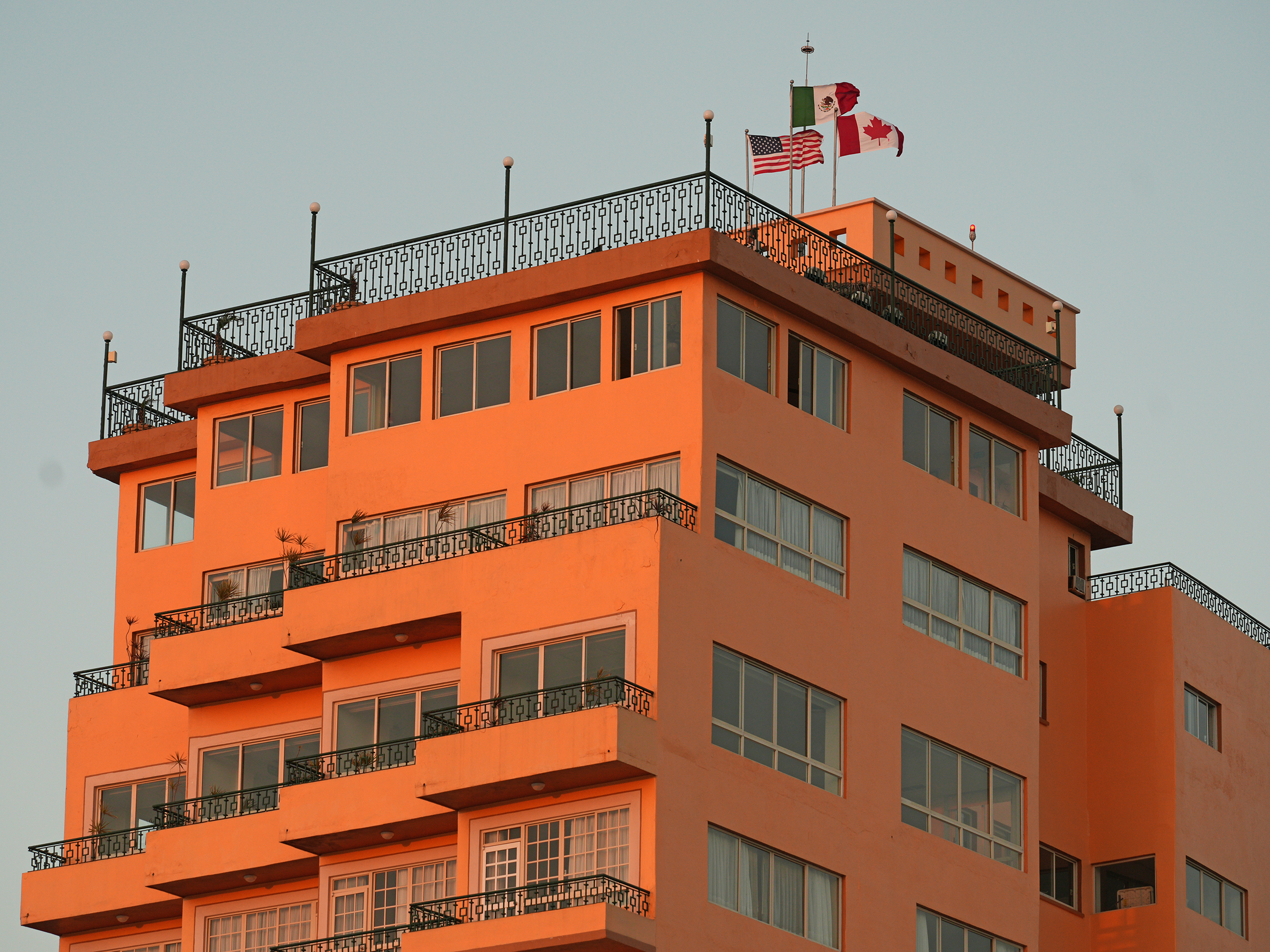
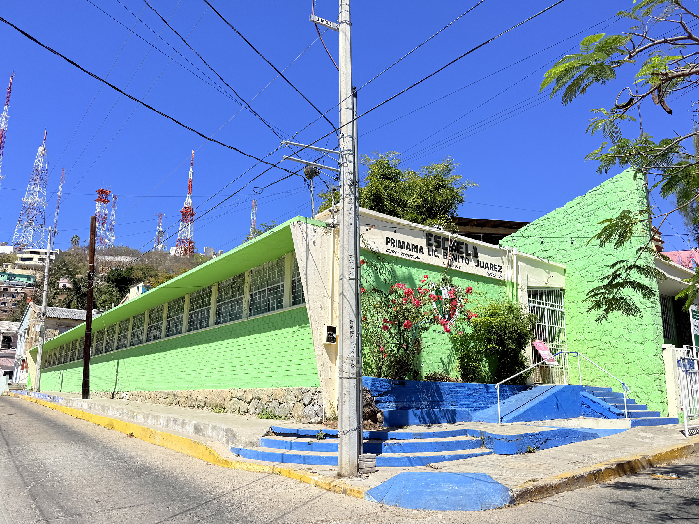
Casa Paredes Herrasti was designed by a young French architect and built in 1907 as a family home for Doña Francisca Rojas de Paredes, a direct descendant of Don Bonifacio Rojas who discovered the prosperous gold and silver mine of El Tajo in 1655. [Source: oceanblueworld.com]It need a a lot of restoration work..Founded in 1845 by the company Heymann Sucesores, in this building was the commercial house known as La Merceria Alemana. It operated as a store for luxury furnishments (pianos, porcelain from Dresden and Meissen, Baccarat and Bohemian crystal), until the beginning of World War II. The orange building opened as a commercial house in 1900 and is called La Casa Elorza. It exported products to Guatemala and Chile. The property functioned as a renowned high school at the end of the 20th century. A colorful mural. The deer is the primary symbol of Mazatlán, rooted in the Nahuatl* word mazatl (“deer”) and tlan (“place of”), translating to “Place of Deer”. *Nahuatl is a vibrant Indigenous language family with approximately 1.5 to 1.7 million speakers, primarily in central Mexico. As the historic language of the Aztec Empire, it remains the most spoken indigenous language in Mexico, known for its agglutinative structure, unique “tl” sound, and influence on English words like chocolate and coyote.The apartment building at 1402 Blvd Niños Héroes. ..The Hotel Freeman, built between 1945 and 1950 overlooking Olas Altas beach, was the first skyscraper in Mazatlán and northwestern Mexico. With 13 floors, it became an icon of modernity for its time. Its presence marked a turning point in the port’s urban landscape, playing a key role in the transformation of the historic center during the 20th century. Despite its innovative design, locals viewed its height with skepticism and often joked about its collapse. [Source: Alfredo Velazquez on Facebook]The flags of the U.S.A., Mexico and Canada are on the flagpoles on the top.Elementary school Benito Juárez on 20 Campana Street, serves children in grades 1-6. Benito Juárez was the 26th president of Mexico, from 1858 until his death in 1872.
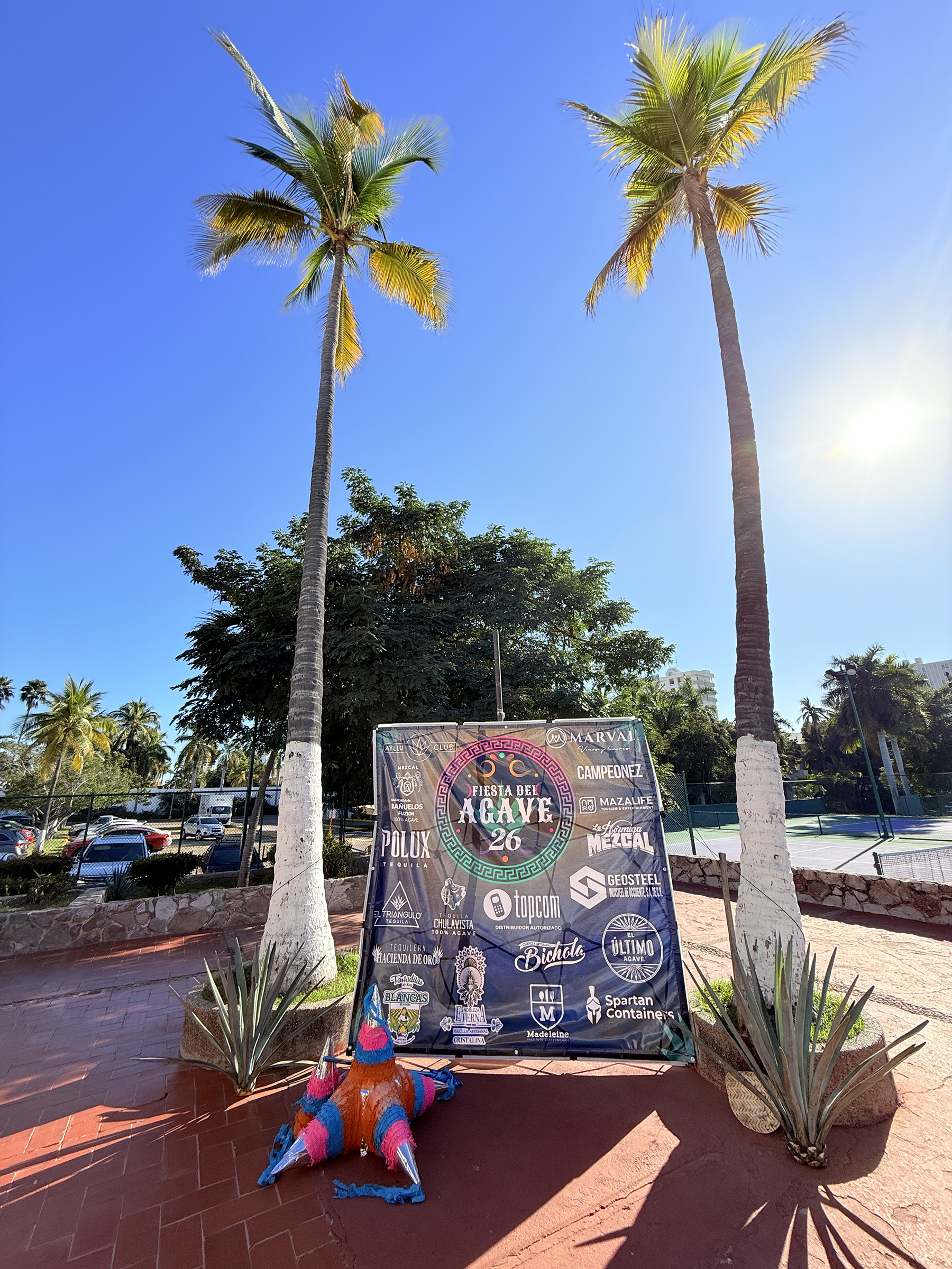
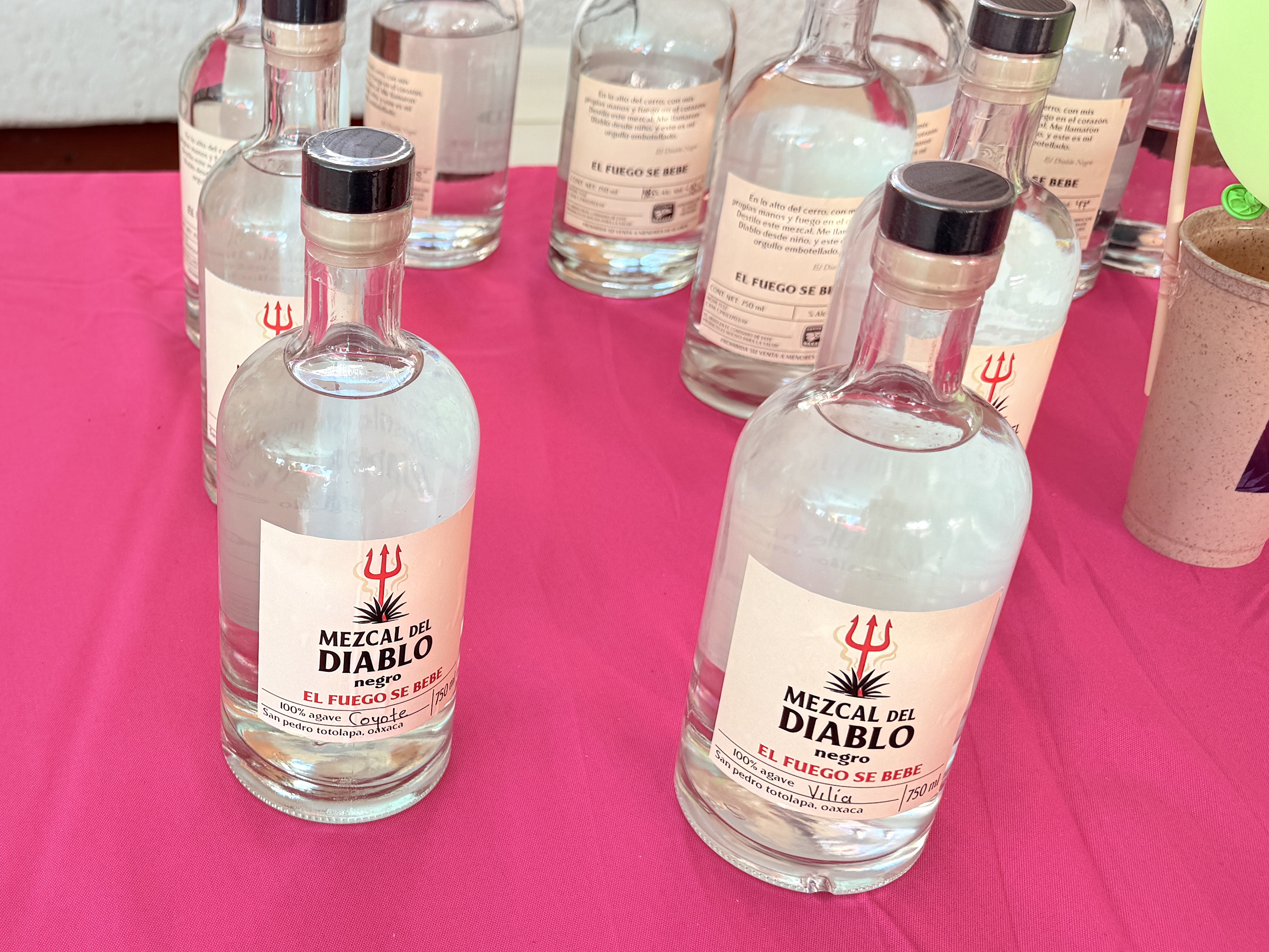
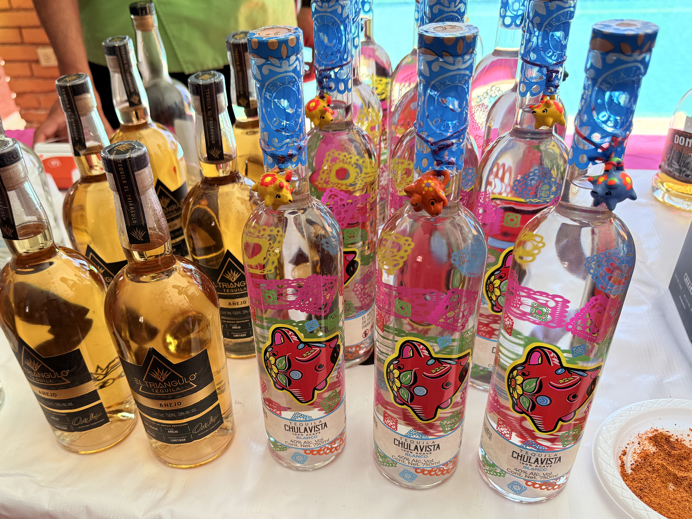
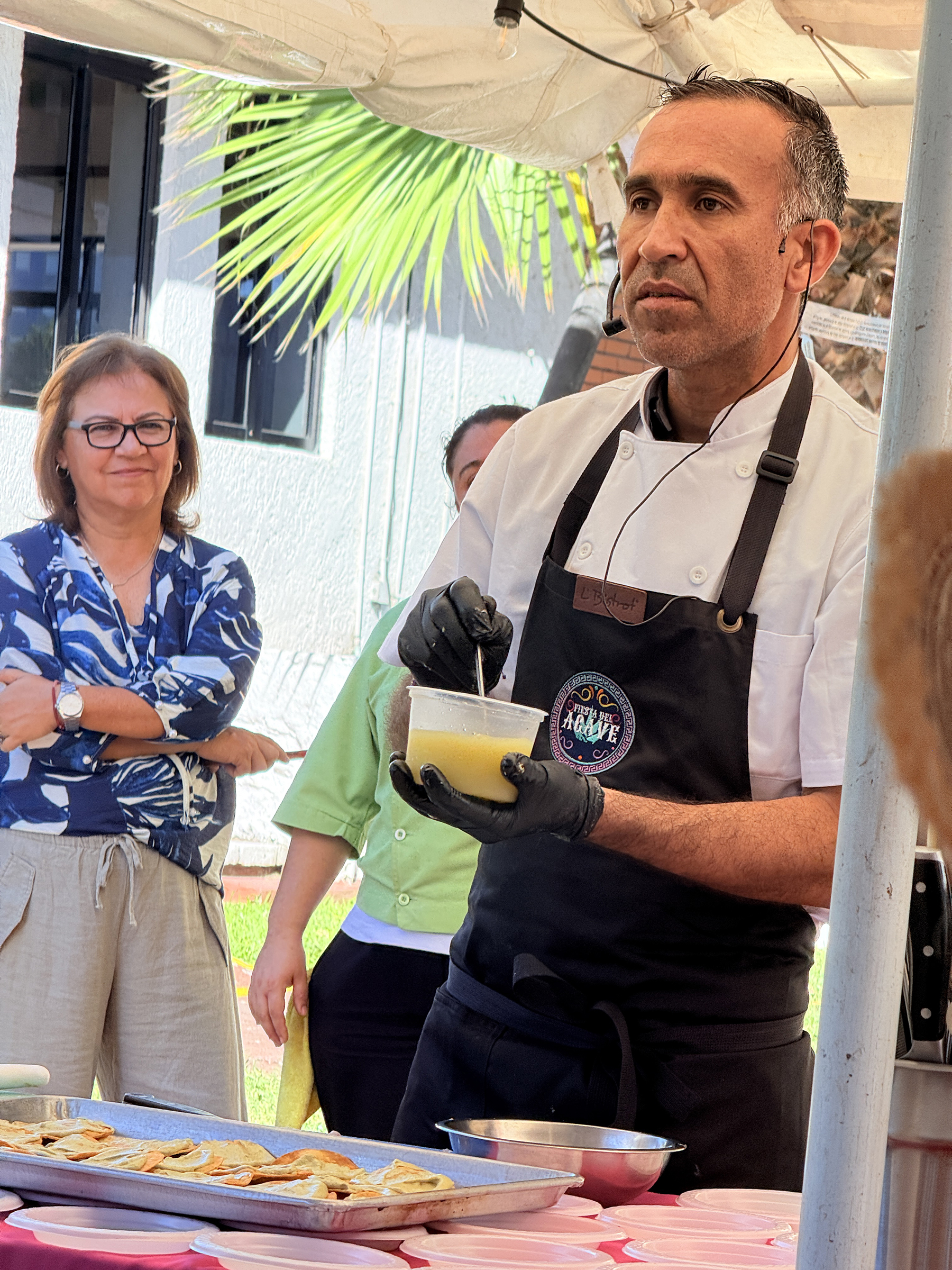
We attended Fiesta del Agave 2026 at the El Cid Golf & Country Club here in Mazatlán today.
There were tables with bottles of mezcal and tequila* for tasting (and to buy, of course). We sat in on chef Héctor Saracho’s food prep demonstration. He prepared a ceviche from Sierra Spanish mackerel, served up on a made-from-scratch toasted tortilla shell. (Chef Saracho has impressive credentials. He travels to Cabo San Lucas and elsewhere to cook for the likes of Jennifer Aniston, George Clooney and Howard Stern.)
Then we had a little lunch and tasted some locally brewed beer (excellent, and the stout was the best). The mariachi band arrived just then and we listened to three or four songs before calling it a day.
The sunset is from a new acquaintance’s lookout over the beach in Mazatlán’s Golden Zone.
*Mezcal and tequila are almost the same, but not quite.
Here is Google AI Overview explaining: Tequila is a type of mezcal, but not all mezcal is tequila. The primary differences are in agave type, region, and production: Tequila uses only Blue Weber agave, mostly in Jalisco, typically steamed. Mezcal uses various agave types (mainly Espadín) roasted in earthen pits, giving it a distinctive smoky flavor.
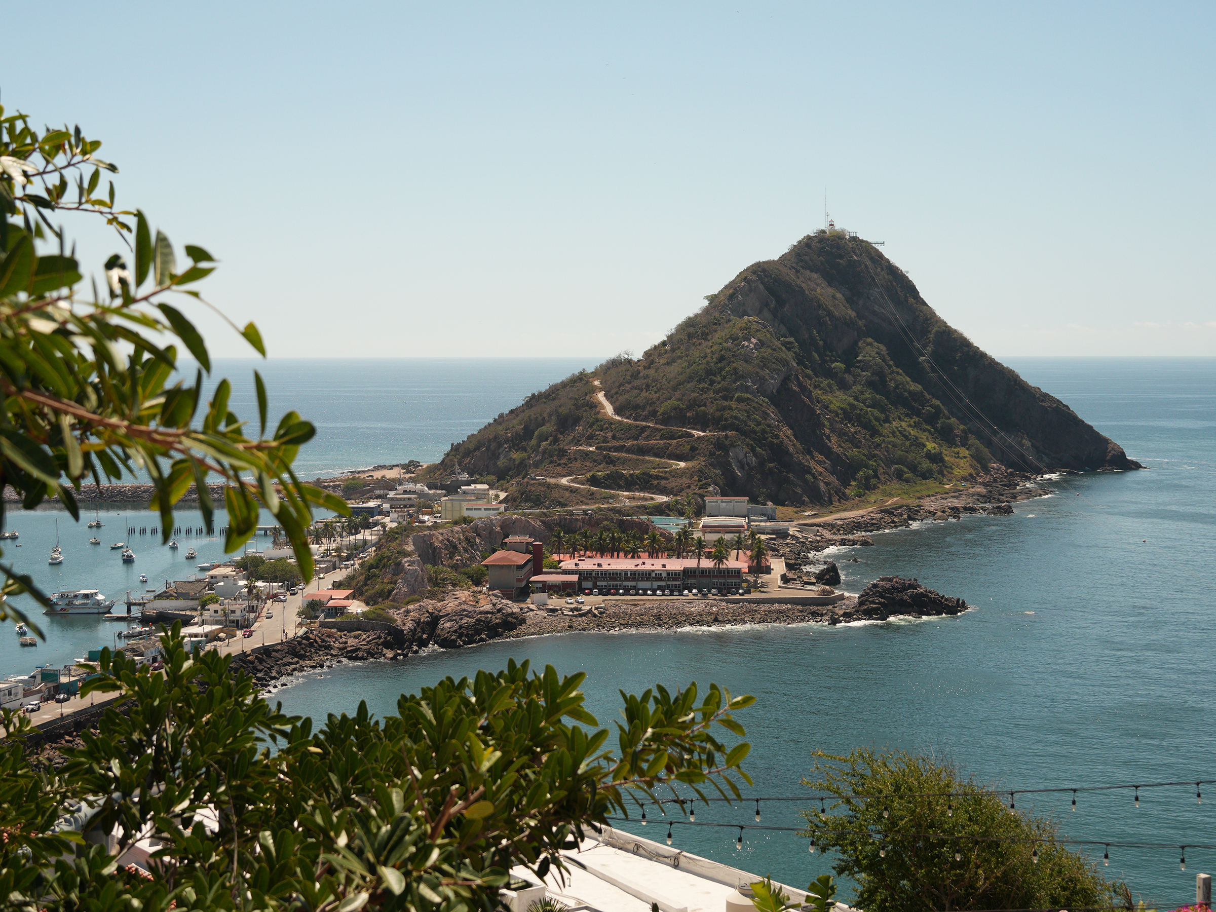
There was a marine layer out on the ocean this morning as we made our way toCerro del Vigía (‘Lookout Hill’).
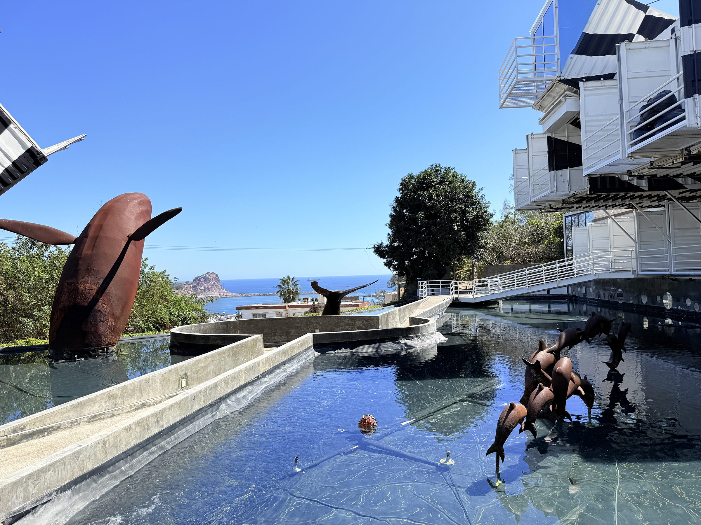
We took the short cable car trip up to the observatory: the touristic park named Observatorio 1873, after the year of its construction.
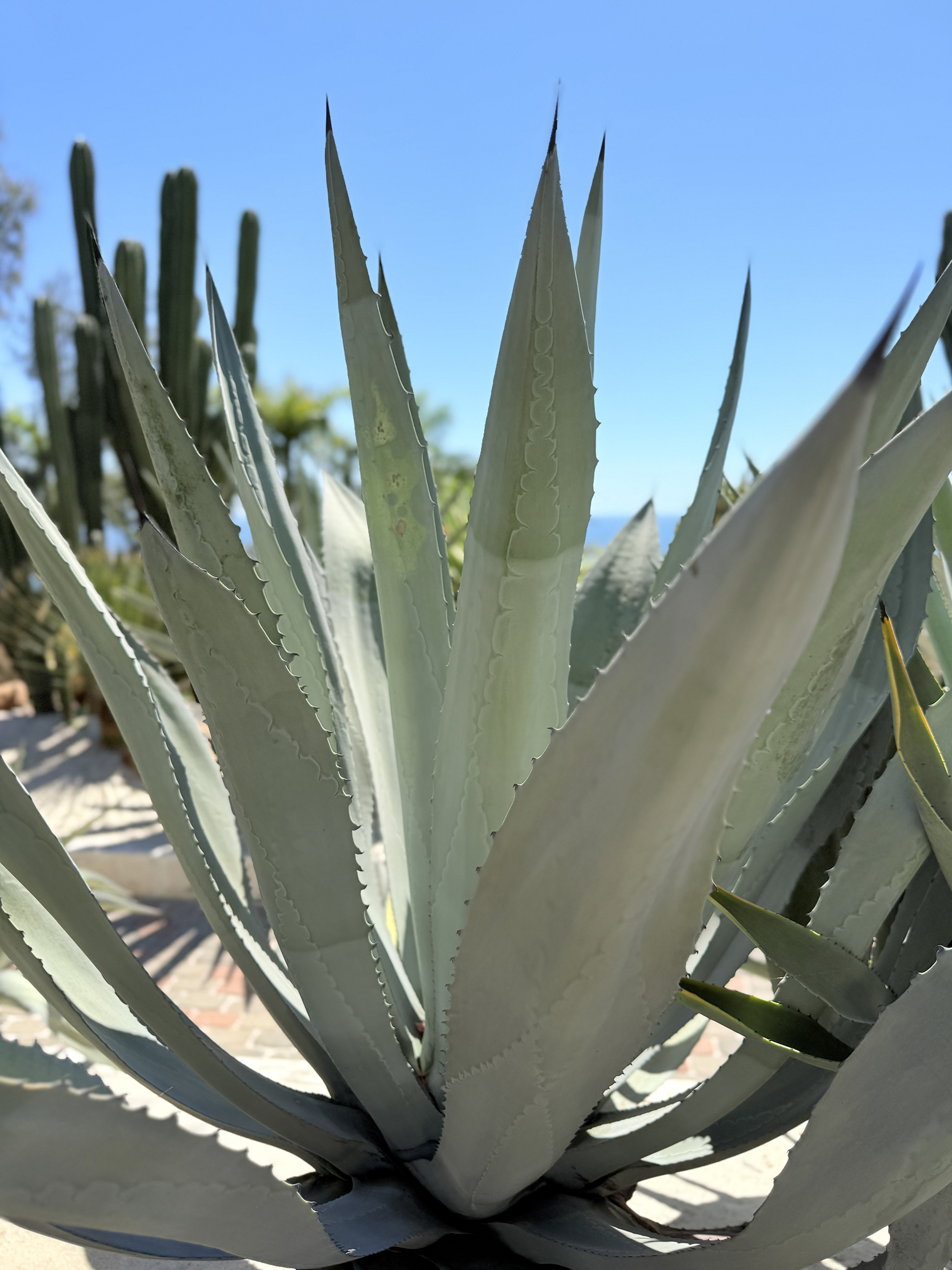
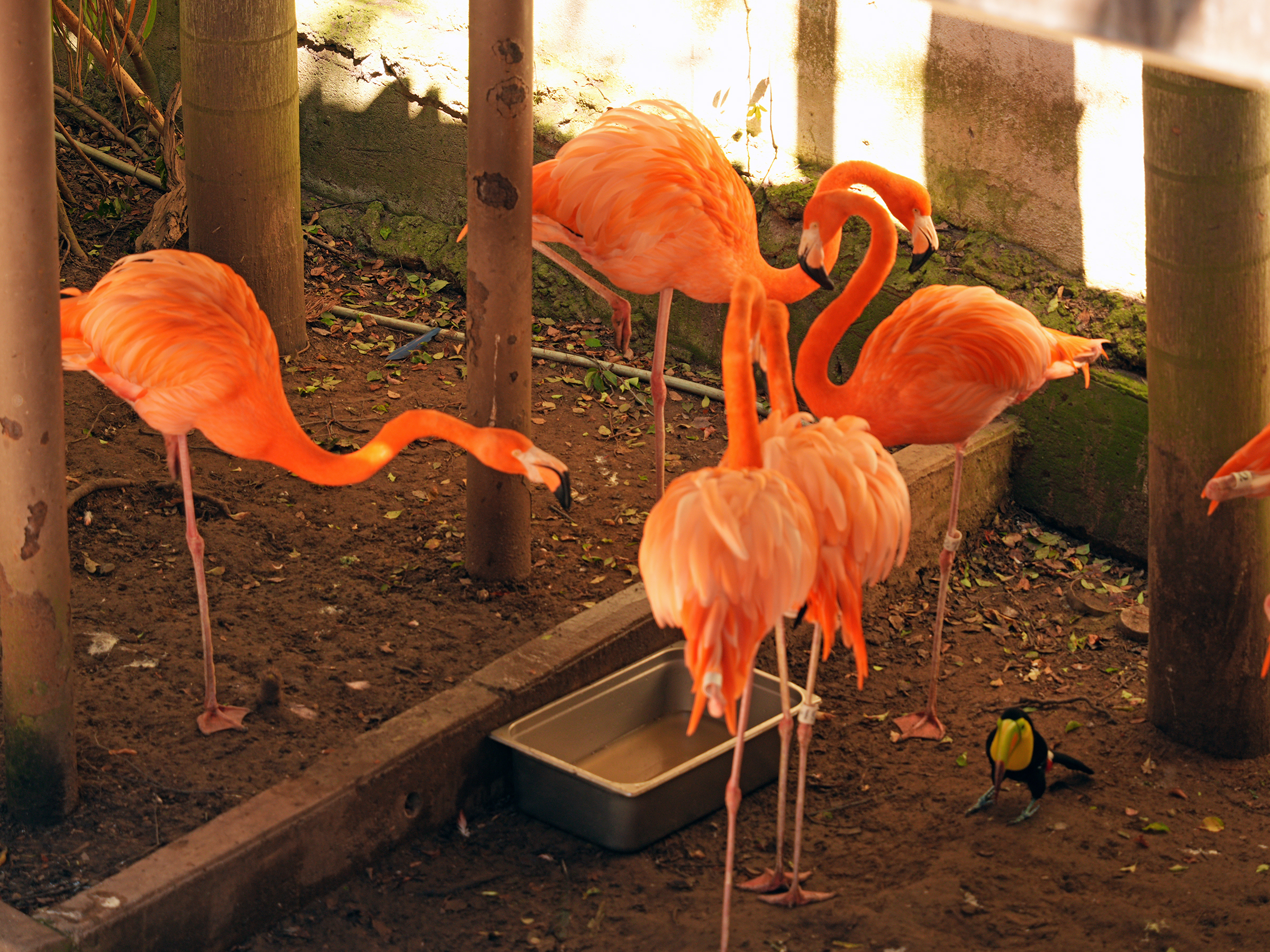
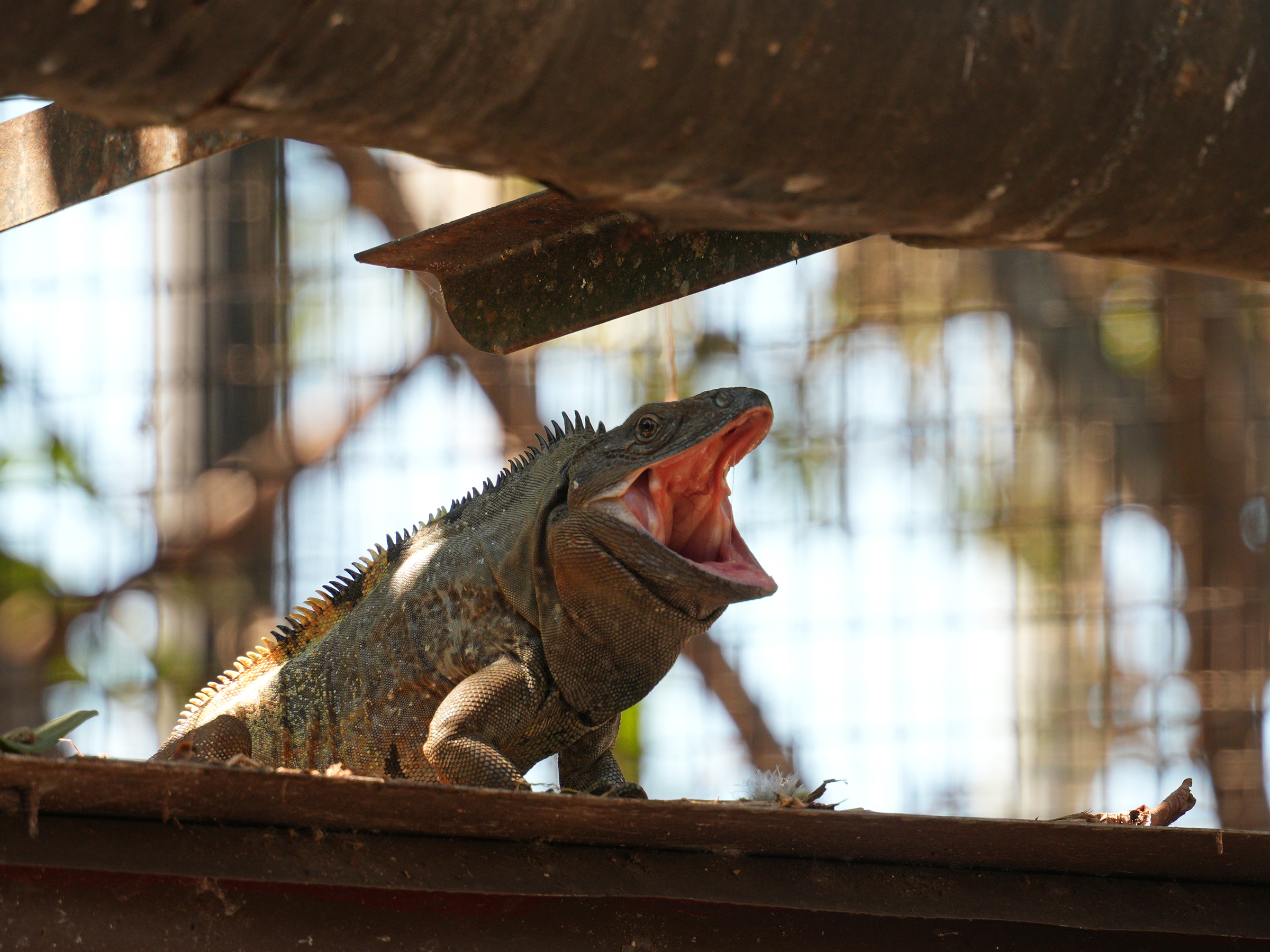
By the observatory there is a small agaviario (a dedicated agave garden) and steps down to a bird sanctuary called El Nido. A few steps further down the hill there is an enclosure with iguanas and tortoises.
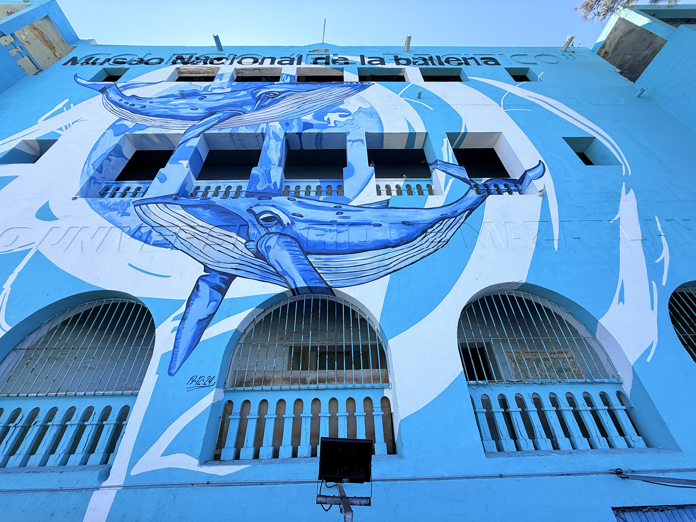
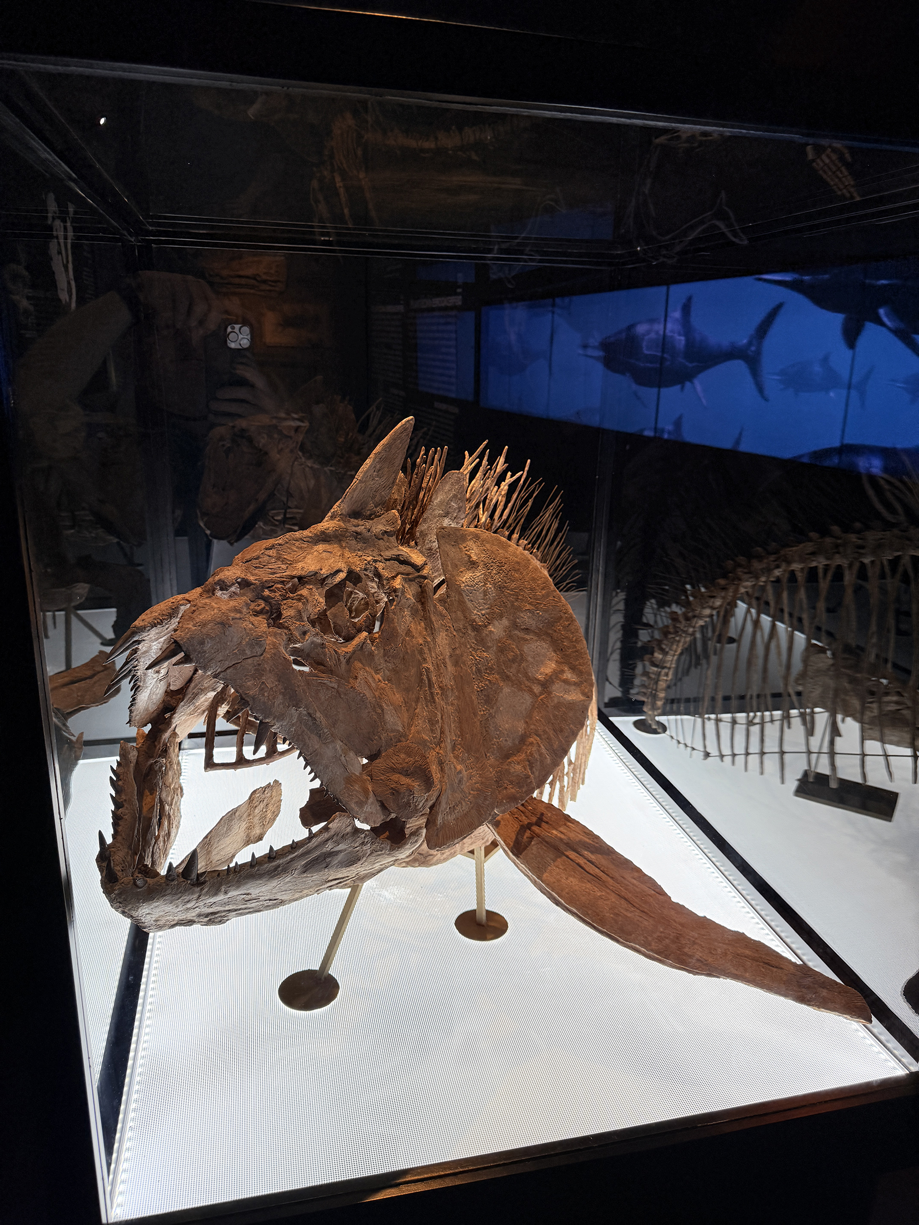
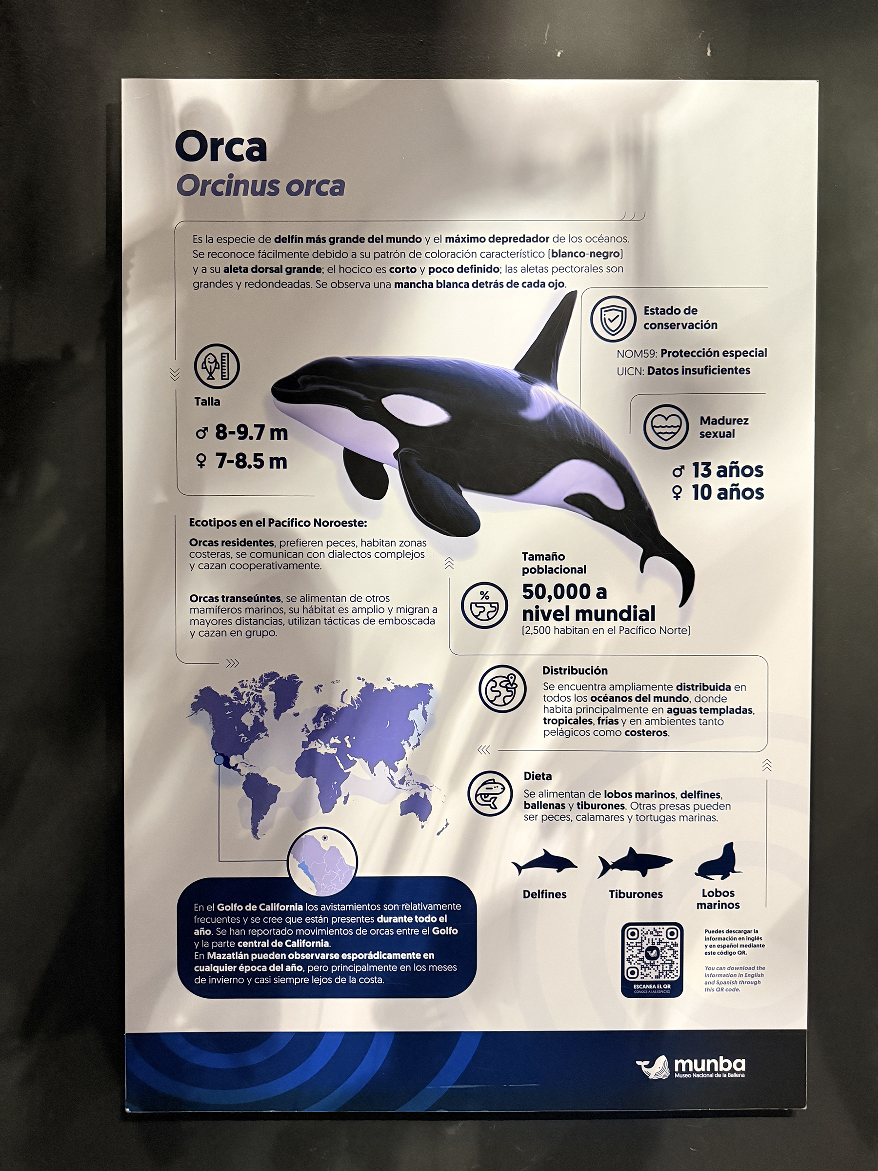
The last stop is the new whale museum called Museo Nacional de la Ballena (National Whale Museum) that opened in August 2025.
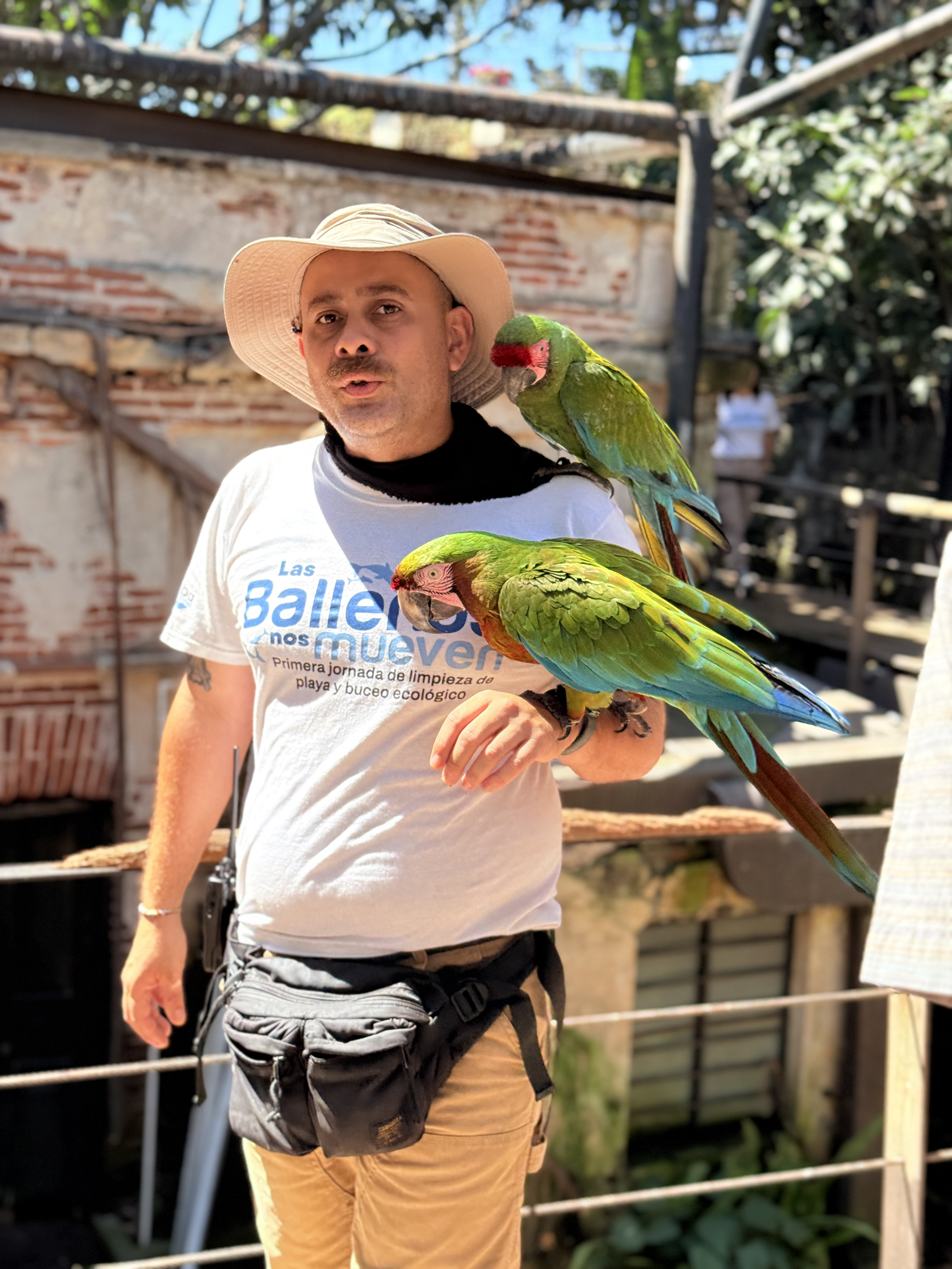
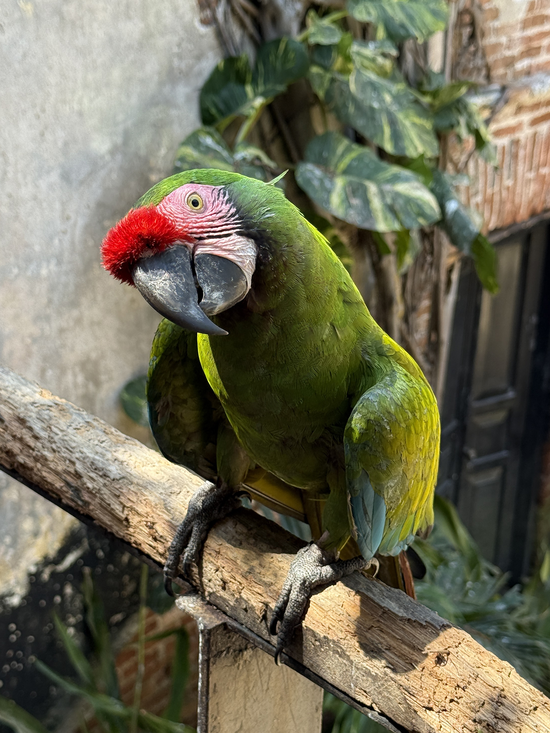
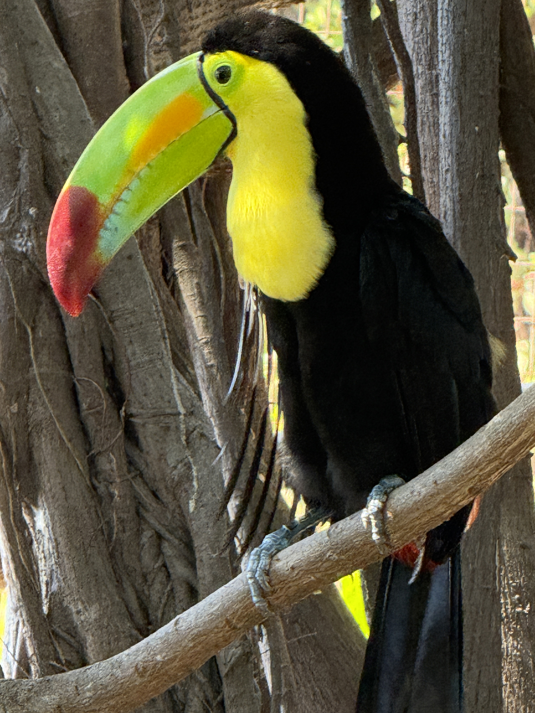
(Thanks to Bryan for the picture of the toucan and of the green parrot).
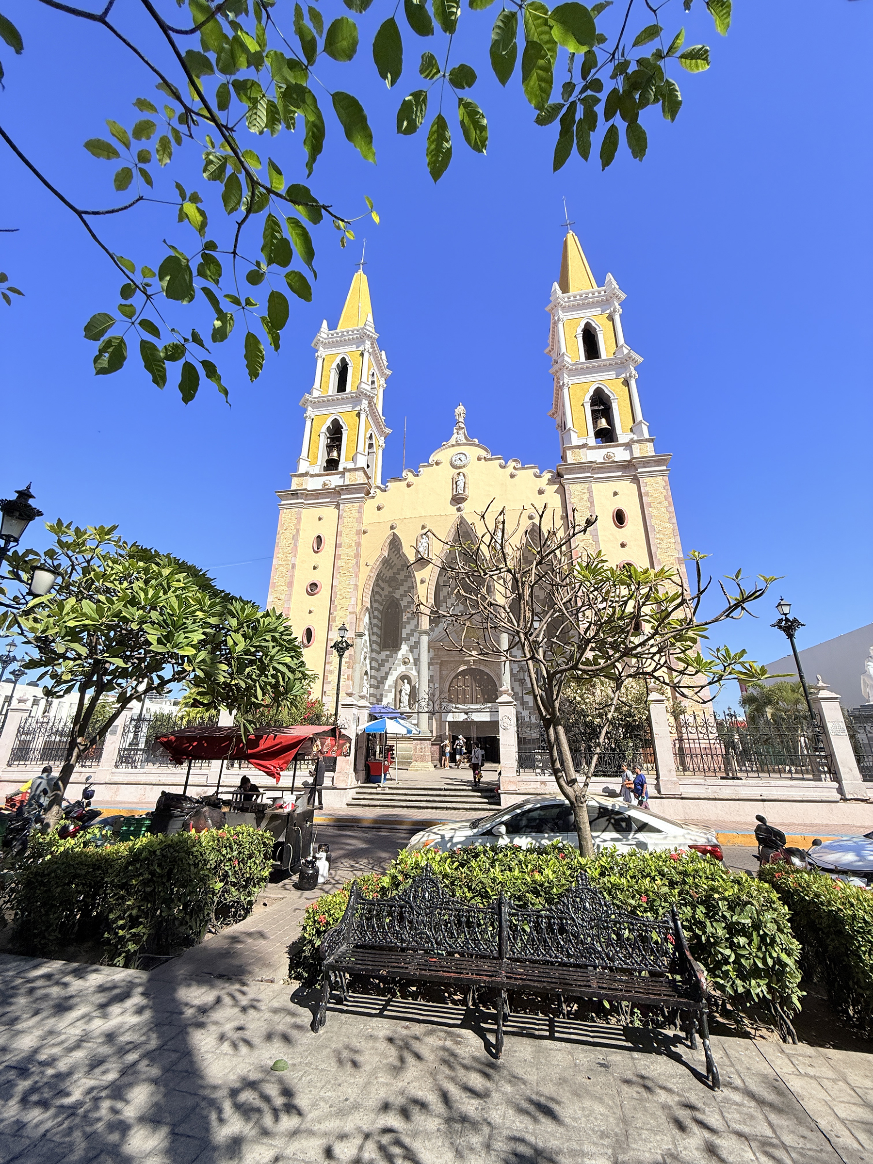
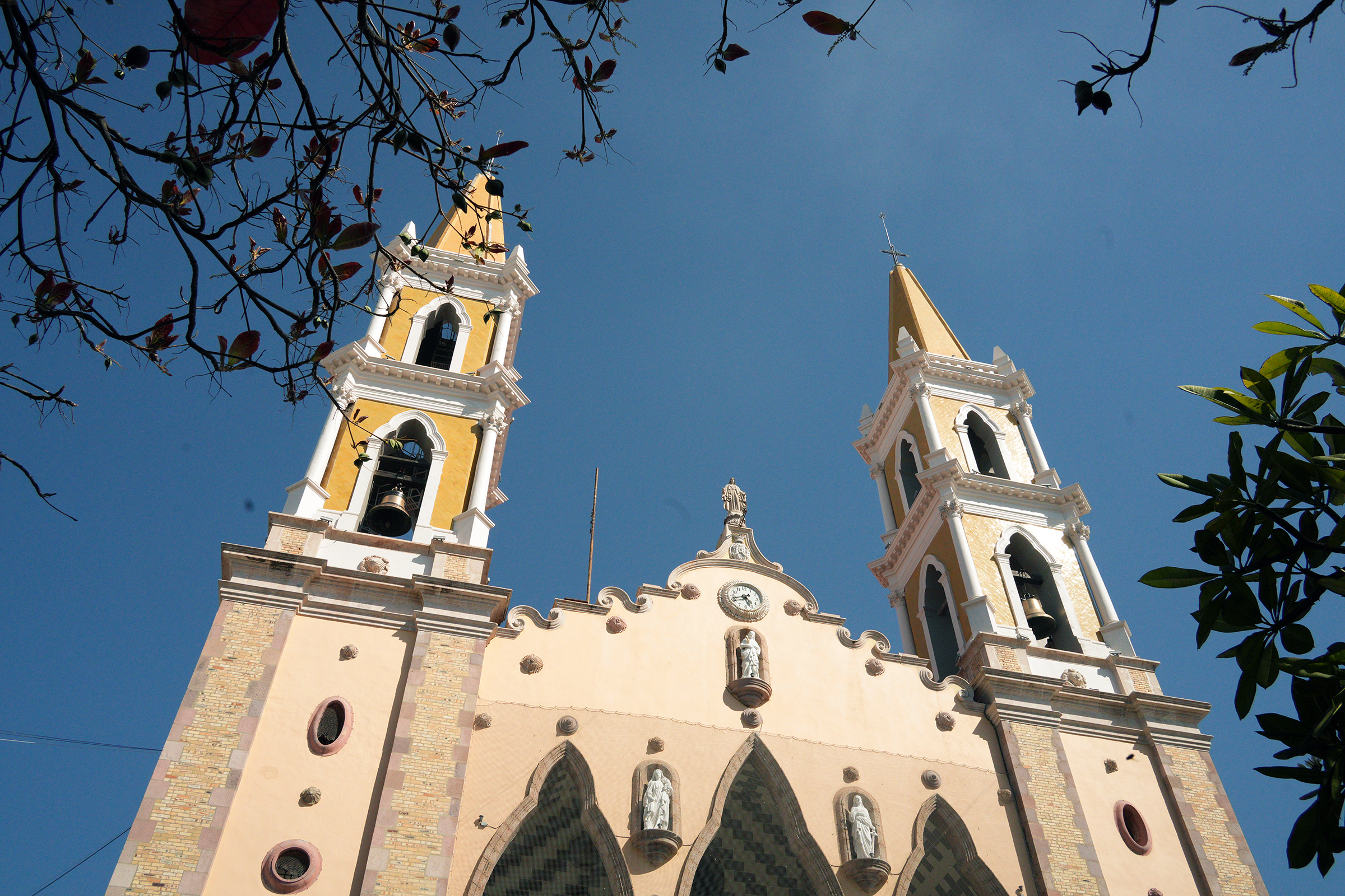
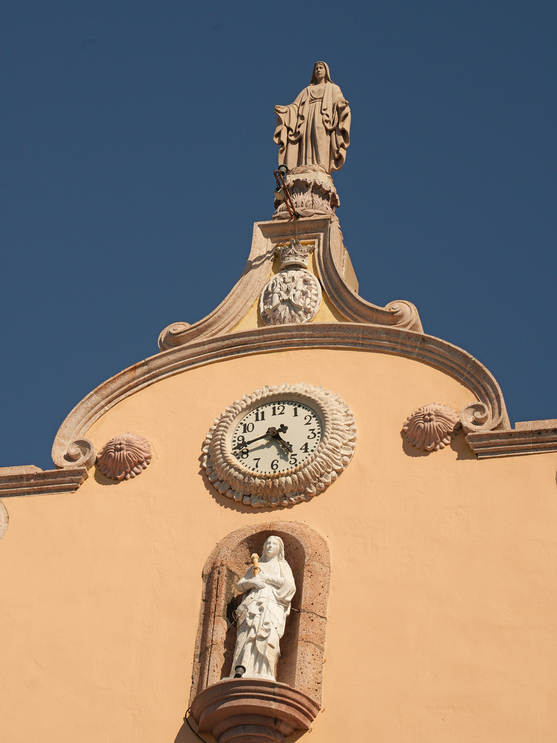
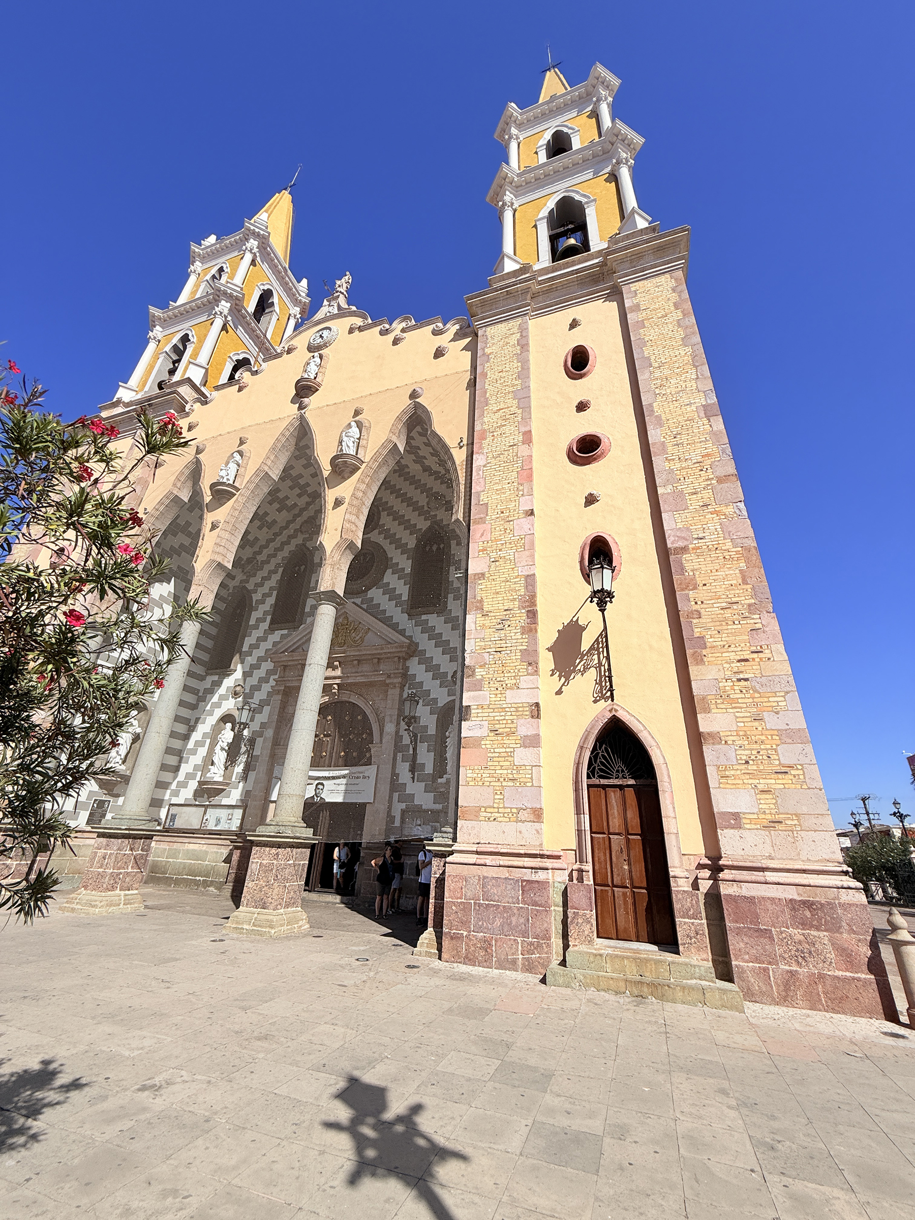
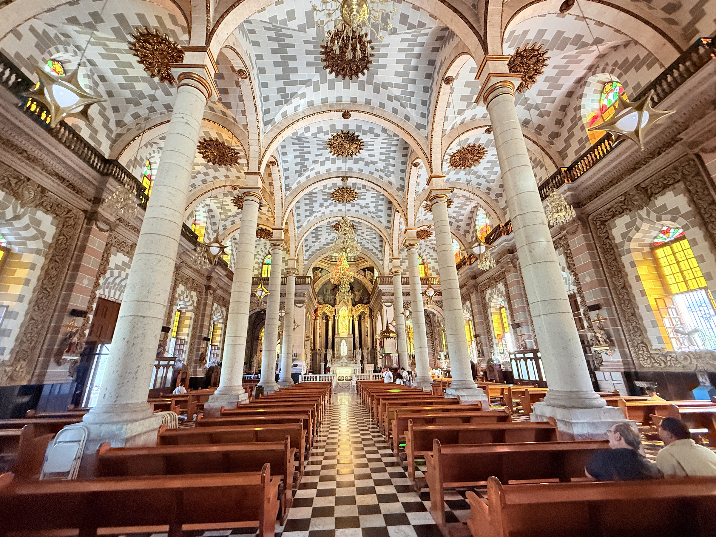
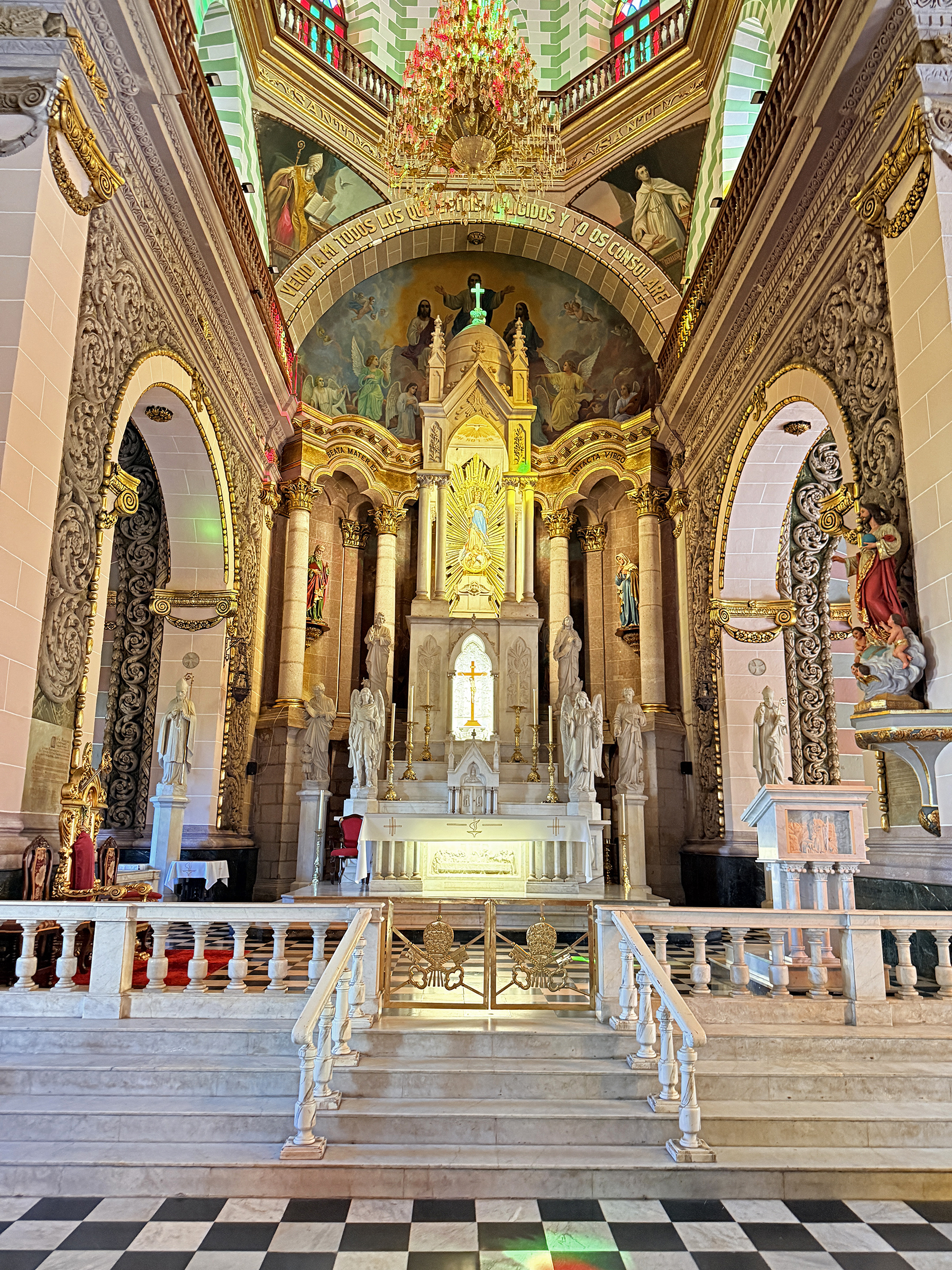
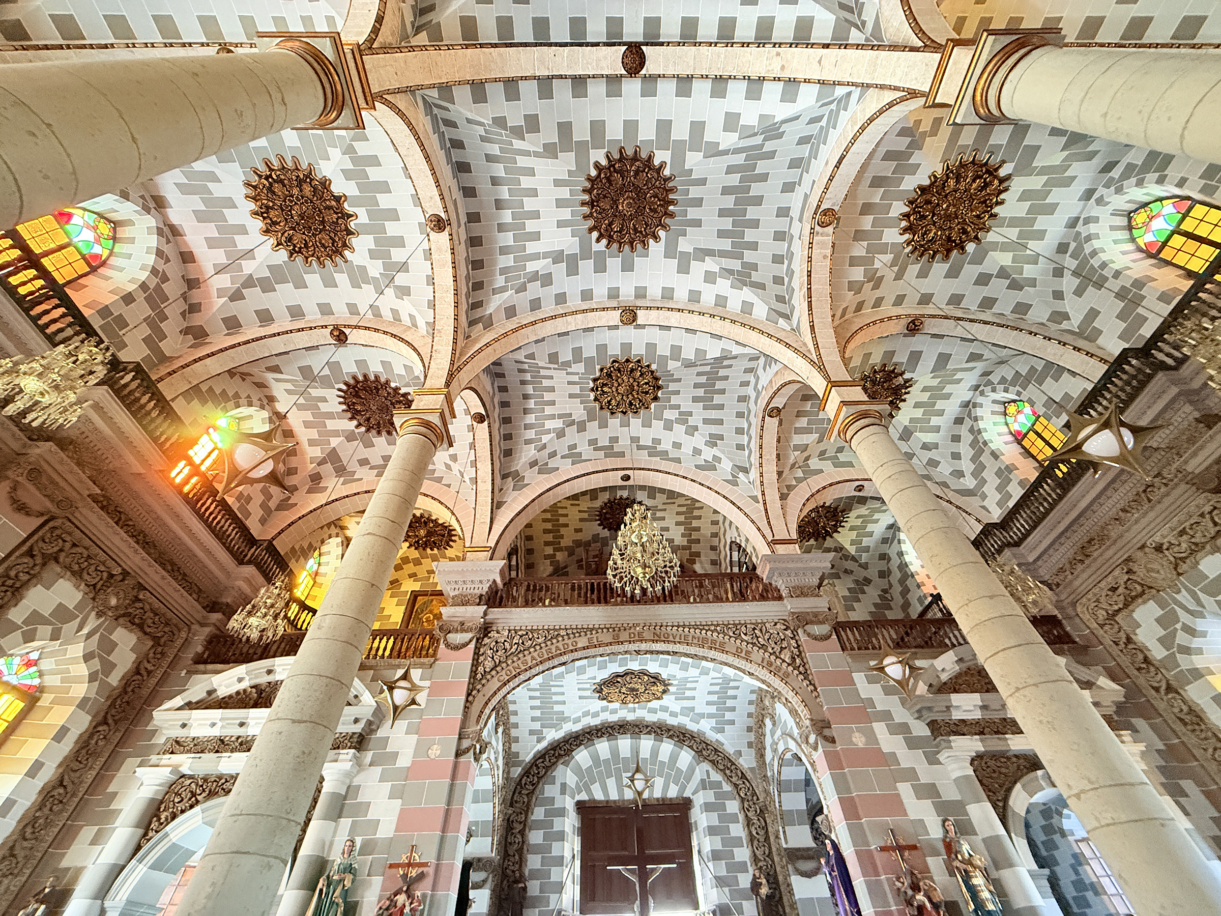
Here is a closer look at the Cathedral Basilica of the Immaculate Conception of Mazatlán (La Catedral Basílica de la Inmaculada Concepción en Mazatlán).
It is a Roman Catholic Church that was built in the Baroque-Revival style from 1856 to 1899. Approximately 78% of Mexico’s population identifies as Catholic, according to the 2020 Mexican government census.
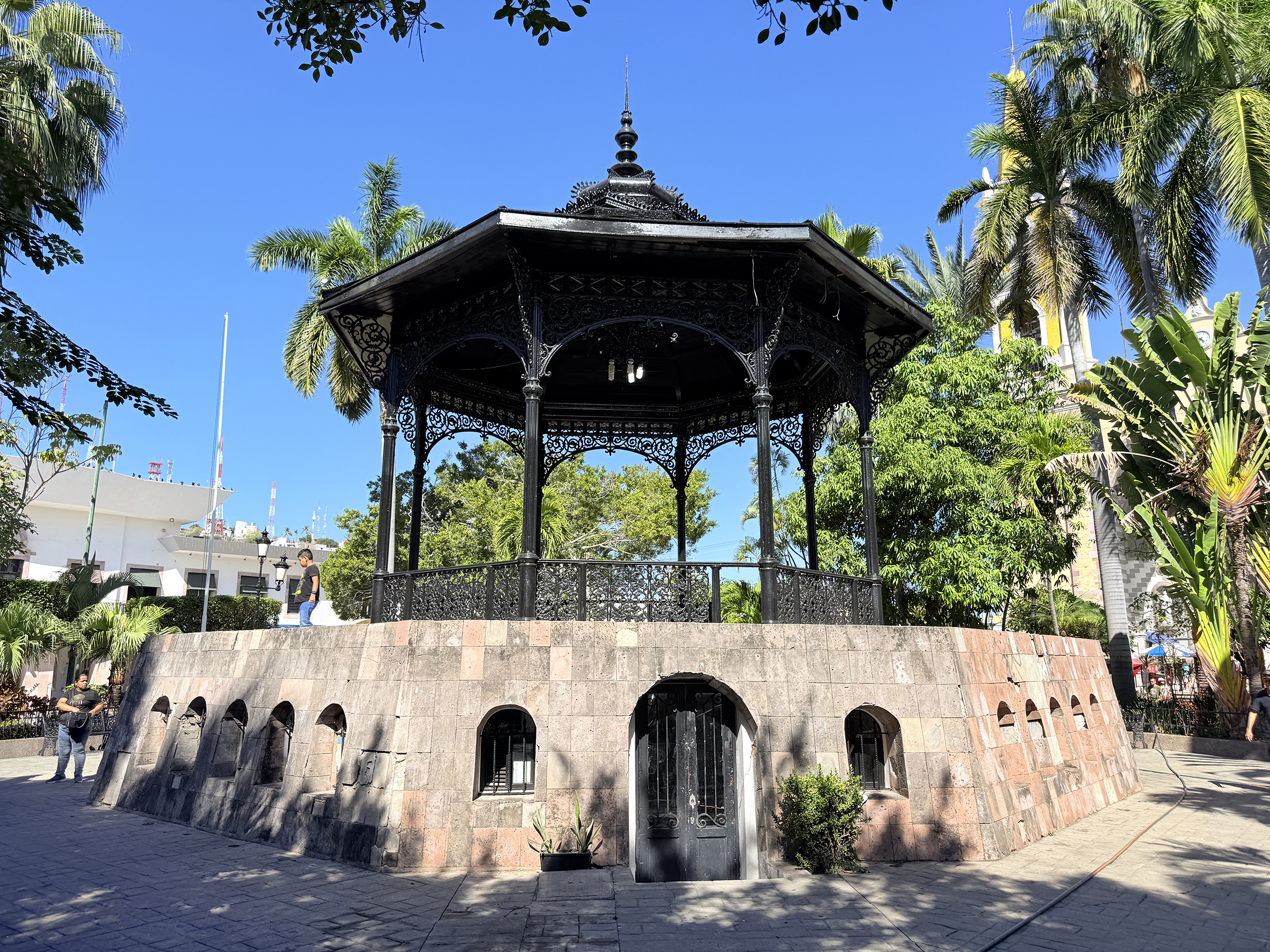
Based on available history for the city’s central public spaces, the notable iron gazebo located in the plaza directly in front of the Cathedral (Plaza República) was built around 1870.
It was another sunny and cloudless day here in Mazatlán (76°F /24°C ).
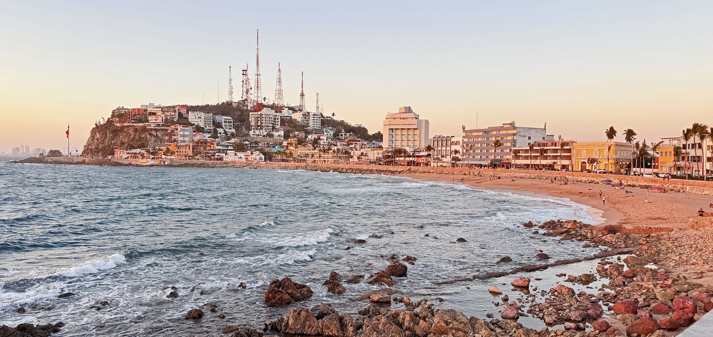
This morning, we went for a walk up the main lookout hill here on the shoreline (Cerro del Vigía).
This afternoon, we ran out to the local Sam’s Club (warehouse grocery store) for grocery shopping. We went there by bus and came back with a little Uber car with its trunk and back seat full of groceries.
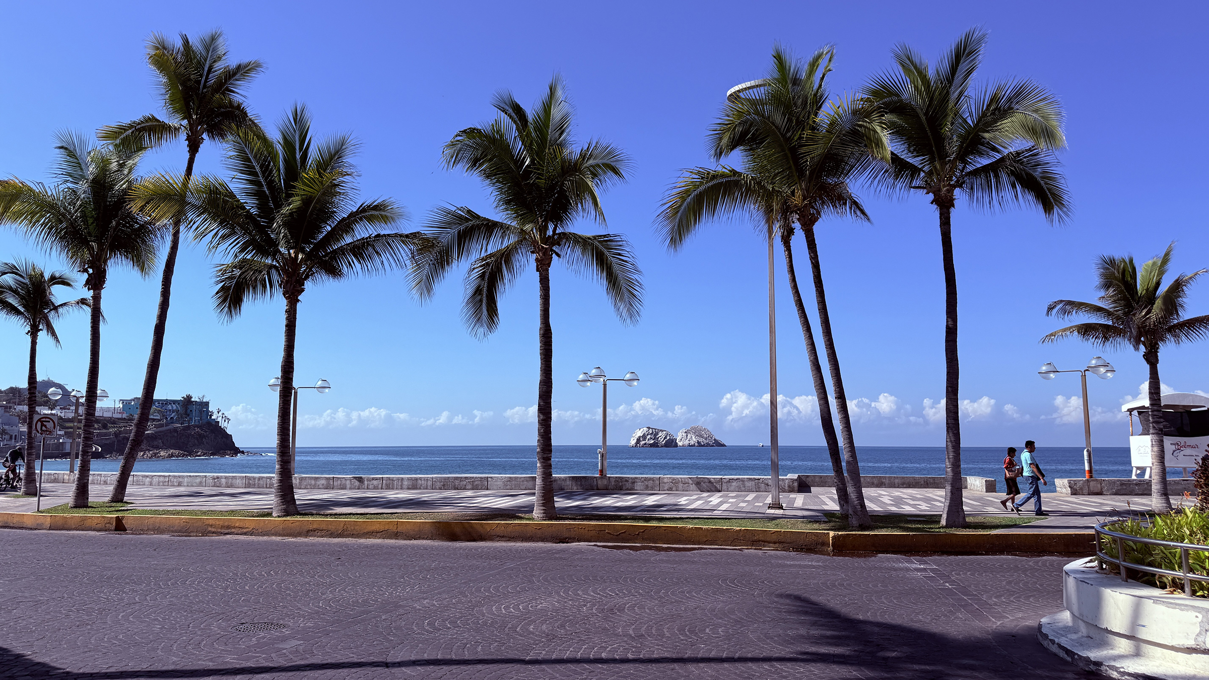
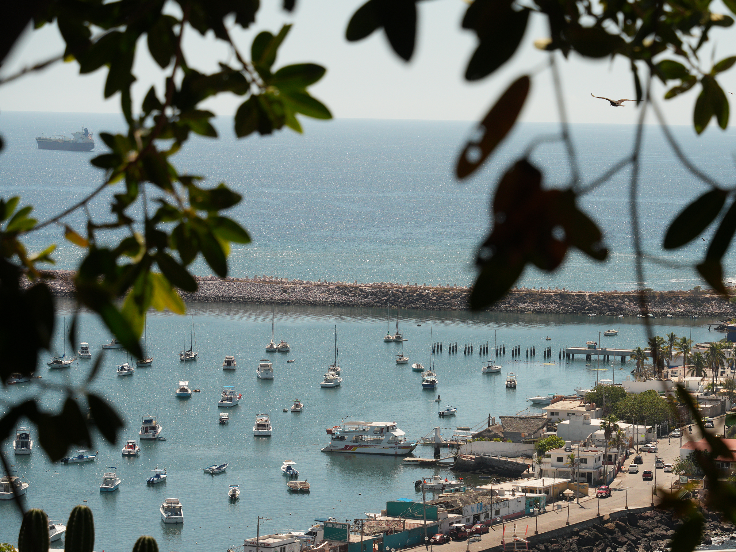
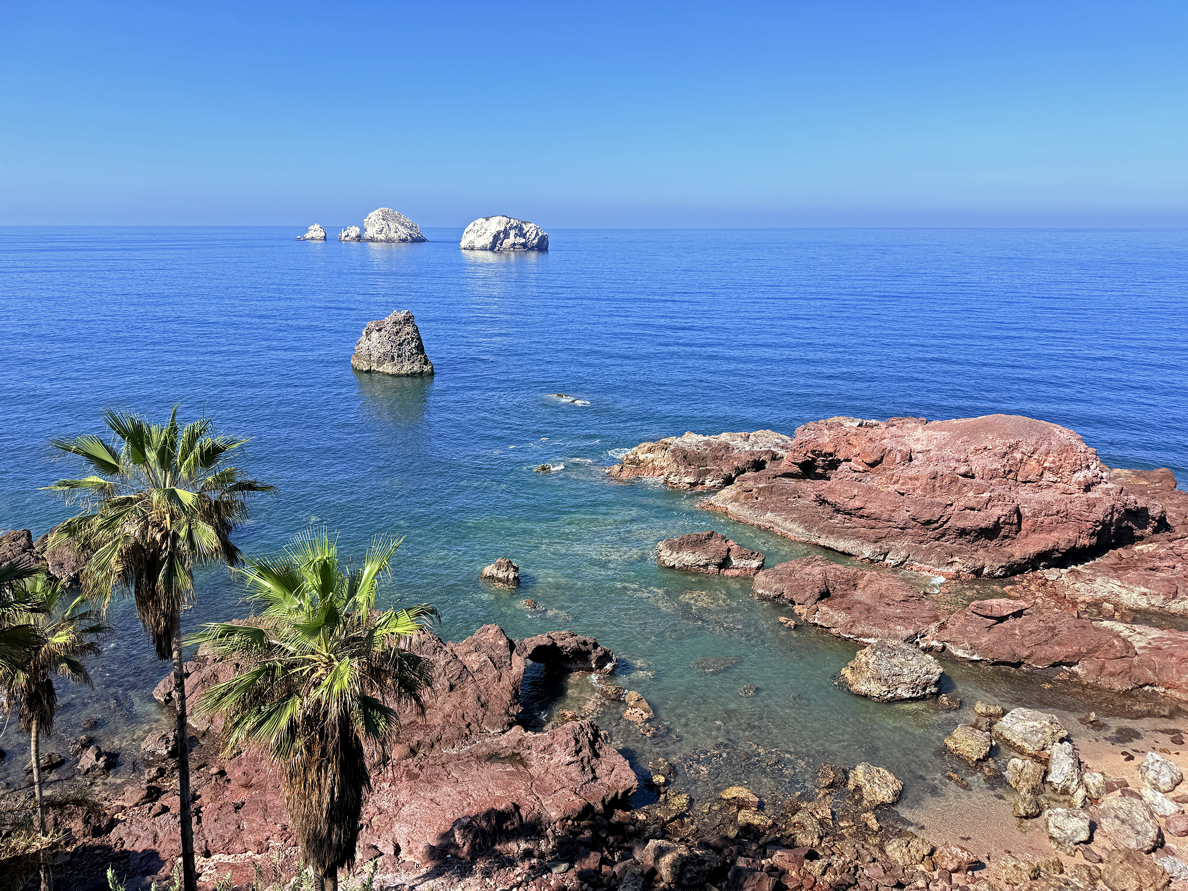
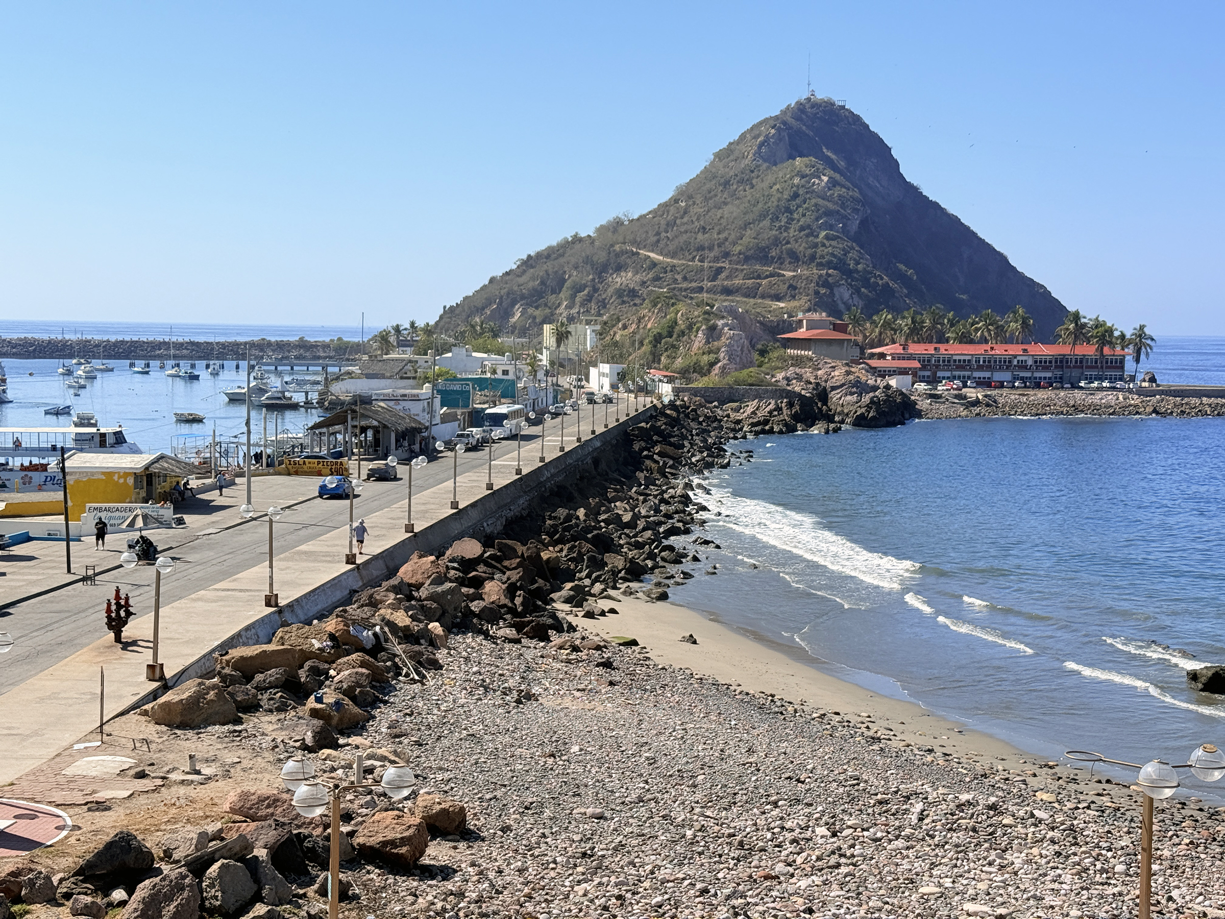
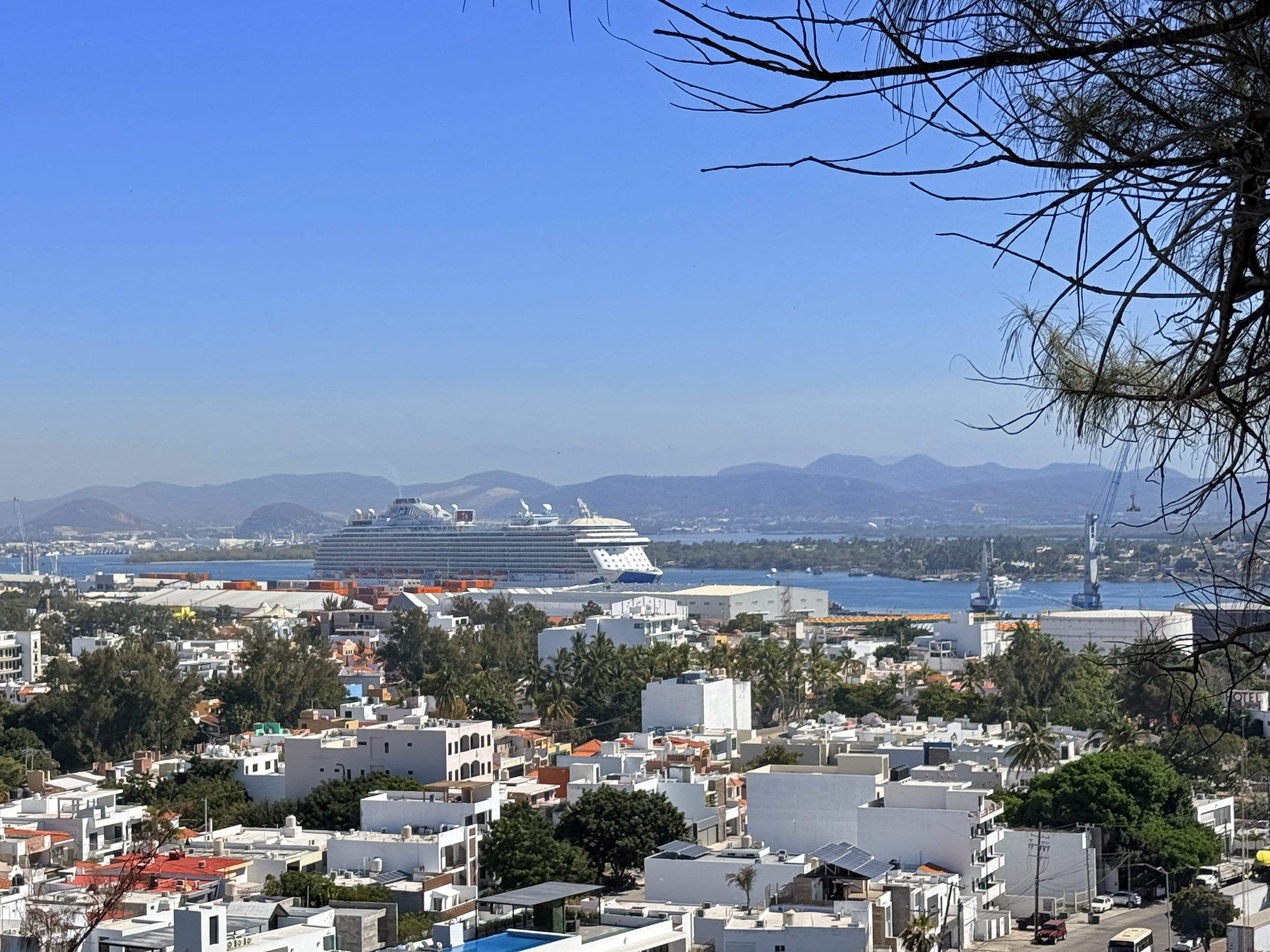
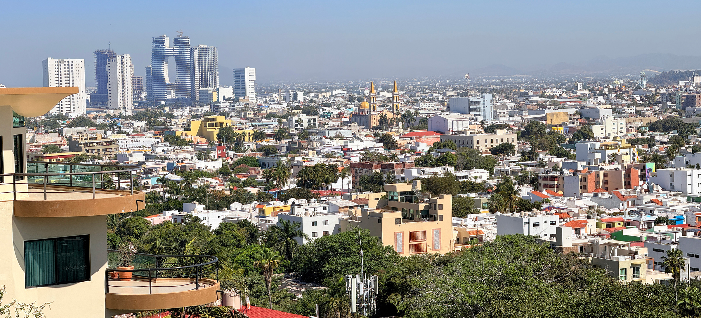
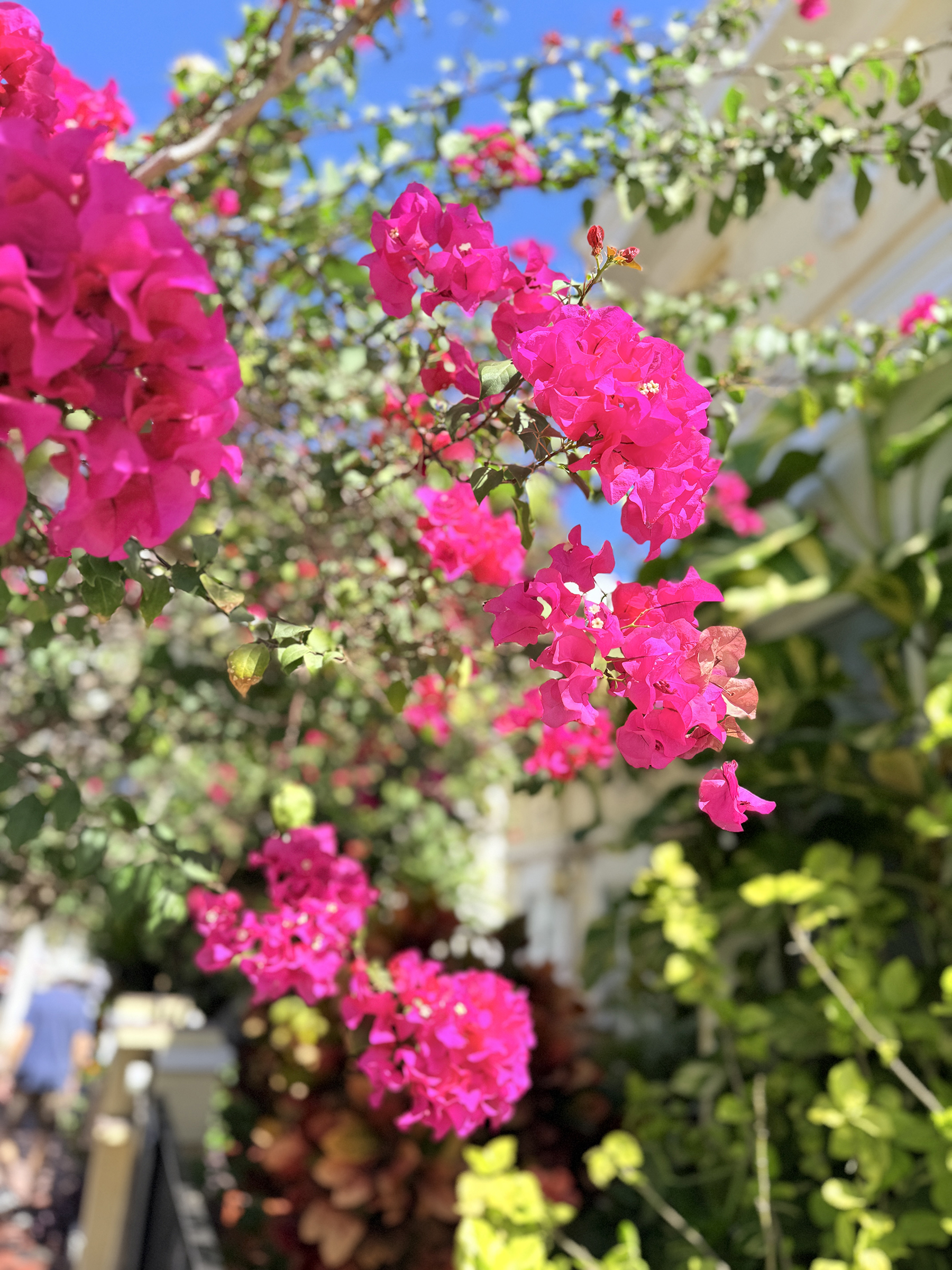
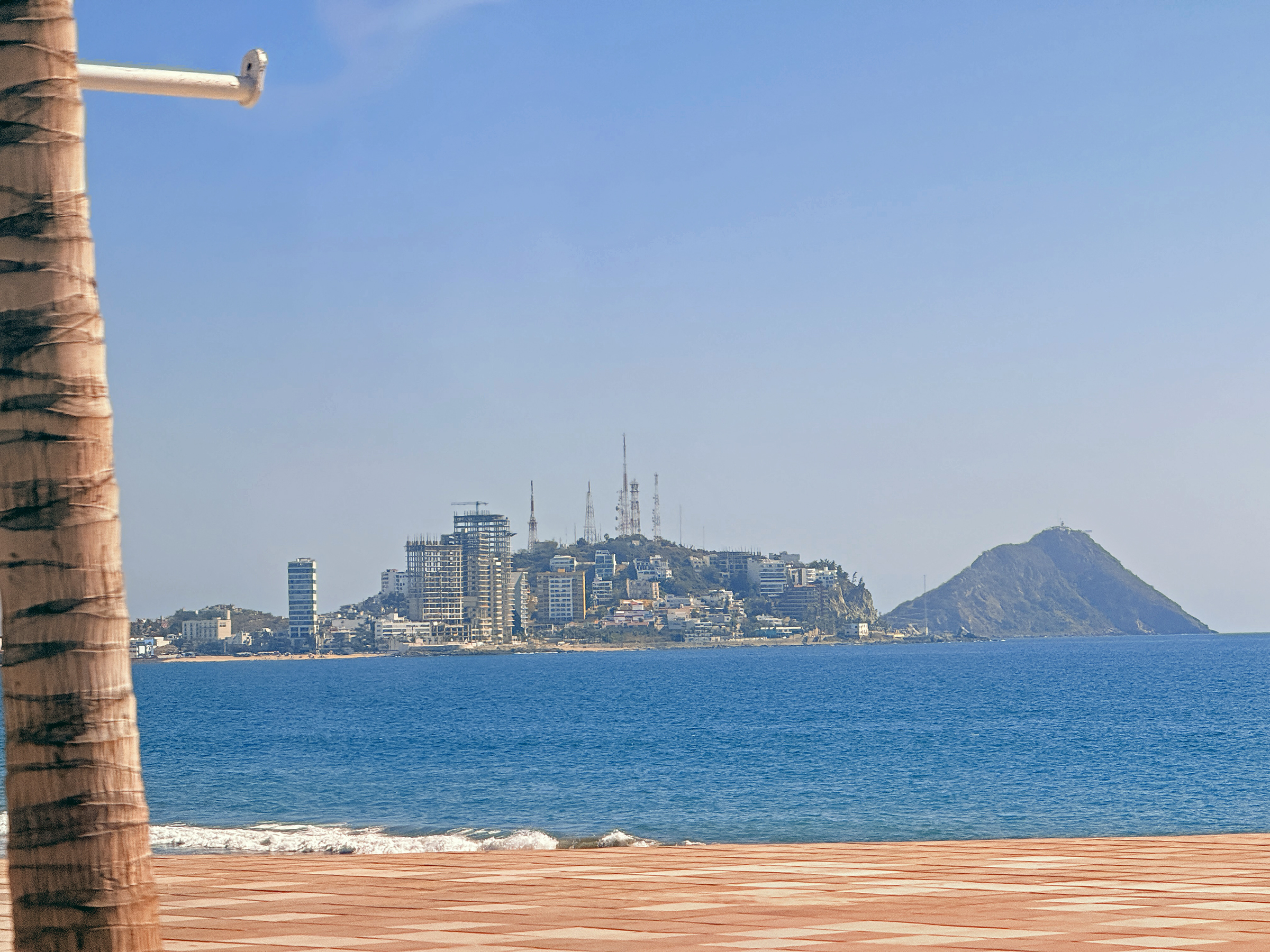
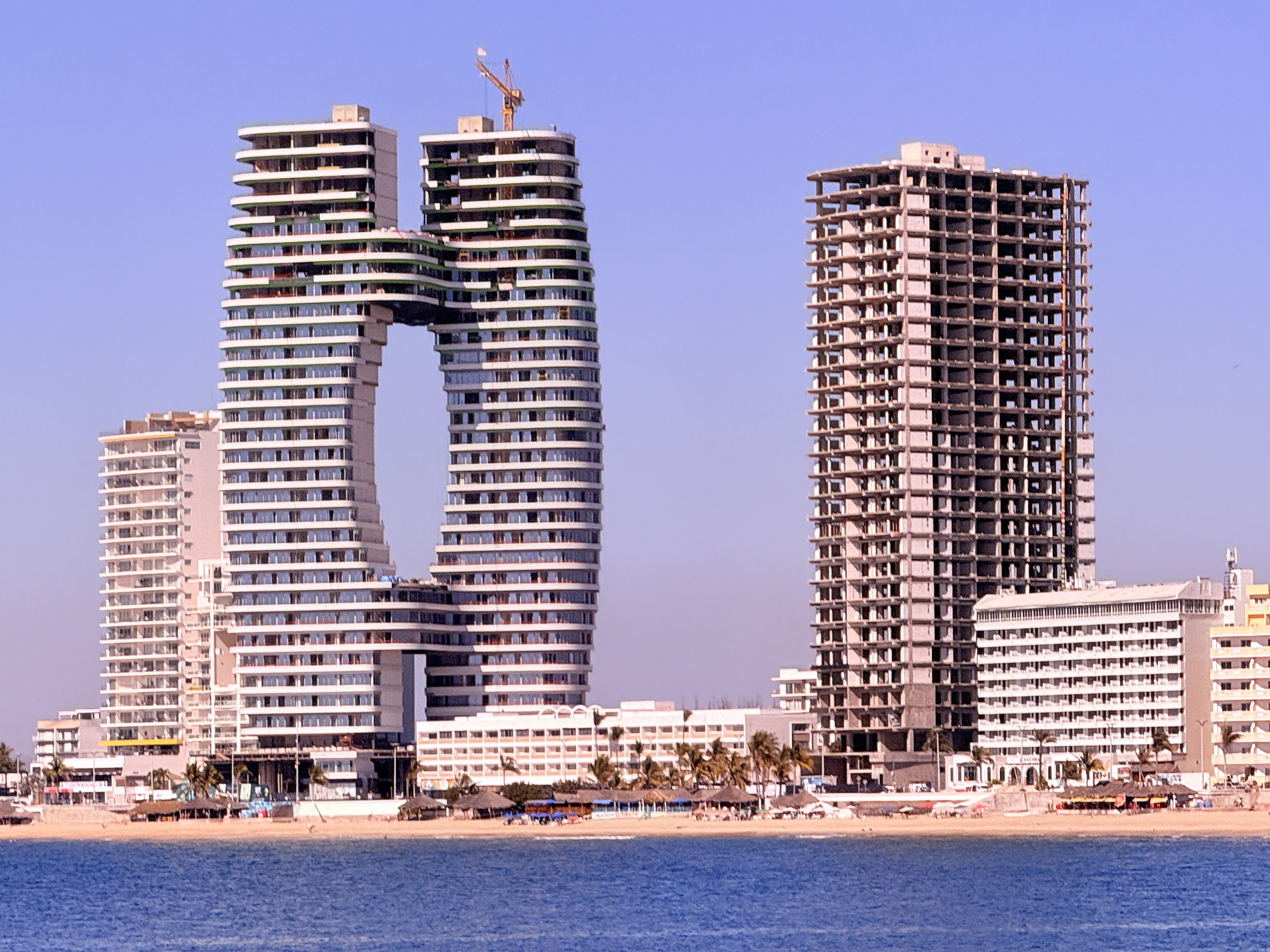
Rocky outcroppings on the coastline, seen from the street above as we walk towards Cerro del Vigía.This is Isla El Crestón (Crestón Island) that is right by Cerro del Vigía. There is a lighthouse at the top of the Crestón Island hill. Almost at the top of the steps that lead up to the outlook at the top of Cerro del Vigía.The photo spot at the top of Cerro del Vigía.The cruise ship at the Mazatlán cruise port is the Royal Princess. She set sail late afternoon for Long Beach, California.A vista of Centro de Mazatlán from the top of Cerro del Vigía. Look for the yellow Catedral Basílica de la Inmaculada Concepción, a beautiful 19th-century Baroque-Revival church. The towering condo buildings at the top left are on Avenida del Mar, the road that runs along the promenade called Malecón Mazatlán. We would drive right by them later in the day.Bougainvillea flowersOur bus looked like this one. There is the church: the Catedral Basílica de la Inmaculada Concepción. I will take close-up pictures of it later this week.Looking towards Centro de Mazatlán (Mazatlán’s old center) and Isla El Crestón from the Uber car on Avenue del Mar the way back from Sam’s Club. (Optical illusion: it looks as if there is no sand and as if the surf is breaking onto the pavement, but there is a drop to the beach and the sand from the edge of the promenade’s paving. )Here are the condo buildings on Avenue del Mar that could be seen from the Cerro del Vigía lookout this morning.Looking back at the Golden Zone, while still on Avenue del Mar.It looks like someone is getting ready for some parasailing at the beach that runs along Malecón Mazatlán (the Mazatlán promenade).
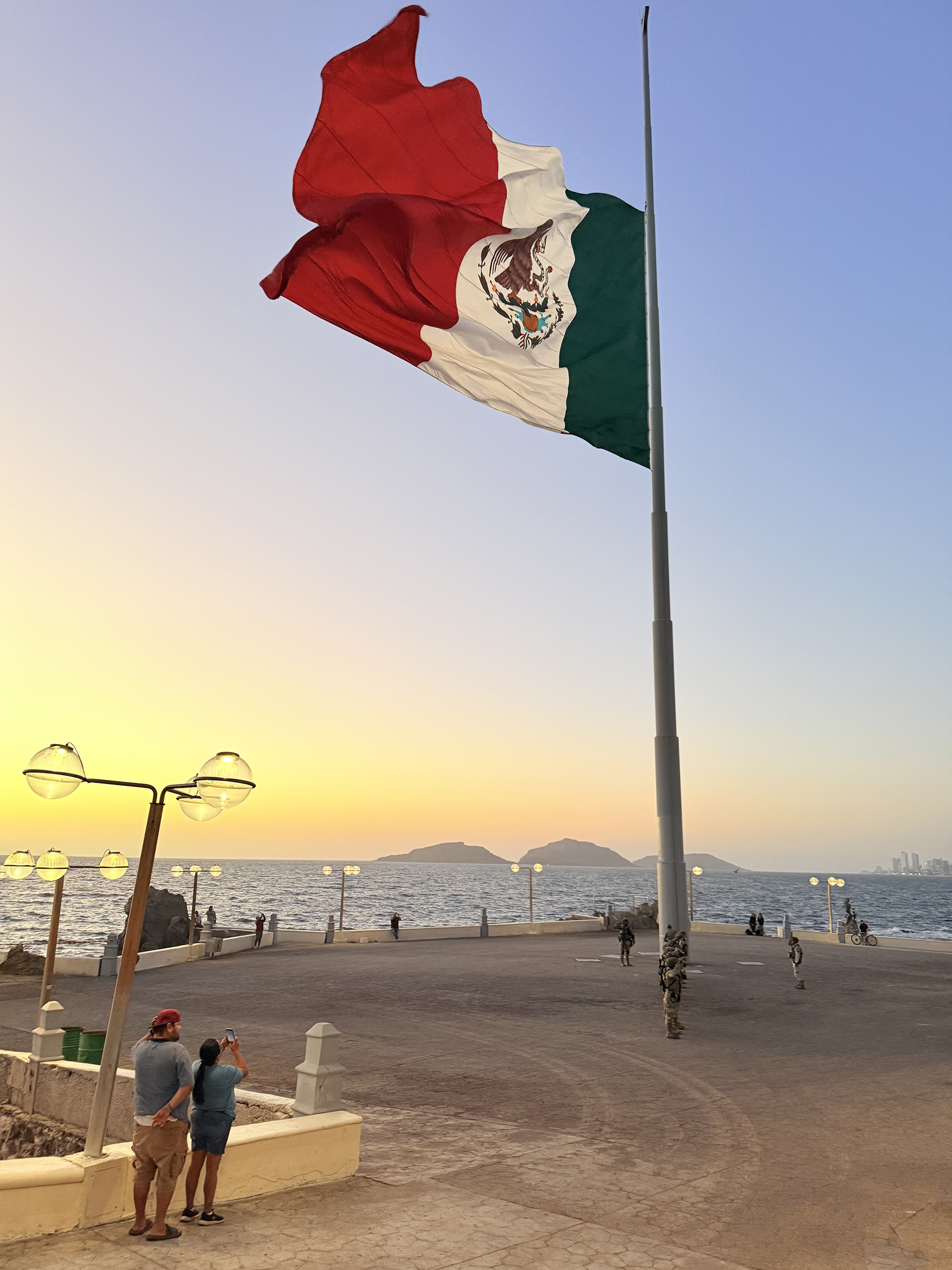
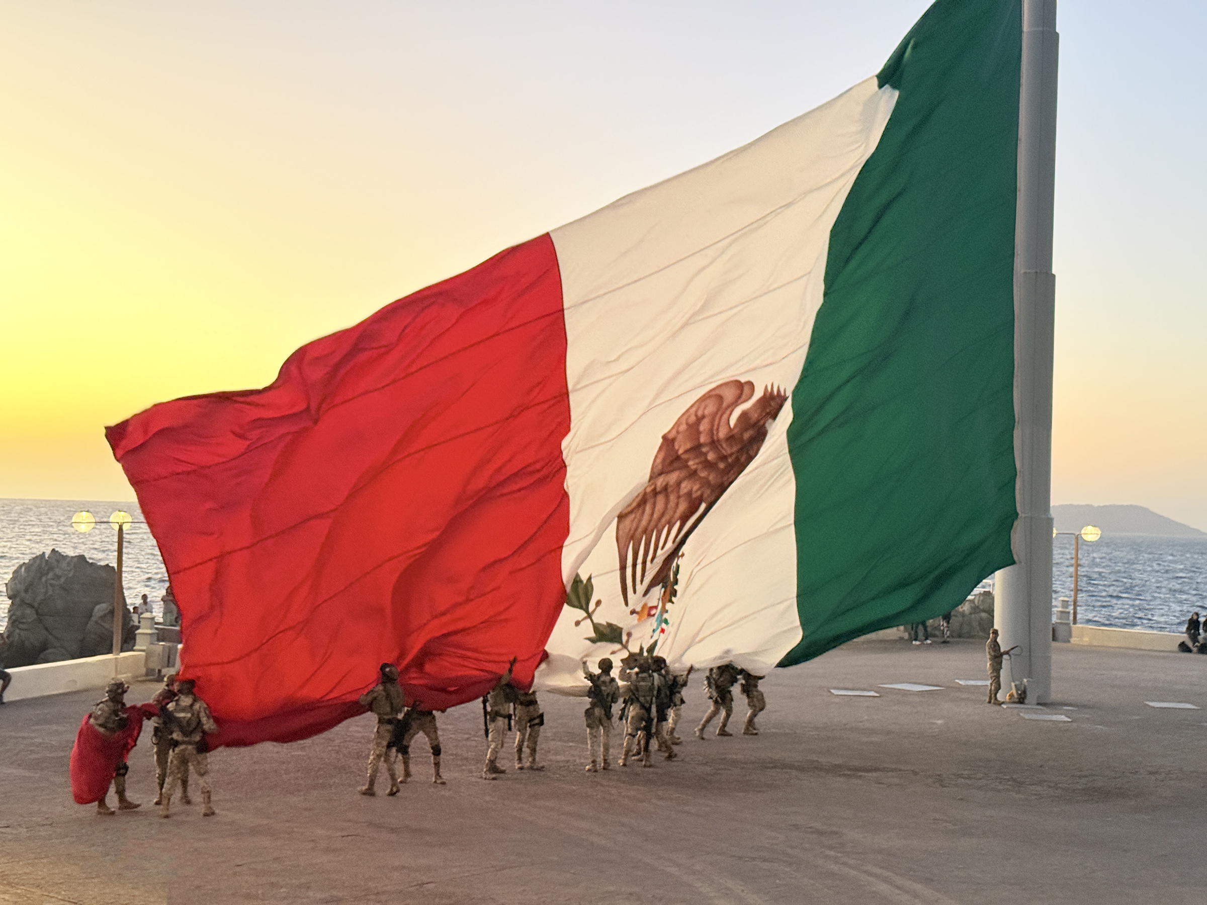
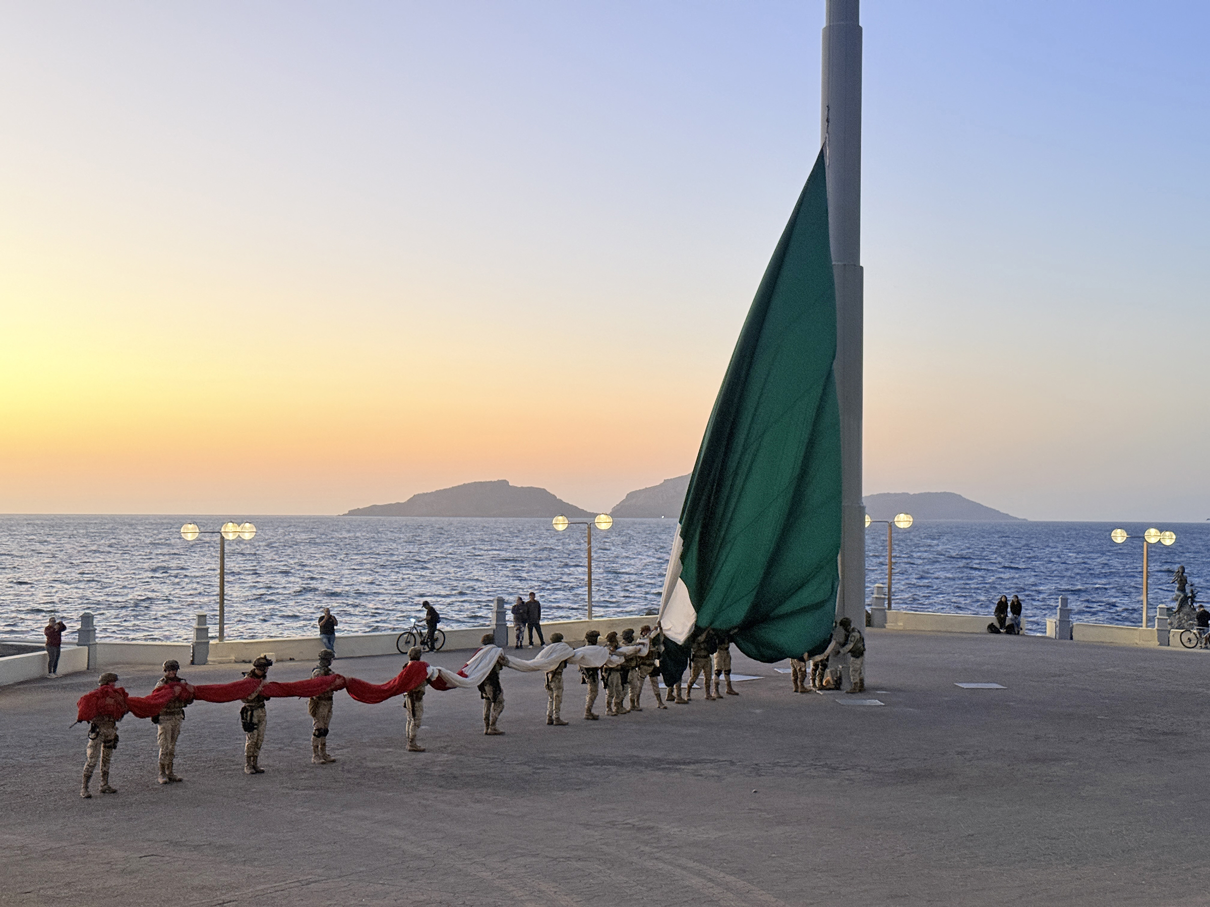
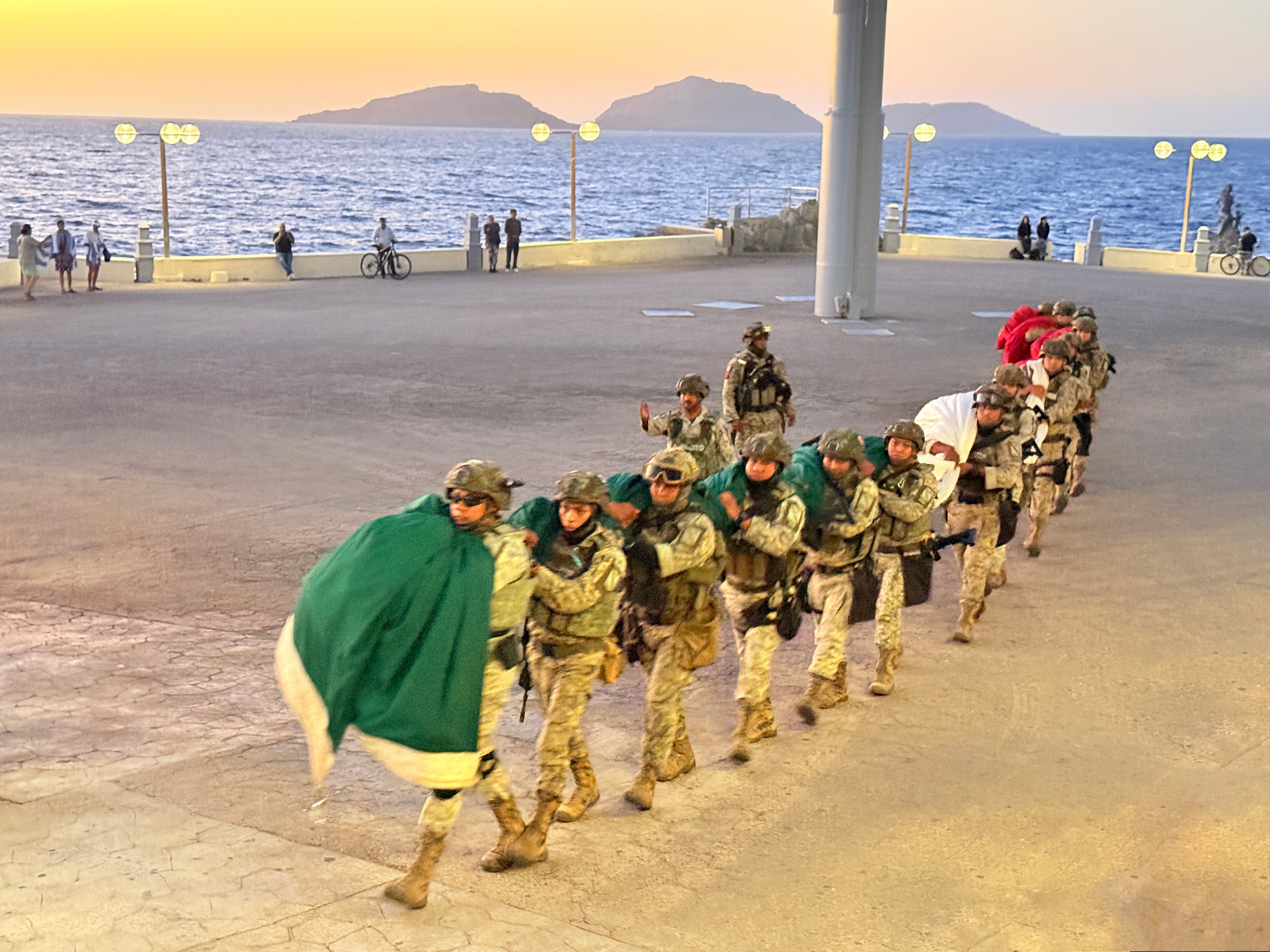
It just happened to be Día de la Bandera— National Flag Day— today here in Mexico.
While catching the sunset at the Olas Altas beach by Centro de Mazatlán, we spotted the giant Mexican flag on the flagpole way down along the promenade (the far left in the second picture)—a rare treat since it’s only up a few days each year.
We reached it in the nick of time, just as the flag was being lowered and taken away.
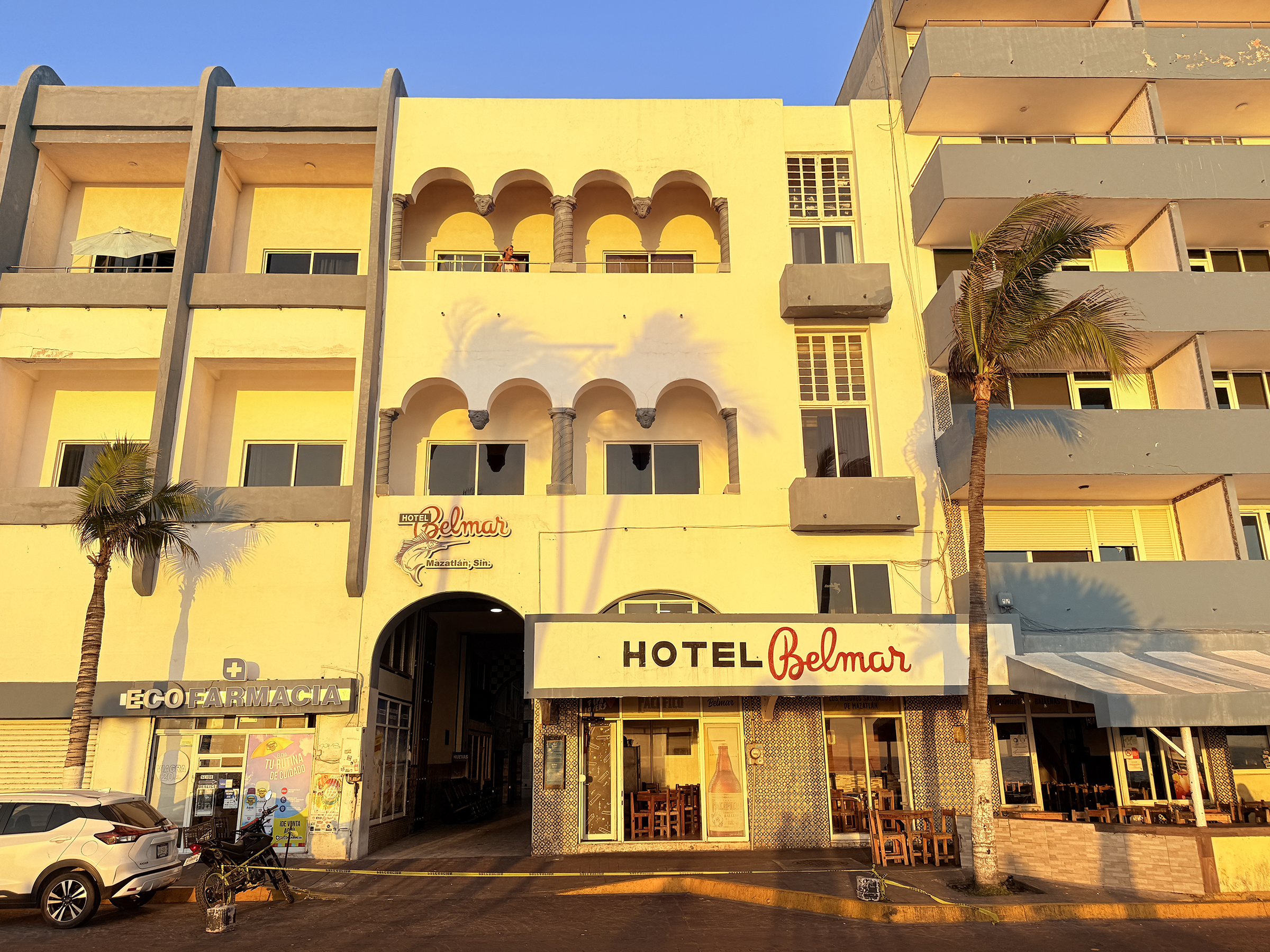
P.S. Built in the early 1920s (often cited as 1919–1920) by Californian Louis Bradbury, Hotel Belmar is Mazatlán’s original oceanfront hotel, representing the city’s golden age. Located on the Olas Altas boardwalk, it was a 1940s/50s hot spot for Hollywood stars like John Wayne and Lucille Ball, known for its elegant, historic, and slightly bohemian atmosphere.
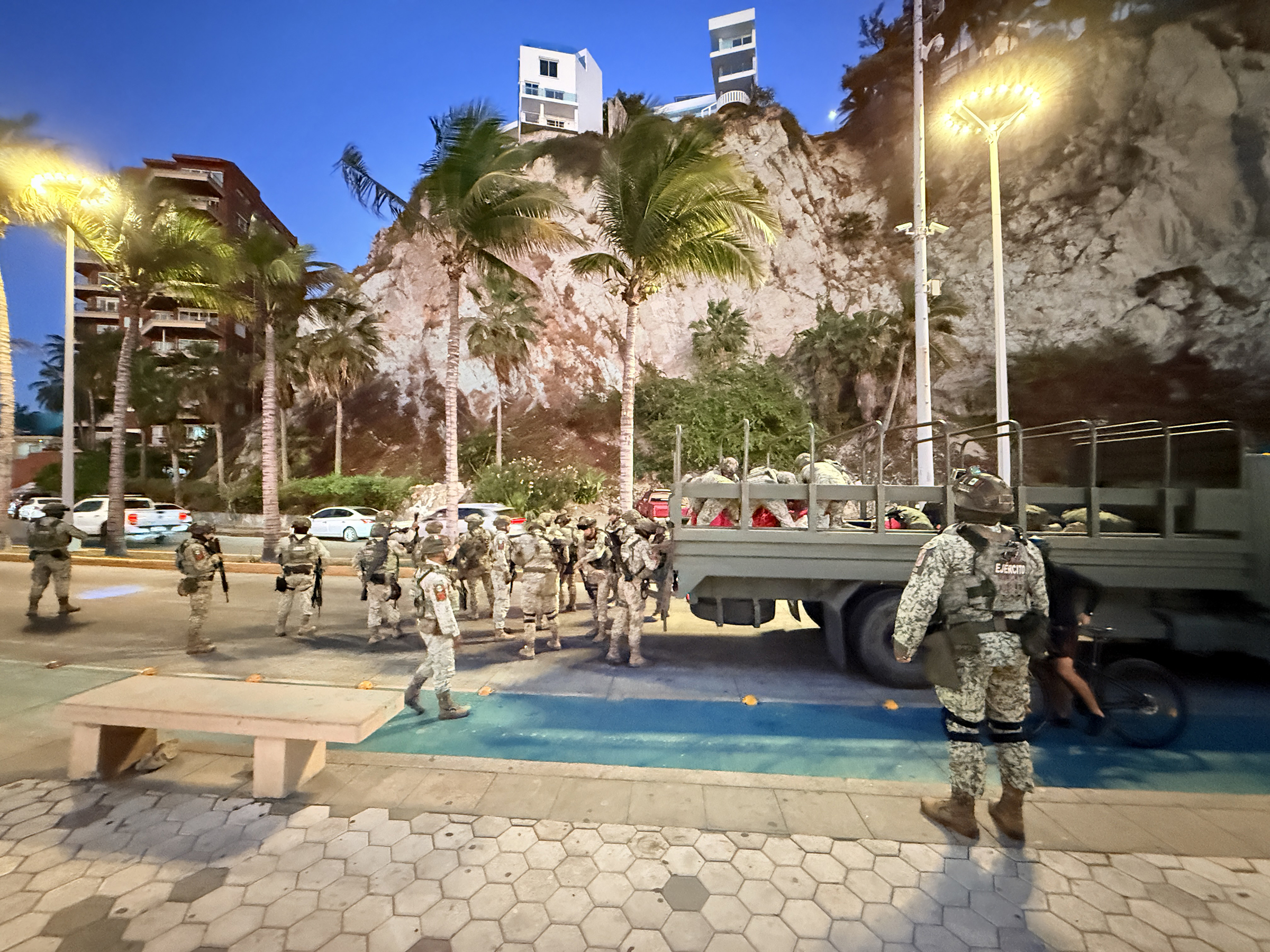
I arrived in Mazatlán, Mexico, today (to visit my two amigos that had been here since January).
I was not sure right up until Sunday night that my trip would happen, because violence broke out in Puerto Vallarta and Jalisco state over the weekend after drug lord El Mencho was killed in an operation.
Here is a brief update from the New York Times:
The authorities in Mexico appeared to have restored order in multiple cities on Monday after a wave of violence set off by the killing of a major cartel leader left highways blocked, buildings burned and at least 62 people dead.
Mexico’s most powerful criminal organization, the Jalisco New Generation Cartel, unleashed the chaos after its leader, Nemesio Oseguera Cervantes or El Mencho, the nation’s most wanted cartel boss, died in a military raid on Sunday in western Jalisco State.
Pictures below:
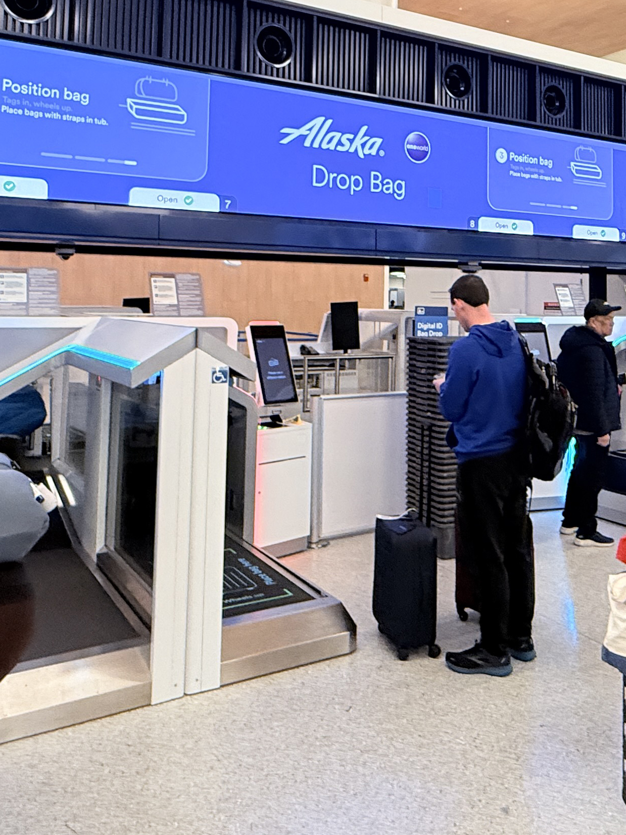
There was a system-wide glitch with the new automated bag drop machines at Seattle airport when I checked in early this morning, but it was soon resolved;
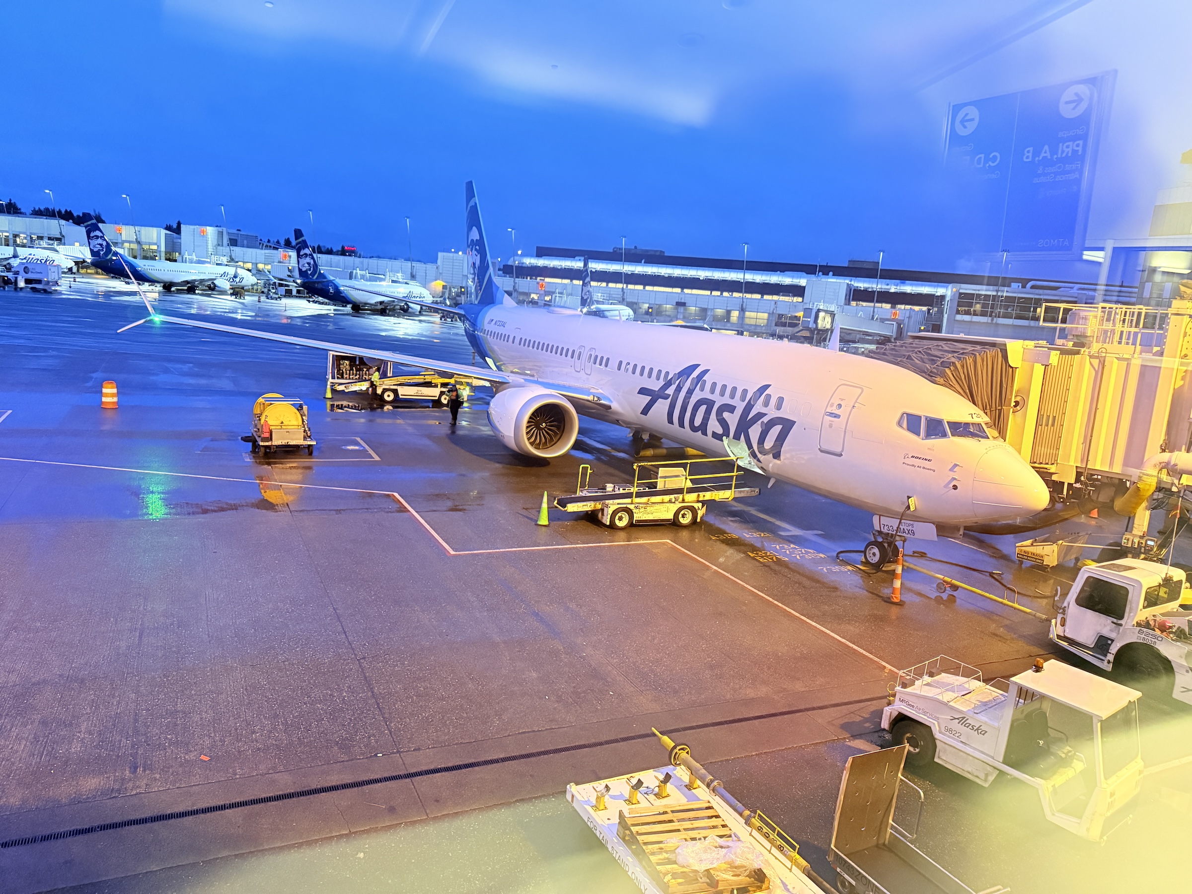
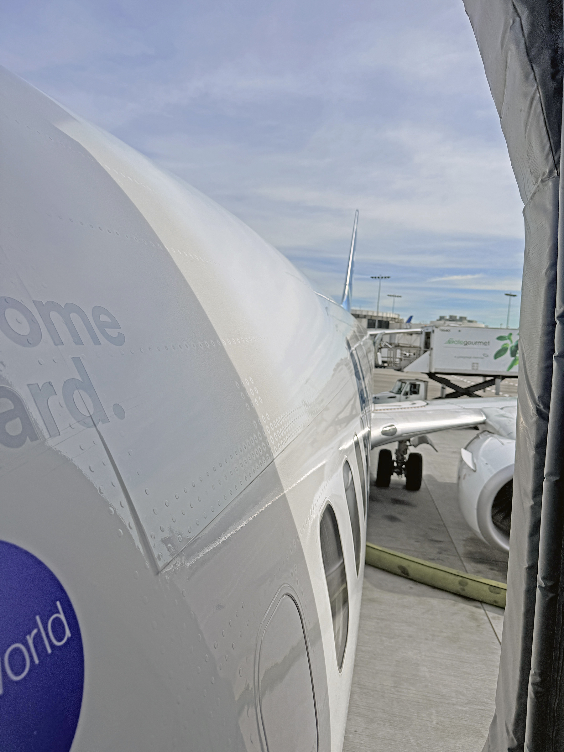
The Boeing 737 MAX 9 (twin-jet) at the gate that took us to Los Angeles’s LAX airport;
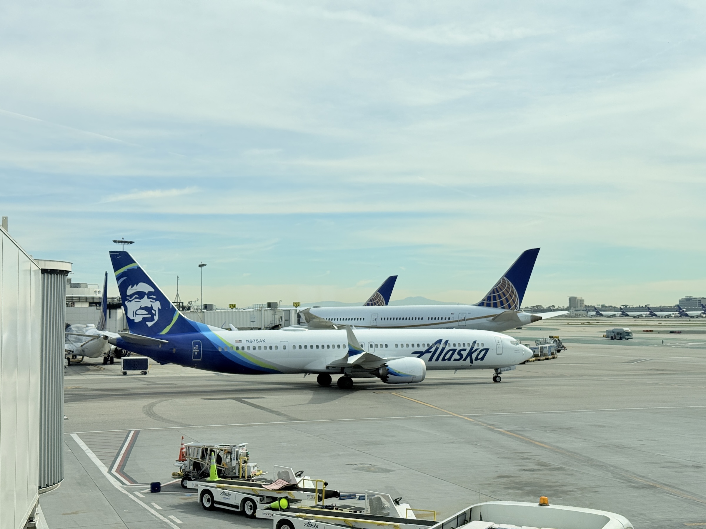
Alaska Air and United Airlines airplanes at Terminal 6 at LAX;
Stepping on board the Boeing 737-900 (twin-jet) that took us to Mazatlán;
Welcome sign with picture of Old Mazatllan, on the wall at arrival in the airport;
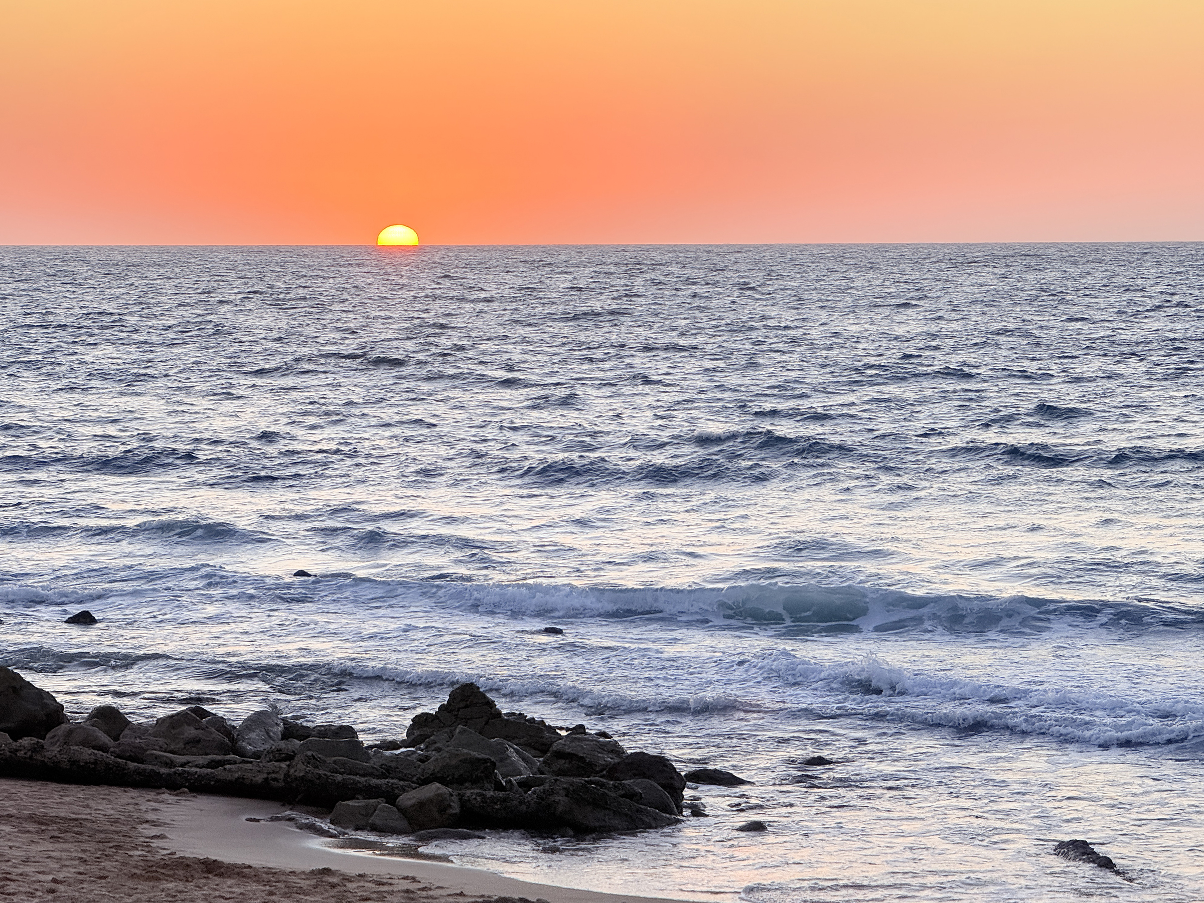
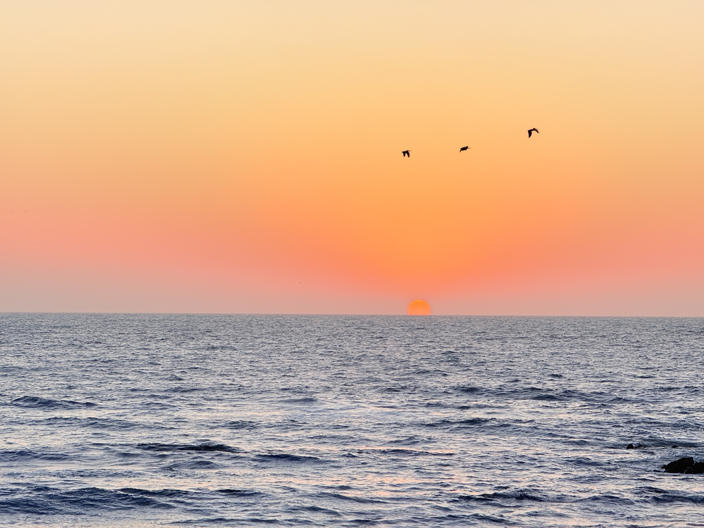
Sunset over the Pacific Ocean tonight, seen from the beach by Centro Histórico, or Old Mazatlán.
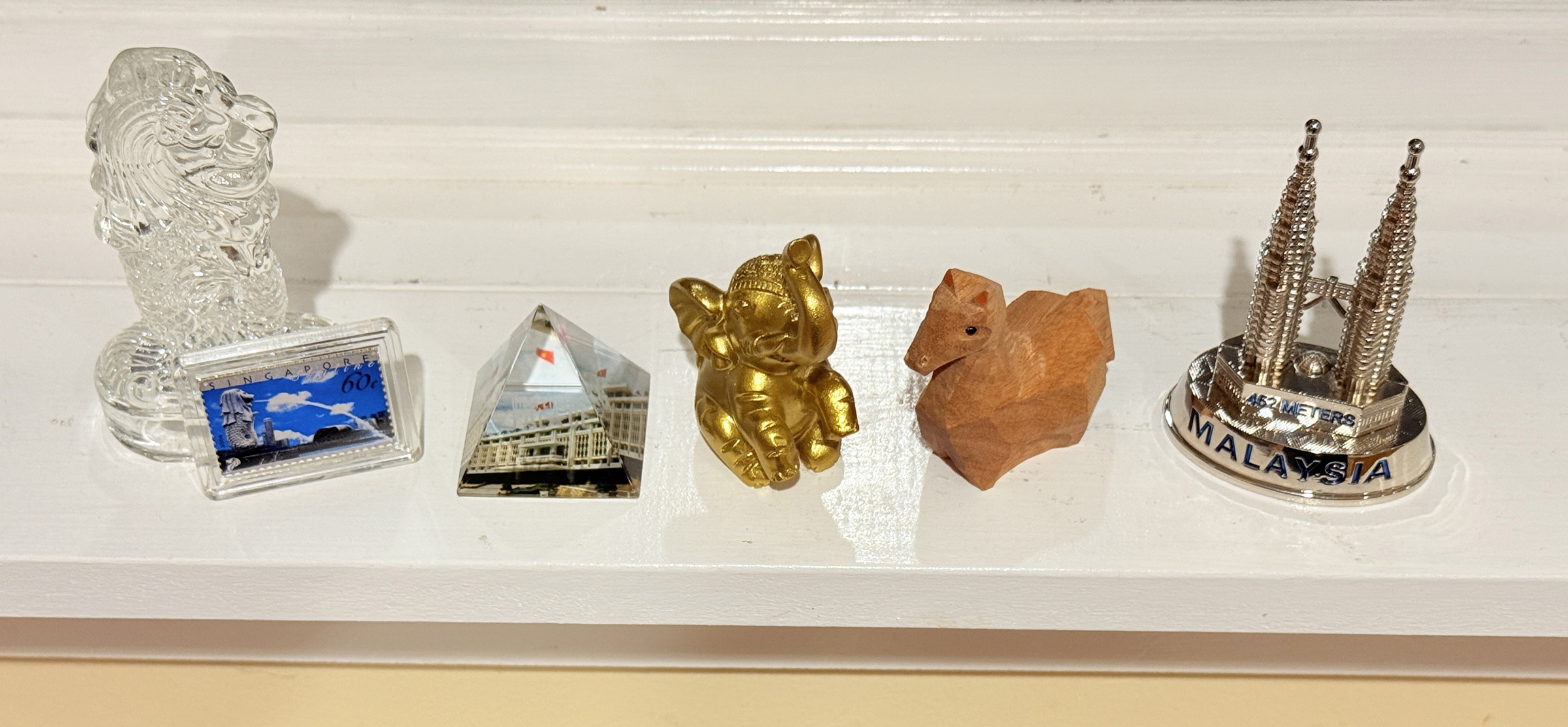
These little souvenirs out of my suitcase are doing duty on in the kitchen window for a week or two.
They will join the many others I already have, in the display cabinet.
From left to right: Glass ‘Merlion’ from Chinatown, Singapore; Encased postage stamp from Singapore General Post Office; Miniature pyramid depicting Independence Palace, Ho Chi Minh City, Vietnam, from the museum store there; Gilded elephant from gift store at Ream Boutique Hotel, Cambodia; Miniature Year of The Horse wood carving from a pop-up store inside Takashimaya department store, Tokyo; Miniature paper weight of Petronas Towers, Kuala Lumpur, bought at Port Klang Cruise Terminal, Malaysia.
There was a young lady named Bright Whose speed was faster than light; She set out one day In a relative way And returned on the previous night.
-Limerick published in London humor magazine “Punch” in 1923.
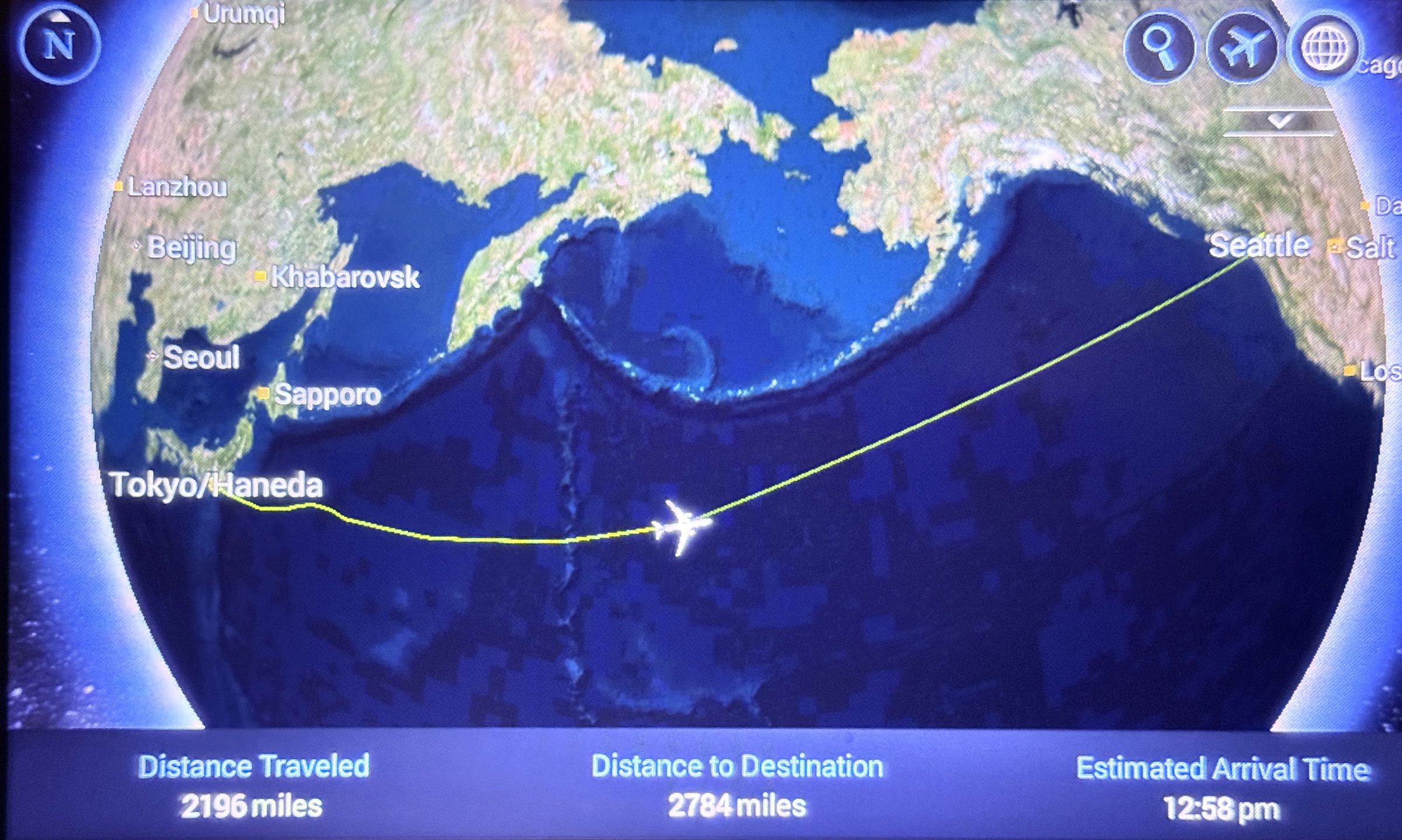
I set out on Tuesday night at 10 and arrived at Tuesday afternoon at 1.
There was no relativity and no speed of light involved, though.
The Boeing 787-9 Dreamliner twin jet that brought us to Seattle traveled at a speed of 563 mph (per flightaware.com).
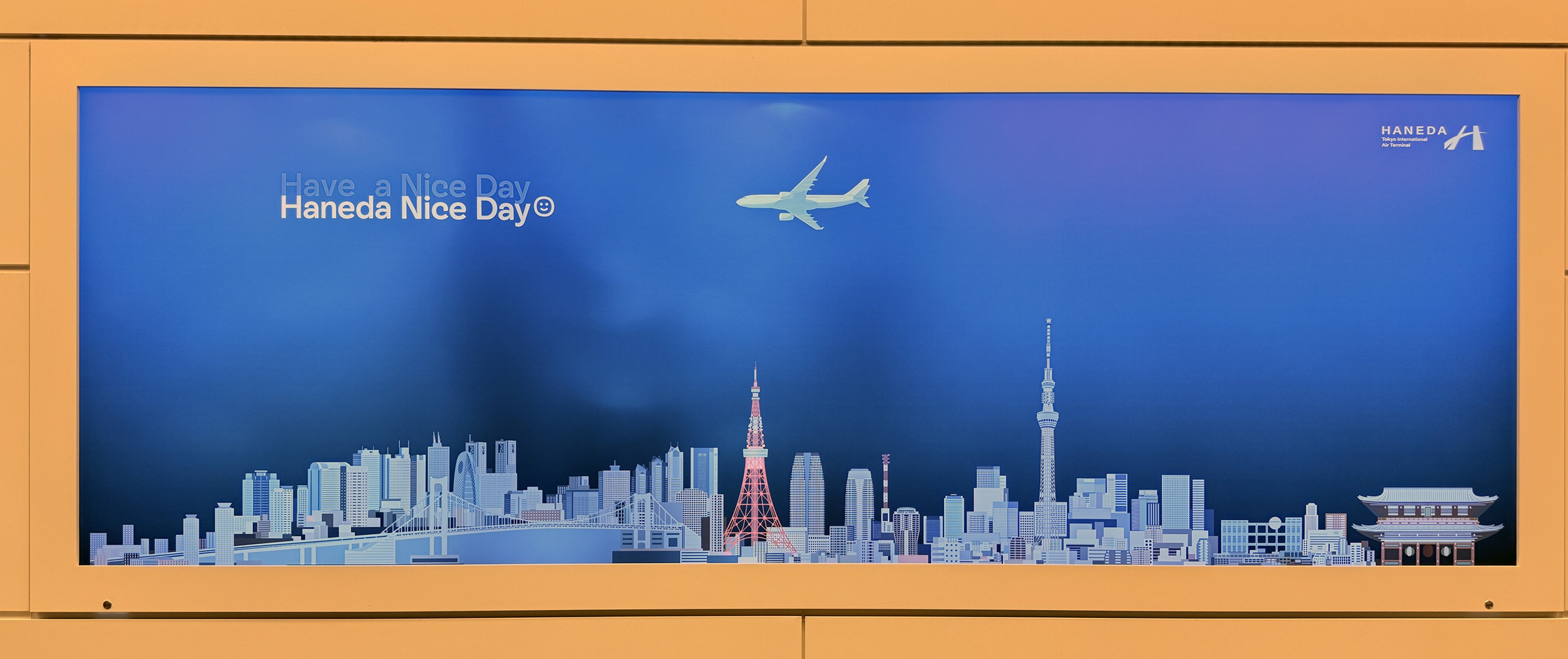
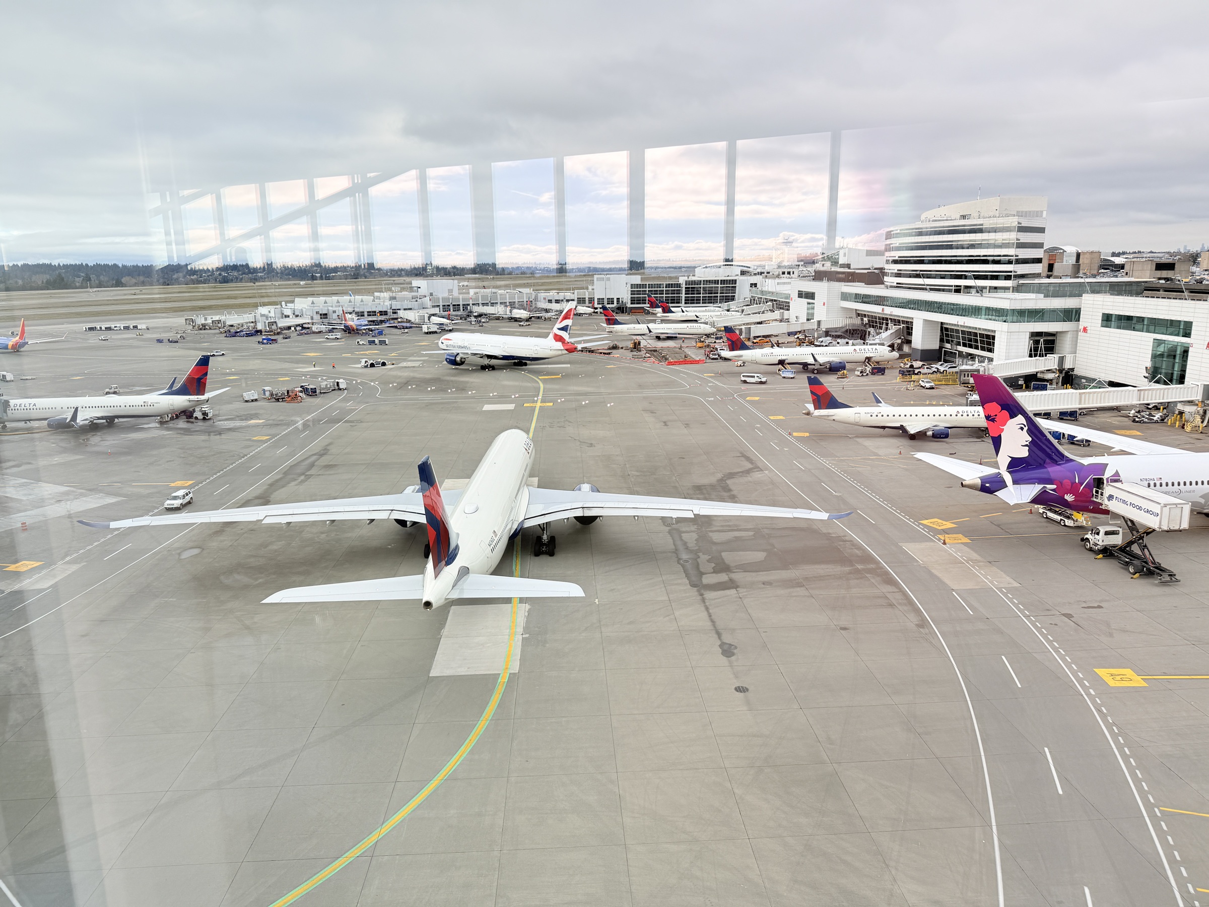
Wall panel at Haneda airport.Travel time across the northern Pacific came to 8 h 27 min.Here comes a Delta plane. I’m looking to the south from inside the long pedestrian overpass that connects the Main Terminal (International Arrivals Facility) to the South terminal at Seattle-Tacoma airport.There goes the Delta airplane, now looking to the north from inside the long pedestrian overpass.