I drove out to Snoqualmie Falls today.
The falls are only some 30 miles east from Seattle as the crow flies, but a 40-minute drive.
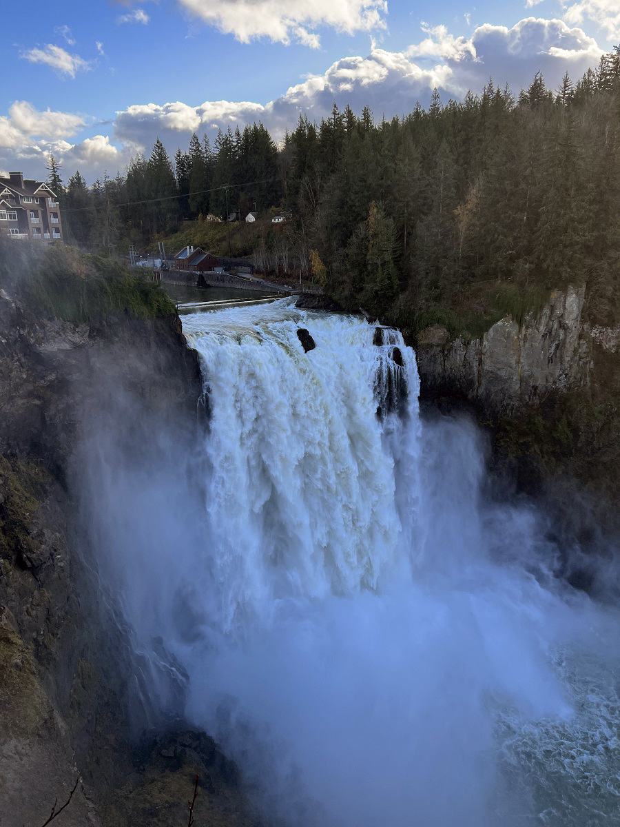
Snoqualmie Falls has a 268-foot (82 m) drop, and is by far the most famous waterfall in Washington State. It draws a million visitors a year.
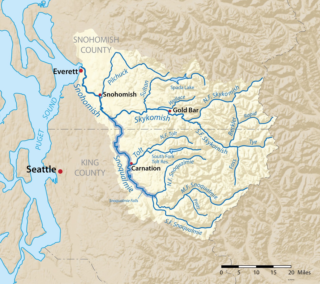
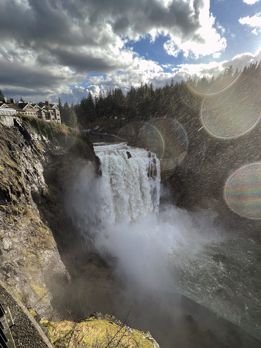
The Snoqualmie River is a 45-mile/72 km-long river in King County and Snohomish County in Washington State. The Snoqualmie River is part of the Snohomish Watershed, on the west side of the Cascades. The Snoqualmie runs into the Snohomish River, which empties into Puget Sound at Everett. [Map from Wikipedia, made using USGS National Map data]Snoqualmie Falls seen from the high view point farthest from the lodge. (There is a trail to the bank of the river down below for a different view, but a sign said that the trail is closed). That’s the Salish Lodge & Spa on the left, and parts of the Snoqualmie Falls Hydroelectric Plant are visible on the opposite bank (middle of the picture). [iPhone 13 Pro picture, standard lens]
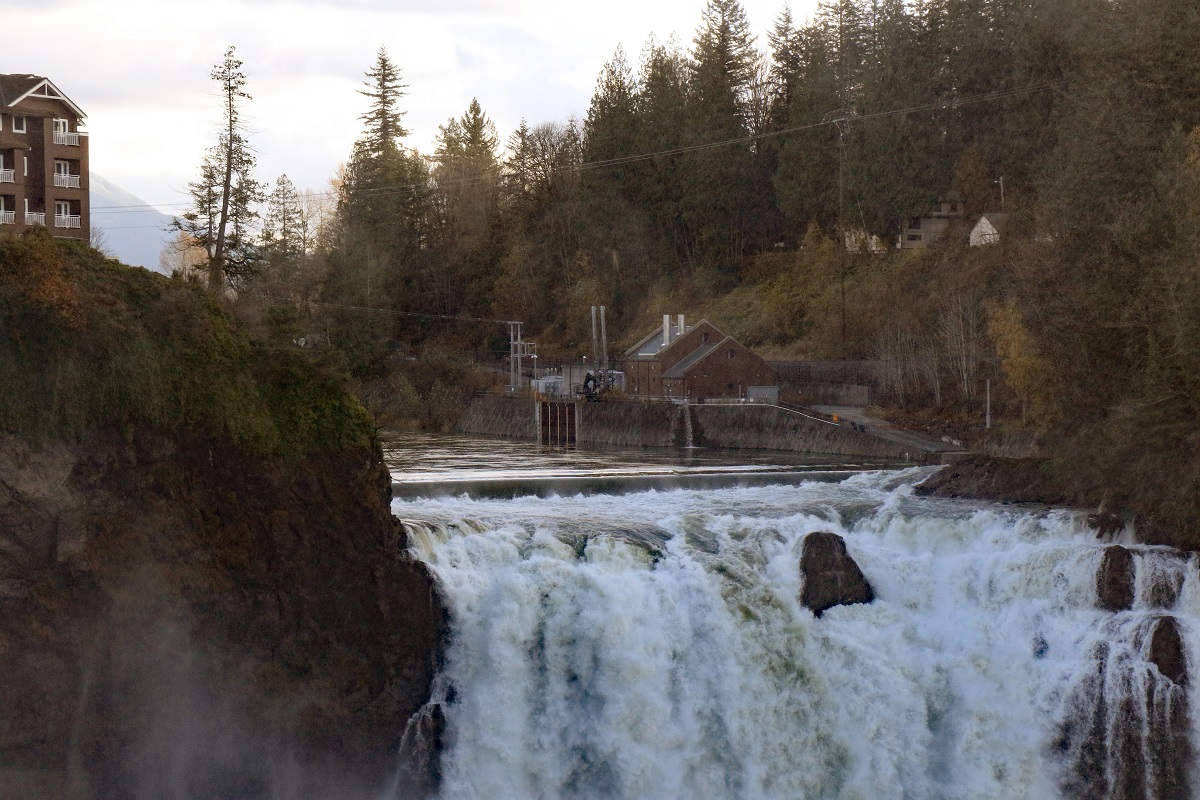
A closer look at the power plant. It consists of two power houses. Plant 1 is underground (installed capacity 13.7 MW) and was completed in 1899, and the picture shows Plant 2 (40.2 MW) which was completed in 1910, for a total installed capacity of 53.9 MW. [Canon EOS 7D Mk II, telephoto lens]Most of the pictures that I took were spoiled by the persistent mist and water droplets from the thundering falls down below. The large lens of my big digital camera kept getting fogged up and downright wet. My iPhone with its tiny lens openings worked better under these conditions. At this time of day (early afternoon) the sun sits in the wrong place for an evenly-lit picture, but hey, you work with what you have. The lens flares even have little rainbows in them. [iPhone 13 Pro, Wide-angle lens]