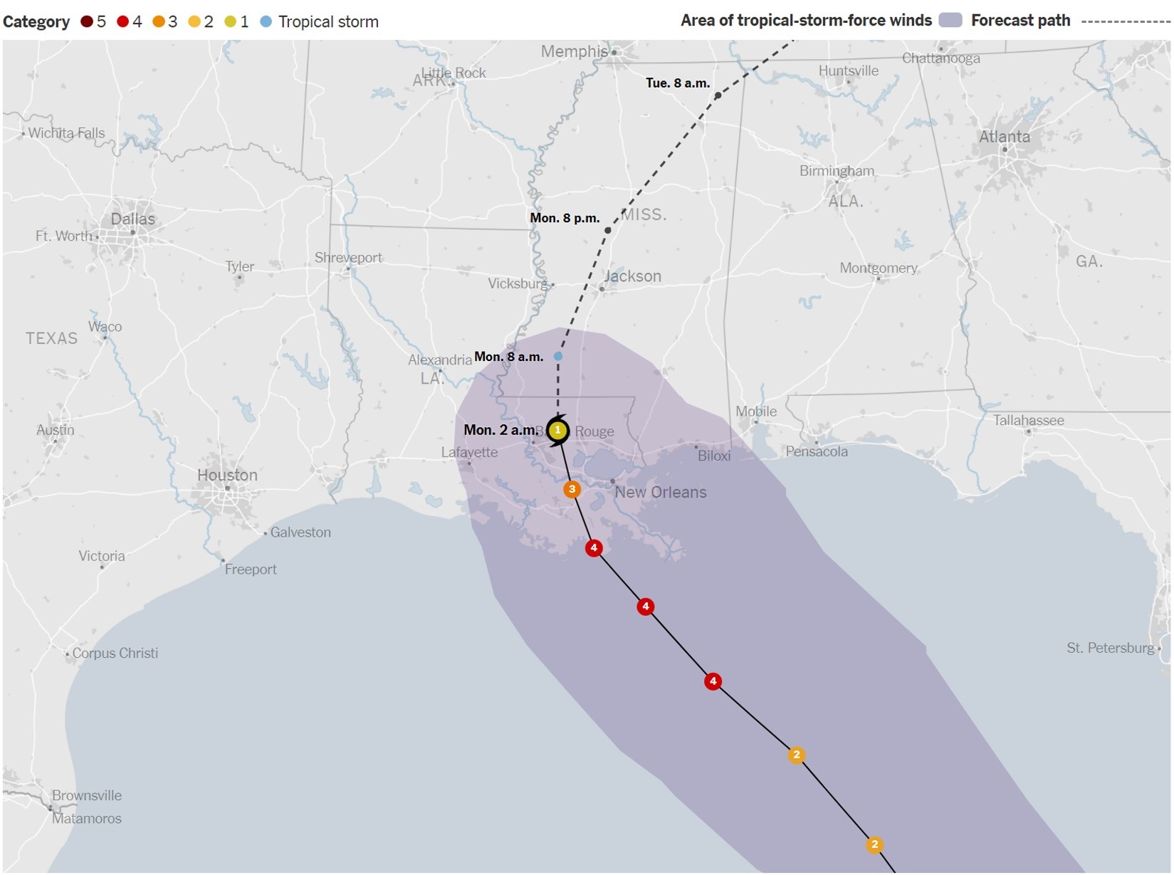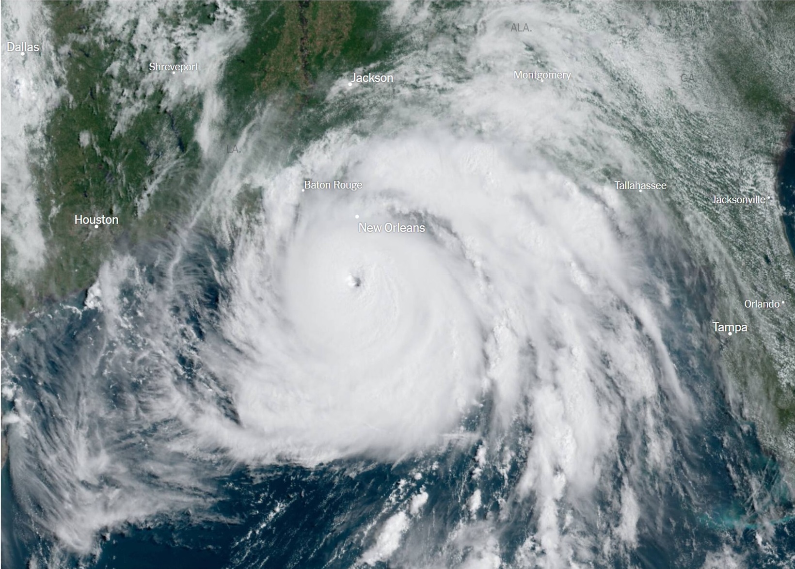
Hurricane Ida is the ninth named storm of the 2021 Atlantic hurricane season, and formed on Thursday in the Caribbean Sea.
A levee failed near Highway 23, resulting in flash flooding. I hope Monday will bring news that the infrastructure that had been added after hurricane Katrina, to mitigate the storm surge threat from the ocean and the bodies of water in the area, had done exactly that.
Mon 8/30 update: Reported by Reuters: A $14.5 billion system of levees, flood gates and pumps has largely worked as designed during Hurricane Ida, sparing New Orleans from the catastrophic flooding that devastated the area 16 years ago in the wake of Katrina, officials said.