We stayed over in the town of Omak on Wednesday night, and made our way back to Seattle on Thursday over the North Cascades* with Highway 20. It’s about a 5 hr drive without stops, to go from Omak to Twisp, Winthrop, Newhalem, Darrington and then with I-5 (or I-405) to Seattle. It was a crisp morning when we started back from Omak (47 °F/ 8°C), but back in Seattle it was a record warm day for Sept 28 at (85°F/ 29 °C).
*The Cascade Range or ‘Cascades’ is a major mountain range of western North America, extending from southern British Columbia in Canada through Washington State and Oregon and into Northern California.
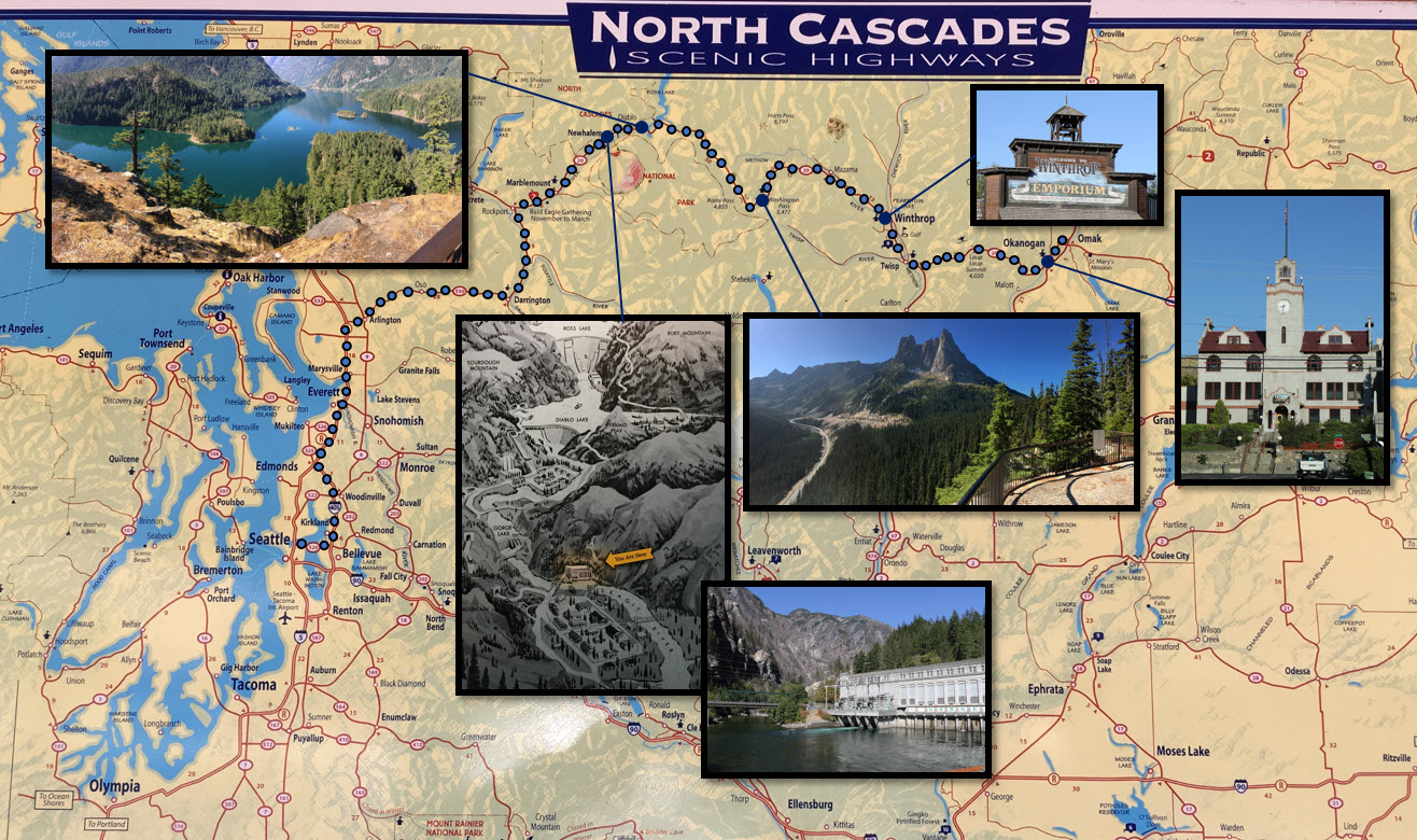
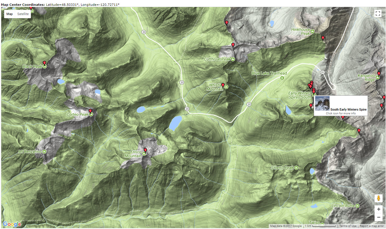
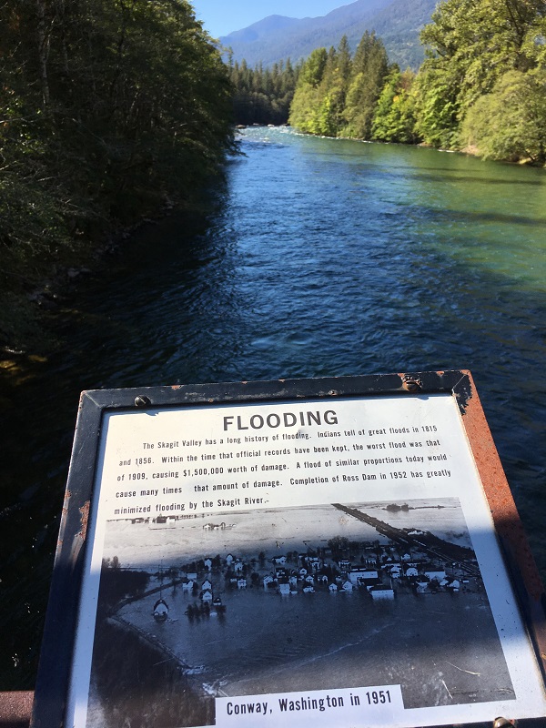
Clockwise from top left: view over the Skagit River Valley, with the Diablo Dam’s dam wall directly ahead; vintage ‘Wild West’ storefront in Winthrop; town hall of Okanogan; viewpoint in Washington Pass on Highway 20, with the Early Winter Spires (7,807 ft / 2 380 m); at Newhalem by the Gorge Dam and Power station; the diagram shows the Ross Dam and the Diablo Dam as well.Here’s a cool topographical map that I generated with a Google search for ‘Early Winter Spires’ that shows how Highway 20 follows the lowest contour lines through the North Cascades. The web site is http://www.summitpost.org. There is a hairpin bend in the road by the Spires, and the map also shows several alpine lakes. These are lakes or reservoirs at high altitudes, usually starting around 5,000 feet (1,500 m). These is still snow and ice visible further up, from small glaciers. Highway 20 gets so much snow in winter that it is completely closed for traffic, sometimes only opening again as late as June.View from a foot bridge overlooking the Skagit River at Newhalem; this is just downstream of the Gorge Dam. Flooding in the Skagit Valley has become a rare event due to the three dams that had been built upstream in the Skagit River (the Gorge, the Diablo, the Ross).