We only got 72 °F (22 °C) here in the city today, but it looks like Sunday will be warm: 90 °F (32 °C).

a weblog of whereabouts & interests, since 2010
We only got 72 °F (22 °C) here in the city today, but it looks like Sunday will be warm: 90 °F (32 °C).
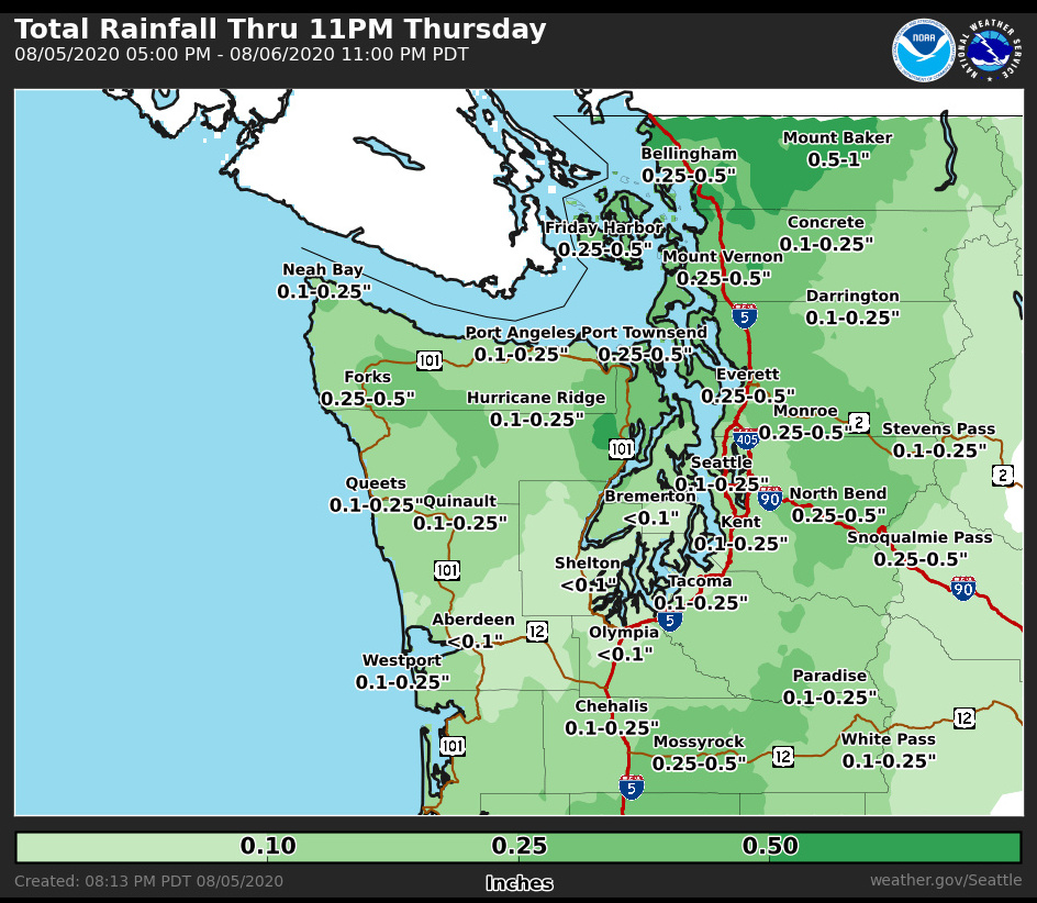
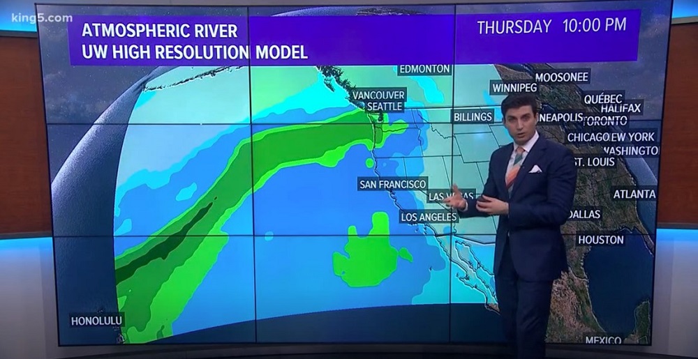
There is rain on the way for Thursday, says the meteorologists.
Yes! I need it to dissolve and disperse the dry moss treatment that the gutter cleaners had left on my roof.
The dry summer weather continues here in the city (79 °F/ 26 °C today).
There were clouds and a chance of drizzle on Saturday morning, but it stayed dry.
It’s going to be warm (for Seattle, that is) this week — 87 °F (30.5 °C) on Monday, and slightly cooler on Tuesday.

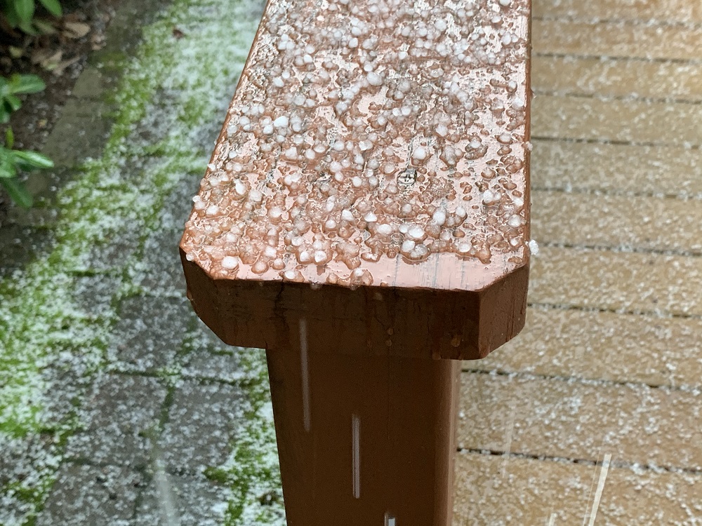
I learned a new word today from our local TV weatherman: graupel.
Graupel is precipitation that forms when tiny, super-cooled water droplets glom onto snowflakes. The soft snowy pellets then fall down to earth.
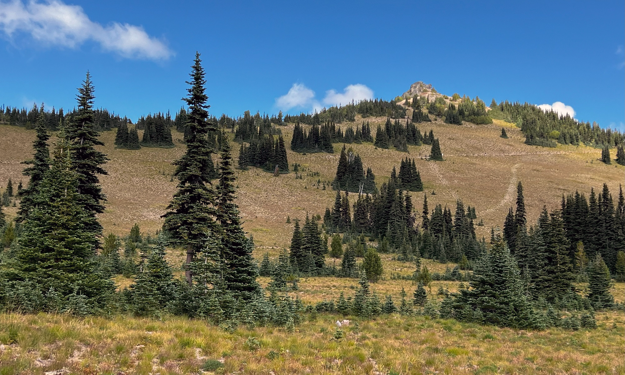
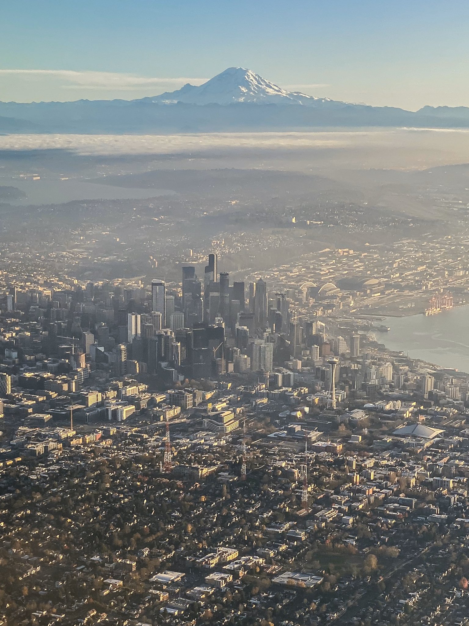
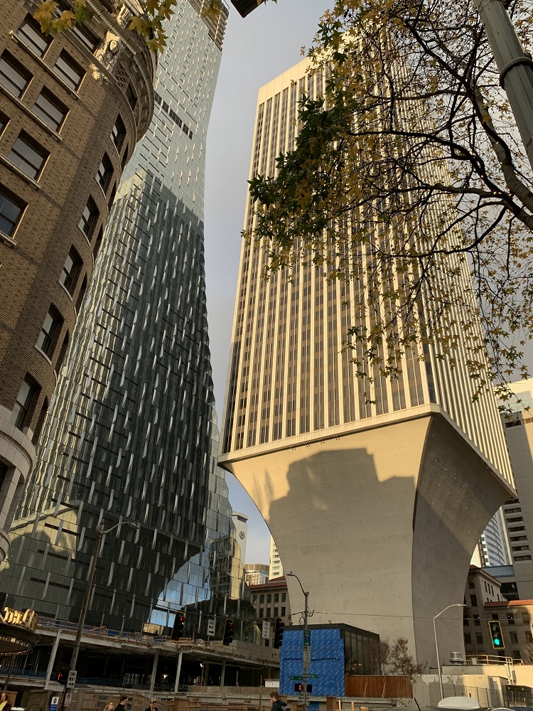
It was another beautiful day here in Seattle.
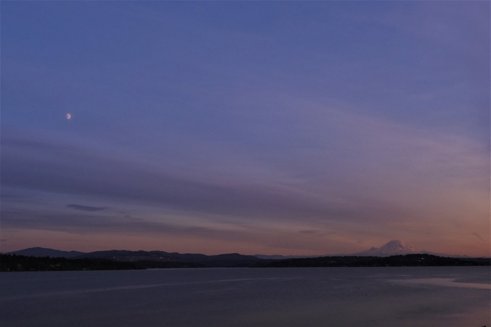
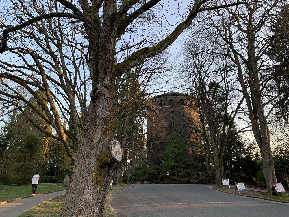
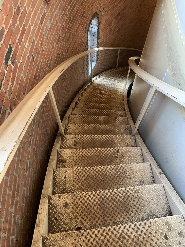
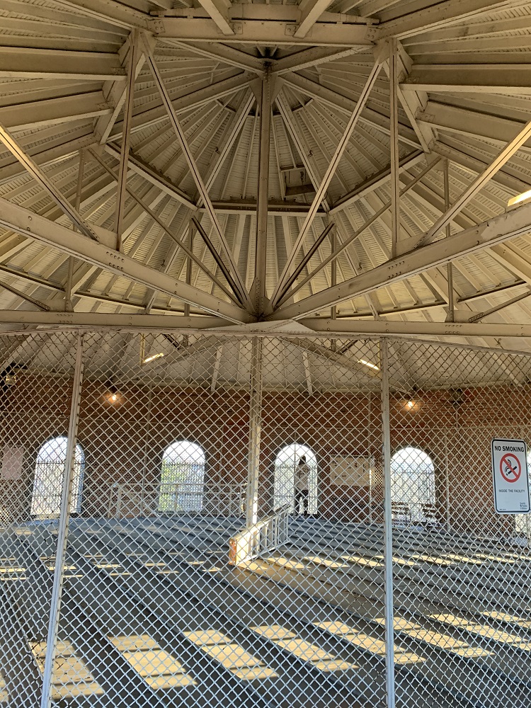
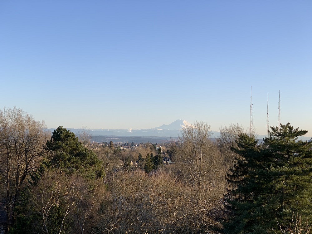
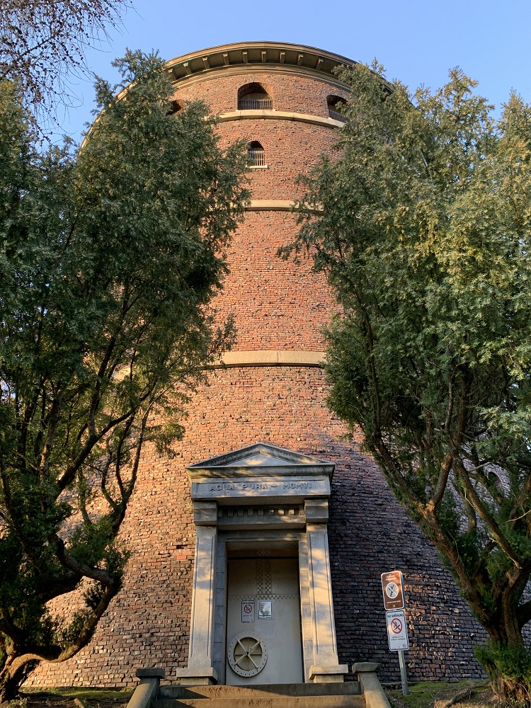
I wanted to get a clear view of Mt Rainier, and the observation deck of the Water Tower here in Volunteer Park on Capitol Hill was a good place to go to get that. And hey, no entry fee: it’s free of charge.
There was sun and blue sky all day here in the Emerald City.
Even so, it was only 47 °F (8° C).
As I walked down to the Capitol Hill Library today, though, bright sunlight would bounce off windows from the buildings nearby and onto me, and I instantly felt the radiated heat on my face.
The rain let up a little today, but some cold air moved in from the Pacific, pushing temperatures down again into the mid-40s (6° C).
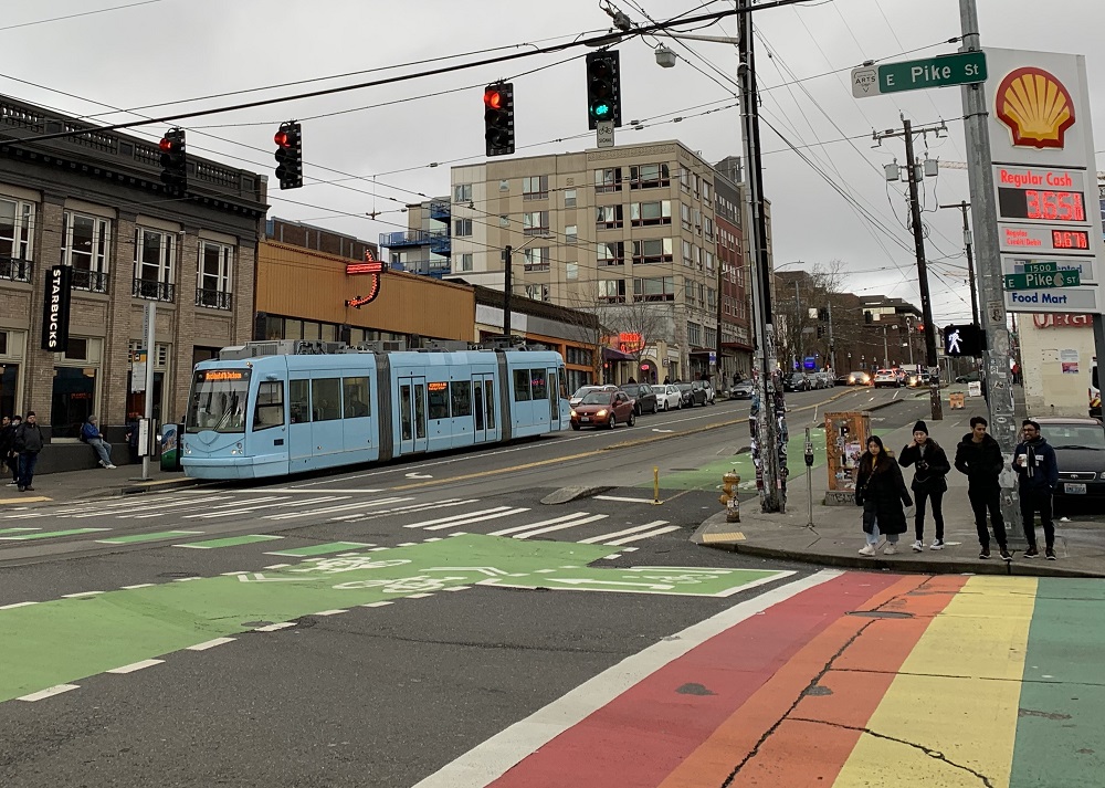
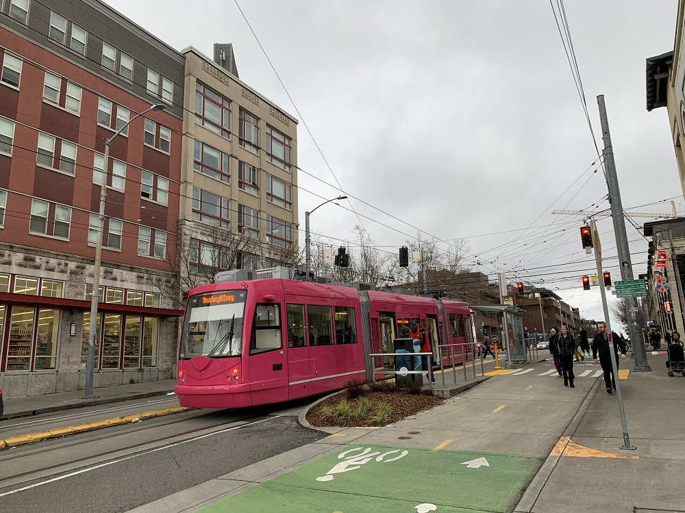
Thank heavens for the rainbow crosswalks, and the blue and pink street cars, I thought, as I walked along Broadway today. They bring some color — to counter the gray skies and sidewalks.
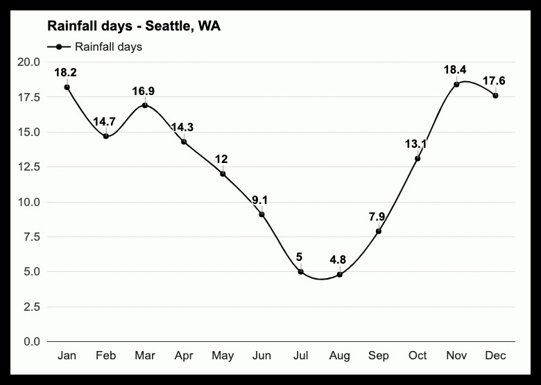
A break in the rain in January here in Seattle, means you have to jump at it, and go for a walk. We had an even rainier-than-usual start to the year here, with 8.04 in so far at Seatac Airport. The average for Jan. is 5.2 in.
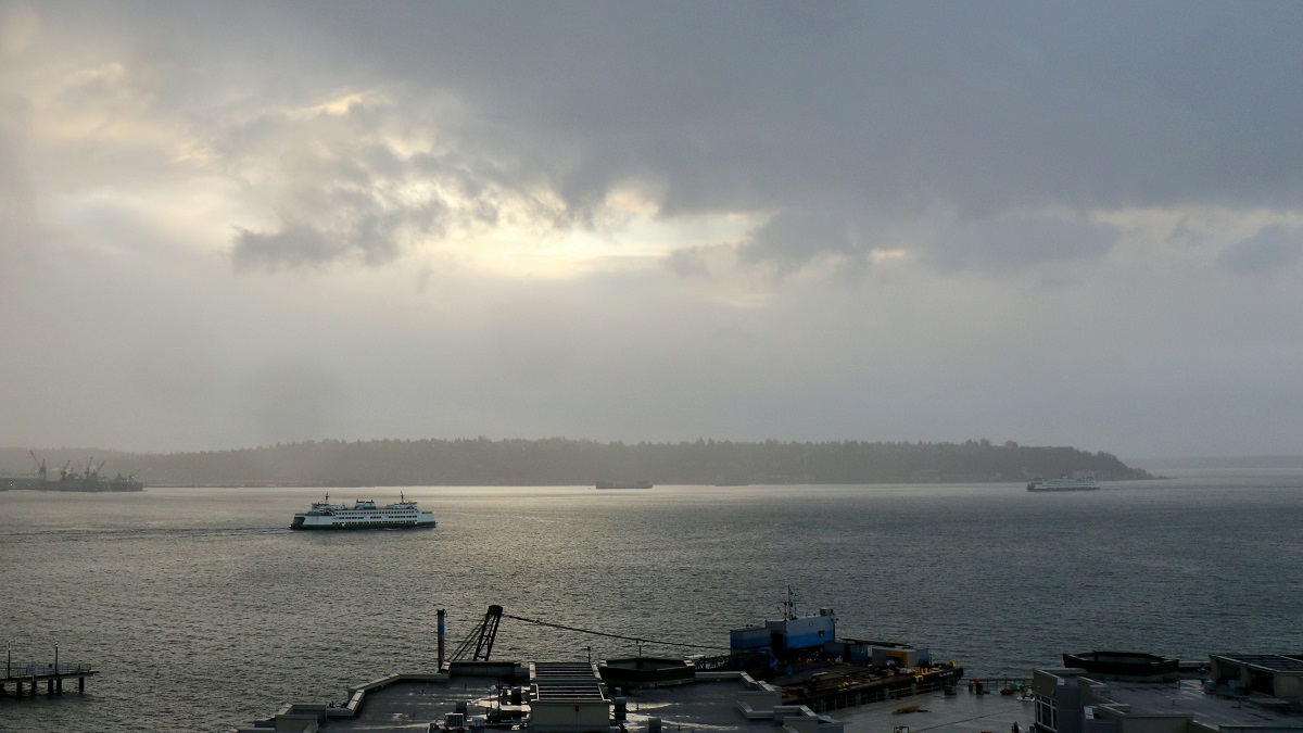
I cut my walkabout in downtown Seattle short today when big raindrops started to come down again.
It was 52 °F/ 11 °C with blue skies when I started out, but grey rain clouds soon swept in from the Pacific.
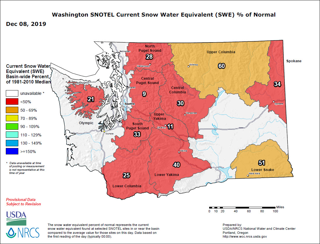
Wow .. the snowpack levels in the mountains and higher elevations have improved dramatically. Snoqualmie Pass (at 3,000 ft on Interstate 90) had 6.7 feet/ 2.04 m of snow in 6 days.
There should still be more accumulation to come, though.
April 1 of every year is (on average) when the snowpack depths peak, and the snow starts to melt in spring.
It was nice to see the clouds clear a little this afternoon, with a little sun and blue sky.
There is a lot more snow coming tonight, moving in from over the Pacific.
Most of it will be to the north of Seattle, and on the mountains to the east and the west of the city.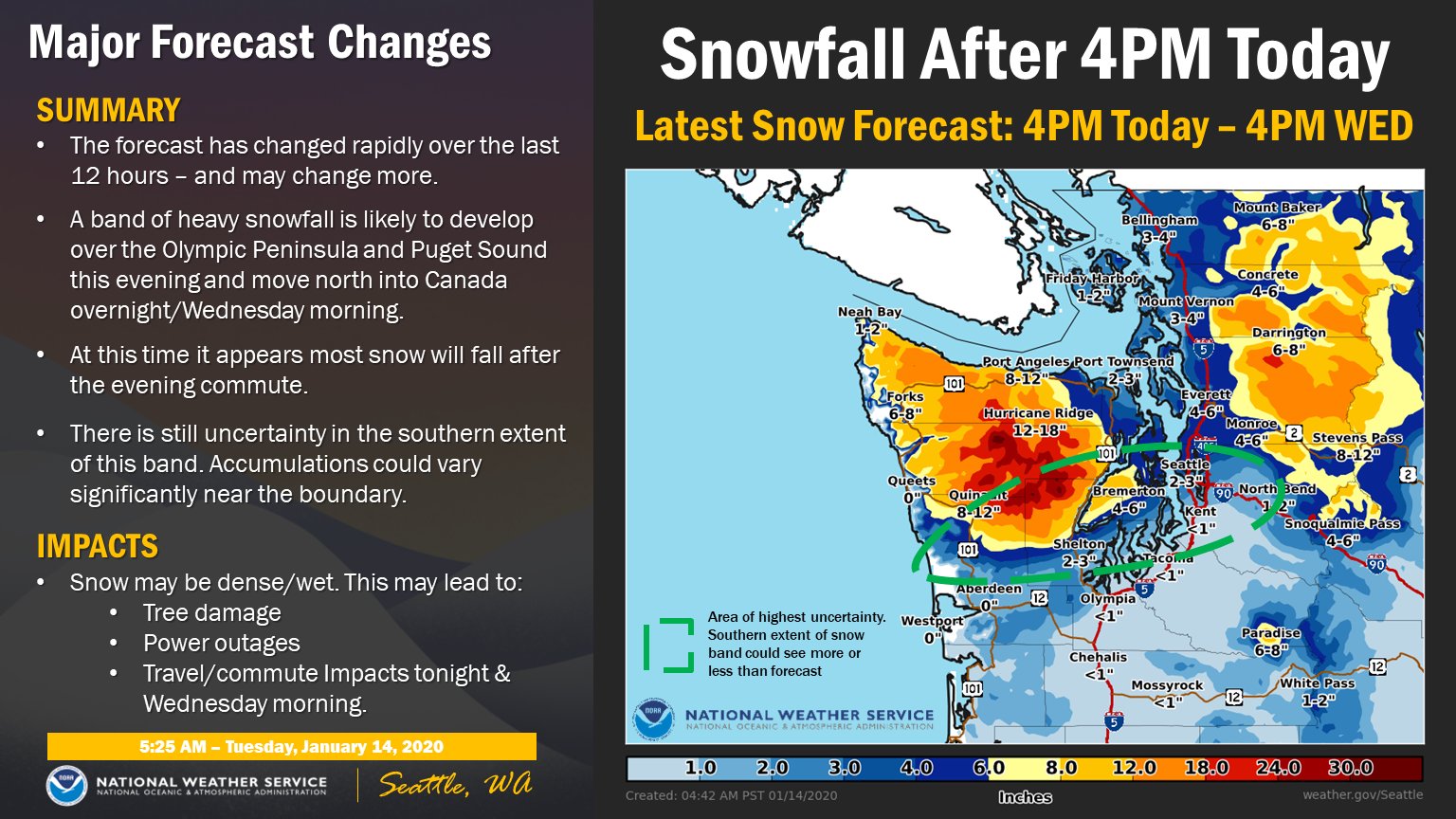
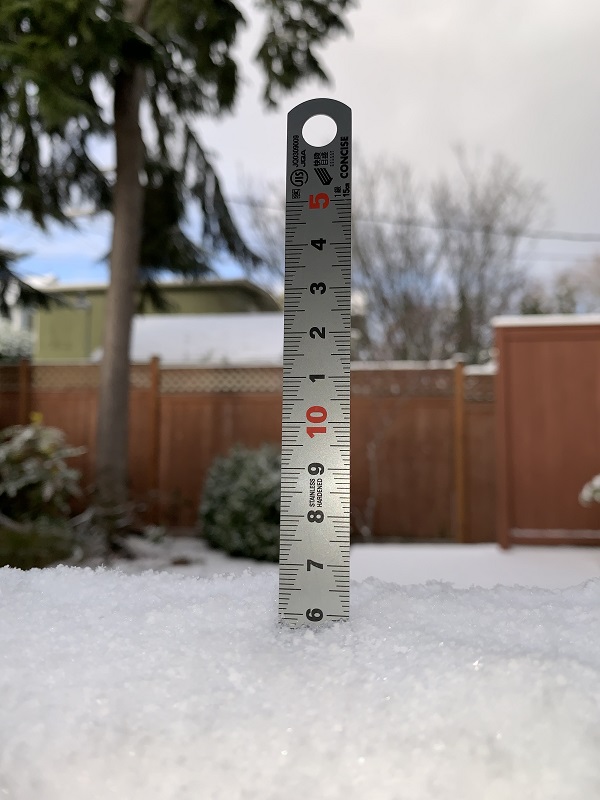
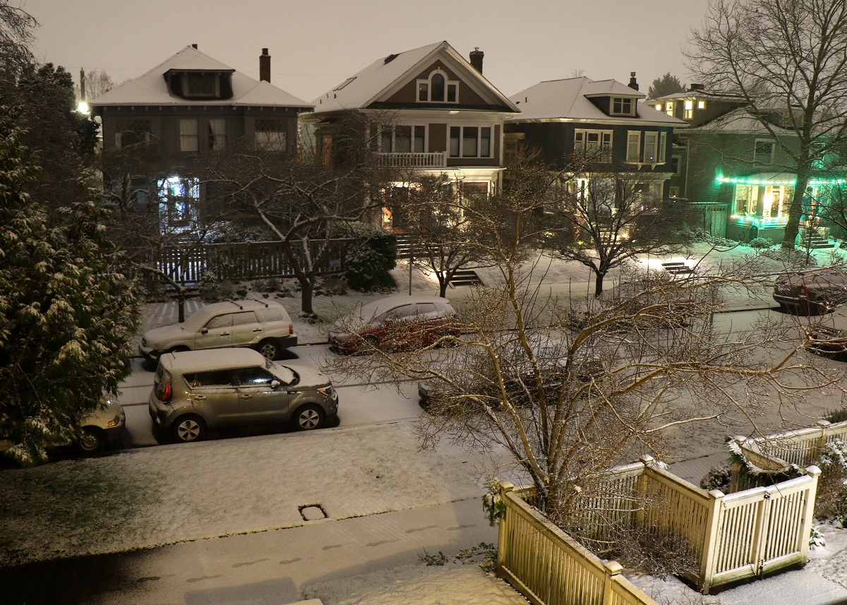
A system with rain met arctic air from the Fraser Valley in Canada tonight here in the Pacific Northwest, and made for light snow on the ground here in the city.
It’s Christmas Day, but firefighters in South Australia, across the Adelaide Hills, are still battling to bring raging bushfires under control there.
Record low rainfall this year has contributed to the scorching of some 5 million hectares (that’s 19,000 sq miles) in Australia so far, by far the worst year on record.

[Cartoon by Dean Alston in the West Australian].
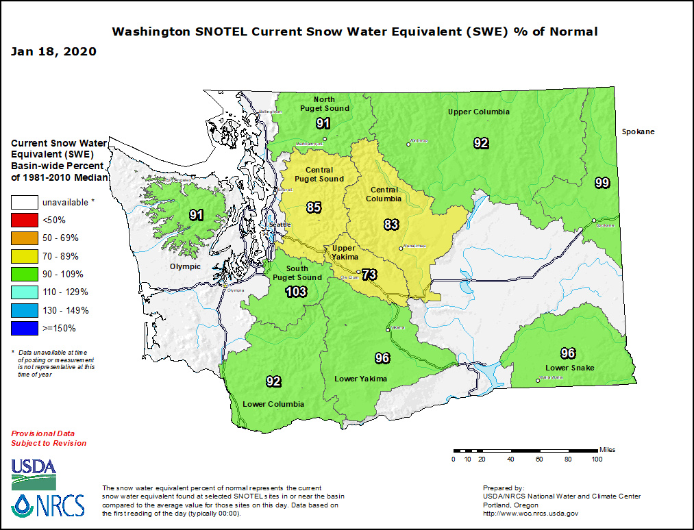
We had relatively warm weather here the last week or so. A massive warmer-than-normal blob of water in the Pacific Ocean off the Washington coast may be to blame.
We also had the driest November in 40 years (only 1.71 in. of rain at Sea-Tac Airport, 26% of the average). That also means that the snowpack levels on the mountains in Washington State are lagging far behind the normal levels for this time of the year.
On Wednesday and today, it was sunny, with lots of blue sky — a high of only 48°F/ 9°C, though.
November is Seattle’s rainiest month, with an average total of some 6 or 7 in. of rain.
So far this month, though, the rain gauge at Seattle-Tacoma airport had recorded only 0.86 in of rain through Sunday night.
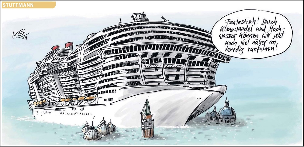
Here’s a little wry cartoon from German weekly magazine Die Spiegel, about the rising waters engulfing Venice. (The city is experiencing its worst flooding in 50 years).

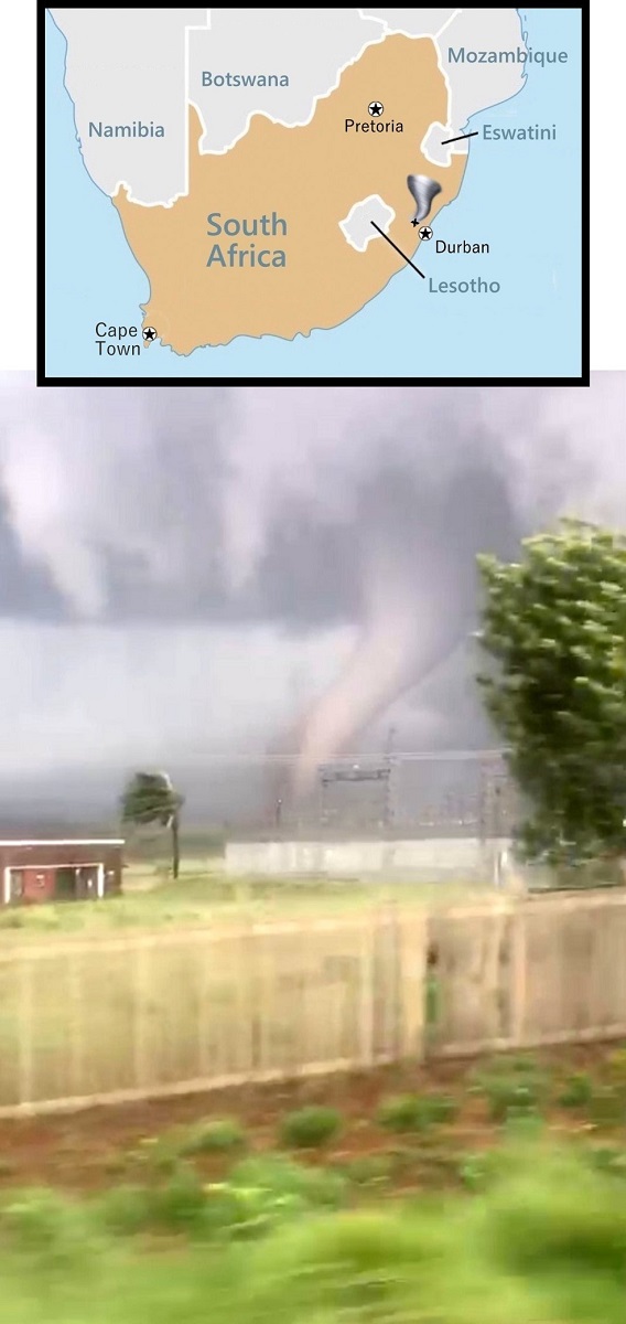
Big, destructive tornadoes are a rare sight in South Africa, but one touched down near the town of New Hanover in KwaZulu-Natal province on Tuesday at 4 pm local time.
No fatalities have been reported so far, but some 30 houses and an electrical substation were damaged.
Update Thu 11/14: Two fatalities have been reported, from homes in the Mpolweni settlement that were struck by the tornado. More people are still reported as missing.
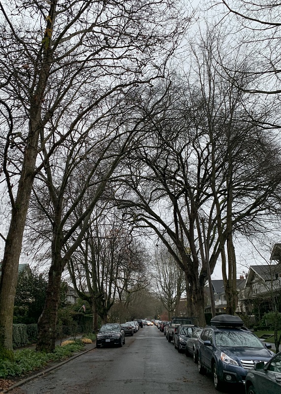
Wednesday marked the 12th day with no rain here in the Pacific Northwest, unusual for this time of year. There is a stubborn stationary high pressure system to the north, that keeps the rain away.