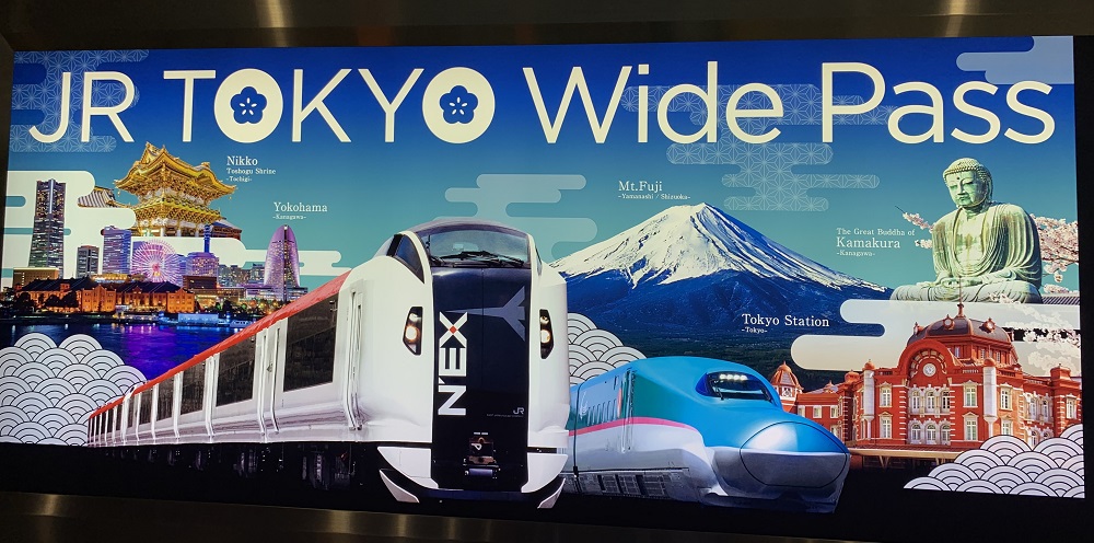
First on my agenda today, was to buy a train ticket to get me back to Narita airport in a few days. Since the first Narita Express will not get me there early enough, I have to take the Skyliner Express, which runs out of Ueno Station on the Keisei Line.
Then I ran out to the Yodobashi Camera store in Akiba. I love that place! LOL. Just beware: the store’s theme song will stay in your head, long after you had left. Its words are set to the tune of The Battle Hymn of the Republic, and sung in an animated voice: Marui midori no Yamanotesen (‘The round green Yamanote Line’) Mannaka tooru no wa Chu-ousen (‘What goes through the middle of it is the Chuo Line’) Shinjuku nishiguchi eki no mae (‘In front of the west exit of Shinjuku Station’) Kamera wa Yodobashikame ra! (‘[For] cameras it’s YodobashiCamera!)’
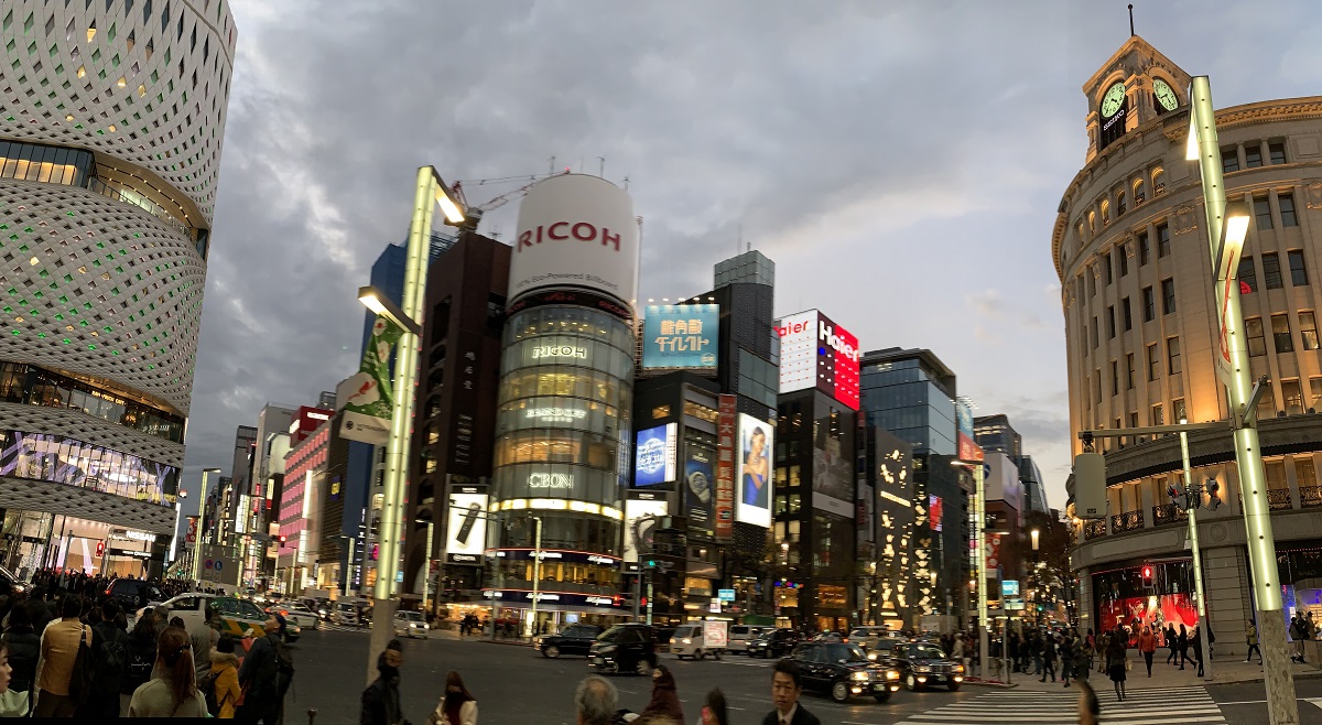
Finally, I walked around the Ginza shopping district a bit, to watch the streetlights come on, and storefronts get lit up, as the sun was setting.
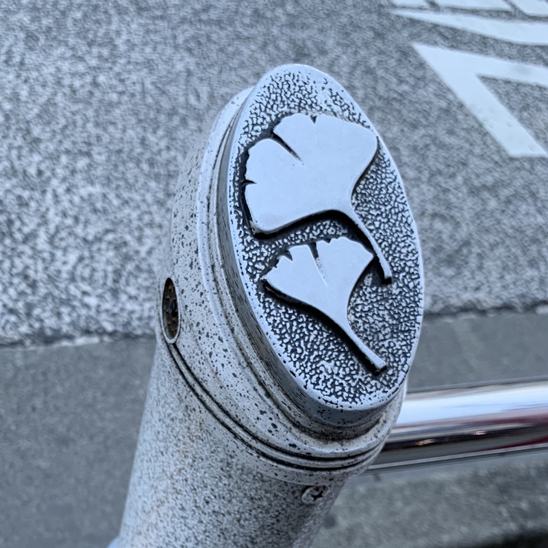
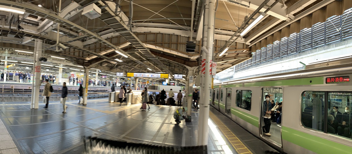
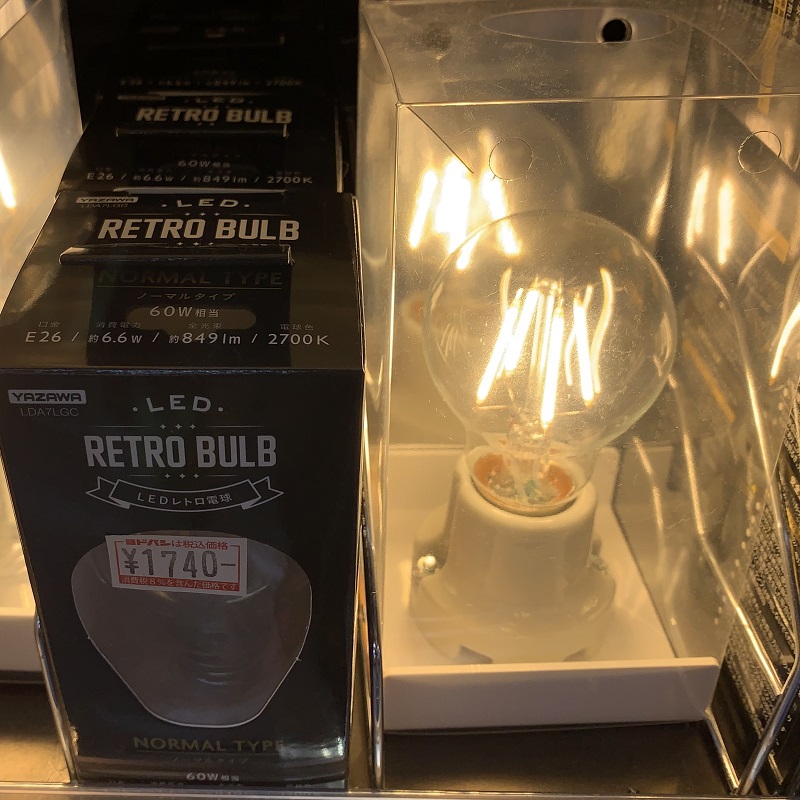
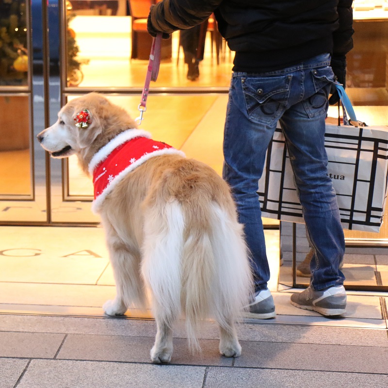
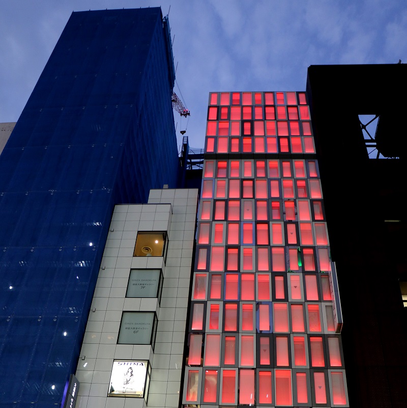
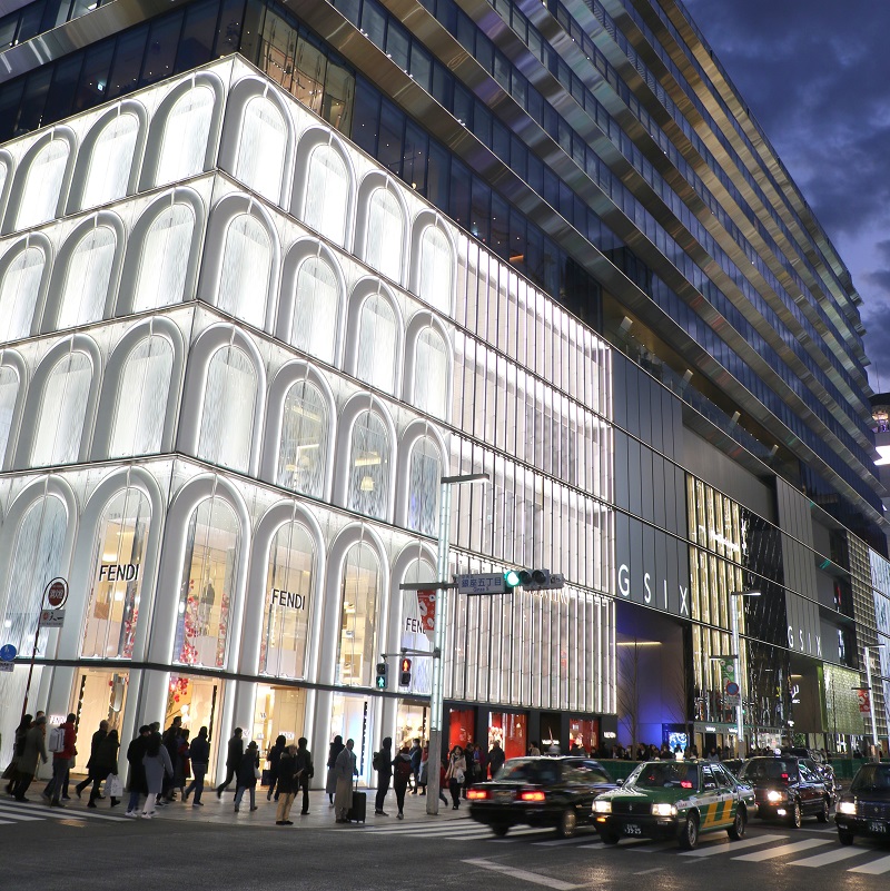
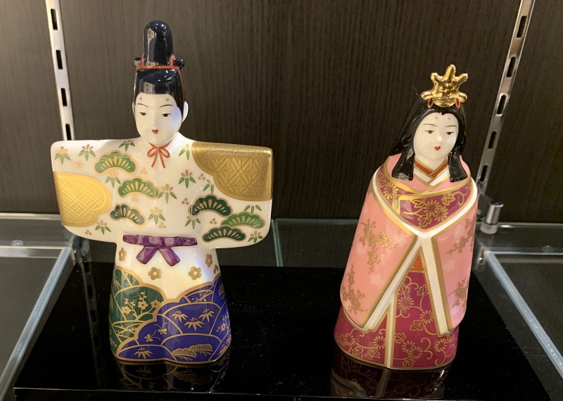
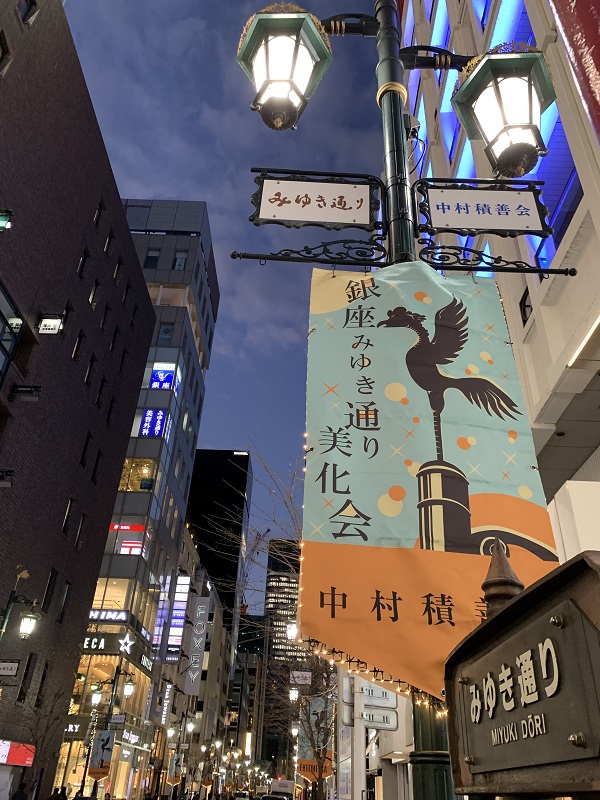
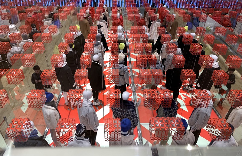
Ueno Station is by Ueno Park, a spacious public park with lots of big ginkgo trees. So the ginkgo leaves on the fence posts along the street is a nice touch.Ueno Station is on the famous green (its color on maps) Yamanote loop line, operated by East Japan Railway Company (JR East). Akihabara is the stop for the big Yodobashi Camera store (there are other locations as well). This photo is of the Tokyo Station stop, close to my hotel.Once I am in the Yodobashi Camera store, and I check out all the home electronics, and Canon cameras and lenses, and Seiko watches, and the toys on Floor 6, AND that rousing theme song plays, I just kind of go: yes! you can take all my money! I don’t care! -you sell so many cool things, and I want to buy all of them! This one I will buy in the United States, though: an LED retro bulb (¥1740 equals US$13), that one can use with a dimmer switch. I would love to have one for my nightstand.Now to the Ginza district. On the left is Ginza Place (completed 2016), with its white façade of 5,000 aluminum panels. Kitty corner from it is the Wako Department Store, built in neoclassical style in 1932, with its Seiko clock. It is one of only a few buildings in the city of Tokyo that survived World War II.This golden retriever pooch with his Christmas garb and soft fur, charmed everyone on the sidewalk and in the store that they went into.This store, lit up in red from the inside for Christmas, is the headquarters of Tasaki, one of Japan’s premier jewelers.And here is Fendi (the white corner section), the Italian luxury fashion house, founded in 1925 in Rome.I had to check into the Noritake store (porcelain wares), but did not buy another coffee mug or dish (I have many already). These are figurines called Hina Dolls (price ¥75,600/ USD 655 .. the artist must have used gold powder paste for the gold). In Japan, young girls are celebrated on Mar 3, called the Peach Festival (also Doll’s Festival). The festival is a wish for their happiness and healthy growth as they grow up.One of the side streets out of the main street, called Miyuki-Dori. The bird on the lamppost banner is the Fenghuang, a bird from East Asian mythology that reign over all other birds.This matrix of mannequins is on the first floor of the Uniqlo flagship stoor. I’m on the second floor, with a glass section that provides a view to down below.
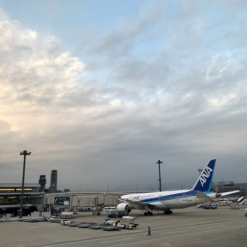
Whew – I made it into the Marriott Courtyard here at Tokyo Station. The flight on All Nippon Airlines was uneventful*, as was the express train ride into the city.
After that, I had to work a little to make my way to the hotel with all my luggage. The express train platform is five floors down from street level, deep under the sprawling Tokyo Station complex.
*I forgot to take my large camera out of my big bag as I checked it in. So I fretted that the camera might get damaged by the baggage handling process, or frozen while in the cargo hold .. but it seems to have survived just fine.
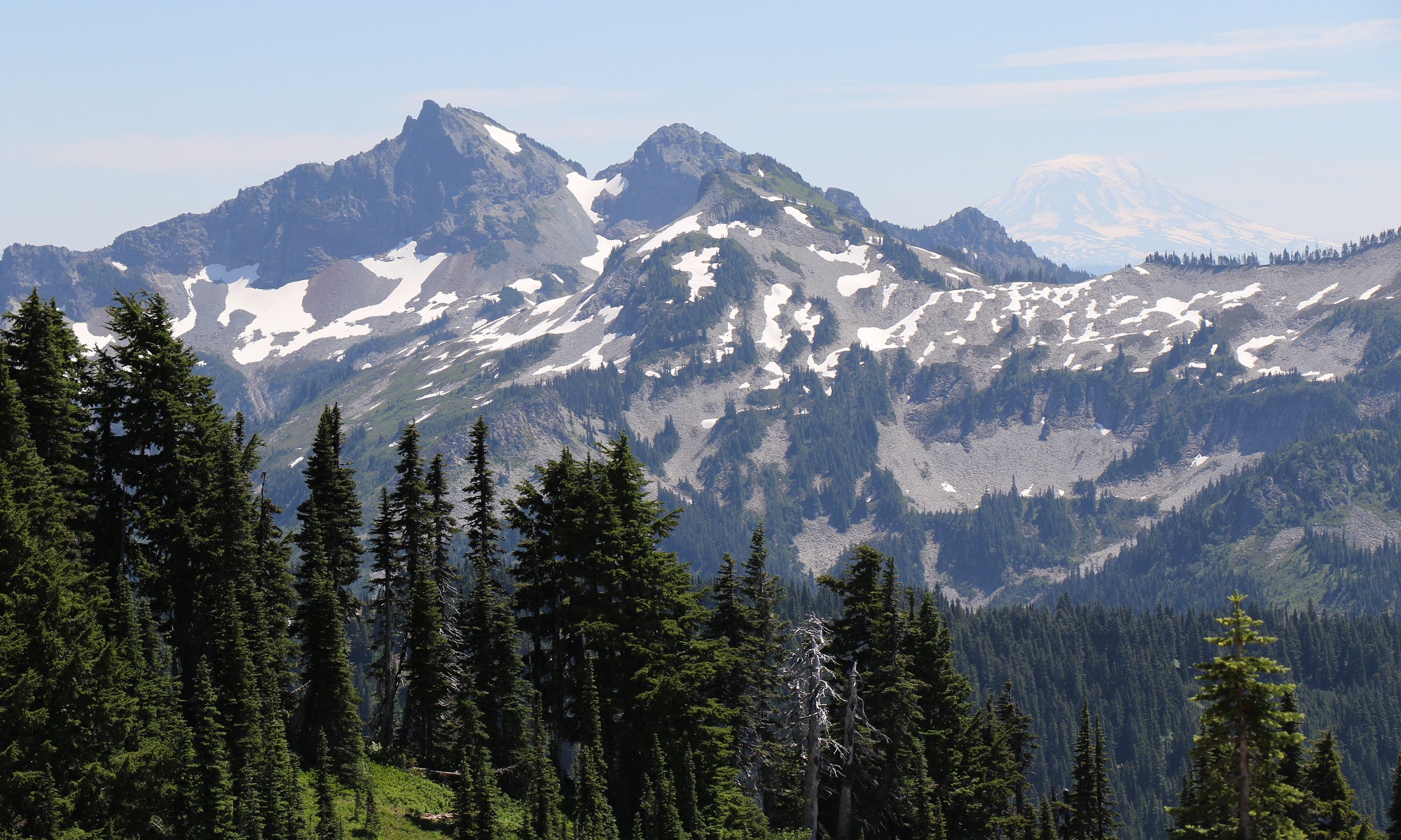
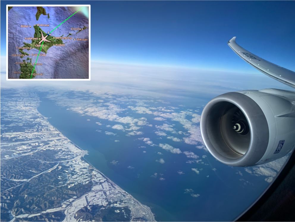
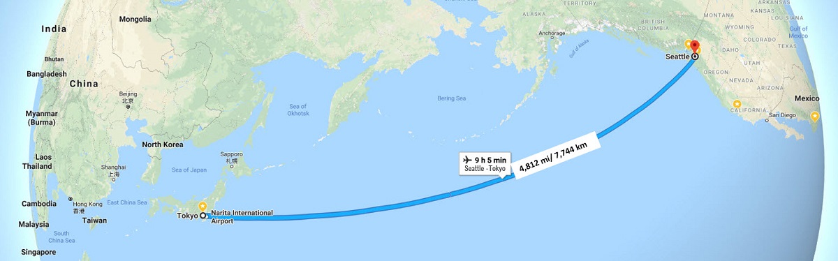
Our flight path had us skirt Juneau and Anchorage to their south, fly north over the Aleutian Islands, and over the Kamchatka Peninsula (part of the Russian Far East). Here is the view from the window, just as we started crossing over Hokkaido, the northernmost of Japan’s main islands.We are just pulling into the gate at Narita’s Terminal 1, next to an aircraft that looks like ours. It was cloudy, rainy and 46 °F/ 8 °C. Tokyo’s latitude of 35° is a little further south on the globe than Seattle’s 47°.Here’s a billboard with the Narita Express train that I took into the city. JR stands for Japan Rail and not for John Ross (the villain in ‘Dallas’). The beautiful red-brick Tokyo Station building is where I ended up from the airport. The original Station building was completed in 1914. Lately it underwent a 5½-year renovation, and reopened in 2012, restored inside and out.
I made it to the airport. We will board in 30 mins or so.
It’s great to get to this point! Just to get packed up and the house taken care of before a long trip, leaves me frazzled. But now I can relax a little.
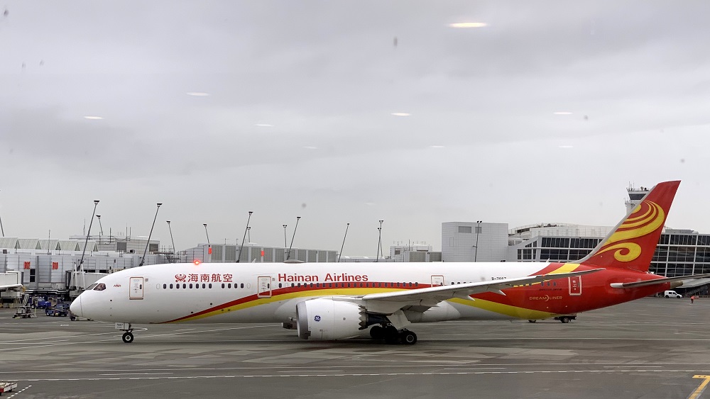
Here’s the engine and tail of Xiamen Air, based in Xiamen, China (across from Taiwan, on the mainland). This is a Boeing 787-8, and I believe it flies the Xiamen-Shenzhen-Seattle route. That’s a symbolic egret on the tail.Here’s Hainan Air taxiing for take-off to either Beijing, or Shanghai. This is a Boeing 787-9 Dreamliner that was made in Charleston, SC. (I looked up its details on planespotters.net with the registration number: B-7667).
.. well, almost. I’m heading out to Tokyo in the morning, as part of my itinerary to get me to Perth, Australia, in a few days.
It’s great to have a direct flight from Seattle to Tokyo, but then: there is only Pacific Ocean between the two cities (unless one can make a stop on those Aleutian Islands off the coast of Alaska!). I’m going to cross the international date line on the way there and fly right into Thursday afternoon in Japan .. but I will get the time back on my return.
It was a beautiful first day of fall here in Seattle, with puffy white clouds in a blue sky and mild temperatures (65 °F/ 18 °C). I went down to South Lake Union for just a bit, and took the streetcar and No 8 bus back up to Capitol Hill.
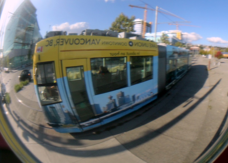
I used the convex traffic mirror on the corner of Roy St and Westlake Ave N to take this ‘selfie’ of the South Lake Union streetcar. ‘South Lake Union to downtown Vancouver BC in about an hour’, says the Kenmore Air seaplane advertising painted on the streetcar. That’s not bad – much quicker than flying commercial out of Sea-Tac!
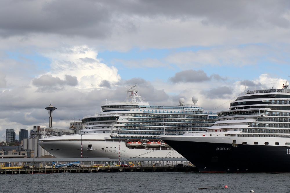
Fall has started, and the cruise ship season is winding down. (The last sailing from Seattle is Oct 10). Friends of ours left on a cruise this afternoon from the Smith Cove cruise terminal. Bryan and I went there to wave them goodbye – but we could not get quite close enough to the pier! We settled for views of the cruise ship departures from the Elliott Bay marina.
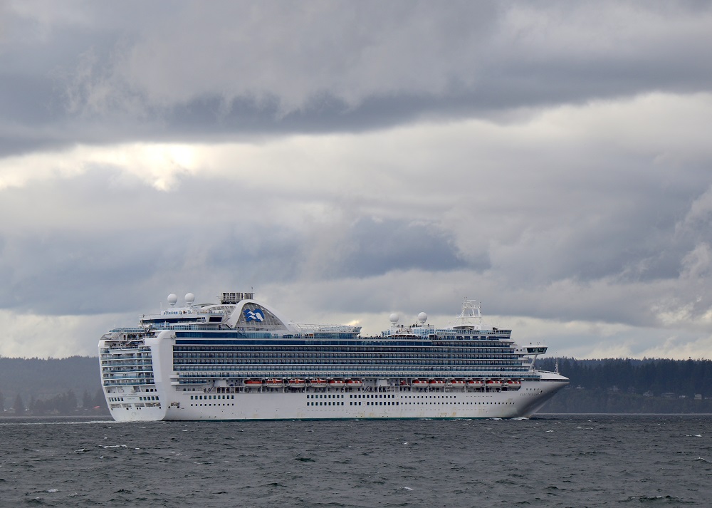
Our friends are on the Ruby Princess on the left (built 2008 for $400m; capacity 3,600 passengers). She was setting sail for San Diego. On the right is the MS Eurodam (built 2007; capacity 2,100 passengers). She was setting sail for Alaska.Here is the Ruby Princess shortly after she had set sail at 4 pm. She is heading north towards the Strait of Juan de Fuca, to get into the Pacific Ocean.
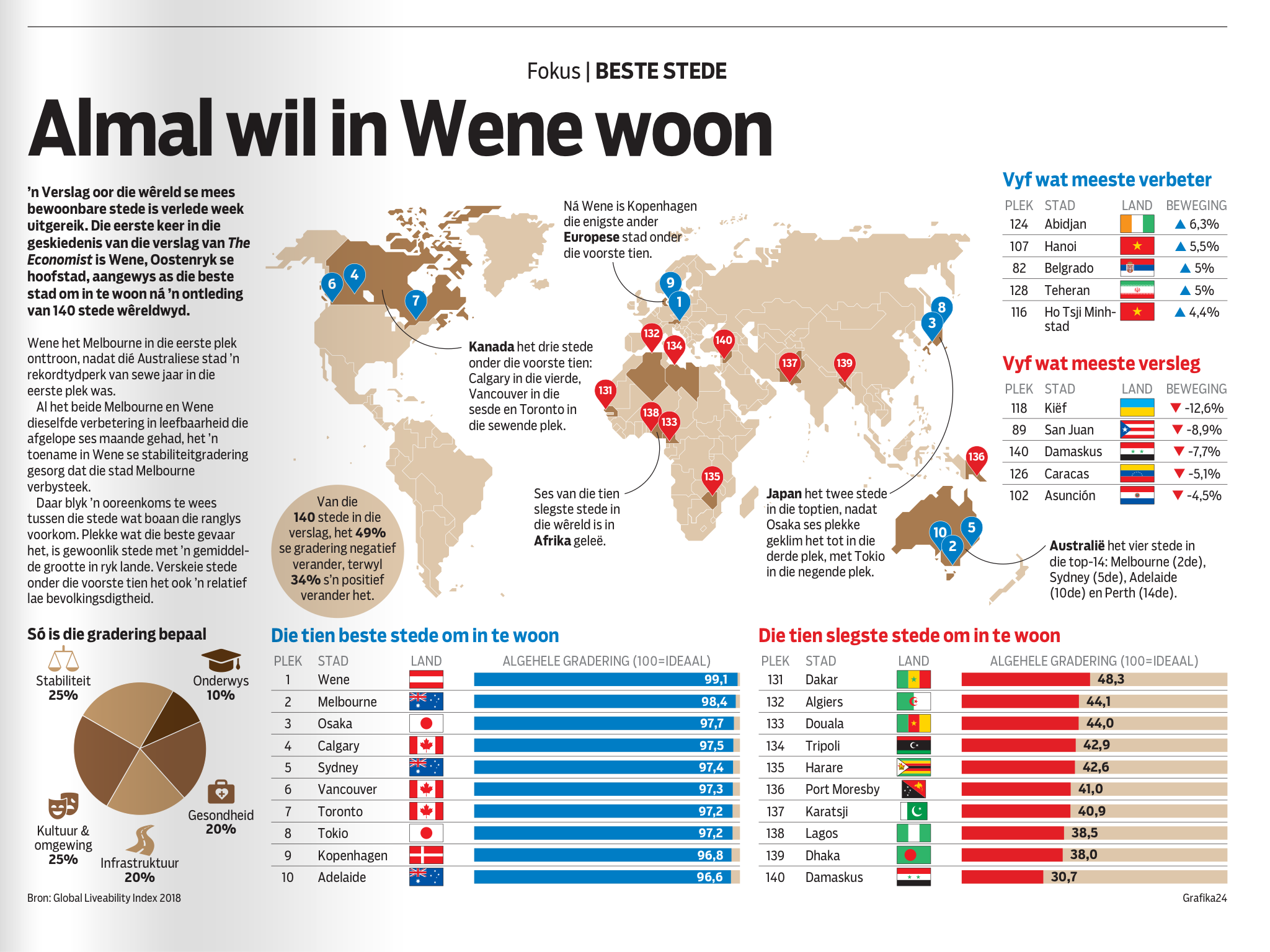
Hmm .. I see The Economist has given Vienna the nod as the world’s ‘best city’ to live in. (Melbourne had been at the top of the list for seven straight years). No American city made the top 10 .. but of course: Seattleites scoff at the notion that Vancouver is better than Seattle. That number 6 pointer on the map should move south to just below the Canadian border!
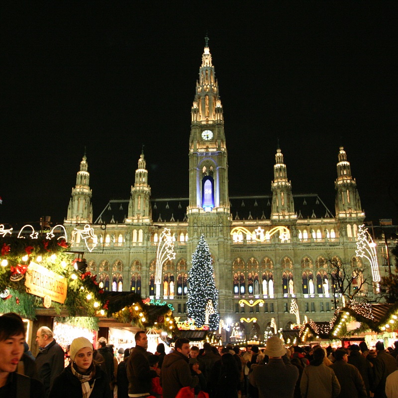
[Graphic from Die Burger newspaper] ‘Everyone wants to live in Vienna’. The grading of the cities were determined by Stability (25%), Education (10%), Health (20%), Infrastructure (20%), Culture and Environment (25%).Ah, Vienna: the City of Music. Here’s a picture I took in December 2008, of the majestic Vienna Rathaus (City Hall), all decorated for the Christmas market. (My colleagues and I were working in on a project Bratislava, Slovakia – just across the Danube river – at the time). We milled around with the crowds, and had some great glühwein!
A vintage-LEGO-set-for-cash deal went down in a Tacoma parking lot today. (I made a run down there to buy a LEGO set advertised on Craigslist. Will show what I got, later).
On the way back, I stopped on Pacific Avenue in the old downtown of the city of Tacoma, and took a few pictures.
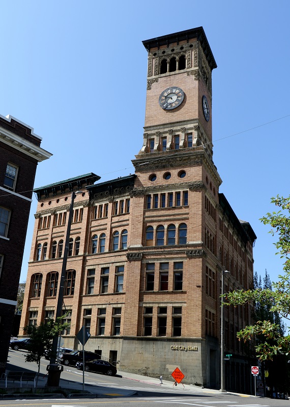
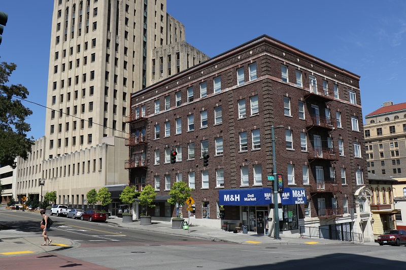
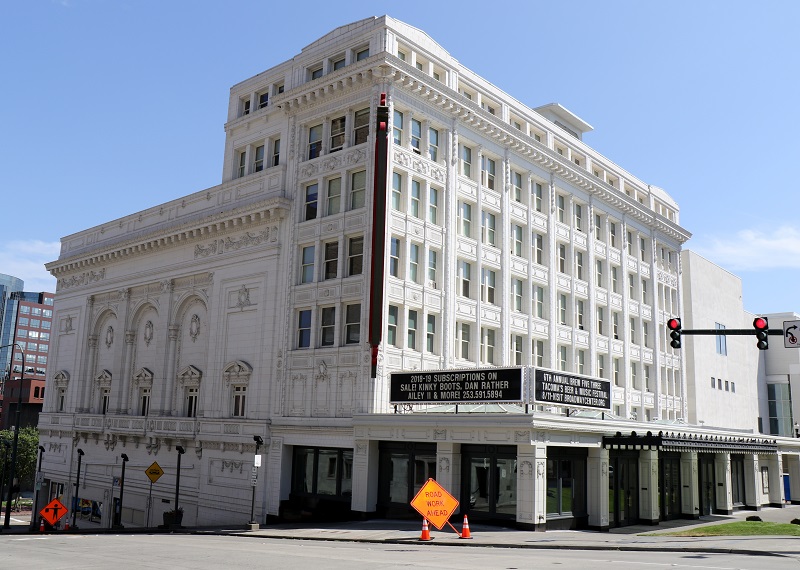
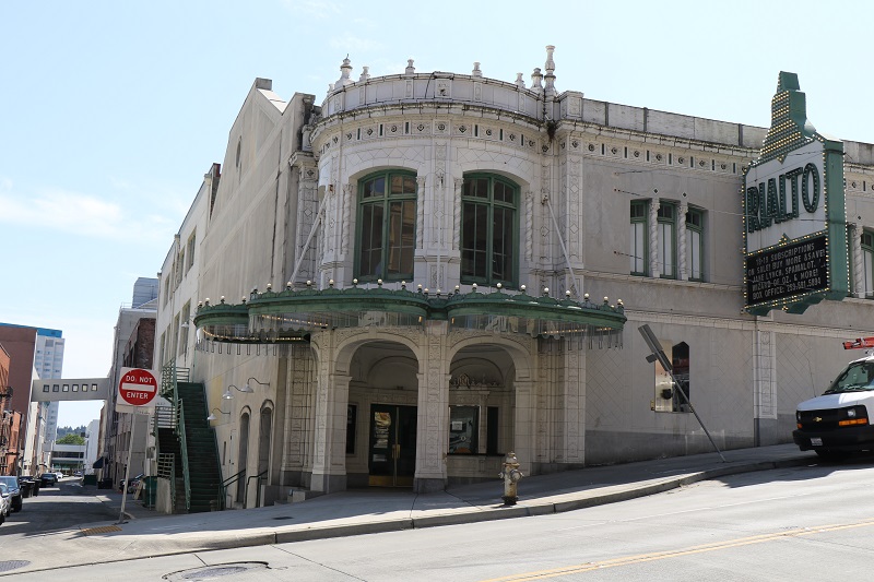
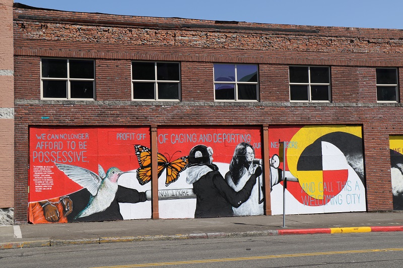
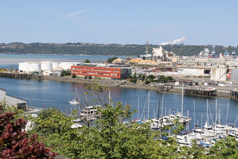
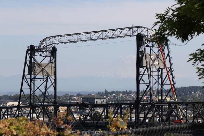
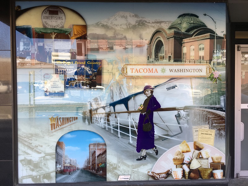
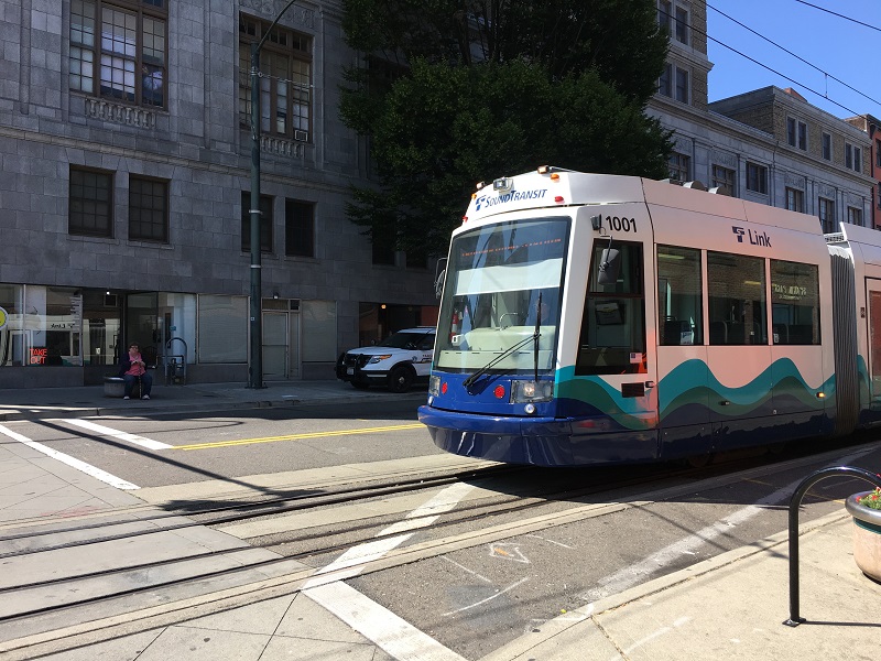
The Old City Hall with its 10-story clocktower and Italian Villa style is on Pacific Avenue and South 7th Street. Construction was completed in 1893, and it was used as city hall until 1957. The city paid $4 million for it in 2015, and is again looking for a developer to buy and renovate it – possibly into offices and conference rooms.I like the look of the Rialto Apartments building (1918). I’m sure the rent is 20-50% less than in Seattle. The Art Deco styled building behind it is the Tacoma Municipal Building, completed in 1931.The Pantages Theater on Broadway was built as a vaudeville theater (variety entertainment) in 1915, and now hosts musicals, live music & comedy.The Rialto Theatre right across the street from the Pantages is a movie theater built in 1918 to showcase movies. (It still shows movies).This artwork must be very new, calling out and criticizing the Trump Administration’s policy of separating kids from their parents at the border, and deporting ‘our neighbors’.This is the Thea Foss Waterway, a dead-end canal with marinas and waterfronts, coming out of Puget Sound.The Murray Morgan Bridge is a vertical-lift drawbridge over the waterway. Constructed in 1911 ( ! ), it was closed for repairs in 2007 – and finally reopened in 2013. (Psst! Look for Mt Rainier in the background).This Wells Fargo Bank window display on Pacific Ave of old Tacoma features a stylish passenger, and Mt Rainier in the background. The building with the green dome is that of Union Station, which opened in 1911.And here comes a streetcar. I think it’s the exact same model that we have in Seattle.
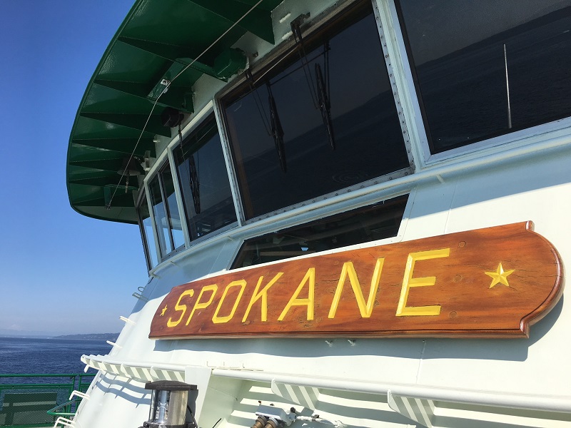
I hopped on the ferry on short notice this afternoon, to go out to my friend Paul’s in Hansville.
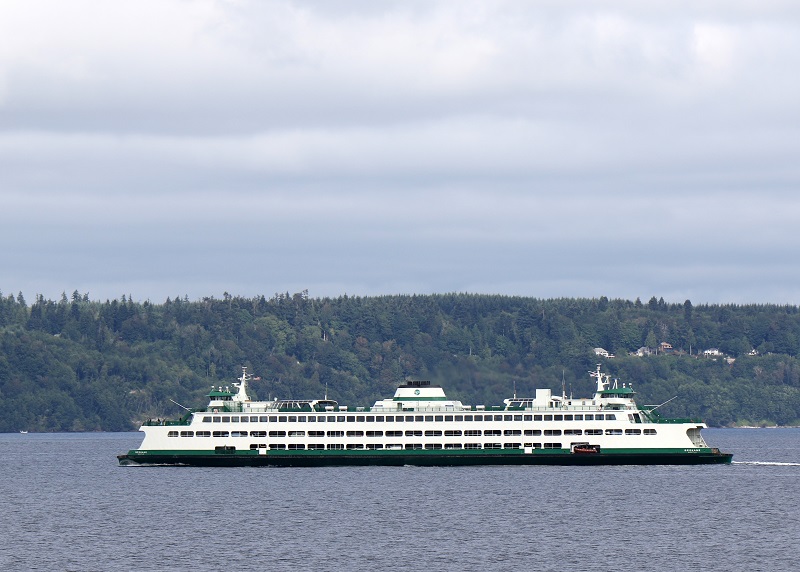
The Spokane is a Jumbo-class ferry. She was built in 1972 by the Todd Shipyards in Seattle, Washington, and refurbished in 1990.
Wed morning 7/18: A few more pictures, from my return trip to the city.
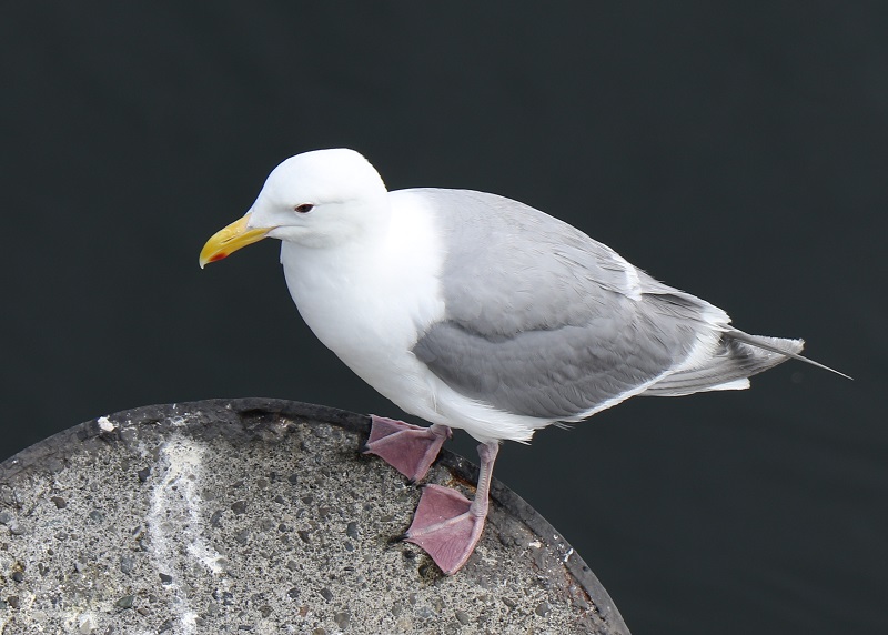
Mr Seagull* .. maybe his name is Nelson (from a South African song from the 70s ‘The Seagull’s Name was Nelson’). Seagulls have palmate (webbed) feet. Cormorants are even better equipped for paddling and diving, with totipalmate feet (four fully webbed toes). *Western Gull (Larus occidentalis).
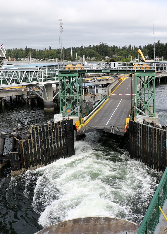
I’m on the Puyallup ferry, Wed. morning, and we’re just pushing away from the terminal at Kingston. The little skybridge on the left is for foot passengers.
A sighting of the Spokane ferry that I was on, on Tuesday, going out the the Kitsap Peninsula.
I had to Google Uruguay after their win over Portugal in the World Cup. Officially the ‘Oriental Republic of Uruguay’ (Spanish: República Oriental del Uruguay) – it is a remarkable country, slightly smaller than the state of Washington, with some 3.3 million people.
More than half the population live in the capital of Montevideo. Uruguay gets high marks for its ‘liberal social laws, and well-developed social security, health, and educational systems. It is one of the few countries in Latin America and the Caribbean where the entire population has access to clean water’ (from the CIA World Factbook).
The country gets 95% of its energy from renewable resources. (Washington State is at about 85% electricity generation from renewable resources, with 8% of electricity from burning natural gas, and 7% from burning coal).
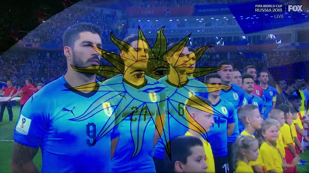
Uruguay’s team at the start of their match against Portugal. The screen changed to the May Sun from the national flag just as I snapped it. Uruguay has by far the smallest population of any country that has won a World Cup Final (although very long ago: in 1930 & in 1950).
The 7-day itinerary for the Norwegian Bliss’s Alaska cruise.
The Norwegian Bliss is brand new, and the biggest cruise ship to visit Seattle yet. (Royal Caribbean’s Symphony of the Seas is slightly bigger).
The Bliss’s passenger capacity is 4,004, crew of 1,716, cruise speed 23.2 knots from diesel electric engines, length is 1,094 ft (333.5 m) and maximum beam 136 ft (41.5 m).
She was constructed at Meyer Werft in Papenburg, Germany.
Picture posted in February by Helmut Weithauer on Google Maps, of the Norwegian Bliss at the facility at Meyer Werft in Papenburg, Germany. Looks like the supertube on the top deck still needs a little work, and the lifeboats still need to be installed into their slots on the lower deck. Could this vessel squeeze through the Panama Canal? Yes. On May 14, she became the largest passenger ship to date, to transit the Canal on the way to the Pacific Ocean.
Instagram picture of the Norwegian Bliss’s arrival in Seattle on Wednesday for her christening ceremony. (Lifeboats with orange tops are now in place).
This was the ship today, from the top of a staircase at Pier 66. The ship has a total of 16 decks (9 with staterooms). There was a high school prom scheduled for the space in front of me, and I could not get closer. The entertainment at the top deck includes a go-kart track, two water slider supertubes and a giant TV screen for movies.
We could get a front view of the ship from the by leaning out from the bar balcony at the Edgewater Hotel. We had to be patient – the scheduled departure of 4.30 pm was delayed by about an hour. A contingent of 48 passengers from Asia had arrived late into Seattle-Tacoma airport.
Here she comes! The humans on the nose deck waving at us, are little ants. The artwork on the hull is by Robert Wyland (56), an American artist known for his large outdoor murals featuring images of life-size whales. These are humpback whales, found in oceans and seas around the world, and also off the coast of Alaska.
The view from Pier 70. Norwegian Bliss is going to make her way out of Elliott Bay, out of Puget Sound, through the Strait of Juan de Fuca, and then sail due north, for a Monday morning arrival into Ketchikan, Alaska.
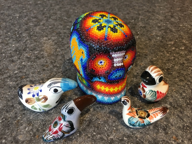
I had no problem getting an Uber driver at 3 am this morning. There is a new, designated spot in the Seattle airport’s parking garage, and Abdulqadir (my driver) showed up in his Toyota Prius in 7 minutes. As always, it was nice to unpack my little souvenirs from Mexico, from my bags today!
I bought the little Día de Muertos (Day of the Dead) beaded skull at the Plaza Machado (Mazatlán town square), and the porcelain mini-birds at Micheal’s gift shop.
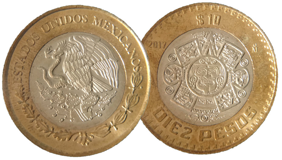
The front and back of a ten pesos coin. The front of the coin has the national shield and says ‘Estados Unidos Mexicanos’: the United States of Mexico. Mexico has 31 states, and then there is Mexico City which is in a special district or state – much like Washington DC in the United States. The back of the coin shows the sun stone from Aztec mythology, with the sun god Tonatiuh.
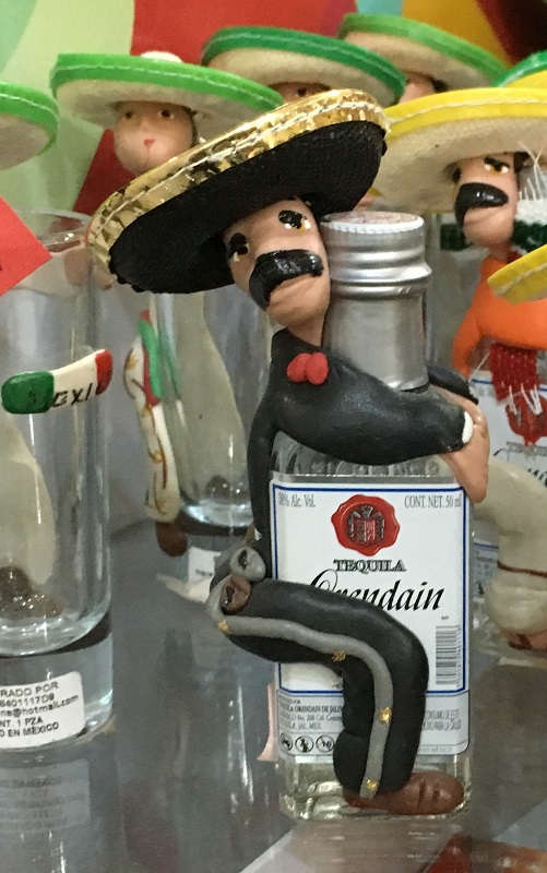
This charming little guy at the airport shop, is hugging Orendain tequila, made in Jalisco state. Orendain’s reposado is 100% agave and aged for up to a year in oak.
My wonderful time in Mazatlán came to an end today – alas! Off to the aeropuerto it was, at noon.
My layover is again at Los Angeles (LAX), and I will catch a red-eye flight out to Seattle in another 3 hours or so.
I will try to summon an Uber car in the wee hours of Thursday morning, to take me home. If I don’t succeed, I can always stay over in a cheapie Seattle airport hotel until later in the morning.
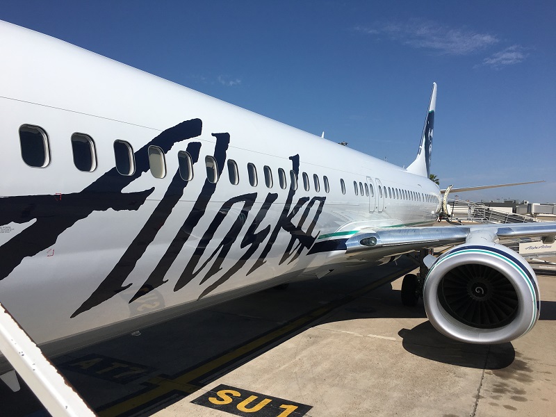
My boarding shot of the Alaska bird (Boeing 737-700) on the tarmac at Mazatlán airport, that took us to Los Angeles.
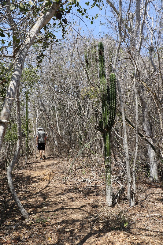
Estero del Yugo is an estuary in the far northern outskirts of the city of Mazatlán. There is a trail around it that we traversed today. The foliage around the estuary is dry this time of year, and the water level was low.
Even so, we spotted herons, ibises, pelicans and a beautiful pileated woodpecker with its red-crested head. A single deer across the water made an appearance as well, but we did not see it again, even after we had made it to the other side.
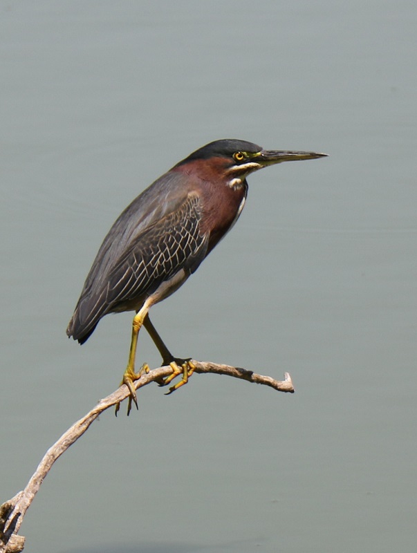
This is a green heron that we spotted today at the estuary – a small heron found in North America and Central America.
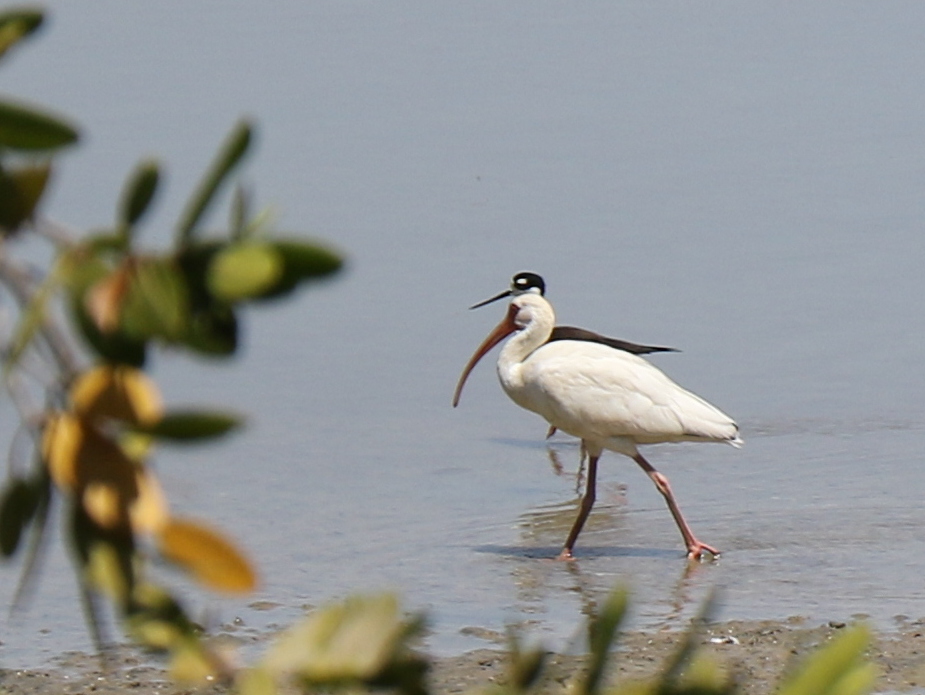
This is an American white ibis, found from Virginia via the Gulf Coast of the United States south through most of the coastal New World tropics. Behind the ibis is a black-necked stilt.
Here’s what a large part of the trail around the estuary looks like. That’s a young Mexican giant cardon (elephant cactus) on the right.
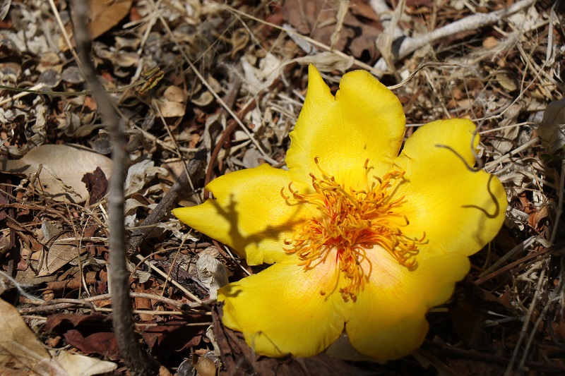
A beautiful tree flower that we found on the ground. It may be a from a tree called ‘palo cruz’, but I’m not sure.
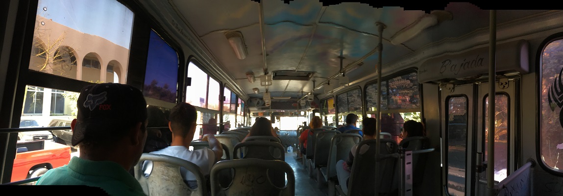
We took the bus today to Juarez in the north of the city of Mazatlan. It’s complicated for a visitor, since the bus stops are not marked with route numbers.
One has to look for the destination that’s written onto the bus (and even then the bus does not always go to the same place in that destination). A good thing I had a little help from my friends here!
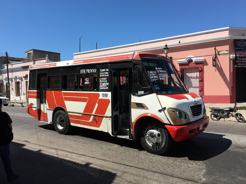
I took this picture a few days ago. This bus goes between Plaza Sendero and Central Mercado (the central market) and the ferry terminal.
Inside our bus today. The fare is 8.5 pesos (46 cents US). Some buses are fancier with airconditioning and nicer seating, and then the fare is 11 pesos (60 cents US).
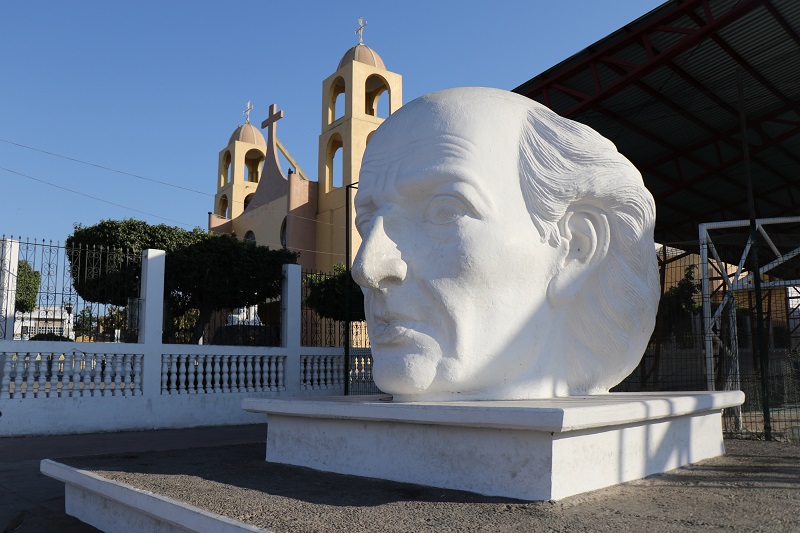
This church is in Juarez where the bus dropped us off. The giant head and face is that of Miguel Hidalgo (1753-1811), a Mexican Roman Catholic priest and a leader of the Mexican War of Independence (1810 -1821).
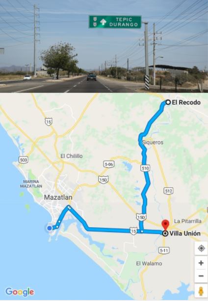
The drive to El Recodo is to the northwest is under two hours. Villa Union is just off Highway 15 on the way back.
On Sunday, we drove out to the town of El Recodo and made a stop at Villa Unión for lunch at a famous seafood restaurant.
We were very lucky to run into a tour guide in El Recodo to show us around. He also phoned ahead to the very popular restaurant in Villa Unión, which allowed us to get in almost right away.
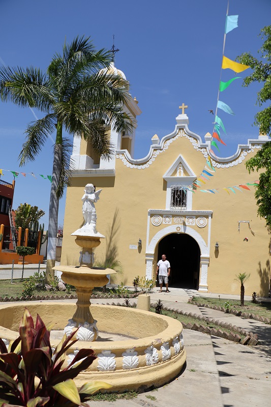
The church off the main street in El Recodo was built in 1855. The bell was made of all kinds of metal that were collected from residents. That’s Samuel, our impromptu tour guide of the church and the town at large. He seems to know everyone there!
This is a beautiful Mexican giant cardon or elephant cactus, native to the area.
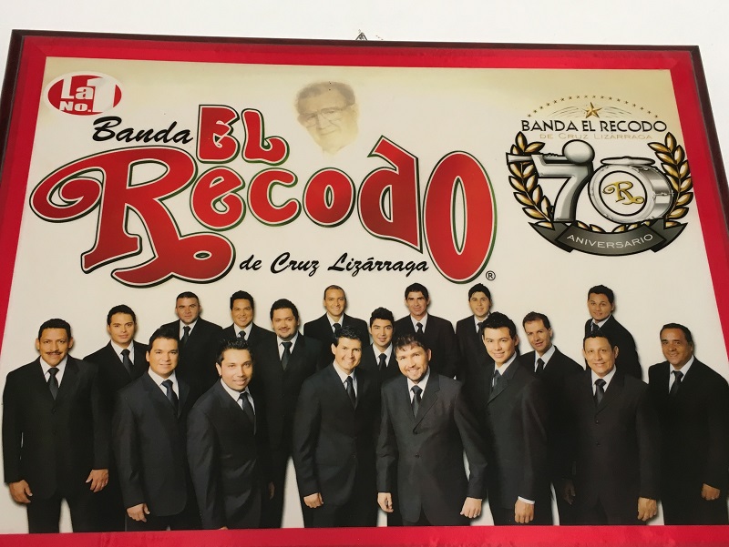
This picture is from inside a little museum dedicated to the famous ‘Banda El Recodo’ band and its founder Cruz Lizarraga (now deceased). It’s the centenary of Cruz’s birthday in 1918.
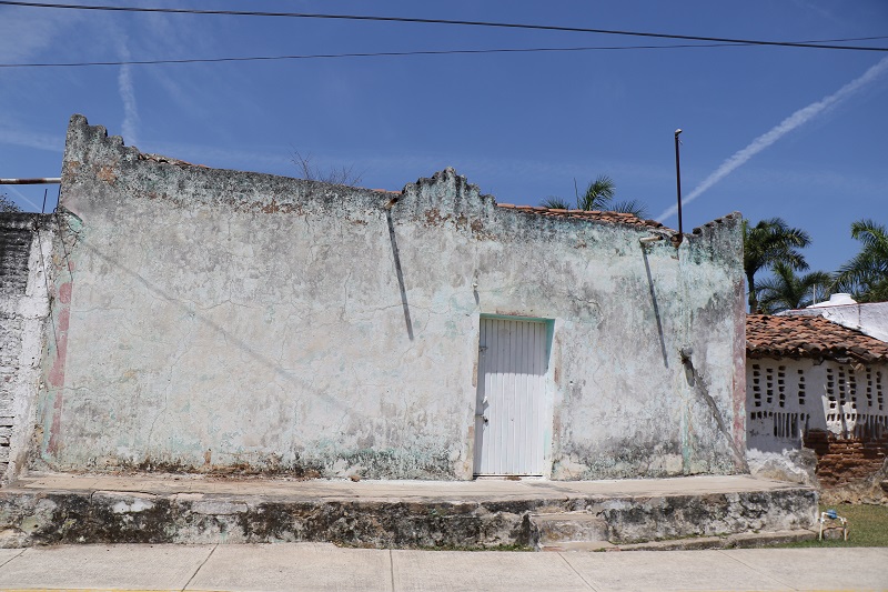
Just an old building with Spanish roof tiles that I liked very much -on a side street in El Recodo.
Here’s the Parroquia San Juan Bautista (Parish of San Juan Bautista) in Villa Unión, located on the main town square.
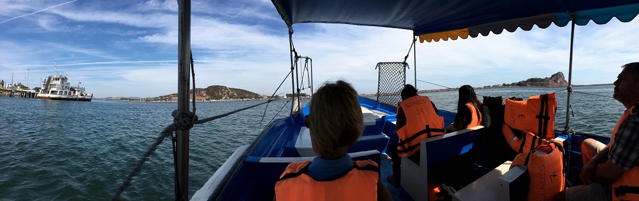
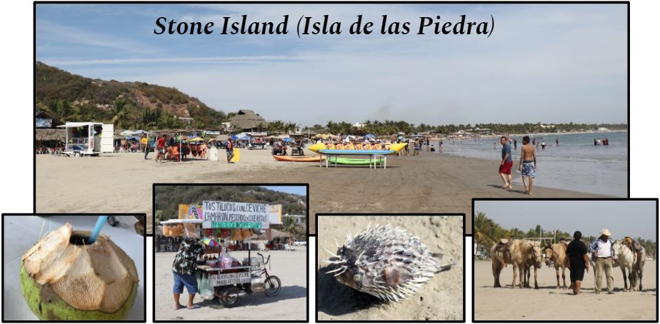
We went out to the beach at Stone Island today (look for Isla de la Piedra on Friday’s map). From where we are, we needed to cross the waterway north of the harbor to get there.
The boat ride across the waterway just north of the harbor to Stone Island takes just 5 minutes. 30 pesos ($1.62) are good for a trip there and back.
Main picture: Stone Island is technically not an island. It has a beautiful, tranquil beach that offers a lot of activities. Left to right: We had frozen cocos (‘Cocos Helados’) at Lety’s. These drinks are served in coconuts. Lots of vendors sell food and souvenirs on the beach. Don’t step on the pufferfish! (Not sure how it got on the beach. It might have been caught by a fisherman and thrown back). Horses and all-terrain vehicles are also available for rides right there on the beach.
We walked up the hill to the observation deck called El Mirador (‘The Lookout’) tonight for a beer at the new restaurant there, and for the great views of the harbor and the lighthouse called El Faro.
Clockwise from top left: El Mirador overlooks the Mazatlán harbor towards the south-west | artwork from a neighborhood wall nearby | one of three British cannons used to defend Mazatlán against invaders at Fort 31 in the late 1800s| the Baja Ferry on the left runs overnight across the Gulf of California to La Paz; deep sea fishing boats in the harbor; the hill with El Faro (‘The Lighthouse’) on top, is on the right
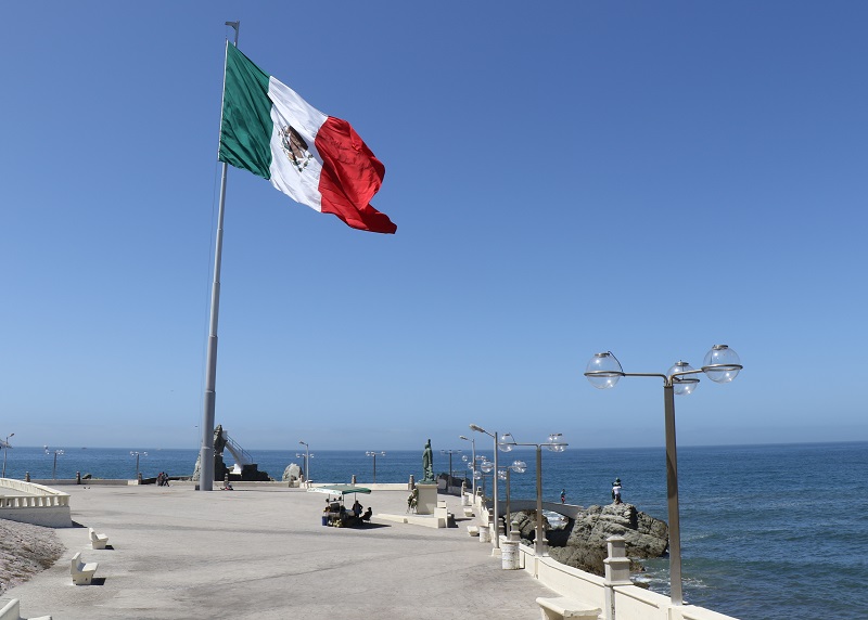
The Mazatlán Malecón is a 13-mi. (20 km) promenade that is lined with street vendors, shops and restaurants, and Pacific ocean views.
Viva Mexico! This enormous flagpole and Mexican flag is just south of the central Mazatlán district. It makes the humans down below look like ants. (The flag is not always up; today was President Benito Juárez’s birthday). The green umbrella below is part of a coconut stand. The Malecón was quiet today, but will fill up with people as soon as the weekend starts.
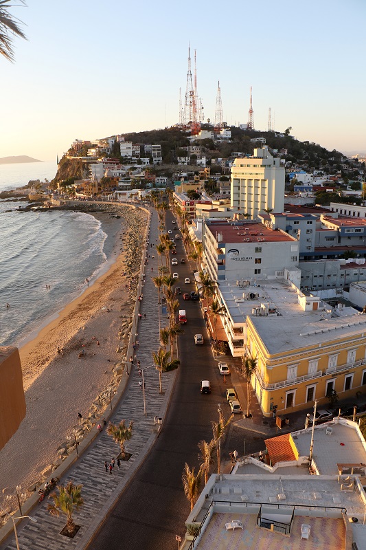
This is the view of the Malecón from the rooftop of the Hotel Posada Freeman where we had a beer at sunset, looking towards the north. The gray paving is brand new. The hill up ahead with the radio towers, is Icebox Hill, home to limestone caves once used to store ice imported from San Francisco during the mid-1800s. Mazatlán families used this ice to preserve their seafood and other perishables before the days of household refrigerators.
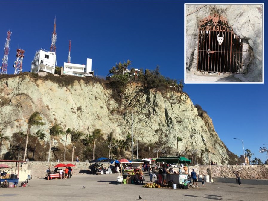
Here’s a view of Icebox Hill looking east from the Malecón. Inset: An entrance to the old limestone caves, now off limits to the public. ‘Cueva del Diablo’, Cave of the Devil, says the lettering.
I made it into Mazatlán on Monday. My Uber driver showed up in just a few minutes after I had summoned him, even though this was 3 am in the morning! (to make my frightfully early departure out of Seattle airport at 5 am).
I arrived in Mazatlán on a national holiday, Benito Juarez’s Birthday. Juárez was a national hero and president of Mexico (1858-1872).
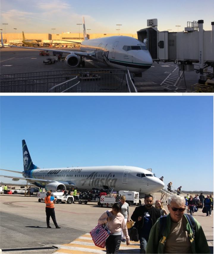
Top: Alaska Airlines, at the gate at LAX after our arrival at 7.30 am. Bottom: Shortly after our arrival at Mazatlan airport. The airport is really small – only one other jet was there at our arrival. There may be only as many as 4 or 5 jets on the gates at the airport at any one time.
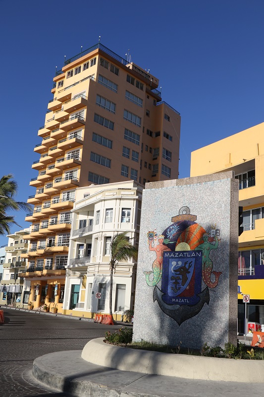
This is near the beach, on the edge of the historic old town center. The beautiful mosaic of the Mazatlán municipality is in the foreground. Mazatlán’s population is a little over 400,000 people.
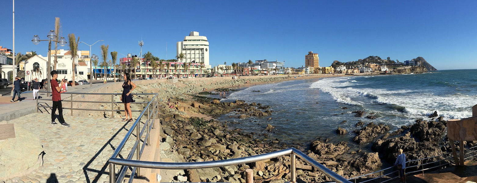
The beachfront across from the old town center. It has a beautiful new promenade and street. Late afternoon it fills up with joggers, tourists, and families hanging out, waiting for sunset to come before they disperse. This is a rocky stretch of beach, but there are plenty of sandy areas as well.