I went on a beer run today to track down some of my favorite German beer. (The grocery store was out of stock, and my own supplies were running dangerously low).
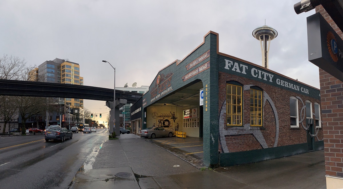
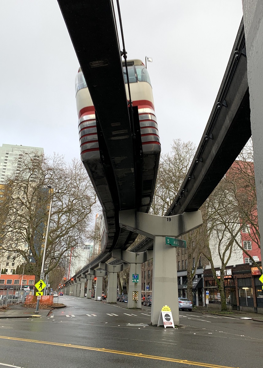
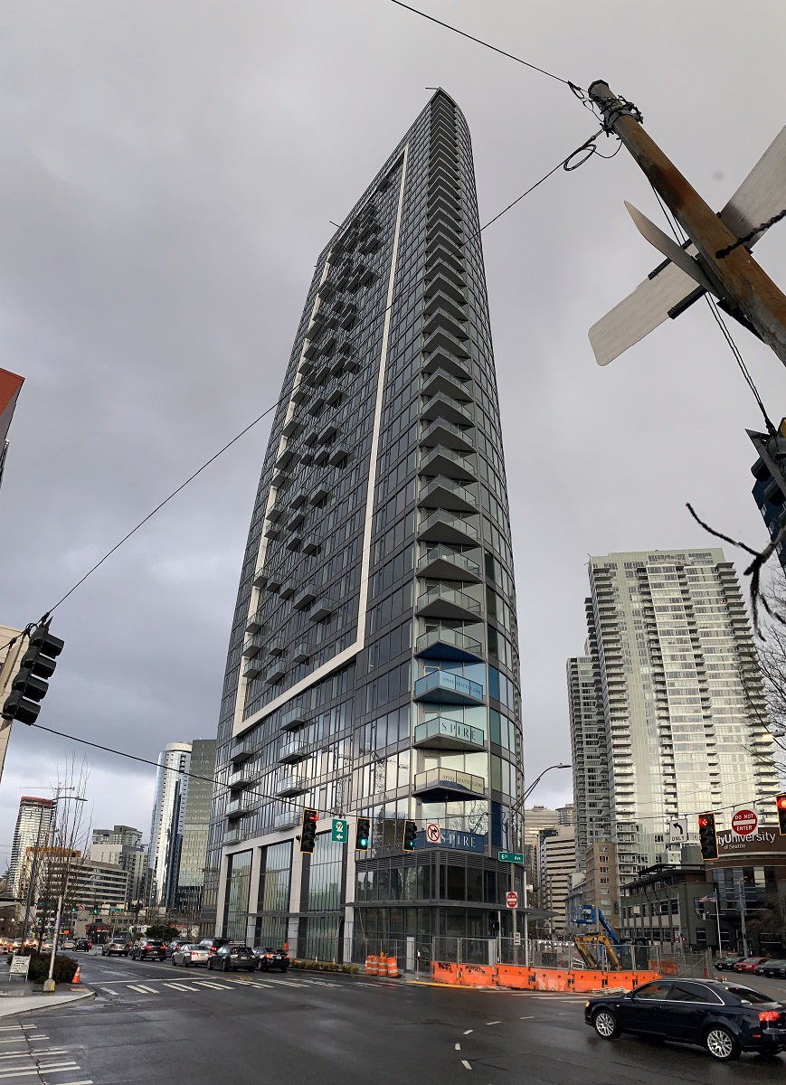
On the way back there was a break in the rain, and so I stopped at Denny Way and 5th Avenue to take a few pictures.
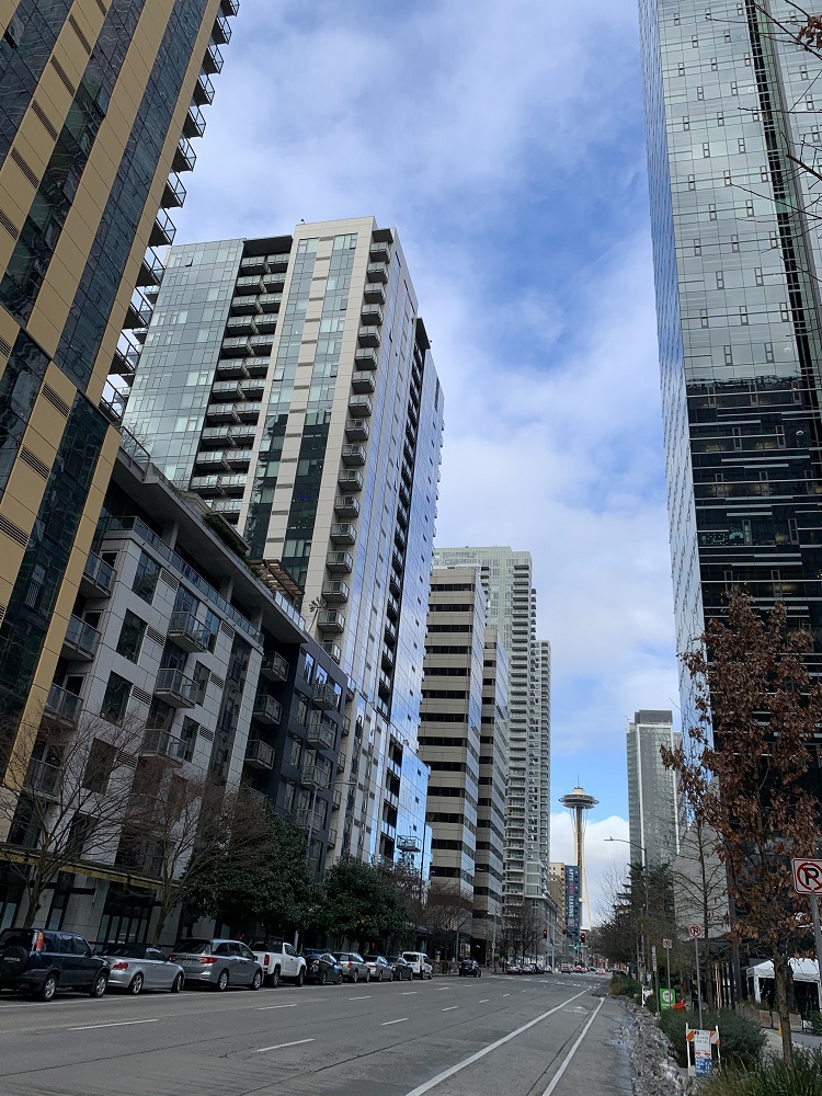
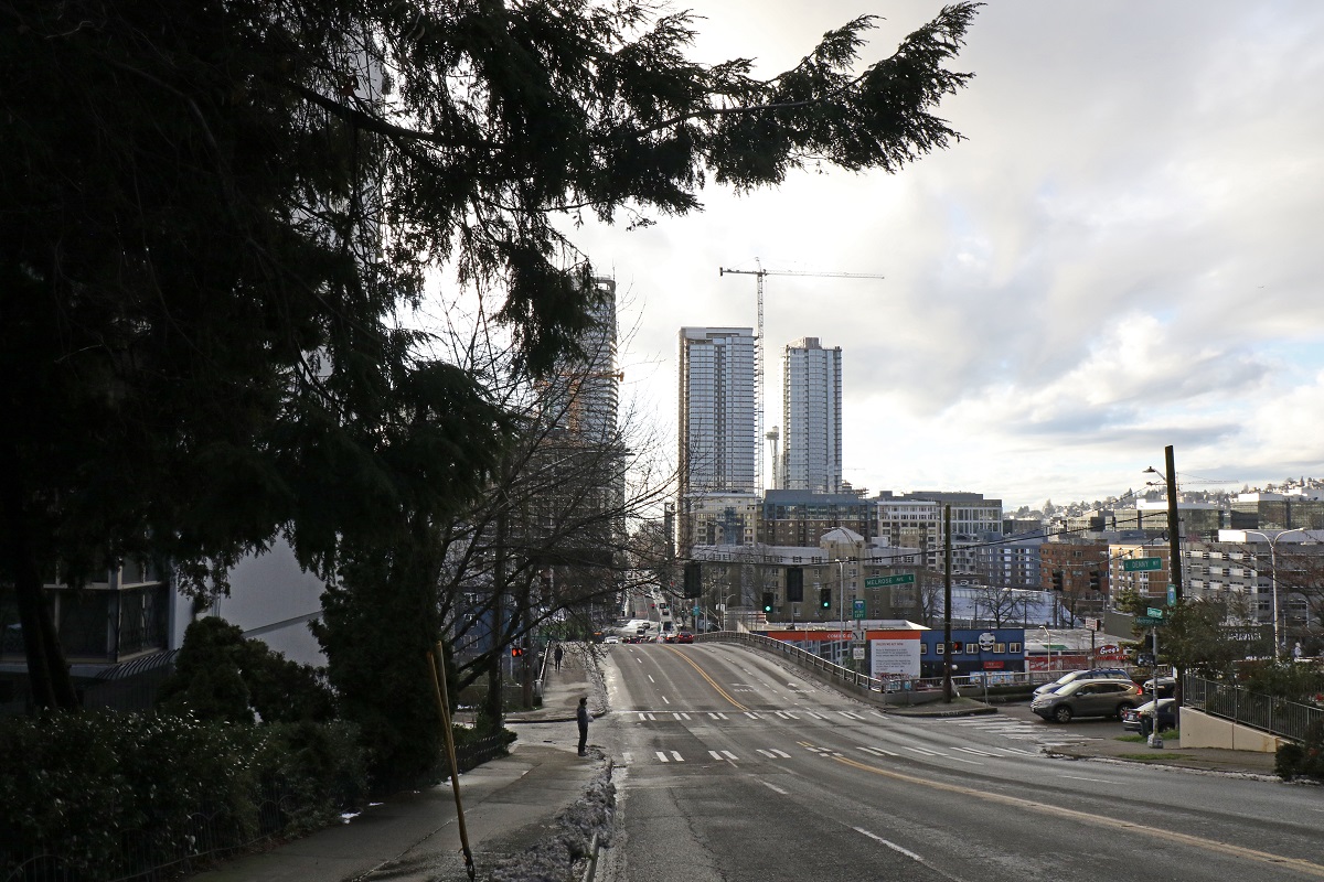
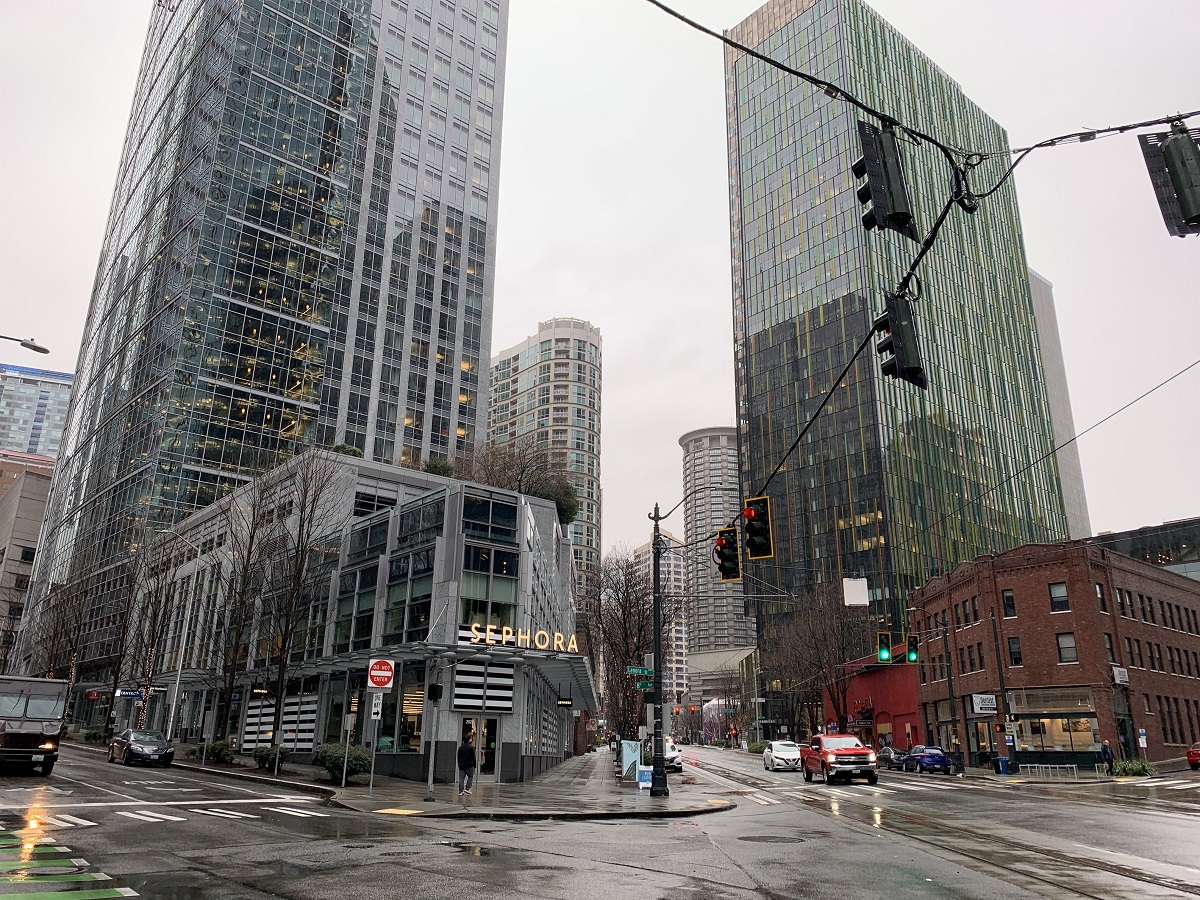
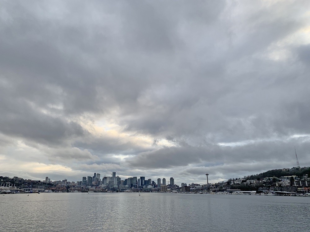
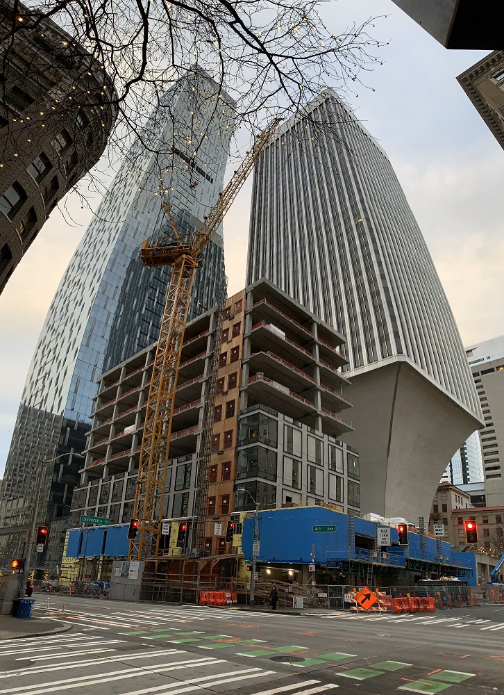
Nice to see that Fat City, the ‘German car clinic’ is still there, at Denny Way and 5th Avenue. (They’ve been there since 1972). The Space Needle is not far away (on the right).There goes the Seattle Center Monorail train, doing its 0.9 mile run from the Space Needle, and running along 5th Ave to Westlake Center in downtown.The new Seattle Spirecondominiums on Denny Way, officially at 600 Wall Street, has 41 storeys. (The building does not taper to the top; the vertical lines are just bent by the wide-angle panorama shot). The two light gray towers on the left are those of the Insignia Towers condominiums (also 41 storeys), completed in 2016.Here’s a little skyline of Amazon’s buildings, seen from the corner of Battery St & 6th Ave. The big square building with the ‘key slot’ in the middle is Amazon Nitro North, the black one in the back, to its right, Amazon re: Invent, and the tall rectangular towers on the right are Amazon Day 1 and Amazon Doppler behind it. There’s a whole lot of Amazon buildings downtown, and I don’t know the ones in the middle, such as that light blue one. I will have to find out, so that I can annotate my picture. The blue Porsche is a 911, I think. (I’m no Porsche expert).
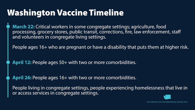
Washington State has published new dates and target groups that qualify for getting the vaccine. I’m not making the cut, yet.
President Biden has promised that there will be enough vaccine doses for all Americans by the end of May*. It takes a lot of logistics to get that vaccine injected into people, of course.
*For example, Merck and Johnson & Johnson will collaborate to ramp up vaccine production, with the help of the federal government.
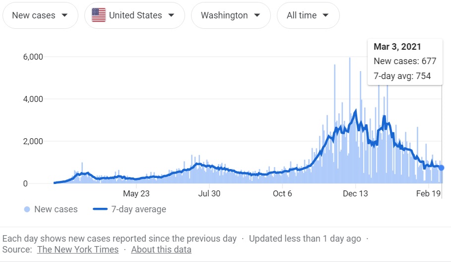
Descriptions of the groups that qualify next for the vaccine. I’m not sure how if or how it will be verified that a person has two or more comorbidities.And here is Washington State’s timeline for Covid-19 cases. We’re down to about 1/3 of the highs in December, but still double where we were in September of last year. The state has now crossed the 5,000 mark as far as recorded Covid-19 fatalities. A little bit of good news: so far, this is the mildest flu season in the 25 years that records have been kept. Of course, it kind of should be: people are wearing masks and not congregating in large numbers.
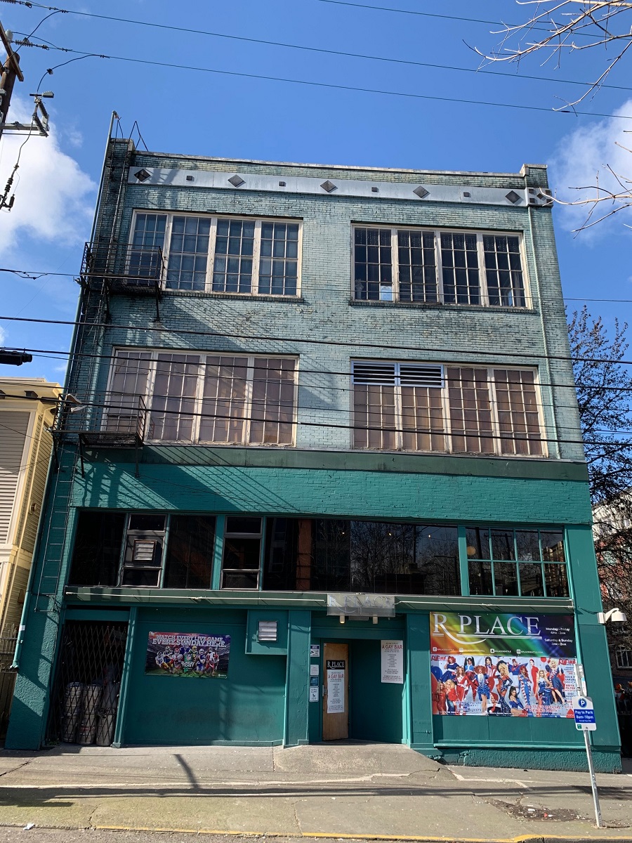
I saw only today (it had been announced in early February), that the gay bar called R Place will not be able to renew its lease at its 619 East Pine Street location, after 35 years there. Apparently it’s not due to the pandemic. The owner of the Pine Street building had died and the estate did not renew R Place’s lease.
The managers of R Place vowed to find a new location, but the loss of the four floors at the Pine Street location is a very big one for the LGBTQ community.
It feels similar to the loss of the beloved CC Seattle complex’s entertainment venue and bars, at the corner of Madison & 15th Avenue. (This was in Sept. 2010, to make way for the office building called the Bullitt Center).
The R Place location at 619 East Pine St. I took this picture a year ago, in Feb. 2020. The building dates back to Capitol Hill’s auto row and is believed to have been a Ford Model T showroom, complete with a car elevator, the remnants of which can still be seen inside the four-story structure. The building must date back to say, 1911, or a little later. At that time, 31 of the city’s 41 car dealers were located on either East Pike Street or Broadway, joined by dozens of businesses catering to an entirely new class of consumers: motorists. [Information from ‘Pike/ Pine Auto Row’ by John Caldbick at https://www.historylink.org/]
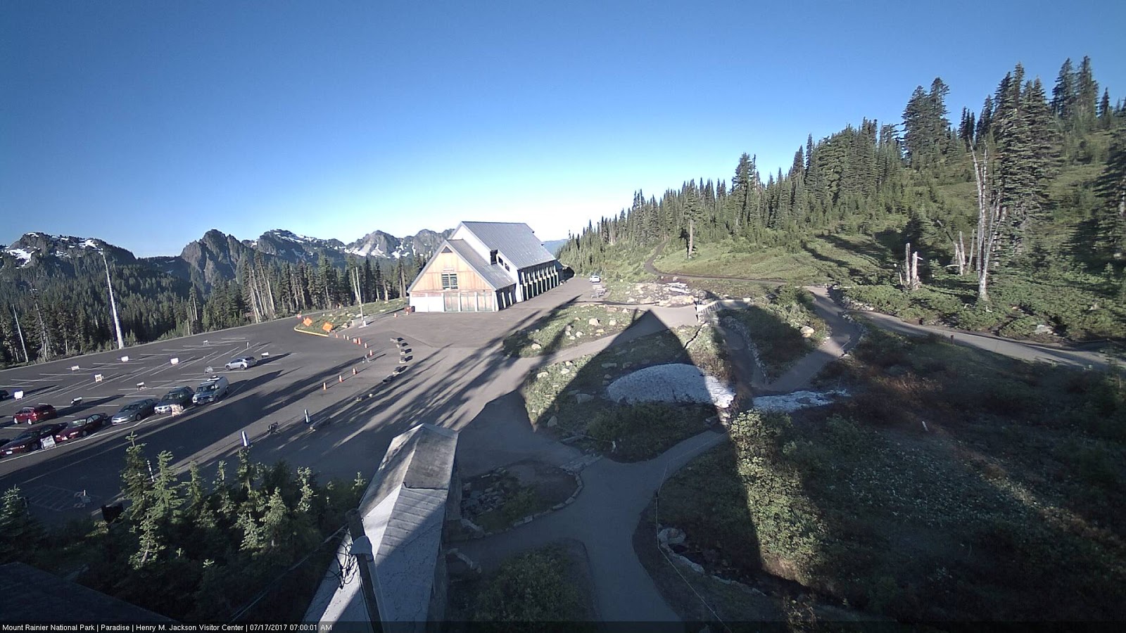
There is a lot of snow on the slopes of Washington State’s mountains this year, in some places already 10% above normal.
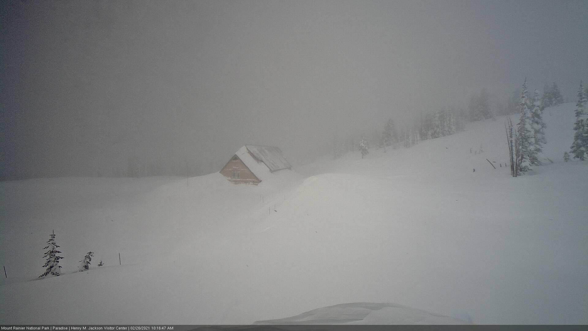
These pictures of the Paradise visitor center at Mt Rainier were posted on the Twitter account from the National Weather Service (Seattle) @NWSSeattle.
JULY This picture is dated Jul 17, 2017. It’s high summer, but late in the day with the long shadows, which is probably why there are not many cars in the parking lot.FEBRUARY This snapshot was recorded this morning, Feb 26, 2021. The US Dept. of Agriculture snow telemetry report says there is 16 feet (4.9 m) of snow on the ground there as of today, and that the air temp. has averaged 25°F (-4°C) the last few days.
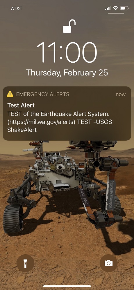
My phone got the test alert this morning. I expected it, but the sound still startled me.
On Sunday, it will be 20 years since the magnitude 6.8 Nisqually earthquake that occurred here in the Puget Sound basin, on Feb. 28, 2001.
We’re soon getting a smartphone ‘shake alert’ system that will produce as much as a 30-sec. heads-up, that earthquake tremors are on the way (see diagram below). Thirty seconds or less — so this is not the time to panic and freeze.
My plan is to duck under my dining room table — or to run into the smallest room (the guest bathroom). The upstairs bathroom would be the plan for the second floor.
And if you’re driving?
US Geological Survey (USGS) recommends :
– Move your car as far out of traffic as possible.
– Do not stop on/ under a bridge or overpass or under trees, light posts, power lines, or signs.
– Stay inside your car until the shaking stops.
– When you resume driving, watch for breaks in the pavement, fallen rocks, and bumps in the road at bridge approaches.
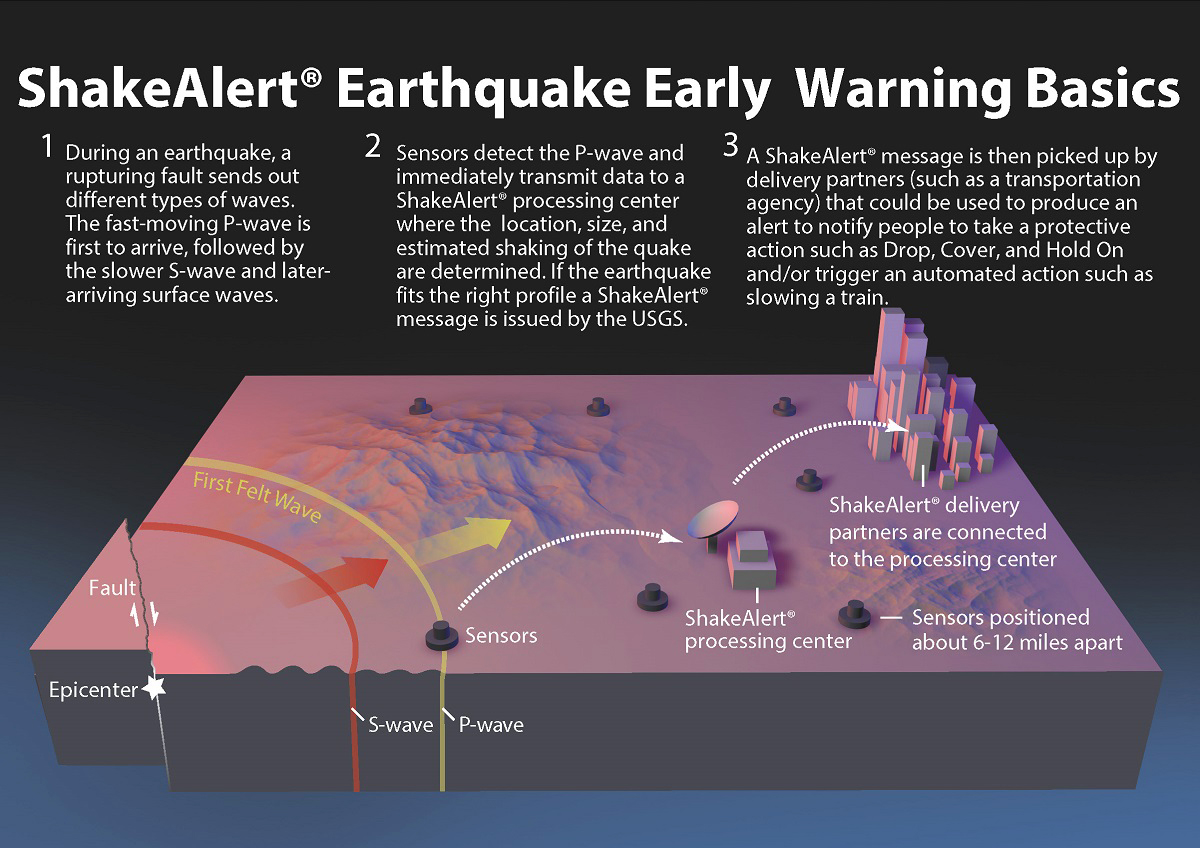
Earthquake early warning systems like ShakeAlert® work because an alert can be transmitted almost instantaneously, whereas the shaking waves from the earthquake travel through the shallow layers of Earth at speeds of one to a few km/ sec (0.5 to 3 mi/ sec). When an earthquake occurs, both compressional (P) waves and transverse (S) waves radiate outward from the epicenter. The P wave, which travels fastest, trips sensors placed in the landscape, transmitting data to a ShakeAlert® processing center where the location, size, and estimated shaking of the earthquake are determined. If the earthquake fits the right profile a ShakeAlert® message is issued by the USGS. The message is picked up by ShakeAlert® partners (cell phone service providers) which could be used to produce an alert to notify people to take a protective action such as Drop, Cover, and Hold On and/or trigger an automated action. [Image created by Erin Burkett (USGS) and Jeff Goertzen (Orange County Register) and updated by Robert de Groot (USGS)].
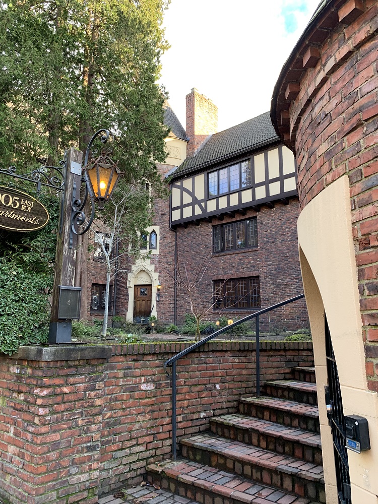
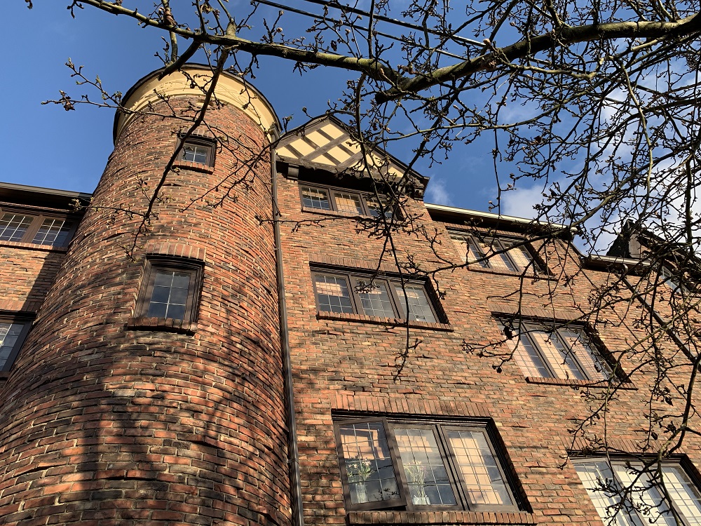
Here’s the apartment building called 1005 East Roy, here on Capitol Hill.
It was designed by Fred Anhalt (1896-1996), officially a developer and never an ‘architect’. Anhalt moved to Seattle from the Midwest in the early 1920s.
This apartment building was completed in 1930 (one of about 40 by him), and the first one in Seattle to feature an underground parking garage.
One of the ground floor residents has two Sphynx cats (the hairless ones). They sit in the window and check you out as you walk by.
1005 East Roy has 25 unique apartments. Apartments.com lists an open one at $2,995 p.m. for 2 beds, 1 bath, 1,195 sq ft (yes, that’s expensive, on a par with similar-sized brand new apartments in the city).A view of the building from 10th Avenue. Anhalt’s buildings have been referred to as ‘Castles in Seattle’. They incorporate Tudor and Norman elements, such as turrets, stained-glass windows, and spiral staircases.
It was back to the dentist for me this morning, to have him replace a filling in one of my teeth (n.o.t. fun).
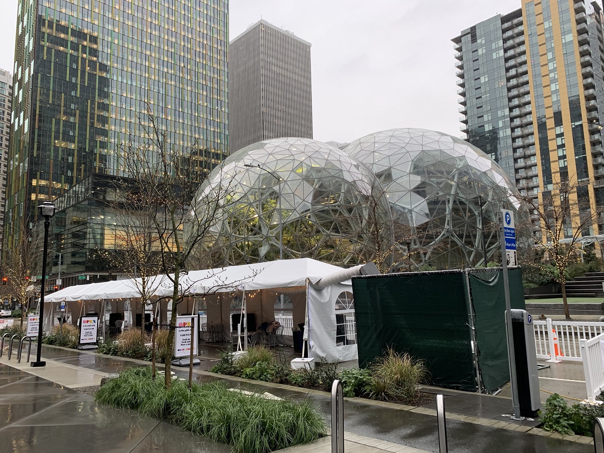
It’s still very quiet downtown, and I just parked on the street close the Amazon biospheres — only $1 for two hours.
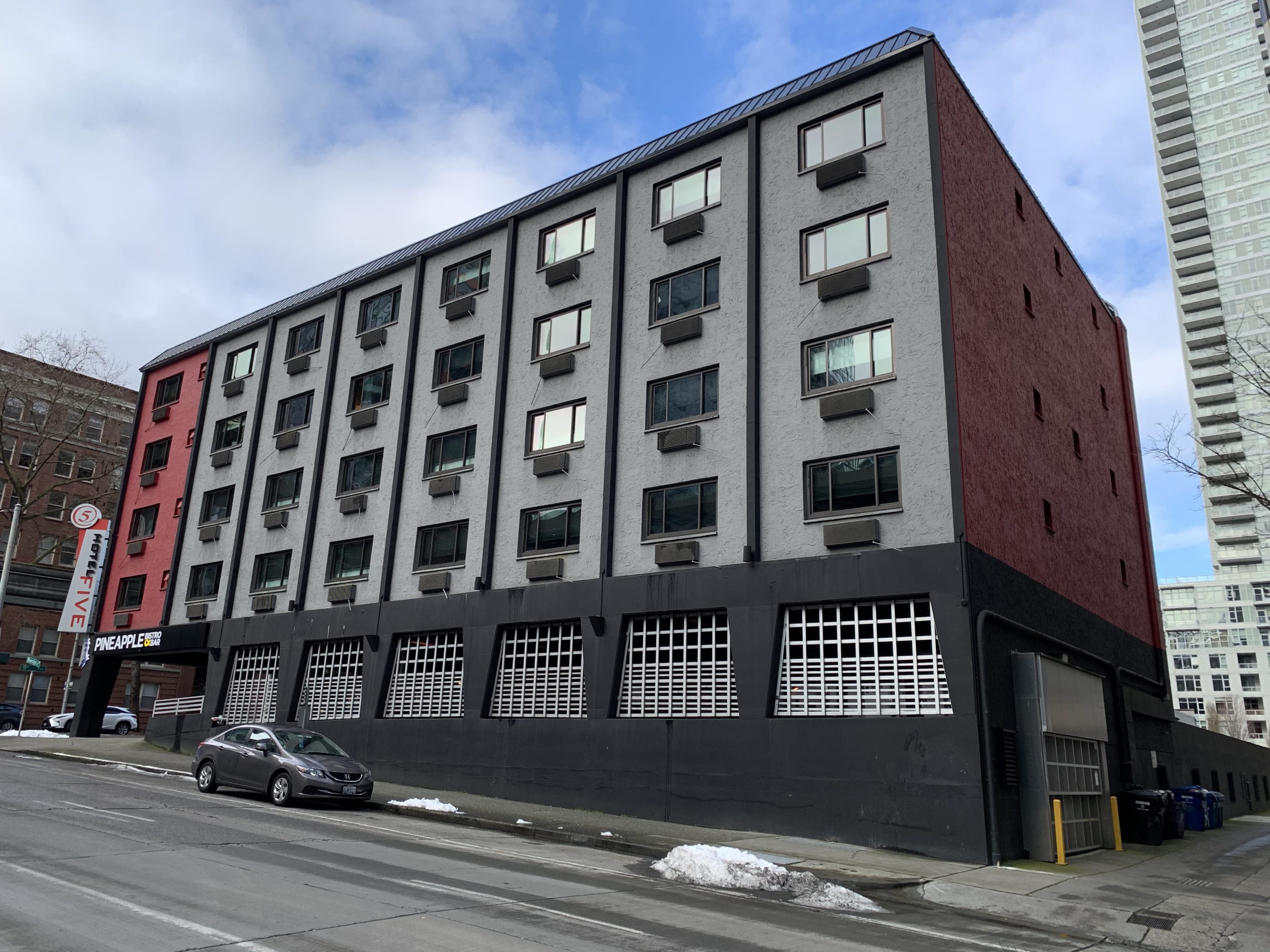
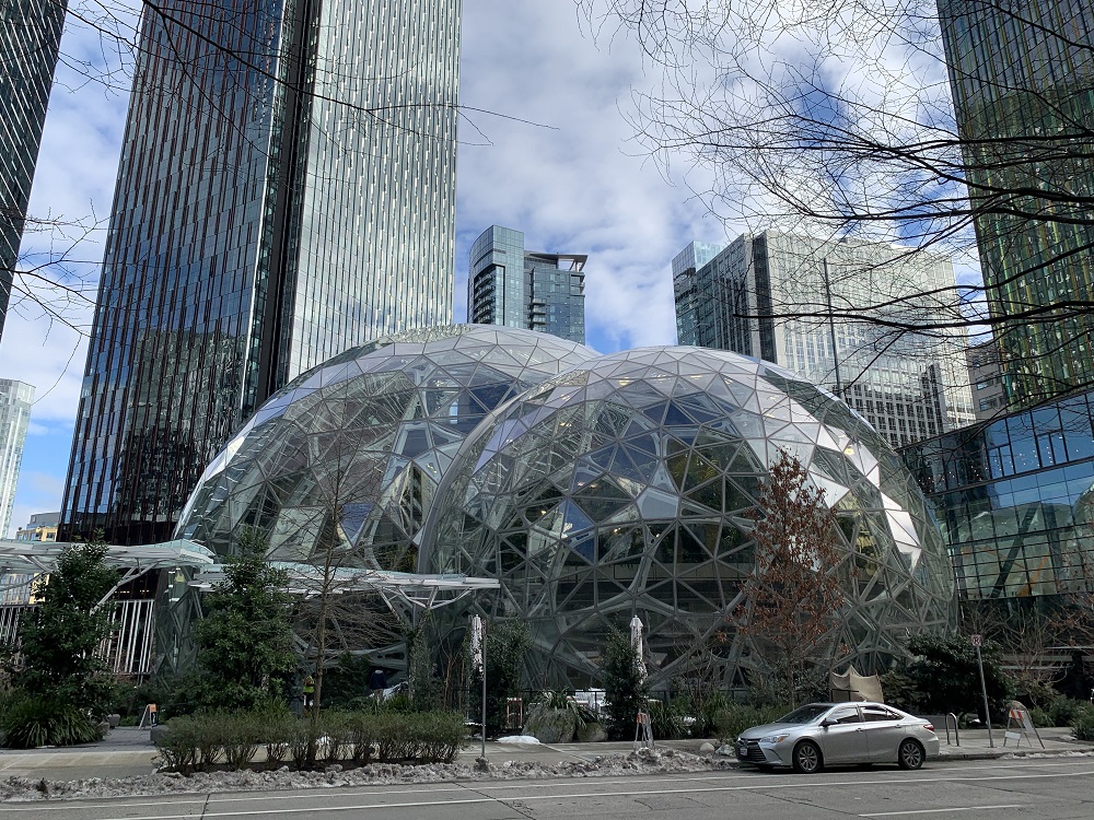
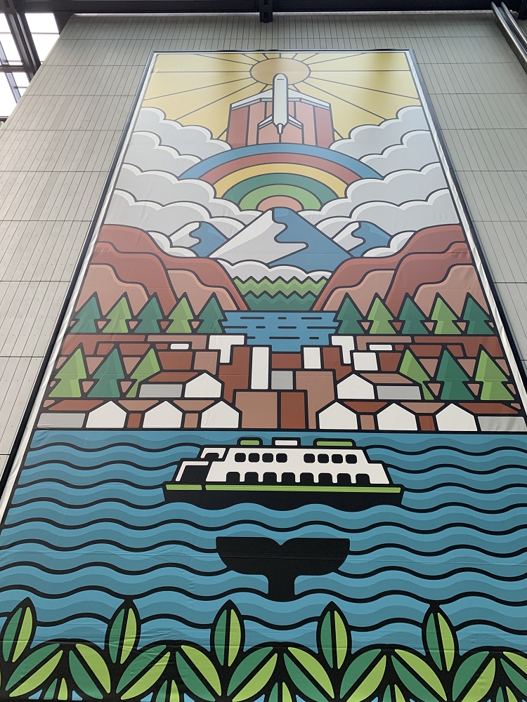
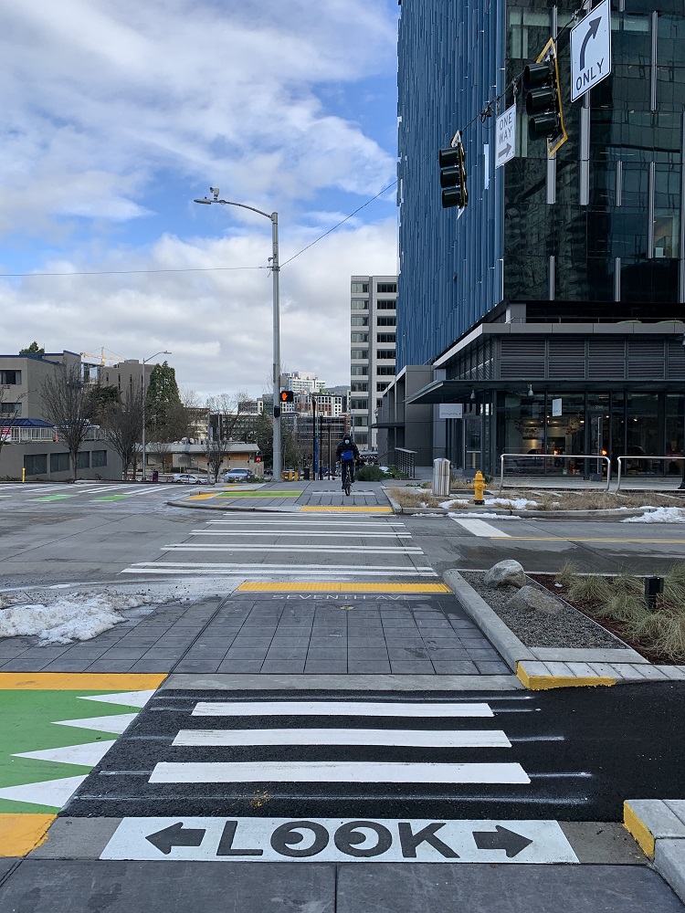
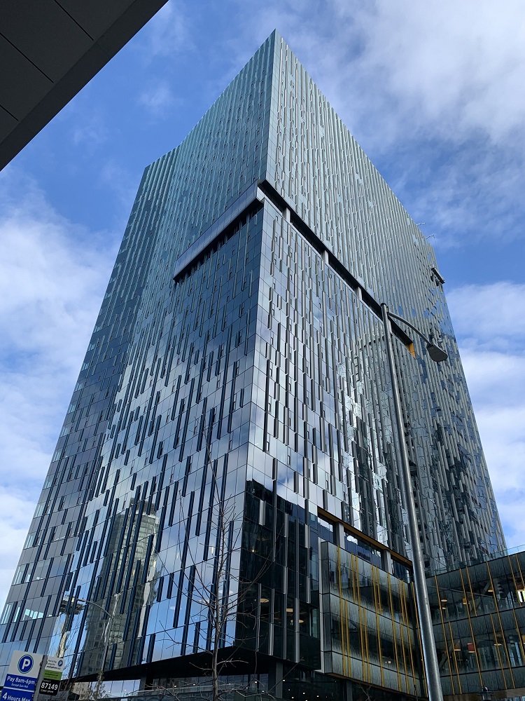
The cute Hotel 5 on 5th Avenue used to be an office building.The biospheres seen from 6th Avenue. I’m sure the greenery inside are flourishing in its controlled climate. On the very left edge of the picture is the Amazon Day 1 building, and on the left is the new Amazon re: Invent office tower. In the distance behind the spheres is the Cirrus apartment tower.I like the giant artwork displayed in the public walkway inside the Day 1 building. I did not get the name of the artist.Looking northwest along 6th Avenue, towards the Space Needle in the distance.This is the corner of 7th Ave & Bell St. A little bit of the new Amazon Nitro North building is visible towards the top right. Good to have that LOOK left and right sign for the new bicycle lane. (Look everywhere, for that matter. That cyclist straight ahead was heading towards me).The new 24-storey Amazon tower called Nitro North. The walkway at the bottom right goes to Nitro South (8 storeys). Hey, should have named them Nitro and Glycerin instead, joked someone on a discussion forum.
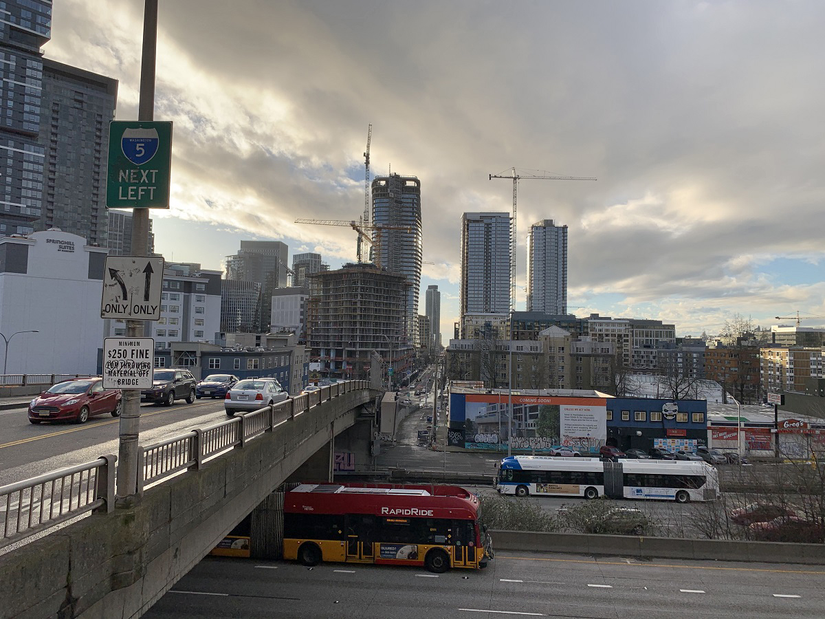
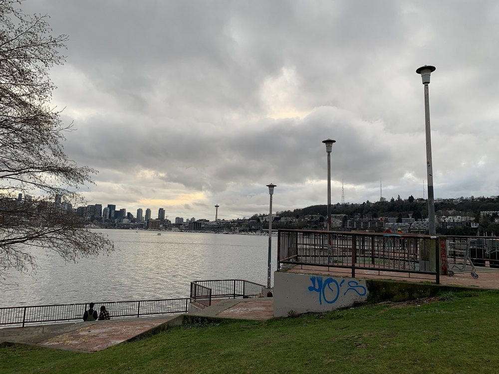
It was dry and warm enough (49 °F/ 9°C) this afternoon, for a nice walk down to Denny Way, to take my customary pictures from the Interstate 5 overpass.
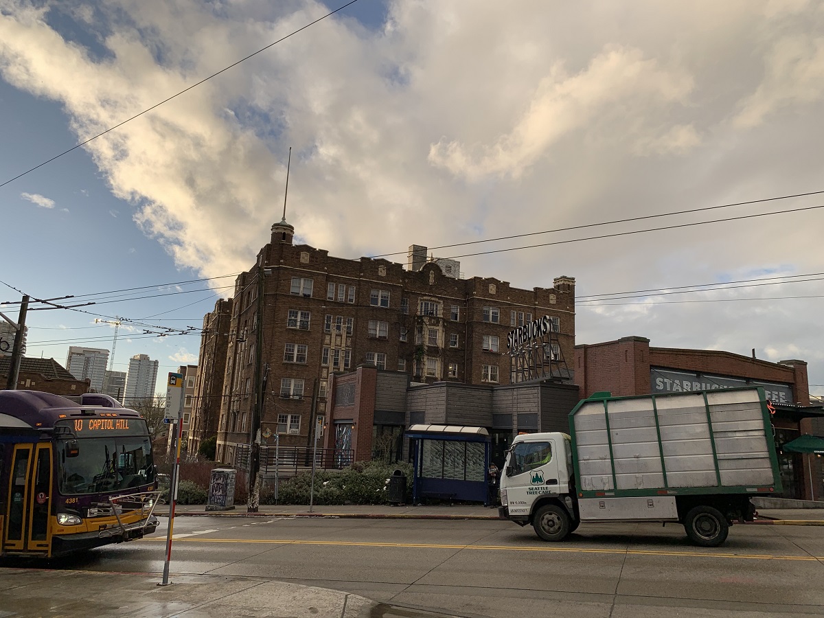
Looking west along the Denny Way overpass. The 1200 Stewart St apartment tower in front, just left of Denny Way, still has some 30 floors to go (of the 45). Behind it, the 2014 Fairview Ave apartment tower seems to be complete (42 floors). The twin towers (on the right) of the 1120 Denny Way apartments have topped out, and are just about complete on the outside. (Will these apartment towers be filled with work-from-home renters, that never go to a corporate office?) The blue & white bus is the Community Transit bus from Snohomish county to the north, and the red & yellow one is a Rapid Ride bus from King County.Now I’m walking up, east, along Denny Way. There’s the Space Needle between the two apartment towers of 1120 Denny Way. The No 8 bus is approaching, just barely visible in the distance. Normally I would hop on, but not today — and not for a while. No public transport for me, for now.Approaching the Denny Way & Olive Way intersection. No 8 bus turning onto Denny Way. A little snow on the sidewalk, still. The blue sky is a welcome sight.Here’s the Broadway & John St intersection with the new apartments at the Capitol Hill light rail station. Hey, I see ‘Oranje Blanje Blou’ I thought: Orange, white and blue, the colors of the old South African flag (in use from 1928 to 1994).Here is the No 10 bus on Olive Way. Starbucks is open, but sadly quiet. It would normally be packed with people just camping out there for the day, until it closed at midnight. Behind Starbucks is the 1924 Biltmore apartments.
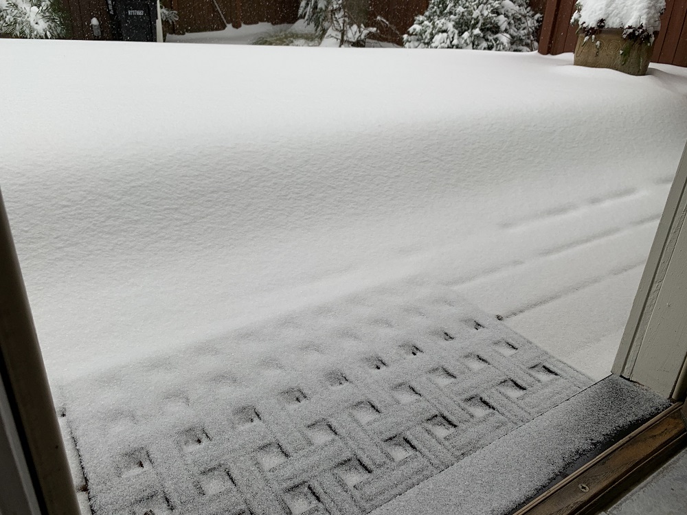
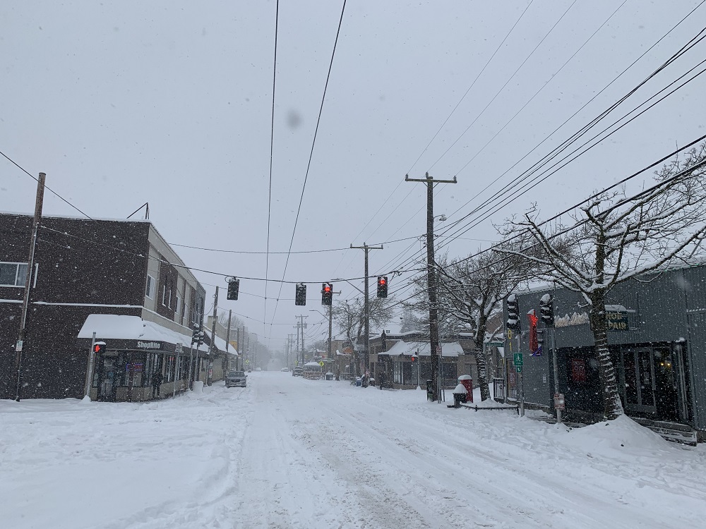
There was more snow this morning, and into early afternoon (maybe an inch), but that was it.
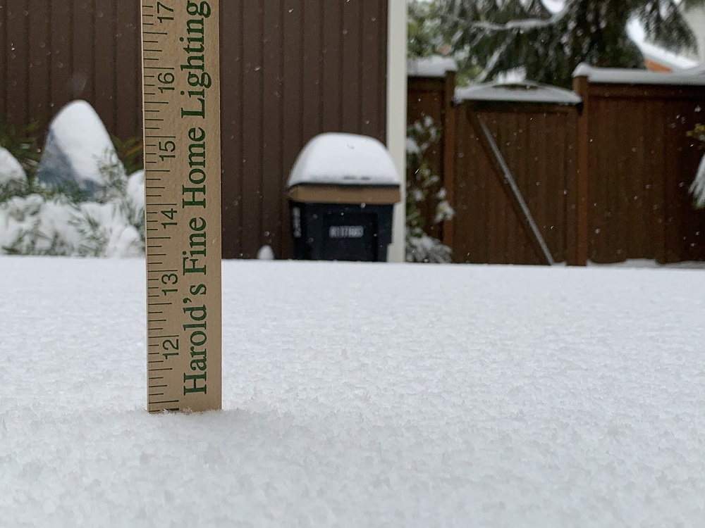
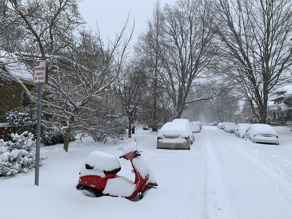
The official tally for the city, for Saturday, is 8.9 in.
Temperatures will now stay above freezing, even tonight, and slowly rise every day. The snow on the ground has already started to melt.
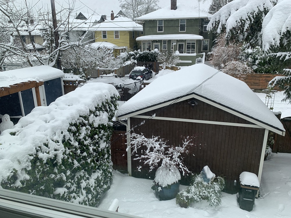
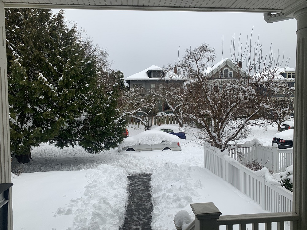
Sunday, 1.20 pm. Still a little snow sifting down. Look for the snowman in the picture. My neighbors across the back alley cleared the snow around, and from their little blue car. Mine is still kind of stuck in the garage, with a lot of snow outside. That’s my out-of-use phone landline to the house, across the garage. For a brief time, it touched the thick blanket of snow on the roof.Sunday, 4.15 pm. I had just run out with my regular-issue shovel (got to get a snow shovel, those wide plastic ones), to clear the walkway to my house, and the sidewalk in front of the house (not visible in the picture), as best I could. Not that I expect any visitors! .. but now the mailman can put junk mail in my mailbox, and Amazon can drop packages on my porch.
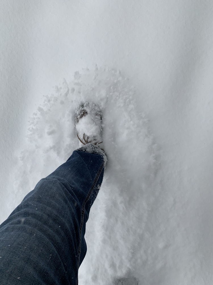
Hellooo .. snow, and lots of it, by my back door on the deck. We almost never get this much snow in the city.Let’s see how much we have (this is Sat. 2 pm): 11 in., just about. This does include the little bit of snow from Thursday which was no more than 1 inch. So we’re well over the 4-8 inches that Seattle was projected to get, and we may very well end up with a foot of snow in the city. That would be a top three value recorded, ever. There were 10″ and 20″ events on two separate days in Jan. 1950, and 14.9″ on Jan. 27, 1969. However, these are dwarfed by the legendary Big Snow of Jan. 1880, which lasted a whole week, and had snowfall that measured several feet (there is no official record of the exact amount).The snow is soft and powdery. The footwear I have on here, is woefully inadequate. Help! I need snow shoes, or Wellington boots!This is 16th Avenue at 10 am this morning.15th Avenue (at 10 am) looked a little more solid, just because a few more intrepid drivers negotiated it this morning. The city does not have many snow plows, but hopefully they will get to the arterials such as 15th Ave. at some point.
I went to the dentist this morning. At 7.30 am on a Monday morning, there was virtually no traffic on the way in. That explains why local TV stations are still not bothering with providing traffic updates like they used to.
After my appointment, I walked around Westlake Avenue, to take a few pictures of the deserted street blocks and offices and store fronts.
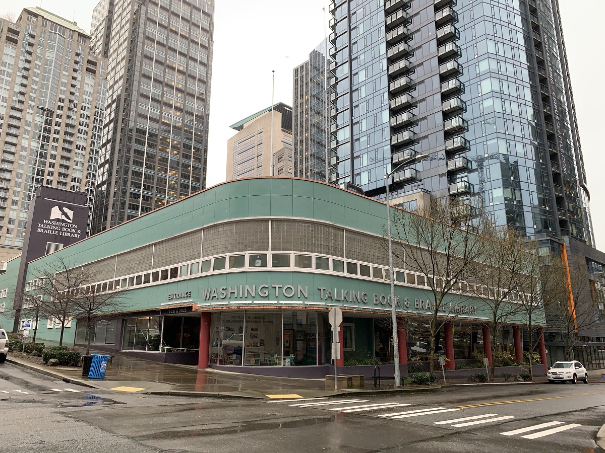
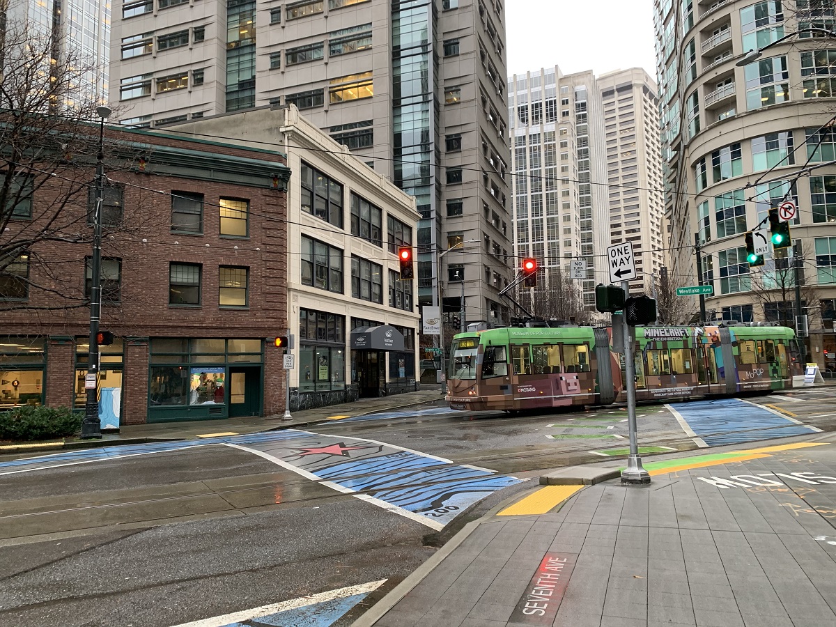
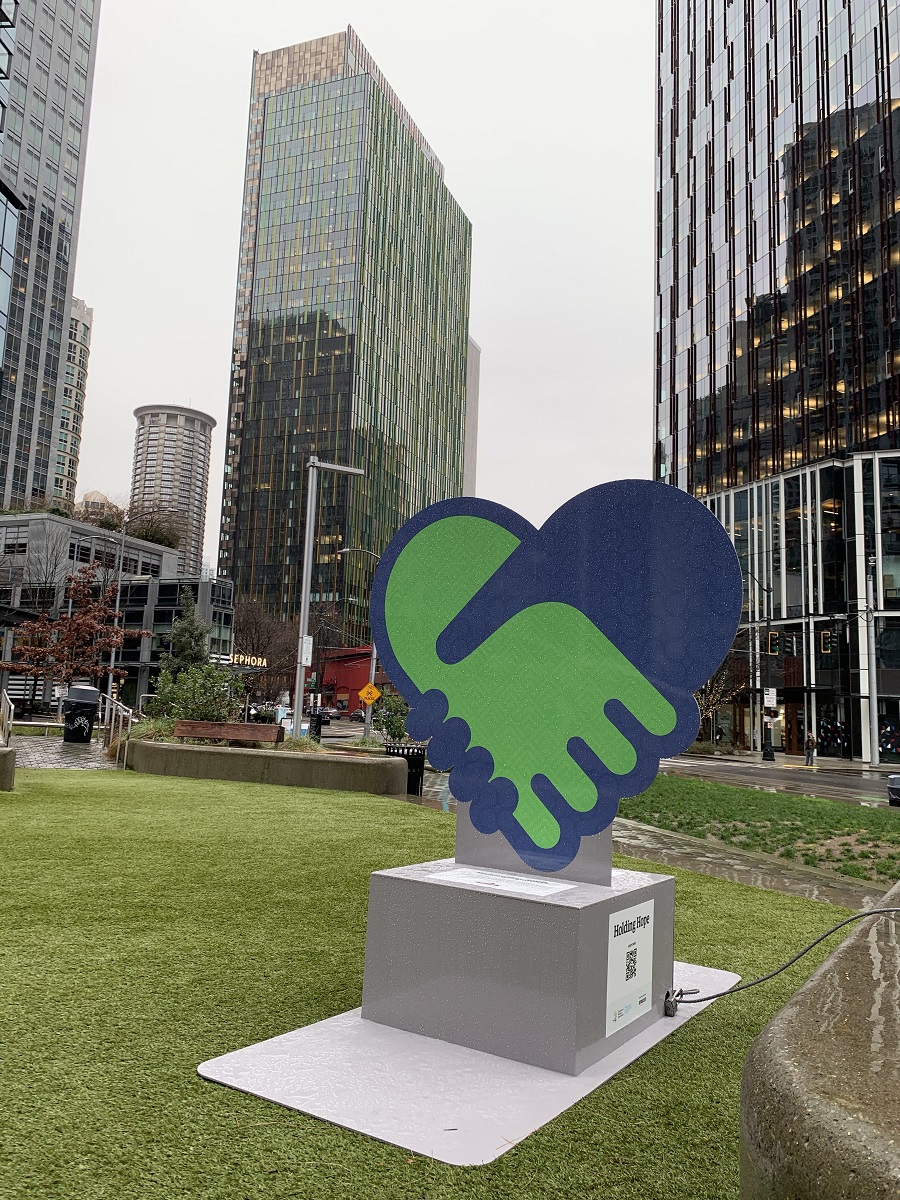
The two-story Streamline Moderne-styled building of the Washington Talking Book & Braille Library is at Ninth Ave. & Lenora St. It was previously a Dodge dealership, the anchor of Westlake Avenue’s long-departed auto row. Streamline Moderne is an international style of Art Deco architecture and design that emerged in the 1930s.Westlake Ave. & Seventh Ave. Here comes the South Lake Union Streetcar. It’s empty. ‘Experience the virtual world of Minecraft like never before‘, says the lettering on the side. Hey, that’s OK. I’ll pass. Wild enough to experience the pandemic world of Covid-19, like never before.I like the inside-outside seating area that had been set up across from the Amazon biospheres. There is an impressive extraction fan system in the green enclosure, for sucking out wayward SARS-CoV-2 virus that may be suspended in the air.This brown office building on Eighth Ave. off Westlake Ave. is now called Amazon The Summit. The lights are on in a few offices in the middle, but the rest is dark.This self-reflecting tower next door to The Summit is called Amazon re:Invent (520 ft tall, 37 floors, completed 2019). That’s the Cirrus Apartment building reflected in the bottom of the picture (440 ft tall, 41 floors, completed 2015).Another view of the Cirrus apartment building on the left, and the Amazon re: Invent on the right.Here’s Urban Triangle Park, with one of several 6-ft high aluminum Holding Hope signs, a new art installation now on display in several locations throughout downtown Seattle. I was supposed to take a selfie there, and post a picture with the tag #HoldingHopeSeattle on Instagram, Twitter or Facebook. I guess my blog does not count. For every post, the Downtown Seattle Association will make a $10 donation to the Pike Place Market Foundation.
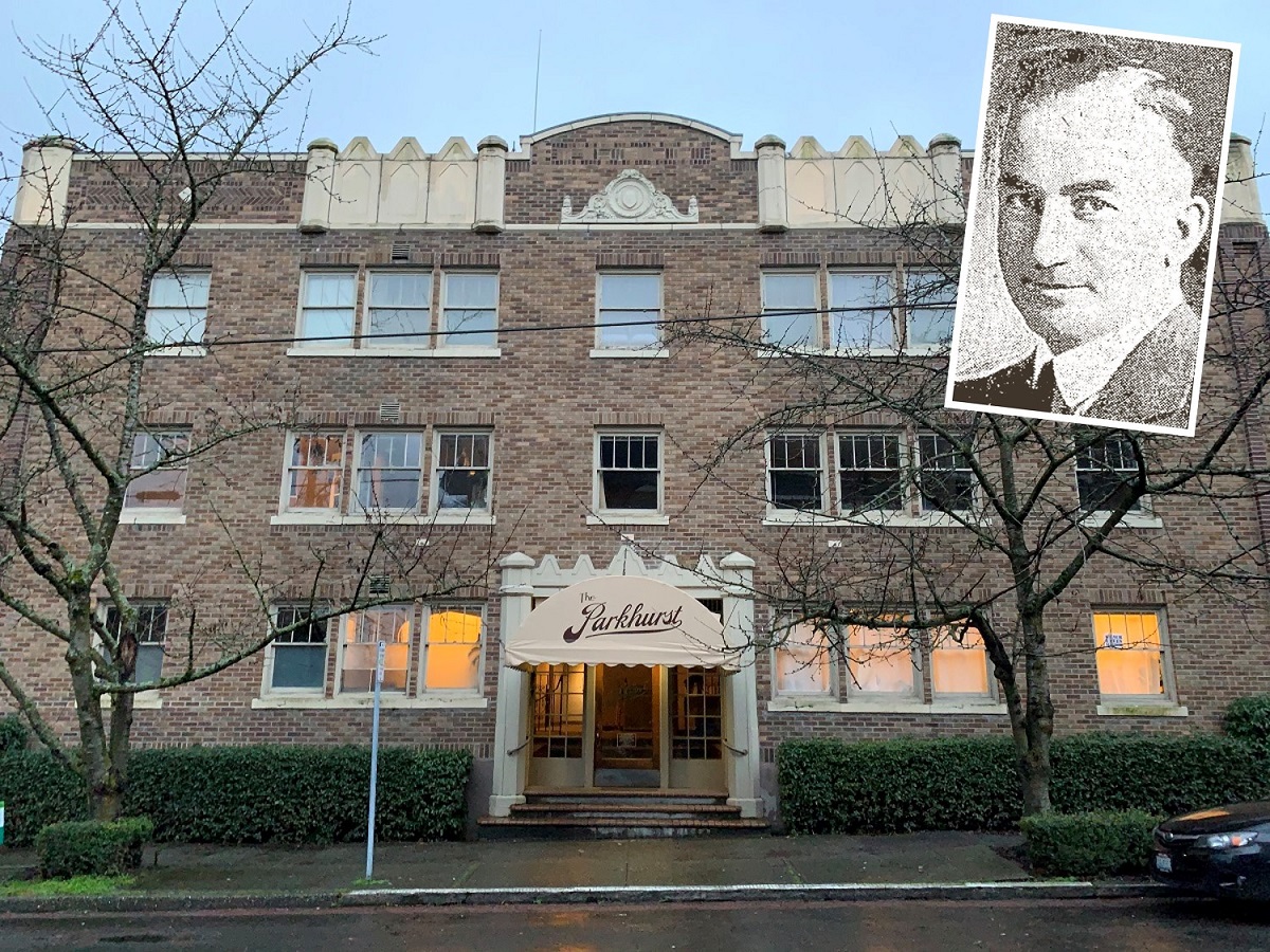
There were no cars in front of The Parkhurst apartment building on 14th Avenue, as I walked by, just before dark.
So I snapped a picture, to check up on its history at home.
Here is what I found.
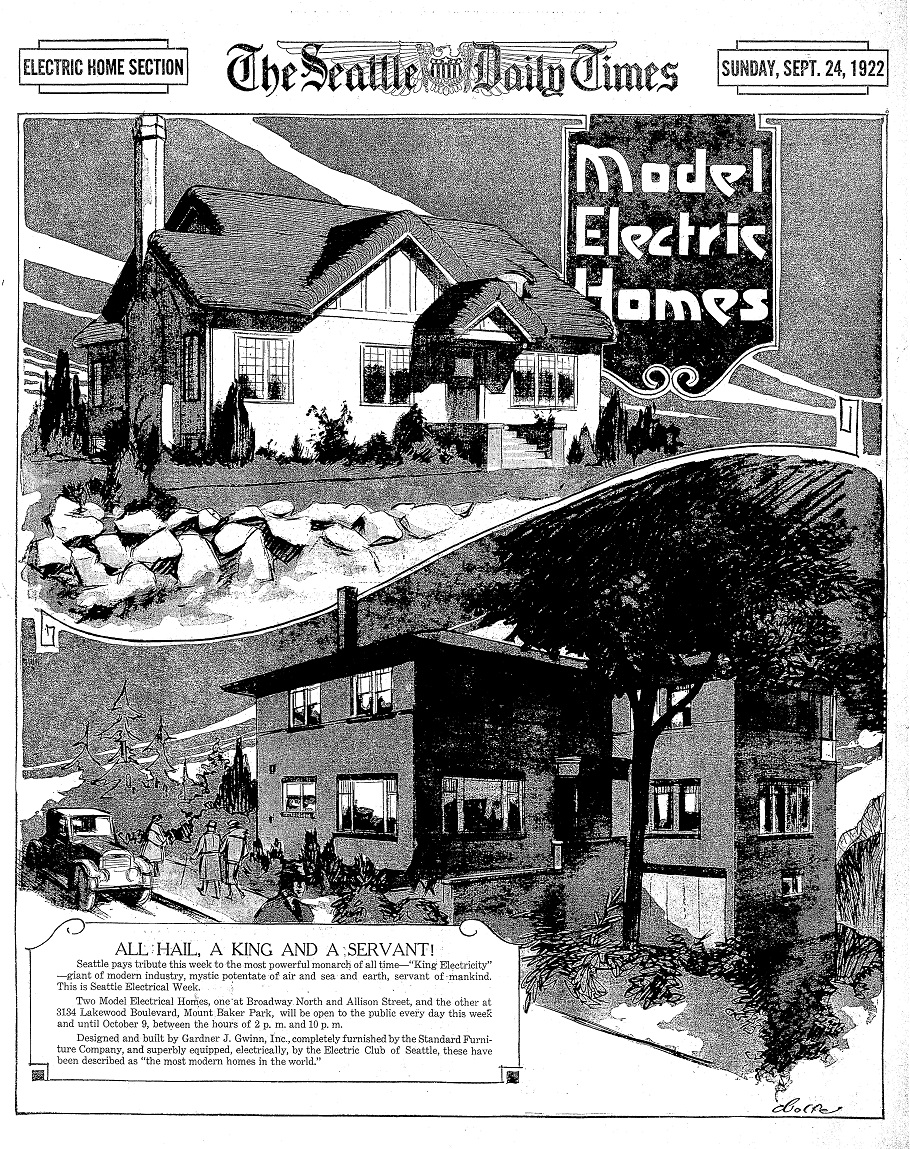
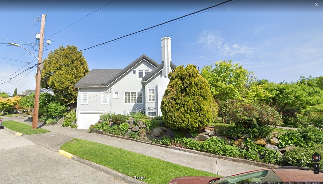
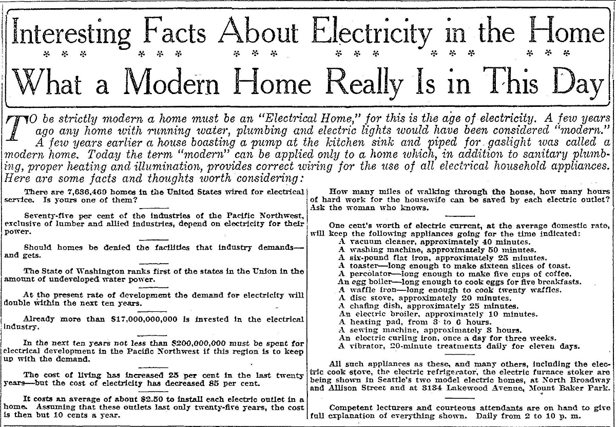
The Parkhurst apartment building on 14th Ave. It was built in 1929 by builder & developer Gardner J. Gwinn (inset picture). A native from Nova Scotia, Canada, he moved to Seattle in 1909 at the age of 21. At the time the Alaska-Yukon-Pacific Exhibition (a world’s fair) was underway (on the site now occupied by the University of Washington), and the city was booming.Gwinn was a prolific home builder, and was selected by the Electric Club of Seattle to promote and market ‘Electric Homes’. In the very beginning, homes were wired with only the basics for electric lighting. ‘Electric homes’ had electric outlets & more extensive wiring for electric appliances in the kitchen and elsewhere in the house. [From the Seattle Times Archives, Sept. 24, 1922].It’s 97 years later, but both of the homes pictured above in the 1924 Seattle Times, are still standing. This picture of the top one is from Google Streetview.From the same Seattle Times supplement from 1924, an article that promotes the ‘modern home’ that has electricity. Vacuum cleaner, washing machine, 6-pound flat iron, toaster, percolator, stove, sewing machine .. who could resist? The nationwide electrical grid was still under construction, though. In 1925, only about half of homes in the US had access to electricity at all.
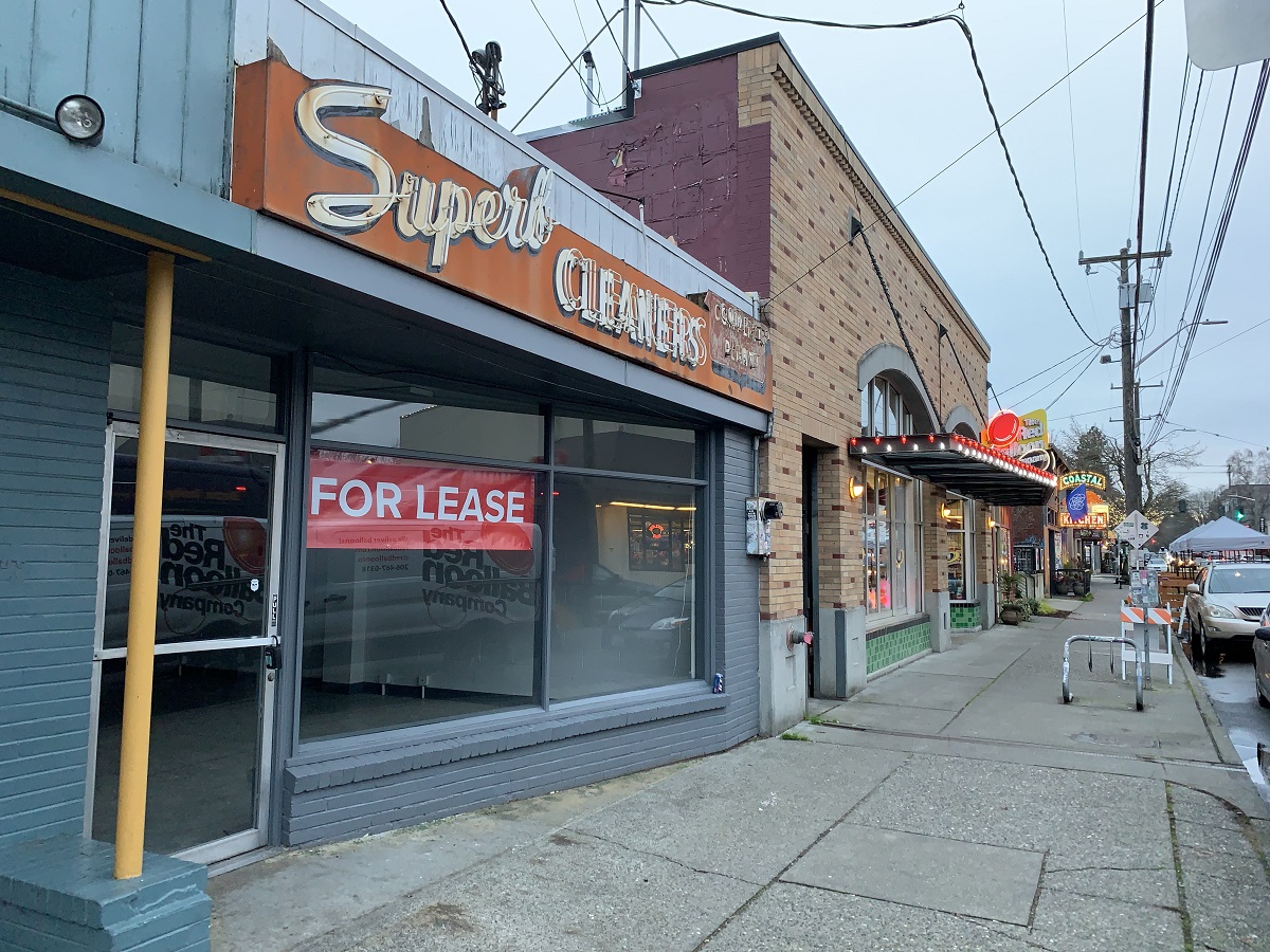
Superb Cleaners dry cleaners on 15th Avenue has gone out of business.
No wonder, right?
In a stay-home-pandemic, people do not need much dry cleaning — not for business trips, not for the opera, and not for a Saturday night dinner party at a fancy friend’s house.
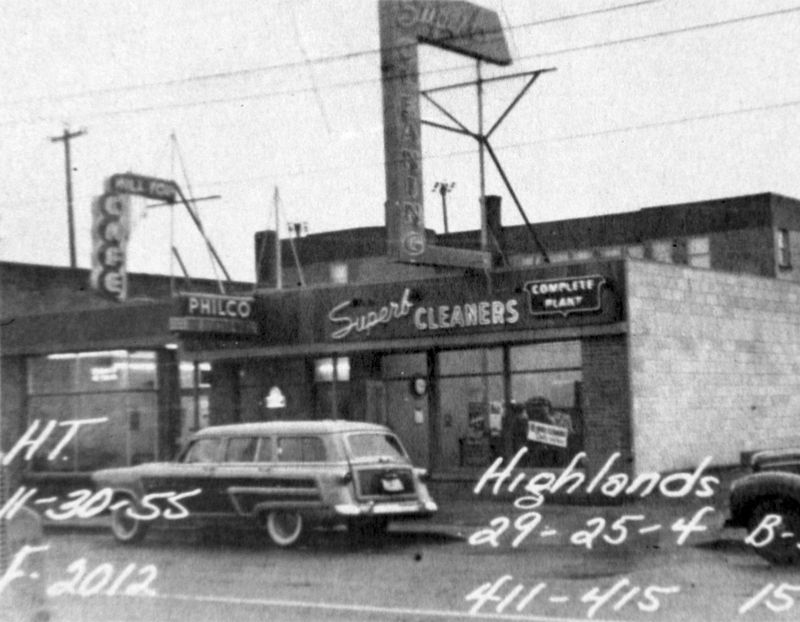
2021: Permanently closed, Superb Cleaners on 15th Avenue. Time will tell if another dry cleaning business will be operated in that space, or if another kind of business altogether will set up shop.1955: The Hill Top Cafe, Philco Radio & TV shop, and Superb Cleaners with its original scaffolded sign. ‘Complete Plant’ simply means the dry cleaning is done right there on site, and not sent out somewhere else for cleaning. P.S. That stylish wagon with its white-wall tires and wood trim is a 1955 Ford Country Squire Station Wagon. [Source: Seattle Before and After at http://octopup.org/]
We had a lot of sun today.
It’s January, though – the doldrums of winter – and the day’s highs only made it to 45 °F (7 °C).
These pictures are from Monday.
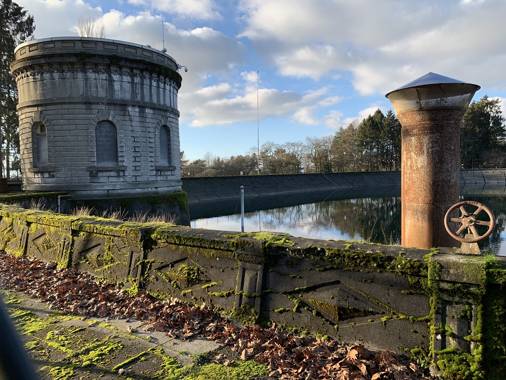
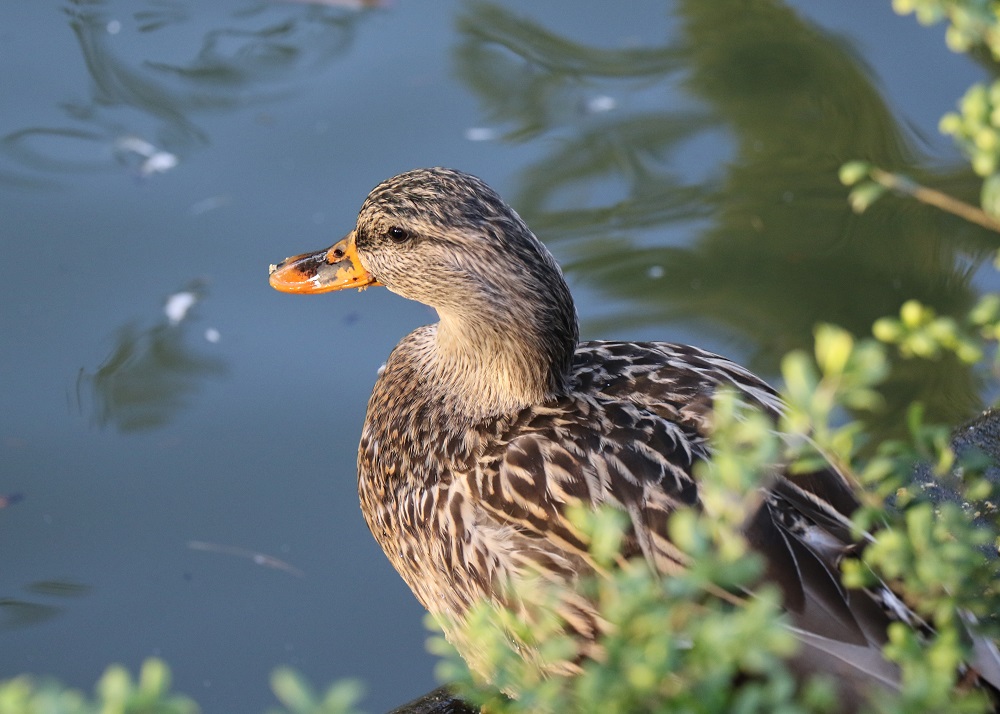
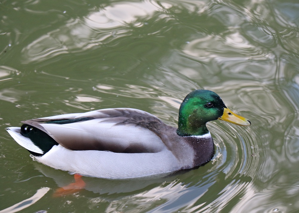
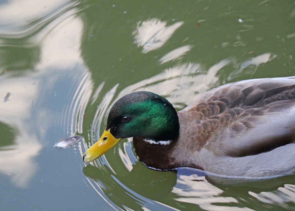
Here’s the Volunteer Park reservoir, here on Capitol Hill in the city. Its water is not considered usable for drinking water (the city has already covered several other reservoirs with lids, but not this one). The Cedar River’s water filled the 22 million-gallon reservoir for the first time in January 1901. The chlorophyll in the moss on the parapet (low wall) around the reservoir, is glowing neon green in the sunlight.Here’s a female mallard (Anas platyrhynchos), at one of the two duck ponds near the reservoir.The male with its glossy green head, doing the duck thing, paddling in the water. Mallards are dabbling ducks: freshwater ducks that feed in shallow water by dabbling and upending as they look for food.This species is the main ancestor of most breeds of domesticated ducks (the white ones that are kept for their meat, eggs and down). Mallard ducks were first domesticated in Southeast Asia, at least 4,000 years ago. [Source: Wikipedia]
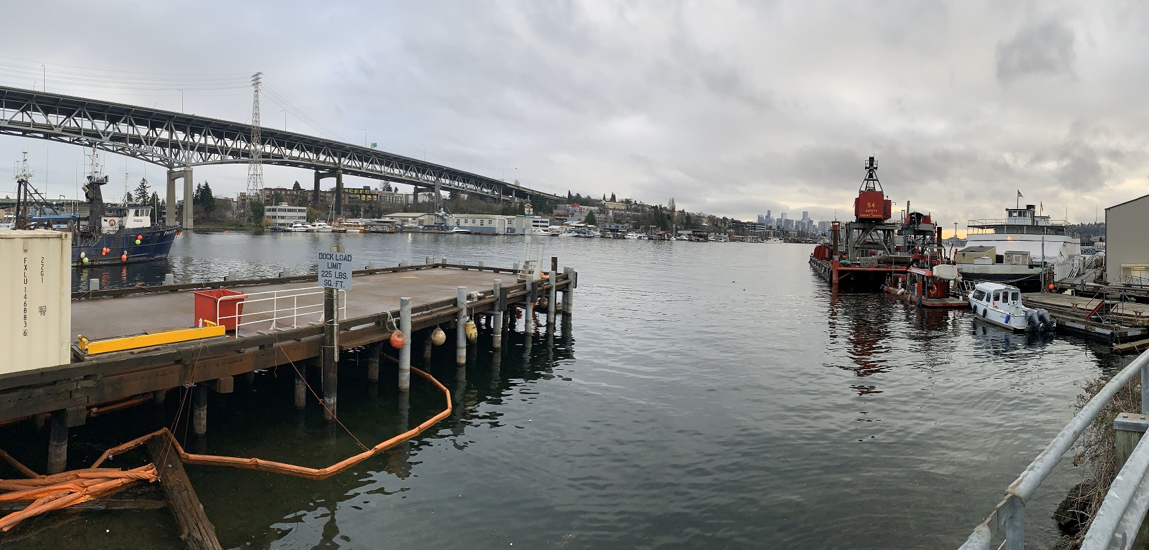
I felt like a change of scenery today for my walk, and went down to the Gas Works Park area on Lake Union.
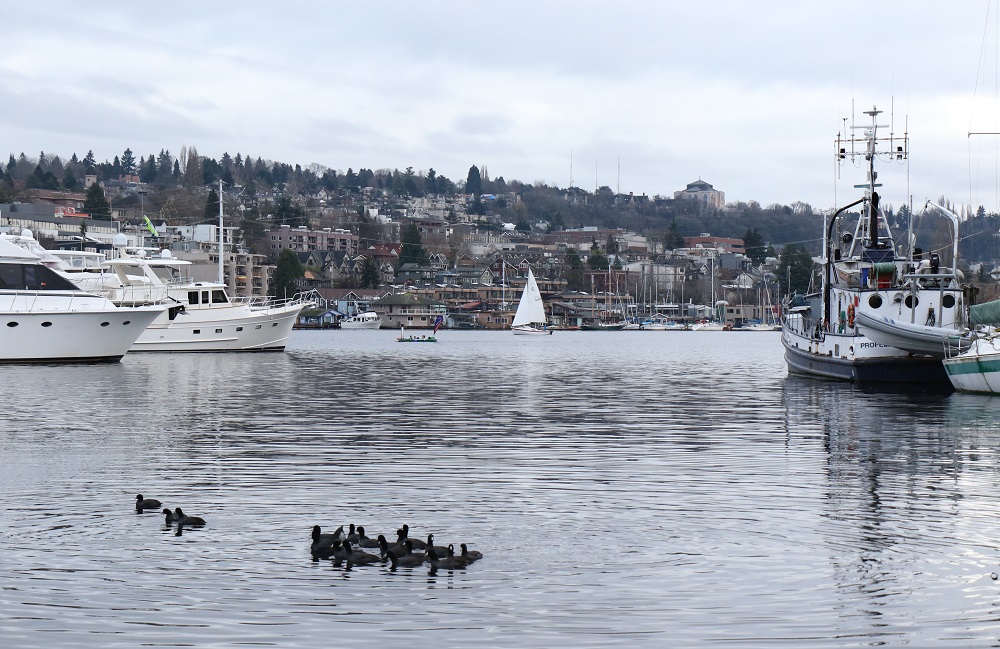
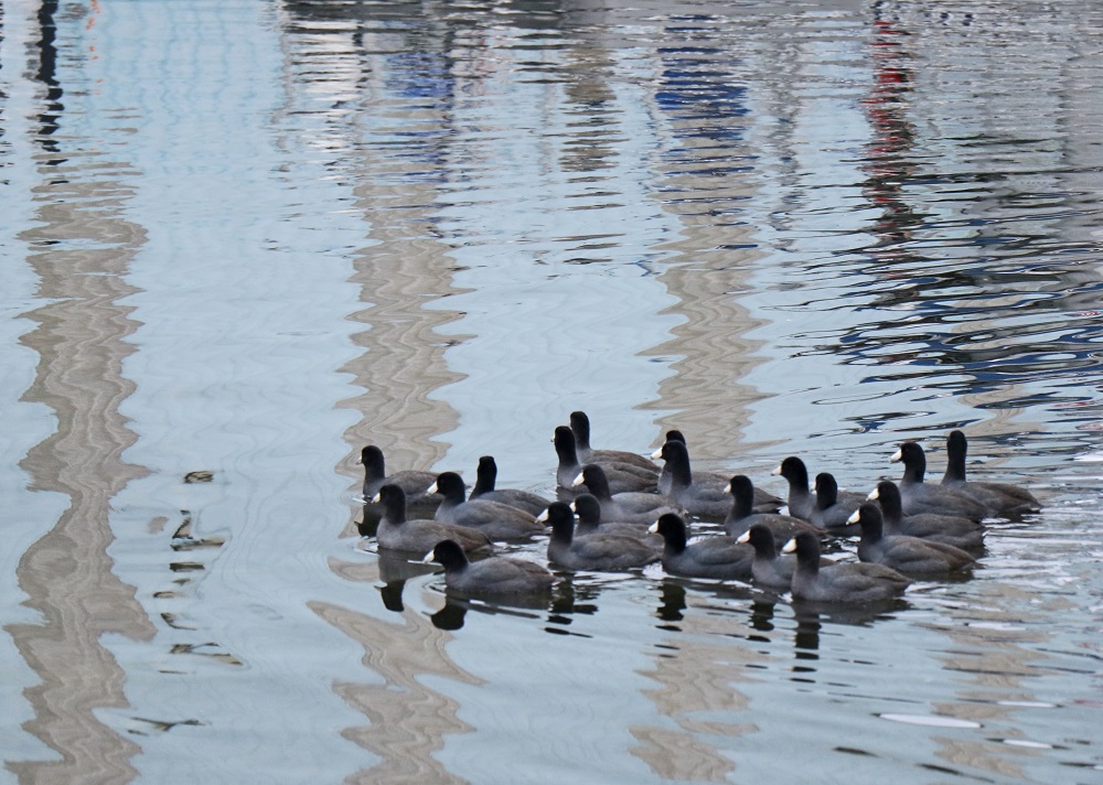
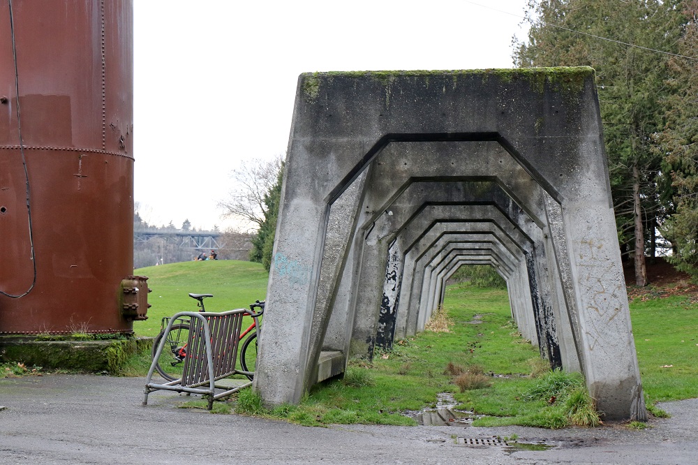
Looking south here. That’s Interstate 5 and the Ship Canal Bridge with its double-deck truss (opened Dec. 1962). On the left edge is the fishing vessel Peggy Jo, built in Tacoma in 1966. This may be a fueling dock. I believe that orange ‘float’ line is to keep accidental oil or gas spills from spreading out further on the water. Look for the Space-Needle-in-a-haystack elsewhere in the picture.A view across Lake Union to the southeast. Merrymakers on the water and a lone sailboat. That prominent square building on the horizon, towards the right, is St. Mark’s Episcopal Cathedral. Its intended architecture was never completed. The reason is the fateful date of its groundbreaking for construction: Sept. 1928, a year before the start of the Great Depression. Construction was incomplete when the cathedral was dedicated on April 25, 1931, and the parish was in default on its mortgage throughout the 1930s. The cathedral was foreclosed upon in 1941 and shut for the next two years. From 1943 -44, the US Army used the cathedral as an anti-aircraft training facility. The mortgage was finally paid off in 1947. [Source: Wikipedia].This raft of waterfowl is a group of American coots (Fulica americana). They are not ducks: they belong to the rail family, Rallidae.I finally arrived at Gas Works Park: a 19.1-acre public park on the site of the former Seattle Gas Light Company gasification plant, located on the north shore of Lake Union at the south end of the Wallingford neighborhood. [Wikipedia]Just some interesting geometric lines to look at. Maybe a cylinder or some other structure had rested on these as a foundation.Needles, all the way down?*. A view from the little promenade that overlooks Lake Union. *It’s my picture – but I’m borrowing the title from a similar picture that I had seen a while ago on Reddit.And the clear view, almost due south, of the ever-changing city skyline. That’s Queen Anne Hill on the right, one of the highest spots in the city at an elevation of 456 feet (139 m).
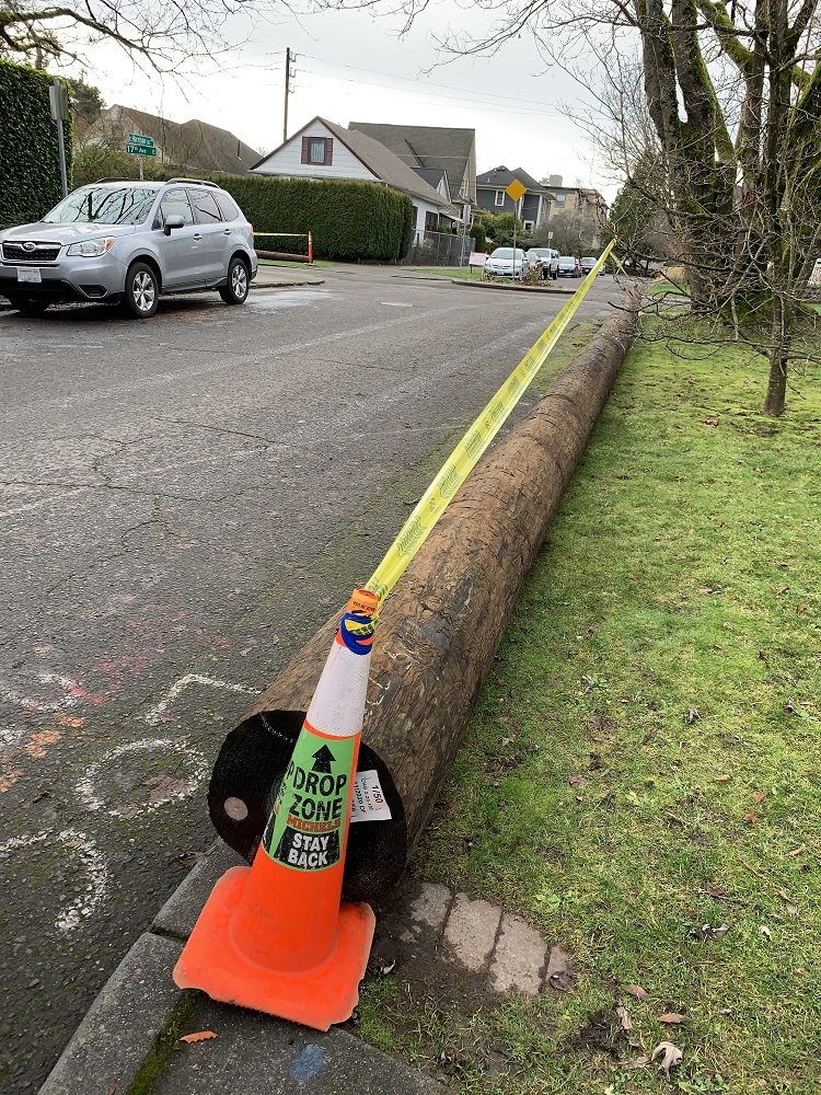
It looks like my street block is getting some new utility poles.
We worked with the data for these utility poles on my project at Southern California Edison. That utility company covers an enormous area, and the utility pole database had some 5 million records (for 5 million utility poles).
The fun starts when you also carry joint-use poles in the database. These are poles owned by one utility (say, it is owned by Seattle City Light, and carries overhead power cables), which then leases space on it to other utilities (say, to CenturyLink for hooking telephone coaxial cable onto).
The standard utility pole in the United States is about 40 ft (12 m) long and is buried about 6 ft (2 m) in the ground. The wood is pressure-treated and this pole is probably Douglas fir or Pacific silver fir, firs native to the Pacific Northwest.
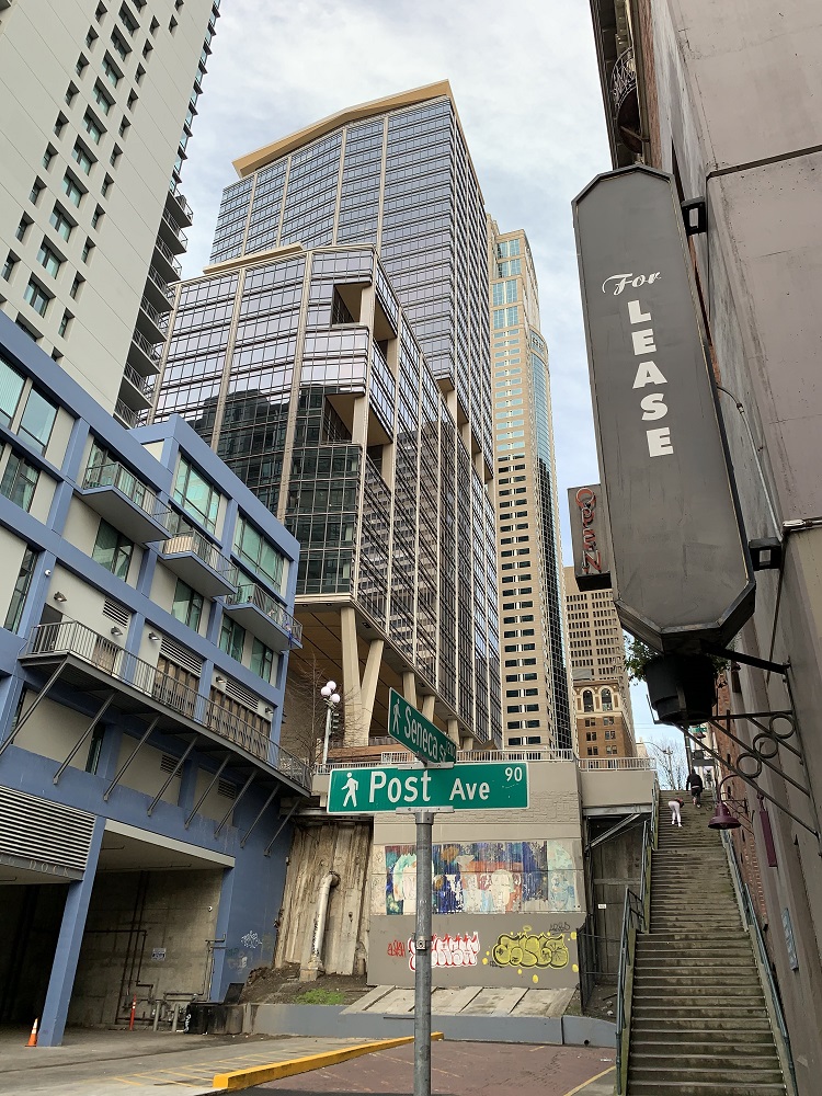
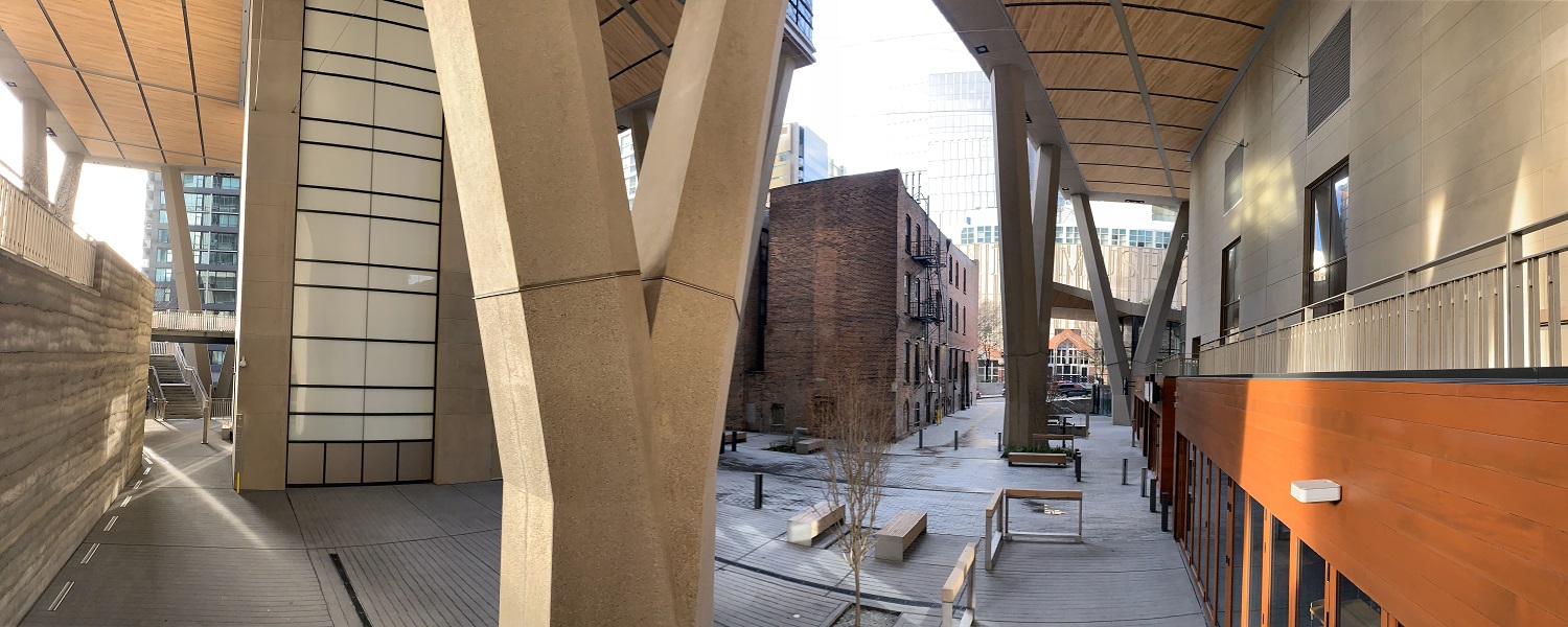
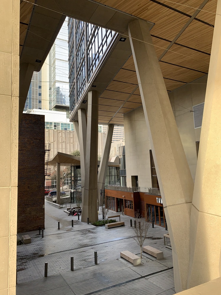
There was a welcome break in the rain today, so I went down to Second Avenue to check out the completed Qualtrics Tower.
My visit turned into a mini-architecture tour, once I started walking.
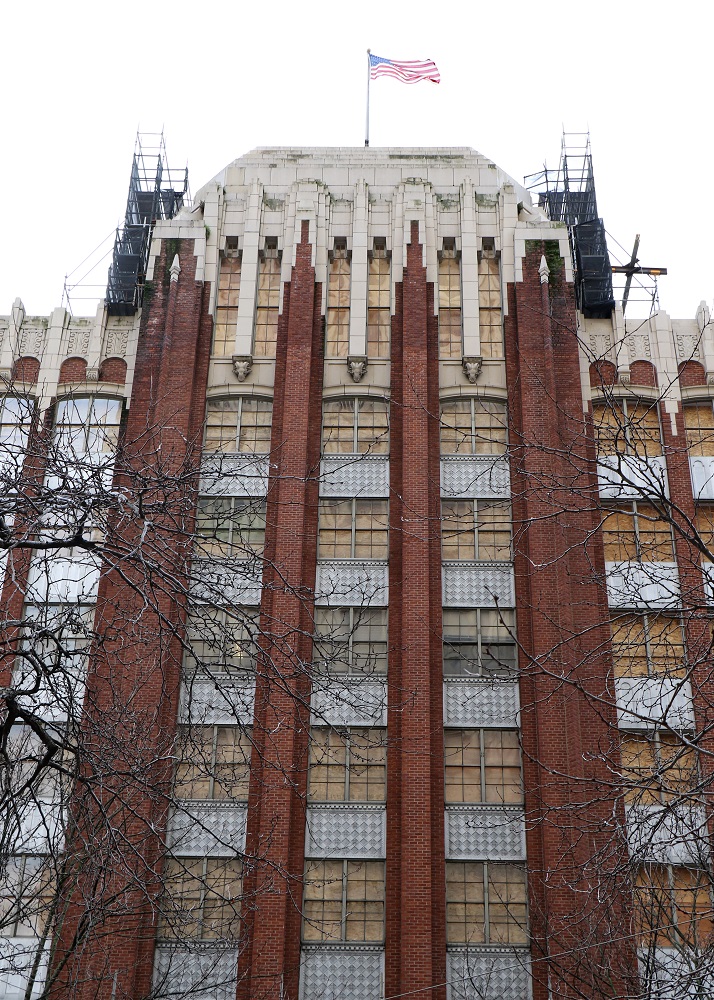
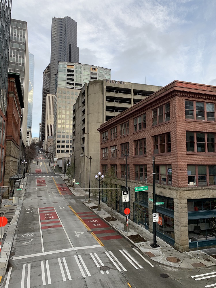
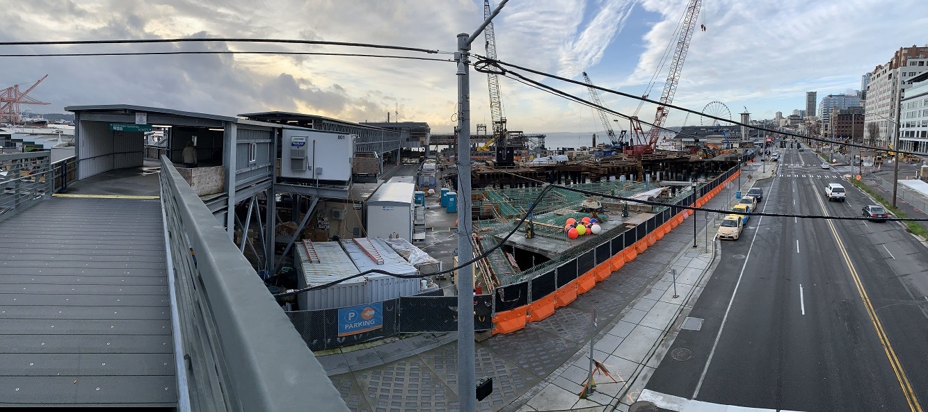
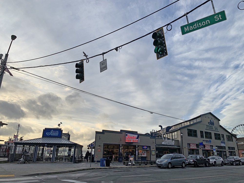
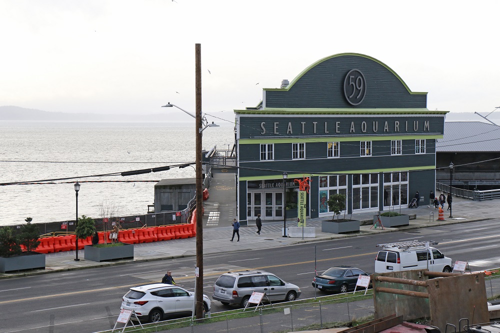
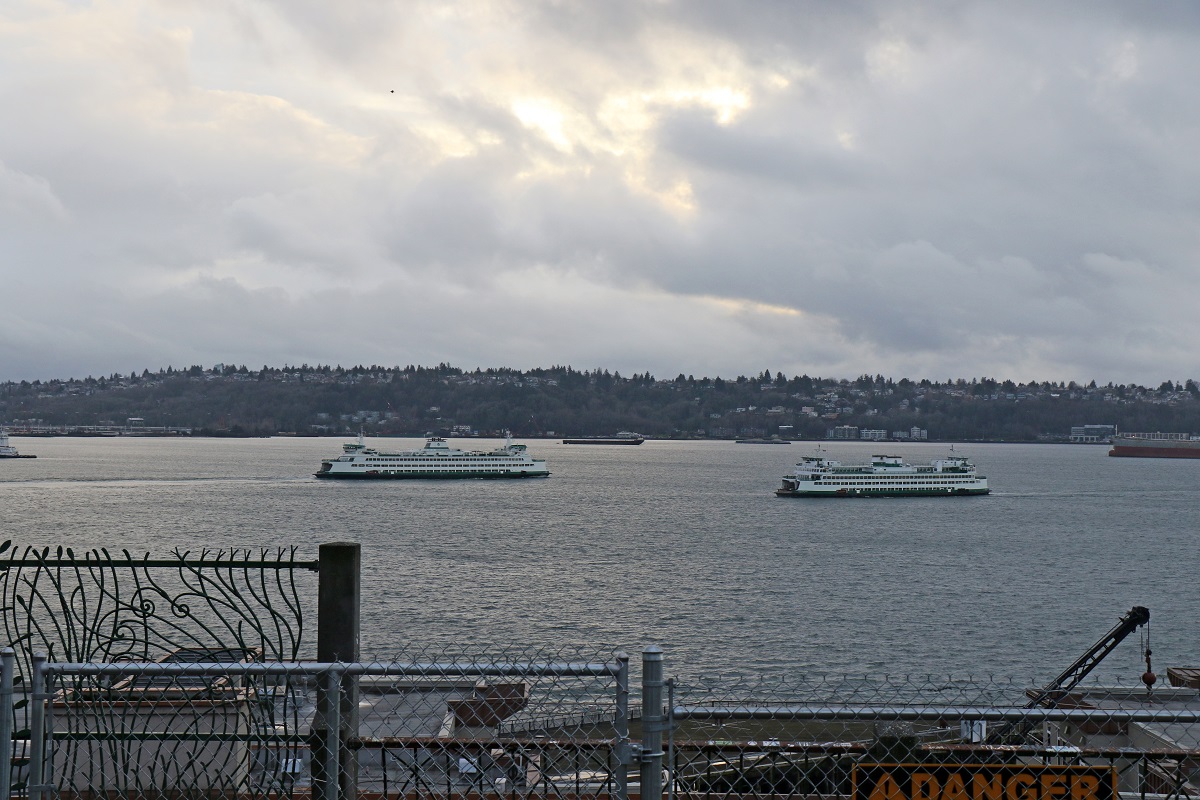
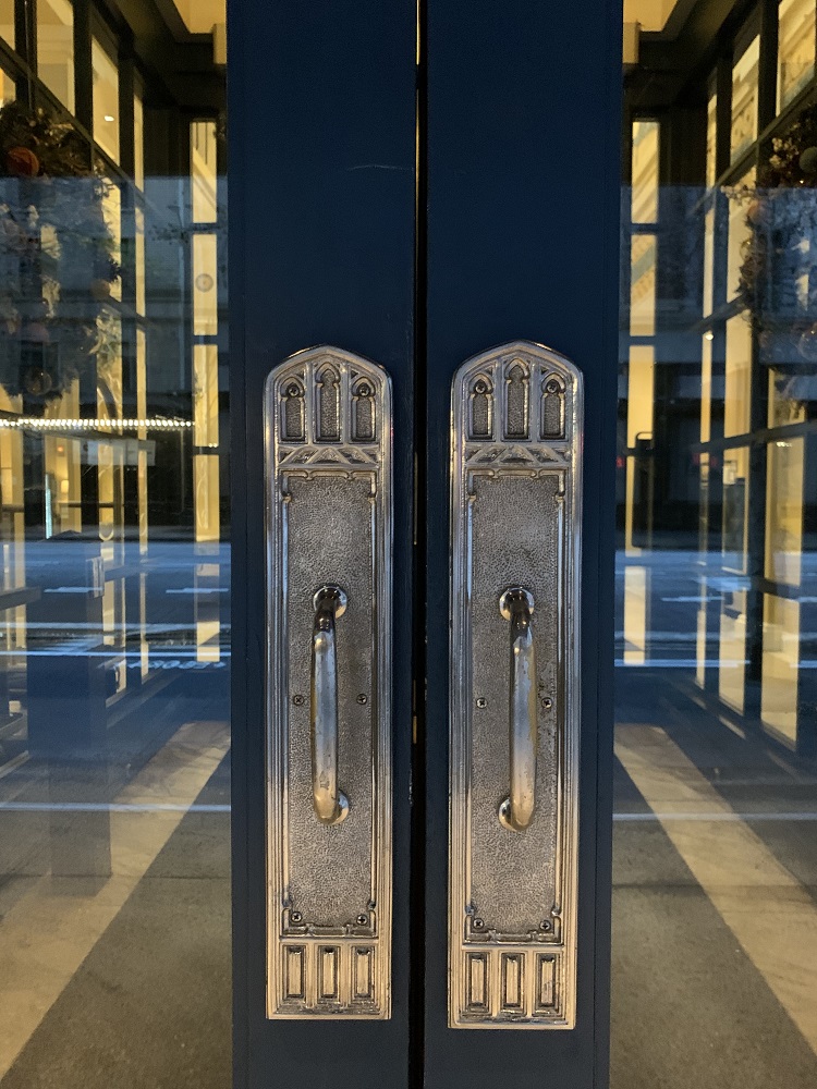
The Alaskan Way Viaduct is gone, and its Seneca Street off-ramp as well. So now one can see all of the $392 million Qualtrics Tower from this below-Seneca Street vantage point. The Tower was designed by Connecticut-based architecture firm Pickard Chilton. The podium facing First Ave. is 19 stories tall with a landscaped rooftop deck. The main tower behind it rises 38 stories above street level, with its own rooftop terrace and amenities.The red brick building is the early 1900’s Diller Hotel. It is one of downtown’s few remaining buildings from the 1890s, built after the Great Fire of 1889 as a luxury hotel. Today, the lobby of the erstwhile hotel is a bar with vintage decor, called the Diller Room.The public passageway and street level space is made larger by V-shaped columns that support the upper floors. The columns also provide 85 ft (26 m) of space up to the overhang. The columns were manufactured in Canada: steel tubes in a rebar cage, all encased in precast concrete.The 11-story Federal Office Building of Seattle on First Ave. opened in 1932. Its Art Deco detail is being restored. There is a banner on the side of the building, from none other than the now-infamous U.S. General Services Administration*. It says ‘Preserving Seattle’s first federal office building for future generations’. *It was the GSA that dragged its feet to acknowledge Biden as President-elect, and approve funds for the Biden transition team.This could be a scene from a zombie apocalypse movie. (Oh wait, it’s actually the Covid-19 apocalypse). I am on the Marion Street Ferry Walkway, looking back along Columbia Street. Flanking Columbia St. at the top are the steel & glass F5 Tower (compl. 2017, 44 storeys), the Seattle Municipal Tower (compl. 1990, 62 floors) and the Columbia Center (compl. 1985, 76 storeys, still Seattle’s tallest skyscraper).Here is Alaska Way South, seen from the Marion Street Ferry Walkway, with the entrance to the ferry terminal and the construction at Colman Dock on the left. It was two years ago in Feb. 2019, that the demolition of the 1953 Alaskan Way Viaduct (double-decker highway) started in earnest. The Viaduct has now been completely gone for a little more than a year.Ivar’s Fish Bar is open for take-aways, but Ivar’s Acres of Clams flagship restaurant next door, is closed (due to the no indoor dining restrictions).The Seattle Aquarium on Pier 59, on the Elliott Bay waterfront, opened in 1977 (now temporarily closed). I’m looking down towards the waterfront from Western Ave.View of Elliott Bay from Victor Steinbrueck Park by Pike Place Market. On the left is the Tacoma, that had just left for Bainbridge Island, and on the right is the Kaleetan, coming in from Bremerton. I did not get to see the sun set, as I had hoped. The park was empty. A construction fence keeps the public away from the rail that overlooks the Viaduct space below. (There are construction workers below).Rainier Square Tower (left) is just about complete. At 850 ft (260 m) tall and 58 storeys, it is the city’s second tallest skyscraper. On the right is the 1977 Rainier Tower (41 storeys, designed by Minoru Yamasaki, who designed the World Trade Center in New York City, as well). The new 10-story building on the southwest corner is 400 University Street. It will open later this year.The doors at the entrance to the Hotel Monaco on Fourth Ave. (constructed in 1969 as the Pacific Northwest Bell office building). The hotel is closed, for now.
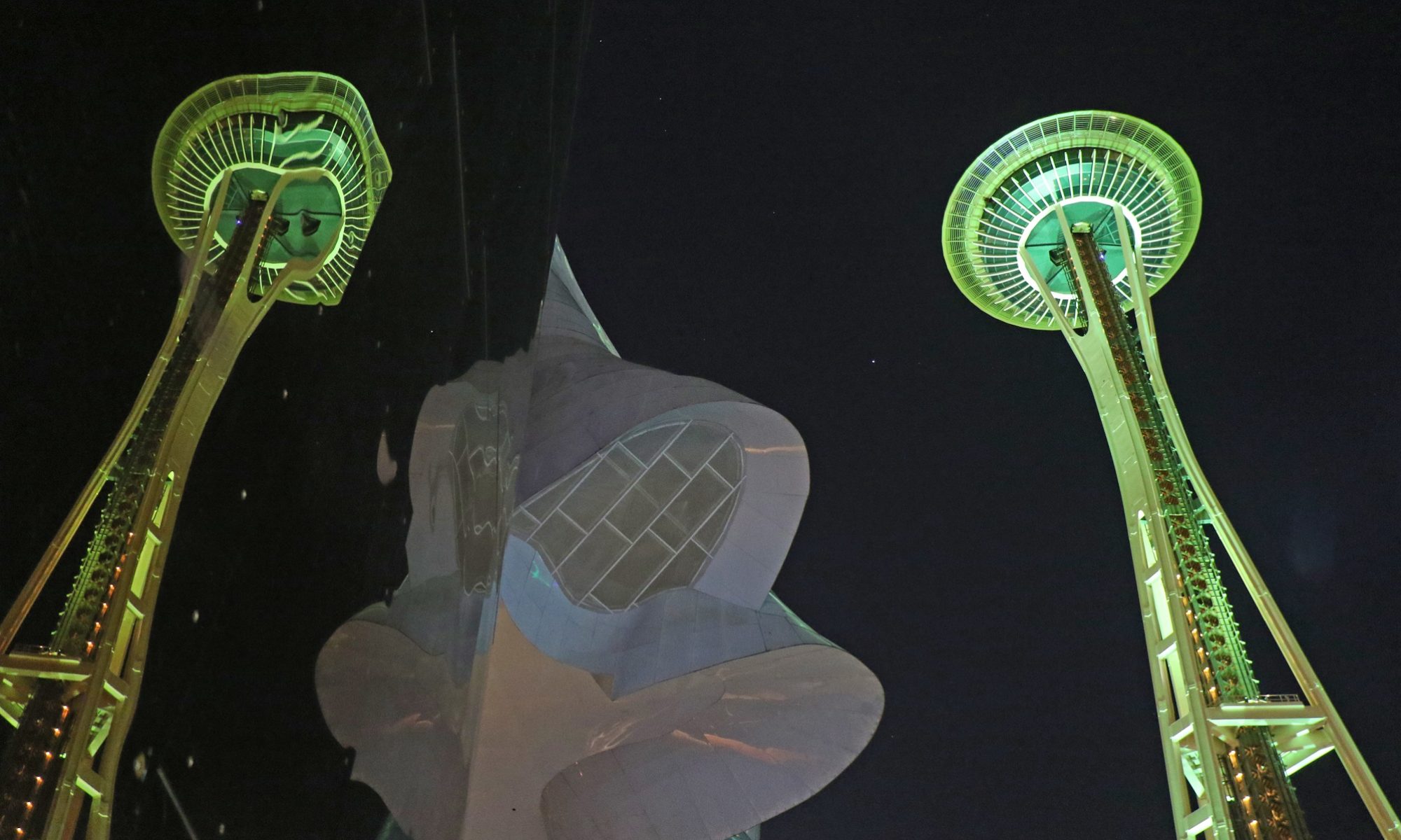
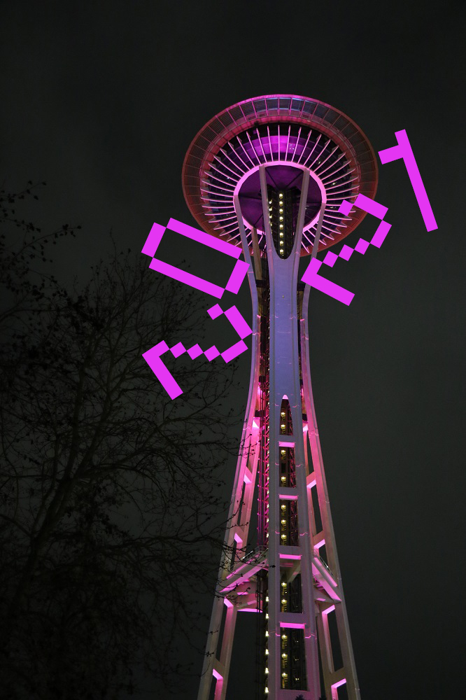
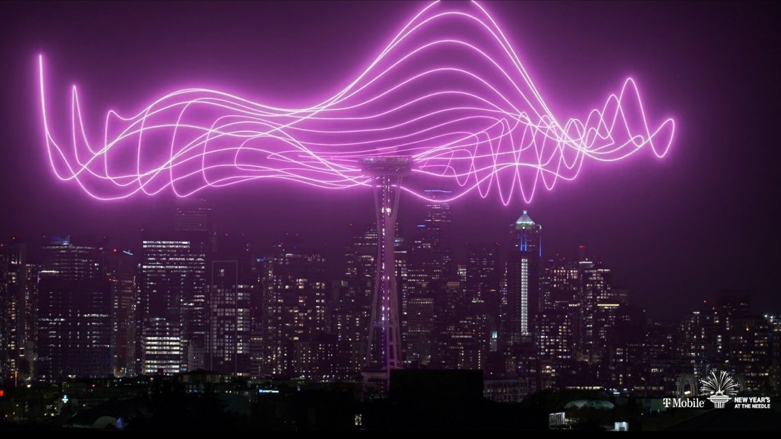
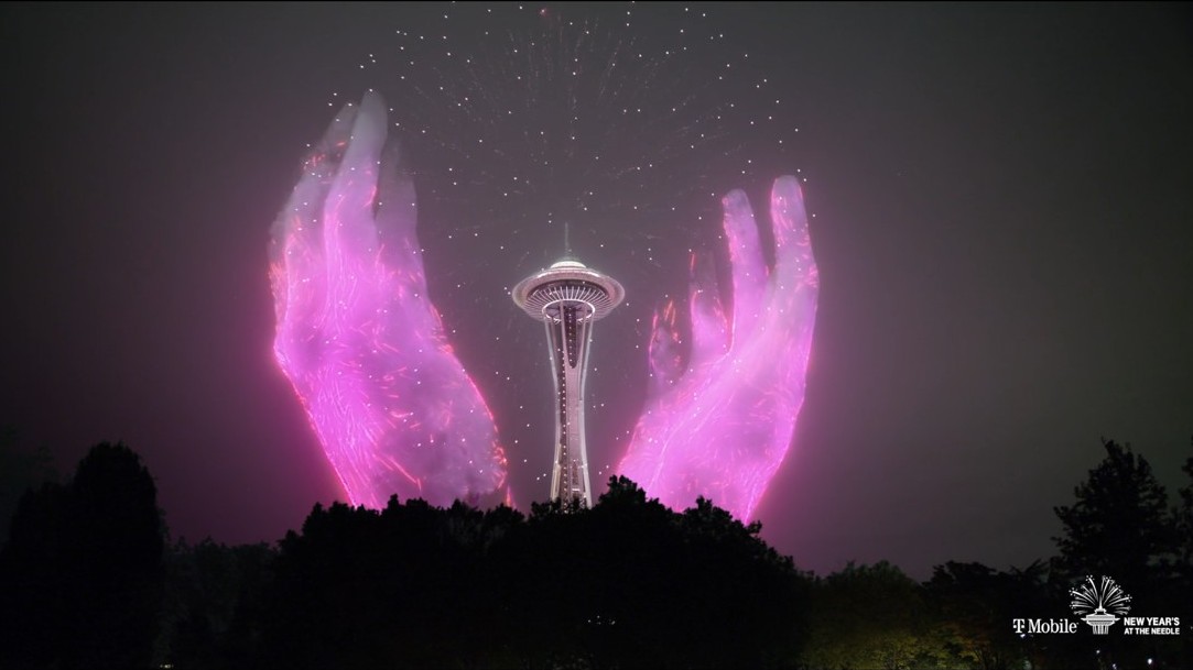
I drove down to the Space Needle last night, to take a few pictures of it in pink. There were no crowds this year, but the monorail was still running to Westlake Park and back, with a few souls inside. Likewise, the Space Needle elevator took a few people at a time up to the viewing deck.
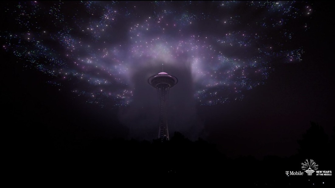
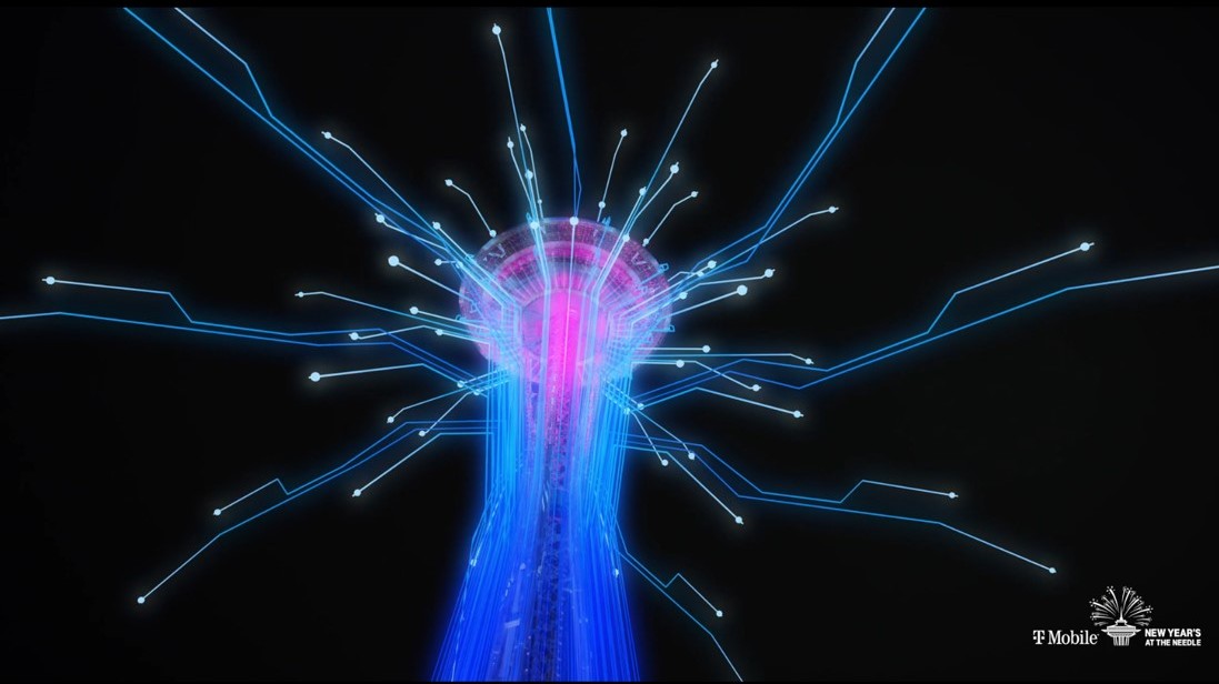
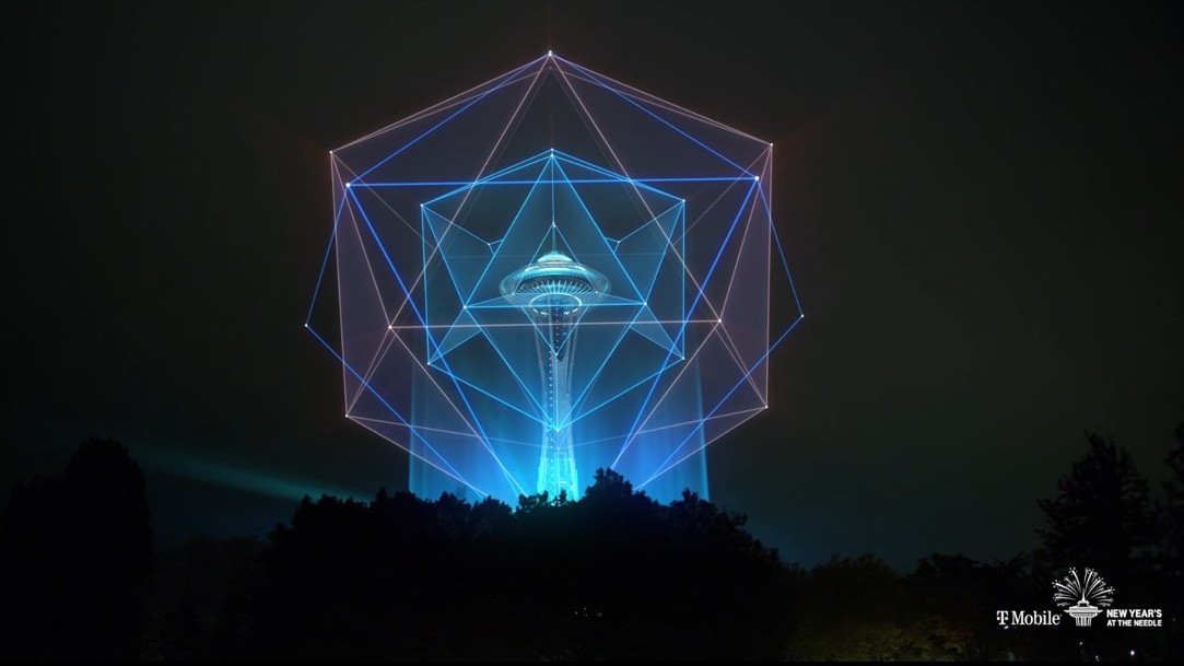
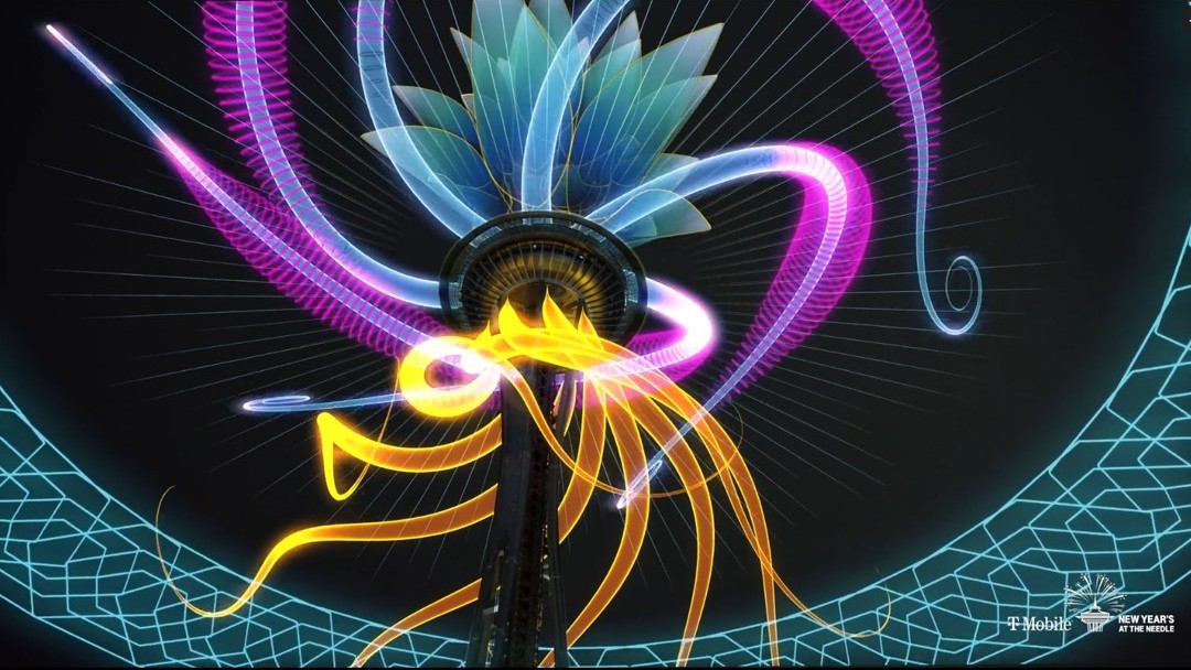
I had to wait until midnight to see the virtual Space Needle celebrations on TV, sponsored by T-Mobile and produced by Terry D. Morgan.
The wait was worth it. The creators used sky-mapping technology and video footage to create a spectacle accompanied by dramatic music. Below are a few stills from the video that was posted afterwards.
Looks like we’re going to spill over into the new year with rain every day here in Seattle (with a little break on Thursday morning). The yearly precipitation total stands at 40.71″ ( yearly normal 37.49″ ).
Does the New Year’s Eve rain matter? No. The annual fireworks display at the Space Needle, and gatherings at Gas Works Park had been cancelled a long time ago.
There will be a ‘virtual’ Space Needle celebration/ ‘fireworks’ display instead, on the local TV station channel. One could argue it’s more or less the same as watching real fireworks on TV — or is it not?
There was a break in the rain just before sunset today. Here’s Olympic Pizza & Spaghetti House III (left) on 15th Ave. A few customers can sit outside, and they have carry out, of course. Governor Jay Inslee has extended the ban on indoor dining to Jan 11. Washington State is doing OK to contain community spread of Covid-19, but I cannot see that the ban will be lifted anytime soon.
Washington State Ferries operates the largest ferry system in the United States. The system operates 21 ferries across Puget Sound and the greater Salish Sea (the body of water that crosses into British Columbia). The vessels ferry nearly 24 million people annually, to 20 different ports of call.
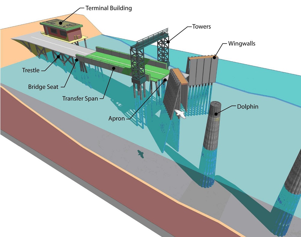
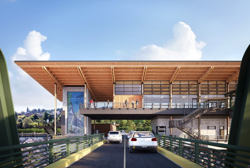
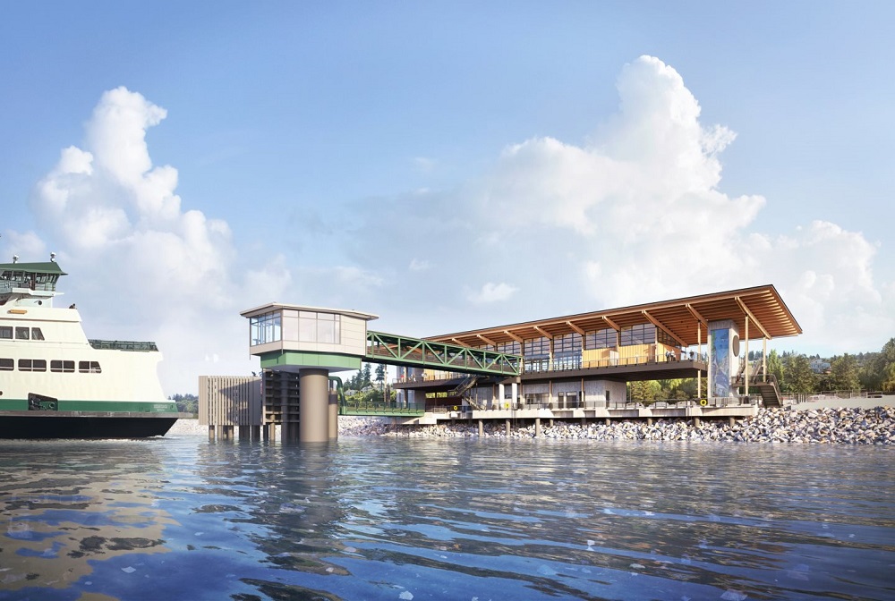
The new $187 million ferry terminal in Mukilteo opened today, without crowds or fanfare. The new facility replaces the old terminal and dock (constructed in 1957).
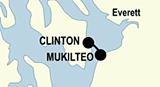
Just a few basics first. The dolphins (pillars) help position the ferry’s ‘bow’* in place against the wingwalls, so that the apron can be lowered to cover the gap between the end of the transfer span, and the loading deck of the ferry. (This simple terminal will have to load and unload pedestrians, bicycles, motorcycles and cars in sequence). *Washington State ferries have double-ended hull designs: vehicles can be loaded on & off from both ends of the vessel. After loading, the direction of travel switches — so the ‘bow’ becomes the stern, as the ferry departs. [Graphic from wsdot.wa.gov]This aerial view of the construction platform is from Feb. 2020. The new Mukilteo ferry terminal is just down the road from the old terminal (at the back; looks like the ferry was just departing for Clinton on Bainbridge Island). The new Mukilteo terminal will allow walk-on passengers & vehicles to board at the same time. [Photo taken by Steve Ringman / The Seattle Times]Here is an artist’s view from an arriving vehicle that has just left the ferry. [Artwork from lmnarchitects.com]And this is a rendering of the view of the terminal from the water. There is a new promenade to the left and to the right of the terminal, as well. [Artwork from lmnarchitects.com]Meanwhile, here in the city of Seattle there is another big ferry terminal construction project in progress: the upgrades to the Colman Dock for the ferries to Bremerton and Bainbridge Island. It is only scheduled for completion in 2023, though.