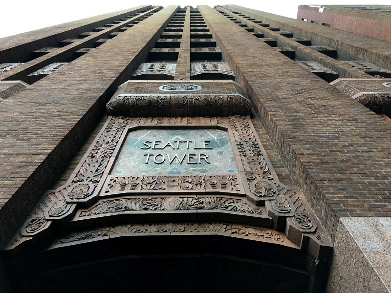
I guess Seattle has many gleaming glass and steel towers nowadays, but the Seattle Tower is one of the city’s original art deco gems.
Its construction was completed in 1929, and at the time it was called the Northern Life Building.
a weblog of whereabouts & interests, since 2010
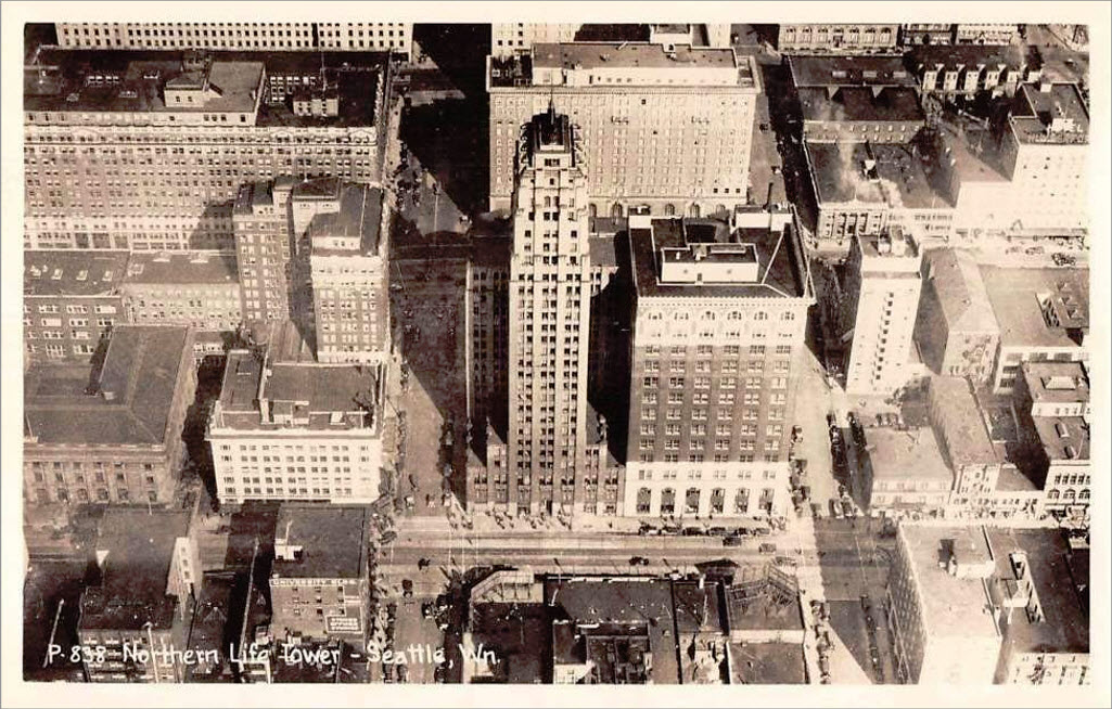
I guess Seattle has many gleaming glass and steel towers nowadays, but the Seattle Tower is one of the city’s original art deco gems.
Its construction was completed in 1929, and at the time it was called the Northern Life Building.
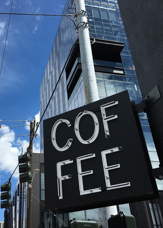
We have had a streak of beautiful blue-sky days here in the city, reaching all of 72 °F (22 °C) on Tuesday. A high pressure system parked above the Pacific Northwest will give us even more clear weather days, all through the weekend, say the meteorologists.
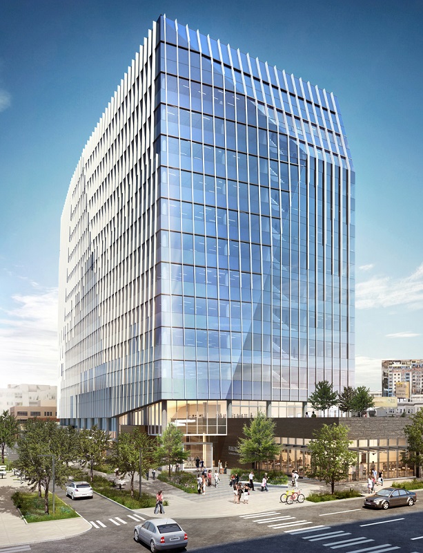
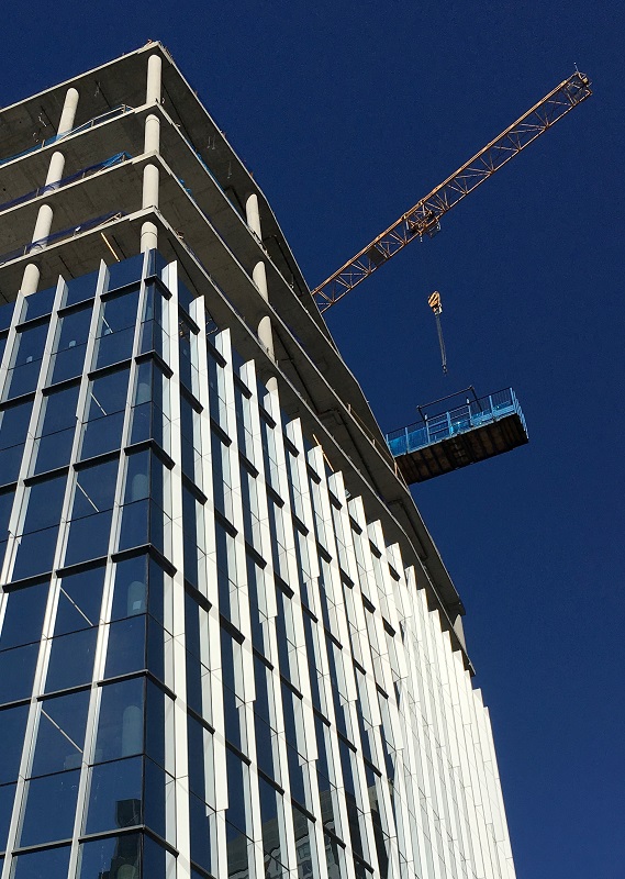
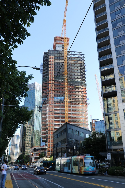
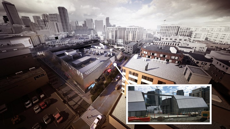
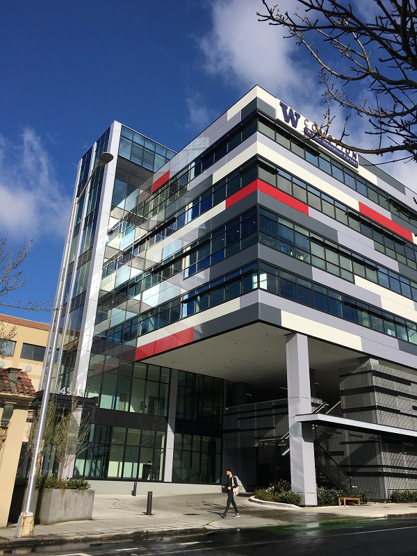
It’s here in downtown Seattle near Denny Way. It is the new building for Seattle Children’s Research Institute to expand into. The Institute’s scientists develop cures and therapies for childhood diseases such as cancers, sickle cell anemia and type 1 diabetes.
The Institute has grown from just 40 employees in 2006 to more than 1,500 today.
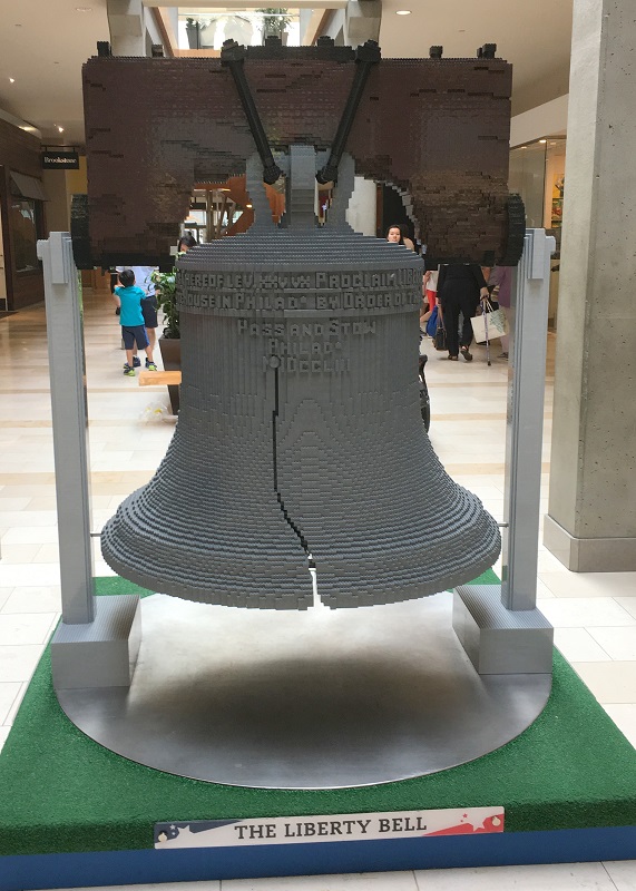
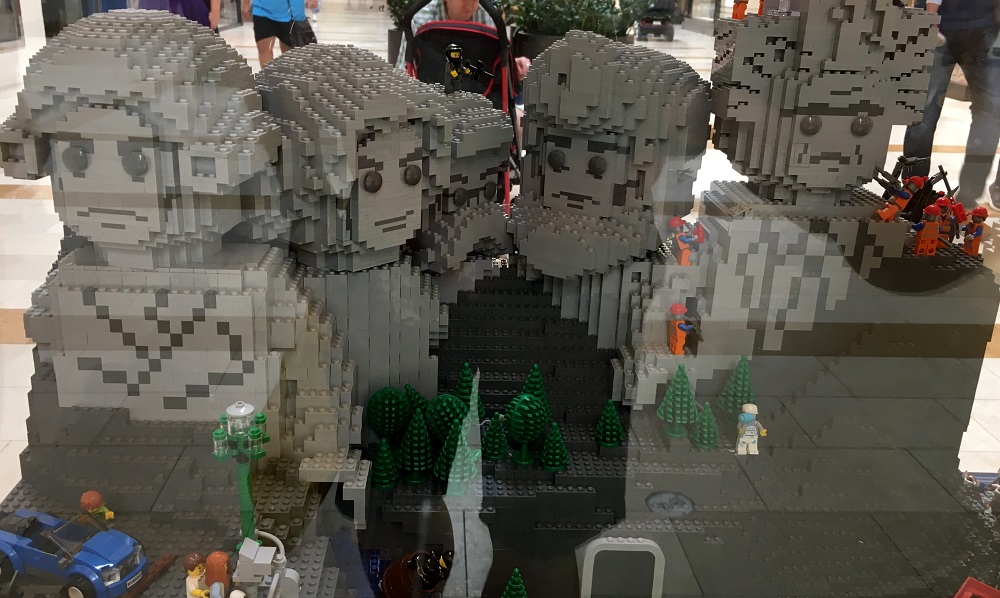
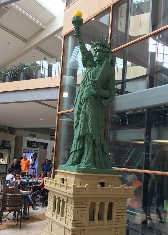
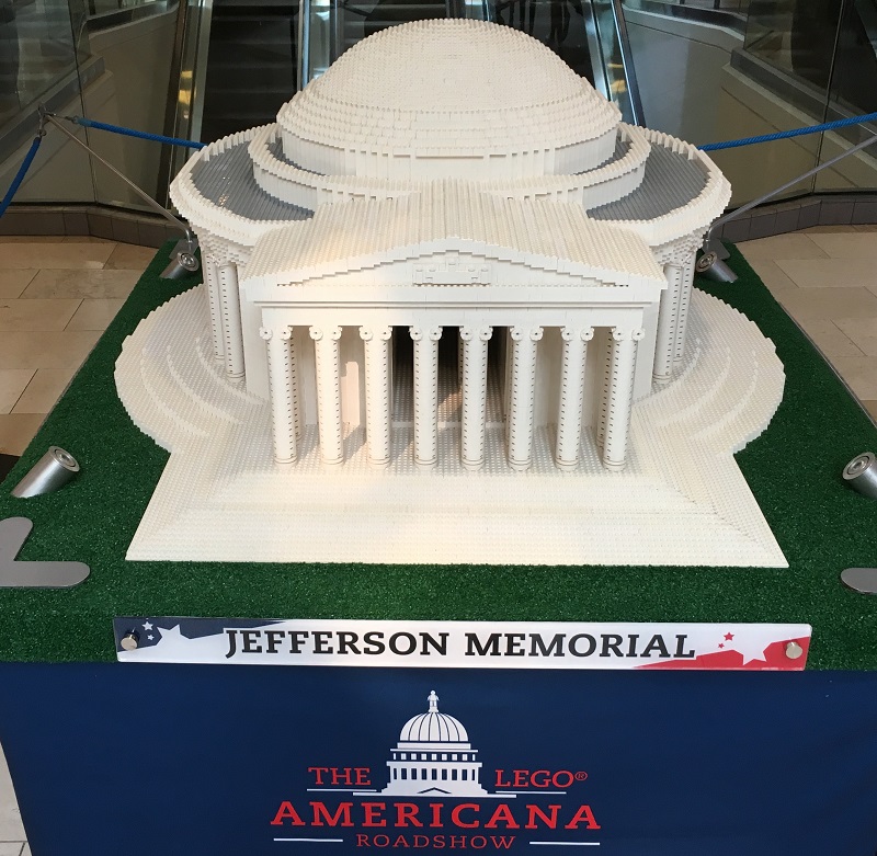
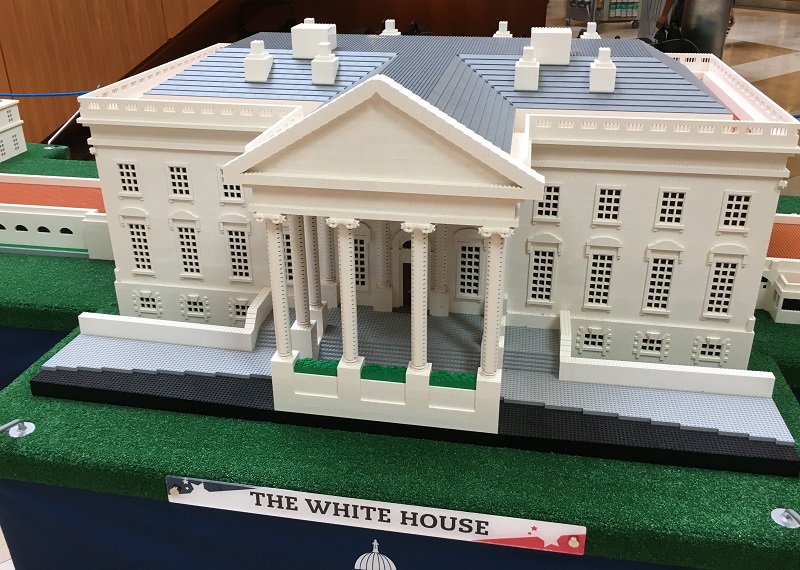
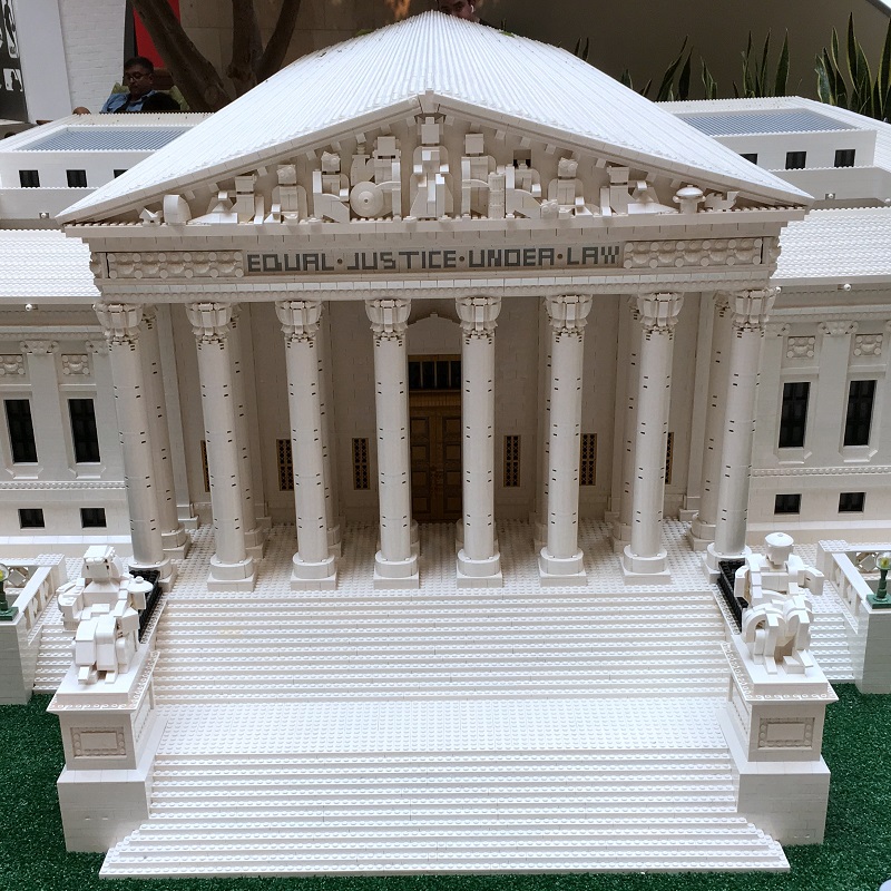
I lucked out and caught the last day when these LEGO ‘Americana Roadshow’ models were on display at Bellevue Square mall, last Sunday.
I don’t think I aspire to build giant LEGO models like these .. but maybe that is just because I don’t have hundreds of thousands of bricks to work with!
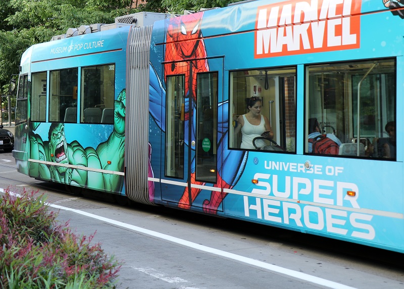
I made like the tourists in the city today, and walked around 2nd Avenue and the Seattle Waterfront.


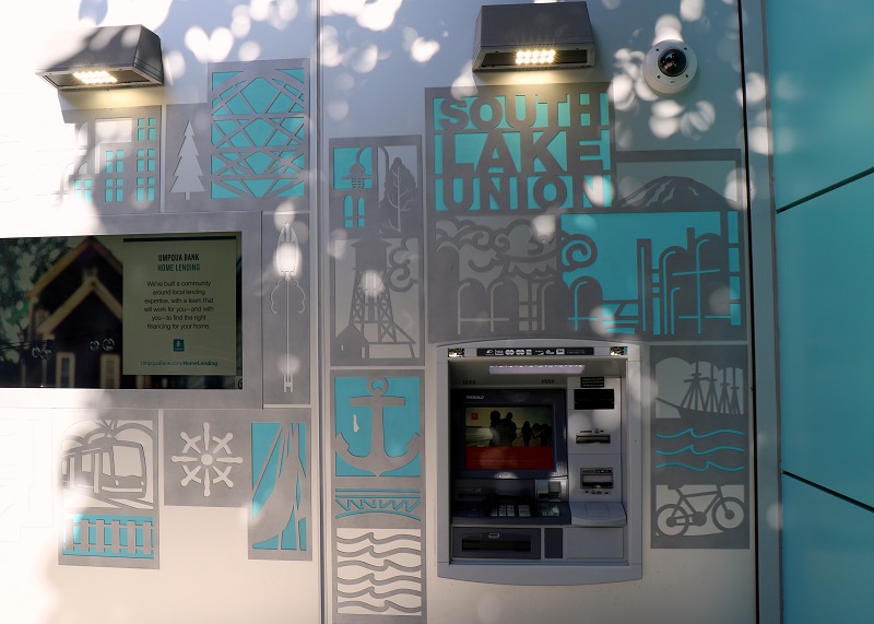
The mercury hit 90°F (32°C) here in the city today, and I waited for the fireball in the sky to sit a little lower, before I ventured out on my usual South Lake Union walkabout. Here are some pictures.
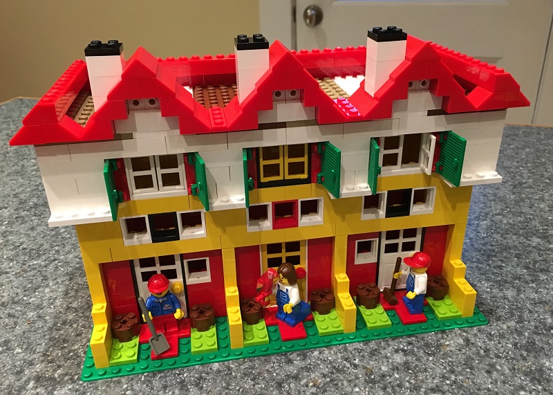
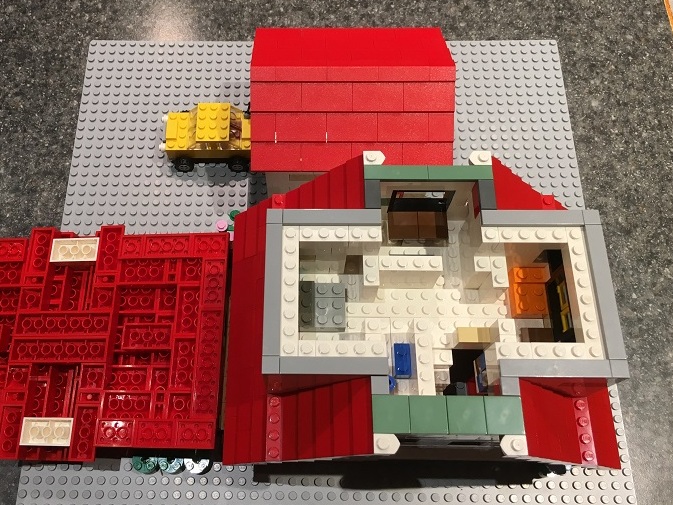
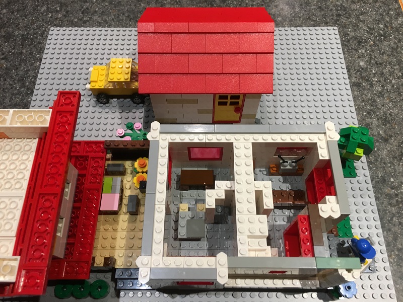
My ‘Townhouse Triple’ used up the last of my windows and white brick stock.
This illustrates the LEGO builder’s dilemma: which creations should one keep on permanent display, and which should one break down (to free the bricks for something else)?
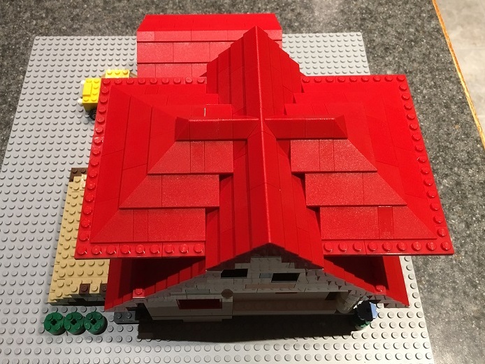
Update 7/22: Here’s an updated model with an improved rooftop.
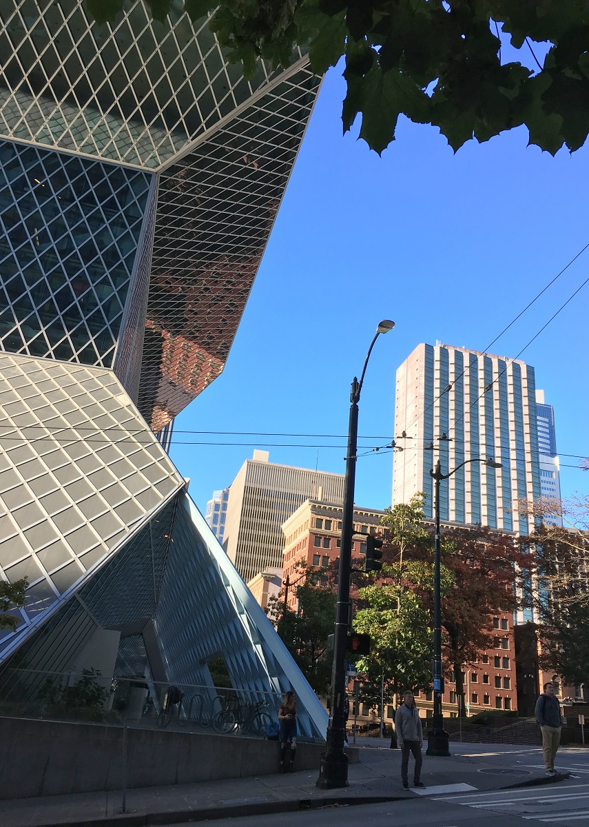
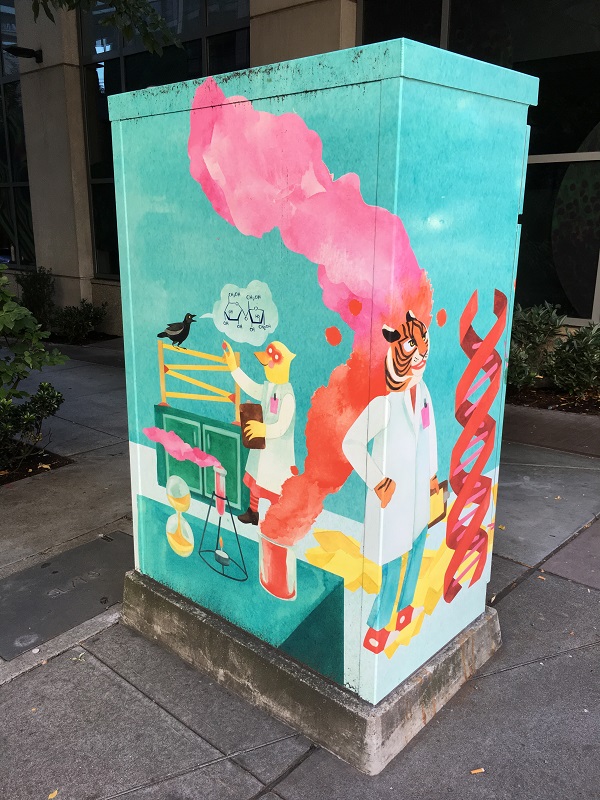
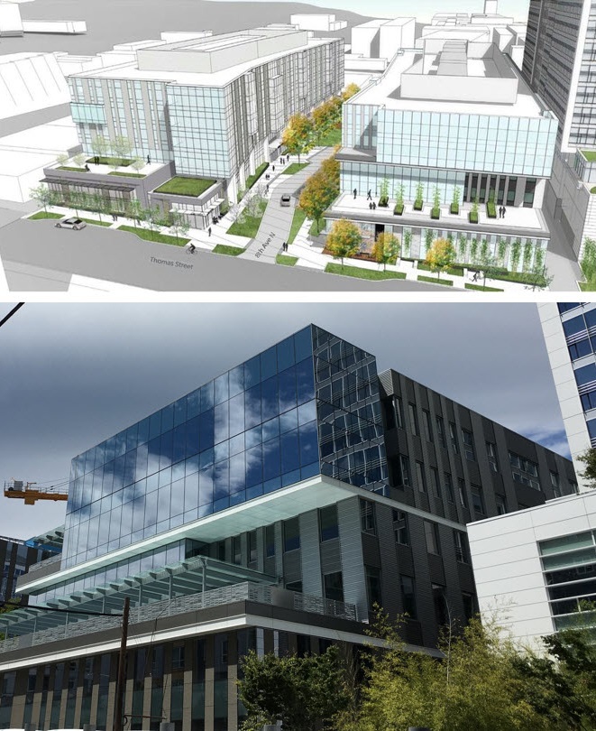
I spotted a building on Saturday at the street food fair on 8th Ave, that had a striking glass-faced box (picture below). So I looked up the design drawing for it (on seattleinprogress.com).
I see there is another woonerf in the making, next to it. (At least one more is planned for 12th Ave). Woonerf (pronounce VONE-erf) is a Dutch word, for a street with park-like surroundings, that is shared by pedestrians, cyclists, and cars (driving slowly).
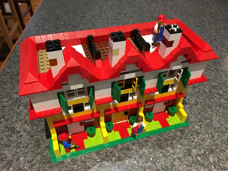
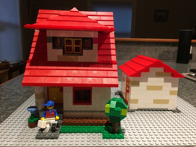
May I present the new and improved version of what I will call ‘LEGO House on the Hill’? The original one was only a shell, with no floors, and not much detail inside.
This house is still very compact, and built with pretty basic bricks. I don’t have custom furniture and kitchen appliance bricks that come with some LEGO house sets – yet.

I went down to the Space Needle this afternoon, to check how the removal of the scaffolding is progressing.


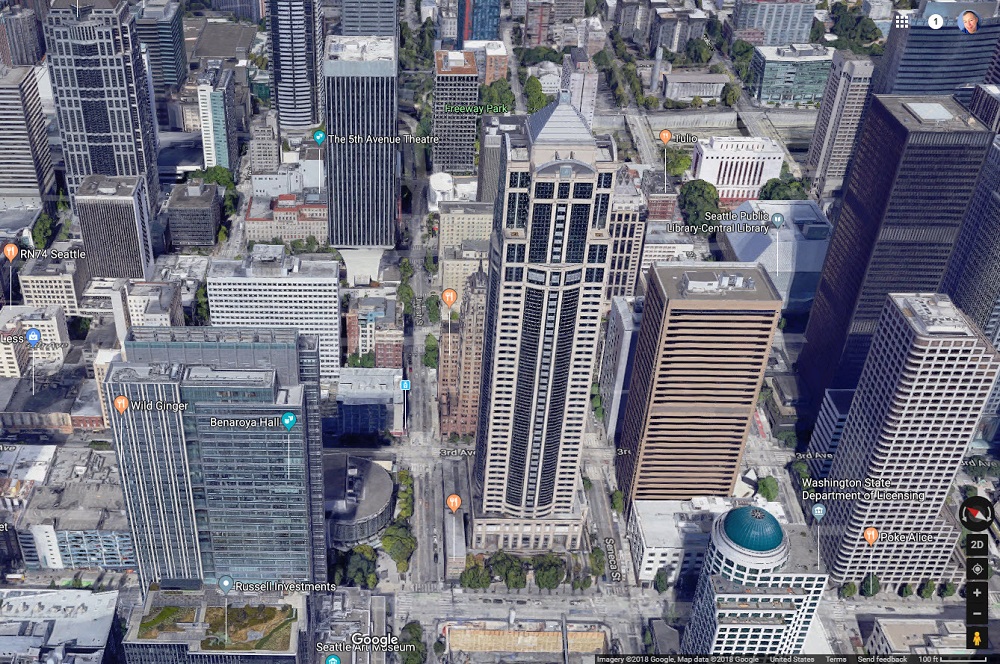
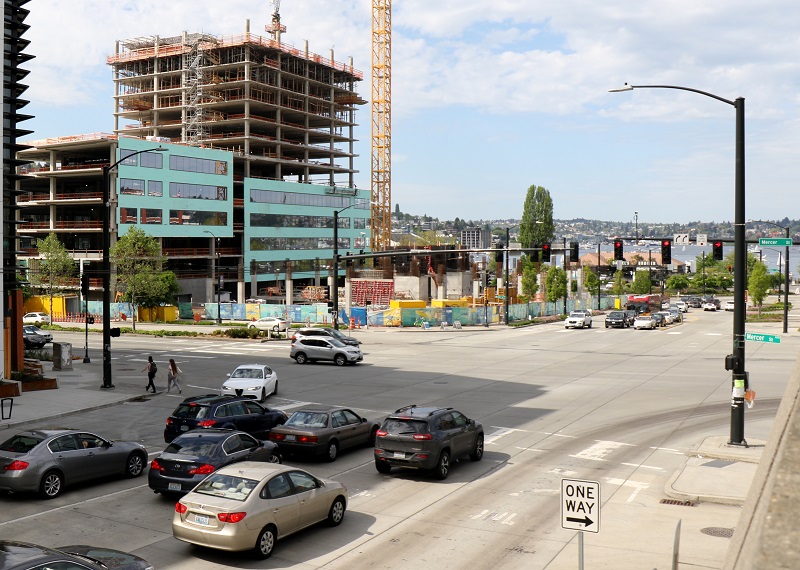
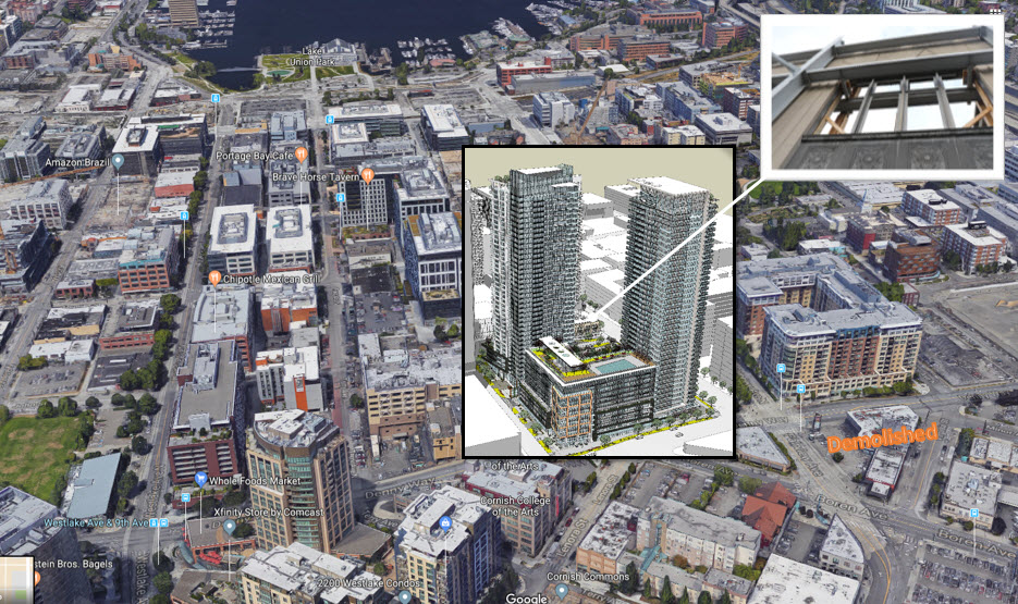
My walkabout today was in South Lake Union, the area next to Seattle’s downtown that is a booming hub for Amazon, Google and the biotech industry. The new Denny Substation and duct banks under the streets (for power distribution) are scheduled for completion in late summer.
It was a brisk 44°F/ 6 °C in the University District this morning at 10 am, where I was this morning. The storm we had on Sunday night was gone. It brought down a little hail at my house, and a thunderbolt so loud, and so close, that it rattled the windows and the glasses up in my kitchen cabinet.
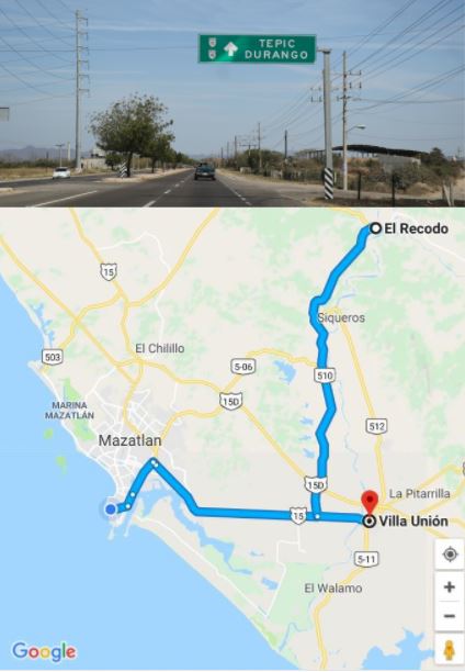
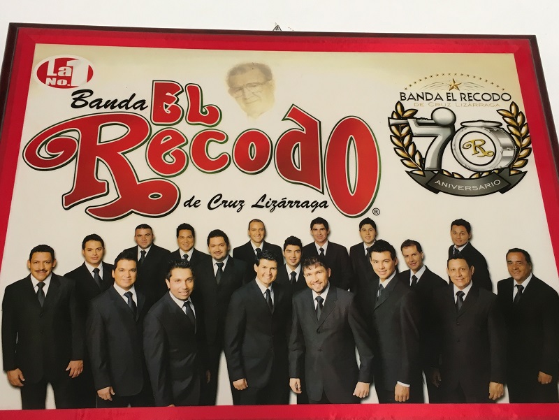
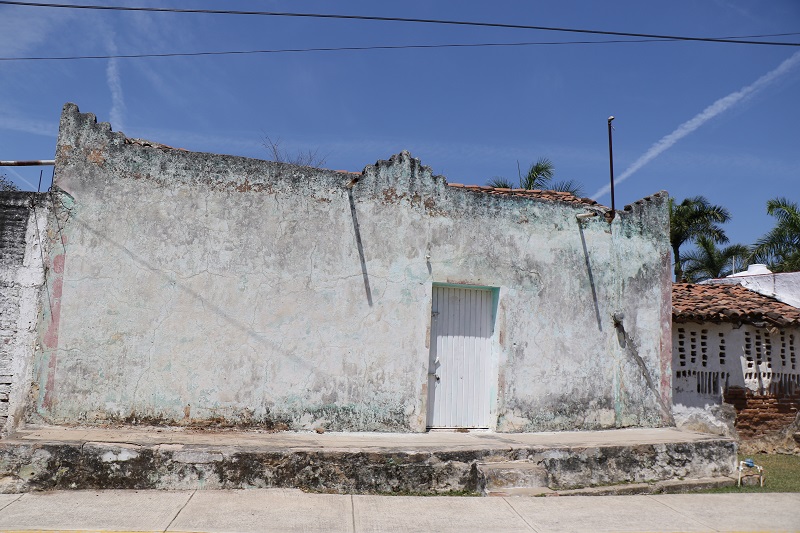
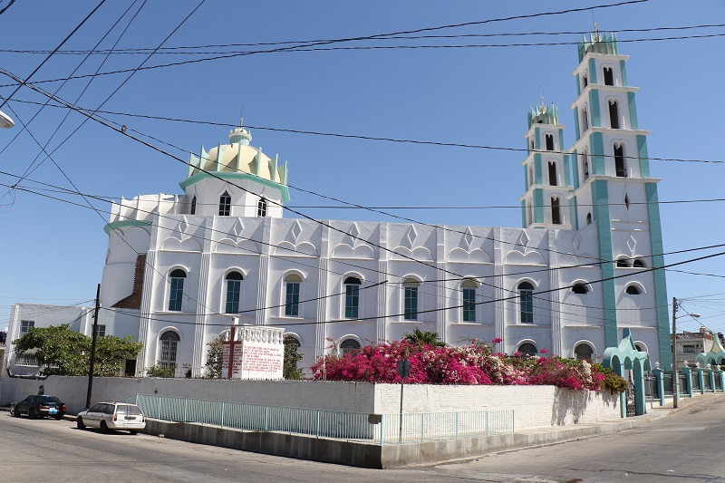
On Sunday, we drove out to the town of El Recodo and made a stop at Villa Unión for lunch at a famous seafood restaurant.
We were very lucky to run into a tour guide in El Recodo to show us around. He also phoned ahead to the very popular restaurant in Villa Unión, which allowed us to get in almost right away.
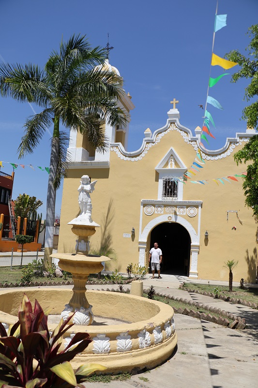


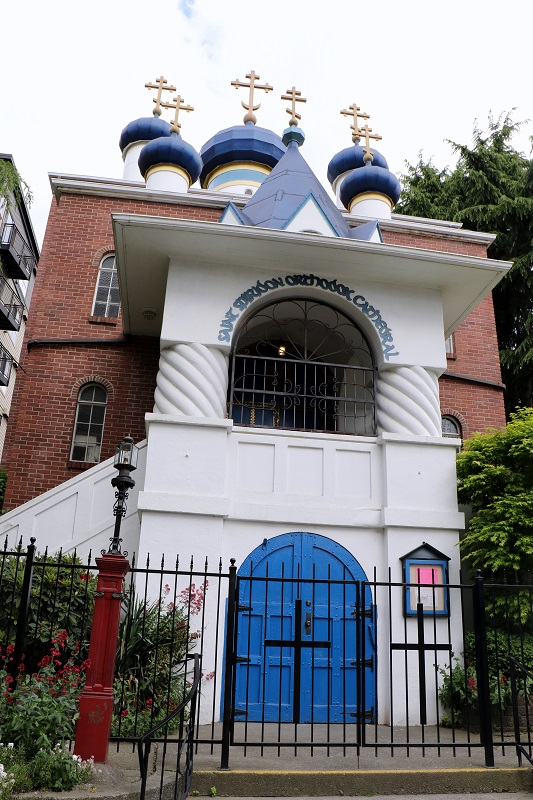
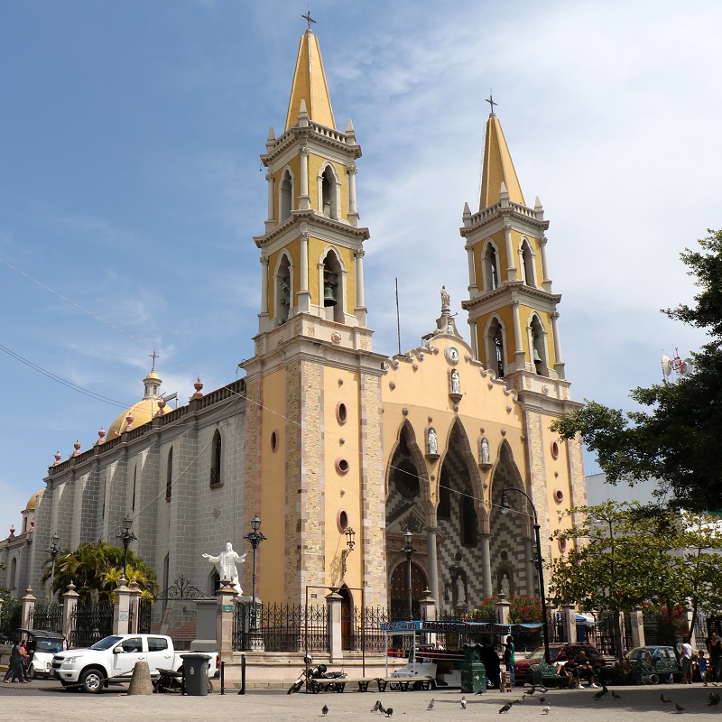
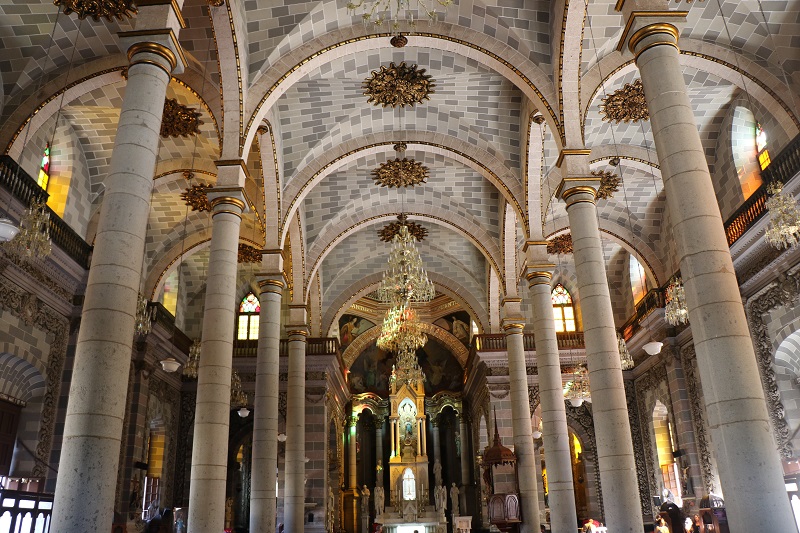
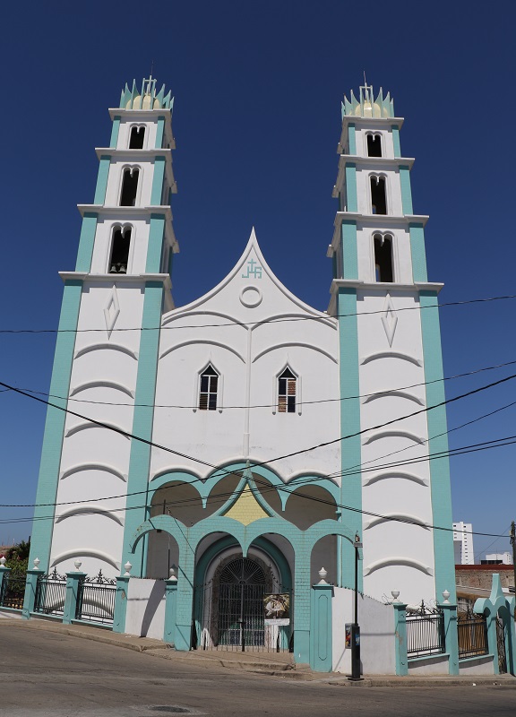
I walked to two beautiful churches here in the city so that I could take a closer look.
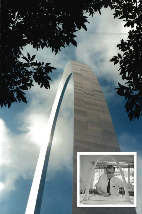
Saarinen (1910-1961) was a Finnish American architect and industrial designer, noted for his neo-futuristic style. I also learned that Saarinen was the architect of the Gateway Arch in St Louis.
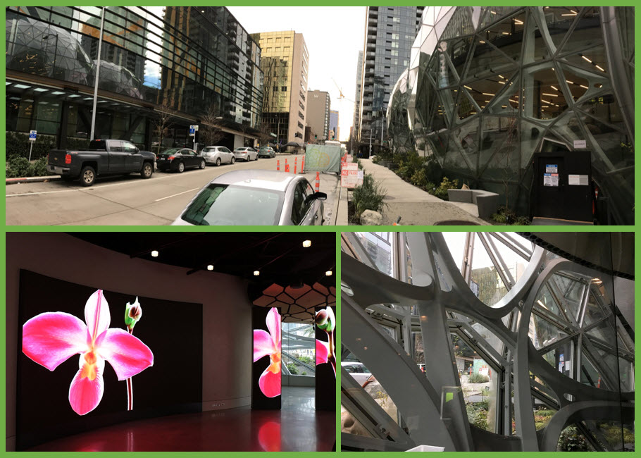
I saw ‘Black Panther’ (more about it later) in the IMAX theater here in the Pacific Science Center today.
The Pacific Science Center was designed by Minoru Yamasaki for the 1962 World’s Fair in Seattle, and housed the United States Science Pavilion. It is located right by the city’s iconic Space Needle.
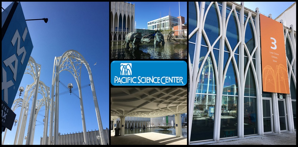
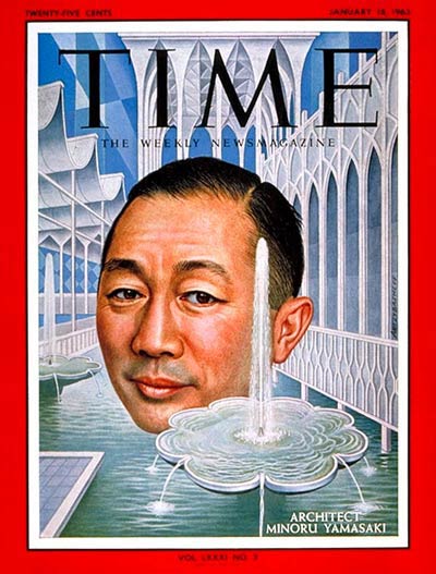
Yamasaki was born in Seattle in 1912, a second-generation immigrant. He graduated from the University of Washington in 1934, and became a very successful architect with his own firm in Seattle.
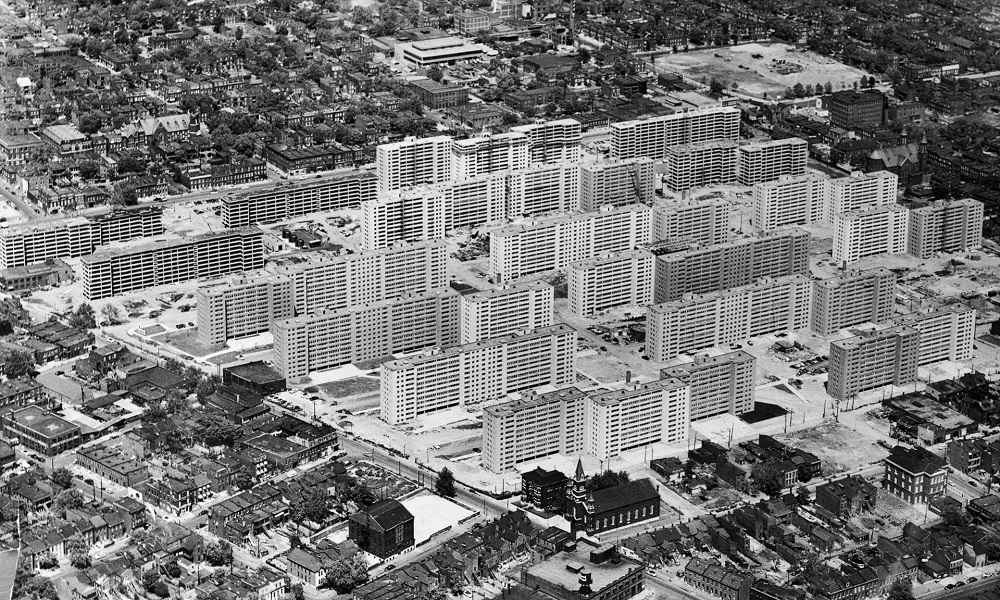
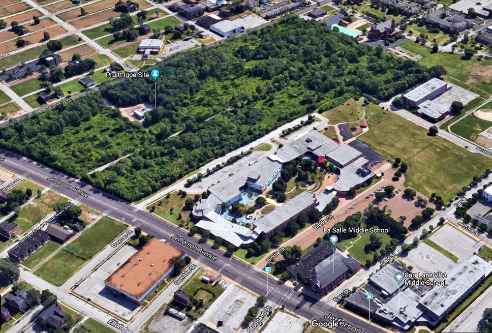
He was the architect of two prominent buildings in downtown Seattle: the IBM Building (1963) and Rainier Bank Tower (1977). His firm won the contract to design the St. Louis’ Pruitt-Igoe Housing Project in 1953, but the project ended in disaster. It was a big setback for his firm and for his reputation.
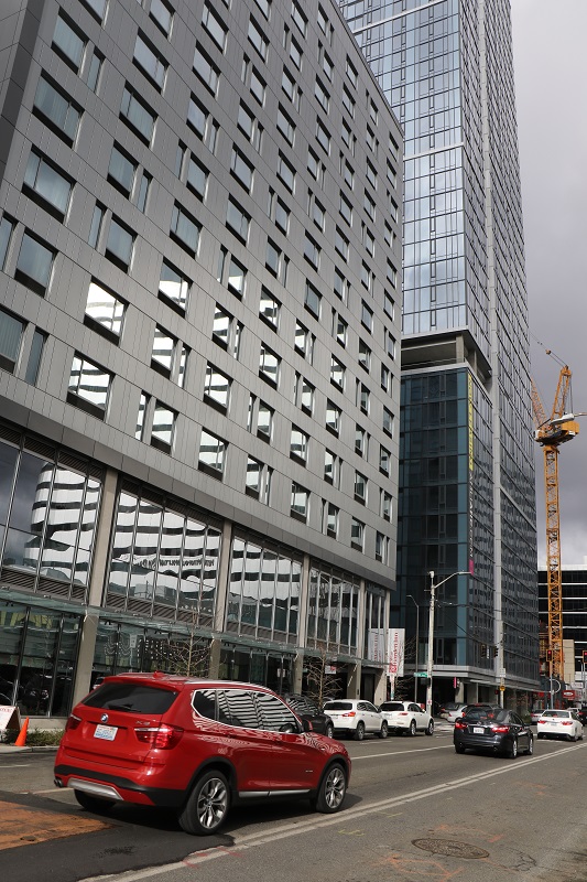
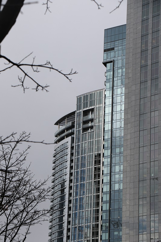
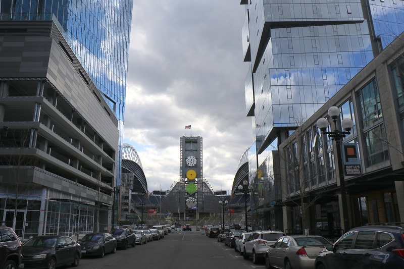
These pictures are from my on Sunday afternoon walk-about to check out the construction projects in downtown and South Lake Union.
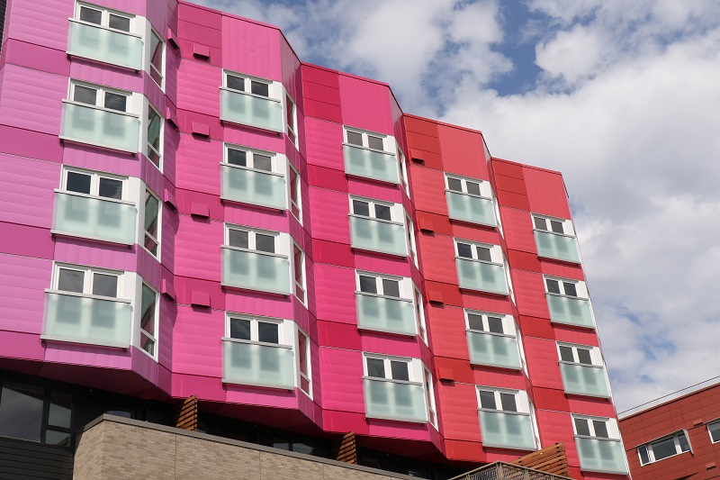
‘The Wave’ is one of a few newly constructed buildings close by Century Link Field (football field) south of Seattle’s Pioneer Square district.
The Wave has a mix of studio, one-bedroom and two-bedroom apartments. The studios start at $1,500 a month, and the two-bedrooms can run up to $6,000 a month, depending on the floor space. The Amtrak station with trains south to Portland and north to Vancouver is right there by these buildings, as is the light rail station to Seatac airport and elsewhere in the city.
It was a beautiful, crisp, sunny day here in the northwest corner of the United States (56 °F/ 13 °C). I made my way down to Pike Place Market and the waterfront and bought a book at a second-hand book store there. Where are you from? inquired the owner. ‘Oh – South Africa’ I said, simply. My camera bag completed my appearance as an international tourist.

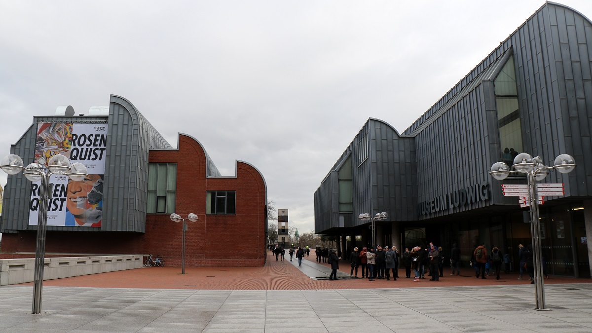
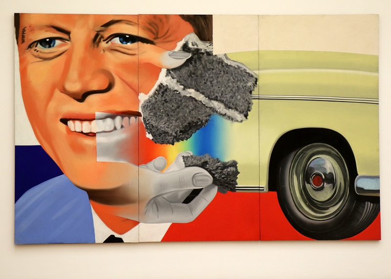
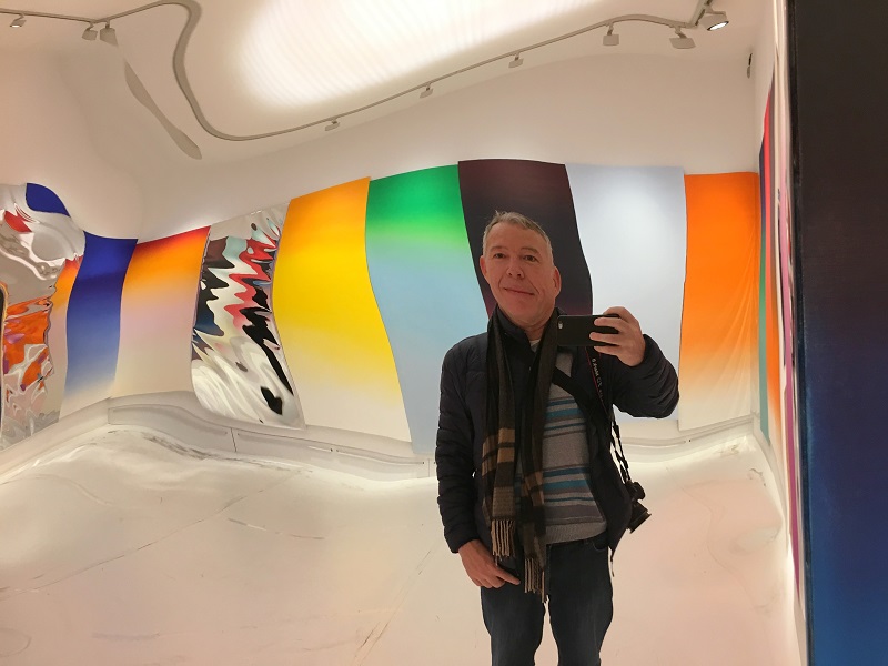
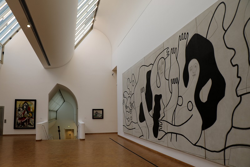
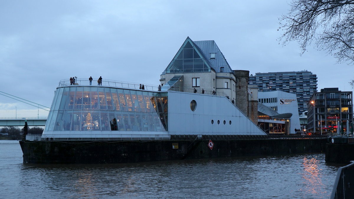
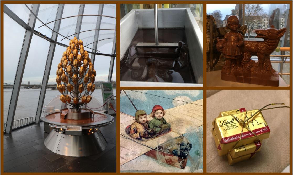
Today was my last day in Cologne. The museums and shops were finally open again after being closed Sunday & Monday. I only made it to two museums, though: the Museum Ludwig and the Chocolate Museum.