With Hurricane Ida projected to slam Louisiana on anniversary of Katrina, anxiety grips the region
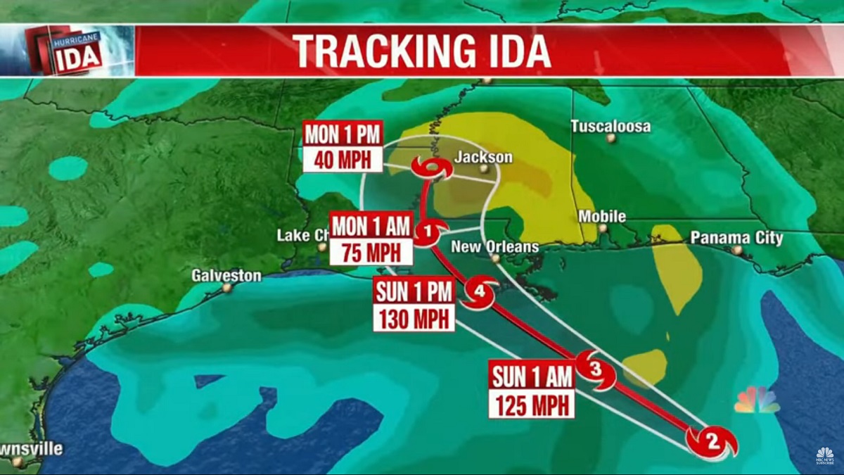
People across Louisiana were deciding Saturday whether to leave or ride out what officials were calling a potentially “life-altering” storm as Hurricane Ida rapidly gained strength in the warm waters of the Gulf of Mexico — threatening to become one of the strongest storms to make landfall in the state since 2005, when Hurricanes Katrina and Rita devastated the region.
The National Hurricane Center was predicting that Ida would strengthen to a Category 4 hurricane with 140 mph sustained winds before making landfall in rural Terrebonne Parish, southwest of New Orleans, on Sunday afternoon. The storm was projected to bring an “extremely life-threatening” storm surge, “potentially catastrophic wind damage,” and widespread flooding, and with Ida projected to come ashore on the 16th anniversary of Hurricane Katrina, anxiety gripped the region.
– Emmanuel Felton, Tim Craig, Carmen K. Sisson, April Capochino Myers, Leslie Fain & Ashley Cusick writing for the Washington Post
[Graphic from NBC Nightly News]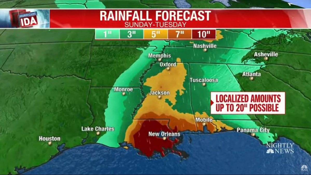
[Graphic from NBC Nightly News]
Batten down the hatches, close the gates
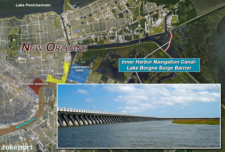
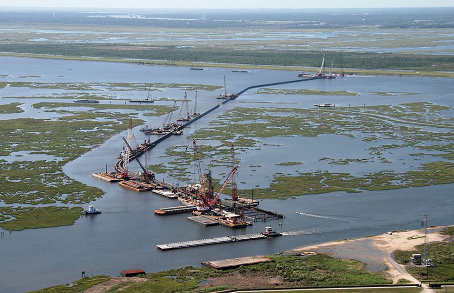
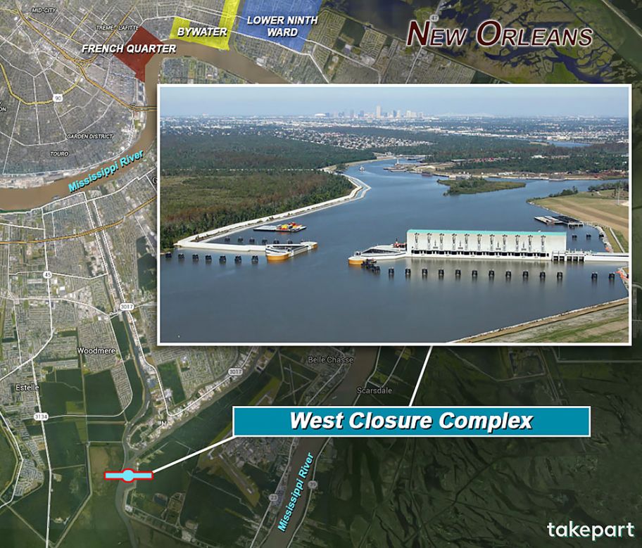
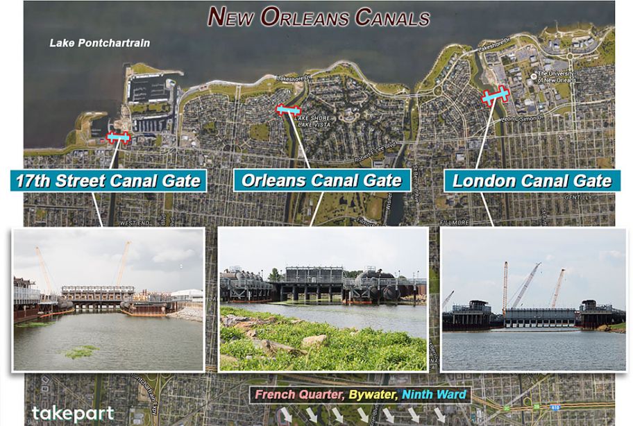
Today, a decade* after Katrina left 80 percent of New Orleans underwater and killed more than 1,600 people, the Big Easy has been reconstructed as a walled city. The Lake Borgne Surge Barrier is just one of a series of gargantuan structures and reinforced levees and floodwalls designed to defend the city against a 100-year storm—a Katrina-like catastrophe that has a 1 percent chance of occurring in any given year. This feat of engineering, prosaically called the Hurricane and Storm Damage Risk Reduction System, forms a 133-mile enclosure around New Orleans and the 350 miles of canals that traverse the city—the canals the Corps had relied on to contain floods and that failed so disastrously in 2005. “We’re taking the fight to the storm instead of letting it come to us,” says Boyett.
-*From a 2015 article asking ‘Will the ‘Great Wall’ of New Orleans Save It From the Next Killer Hurricane?’ by Todd Woody