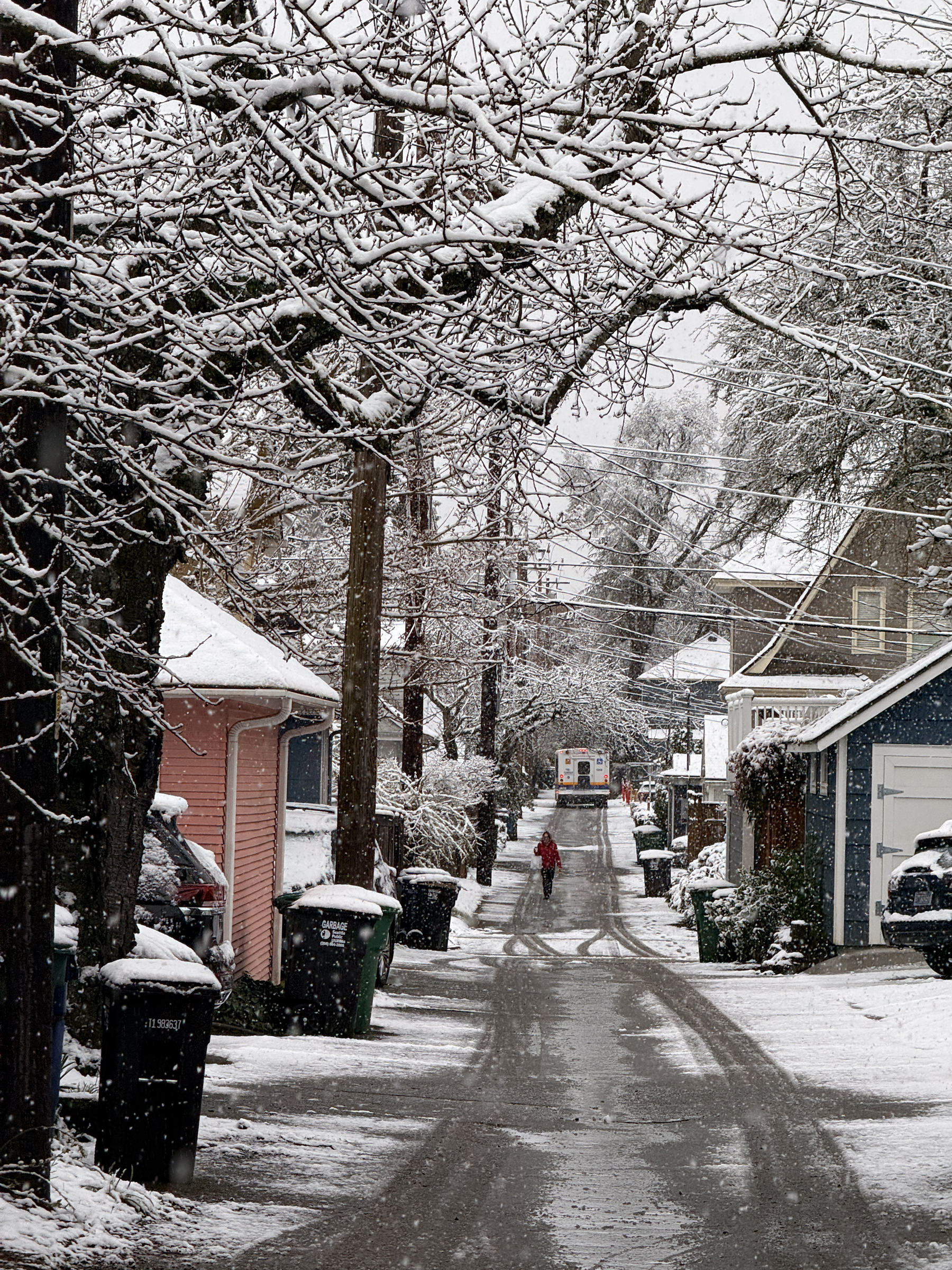
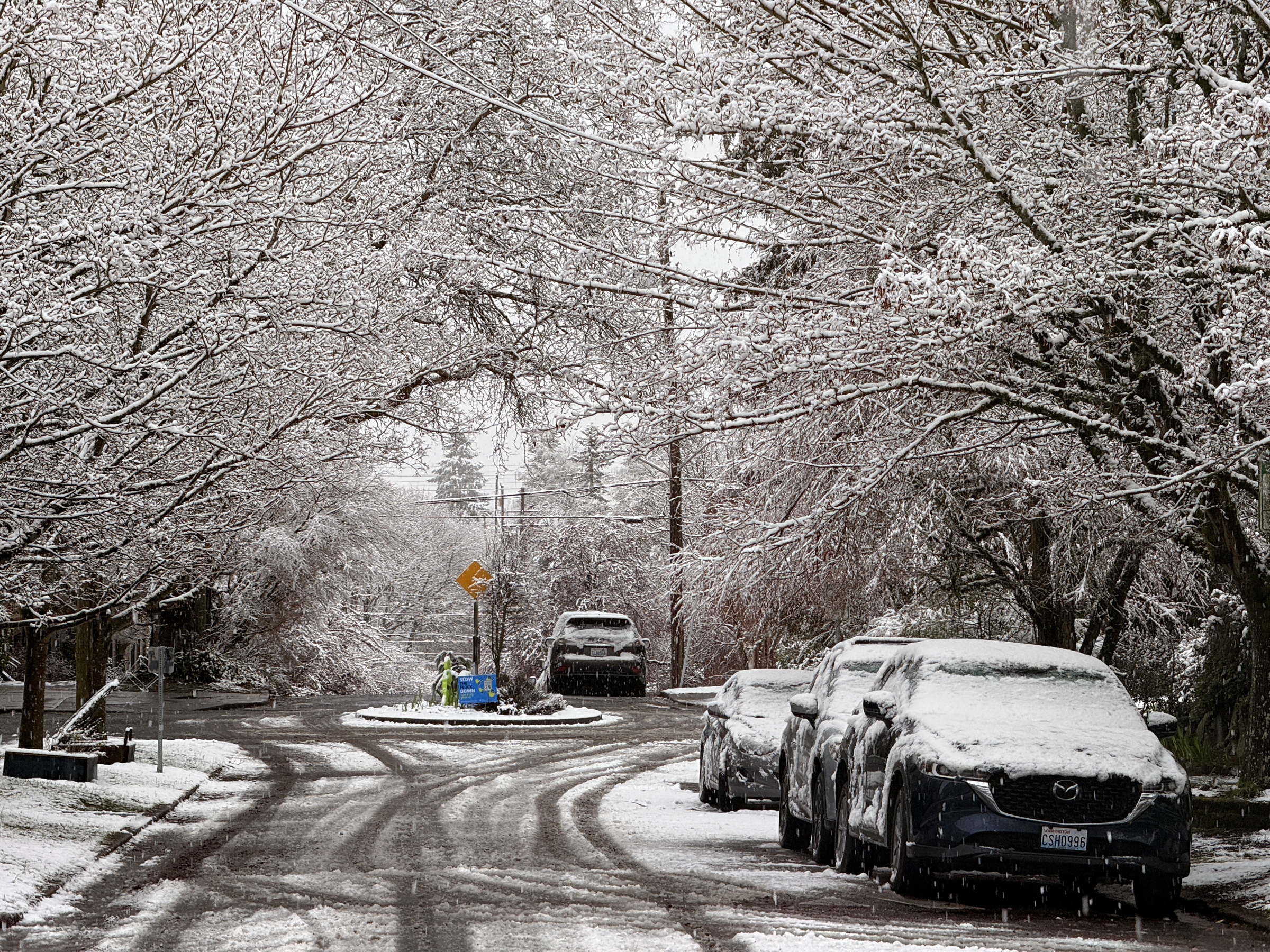
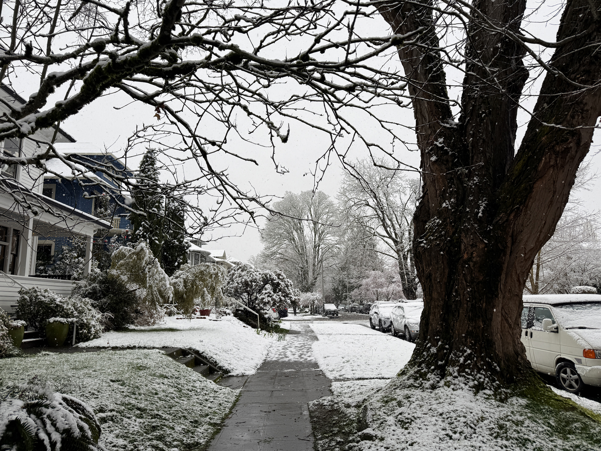
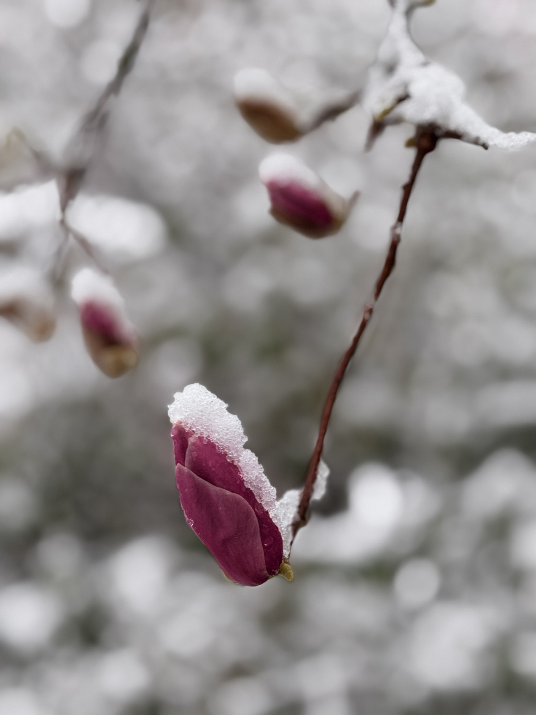
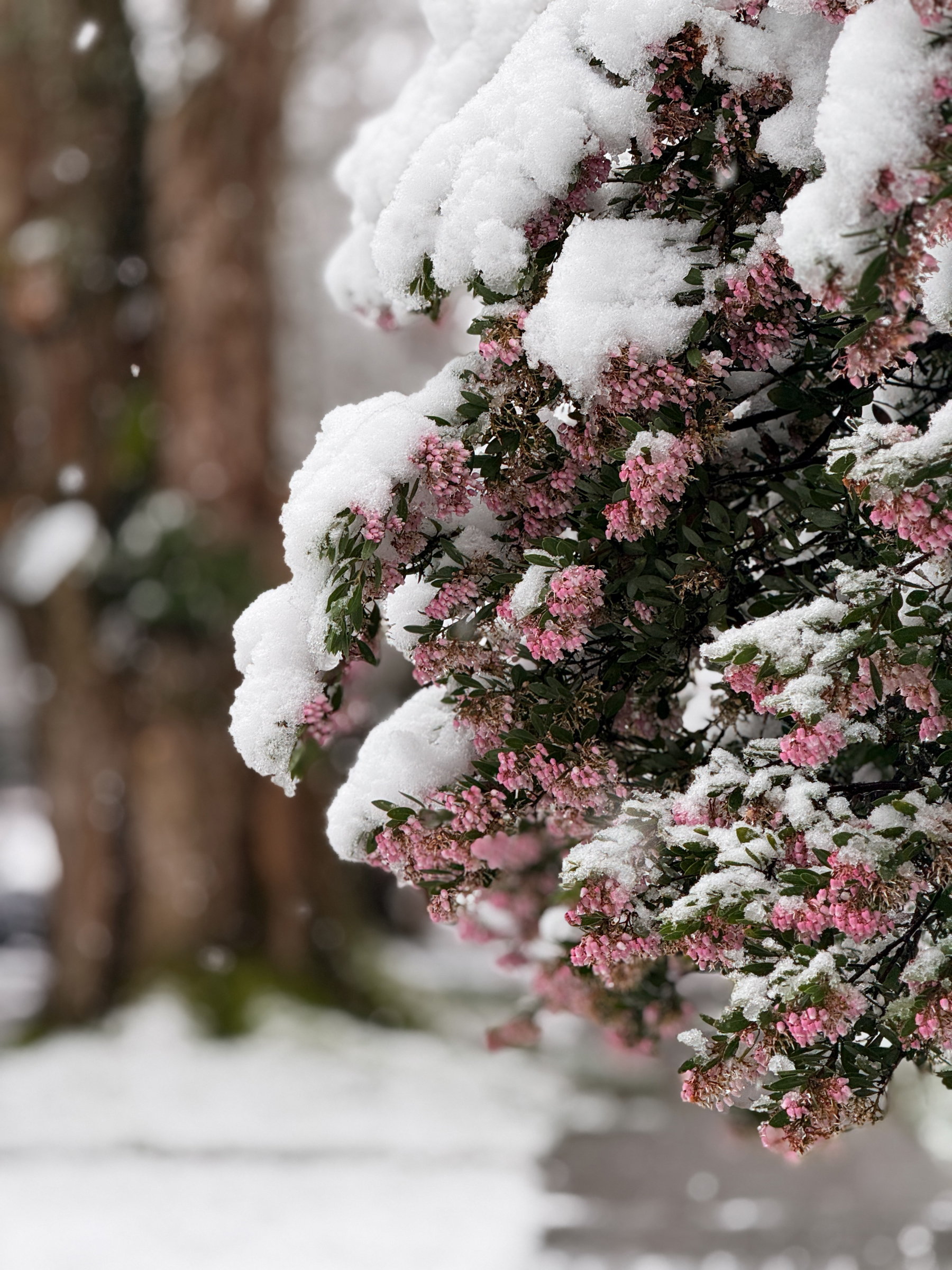
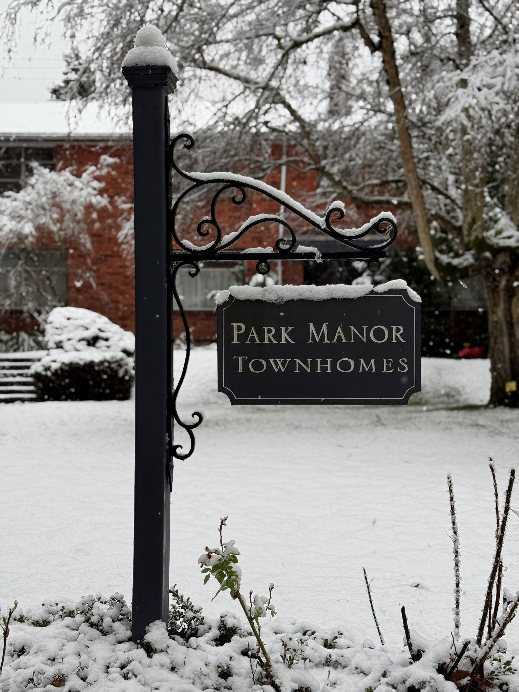
White snow flakes started coming down here in the city in the wee hours of the morning, transitioning to a very light snow for most of the daylight hours.
Snow in Seattle during March is uncommon— recorded only a handful of times in the last century.
Temperatures are mild today (38°F/ 3°C), so some of the snow on the ground has melted away already. (About 3 in. of snow on the ground).
I took these pictures shortly after 9 am this morning.
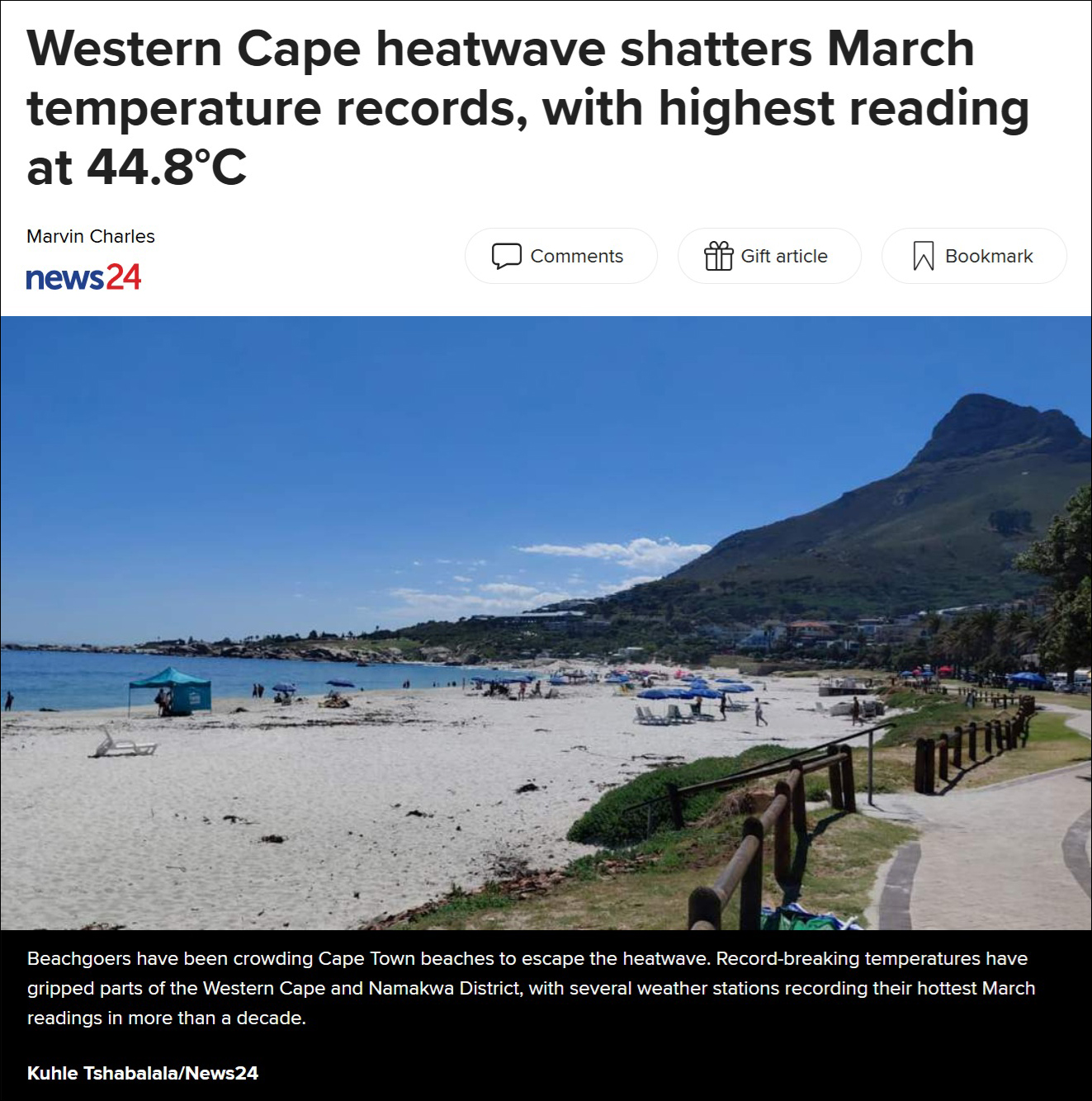
A heat wave in the Cape Town area in the Western Cape in South Africa is driving late-late summer temperatures to record highs.
At Kirstenbosch, the botanical garden in heart of the city, the high reached 42.1 °C (108 °F) on Wednesday, the highest since records began 66 years ago.
Cape Point on the Cape Peninsula also set a record with a temperature of 40°C (104 °F), a first for that location, and verified by the South African Weather Service.
At Alexander Bay in the extreme and arid northwest of the Western Cape province and on the border with Namibia, a reading of 44.8°C (112 °F) was logged.
This is Cape Town’s Camps Bay Beach on the Atlantic Ocean, with the distinct peak of Lion’s Head on the right— the mountain between Signal Hill and Table Mountain.
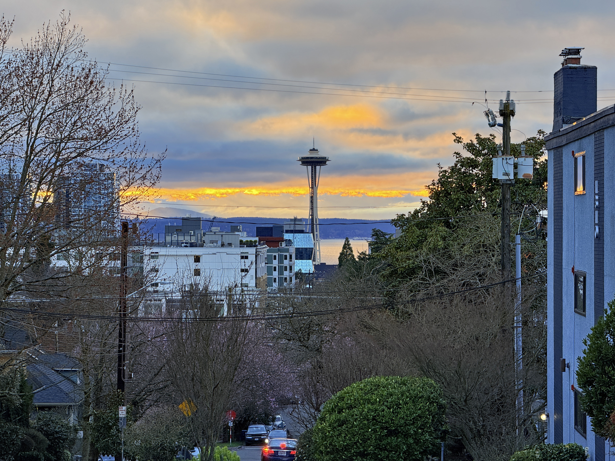
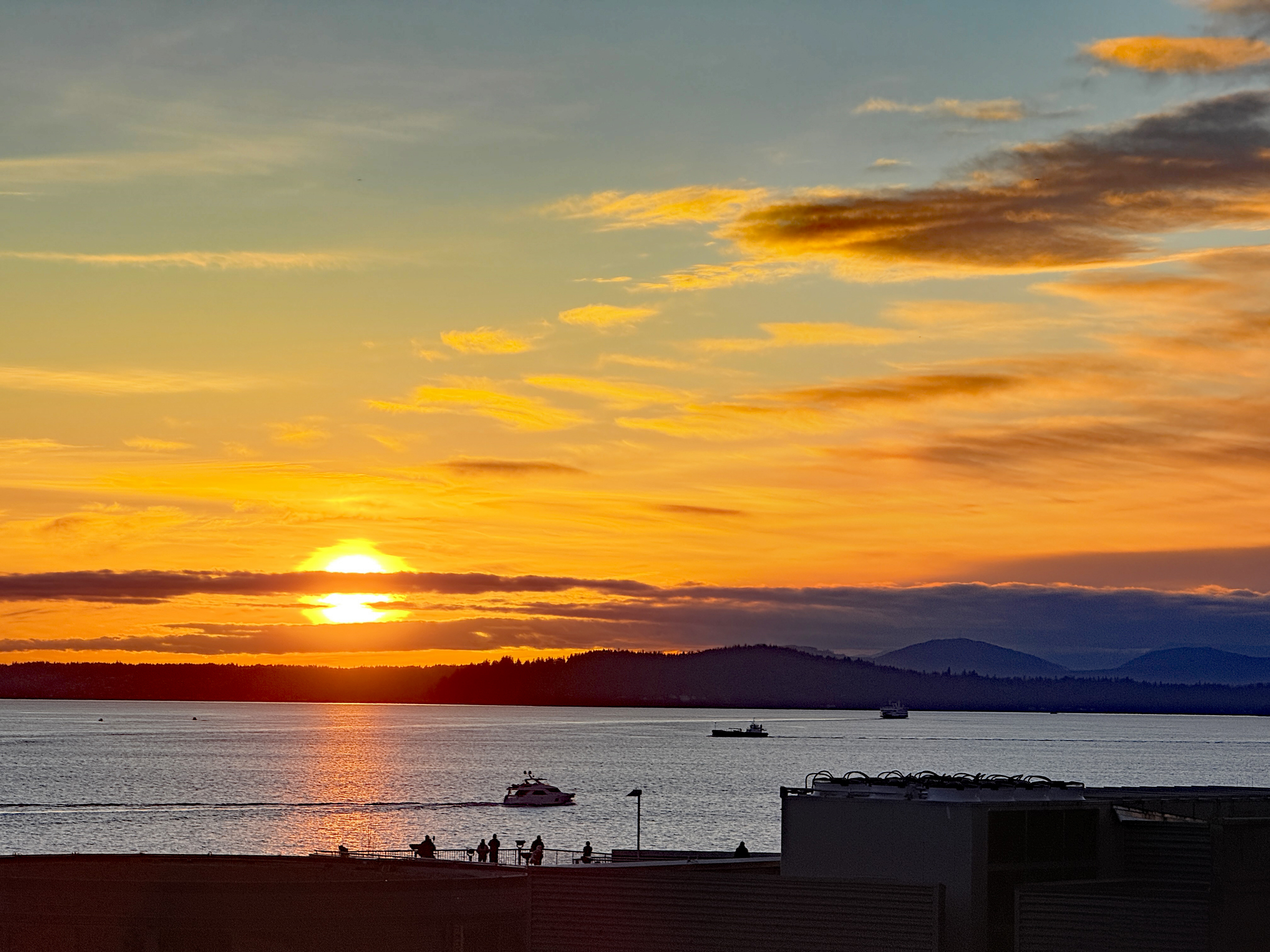
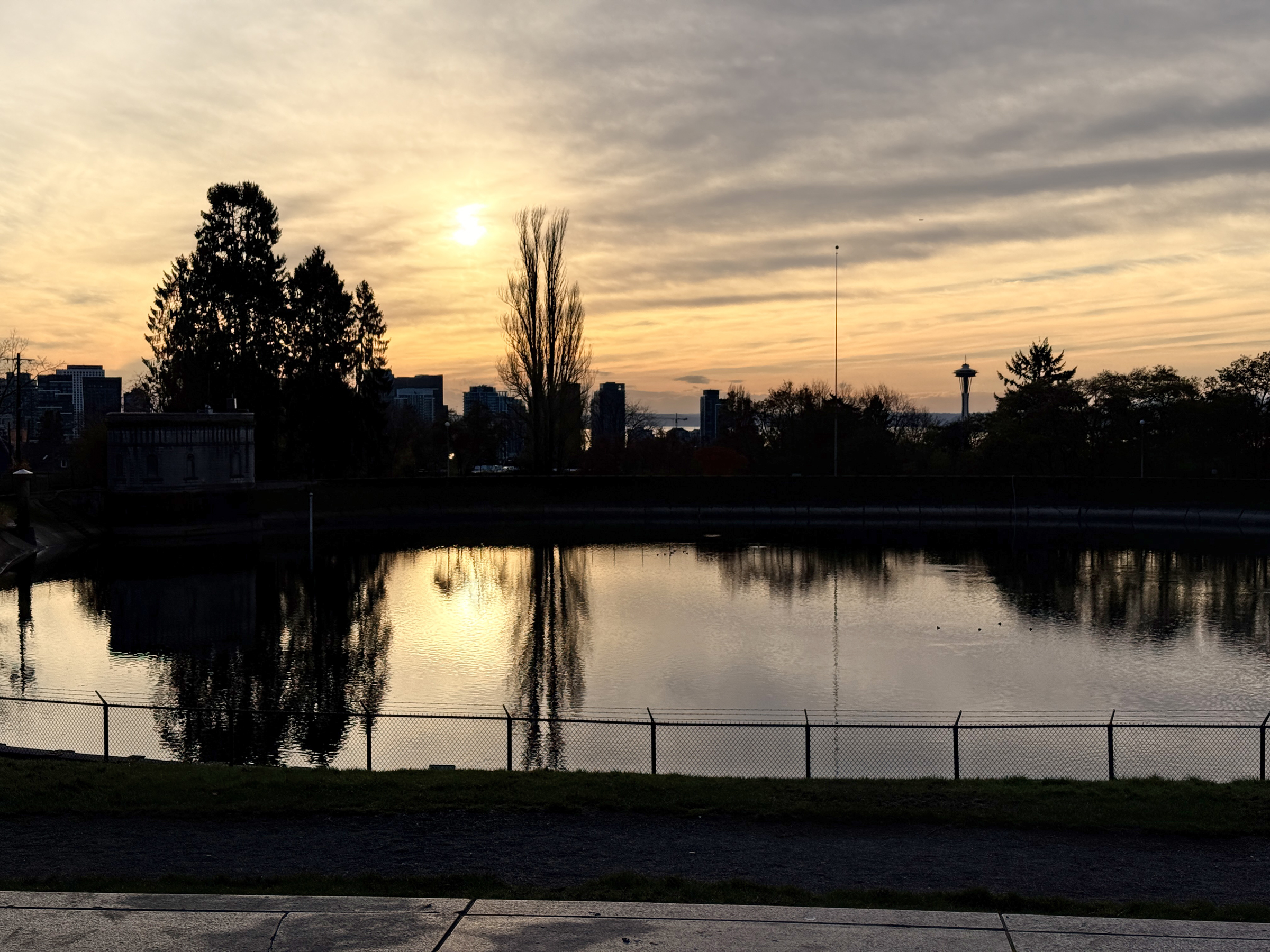
There were clouds and a little rain today here in the Emerald City.
It was 54°F (12°C) outside when I went for a walk just before sunset.
The Olympic Mountains were hidden from view tonight, with fiery color bands in the distant skies. Sunset was at 6.04 pm tonight, and that will change to 7.04 pm tomorrow night after Daylight Saving Time has kicked in at 2 am Sunday morning. (For the record: I think that’s crazy and that we should stop messing with the time.)
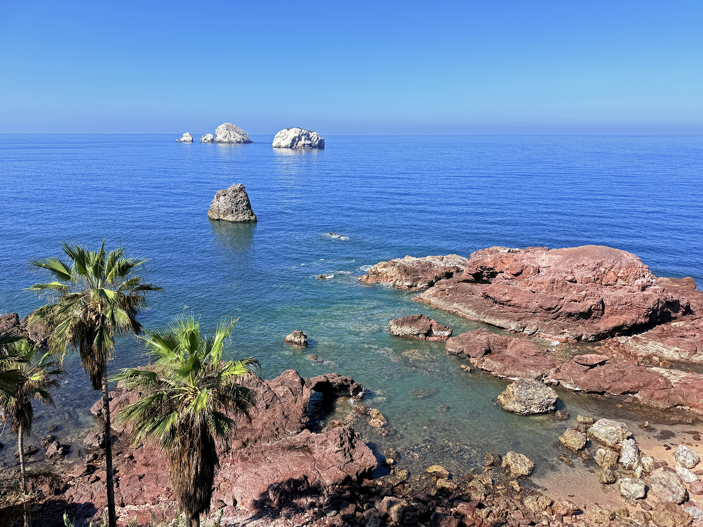
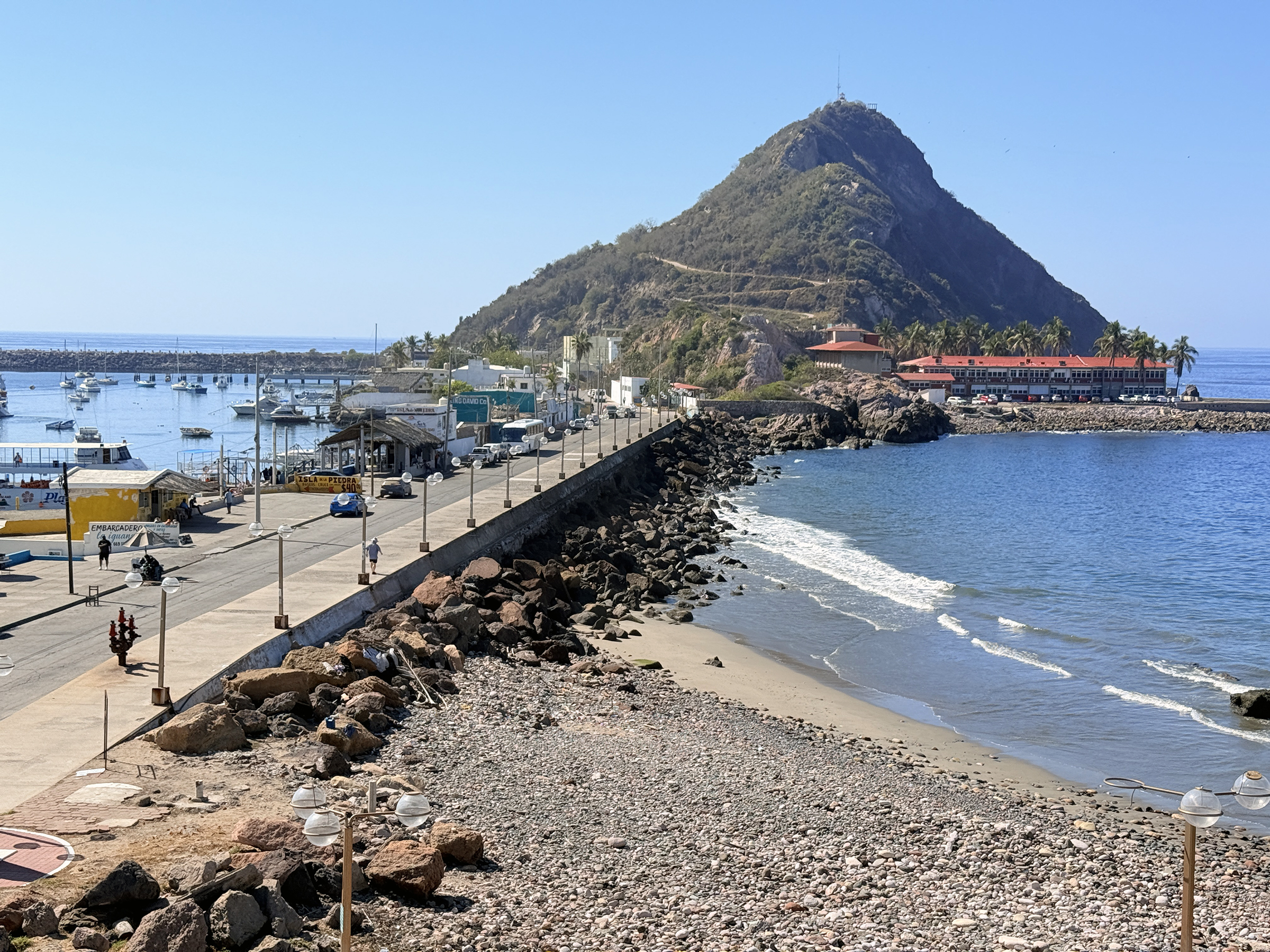
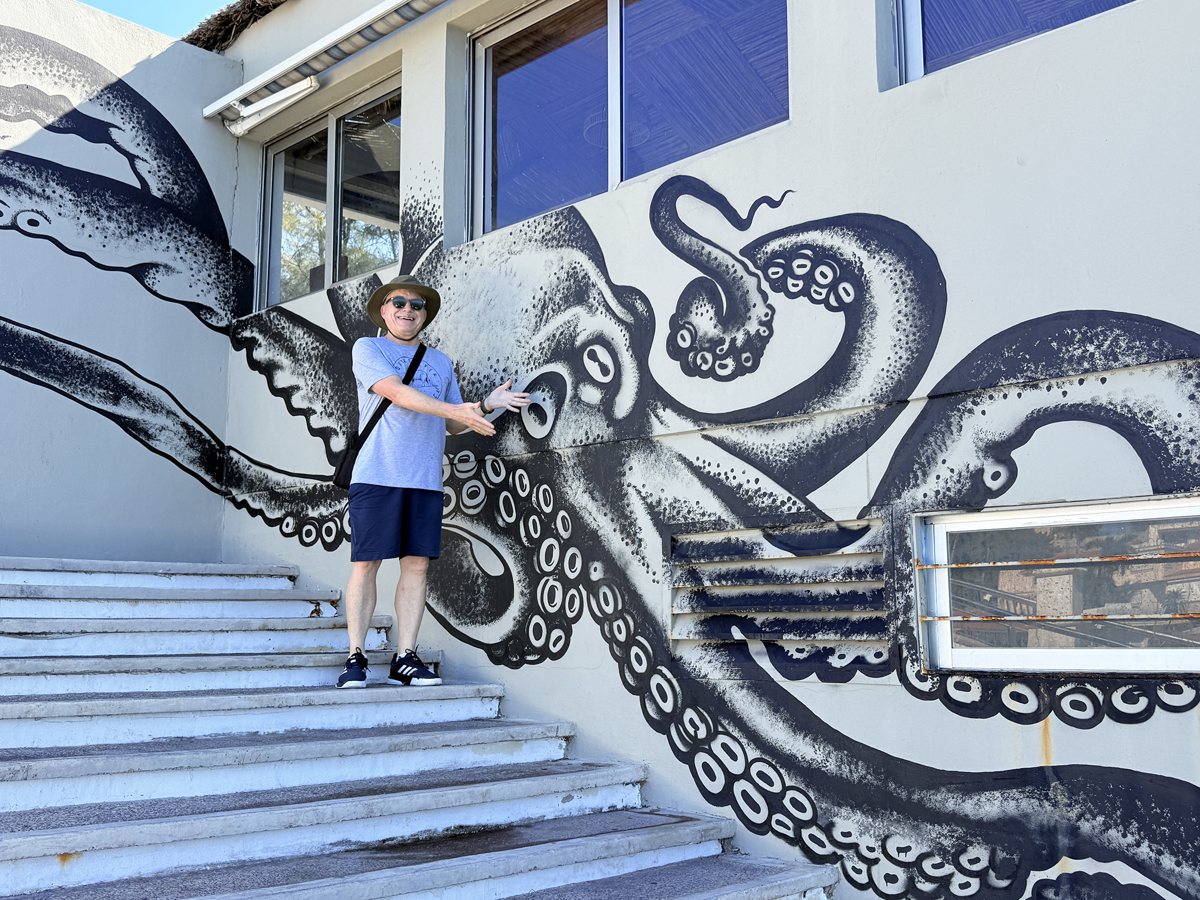
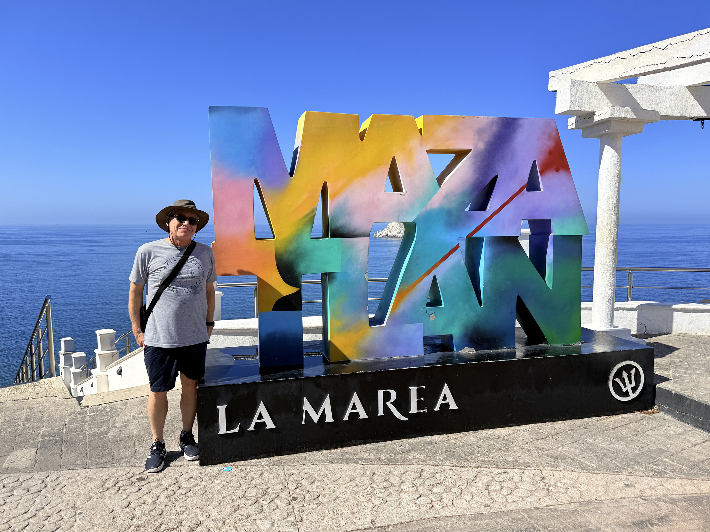
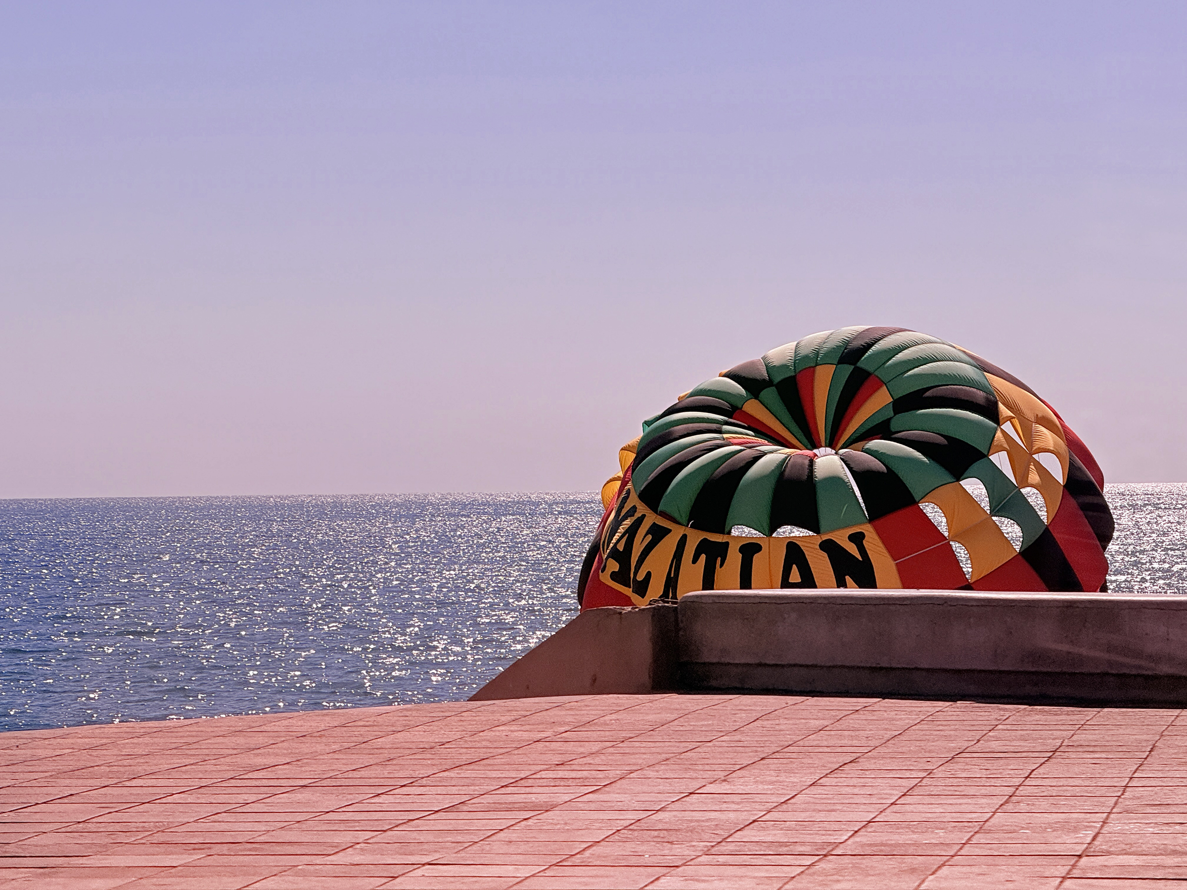
It was another sunny and cloudless day here in Mazatlán (76°F /24°C ).
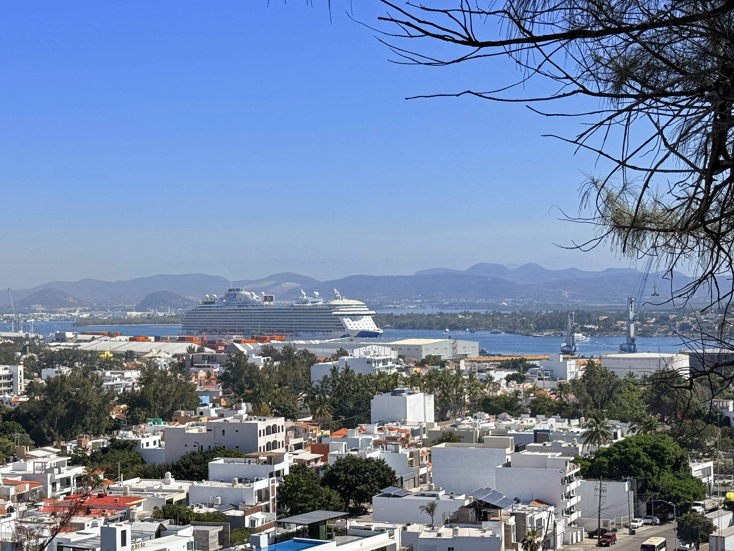
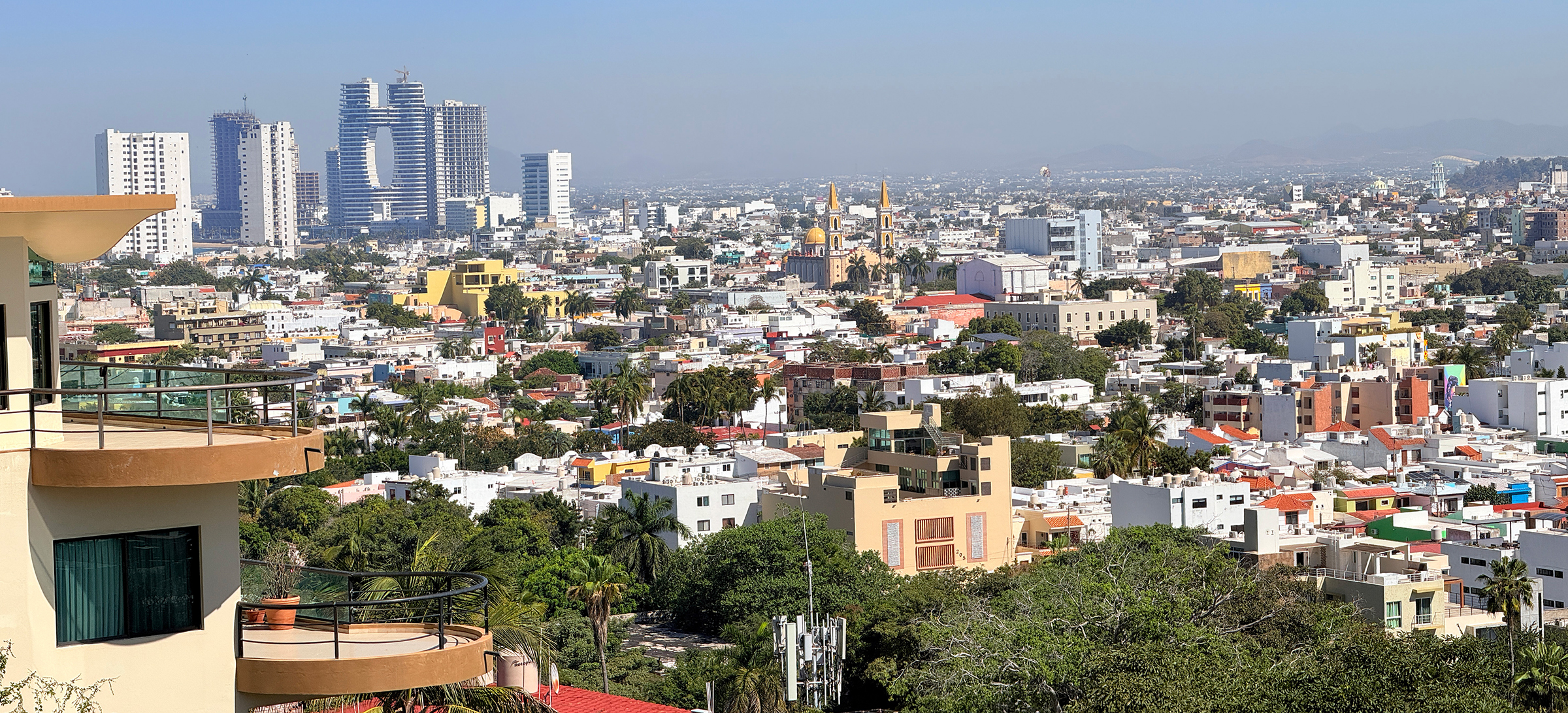
This morning, we went for a walk up the main lookout hill here on the shoreline (Cerro del Vigía).
This afternoon, we ran out to the local Sam’s Club (warehouse grocery store) for grocery shopping. We went there by bus and came back with a little Uber car with its trunk and back seat full of groceries.
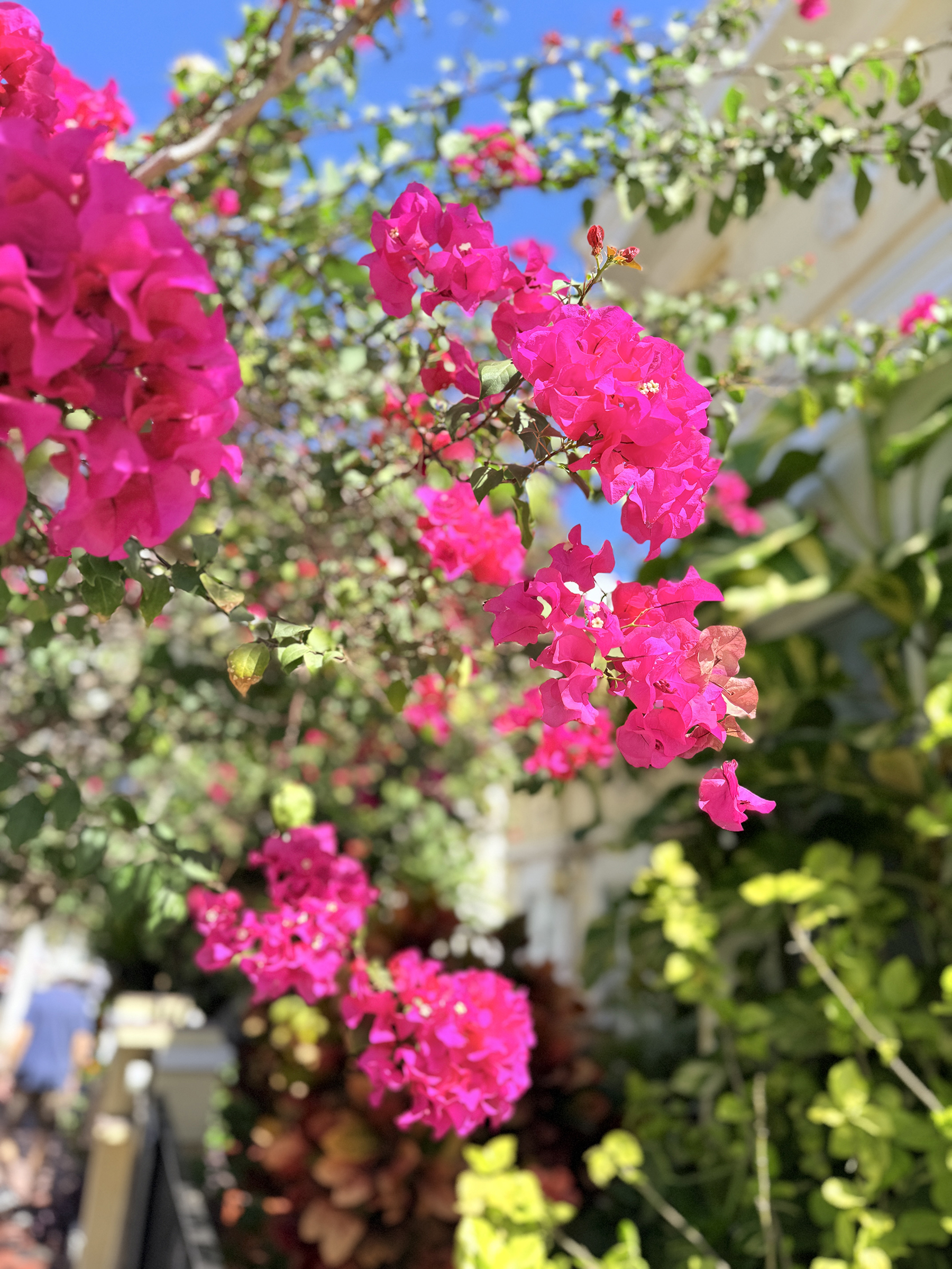
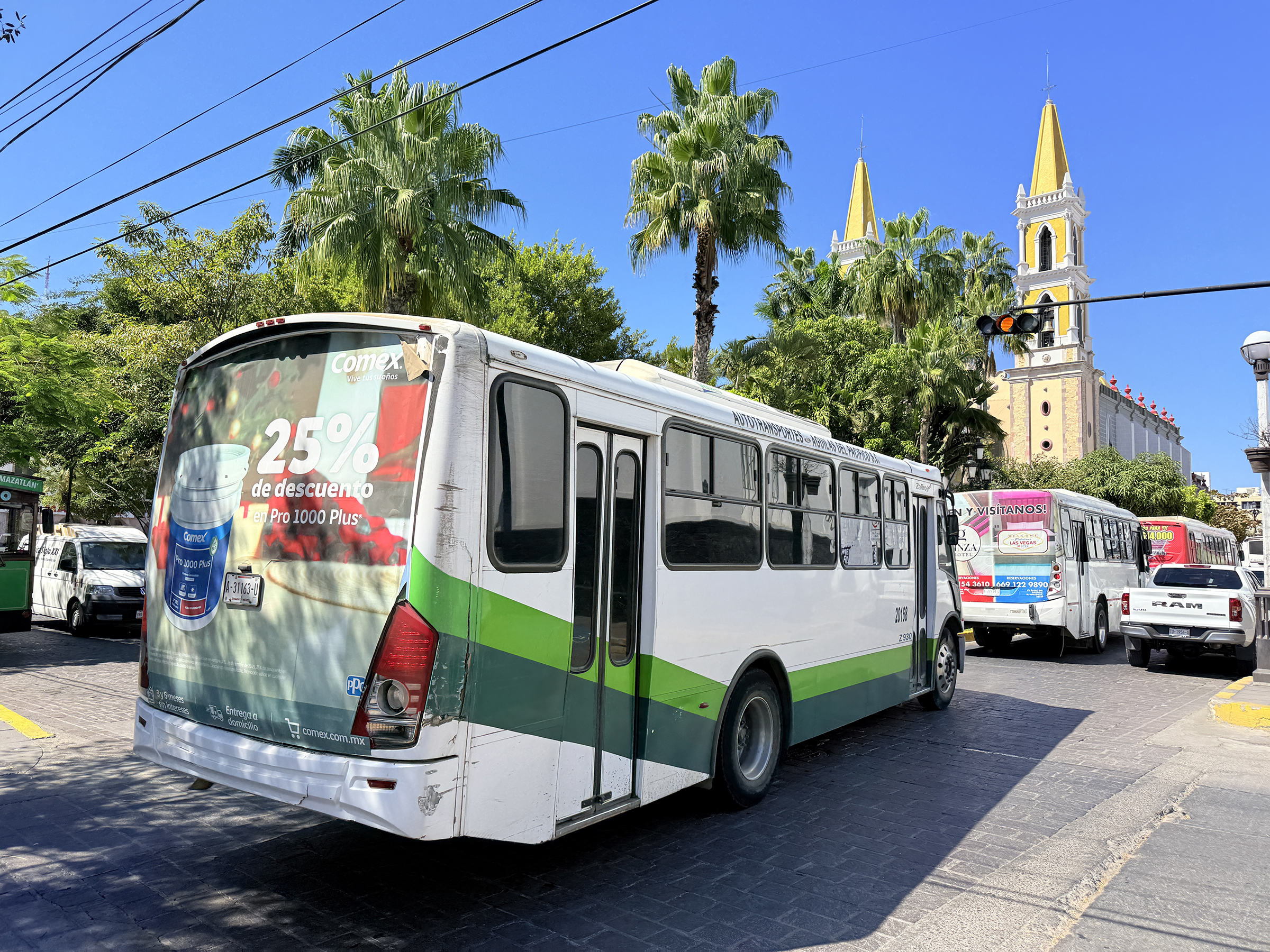
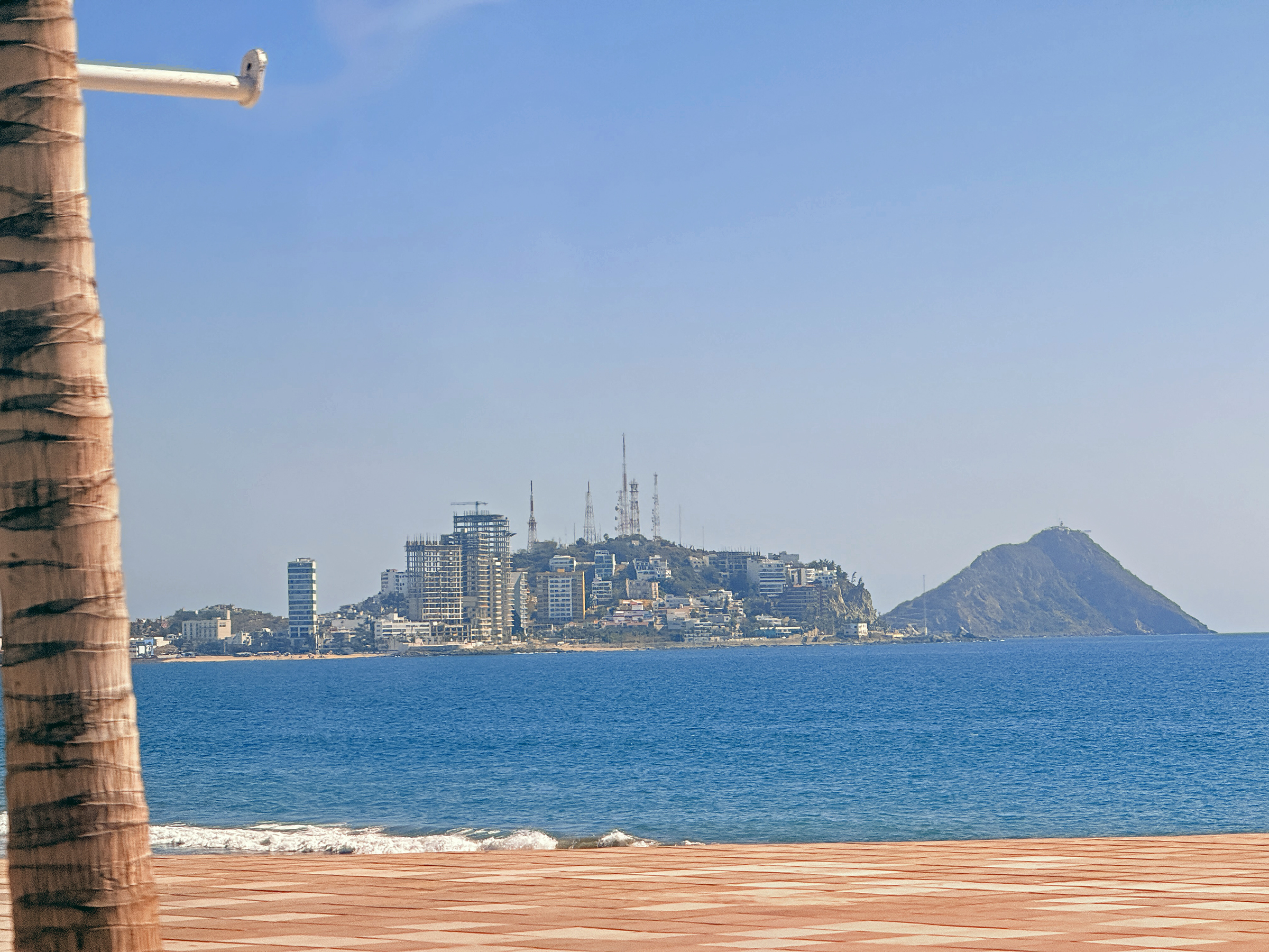
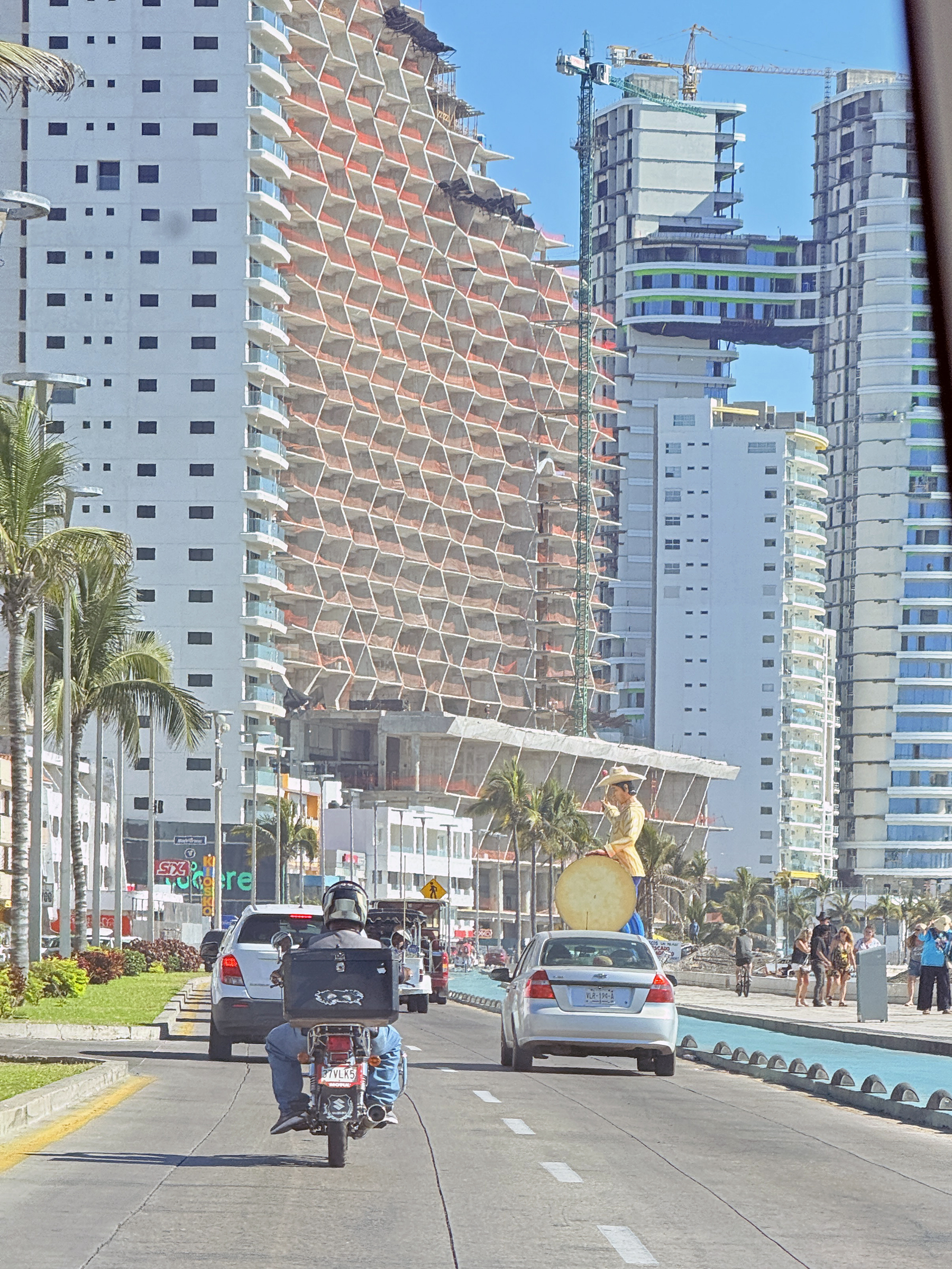
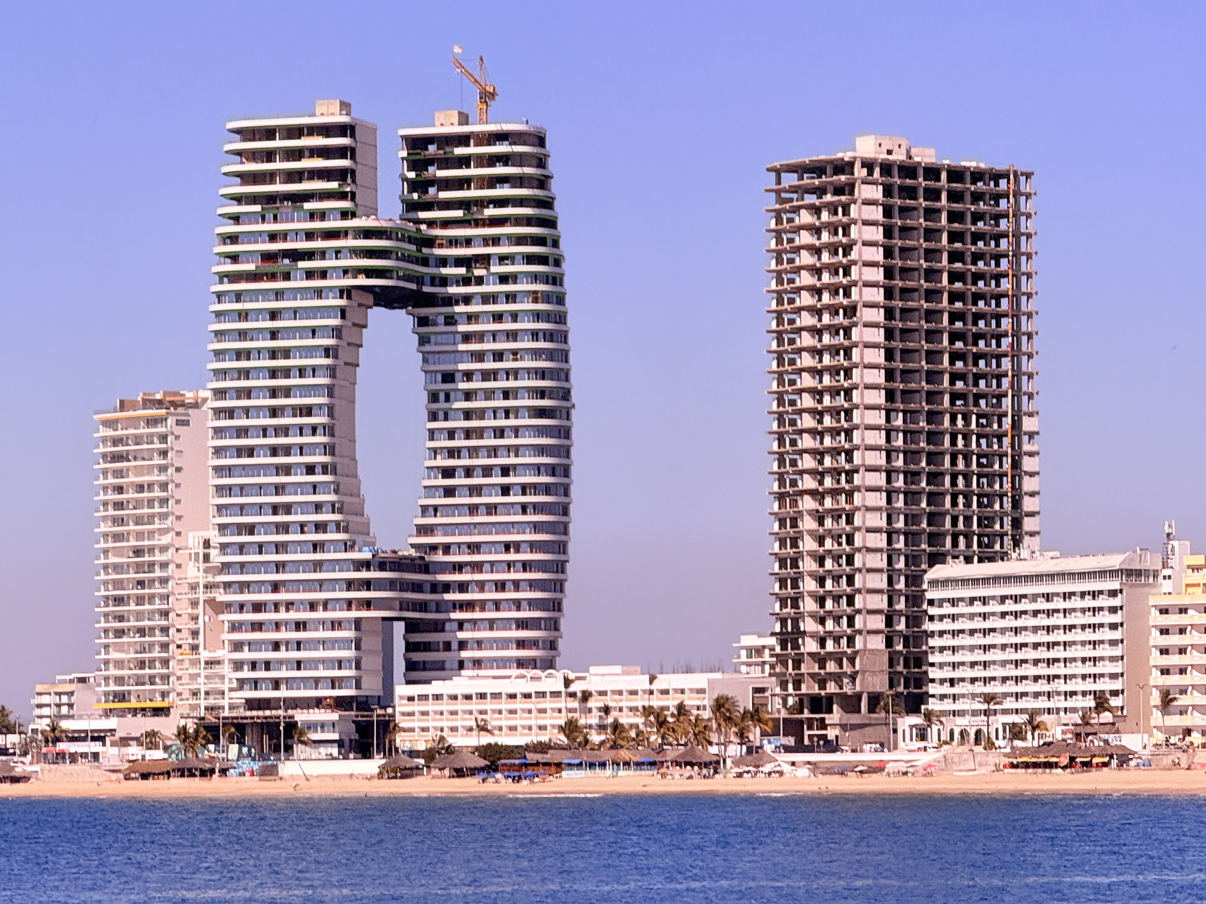
Rocky outcroppings on the coastline, seen from the street above as we walk towards Cerro del Vigía.This is Isla El Crestón (Crestón Island) that is right by Cerro del Vigía. There is a lighthouse at the top of the Crestón Island hill. Almost at the top of the steps that lead up to the outlook at the top of Cerro del Vigía.The photo spot at the top of Cerro del Vigía.The cruise ship at the Mazatlán cruise port is the Royal Princess. She set sail late afternoon for Long Beach, California.A vista of Centro de Mazatlán from the top of Cerro del Vigía. Look for the yellow Catedral Basílica de la Inmaculada Concepción, a beautiful 19th-century Baroque-Revival church. The towering condo buildings at the top left are on Avenida del Mar, the road that runs along the promenade called Malecón Mazatlán. We would drive right by them later in the day.Bougainvillea flowersOur bus looked like this one. There is the church: the Catedral Basílica de la Inmaculada Concepción. I will take close-up pictures of it later this week.Looking towards Centro de Mazatlán (Mazatlán’s old center) and Isla El Crestón from the Uber car on Avenue del Mar the way back from Sam’s Club. (Optical illusion: it looks as if there is no sand and as if the surf is breaking onto the pavement, but there is a drop to the beach and the sand from the edge of the promenade’s paving. )Here are the condo buildings on Avenue del Mar that could be seen from the Cerro del Vigía lookout this morning.Looking back at the Golden Zone, while still on Avenue del Mar.It looks like someone is getting ready for some parasailing at the beach that runs along Malecón Mazatlán (the Mazatlán promenade).
It has been a cold week here in the Emerald City with the low dipping below freezing on Friday morning, and a few snowflakes in the air this morning.
Highs were in the low to mid-forties (6° to 7°C).
Here is a late afternoon sunbreak on the Cascade Mountains today.
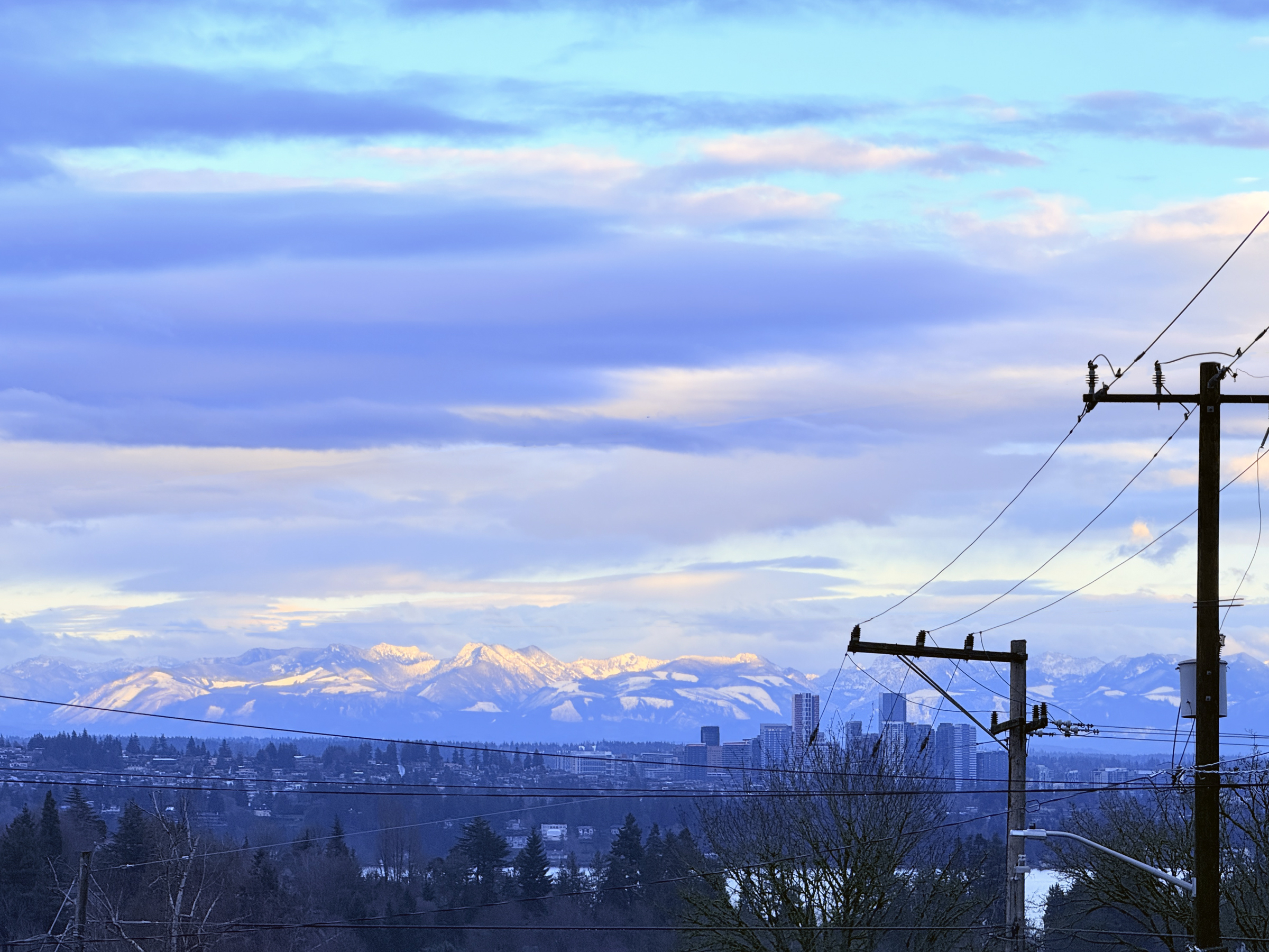
I am standing at Capitol Hill’s 23rd Avenue and Mercer Street.
That is Lake Washington and downtown Bellevue in the foreground.
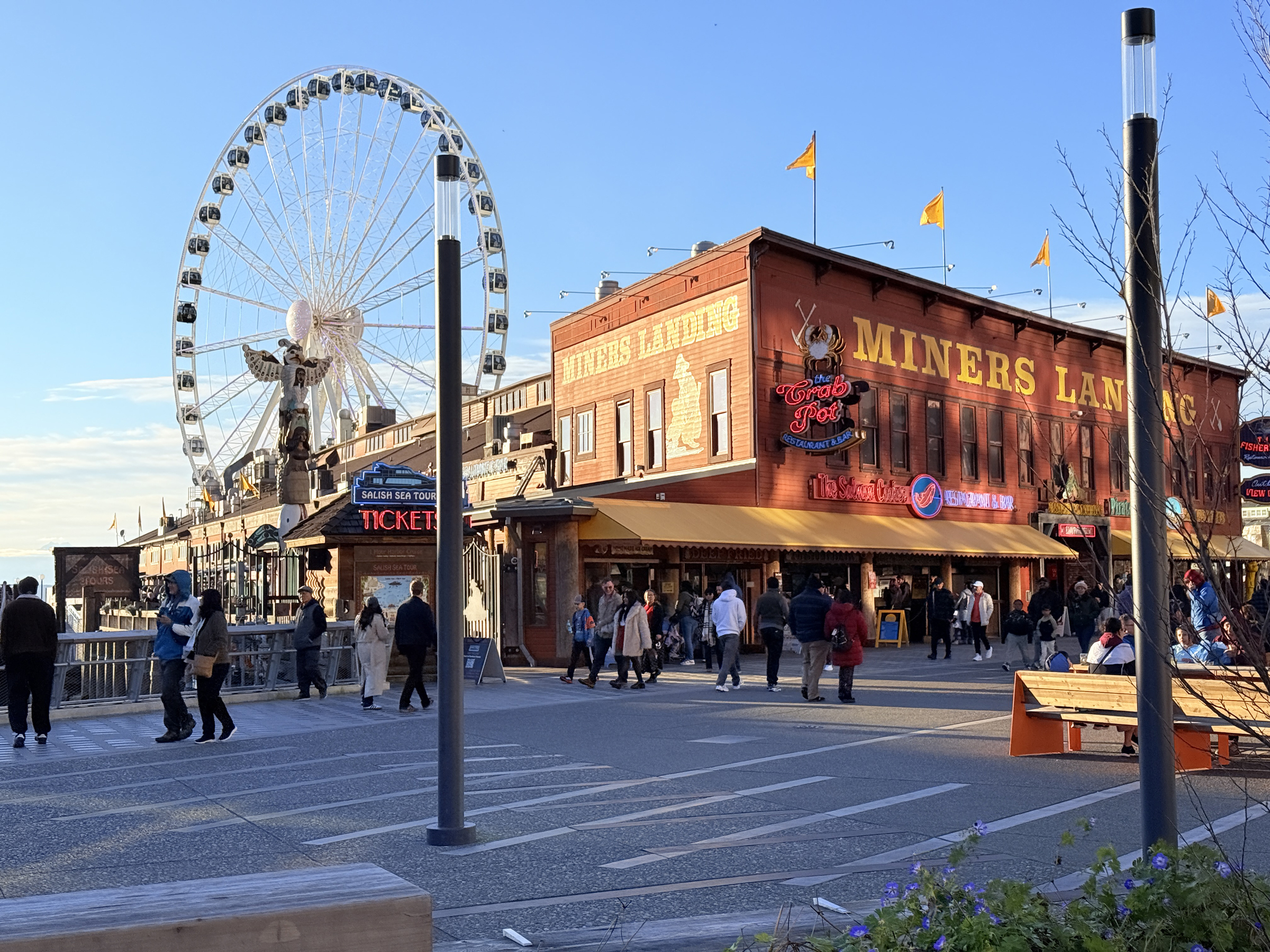
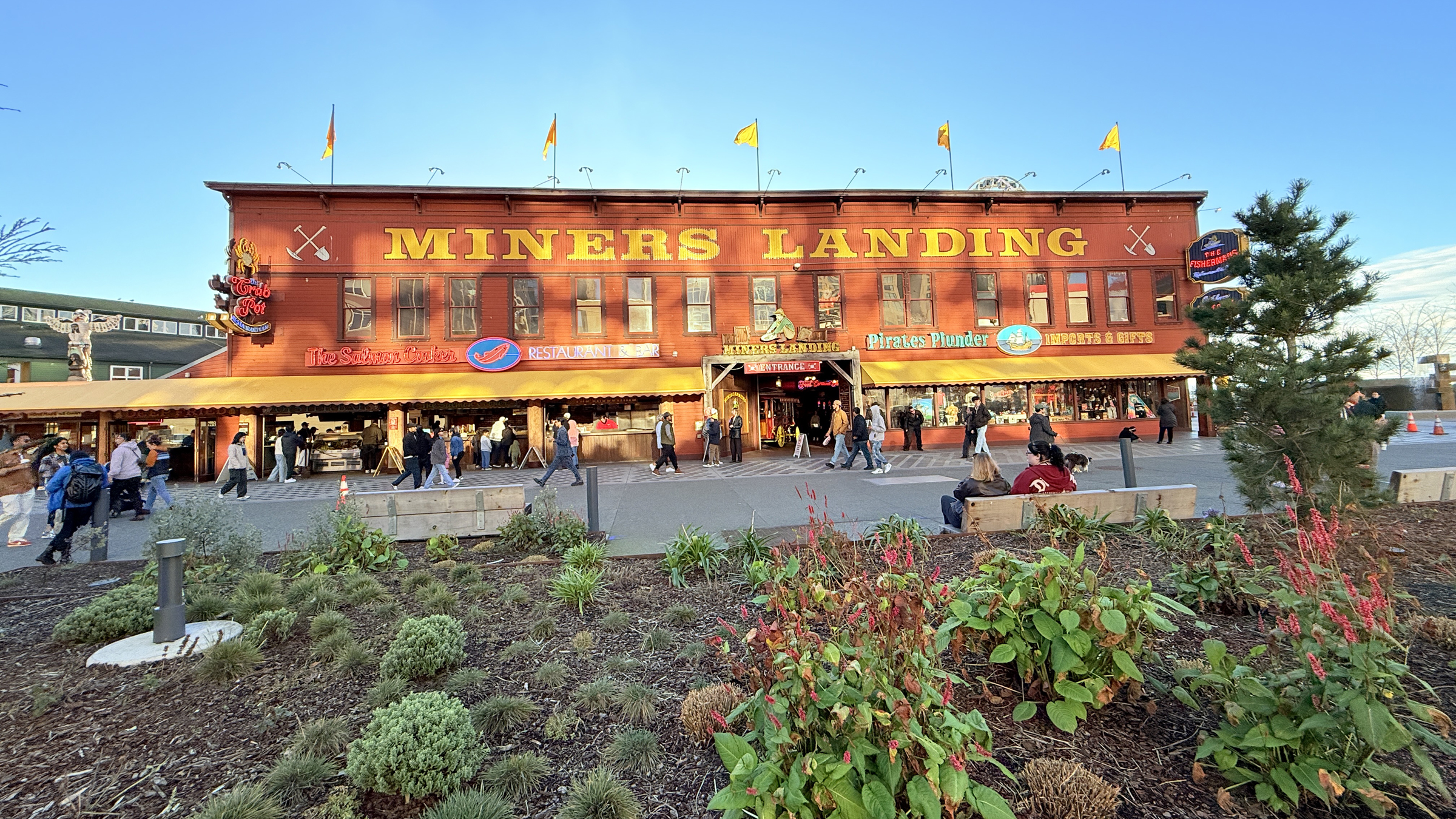
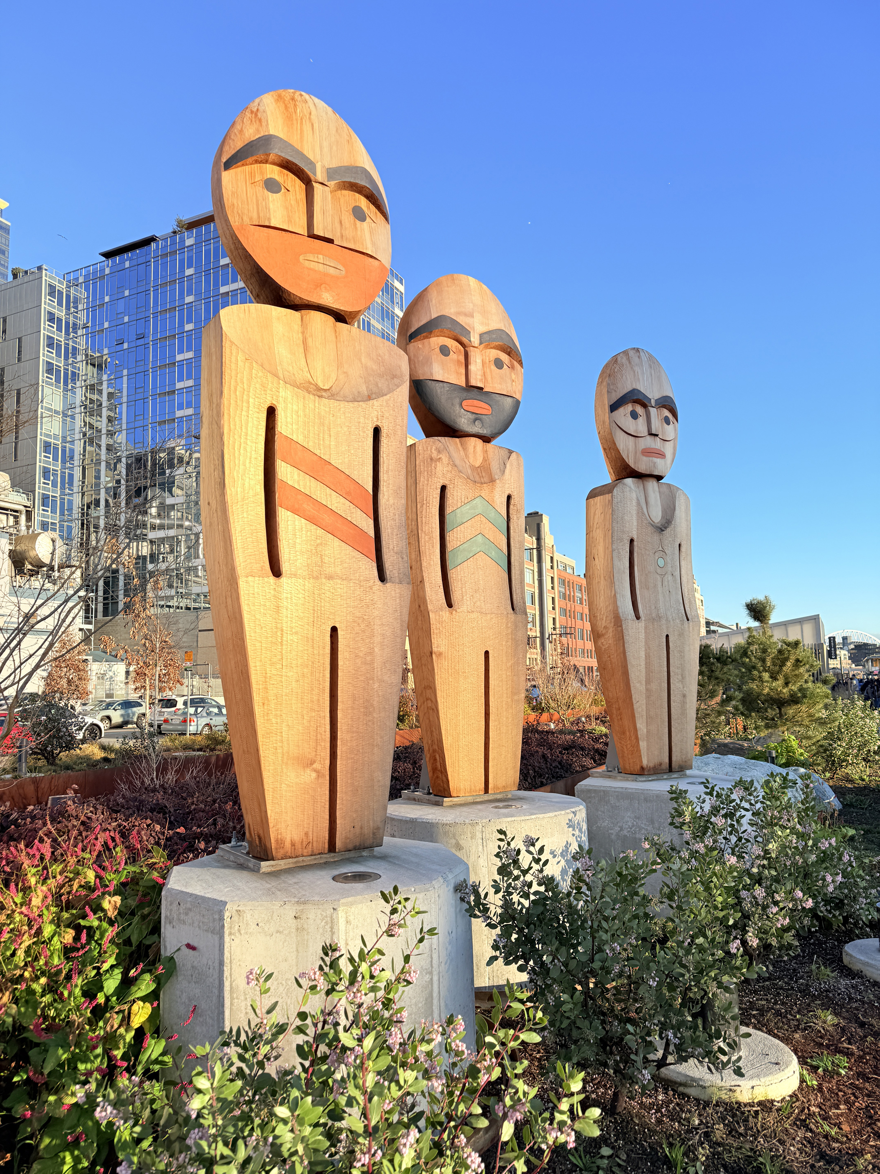
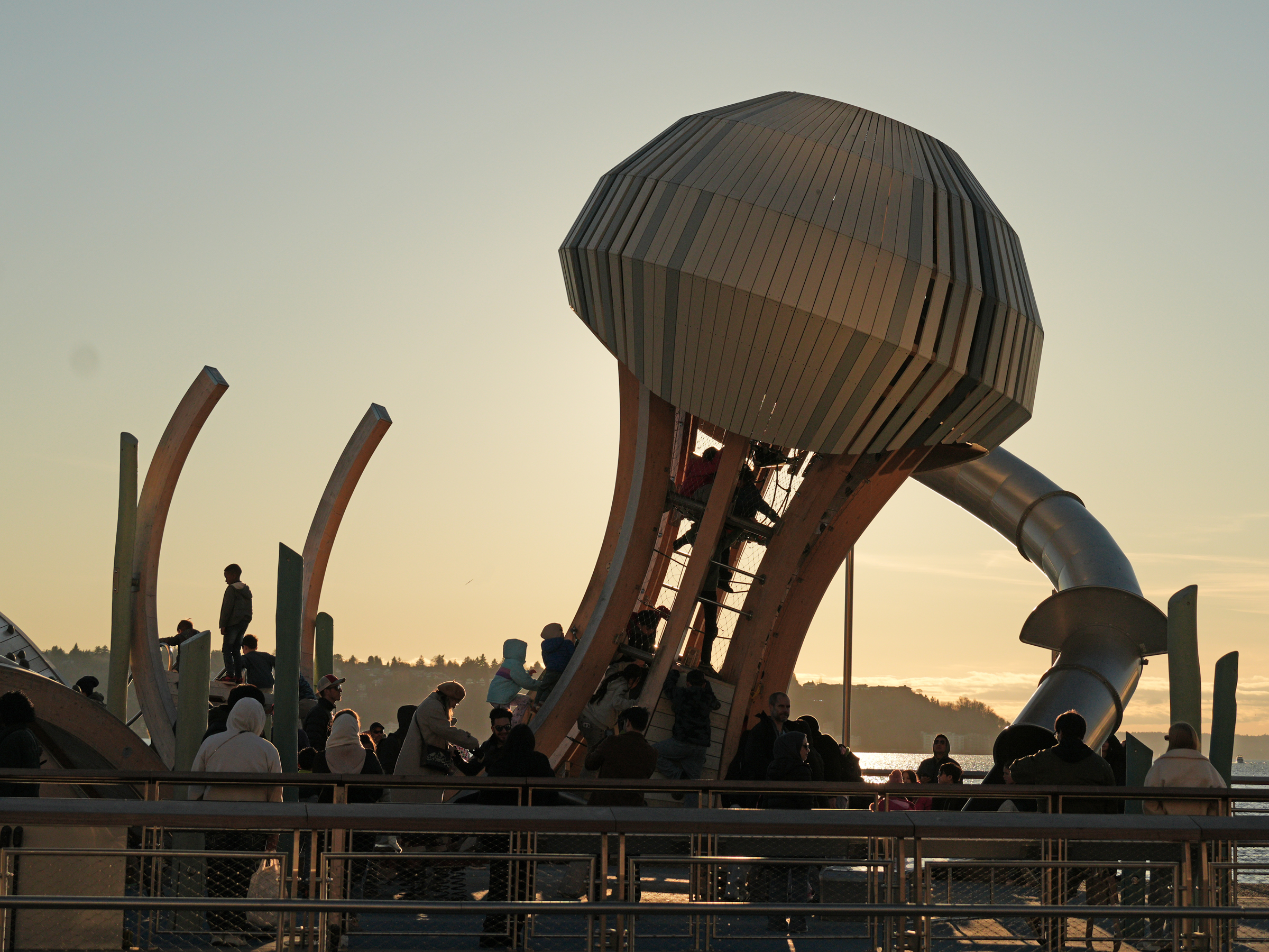
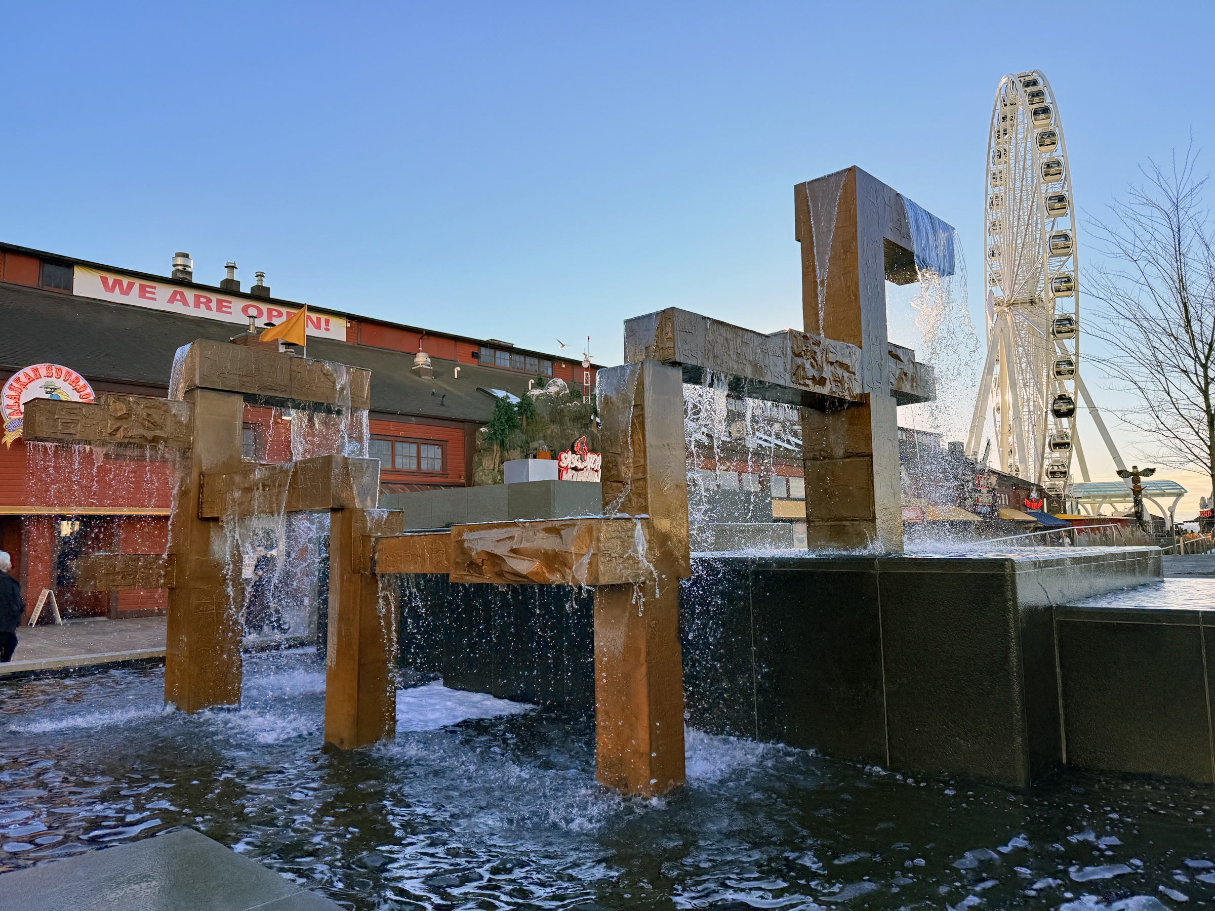
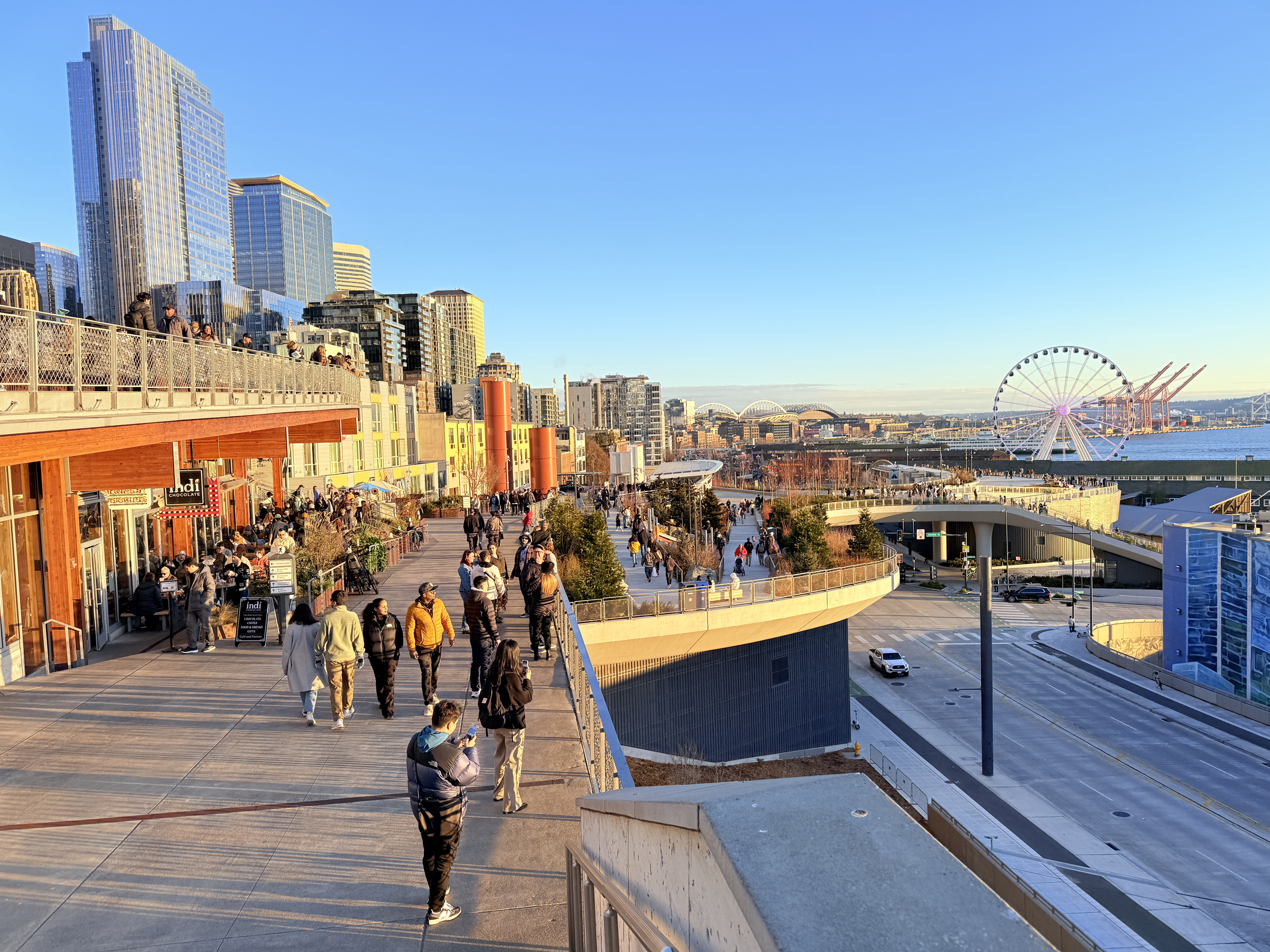
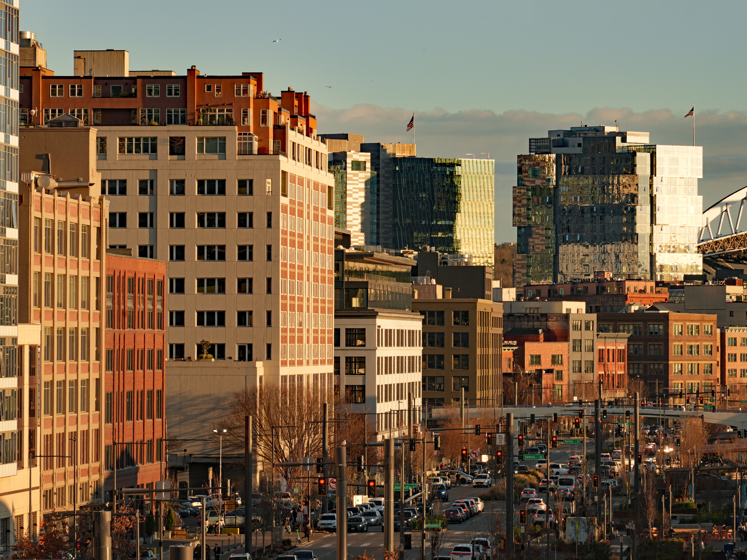
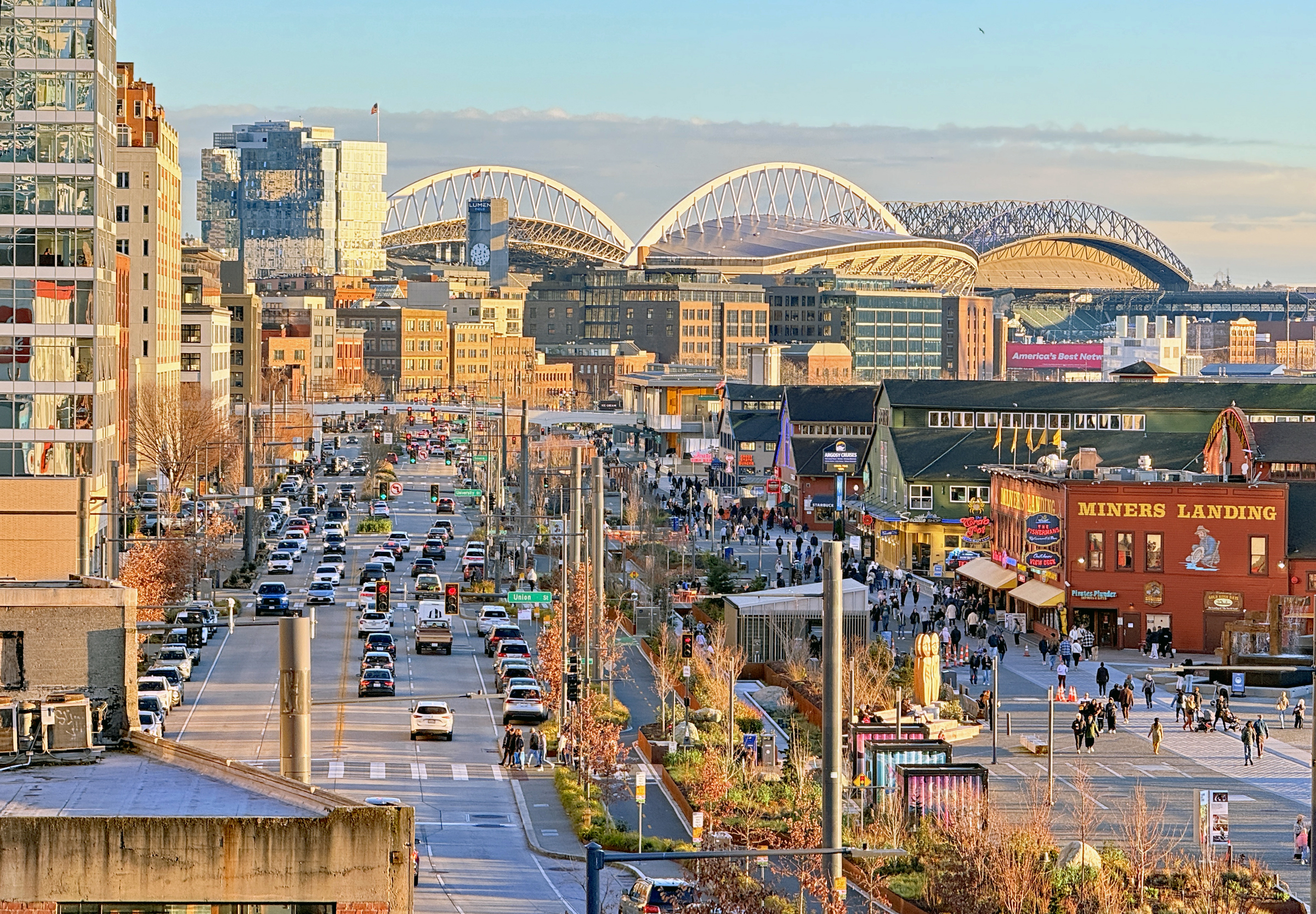
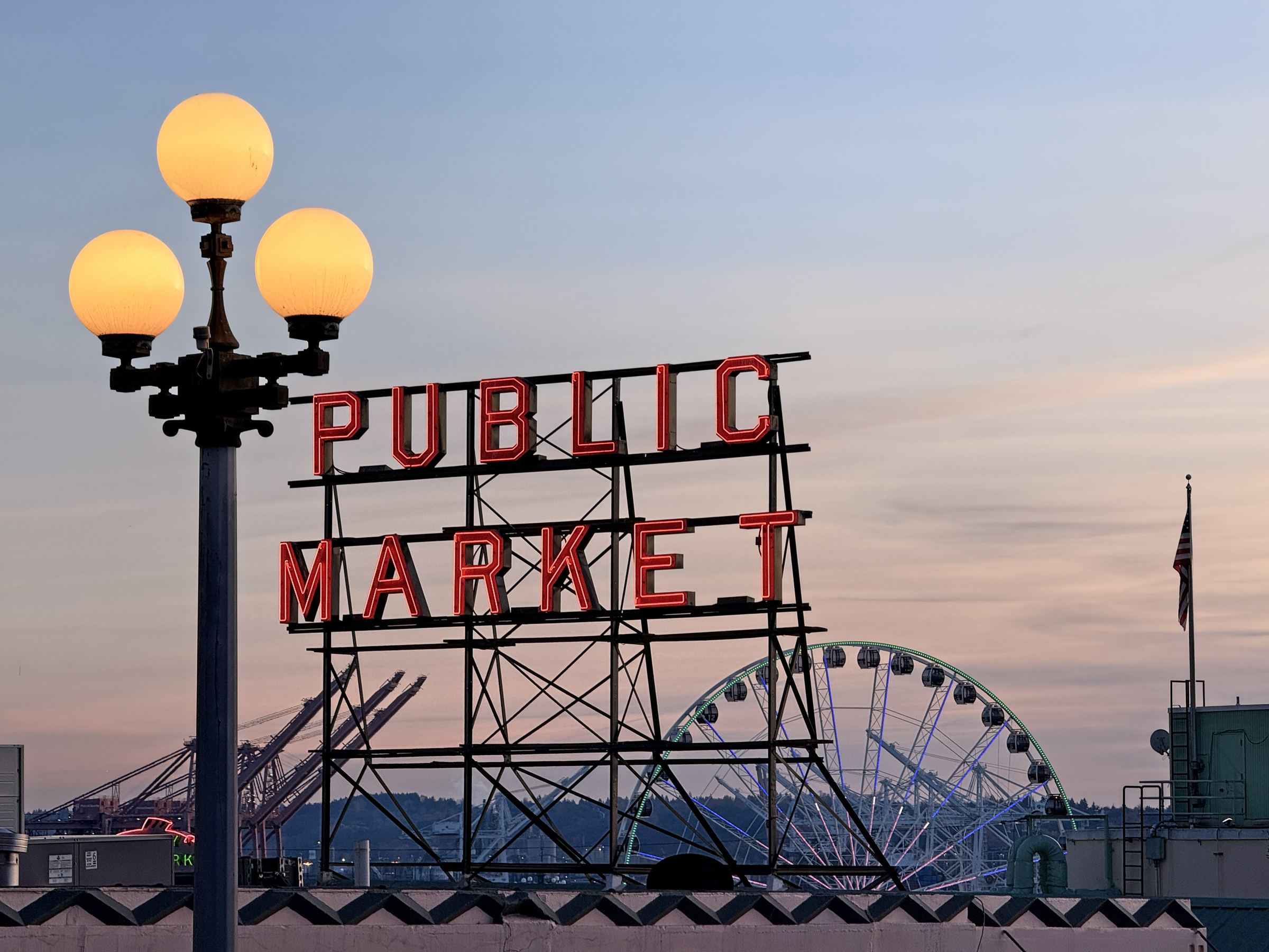
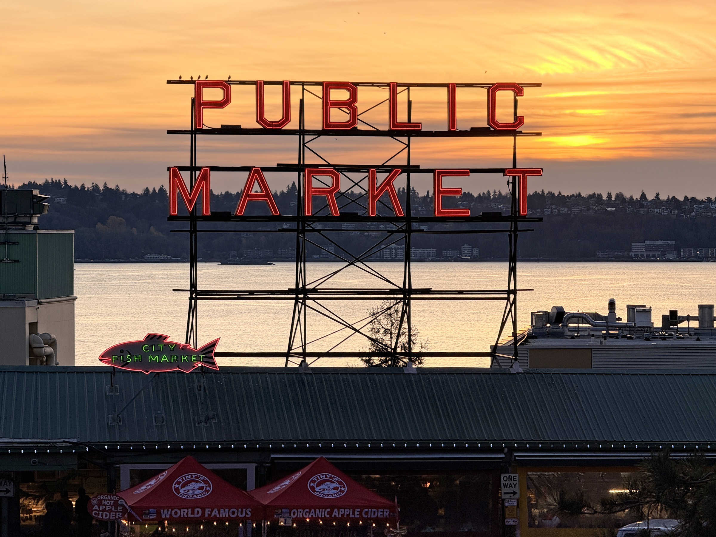
I made my way to the south end of the waterfront late this afternoon and walked up to Pike Place market.
The day was brilliant and bright out— but with the air temperature still sharp at 48°F/ 9°C.
I took the sunset picture from Elliot Avenue and Lenora Street.
Today was another very mild winter’s day here in the city (57 °F/ 14°C) with clouds and sun.
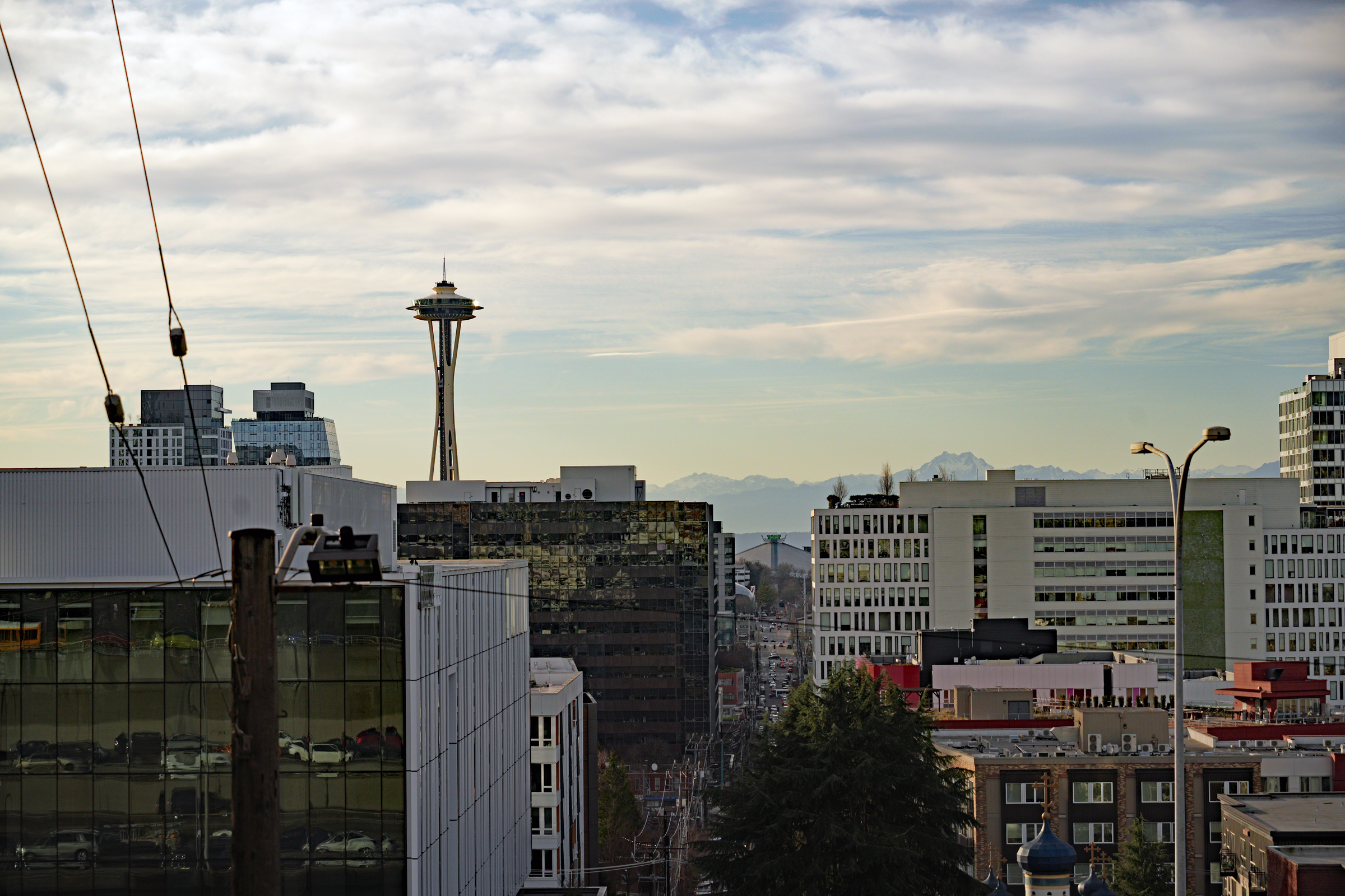
I walked down to the Melrose Avenue overlook to see if the 12’s flag is up on the Space Needle yet.
(It is not. I believe it will go up tomorrow, Friday).
Look for the sunlight reflecting off the glass panels of the observation deck at the top of the Needle. That’s Harrison Street between the buildings to the right of the Space Needle, running all the way out to Climate Pledge Arena, home of the Kraken (ice hockey team). At the very bottom right of the picture the spires of Saint Spiridon Orthodox Cathedral church are visible. Those are the Olympic mountains in the distance, with the twin peaks called The Brothers. There should be more snow on the mountains at this point – a lot more snow! 😟 Snowpack levels in Western Washington are very low, with most areas reporting only 37% to 45% of normal, a concern for water supply and increased summer fire risk.
Dry January has come to an end, with rain last night and today— about a quarter inch here in the city today.
There will be more on Thursday and Friday.
The cloud cover made for elevated temperatures as well: 48 °F (9 °C) in the morning, with a high of 52 °F (11 °C).
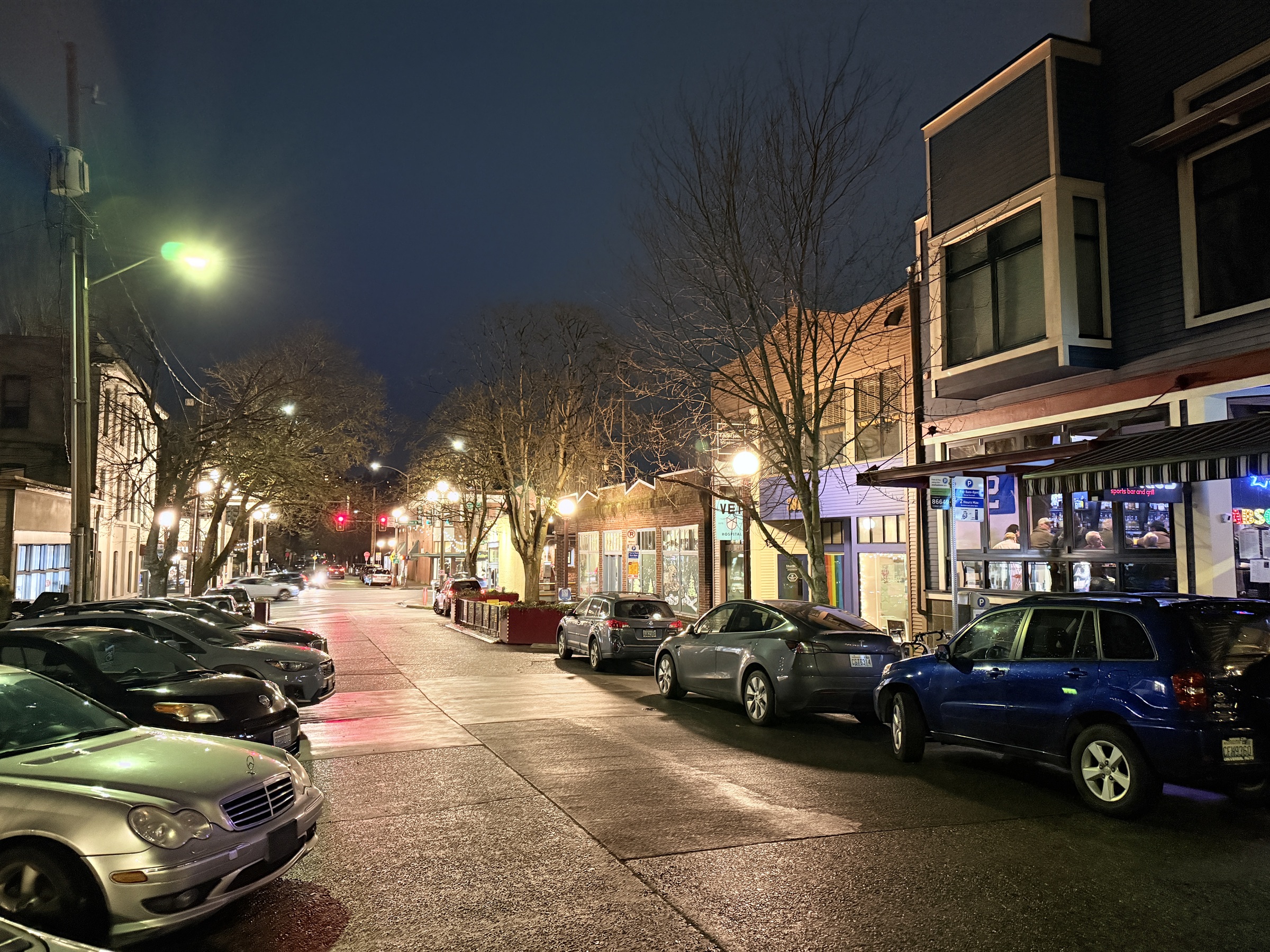
Three amigos ran out to Rookies Sports Bar and Grill (on the right) on Ferdinand St in Columbia City.
This January here in the city, has now seen a record-setting stretch of over 10 consecutive days without rain.
Every day has been sunny and cold, and the massive storm system playing out in the rest of the country is also passing us by.
Late afternoon, I ventured out for a quick walk (39 °F/ 4°C).
The ’12’ flag is up on top of the Space Needle.
(The 12 represents the “12th Man” —a tribute to the dedicated fans of the Seattle Seahawks NFL team.)
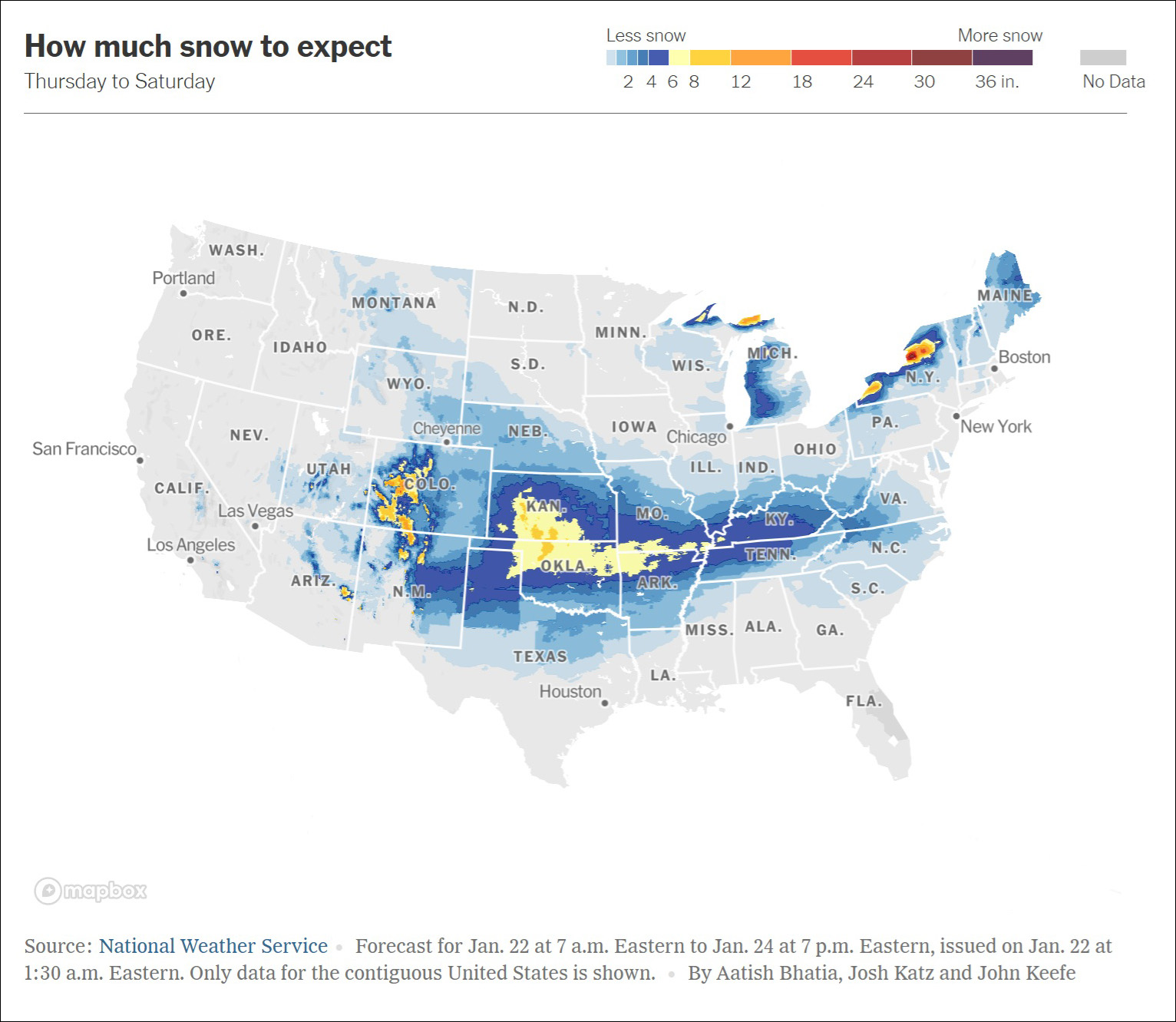
Reporters Greg Allen and Ava Berger write on npr.org: A massive winter storm system is forecast to sweep the country this weekend, stretching from Central Texas through the Northeast.
The National Weather Service says the system will dump heavy snow, sleet and freezing rain from the Southern Plains to the Mid-South starting Friday. The storm is expected to move across the East Coast throughout the weekend, according to a bulletin from the NWS posted on Wednesday.
The NWS warned of “treacherous travel conditions, prolonged power outages, and tree damage,” across the southeast U.S.
Government officials in these areas are asking residents to avoid traveling and prepare for possible power outages.
A blast of cold air from Canada will mix with warmer air from the south, bringing significant snow and ice accumulations, forecasters said.
Parts of Oklahoma could get more than a foot of snow, and up to two feet in upstate New York. The NWS warns that wind chill temperatures may fall below -50 °F (-45 °C) across the Northern Plains (parts of North Dakota and Minnesota). Those in Texas to North Carolina could feel wind chills below 0 °F (-17 °C). [Graphic from nytimes.com]
The rain has started again, and there was a failure in the levee alongside the Green River in Tukwila at around 11:30 a.m.
King County emergency officials sent out a warning of ‘life threatening flash flooding’ for the nearby low-lying area of some 46,000 residents.
There were no injuries as a result of the breach, though. Soon thereafter the area under threat was narrowed down and involved only about 1,100 people, who were urged to evacuate.
The county’s flash flood warning ended by 6.30 pm.
A crew moves sandbags into a gap where a levee was breached along the Green River in Tukwila on Monday, Dec. 15, 2025. From the Seattle Times: Repairs were underway for the breached levee and were expected to be done Monday evening, said John Taylor, director of the county’s Department of Natural Resources and Parks. But the risk isn’t over. Whole sections of the levees were soaked through after more than a week of heavy rain and high river levels. Already other spots were seeing water seeping through, and county officials expected to monitor the structure through the coming days, with even more rain in the forecast. [Photo by Ellen M. Banner / The Seattle Times]
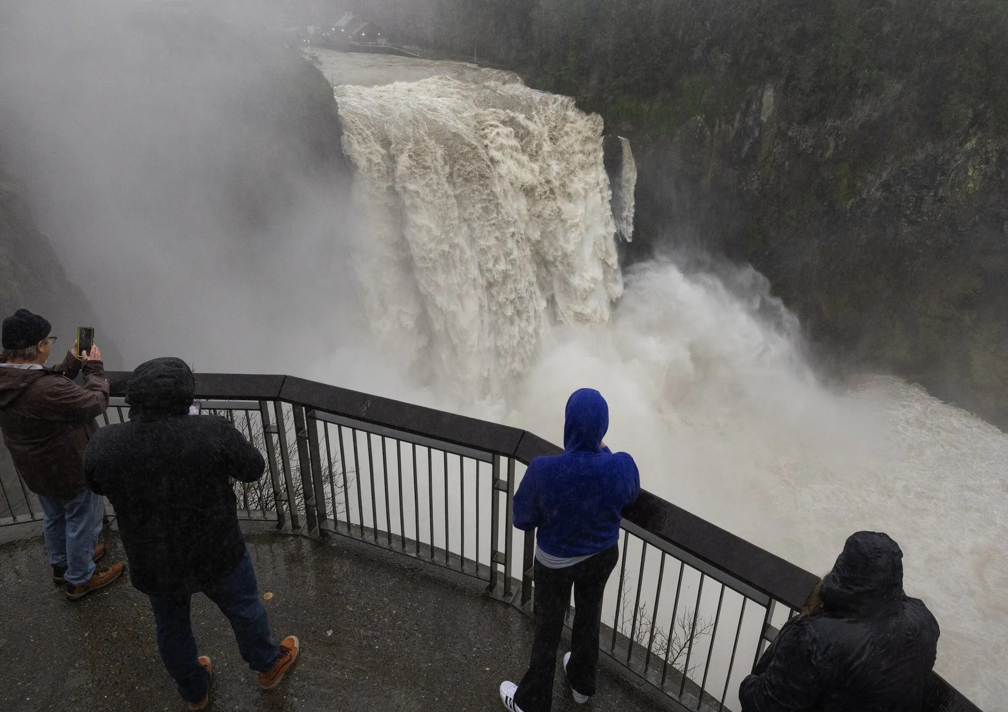
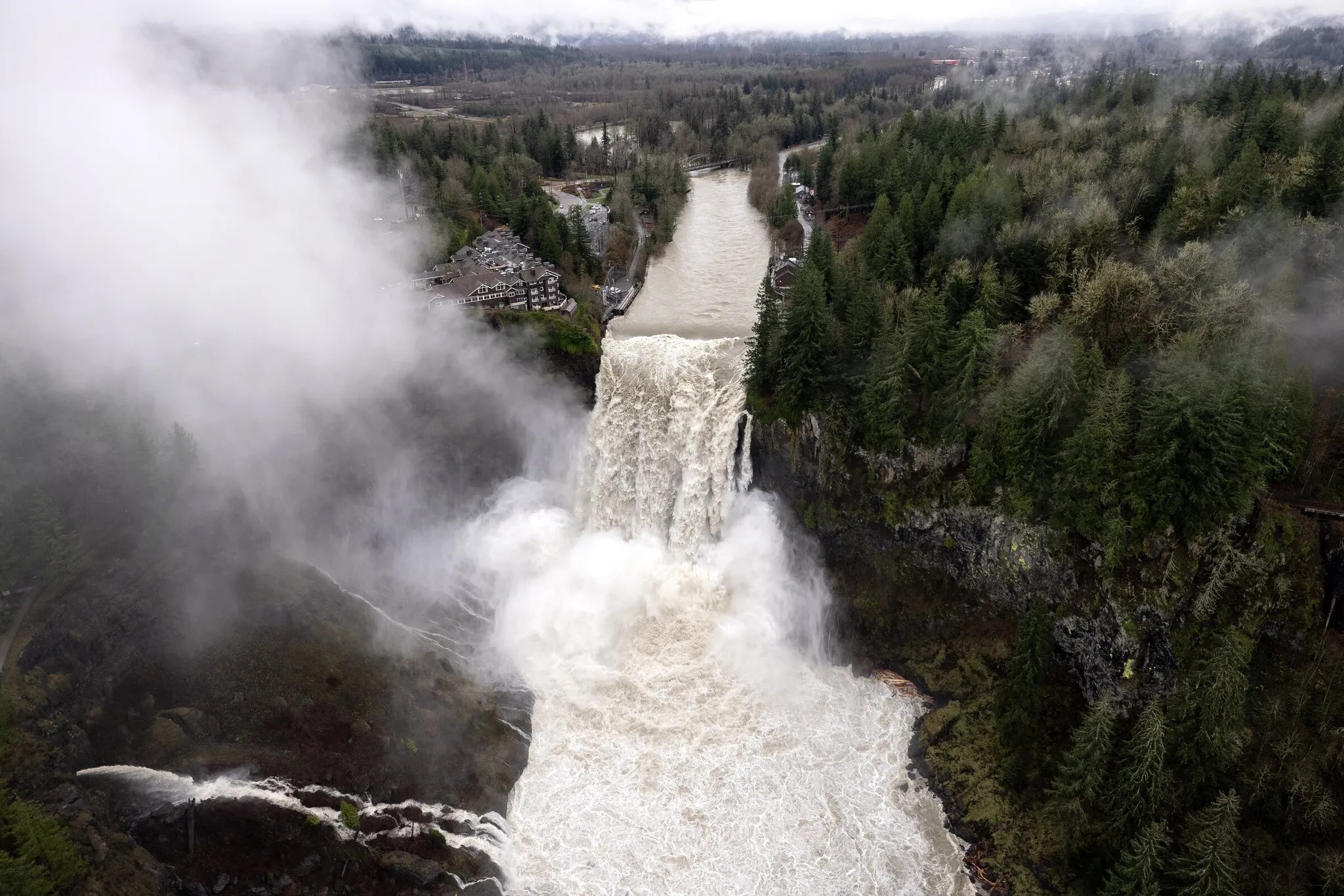
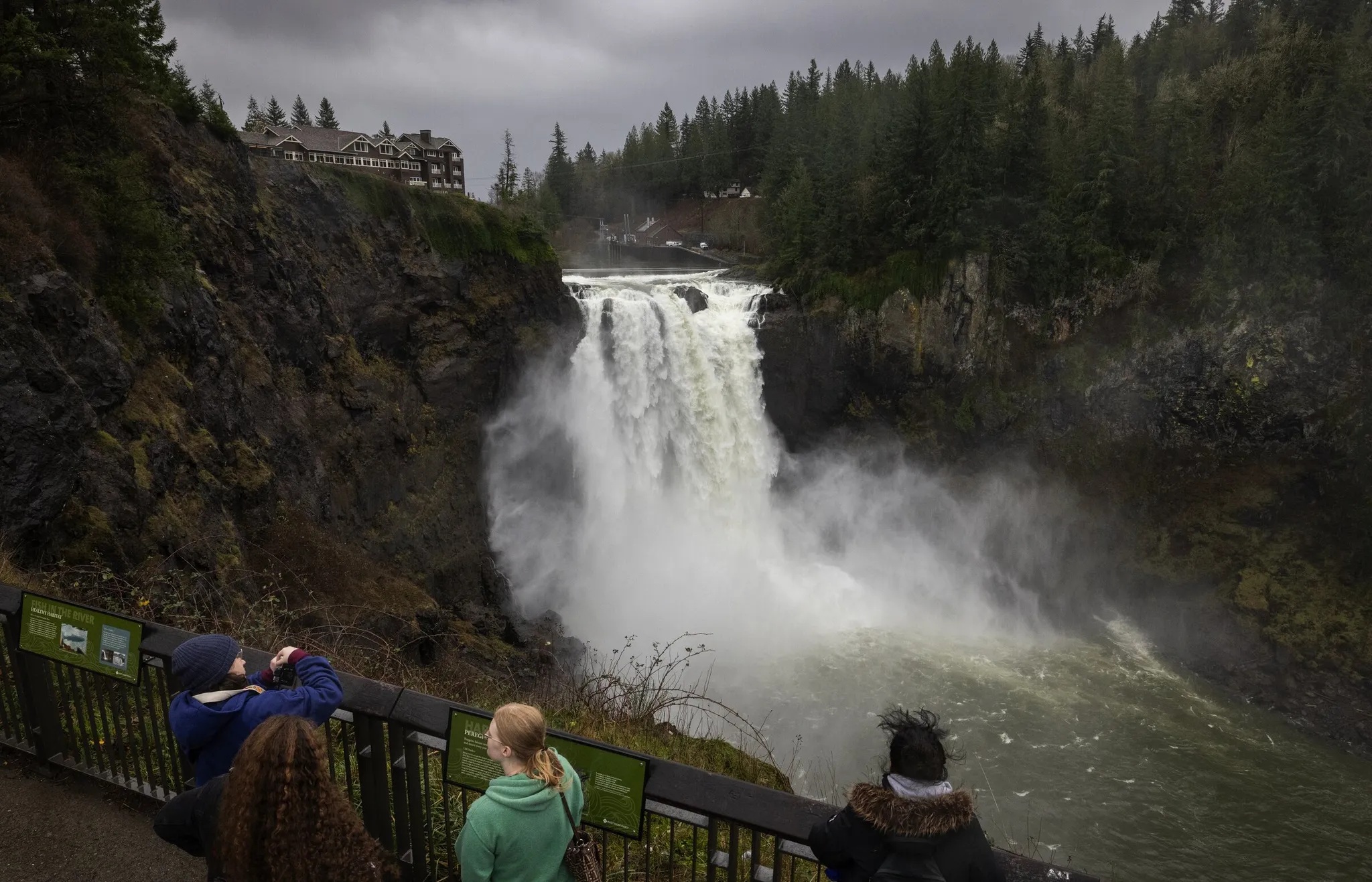
Here are updated pictures of the Snoqualmie Falls from the Seattle Times.
The Snoqualmie river was at major flooding level for much of Wednesday and Thursday.
Visitors to Snoqualmie Falls get soaked by a steady mist kicked up from raging Snoqualmie River waters Thursday morning. [Photo by Ken Lambert for The Seattle Times. Caption from The Seattle Times]Snoqualmie Falls roars on Thursday. [Photo by Nick Wagner for The Seattle Times. Caption from The Seattle Times]
The second wave of moisture from a strong atmospheric river filled in across western Washington last night.
All that water is flooding from the western slopes of the Cascade mountains into the streams and rivers below.
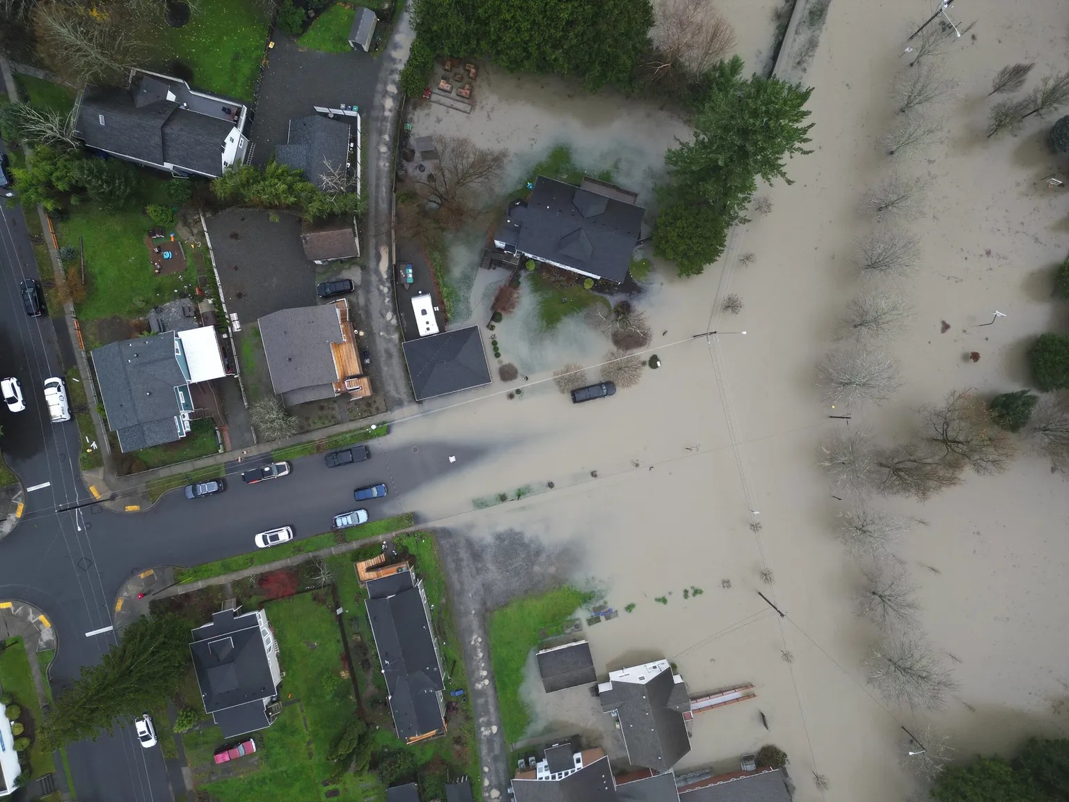
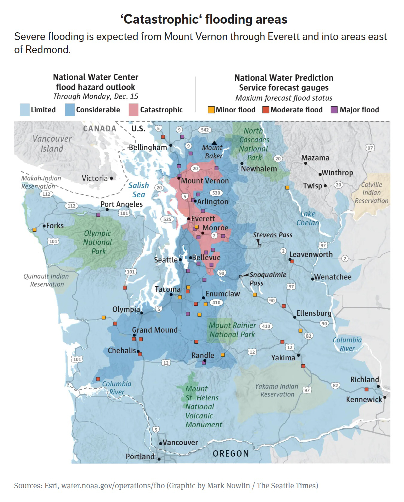
Greg Kim writes for the Seattle Times: River flooding in parts of Western Washington is expected to be “catastrophic,” especially in the coastal lowlands near the Snohomish, Stillaguamish and Skagit rivers, according to a new assessment by the National Weather Service. Areas facing “considerable” flooding stretch from Bellingham through south of Olympia. Catastrophic flooding could bring significant risk to life and property, with a high risk of levees being topped and landslides expected in steep terrain, according to the National Weather Service. It could also mean record floods that destroy roads and structures and require evacuations or rescues of people and property, National Weather Service meteorologist Steve Reedy said.
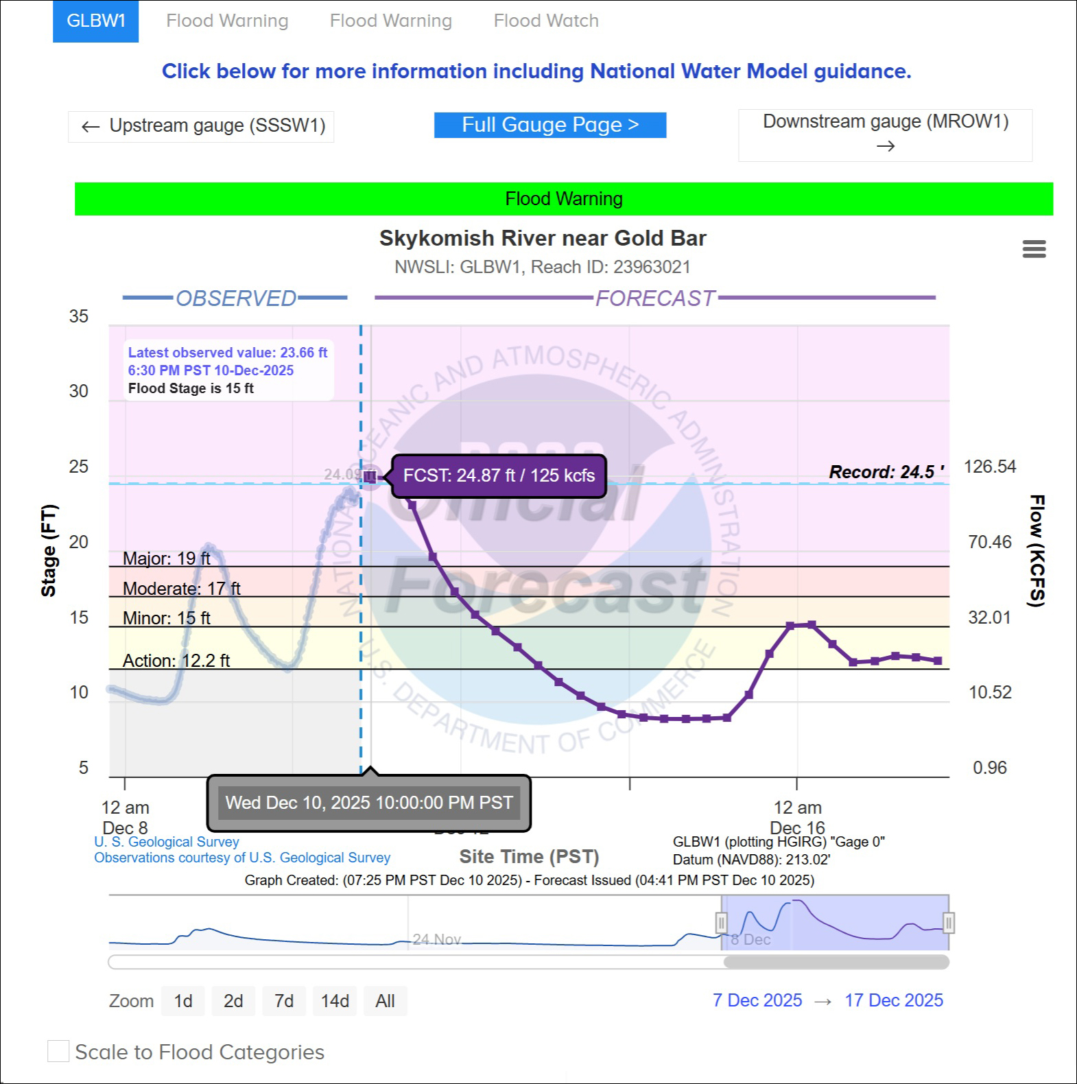
The Snoqualmie River floods over its banks in Snoqualmie at Riverview Park, with water heading towards homes, Wednesday afternoon, Dec. 10, 2025. [Photo by Ken Lambert / The Seattle Times]Map compiled by Mark Nowlin for Seattle Times with information from ESRI and water.noaa.gov/operations/fhoThe Skykomish River near Gold Bar is the purple block just east of Monroe on Highway 2 in the map above. The river is projected to top out at its highest level ever, at 24.87 ft. Flood stage is 15 ft. [Graphic from National Water Prediction Service at https://water.noaa.gov/]
Kai Uyehara and Paige Cornwell write for the Seattle Times:
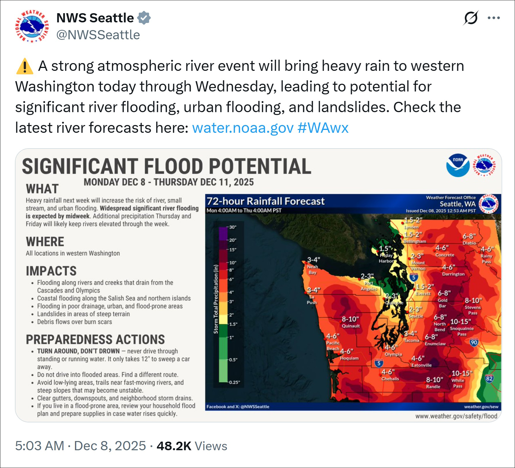
The opening salvo of a major atmospheric river hit the Pacific Northwest on Monday, drenching much of Western Washington with heavy rain that is forecast to continue at least until Thursday.
The National Weather Service warned of a high risk of widespread and significant river flooding.
South of Puget Sound, the Puyallup, Nisqually, Cowlitz and Carbon rivers were already seeing waters about to spill over their banks by 7 p.m. Monday, with serious flooding expected within hours.
Post by National Weather Service Seattle @NWSSeattle on X. Even though we are in somewhat of a rain shadow here in the city, 2-3 inches over 3 days is still a lot of rain.
People visit Snoqualmie Falls, which is raging, on a rainy Monday, Dec. 8, 2025, in Snoqualmie. The area is under flood risk. [Photo by Ken Lambert / The Seattle Times]
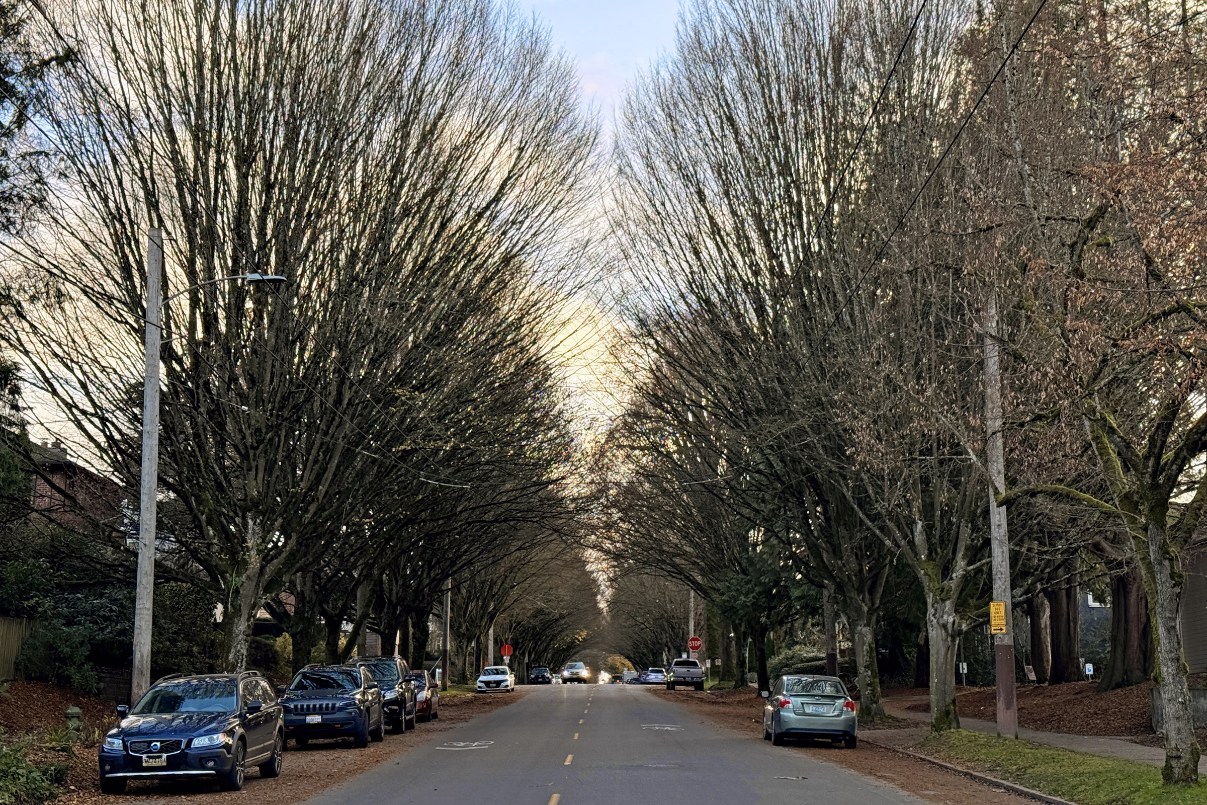
There was a break in the rainy weather today here in the city— with a powder blue sky, a little late afternoon sun, and blustery conditions.
Looking south along 19th Avenue East by Stevens Elementary School (3.10 pm with sunset coming at 4.18 pm). The leaves are all gone now, on the trees that line the street.
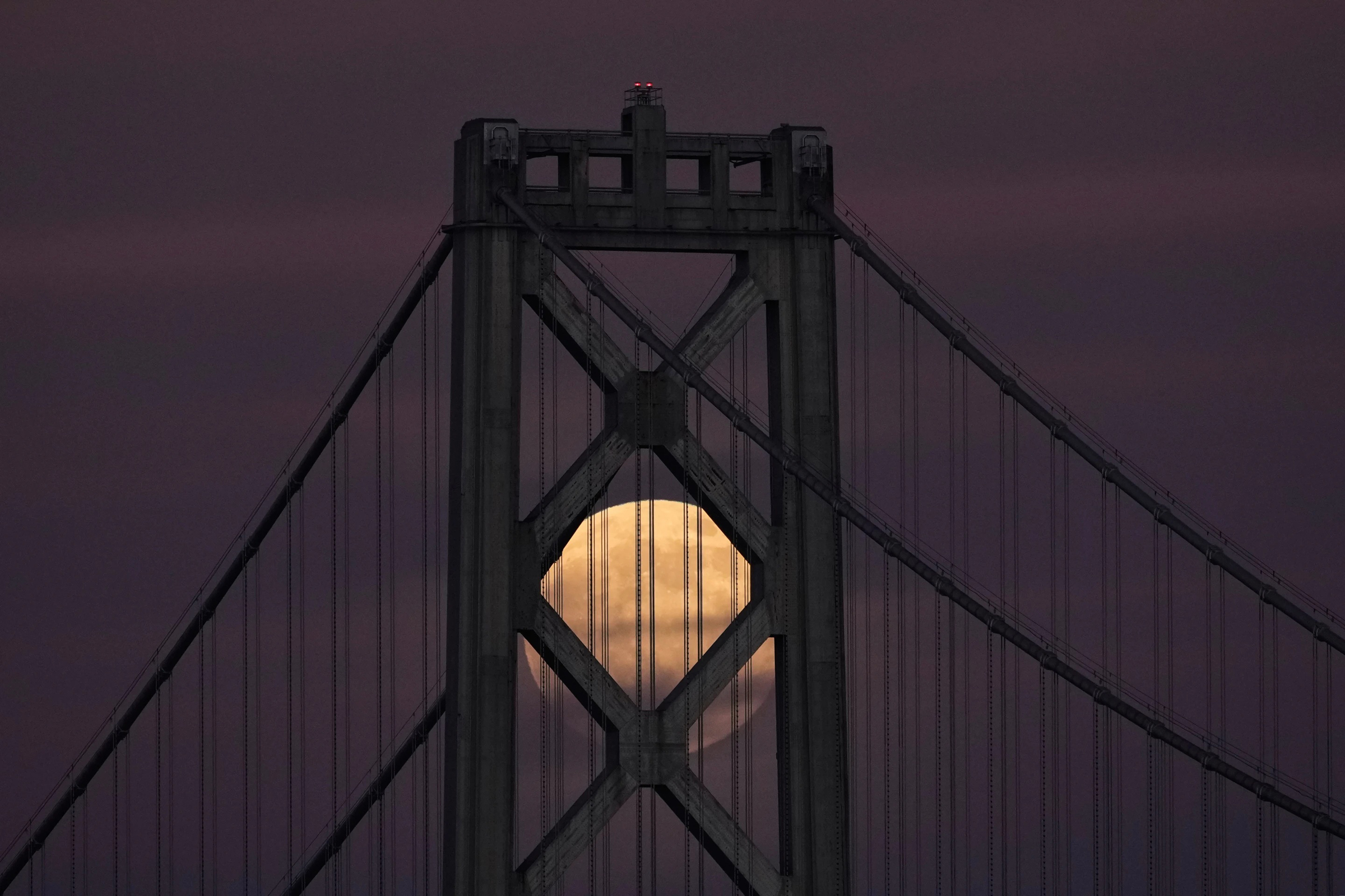
Tonight the last supermoon* of the year— and the third in a consecutive sequence— is out. (There will be a fourth supermoon in this same celestial series in January 2026).
We have cloud cover and lots of rain here in the city in Seattle tonight, so for now I can only look for pictures of the supermoon online.
*A supermoon is a full moon that occurs when the Moon is at or near its closest point to Earth in its elliptical orbit, a point called perigee. This proximity makes the Moon appear slightly brighter and larger than an average full moon, although the difference may be difficult to notice with the naked eye. The term can also technically apply to a new moon, but it is typically associated with the visible full moon.
[Google AI Overview]
A supermoon, the last full moon of the year, rises behind the San Francisco-Oakland Bay Bridge, Thursday, Dec. 4, 2025, in San Francisco. This one is called the Cold Moon. [Associated Press Photo/ Godofredo A. Vásquez]
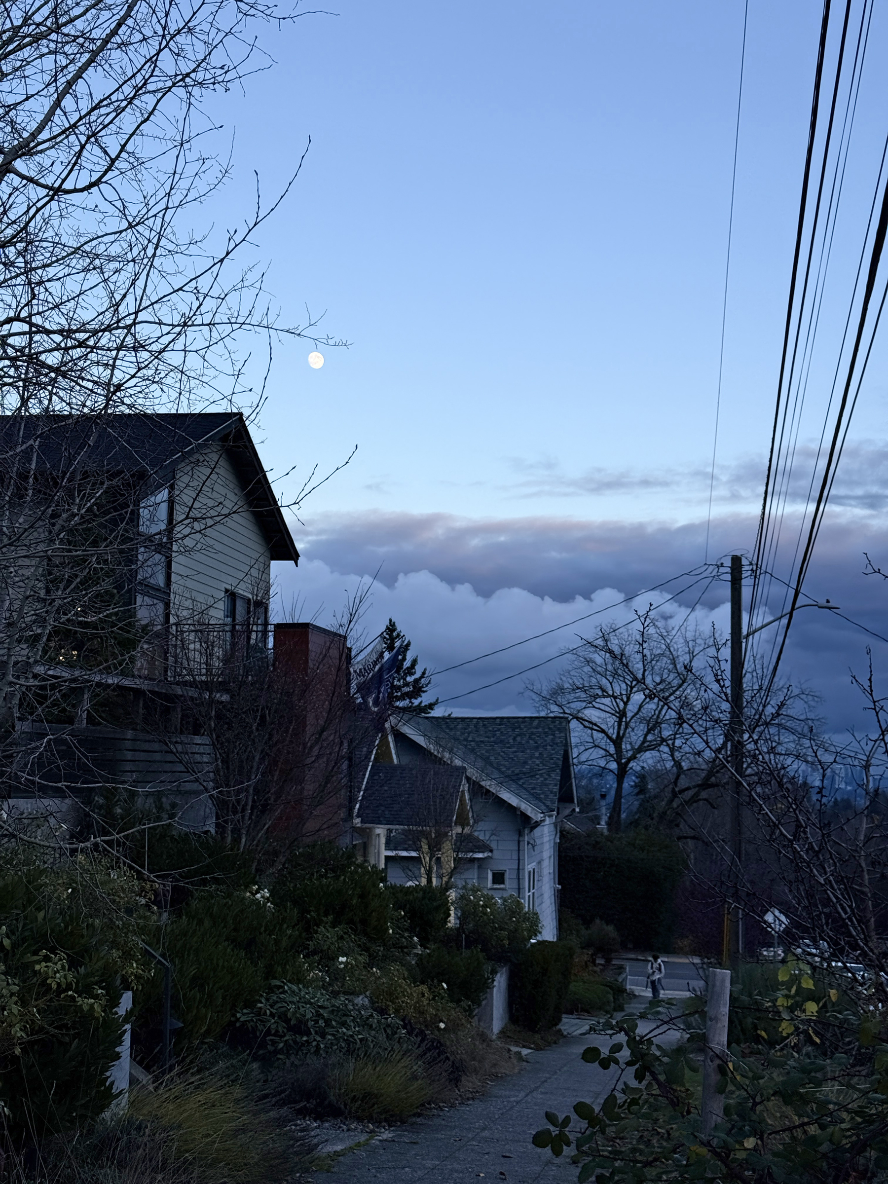
I thought it too cold to go for a walk today—44°F (6°C)— then changed my mind at the last minute before dark.
It’s 4.00 pm on the nose, and I’m on 22nd Avenue East looking out towards the east. Sunset is 19 minutes away. There’s the moon in a bare sky, not quite full. (The full moon on Thursday will be the Cold Moon.) No cloud cover means temperatures will dip down close to 0°C in the early morning.
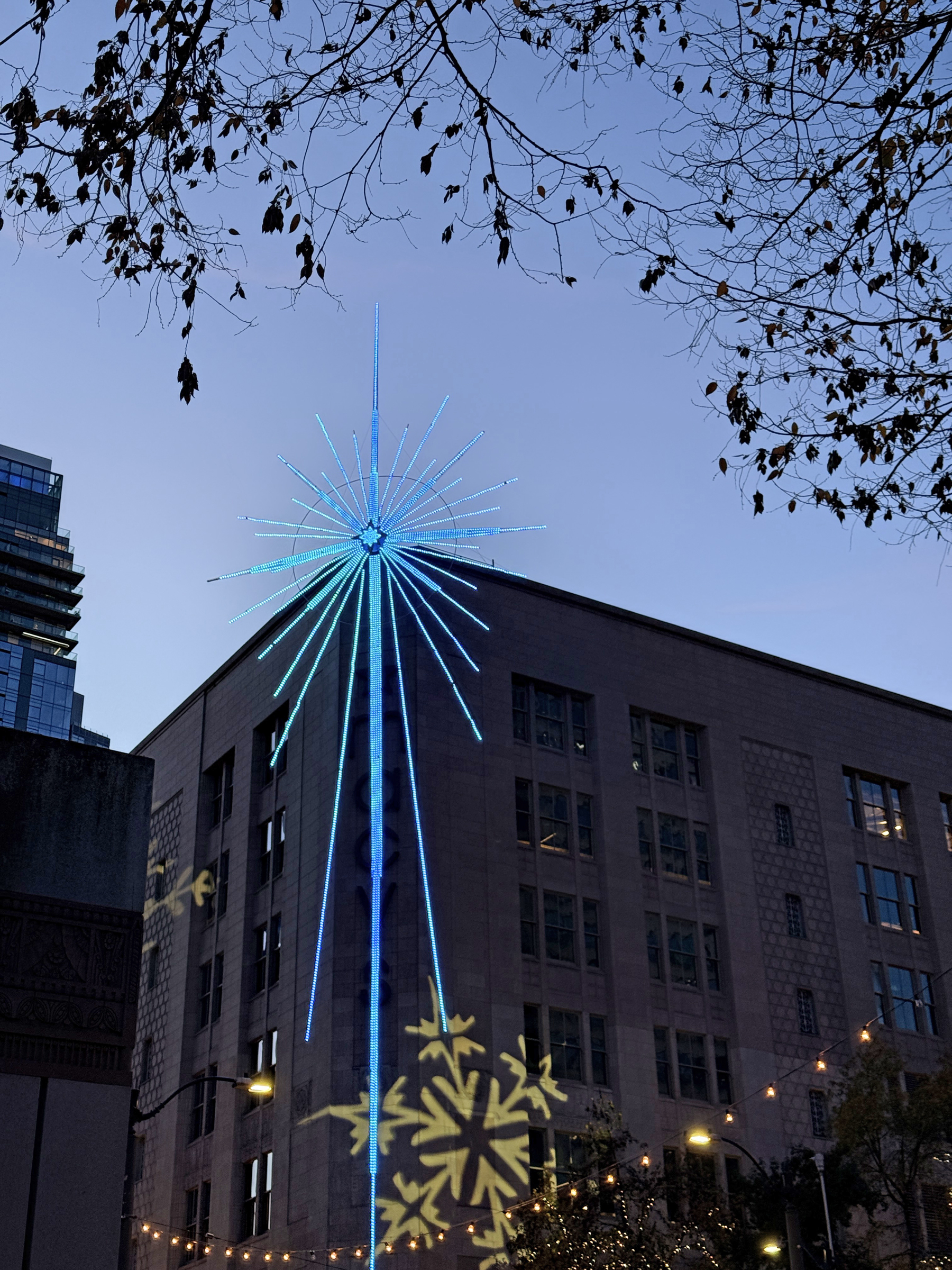
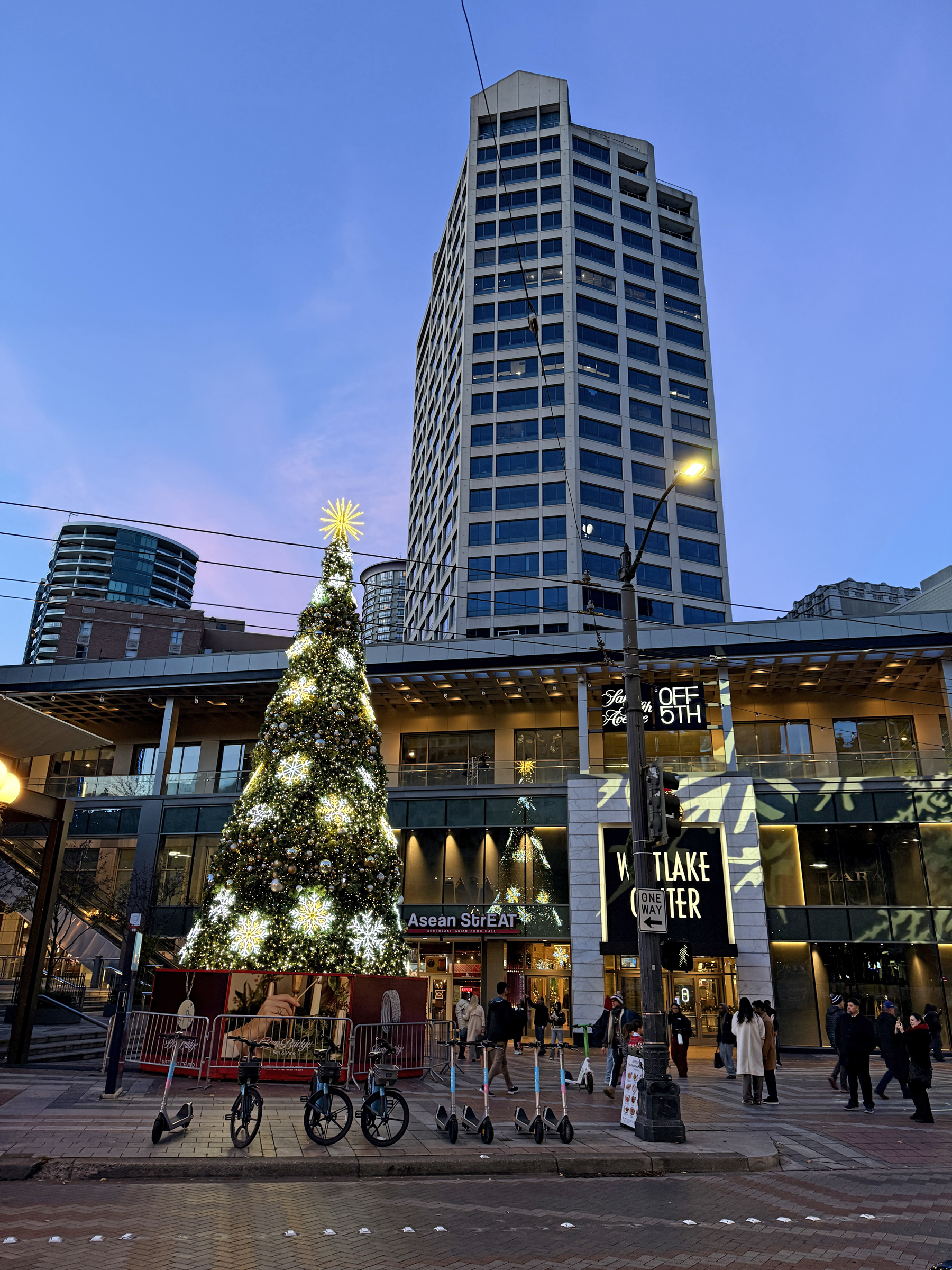
I took the No 10 bus to Westlake Center at sunset to check out the Christmas tree and its lights. (Pike Place Market is just a few blocks away).
There were not a lot of people around, probably because it was chilly (43°F/ 6°C). A few Seahawks fans were back from Lumen Field, where the Hawks took out the Minnesota Vikings 26-0 tonight.
The sun wasn’t out today, and it was a cold fall day here in the city.
The low this morning was 38°F (3°C) and the high 52°F (11 °C).
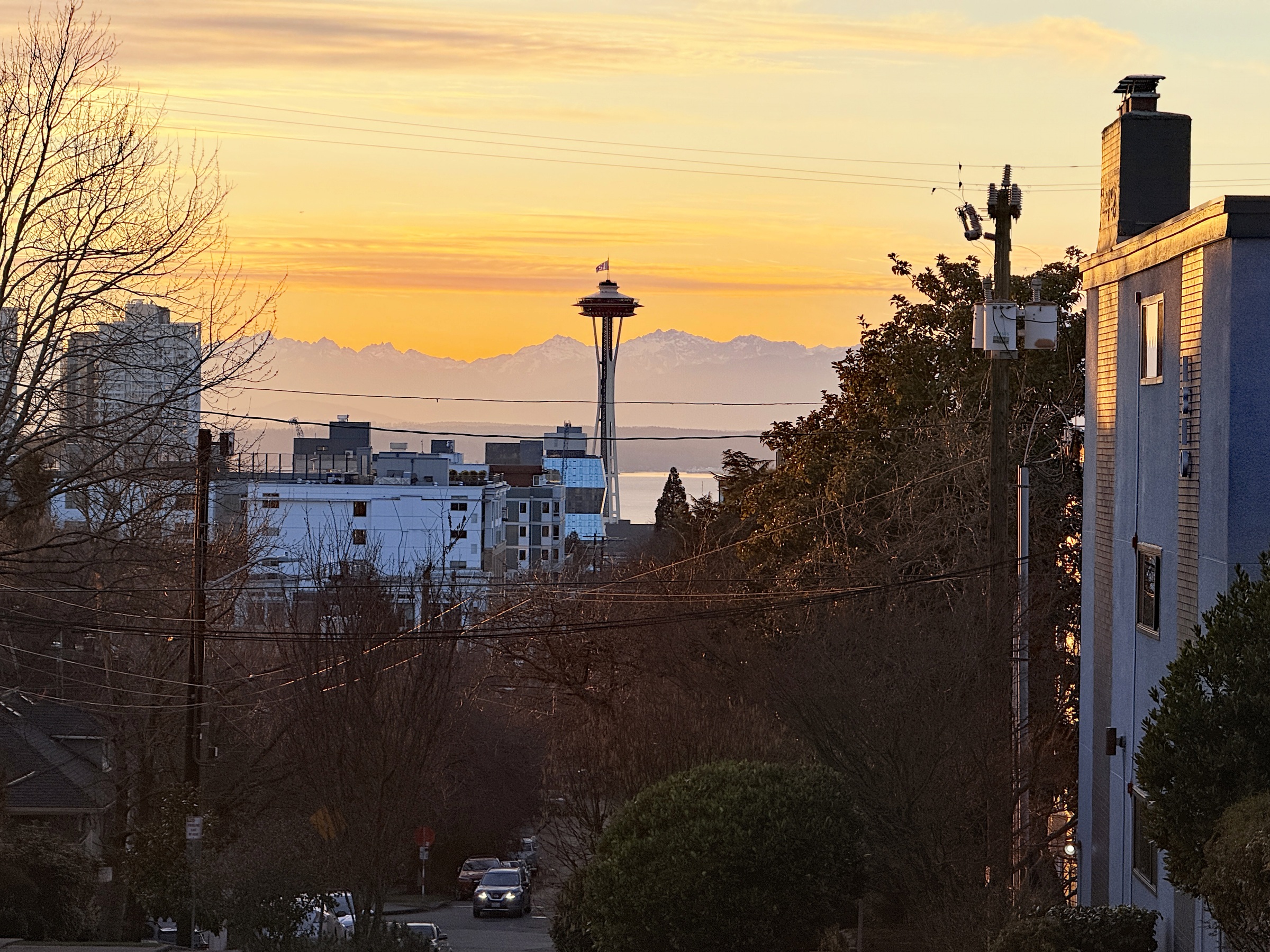
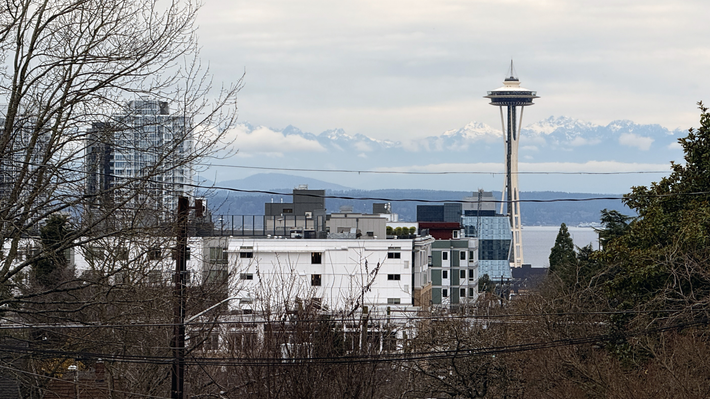
Here’s looking out to the Olympic Mountains at 3.26 pm today from my usual spot on the corner of 14th Ave East and East Thomas St on Capitol Hill. It looks like the Christmas lights (cables with lights) are up, on top of the Space Needle.
Here is the sun today, with about 45 minutes of daylight remaining.
The days are now 9 hours 5 minutes long, with sunset at 4.27 pm.
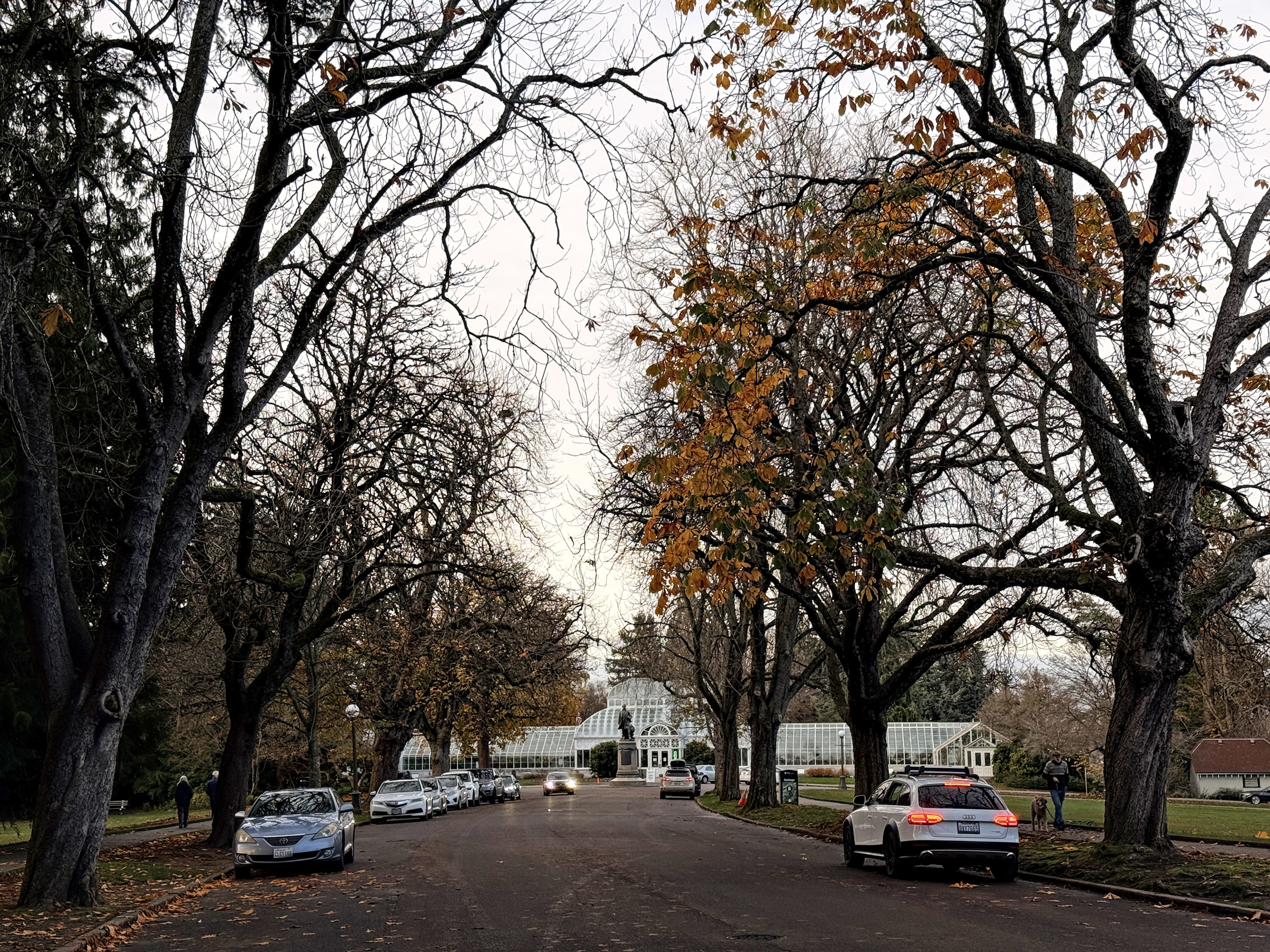
The trees that lead to the Volunteer Park Conservatory are now mostly bare of their leaves.