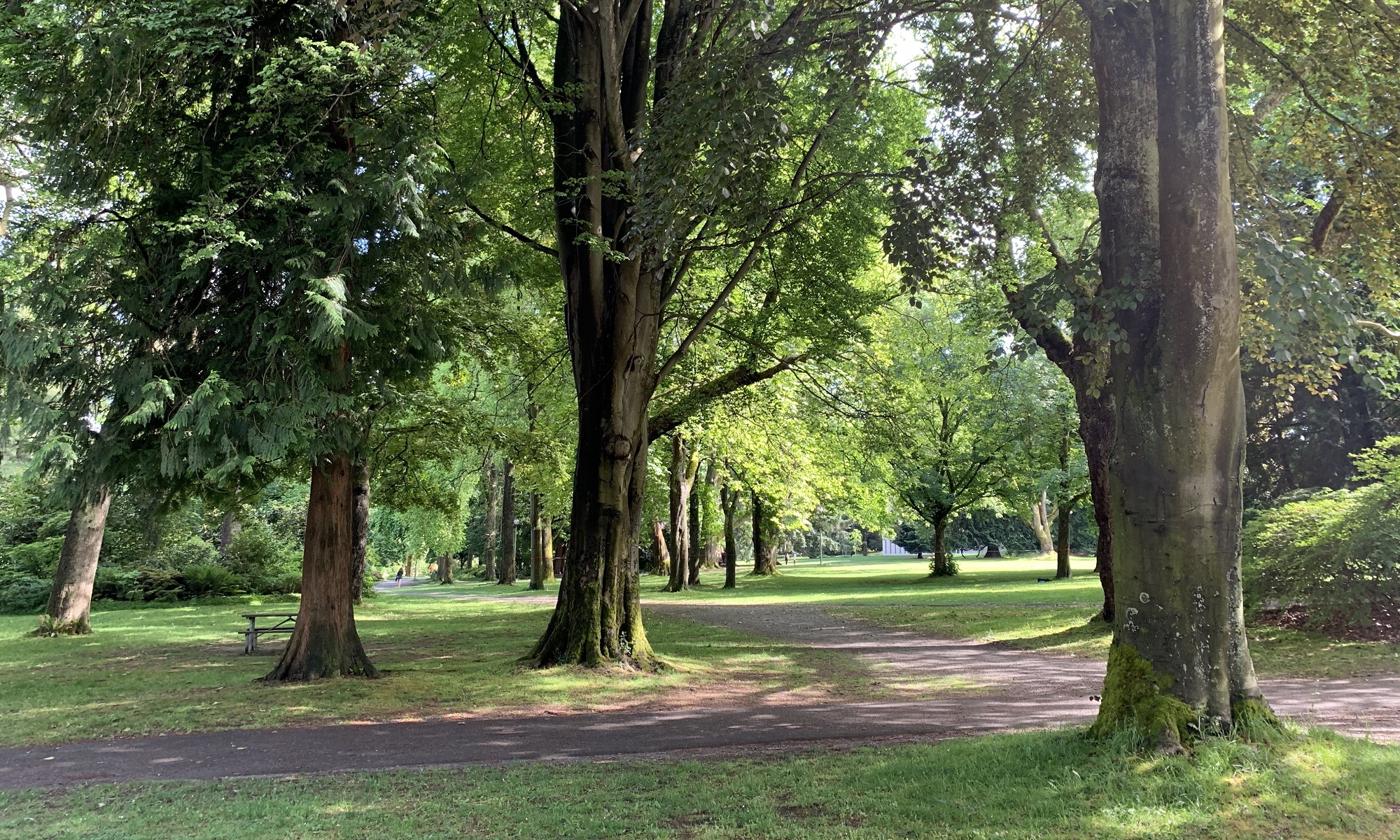
It was a beautiful, crisp, sunny day here in the northwest corner of the United States (56 °F/ 13 °C). I made my way down to Pike Place Market and the waterfront and bought a book at a second-hand book store there. Where are you from? inquired the owner. ‘Oh – South Africa’ I said, simply. My camera bag completed my appearance as an international tourist.
Here’s the Seattle waterfront by Pier 59 today. That’s the Seattle Aquarium, the green building with the solar panels on the roof.
The drawing is from inside the cover of ‘Die Mooiste Afrikaanse Sprokies/ The Most Beautiful African Fairytales’, published in 1968 by Human & Rousseau.
P.S. It’s a white Christmas in Seattle, with an inch or two of snow falling overnight in the city. White Christmases are rare in Seattle, but in 2008 four inches of snow blanketed the city on Christmas Day.
There was a thick fog hanging in the city this morning, but it was dry, and the sun came out later.
Here’s a gorgeous picture, tweeted today by Irfan Chaudhry@IrfanDesign, of a Kenmore seaplane at Kenmore, Washington. Kenmore is at the north end of Lake Washington, close to Seattle.
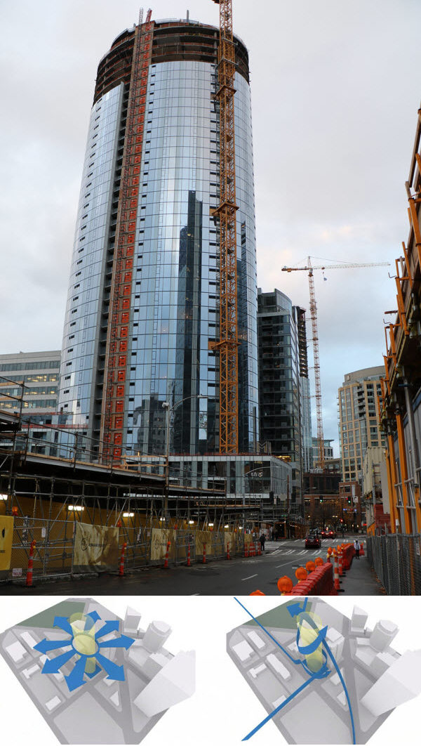
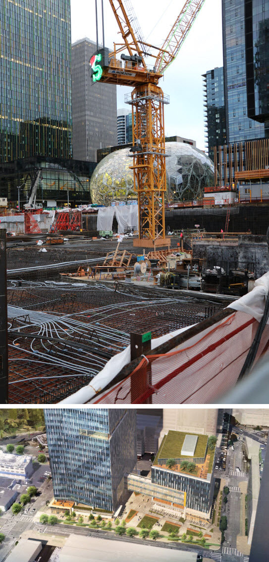
Deadlines have to be met, and time costs money – so construction on the new downtown Seattle buildings soldiers on, regardless of the season. The crews do take a break on Sundays, and then I can go check on their progress. Here are two buildings near Westlake Avenue and Denny Way.
This is 2202 8th Ave, a 40-storey condo building, as seen from the south from Blanchard St. The inset below shows Denny Park as a green patch behind the building, and the architect picked an oval shape to ‘provide a visual bridge between the intersecting Downtown and South Lake Union neighborhoods’. The building is near a weird triangular confluence of major streets.This is 2100 7th Ave (‘Amazon Block 21’), viewed from the corner of Blanchard St and 8th Ave. There will be two buildings, an 8-storey and a 24-storey. The bottom picture is an artist’s rendering of the completed project, and is the view when one stands on the opposite side of the construction site (with one’s back to the biospheres). I guess the S on the crane stands for Santa?
I replaced just about all the light bulbs inside my house with light-emitting diode (LED) bulbs this year. It’s amazing: a tungsten-filament bulb that used to run at 60 Watt, can now be replaced with one that run only at 9 W! This is much better still, than the 13 W for compact fluorescent light (CFL) bulbs. General Electric is now stopping production of domestic CFL lamps in favor of LEDs.
So for Christmas lights, many home-owners can now install strings of LED lights as well. Yes, these cost more to purchase, but a lot less to operate. (Every year we see reports of home-owners that set up displays with 100,000 bulbs or more, and that ‘borrow’ electricity from their neighbors to power it all up). LEDs also last longer than traditional incandescent glass lights, and are a safer light source since the bulbs do not get as hot, and are made of epoxy, not glass.
The Christmas lights on my neighbors’ homes across the street brightens up the winter darkness. Alas, I do not offer them the same view in return. I did put up ‘icicle lights’ on my front gutter one year, and maybe I should do that again – next year.This Seahawk-themed Christmas-light display of a Kirkland resident (east of Seattle) drew complaints by some neighbors last year about traffic, noise and flashing lights — 175,000 of them — from Thanksgiving through Christmas. So the house went dark last year. This year, the home-owner worked with the city to diminish the impact of visitors to his neighborhood, and the ‘Hawk’ house is back! [Picture from Seattle Times]
I wish I could send some of the rain water from here, all the way down to Cape Town, South Africa. (The city of Cape Town is experiencing the worst drought in its recorded history).
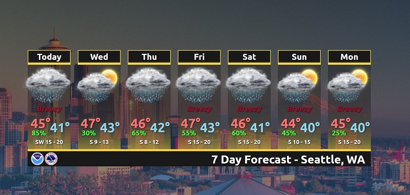
Here is the Seattle area forecast for the next seven days.
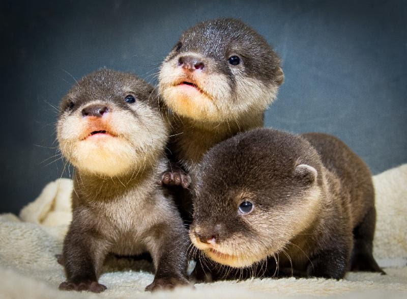
Graphic from the official Twitter account for the National Weather Service (Seattle). Those highs of 45 °F is equal to 7 °C.I’m sure these three little otters love rainy weather .. they are Asian small-clawed otter pups, born at the Cleveland Metroparks Zoo. Irresistably cute, not? [Picture: James Ewinger, The Plain Dealer]
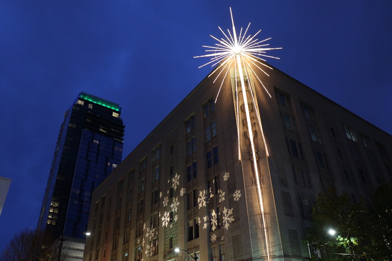
It was rainy today, and so I limited my Sunday walkabout to downtown. I did manage to snap a better picture of the Macy’s Christmas star!
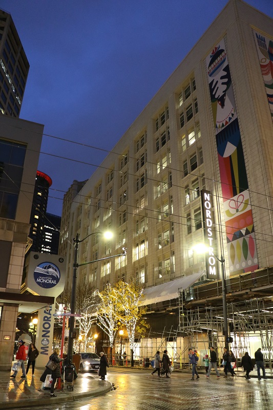
The Christmas star on the Macy’s department store shortly after dark, nicely lit up.A smattering of shoppers on Sunday night, at the corner of 5th Ave and Pine. The monorail station is on the left, and Nordstrom’s flagship store on the right. The Nordstrom makeover is almost complete (there is still scaffolding at the street level), but the Santa photo booth is up and running, with a Santa Claus on duty.
Black Friday has some and come, and Small Business Saturday – but I still have not done any shopping. I guess I will venture out to downtown Seattle soon to go check on the merchandise (it’s still nice to go out to the store and look at stuff) .. and I will pull the trigger on a few books, and other items, that I let lie in my Amazon cart for several days now.
Bloomberg Businessweek says the single biggest mistake a department store such as Macy’s had made, was to buy up all the other failing department stores over the years. Macy’s have now had sales declines for the last 11 quarters. Management knows they have to train sales staff better, and improve in other ways the in-store experience for the 41 million shoppers that still come into their stores every year.
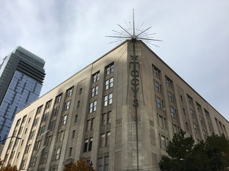
The Macy’s department store in downtown Seattle. I will have to go back and take another picture – the star is now lit at night. The store is suffering the indignity of getting its top four floors (of six) retrofitted into office space for none other than Amazon. Macy’s sold it to Amazon, and thereby downsized the store from six floors to two.
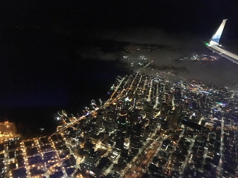
I made it back to Seattle late on Thursday night, courtesy of Alaska Airlines.
Downtown Seattle as we came in last night. Pro tip: pick a starboard window seat (right side) for the best views, while coming in on the flight back. We usually make a wide turn over Puget Sound, and then fly south over downtown. The Space Needle is not in this picture, but look for the Ferris wheel on the waterfront, and a ferry docked at its landing (I think that’s the ferry).
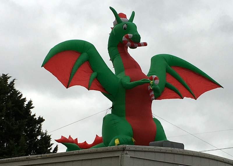
There’s a friendly ‘Christmas dragon’ on a parking lot close by my house, where they sell Christmas trees every year. The trees are said to be up to 10% more expensive this year. The reason: in the 2007-2008 recession fewer trees were planted, and those are the ones now being harvested.
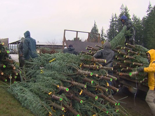
(Picture from KING5 TV station): Trees from Christmas Hills Tree Farm in Mossy Rock, some 2 hrs south of Seattle. These are probably ‘noble firs’ (the farm’s specialty). Noble firs are limited to the Cascade Range and Coast Ranges of the Pacific Northwest.
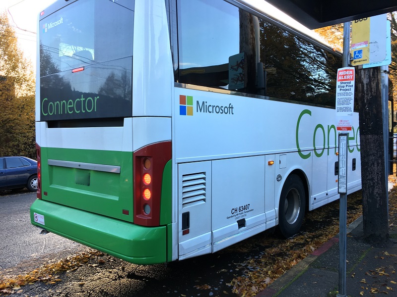
Microsoft’s Connector bus service started in 2007, and shuttles its employees from the Seattle side to Redmond and Bellevue. The King County public bus Route 545 does run an express service out there as well, and some say that Microsoft is taking commuters out of the public transportation system. In 2014 a small group of protesters blocked Connector buses in Capitol Hill, blaming them for ‘enabling’ local Microsoft employees to drive up property prices. (It’s complicated. There is also Amazon’s impact – and Seattle City Council policies lacking incentives for encouraging affordable housing construction. And a new tax on international buyers in Vancouver in 2016 just made Seattle more popular for these buyers as well).
Microsoft did support the ‘Yes’ initiative for ST3, the expansion of light rail service over to the East side. So in a few years, commuters to the East side will have even more options. I think it’s all good. The more buses and trains and street cars, the better.
I was waiting for the No 12 bus on 19th Ave on Monday morning to run an errand, when the fancy Microsoft Connector bus swept in and picked up a dozen or so Microsofties. The Connector stopping at King County bus stops is part of a pilot program. King County says this makes ‘better use of curb space’.
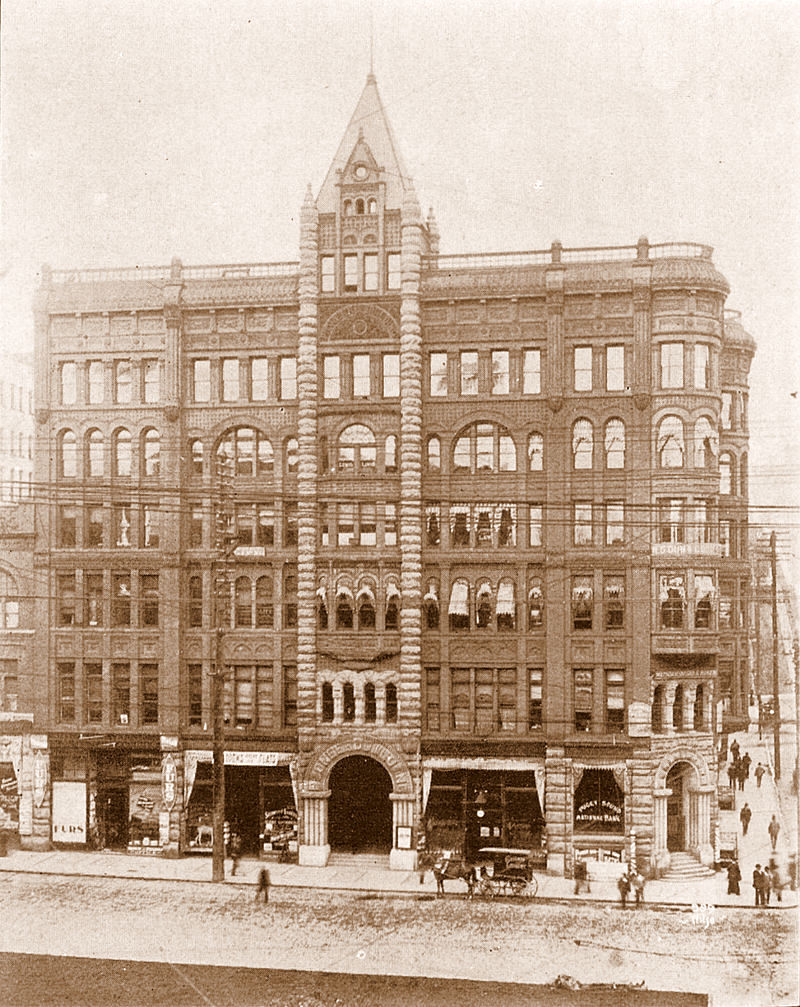
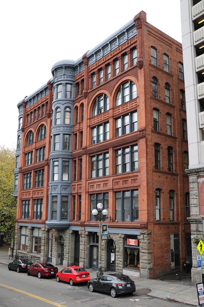
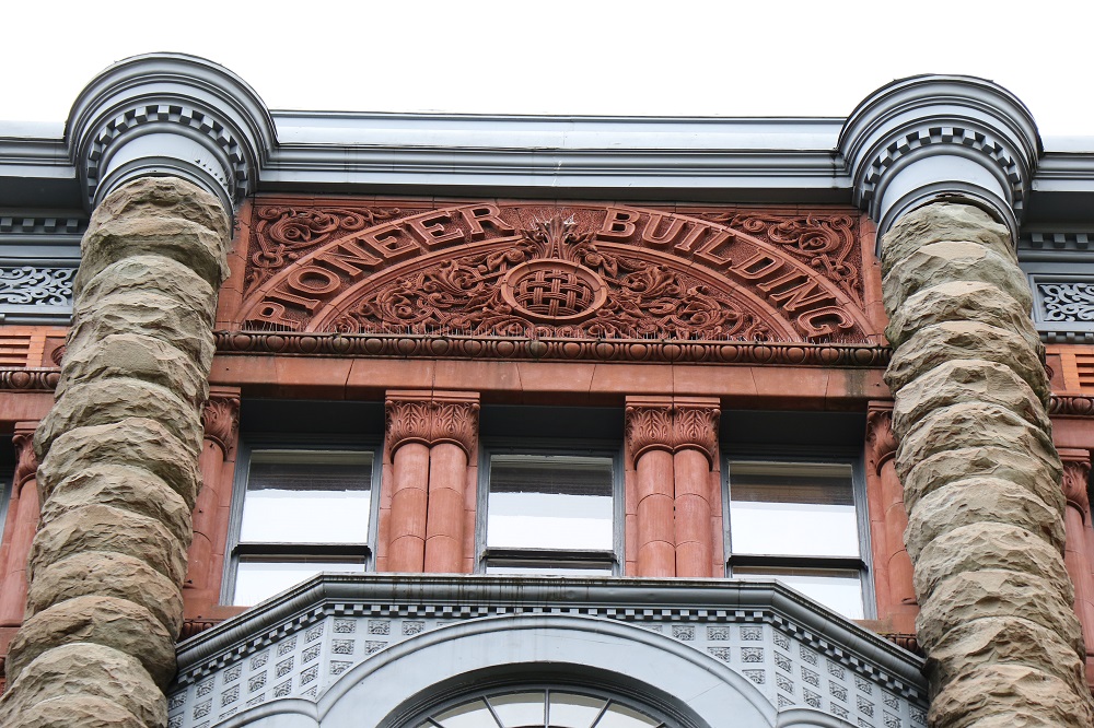
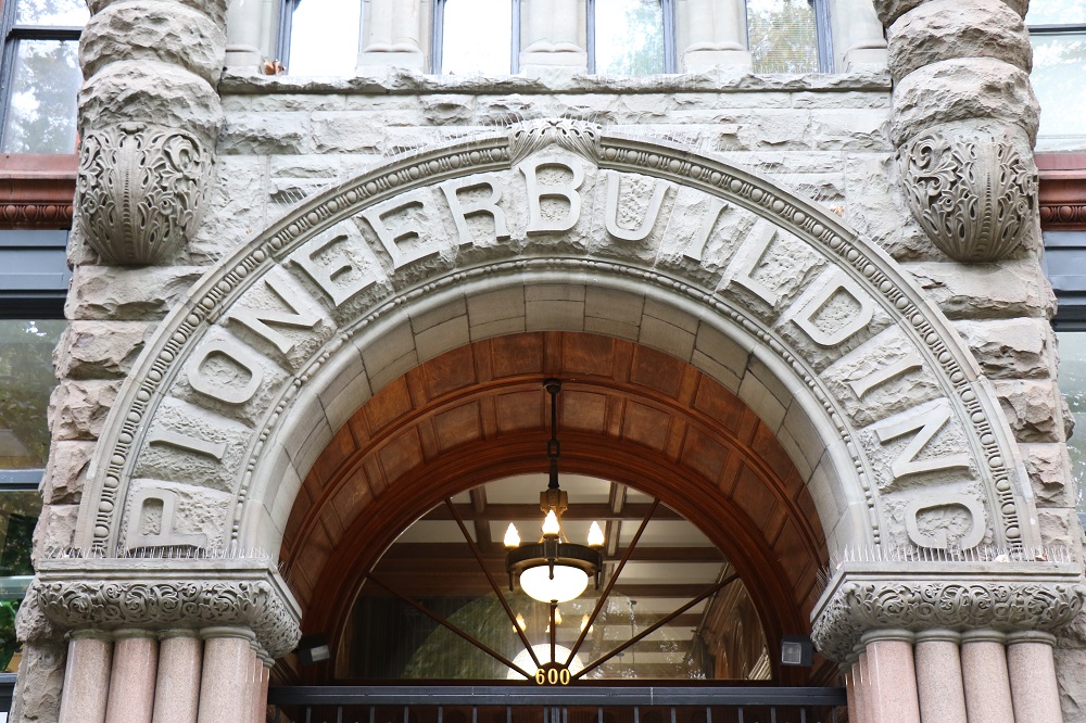
I managed to walk down 1st Avenue from Pike Place Market to Pioneer Square today, before the rain caught up with me and I had to call it quits. I took a few pictures of the Pioneer Building. For awhile, it was the tallest building in Seattle and Washington state – from 1892 to 1904. In December 2015, the building was purchased by workspace provider Level Office. They renovated the building’s interior to create private offices and co-working space for small businesses.
(Picture & Text From Wikipedia] The Pioneer Building is a Richardsonian Romanesque stone, red brick, terra cotta, and cast iron building located on the northeast corner of First Avenue and James Street, in Seattle’s Pioneer Square District. Completed in 1892, the Pioneer Building was designed by architect Elmer Fisher, who designed several of the historic district’s new buildings following the Great Seattle Fire of 1889. During the Klondike Gold Rush, in 1897, there were 48 different mining companies that had offices there.The Pioneer building’s south side, today. It is difficult to get a picture of the whole front facade (tall trees, other buildings). The original pyramid tower from the first picture is gone now.Intricate stone detail in the top panel with the building name.And here is the stonework arch on the main entrance.
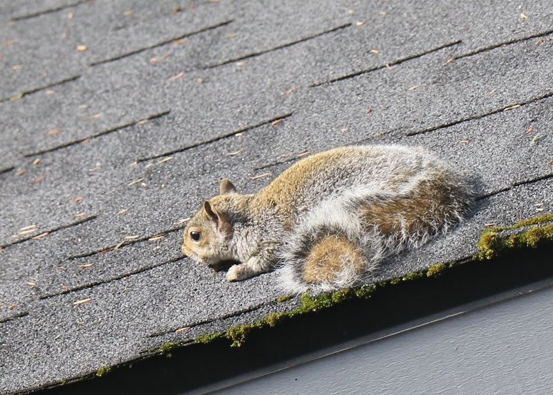
Mr Squirrel sunning himself on my garage roof. (Eastern Gray Squirrel, sciurus carolinensis). With the neighbors’ maple tree out, a lot more sunshine is coming into my backyard – but the squirrels no longer have the seeds to forage on.
A series of cloudy and rainy fronts weather is set to roll over Seattle the next several days.
So when the sun came out from under the clouds today, I said to myself: get out of the house now! go get some sun!
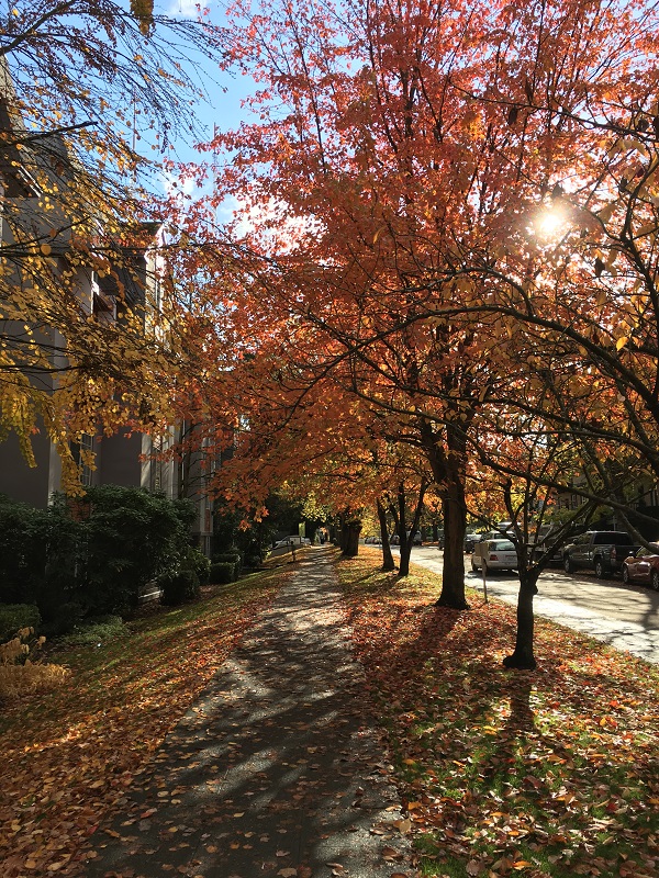
Sun, and blue sky! This is early afternoon on 17th Ave in Capitol Hill (temp. 51°F/ 11 °C).
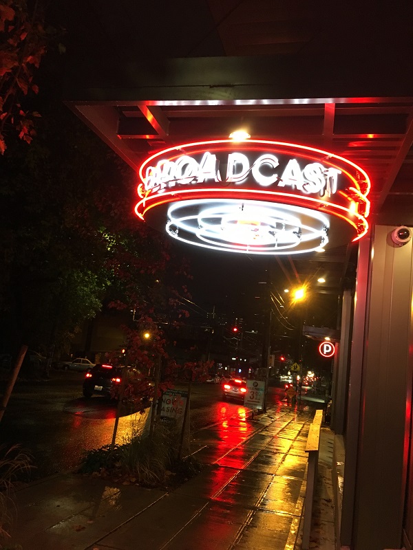
The neon sign at the entrance of the new Broadcast Apartments on Madison Avenue on Capitol Hill. It comes in handy, in the long, dark nights of Seattle’s winters. Sunset is now at 4.45pm already.
It’s the end of Daylight Saving Time in the USA. At 2 am we’re all* setting our clocks here in the USA back by one hour. Yay! An extra hour for the party animals that hang out in the bars until 2 am – and an extra hour of snooze time for me on Sunday morning.
*Not Hawaii, Arizona— nor the U.S. territories of American Samoa, Guam, Puerto Rico, the Virgin Islands and the Northern Mariana Islands. They do not observe DST.
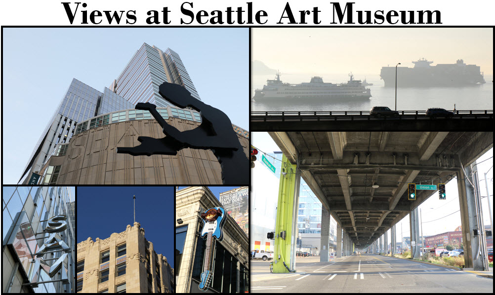
I took advantage of the nice fall weather here (sunny, 60°F/ 15°C) before the next rain storm sweeps in, and went down to Seattle Art Museum (SAM) in downtown. I just checked out the artsy offerings in the museum store, and took a few pictures on the streets nearby.
Clockwise from the top left: Hammering Man outside SAM was designed by Jonathan Borofsky and installed in 1992 | a big old containership tugged into the Port of Seattle just as the Bainbridge Island ferry was leaving, viewed from the Four Seasons Hotel street level | under the Alaskan Way Viaduct whose days are now numbered -it will be torn down completely by fall 2019 | Hard Rock Cafe’s guitar | beautiful art deco detail on the Vance Building (completed 1929) | mirrored SAM lettering on the side of the building.
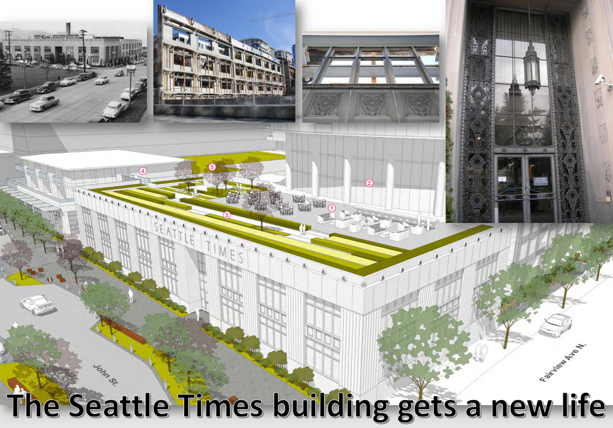
I went down to South Lake Union today to check out the construction on the old Seattle Times Building’s site.
The original Seattle Times Building was completed in 1931 with offices and newspaper printing presses and all. Operations stopped there in 2011, and were moved to Bothell (some 20 miles from of Seattle). The real estate and buildings were sold in 2013 to a company from Vancouver. The developer has to preserve the exterior facade and roof of the Seattle Times Building, since these were designated a Seattle city landmark in 1996. It’s a little weird that only the exterior walls and roof of a building can be designated a landmark! .. but at least some semblance of the old building remains. The developer has already demolished all of the inside, and while the rooftop is not built on, it is getting a make-over with landscaping and seating.
Top left to right: The Seattle Times building in 1946; the side facade of the main building from behind (there is a support framework on the front); Art Deco elements on the side of the building and by the main entrance. Main picture: 1 Exterior landscaped amenity deck for building residents | 2 Double-height indoor amenity space adjacent to outdoor deck | 3 Tall landscaping elements kept back from roof deck perimeter to give priority to the landmark Seattle Times facade | 4 Bridge element connects roofdeck with podium over breezeway | 5 Display of Seattle Times industrial artifact.Here is the proposed massing of the tower buildings around the Seattle Times Building (in red outline). ‘Massing’ in architecture refers to the perception of the general shapes, forms and sizes of a buildings.
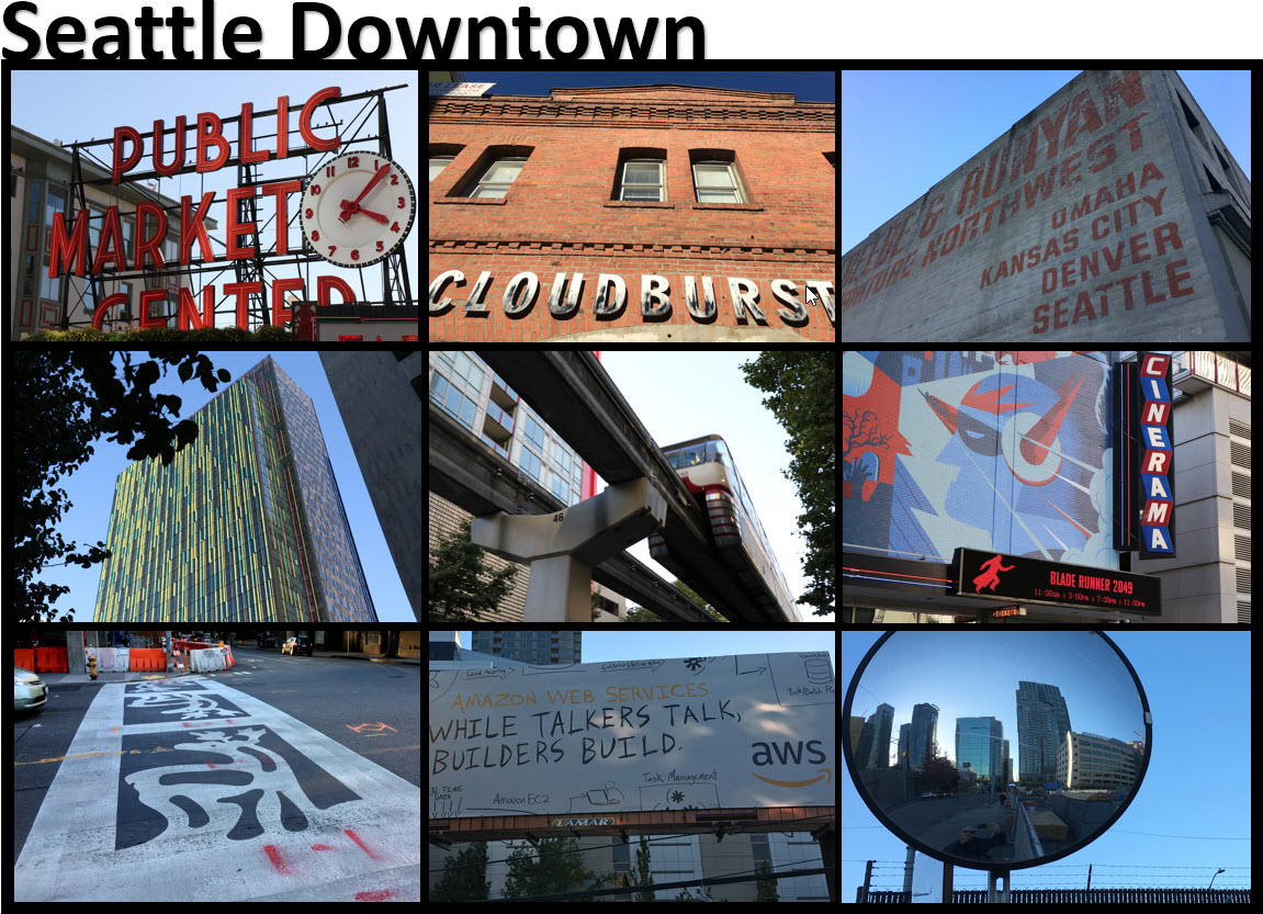
Here’s a collage of pictures from my random walk around Seattle downtown this afternoon. It was sunny but only 60°F/ 15°C, so ‘light jacket’ weather. ‘Scarf weather’ is coming, sometime in November.
Clockwise from top left: iconic Pike Place Market sign | Cloudburst microbrewery on Western Ave, with a hole-in-the-wall beer hall downstairs | long-ago furniture store turned into offices | Bladerunner 2049 at the Cinerama (will go see it there next weekend) | construction truck mirror near Denny Way | new billboard for Amazon Web Services off Denny Way | is this a ‘Christmas’ pedestrian crossing? this at c/r of Boren & Howell | yellow & green on Amazon Tower II | monorail from Space Needle, going to downtown.
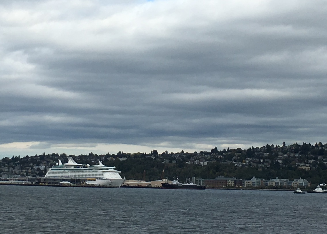
Royal Caribbean’s Explorer of the Seas (built 1999, passengers 3,825) was at the Seattle cruise terminal at Pier 91 on Friday. This one was the very last of the cruise ships for the season.
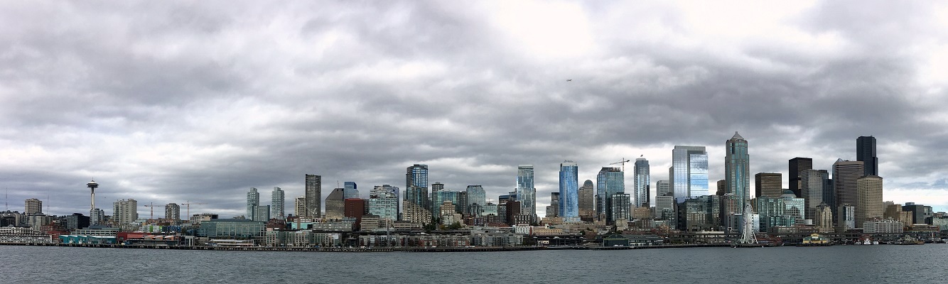
It was blustery and cool on the top deck of the ferry as we came in on Friday afternoon to Seattle from Bainbridge Island.
We spotted a cruise ship, unusual for October. The 2017 cruise season is now over, and the 2018 season will start in May.
The Seattle skyline, seen from the ferry. Thursday’s blue skies gave way to lots of low clouds.
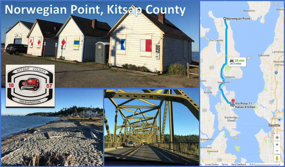
Bryan and I made a run out to Kitsap peninsula for dinner with friends. We stopped at Norwegian Point to catch a little of the beautiful fall weather, and then made it down to Bainbridge Island for dinner at a restaurant-store called Via Rosa 11: great wood-fired pizza, and other Italian food.
Norwegian Point’s little storage houses with their colorful maritime flags; the Kitsap County logo* from a ballot box/ mail box right there; the view from Norwegian Point looking south west; the bridge crossing at Agate Point onto Bainbridge Island. *As far as I can tell this is a depiction of a thunderbird (rainbird), a legendary creature in certain North American indigenous peoples’ history and culture.
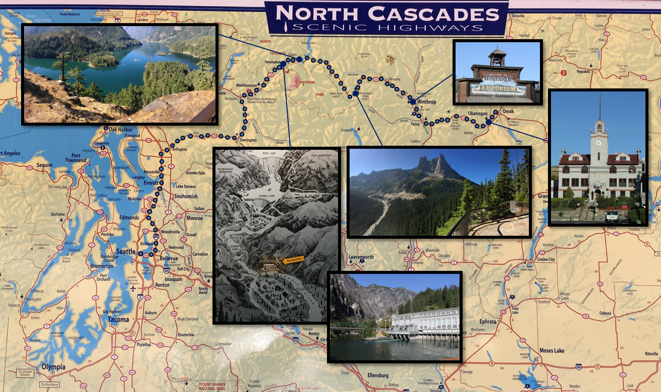
We stayed over in the town of Omak on Wednesday night, and made our way back to Seattle on Thursday over the North Cascades* with Highway 20. It’s about a 5 hr drive without stops, to go from Omak to Twisp, Winthrop, Newhalem, Darrington and then with I-5 (or I-405) to Seattle. It was a crisp morning when we started back from Omak (47 °F/ 8°C), but back in Seattle it was a record warm day for Sept 28 at (85°F/ 29 °C).
*The Cascade Range or ‘Cascades’ is a major mountain range of western North America, extending from southern British Columbia in Canada through Washington State and Oregon and into Northern California.
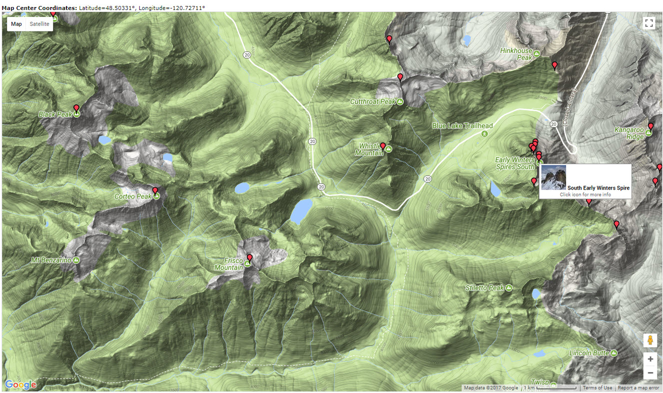
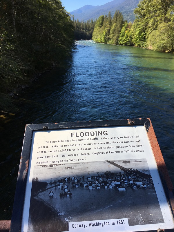
Clockwise from top left: view over the Skagit River Valley, with the Diablo Dam’s dam wall directly ahead; vintage ‘Wild West’ storefront in Winthrop; town hall of Okanogan; viewpoint in Washington Pass on Highway 20, with the Early Winter Spires (7,807 ft / 2 380 m); at Newhalem by the Gorge Dam and Power station; the diagram shows the Ross Dam and the Diablo Dam as well.Here’s a cool topographical map that I generated with a Google search for ‘Early Winter Spires’ that shows how Highway 20 follows the lowest contour lines through the North Cascades. The web site is http://www.summitpost.org. There is a hairpin bend in the road by the Spires, and the map also shows several alpine lakes. These are lakes or reservoirs at high altitudes, usually starting around 5,000 feet (1,500 m). These is still snow and ice visible further up, from small glaciers. Highway 20 gets so much snow in winter that it is completely closed for traffic, sometimes only opening again as late as June.View from a foot bridge overlooking the Skagit River at Newhalem; this is just downstream of the Gorge Dam. Flooding in the Skagit Valley has become a rare event due to the three dams that had been built upstream in the Skagit River (the Gorge, the Diablo, the Ross).