Saturday/ the Elliott Bay trail

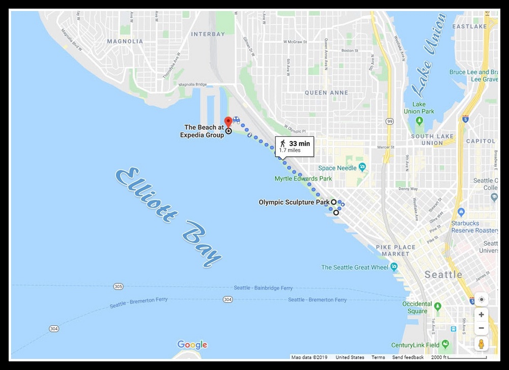
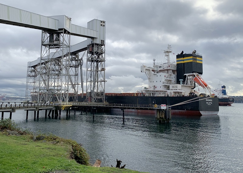
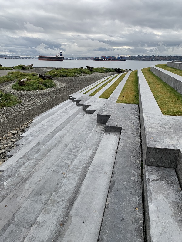
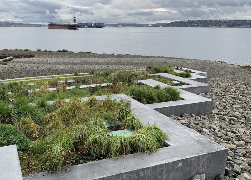
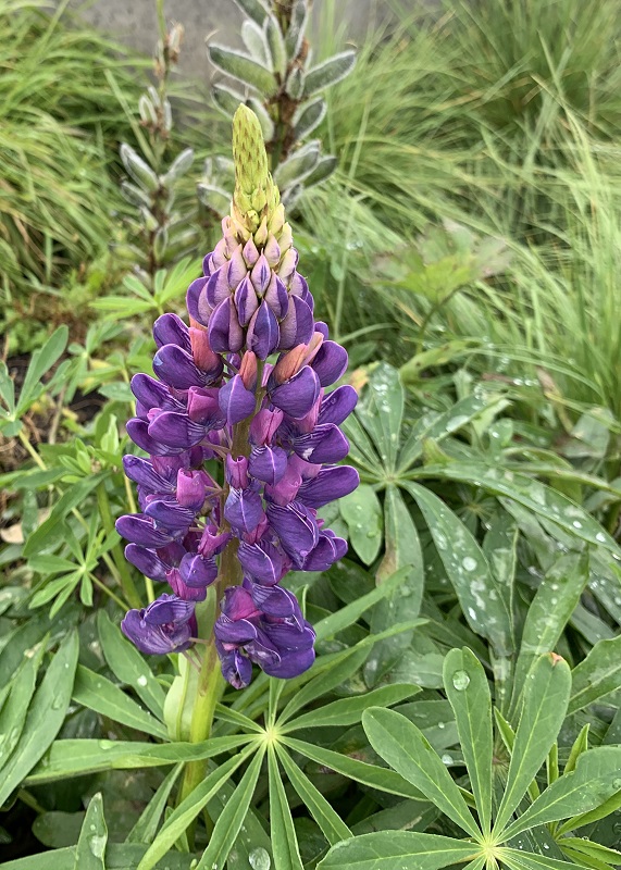
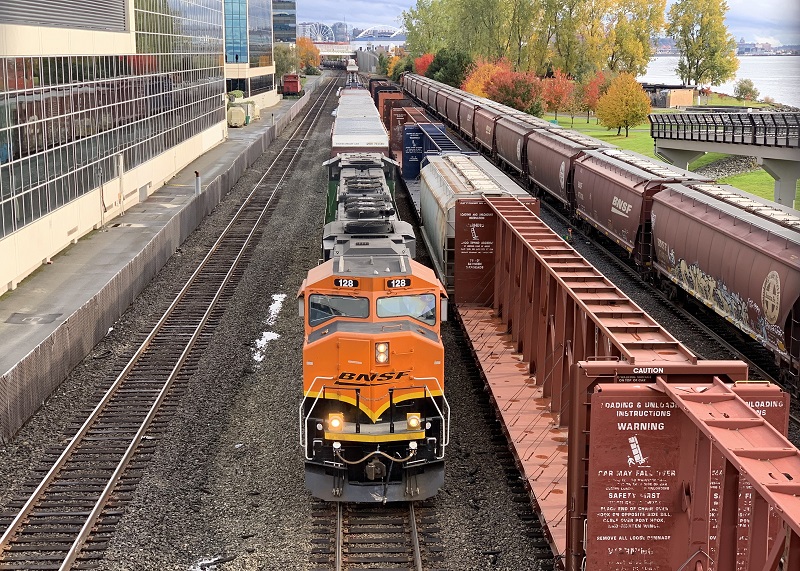
Here are some pictures I took while walking along the Elliott Bay trail. Three of us went to go check out the new beach park by the new Expedia headquarters at its north end.
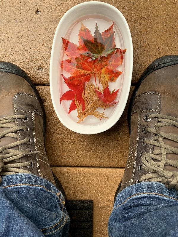
It’s about a half hour walk from Olympic Sculpture Park up to the new Beach at Expedia Group on the Elliot Bay urban trail.
This railway line runs under Olympic Sculpture Park. The maintenance trucks have been fitted with rail wheels to make them run on the track. The yellow and black sign (bottom left) has numbers on that indicate speed limits: F-Freight 25 mph, P-Passenger 30 mph, T-Transit 30 mph.
Here is part of a 32′ (10 m) tall totem pole next to the trail. It was carved by Tlingit Indians (‘Thu-lin-git’ with a hard g) in 1975 for Alaska Indian Arts in Haines, Alaska.
Here is the Pier 86 Grain Terminal, in operation since 1970. I looked up this bulk vessel’s name Nasaka on https://www.vesselfinder.com. It was built in 2014 and is sailing under the flag of Malta. Its recent ports of call were Rizhao, China and Shanghai, China – so it will probably head out there again. Check out those yellow ‘dinner plates’ mounted on the mooring ropes by the stern of the ship. They stop rats from running onto the ship (to chomp on that yummy grain). And that orange emergency vessel, yikes! Bet it would be a hair-raising, stomach-churning ride, strapped in & sliding down, to go bob on the ocean chop!
Here’s the newly landscaped Beach Park at Expedia Group, at the north end of the Elliott Bay trail. Nicely done: a set of contoured cement steps with a little bit of lawn in, and with crushed gravel, greenery and logs down below. (There is no sand on this part of the Sound’s water edge).
Another shot, this one looking more or less south. Just to the right of the cargo ships in the distance, are the red container cranes of Terminal 5 of the Port of Seattle. The embankment on the right in the distance is West Seattle. 
There were even some bluebonnets (genus Lupinus) in bloom. The bluebonnet is the state flower of Texas. 
Train coming! A Burlington Northern Santa Fe (BNSF) railway train, as we were standing on the Thomas St pedestrian overpass. BNSF operates one of the largest freight railroad networks in North America.

Tuesday/ the euagarics are here

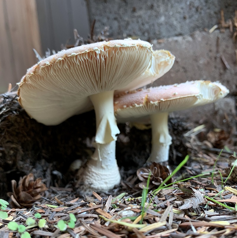
The gilled mushrooms (fancy name: euagarics) that usually pop out of the ground this time of year, have appeared again in my backyard.

The ones I have gotten so far, are not as red, nor as big, as years before. It could be because the soil has dried out these last two weeks. (That is about to change, though. The weatherman says we will get up to 2 inches of rain the next few days).

Gilled mushrooms are called euagarics by fungus aficionados. I believe these are fly agaric mushrooms (Amanita muscaria), even though they are smaller and not quite as big and red as ones I had last year.

Monday/ First Light’s art installation

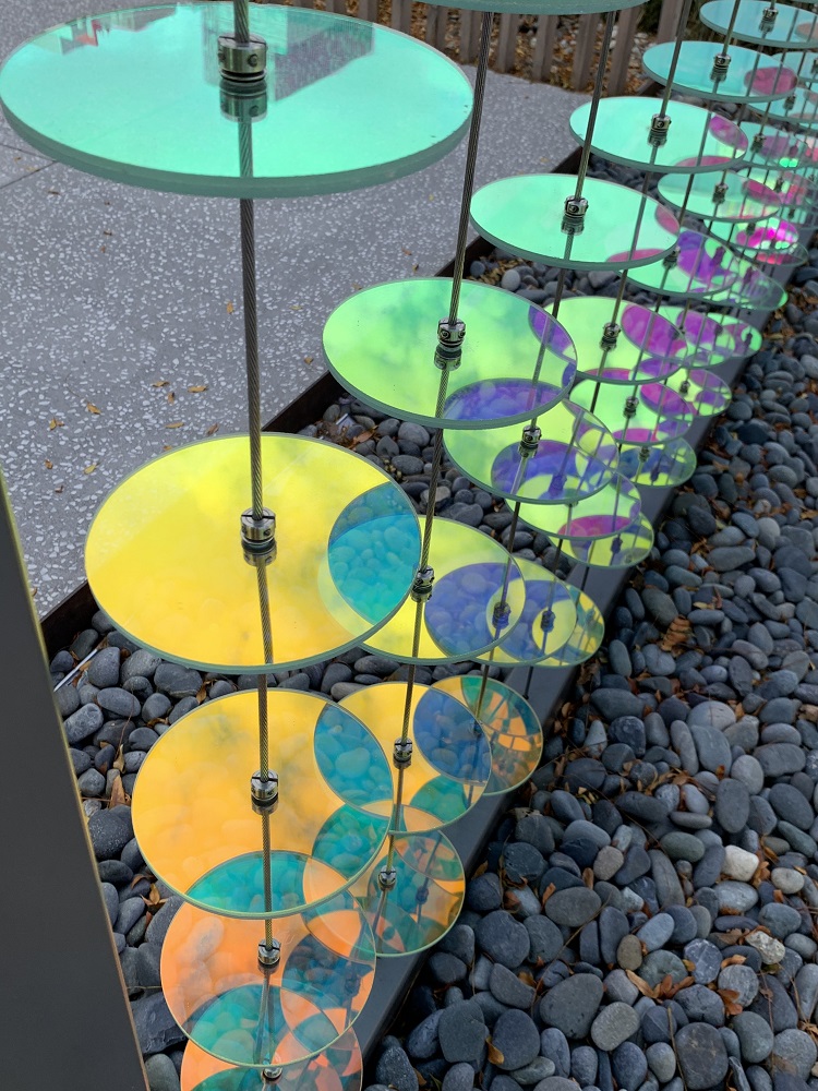
Here is another picture from Sunday, of the art installation on the corner of 3rd Ave. and Virginia St. at the sales office of the future First Light condominium tower.

The artwork is a demonstration of the ‘curtain’ of cords and discs that will be installed around the lower floors of the First Light condominium building. The condo tower is only slated to open in the summer of 2022, though. A sign nearby says 60% of the units have been sold to date.

Sunday/ Alaskan Way viaduct: almost gone

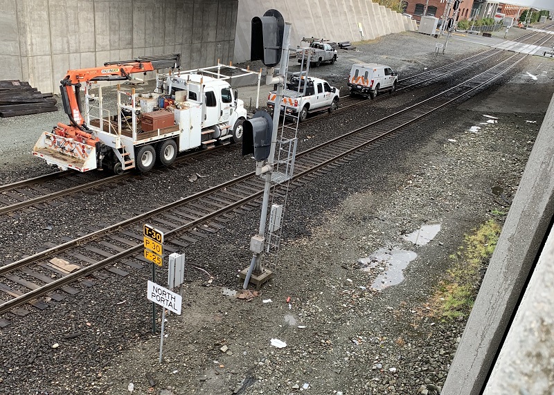
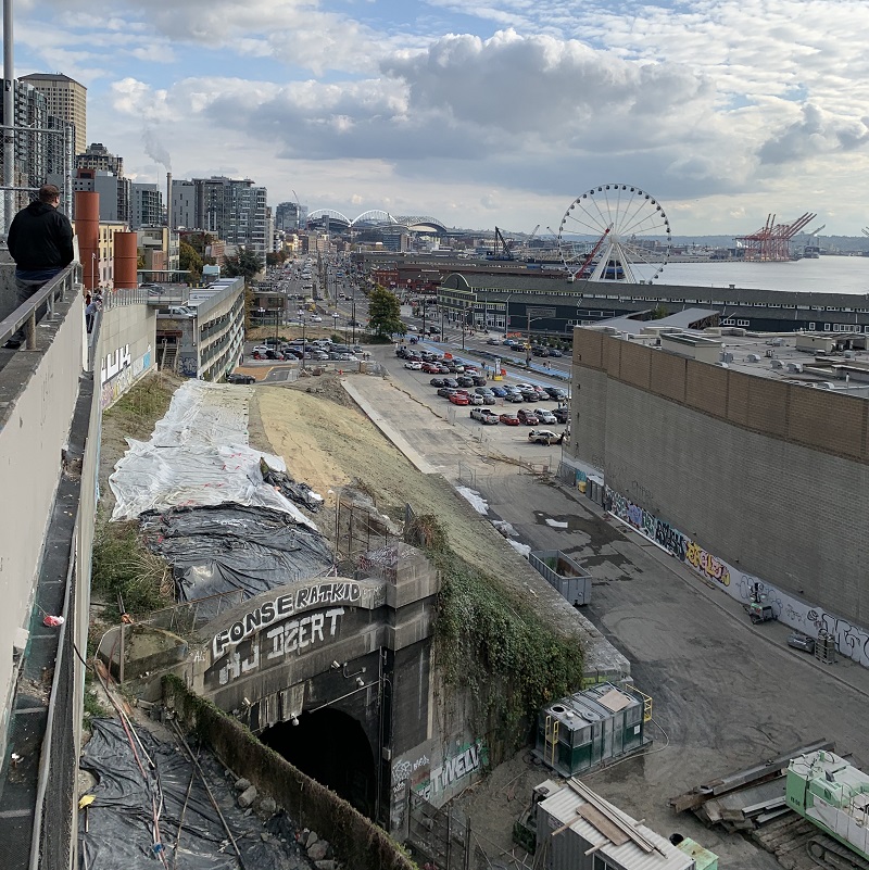
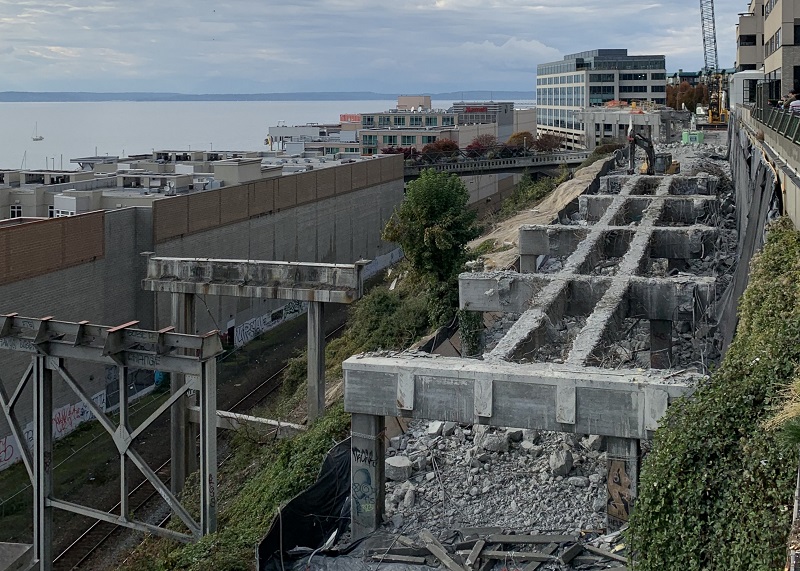
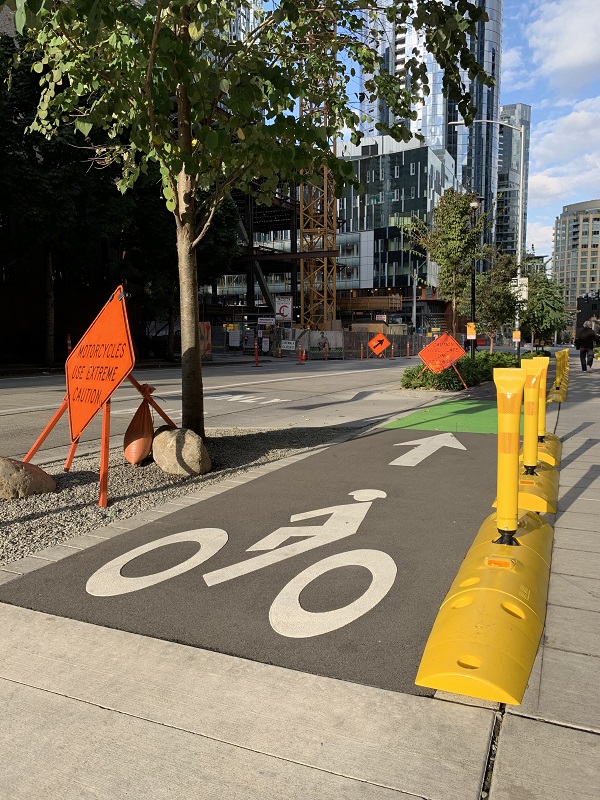
I went down to the railing at the top of Pike Place Market today, to go check on the Alaskan Way viaduct demolition. Only some support beams for the now-demolished double-decker viaduct, are still there.

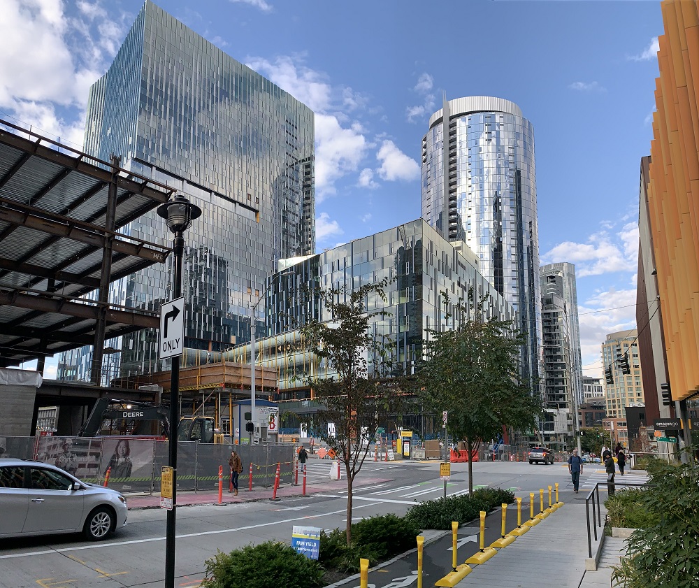
A few blocks away more of the new Amazon buildings are nearing completion, gleaming glass and steel on the outside.

Here’s the view looking south: no sign of the viaduct! Yay! (P.S. A pity that railway tunnel and line is still there, though. Just as I was leaving, a noisy coal train came chugging through, probably headed up north to the coal export terminal in British Columbia. We don’t like coal trains in Seattle. As the freight cars cross the roadways, motorists are backed up for blocks. And in a Nov. 2016 trial against rail company BNSF, scientists testified that a million or more coal particles per second come off of each rail car, dumping mercury, arsenic, and hundreds of other pollutants into rivers, lakes and oceans along BNSF rail lines. And then of course, somewhere all the coal will get burned, become CO and contribute to the climate change crisis).
Here are some of the remaining support beams that will be demolished, looking north from the same spot.
Here is what the corner of Blanchard St & 7th Ave looks like now. The two shiny buildings are Amazon Block 21. The oval one is McKenzie luxury apartments (1 bed, 1 bath: $3,000 pm). To the left rises Amazon Block 18, a 17-story office building. Quite a transformation .. not that many years ago, I would bring my Toyota Camry to the Toyota service station that used to be right here, in Block 21.
New bike lane, watch for bicycles as you cross, pedestrians! I wonder if the bicycle picture will eventually have to be updated to include say, electric scooters.
This is the nearby Amazon Block 20 tower that has been completed for a few months now. Amazon employees must have started to move into it.

Friday/ a tunnel of yellow frames

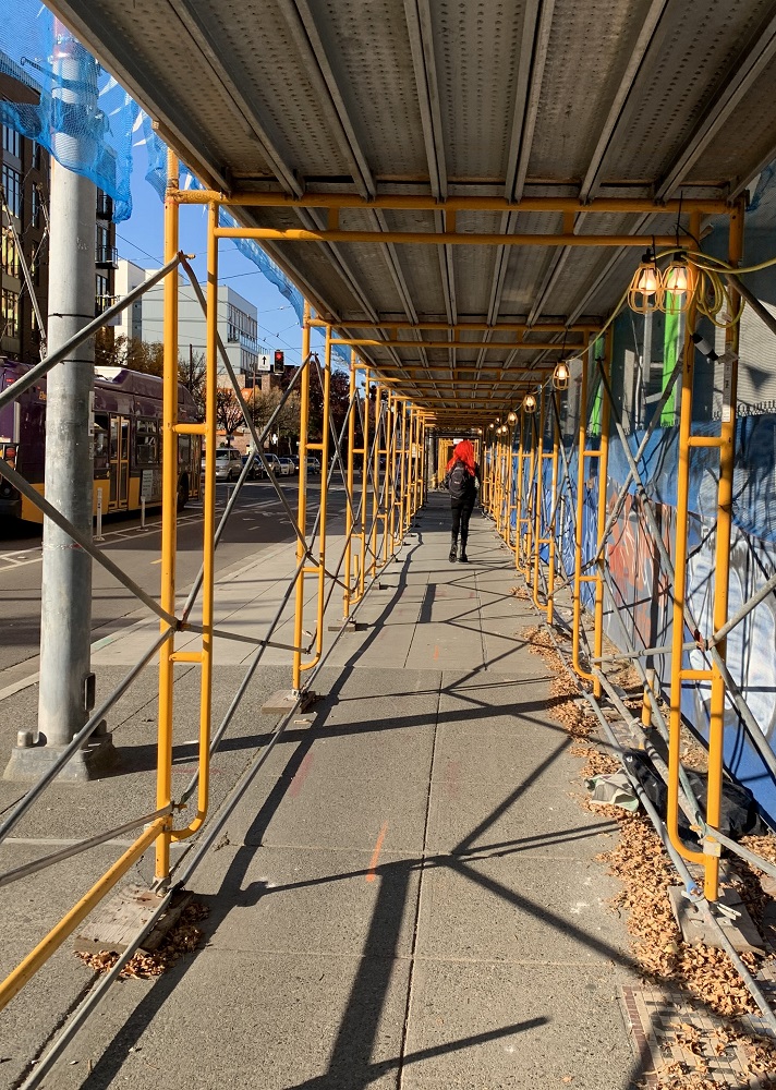
Here’s a tunnel of yellow frames along Broadway, as I made my way back to the Capitol Hill train station today.  I guess the scaffolding protects pedestrians from falling tools and other accidental debris, from the construction of the three new apartment buildings right there.
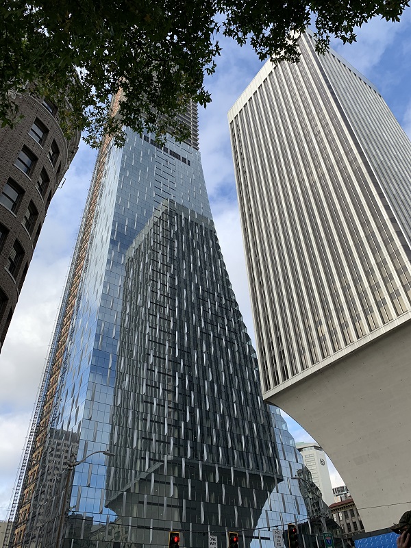
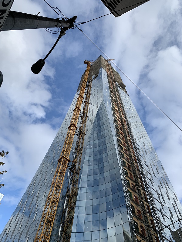
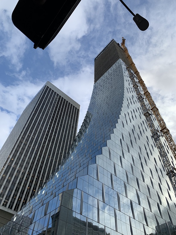
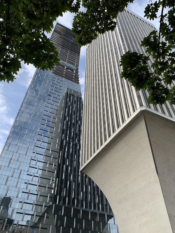
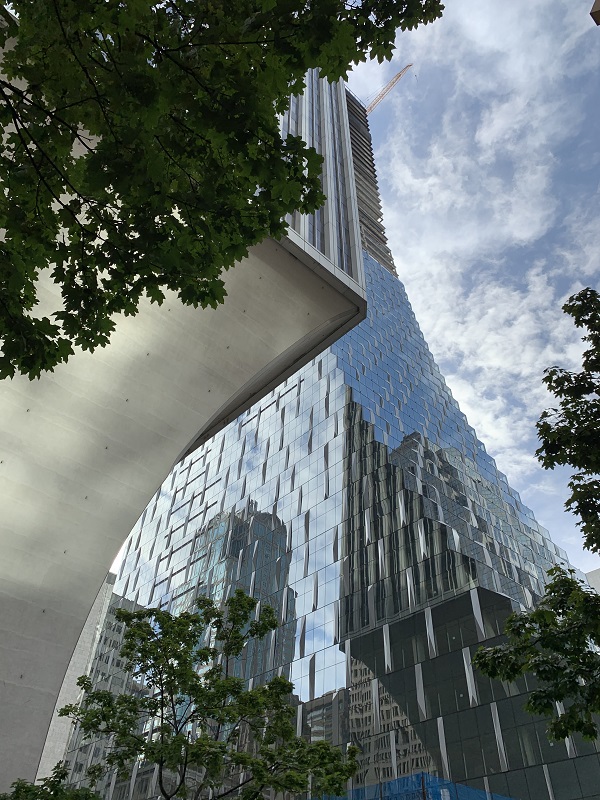
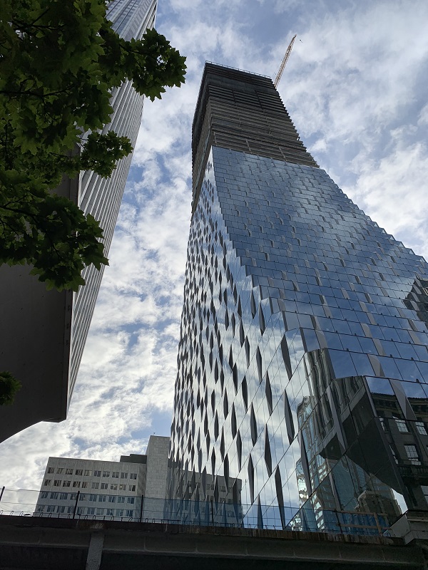
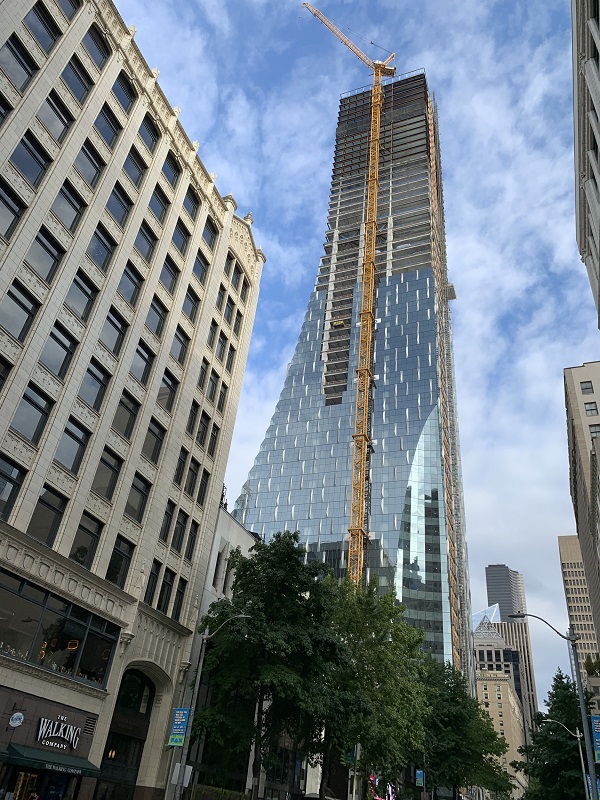
The figure in the distance is a woman with scarlet-red hair, clad in black with matching 6- inch platform shoes.

Sunday/ fall colors start to appear

It’s autumn – fall, as we say in the US – and the leaves are starting to change color. It was a nice sunny day (64° F/ 18° C), but the daylight shortens by 3 minutes every day now.

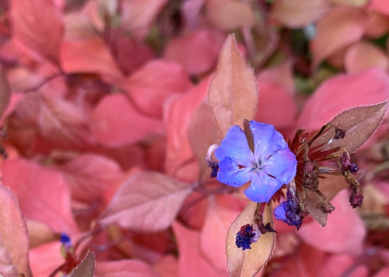
The blue leadwood (Ceratostigma plumbaginoides) on my back porch still has some of its delicate flowers, and the green leaves have now turned red.

Monday/ at the airport

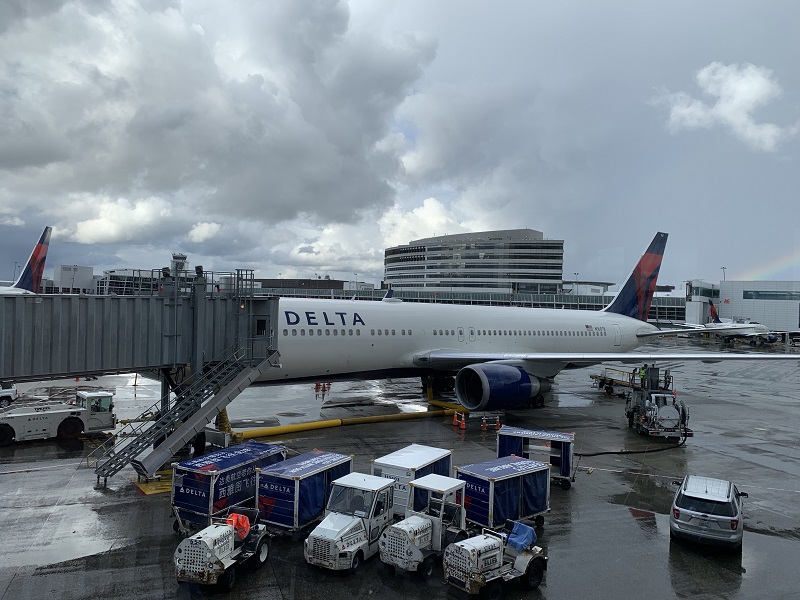
I made it to the airport. Both escalators at the light rail’s airport stop were out of service, so we all had to use the elevator to get downstairs – a little bit of a delay.

Delta flies out of South Terminal, which is still undergoing renovations.

Here is the view from my gate at South Terminal.  Delta’s Boeing 767 bird in the front has an extended range and is shortly flying out to Beijing (11 hrs). My airplane looks similar, and is the one with the tail on the far left of the picture.
A billboard from Cathay Pacific at South Terminal. They now fly non-stop from Seattle to Hong Kong, and back, four times a week. It’s a 13 hr flight.


Saturday/ thunder and lightning

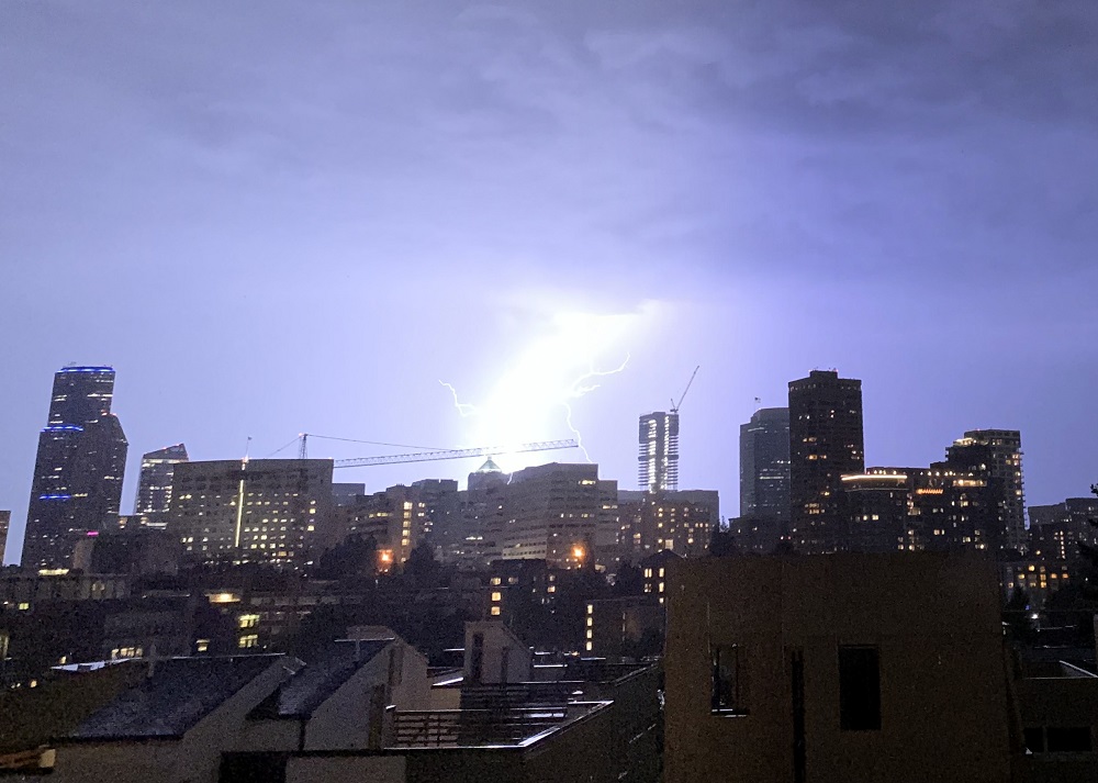
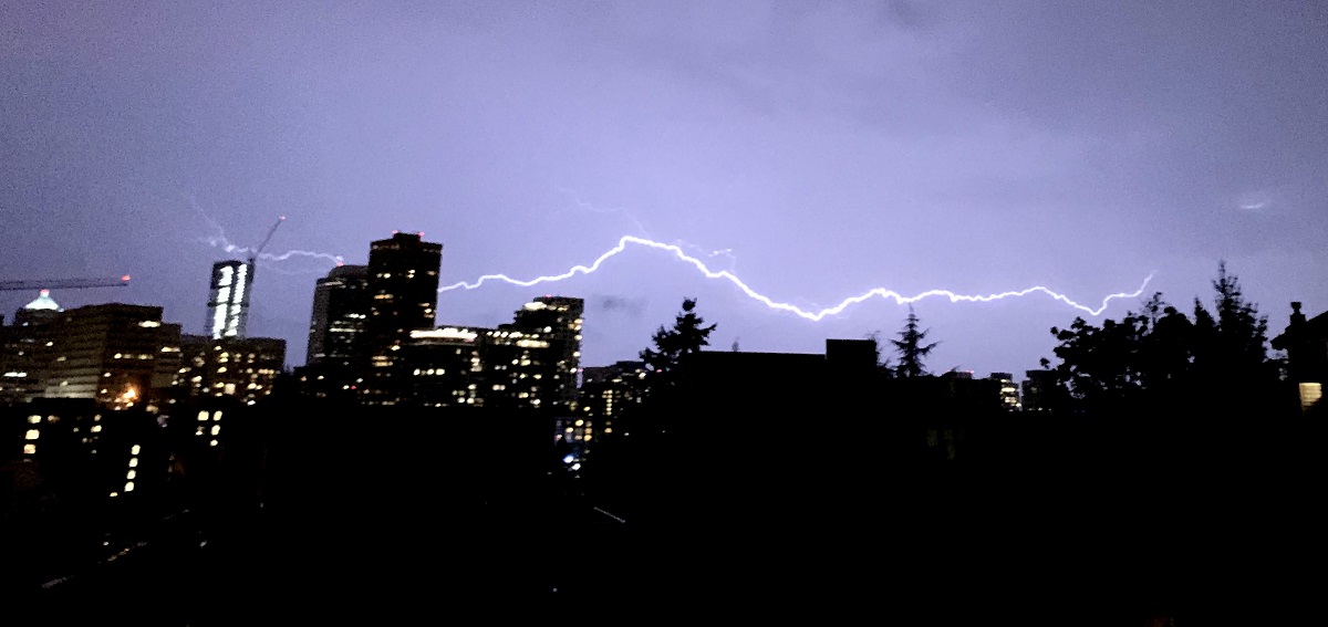
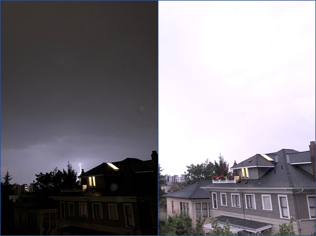
There was a big storm with thunder and spectacular lightning, that moved over the city on Saturday night. Some flights to Seattle-Tacoma airport had to be diverted to Vancouver.

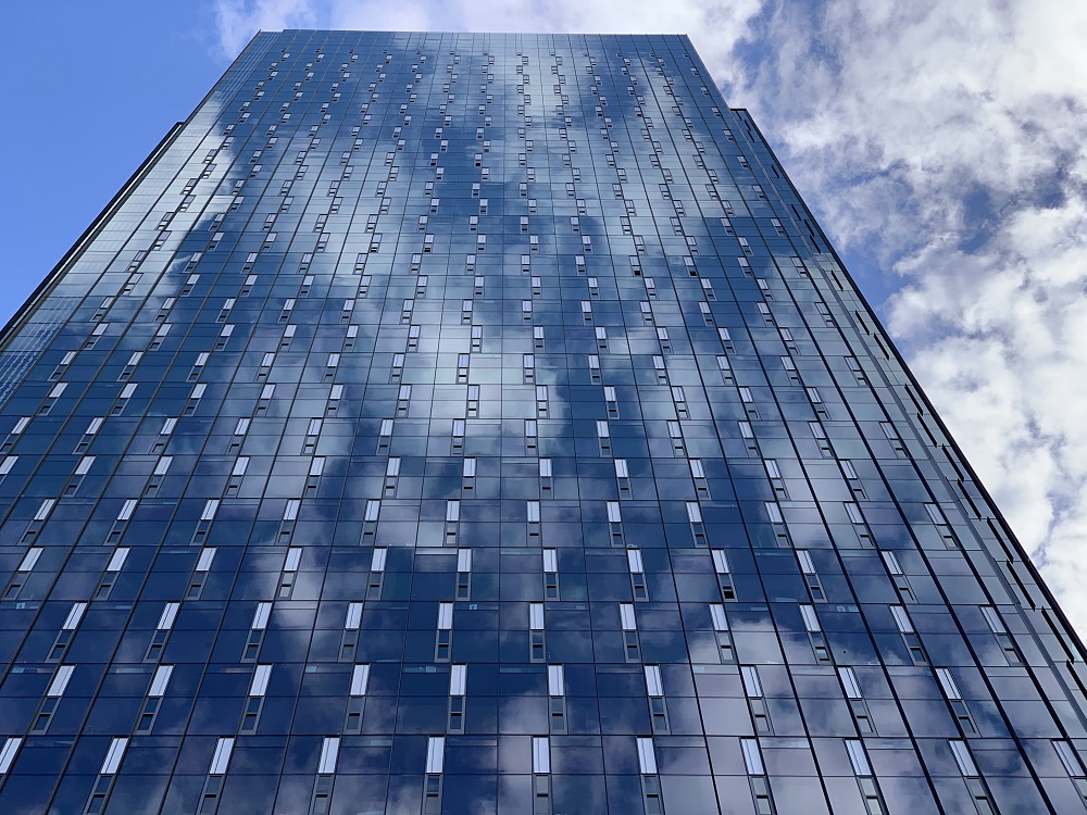
These are iPhone pictures that I took from my friends’ house, of the city skyline, looking westward to Puget Sound.

A compound lightning bolt behind the US Bank Center (pyramid top) building in the city skyline. On the far left is the Columbia Center (the city’s tallest) and to the right of the lightning bolt, the Rainier Square Tower building that is still under construction.
Here’s a longer cloud-to-cloud bolt that streaked across the skyline.
On the left, a lightning bolt in the distance. On the right is the exact same scene (some time later), lit up as bright as broad daylight, with the overhead lightning flashes.

Friday/ drive like a sloth .. or maybe not

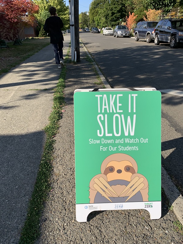
School has started, and drivers (me*) have to look for those flashing lights that indicate school zone speed limits are in force: generally 20 mph instead of 30 or 35 mph.

*In April, moi got caught, whizzing by a 20 mph sign & flashing light, at the regularly allowed 35 mph. I did not see the sign or light until it was way too late! – honest. $234 fine, which I paid. Ouch.

This sign was up by Meany Middle School today. Yes, slow down and take it slow, but definitely DO NOT go as slow as a sloth. The sloth is the world’s slowest mammal, and moves at a top speed of 0.15 mph.

Thursday/ under ‘surveillance’

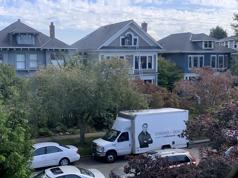
There has been ‘suspicious’ activities going on at a house across the street from mine. There was a moving truck last week, and this week a staging truck was parked in front of it for three days.
So now I take a look every day out the window, to see if that classic white sign post with the ‘For Sale’ sign on the sidewalk, is up yet.

The house that I have ‘under surveillance’. It has been pressure washed outside, and a contractor is cleaning the windows. There’s the staging truck in front of it (picture from Tuesday). The house was built in 1902, and its online history says it was last sold in July of 1999: 20 years ago. The Seattle housing market is still very competitive, but much more balanced between buyers and sellers compared to just a year ago.

Wednesday

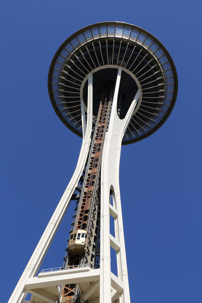
Here is the Space Needle, against a clear blue sky today.
It has now been open for a year since its 2017-18 renovation. I still have to go up to the viewing deck to check out the new glass floors that were put in.

If ever we have a hurricane here in Seattle ( ! ), the structure should be able to hold its own. It was built to withstand wind speeds of 200 mph (320 km/h), double the requirements in the building code of 1962.

Friday/ the Rainier Square Tower has topped out

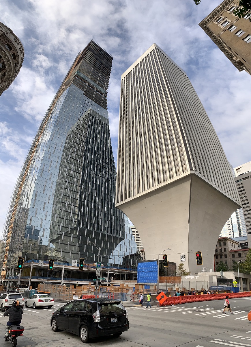
The construction of the Rainier Square Tower has topped out at its designated 58 stories. At 850 ft (260 m) tall, it is now the city’s second tallest tower ⁠— bested only by the 1982 Columbia Center at 937 ft (285 m).

I walked around Rainier Square Tower today and took these pictures.

Looking north from the corner of 4th Ave and University St. Now there is a real 1977 Rainier Tower and a virtual 1977 Rainier Tower (reflection of it on the new Rainier Square Tower)! The architect of the 1977 Rainier Tower is Minoru Yamasaki, who also designed the original 1973 World Trade Center twin towers in New York City.
Walking towards 5th Ave on University St ..
.. and seen from 5th Ave. The 1977 Rainier Tower with its pedestal is on the left.
The view from Fifth Ave while walking towards Union St ..
.. and the view from the corner of Fifth Ave and Union St.
The view towards the south, from Pike St and Third Ave.

Wednesday/ (we want) the most beer for our buck

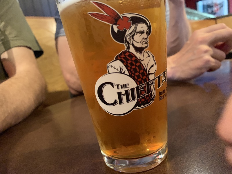
We gathered at one of our regular watering holes for beers and something to eat tonight: The Chieftain Irish pub on 12th Avenue.
Should we have a pitcher of beer, or a beer for everyone? we asked the waitress.
She was new and did not know right away, but came back and said five beers (pints) at $4 each was probably the better choice – which is what we did.
A pitcher was $16, but five glasses of beer from it would be much less than a pint each.

The Chieftain Irish pub logo is on the beer glass. The beer inside is a Northwest American-Style IPA from 10 Barrel Brewing Co. in Bend, Oregon.

Tuesday/ the last of summer

We will get to 88°F (31°C) here in the city tomorrow, possibly the last hot weather, in what has really been a mild summer.
The days are getting shorter and our sun sits lower in the sky, every day now.

A bee making the best of what’s still out there, on a ‘black and bloom’ anise or Brazilian Sage (Salvia guaranitica) that I found in Seattle’s University District. The sage flowers bloom nearly continuously from spring until winter.

Sunday/ take me to the Space ‘Neevle’

I spotted the Apple Maps car on Sunday here on Capitol Hill, presumably upgrading its survey of my neighborhood.

I see (online) that Apple Maps has improved vastly in recent years, and is ready to challenge Google Maps. Hmm. I have them both on my phone, so maybe if one leads me into a dead end somewhere in a new country or city, I can switch to the other app, and give it another try.

Just for fun, I asked for directions to the Space Needle on Apple Maps, and it really, really sounds as if the voice says Starting Route to Space Neevle. Proceed to .. ‘. That’s OK, though. Space Neevle/ Space Needle – close enough.

Here is the little Apple Maps car with its high-definition 360° cameras in the white dome, and that must be the LIDAR equipment (Light Detection and Ranging), in the gray cylinders below. The radars scan a terrain up to 80m all around, and collect a detailed cloud of points at some 700 000 points per second.

Friday/ a dystopian Seattle

Tintin pursues a gang of counterfeiters in The Black Island (it’s in Scotland, hence his Scottish garb). It was originally published in French as L’Île Noire in 1937 by Belgian cartoonist Hergé.

Check out Tintin’s gangster look, and Snowy’s spiked collar! Here’s my effort at cataloging the Seattle icons in the mural. Clockwise from bottom left: pink ‘Toe Truck’ from Lincoln Towing Co., now on display in Washington State Museum of History and Industry | I don’t know the upside down blue boat or its driver | to its left a Route 8/48 bus stop sign | and a purple starfish trying to survive (Puget Sound has had a massive starfish die-off tied to global warming) | the Kalakala ferry that operated on Puget Sound from 1935 until her retirement in 1967 | red container cranes from Port of Seattle | building of Rainier Brewing Company (operated 1878–1999) at south end of town, next to I-5 | Chubby & Tubby (operated 1946–2003) was a Seattle institution, offering bargains in hardware, housewares & garden supplies | Coca-cola vending machine from John St | skeleton biker is prob. from Bethel Saloon, a popular biker bar in Port Orchard | Dick’s Drive-in burgers & milkshakes (founded 1954), has three popular locations in the Seattle area | George Washington Memorial Bridge, commonly known as the Aurora Bridge, opened in 1932 | Deano’s 24-hour grocery store on Madison St closed in 2007 | endangered Puget Sound orca below the bridge | the iconic Pink Elephant Car Wash sign off Denny Way | not sure where the Sink or Swim bottle & buoy is from | sea lion eating clams could be from Elliott Bay. [Mural by Ton Chan & Lawrence Genette].
The newest incarnation of the restaurant & bar space at 1407 14th Ave is called Bar Sue. The mural in front of the bar is definitely an homage to the seventh volume of the Adventures of Tintin, called The Black Island.

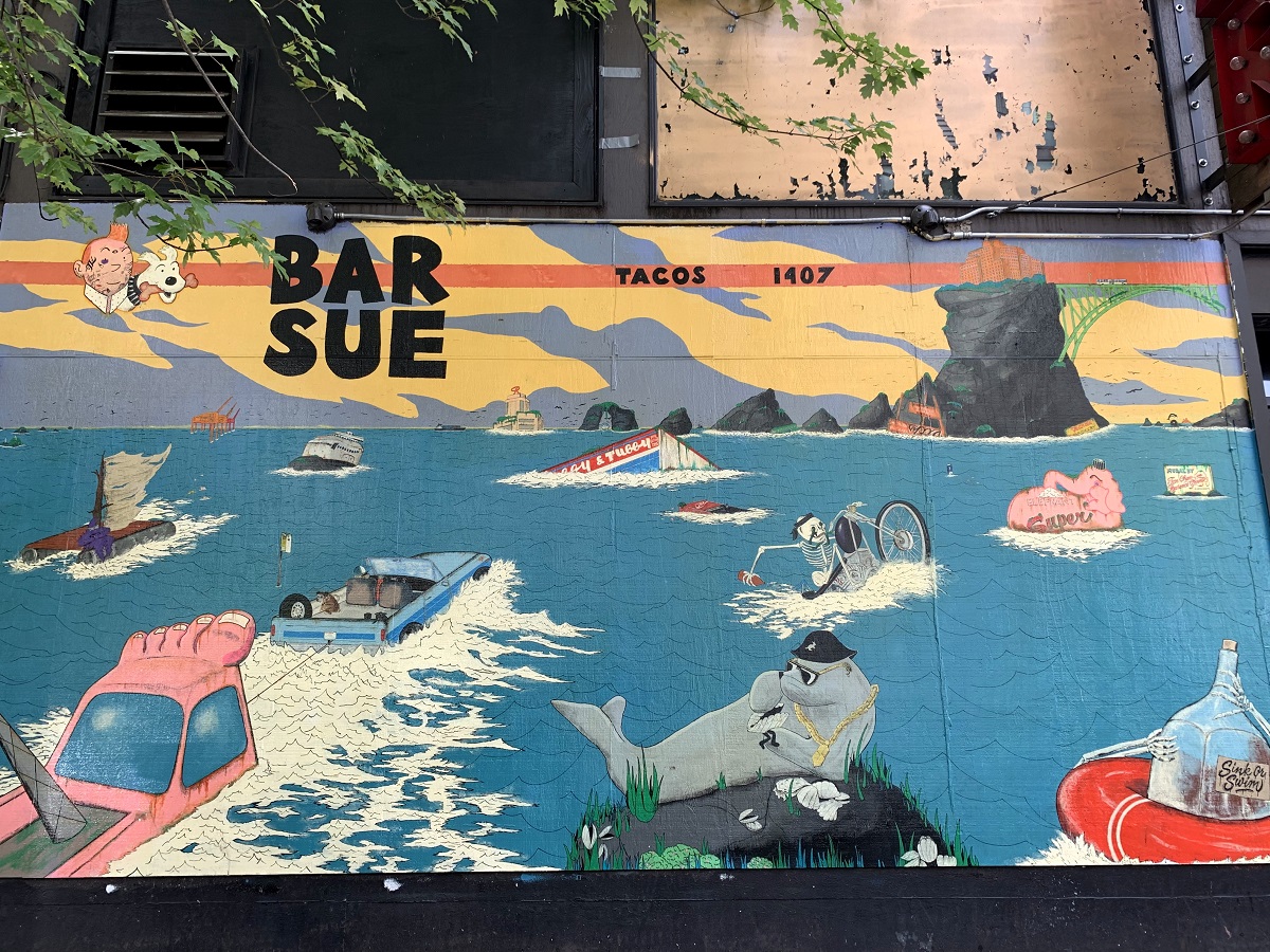
The mural shows several Seattle iconic signs and objects awash in seawater. I guess it could be seawater that had swept over the city from a tsunami .. or the elevated sea levels from Earth’s melting ice caps.

Some signs are from beloved businesses that had closed years ago, and others are from places that are very much still around.


Tuesday/ the Douglass-Truth branch library

I checked out the Douglass-Truth branch library today, on the corner of 23rd Ave and Yesler Way.

Frederick Douglass (1818-1895) became a national leader of the abolitionist movement in Massachusetts and New York after he escaped from slavery in Maryland. Sojourner Truth (1797-1883) was similarly an abolitionist and women’s rights activist who had escaped from slavery.

The ornate entrance of the Douglass-Truth branch of the Seattle Public Library. The building opened in 1914. The library houses the largest collection of African American literature and history on the West Coast.

Saturday/ celebrating another birthday

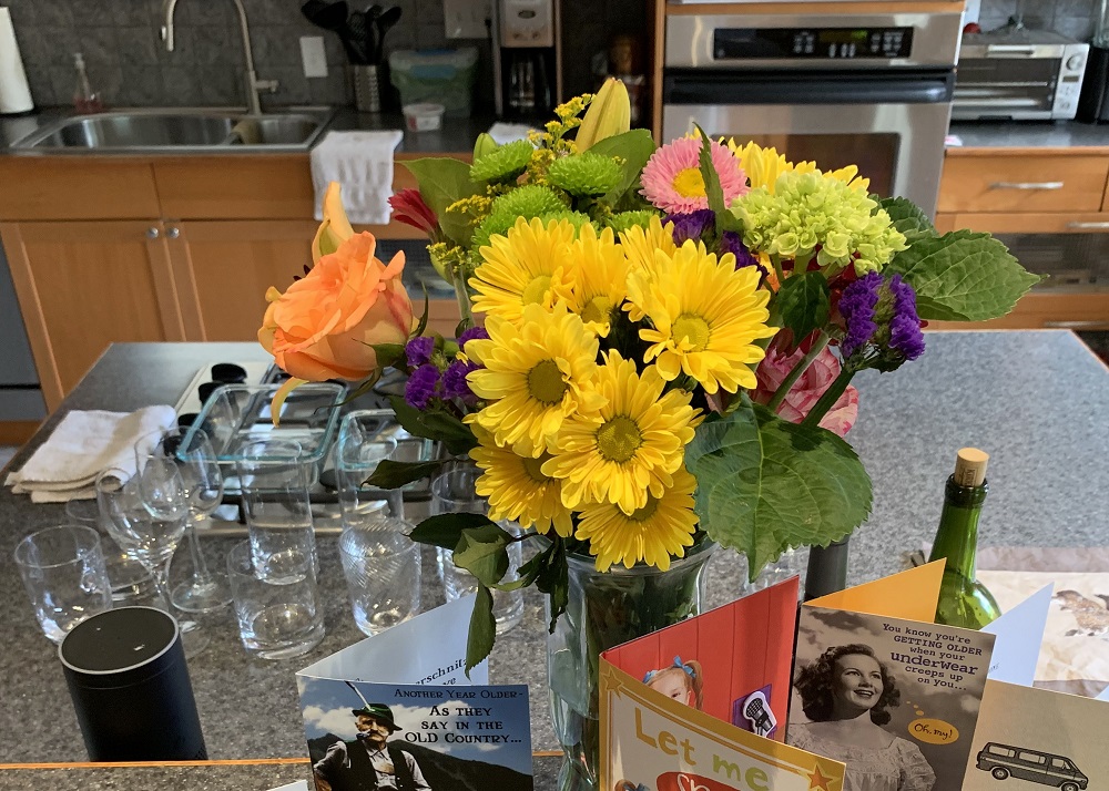
Another birthday is rushing up to me, and we celebrated it on Saturday night at my house.
It did not take long to lose the helium balloon I was given for my birthday, though. (Aw. It became unmoored from where it was tied to the porch rail and floated up, up and away).
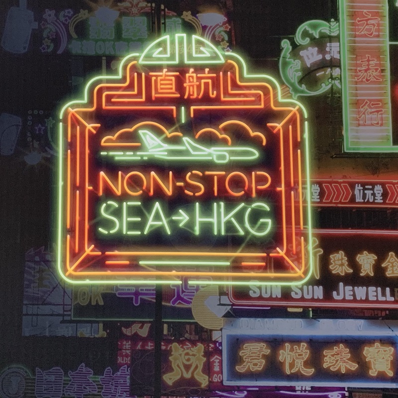
While we were outside on the deck, we spent a little time tracking the overhead incoming flights to Seattle-Tacoma airport (just 12 miles to the south of my house as the crow flies).
The nicest of them all was the new Airbus A350-900 (with its quiet twin jet engines) from Cathay Pacific Airlines, directly from Hong Kong, that flew over shortly after 8 pm.

Picture from Sunday morning: flowers & cards from my friends for my birthday .. looking great in my kitchen.