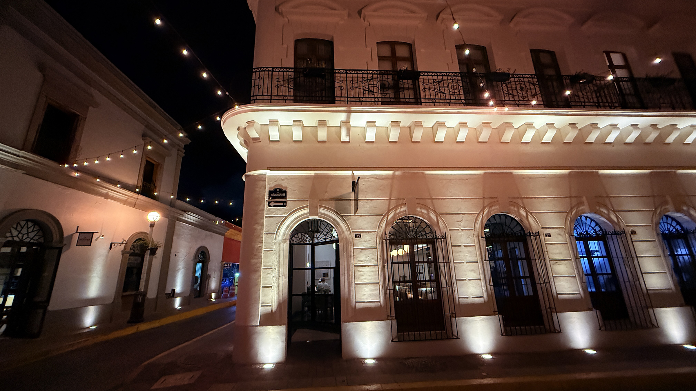
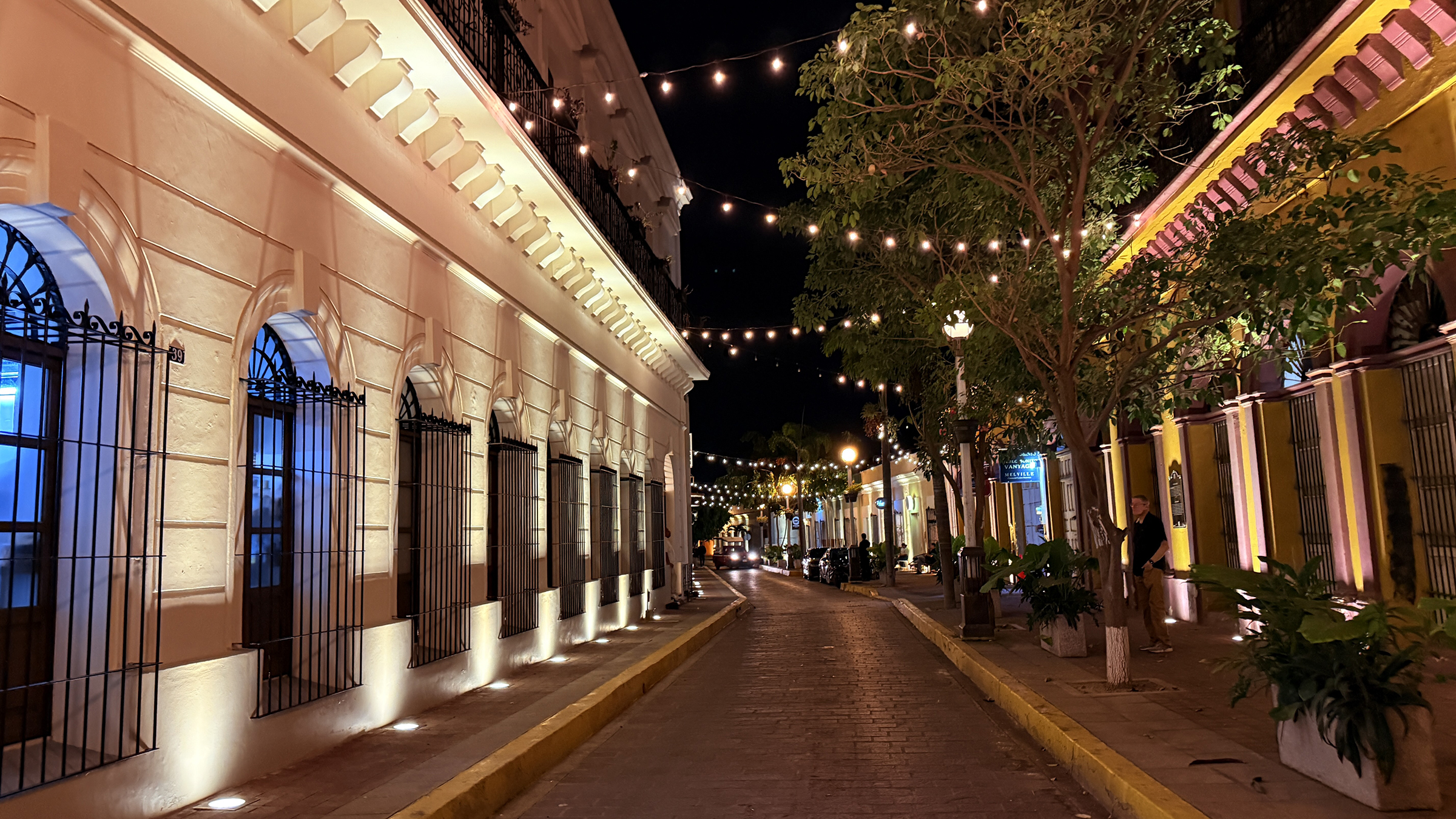
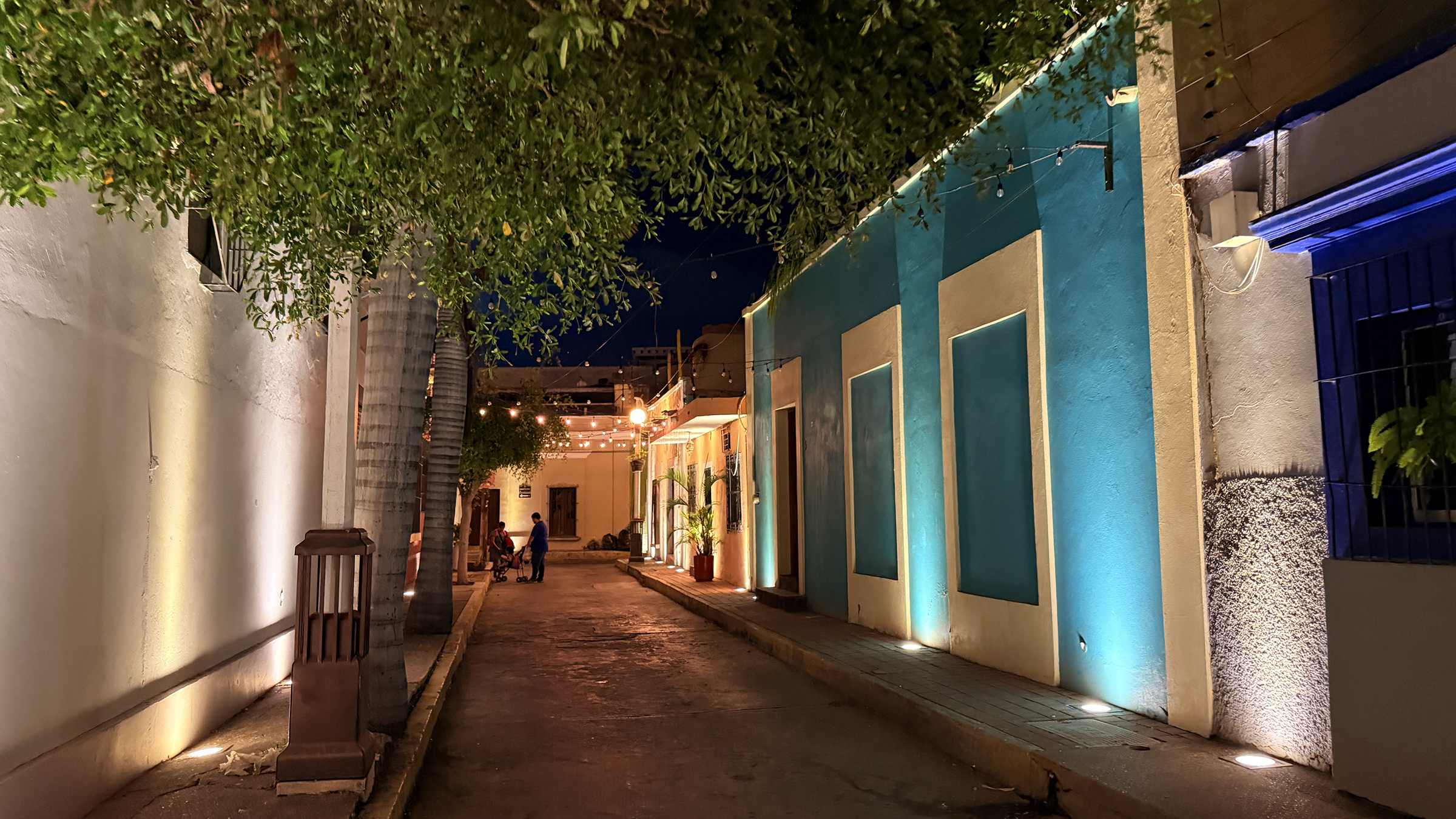
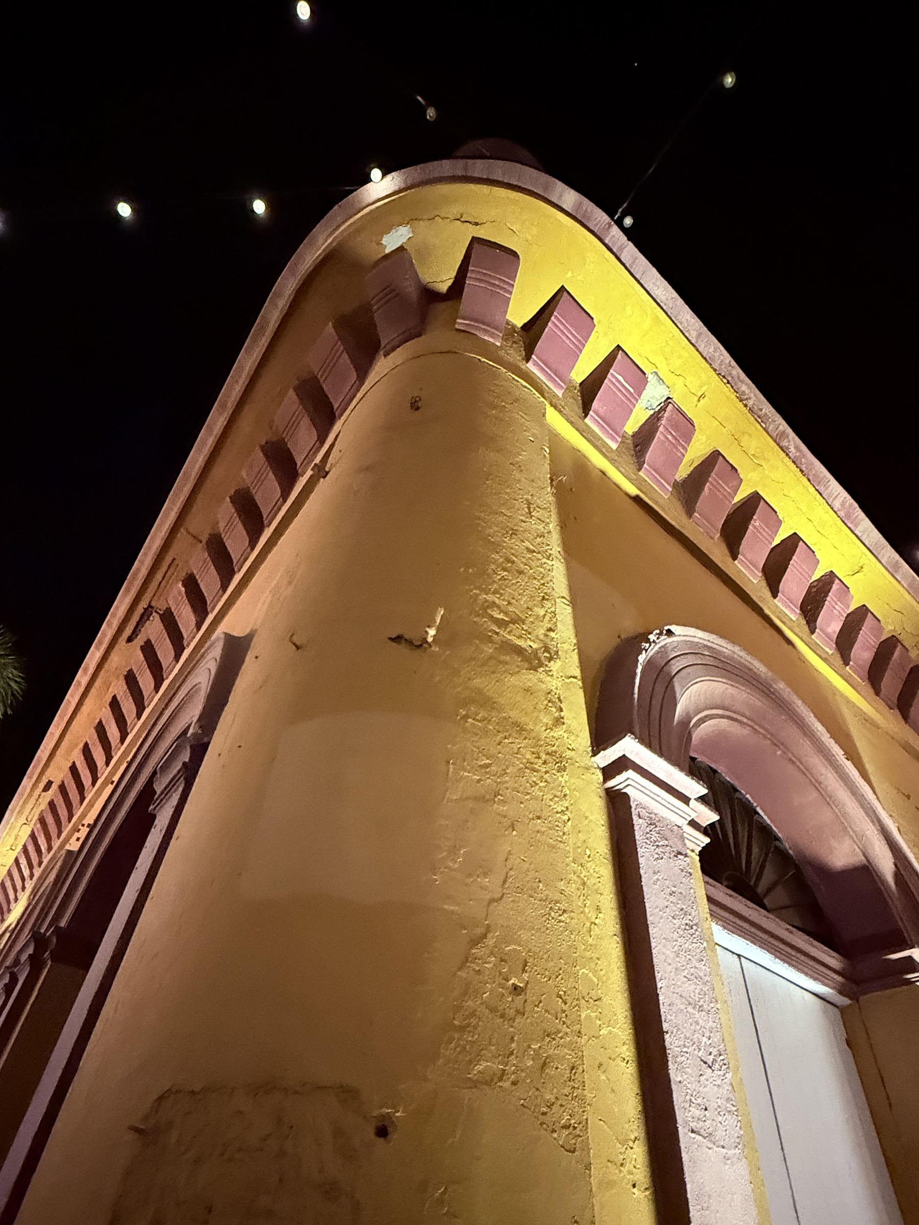
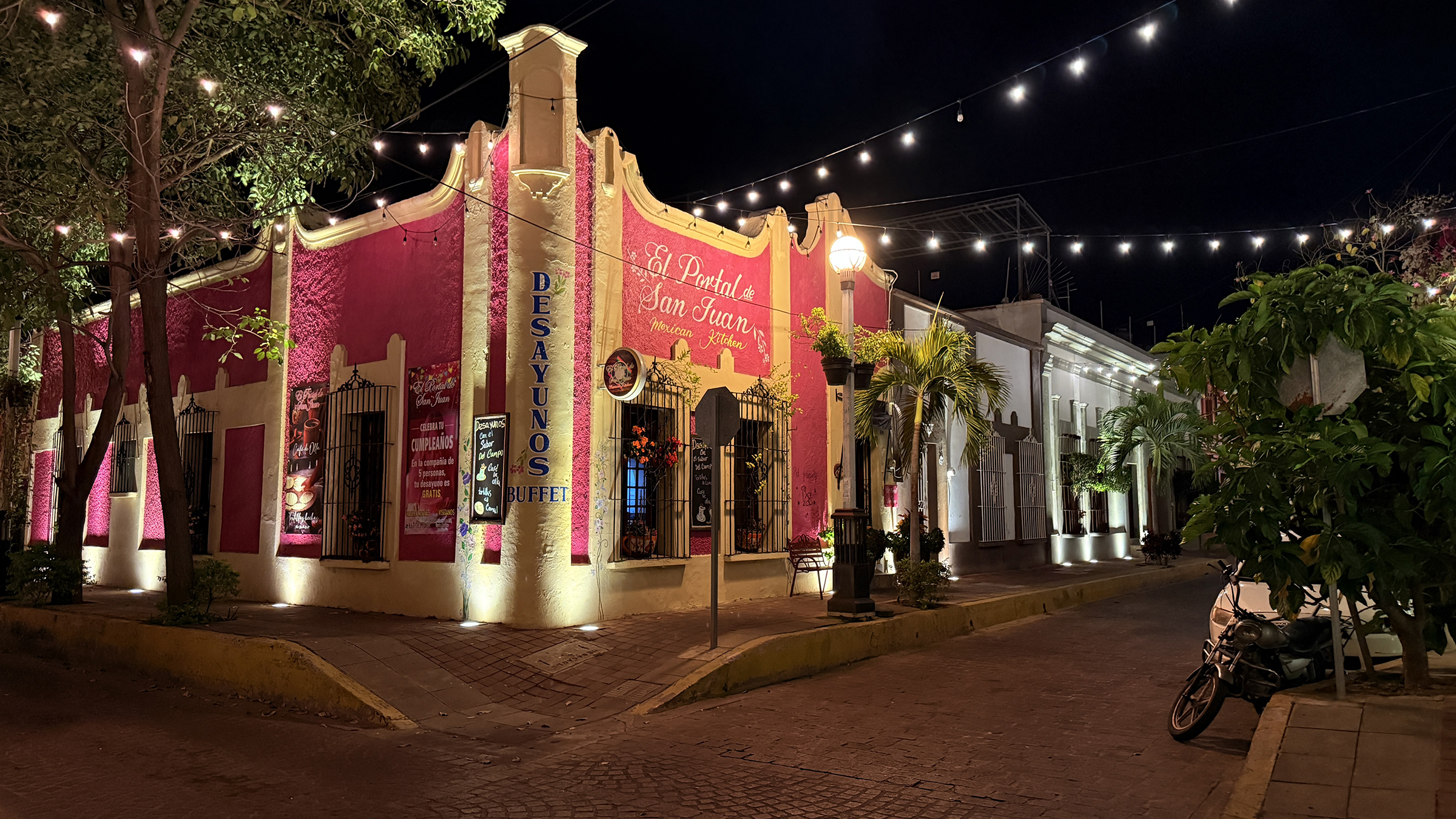
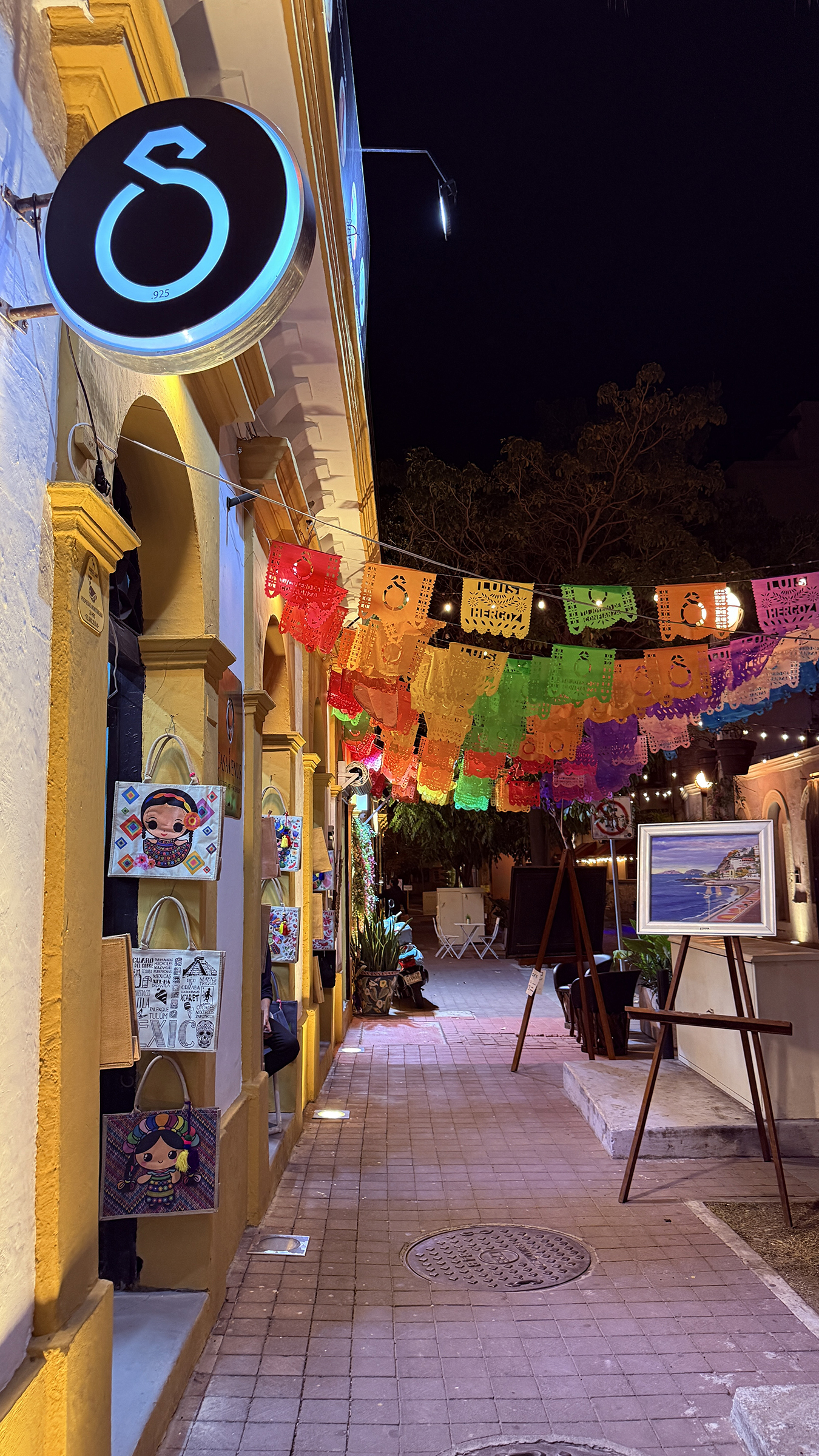
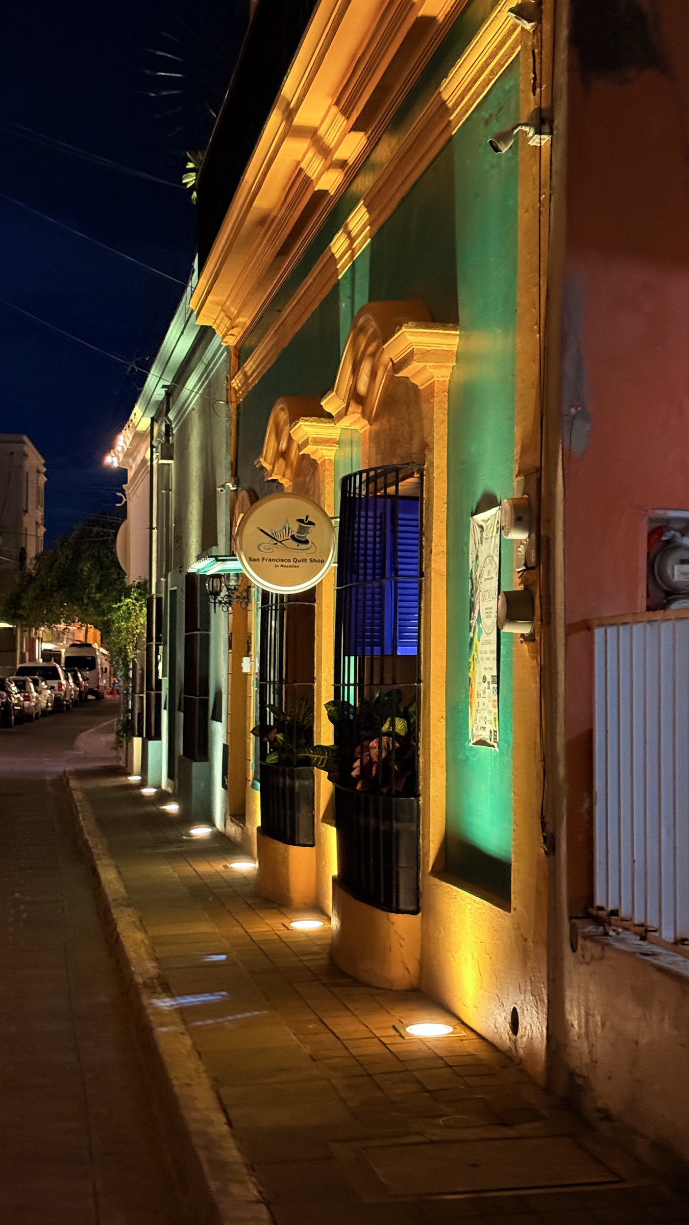
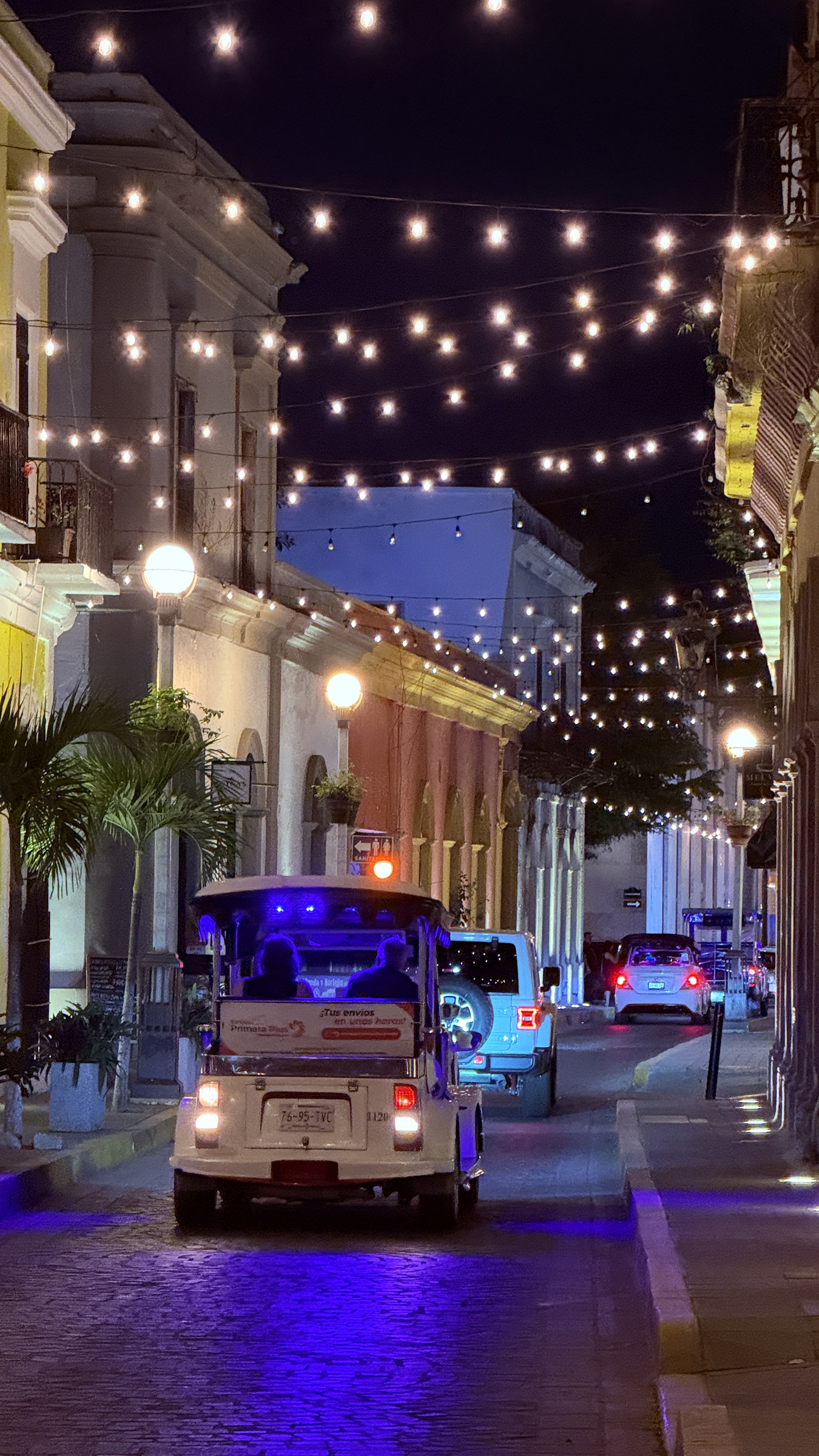
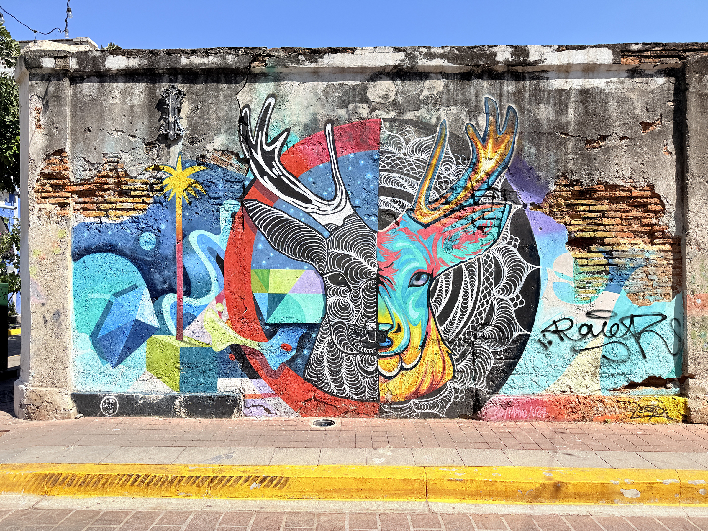
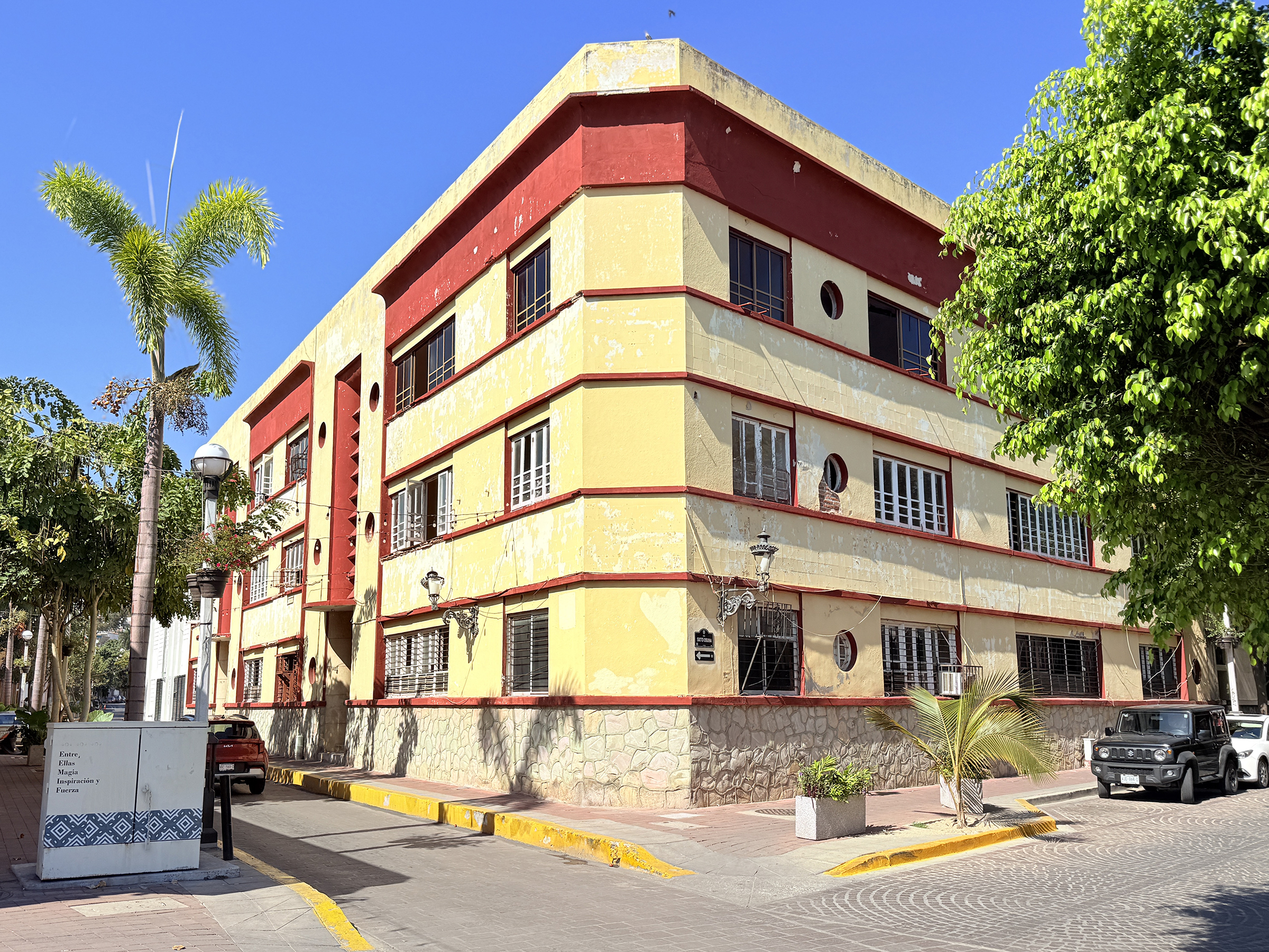
Here are some night time pictures of the beautiful historical center of Mazatlán.
a weblog of whereabouts & interests, since 2010
Here are some night time pictures of the beautiful historical center of Mazatlán.
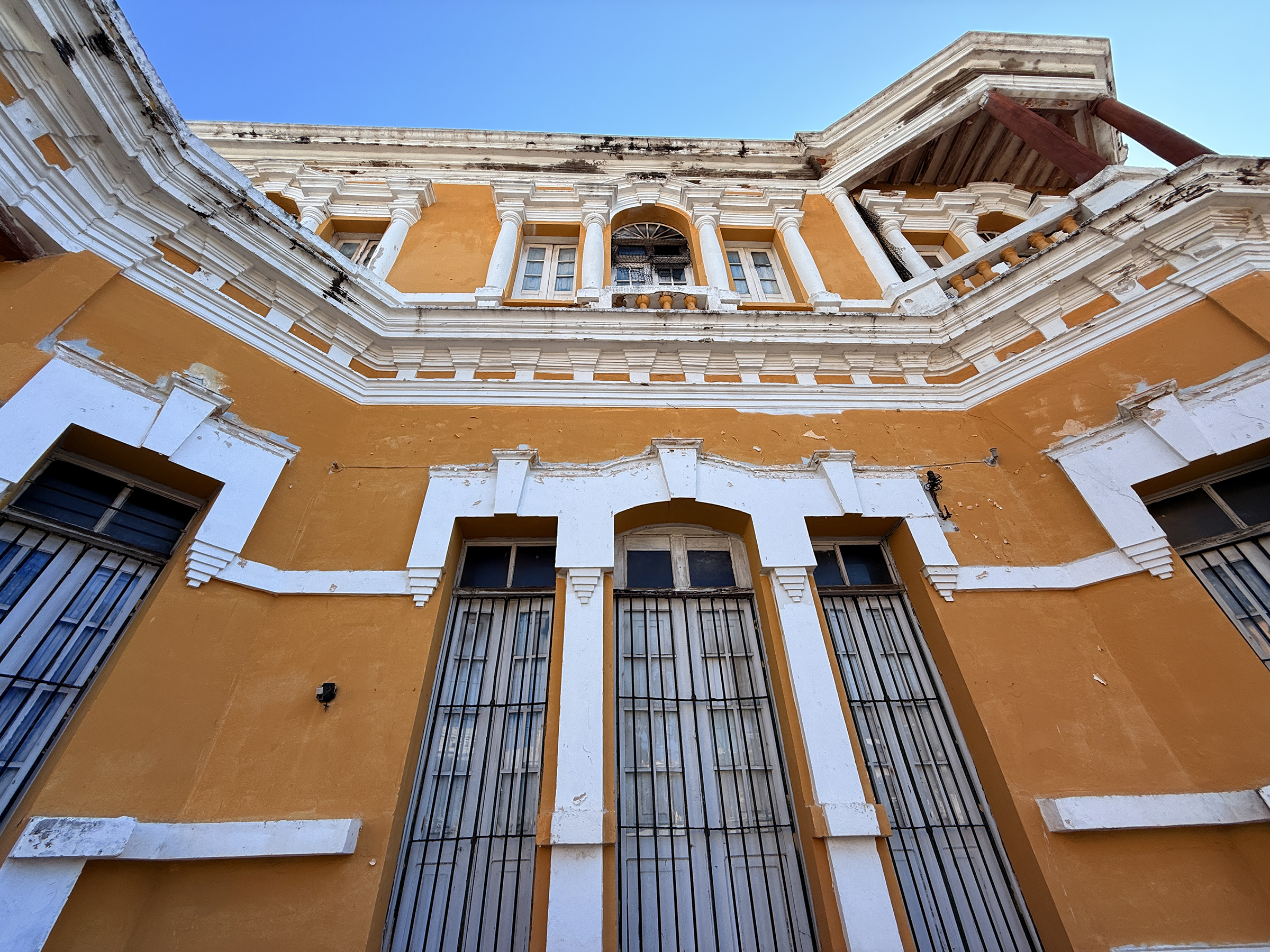
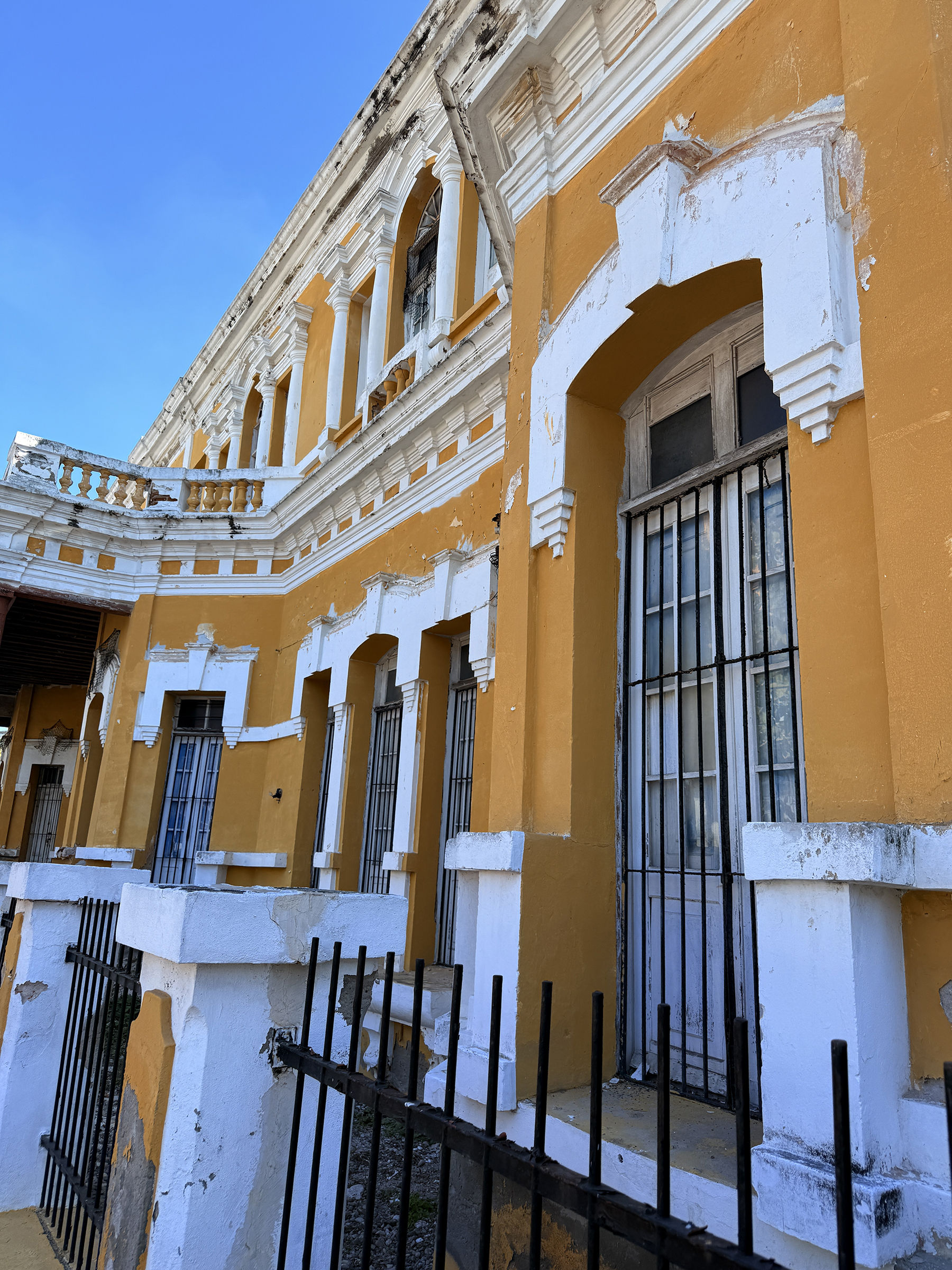
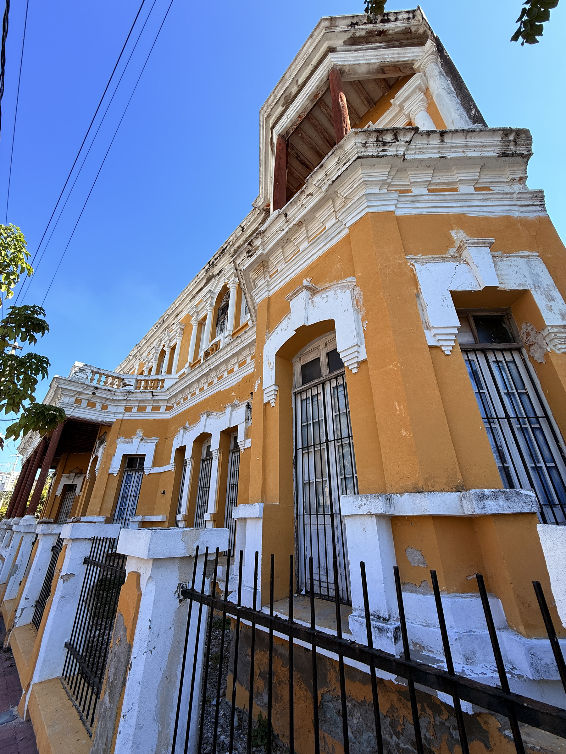
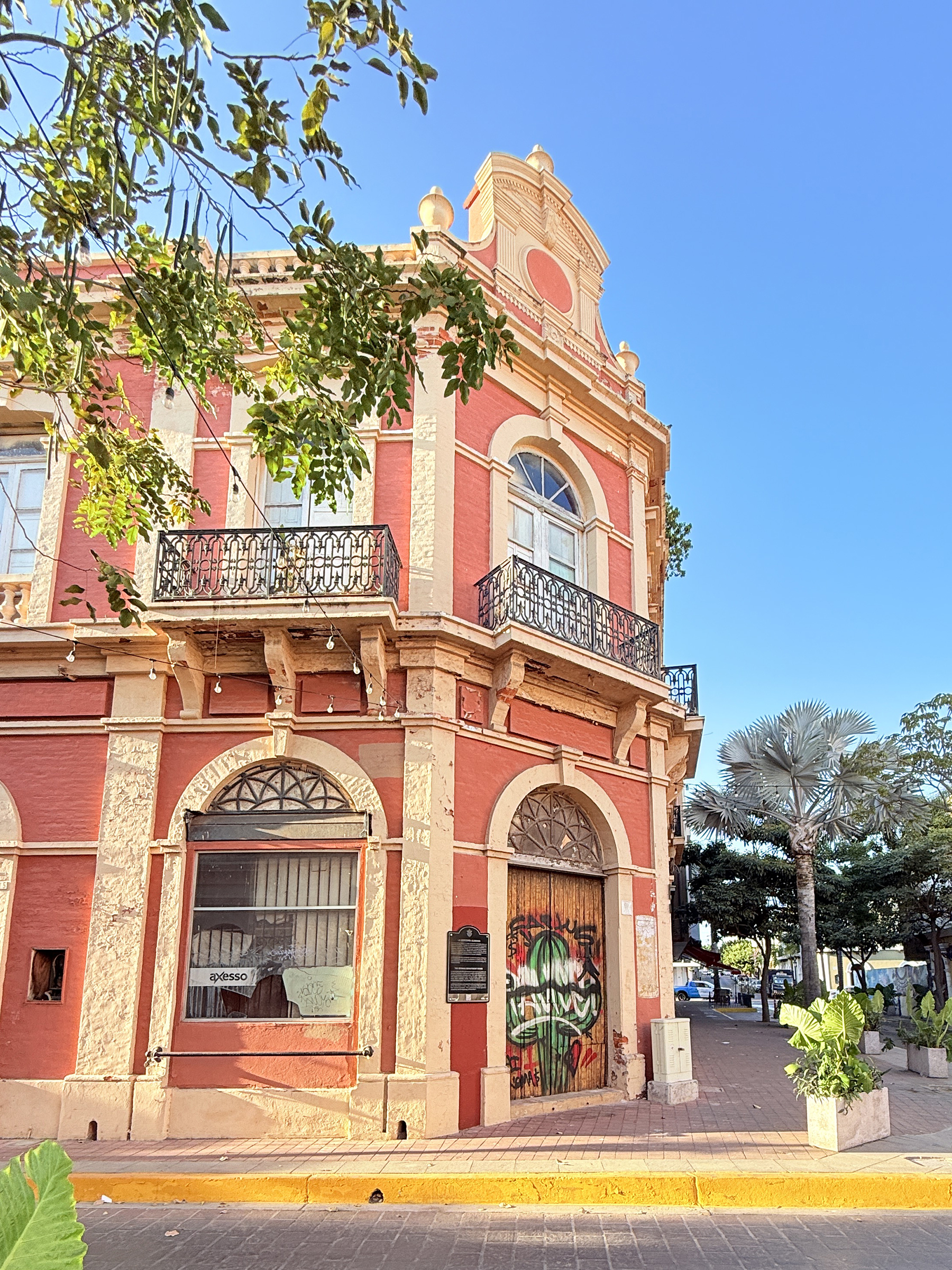
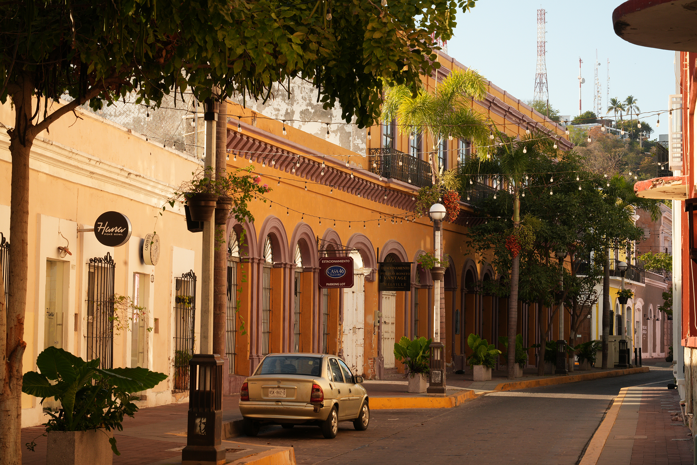
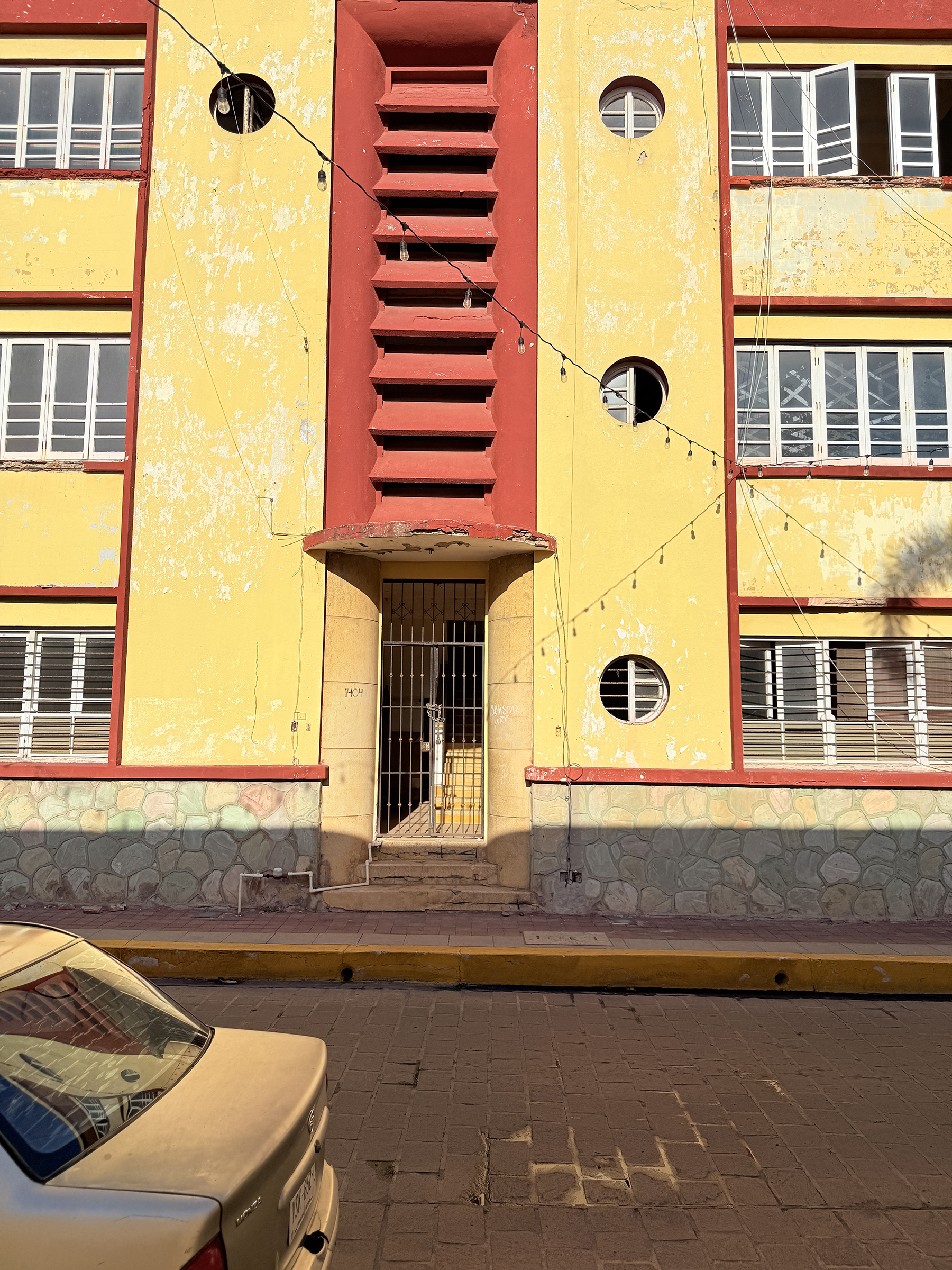
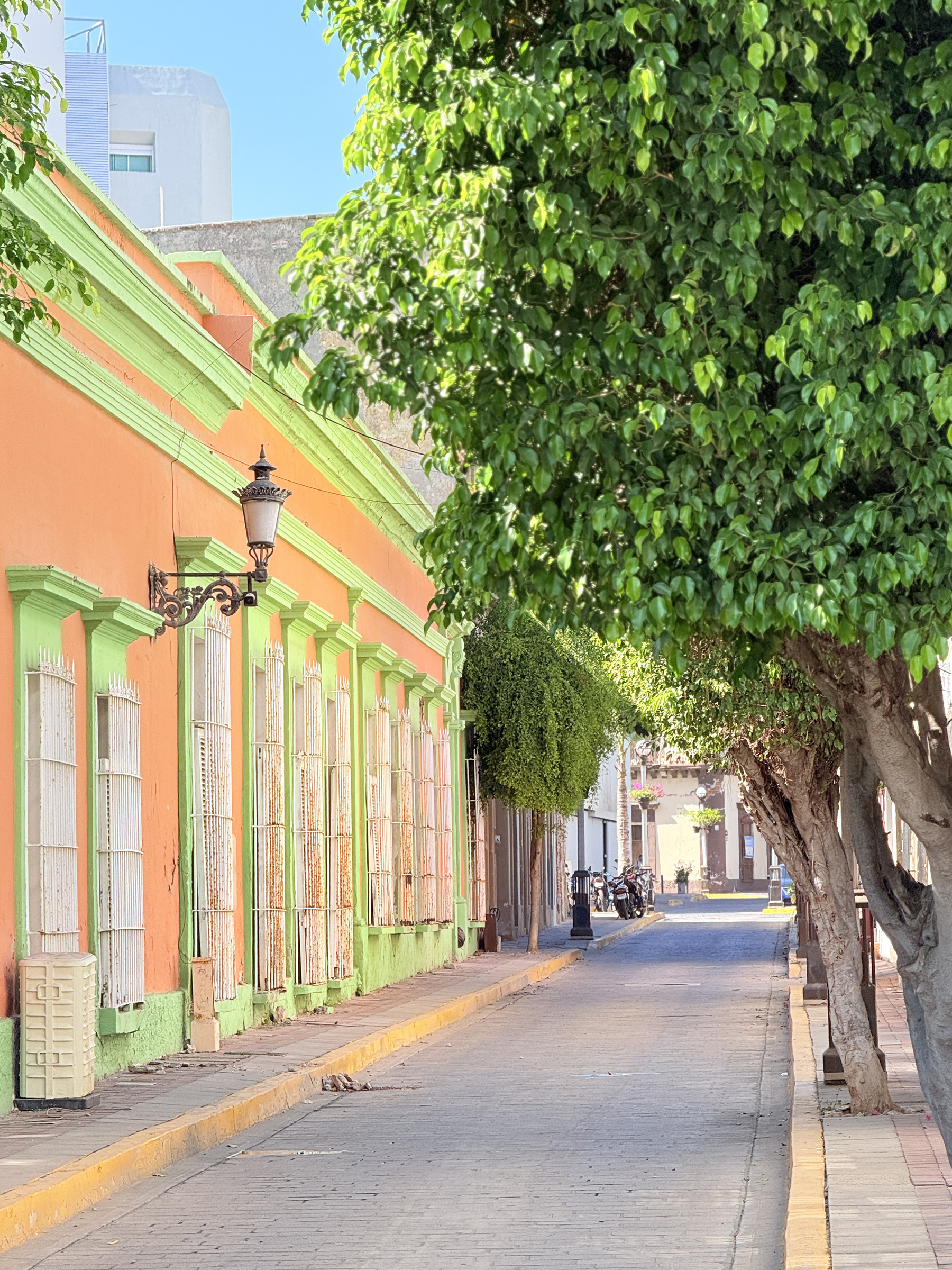
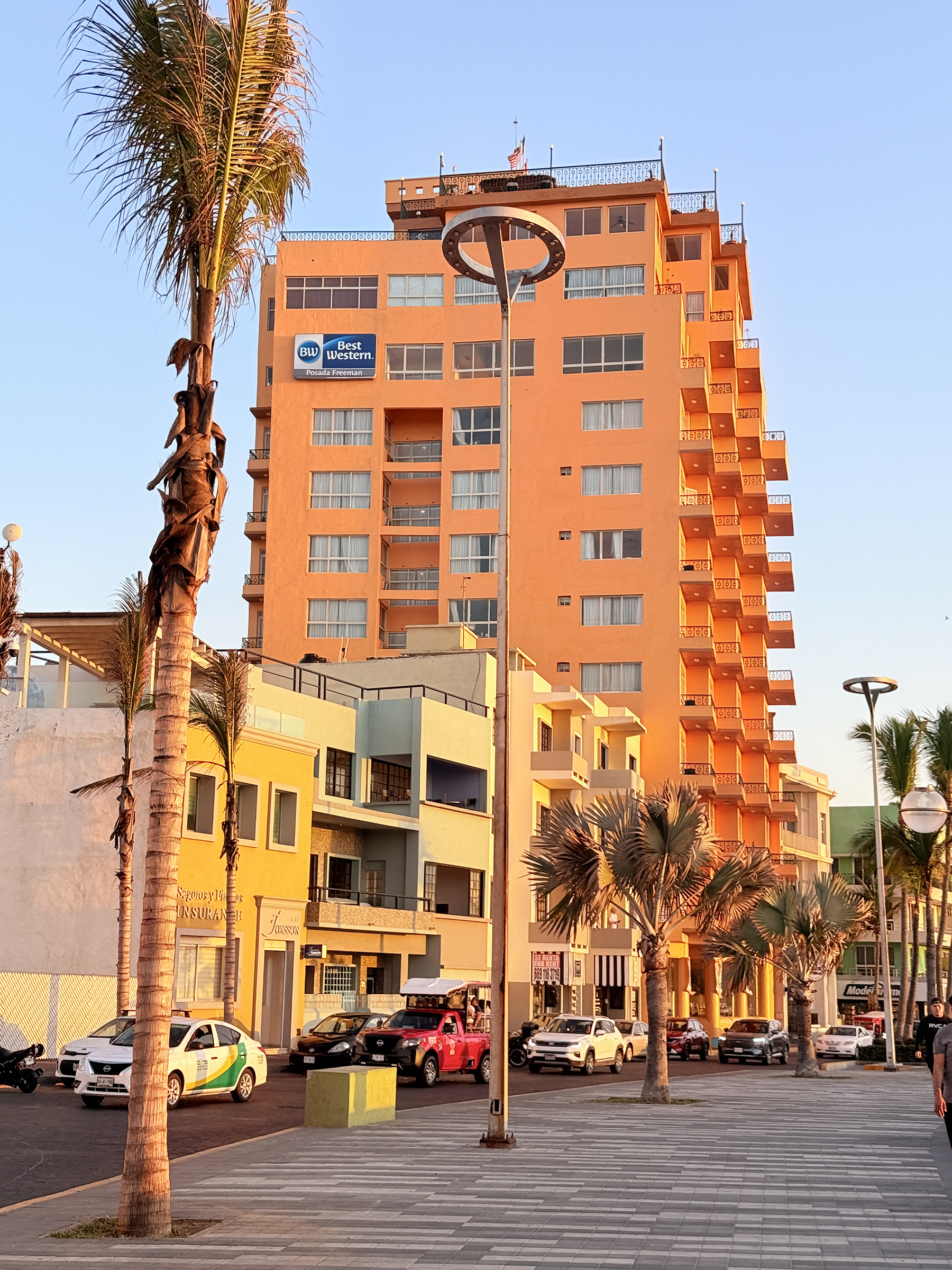
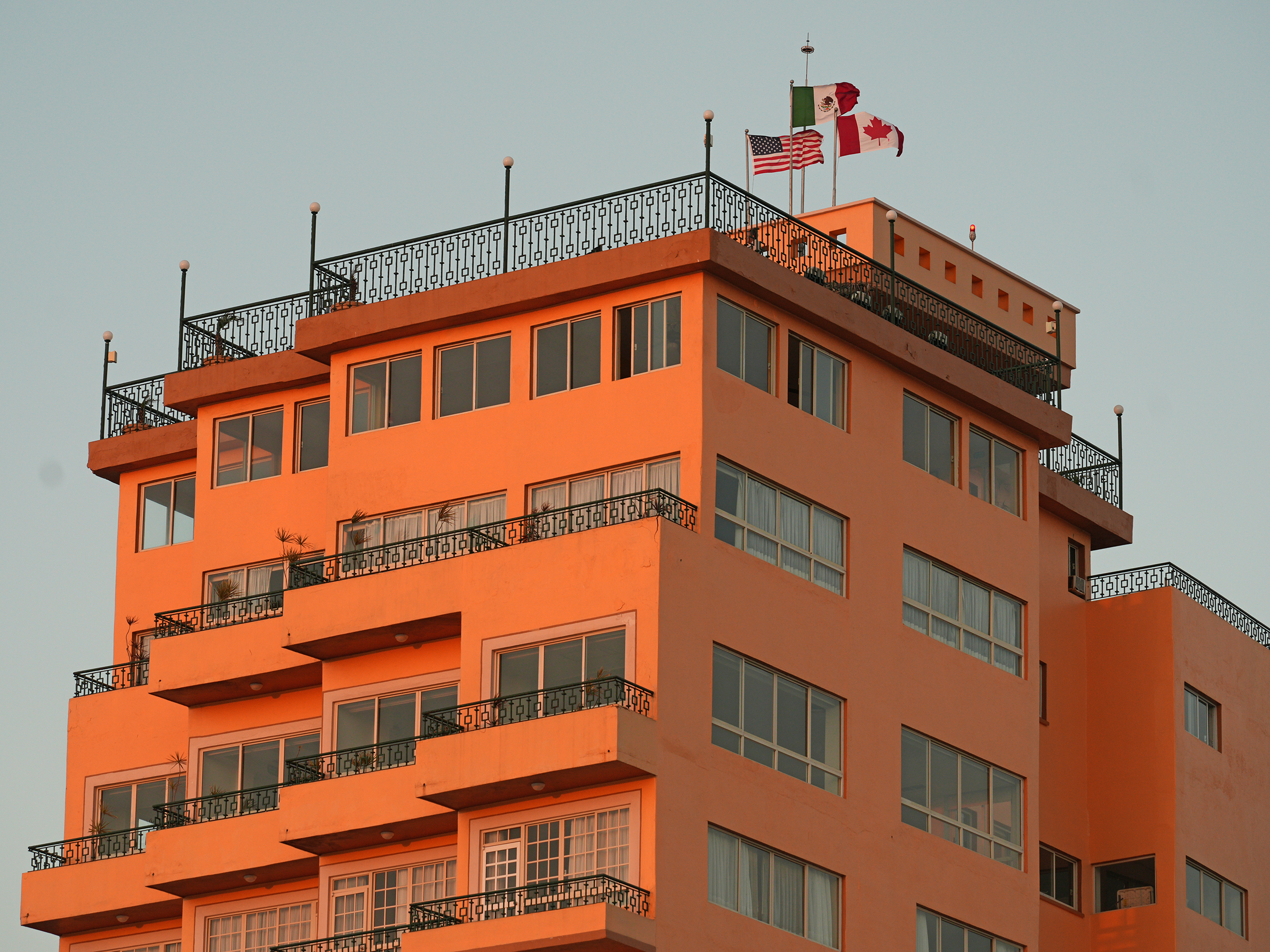
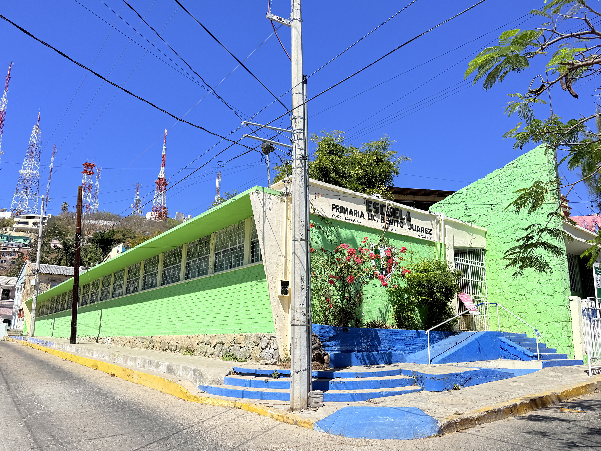
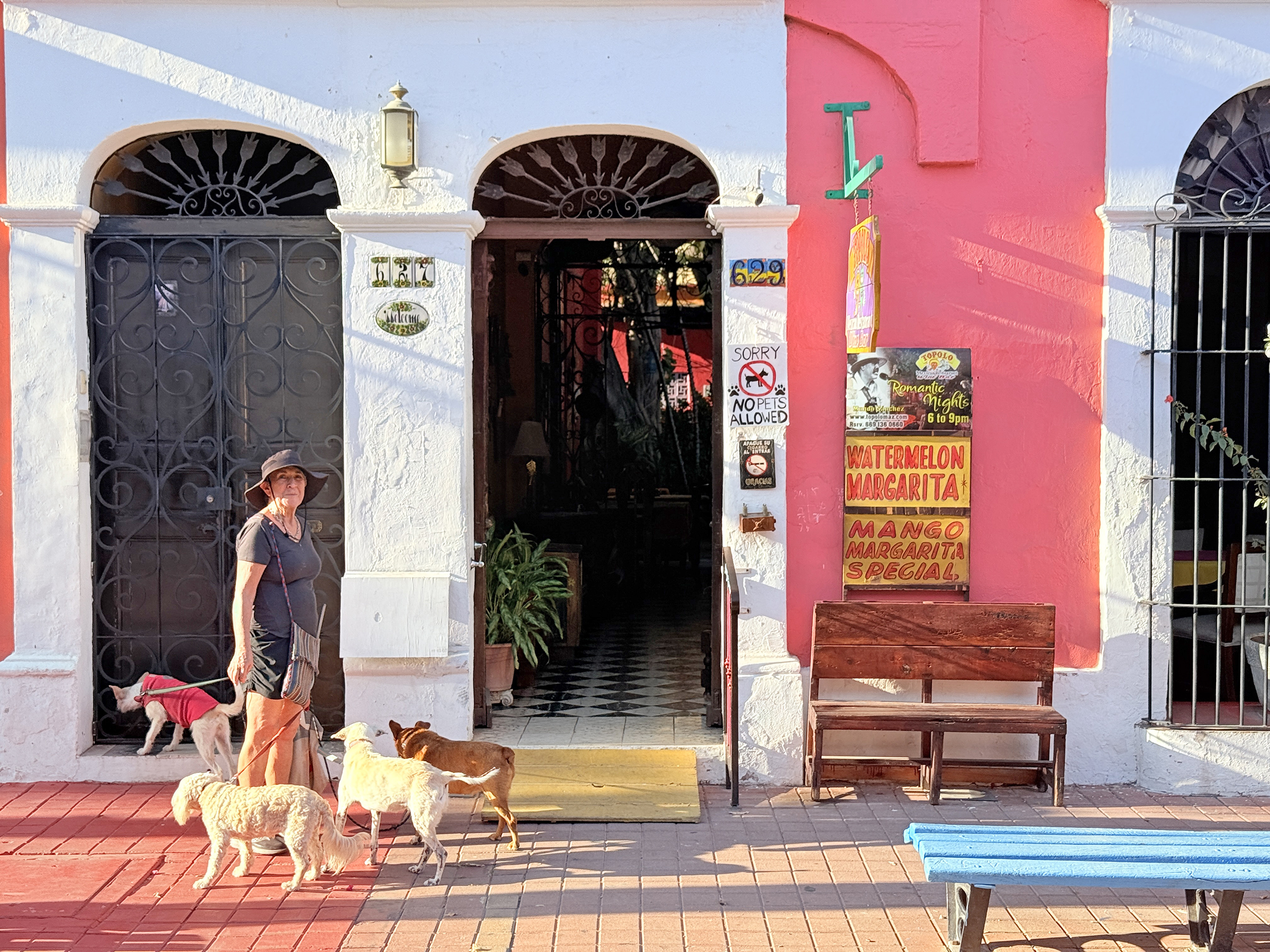
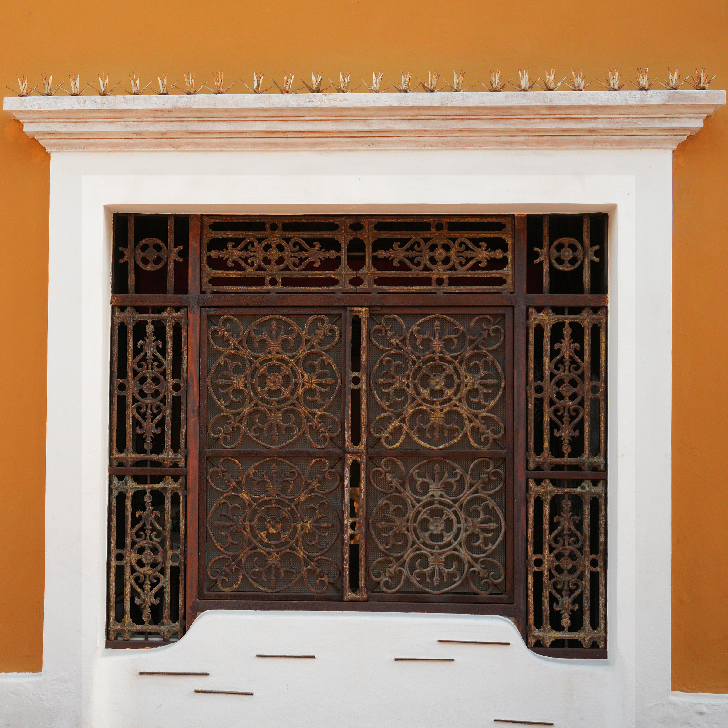
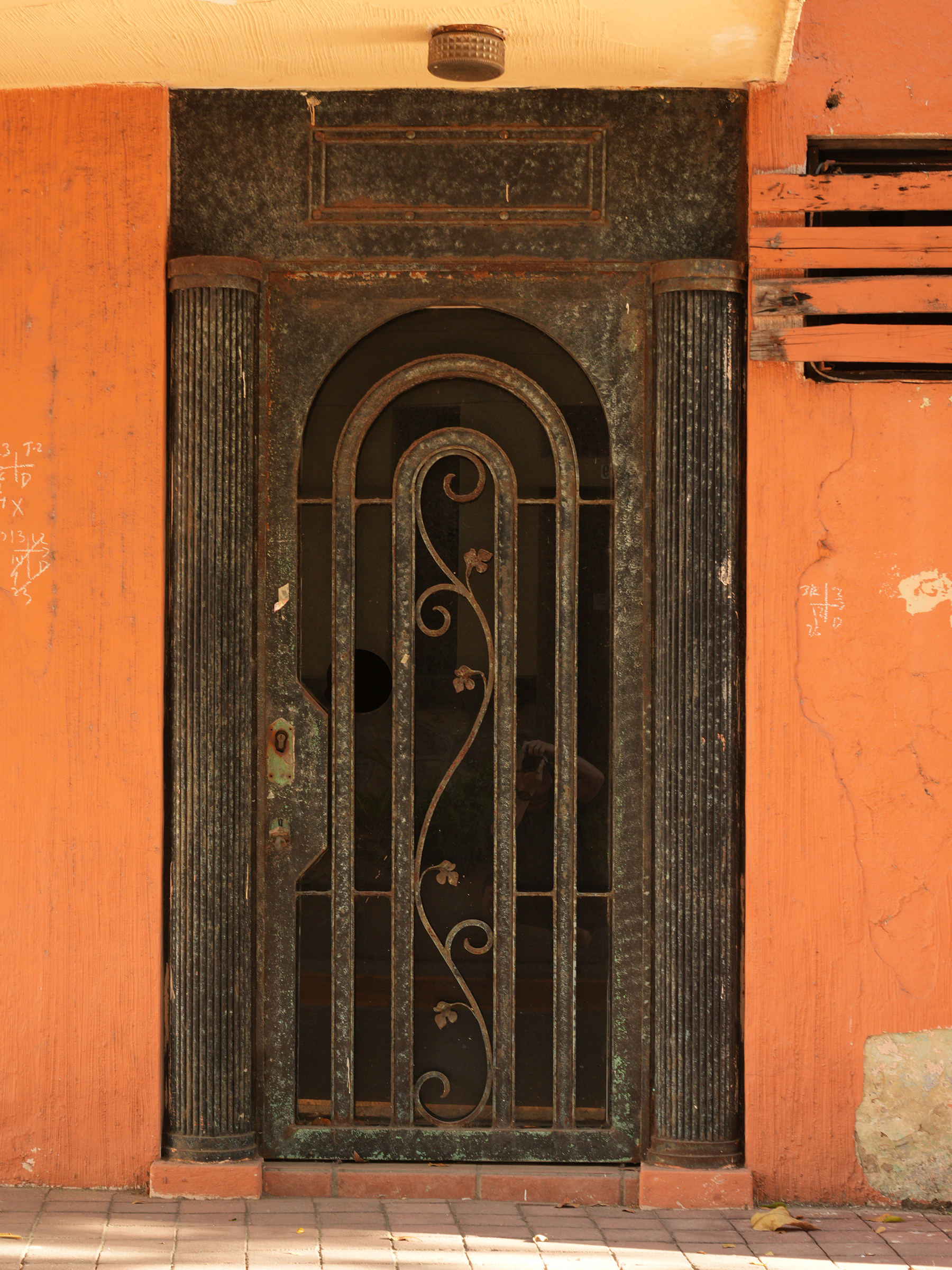
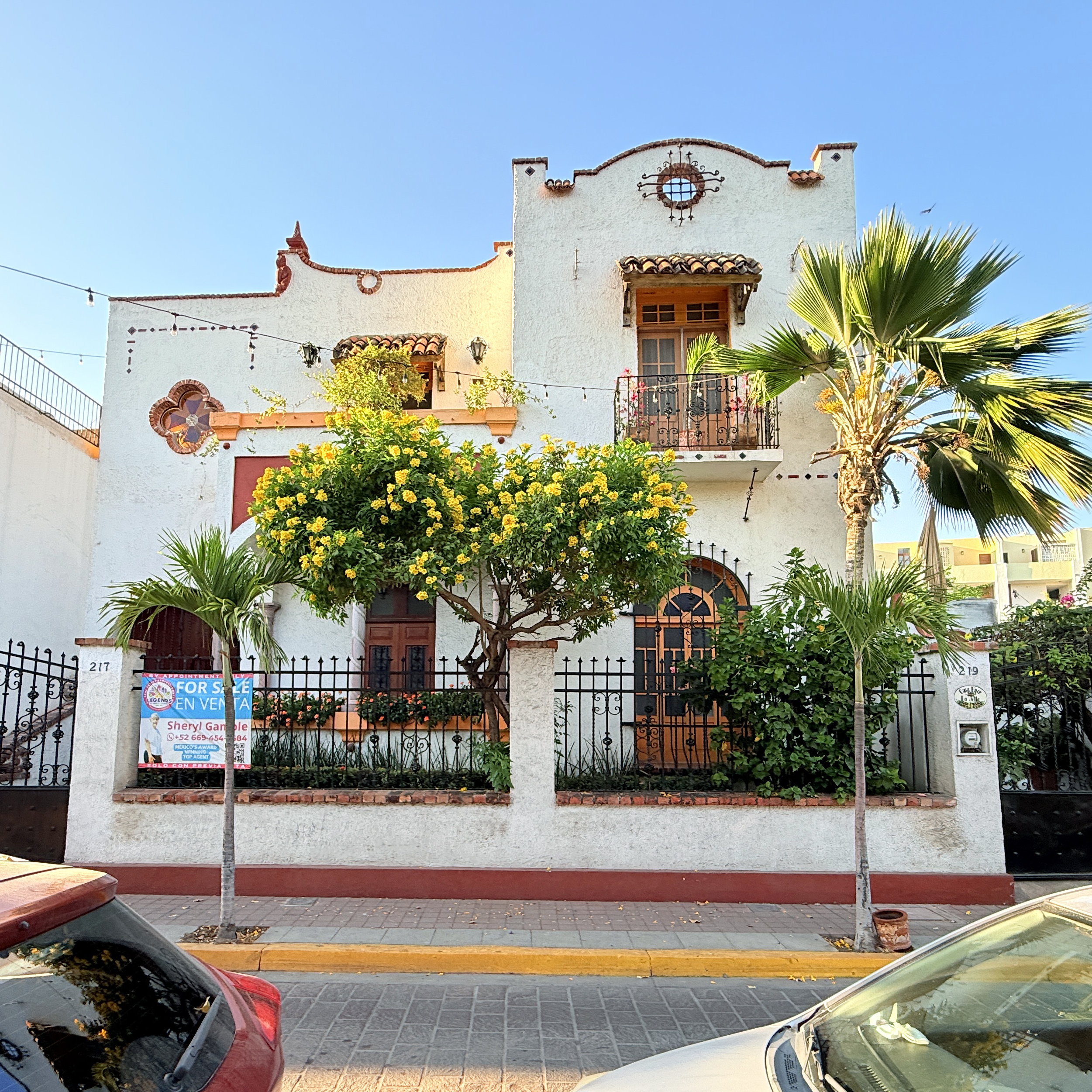
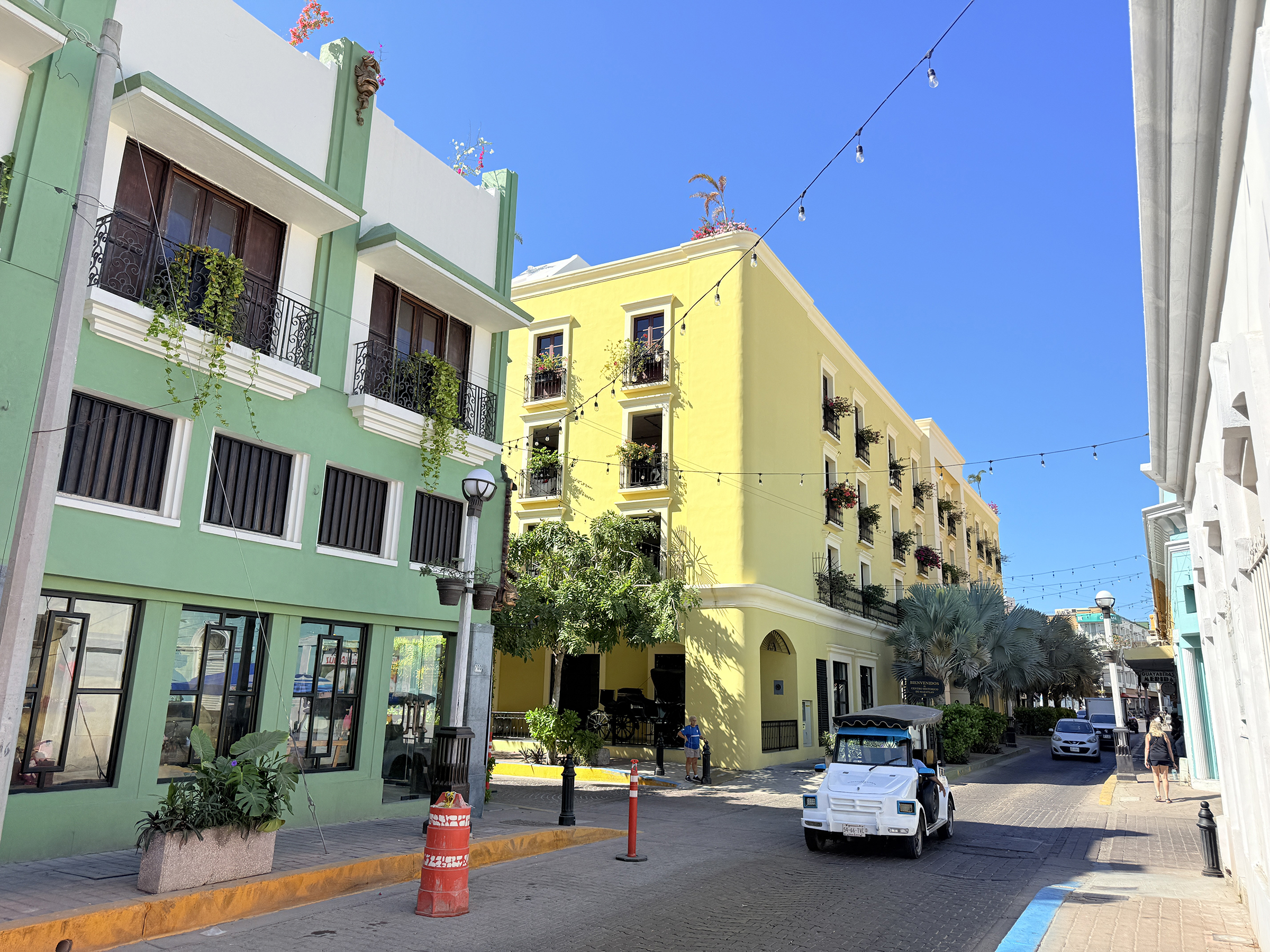
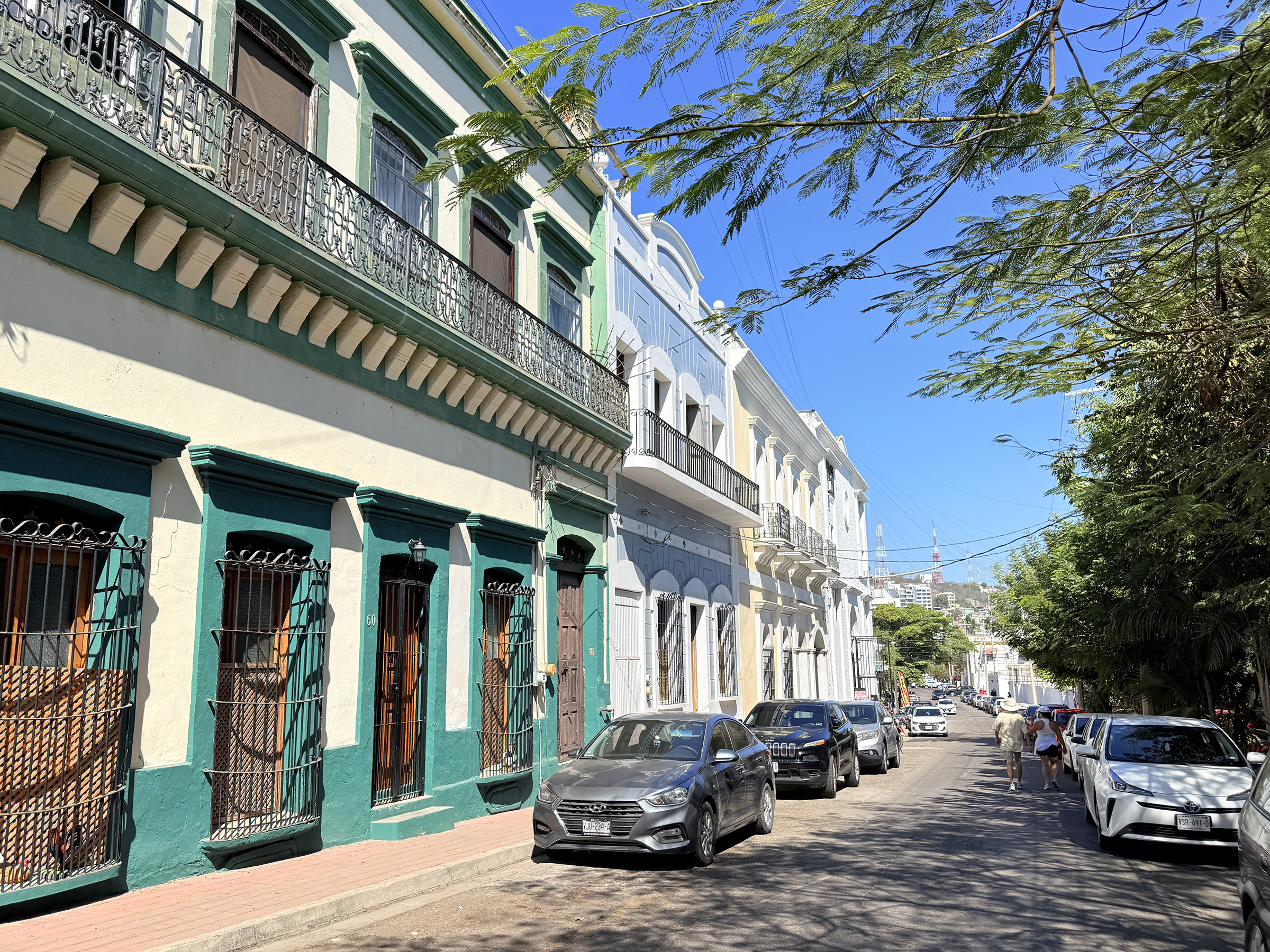
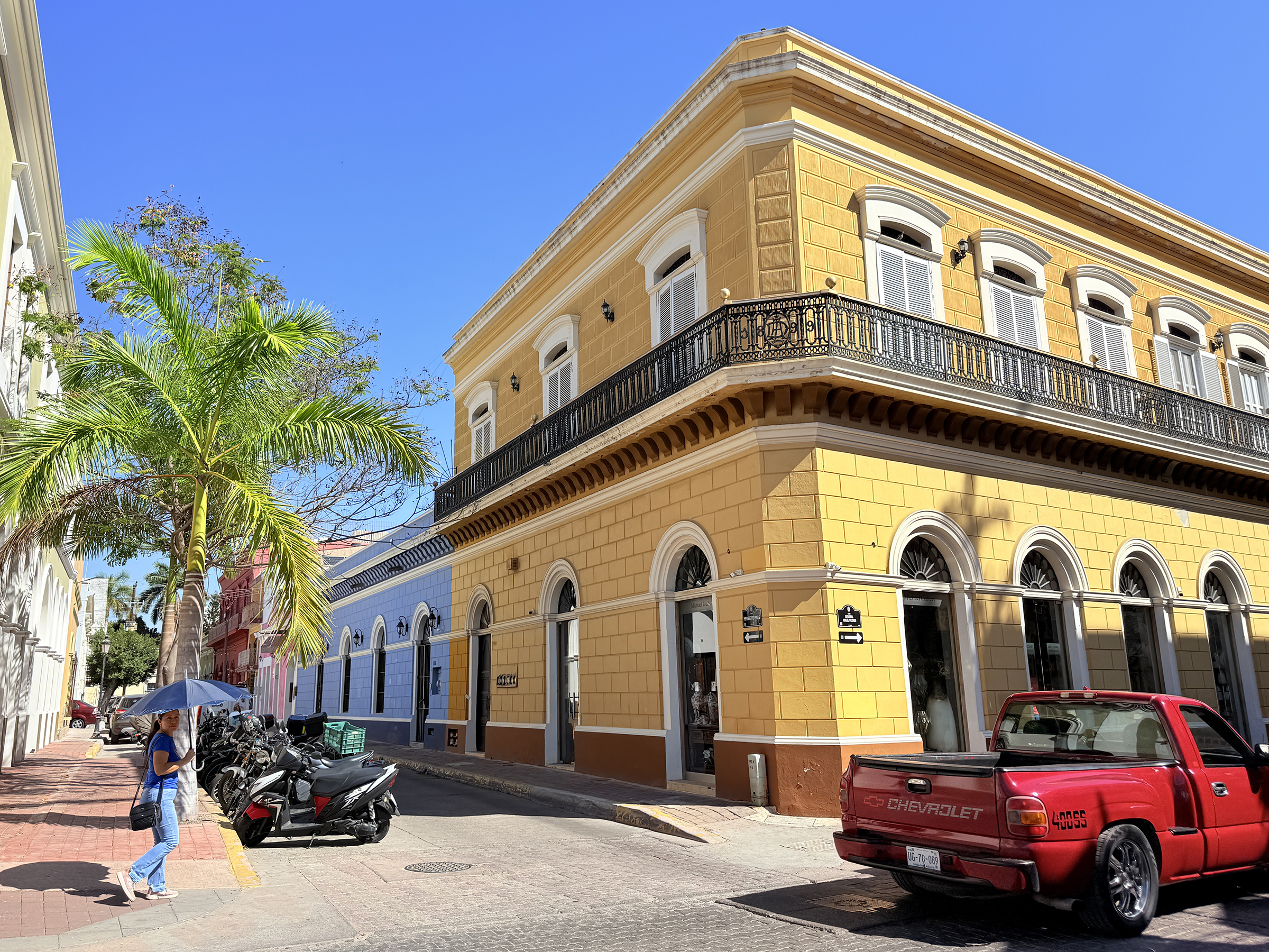
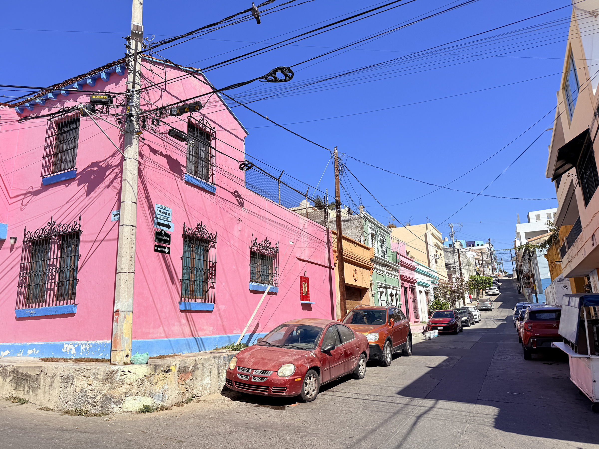
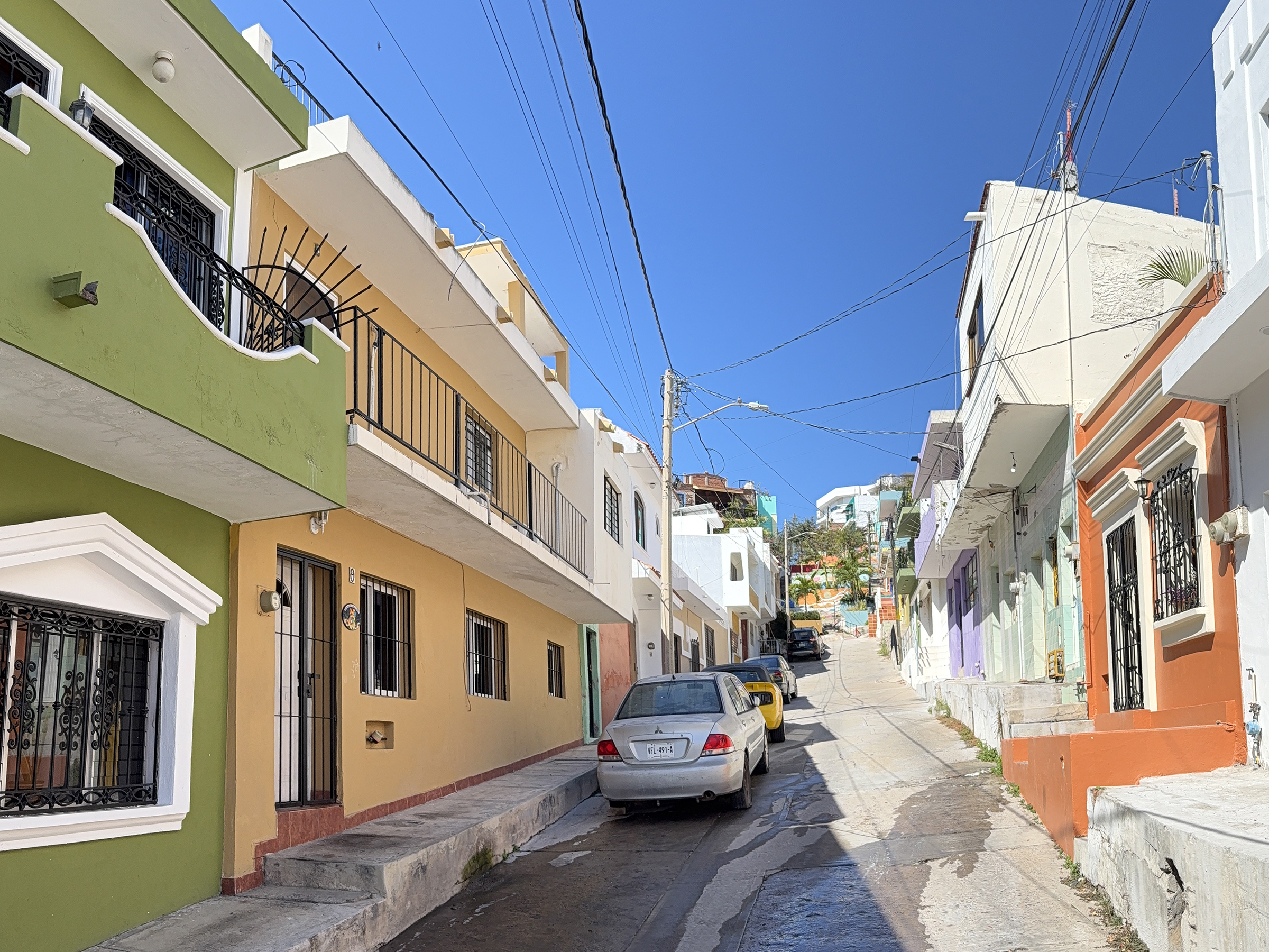
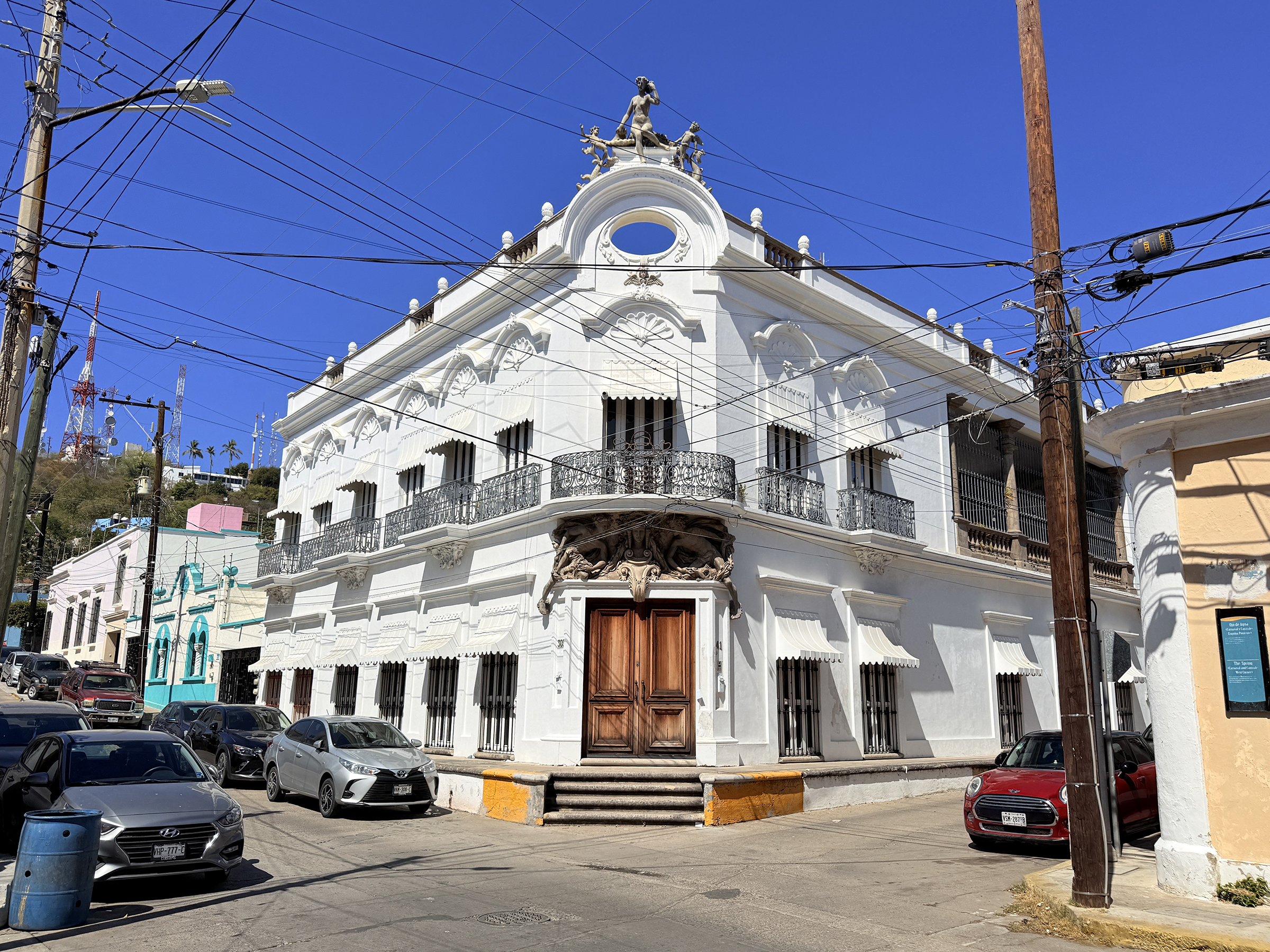
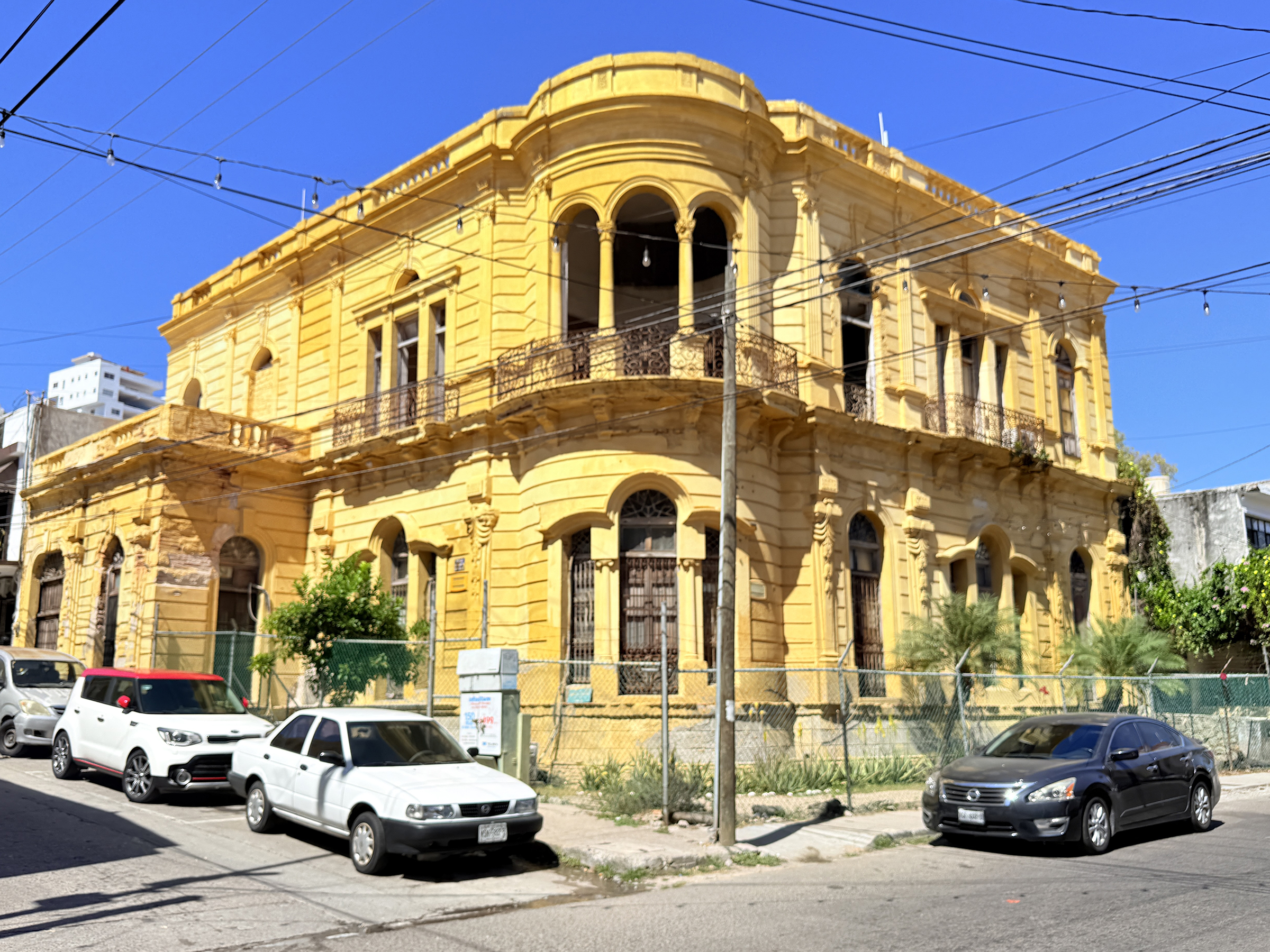
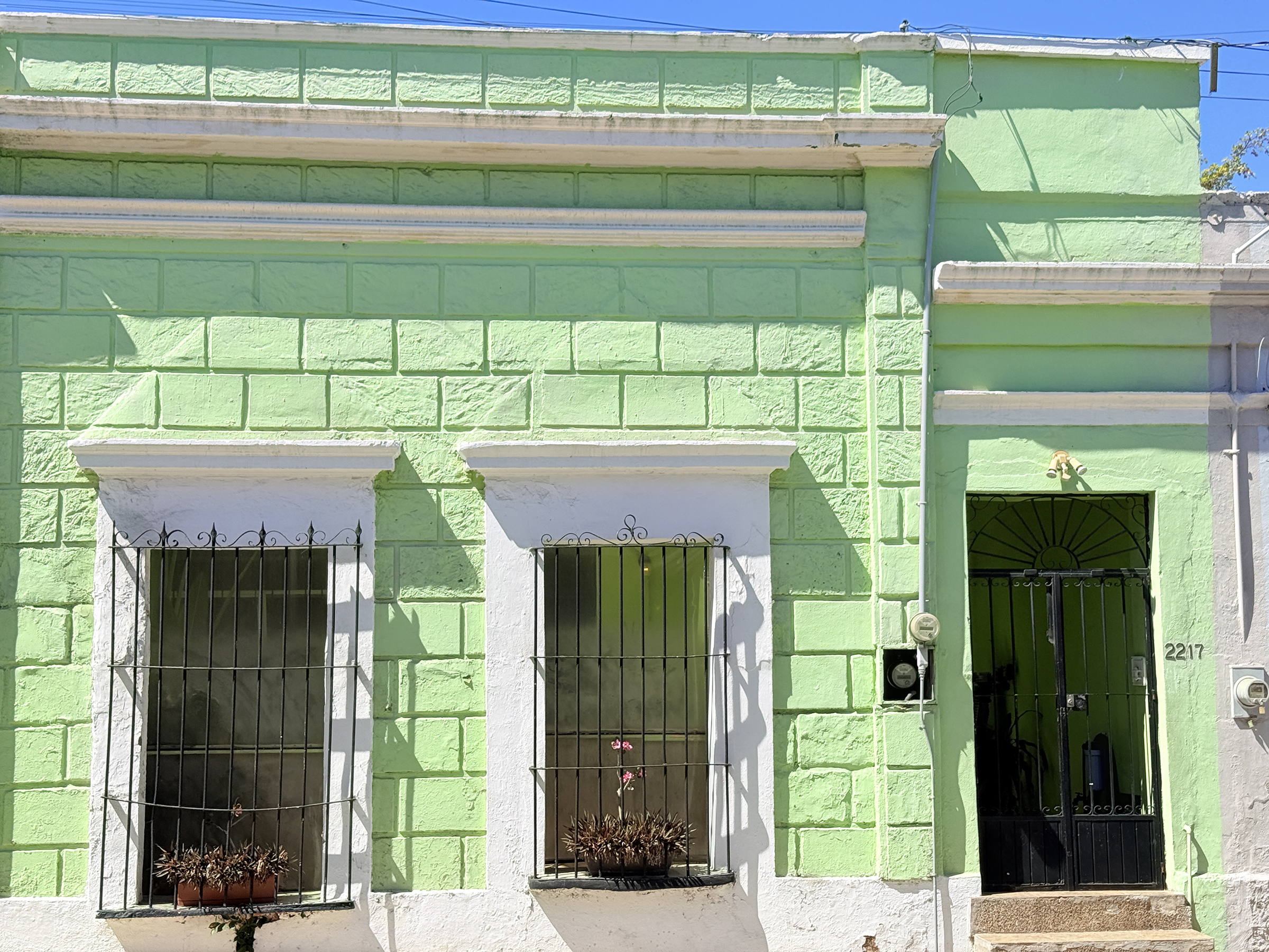
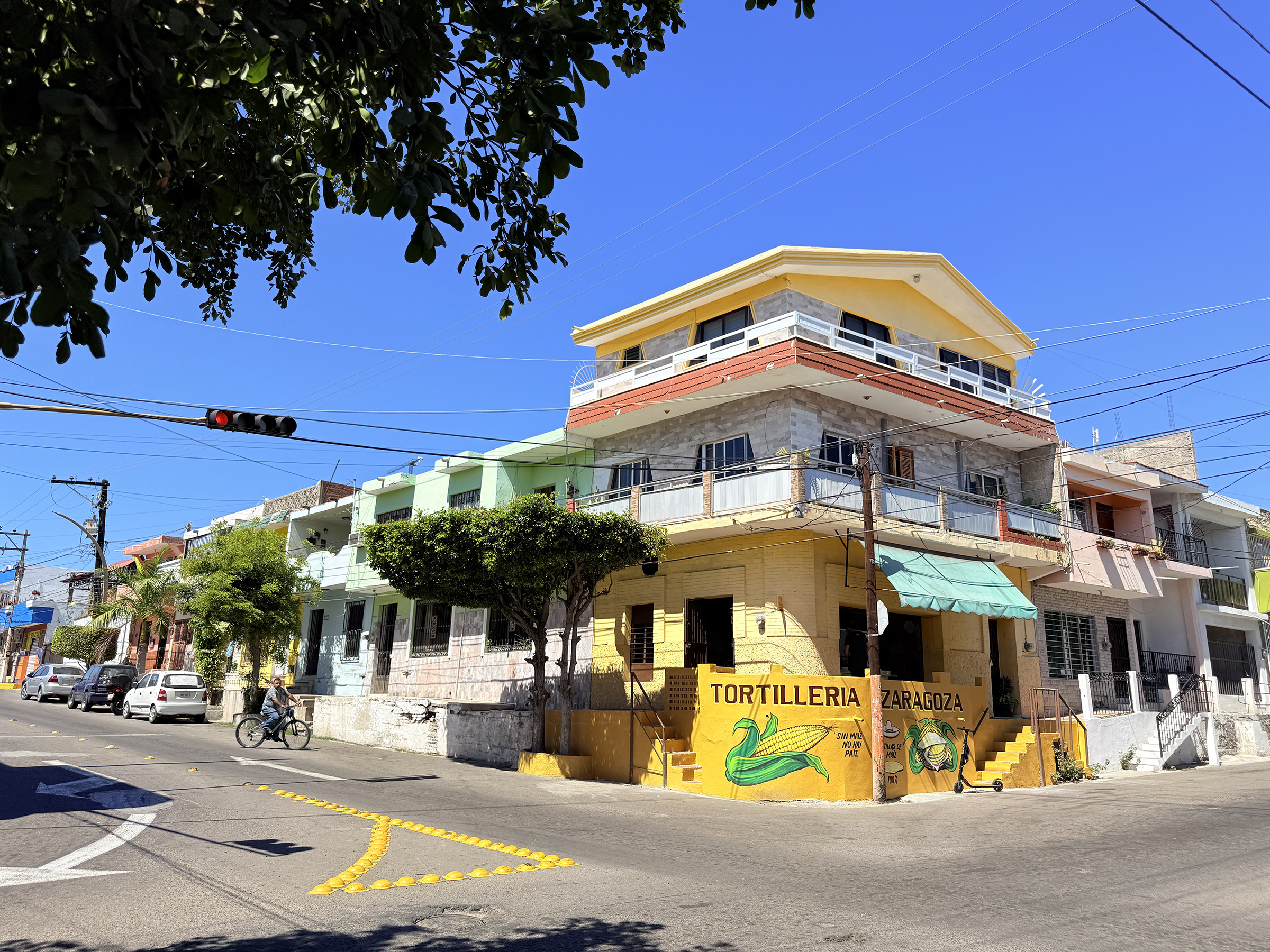
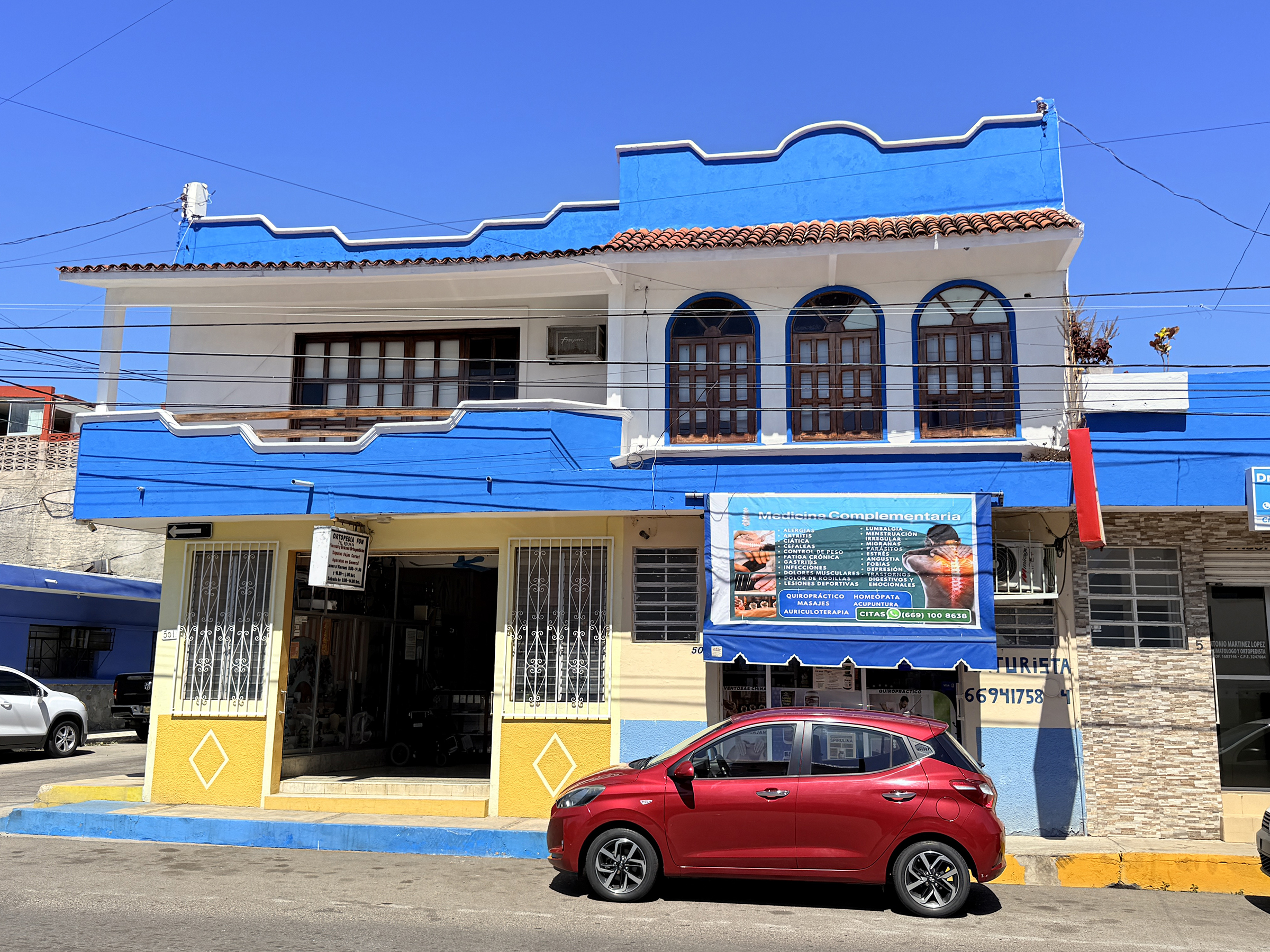
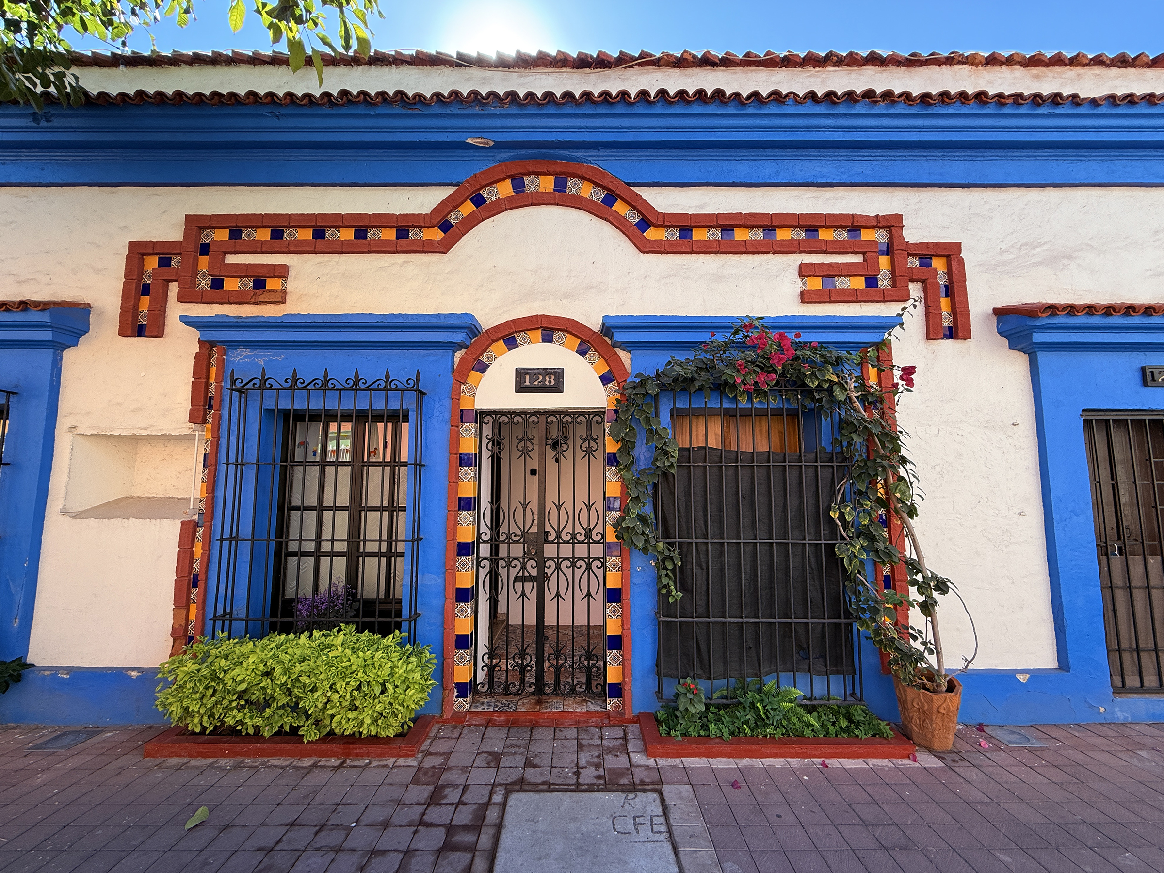
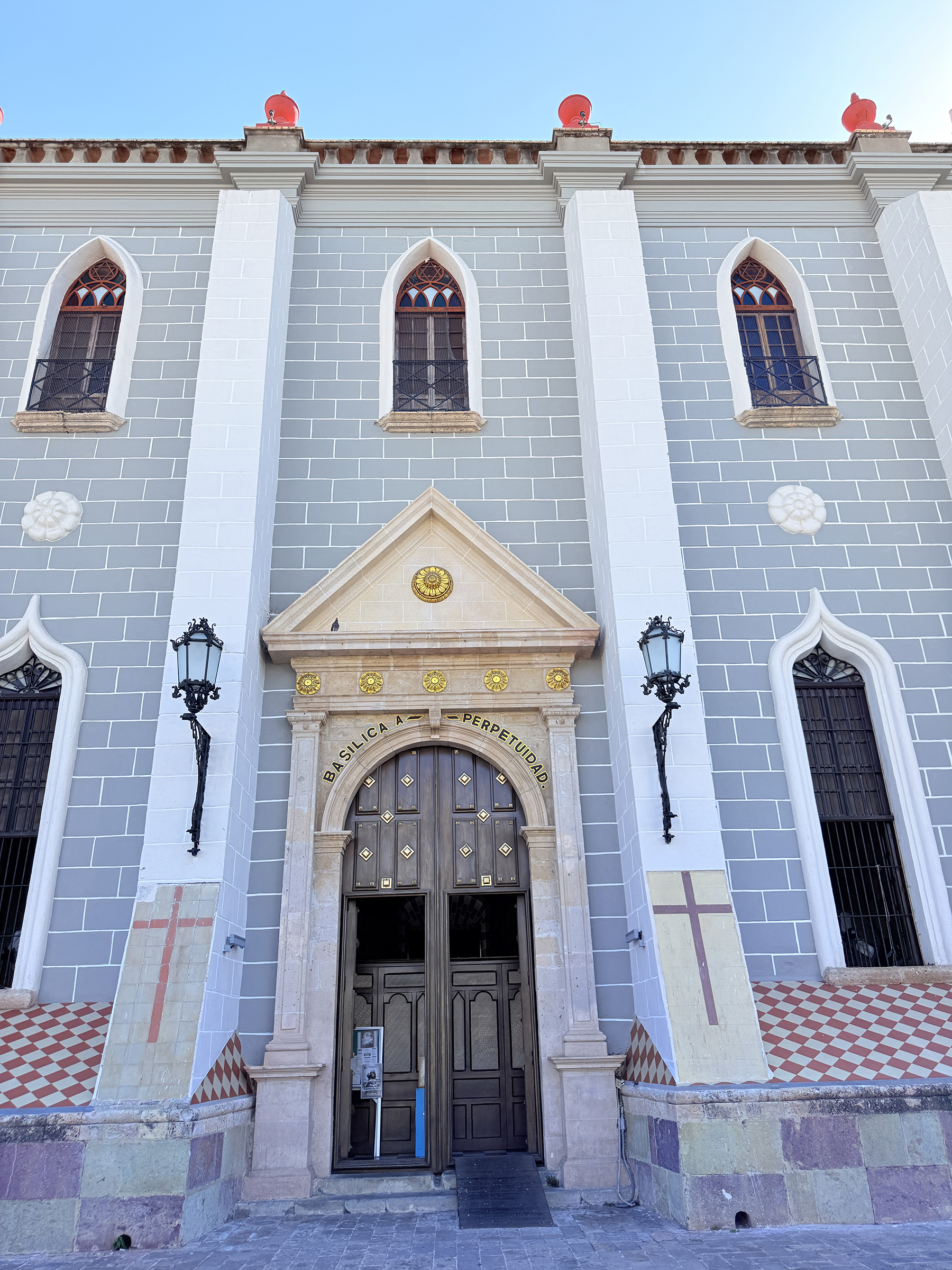
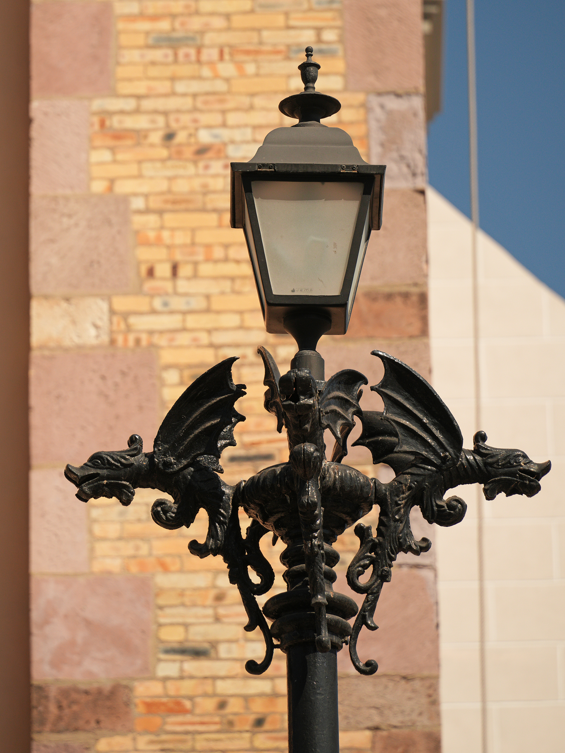
Here is a sample of beautiful architecture that had caught my eye the last few days as I walked around Centro de Mazatlán (the old center of Mazatlán).
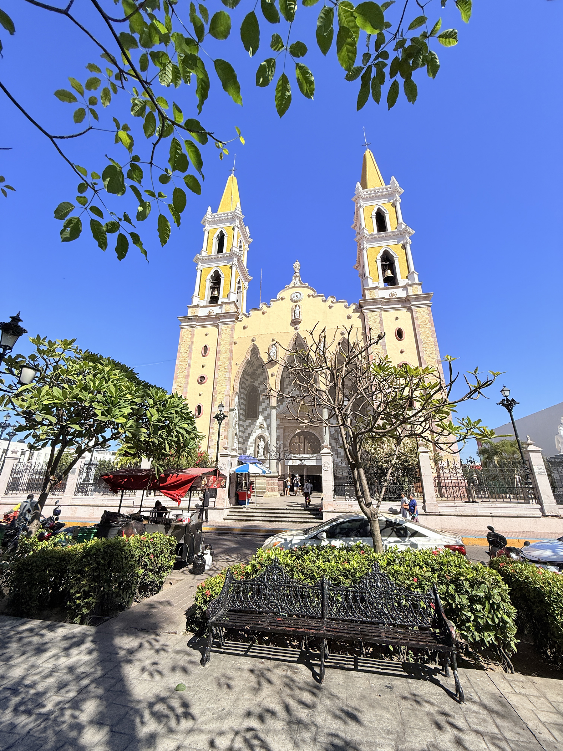
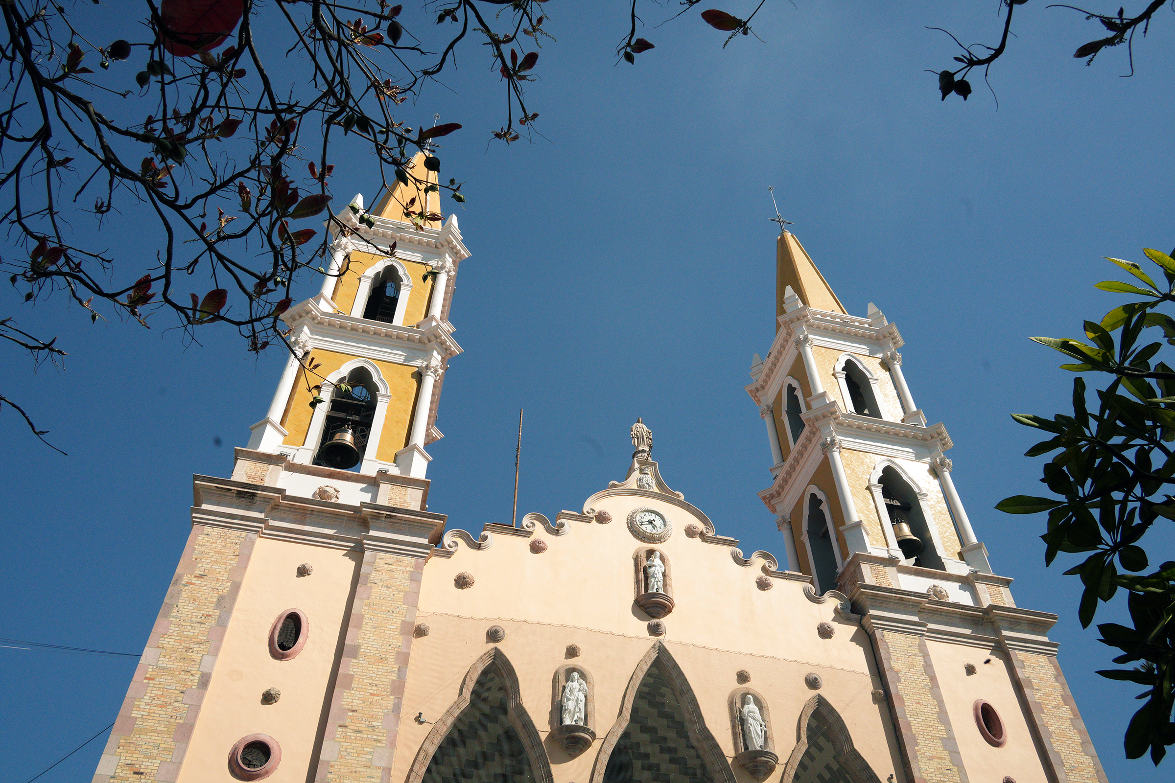
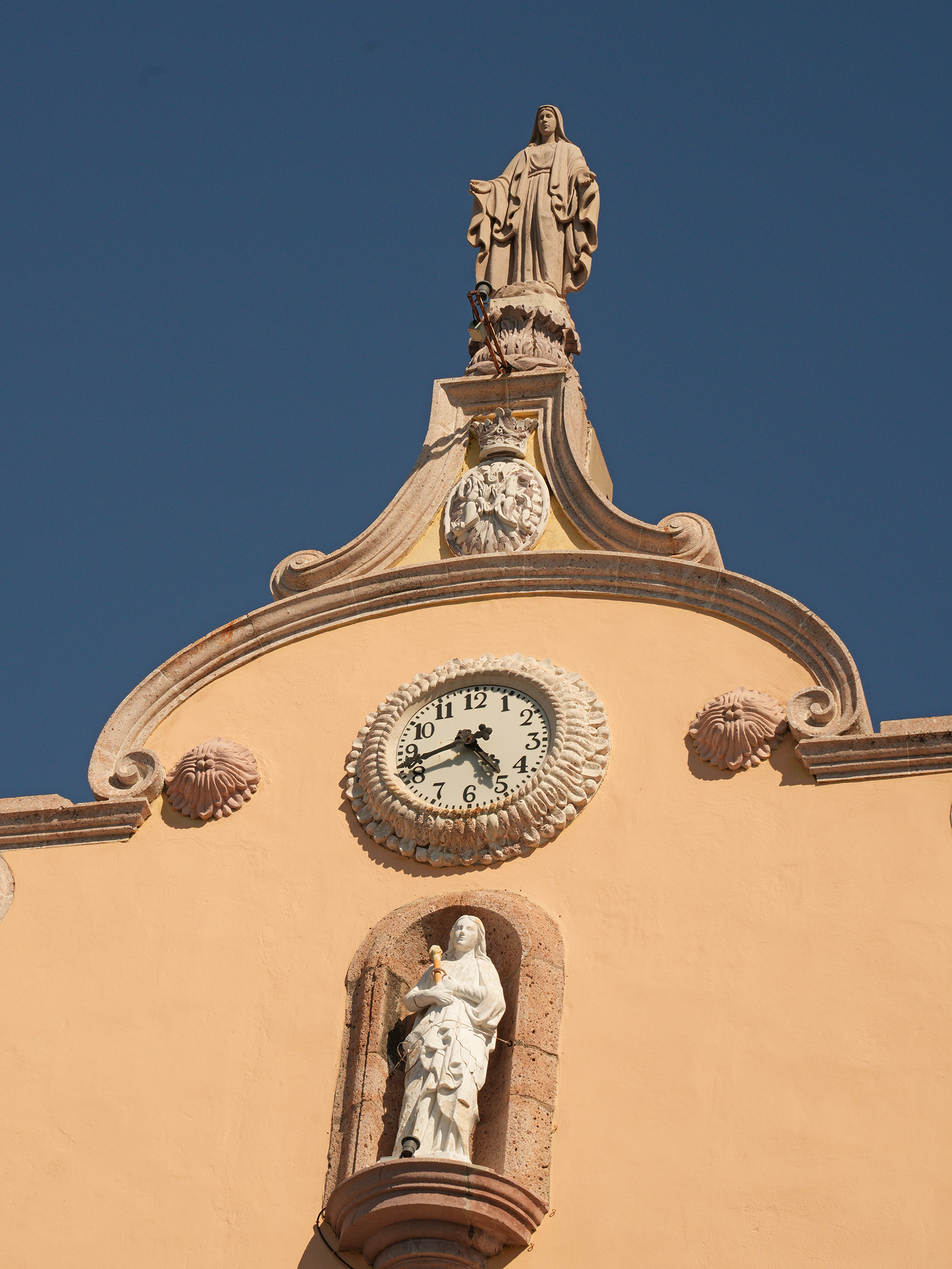
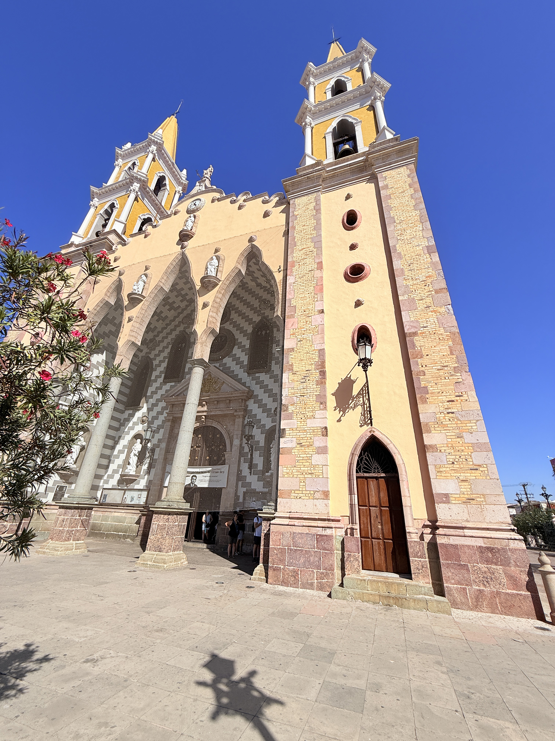
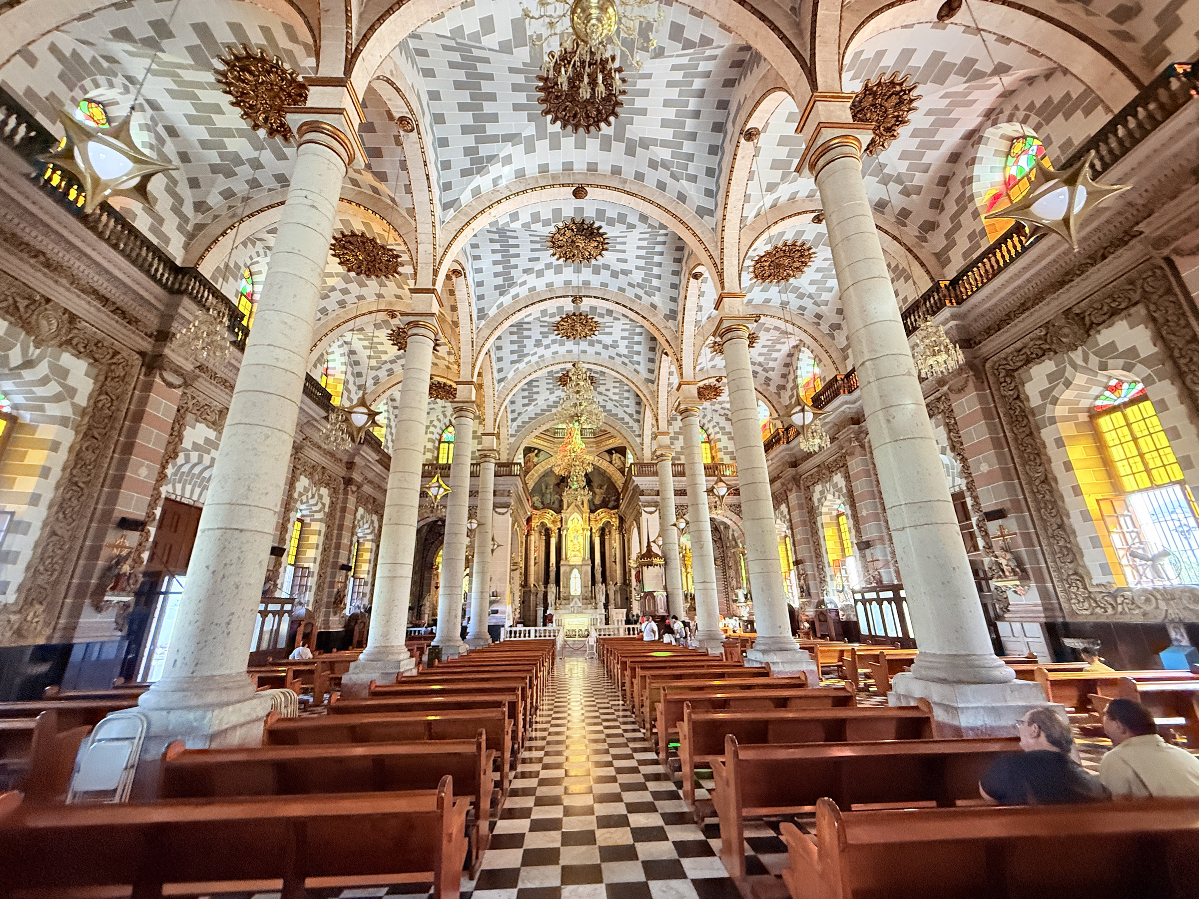
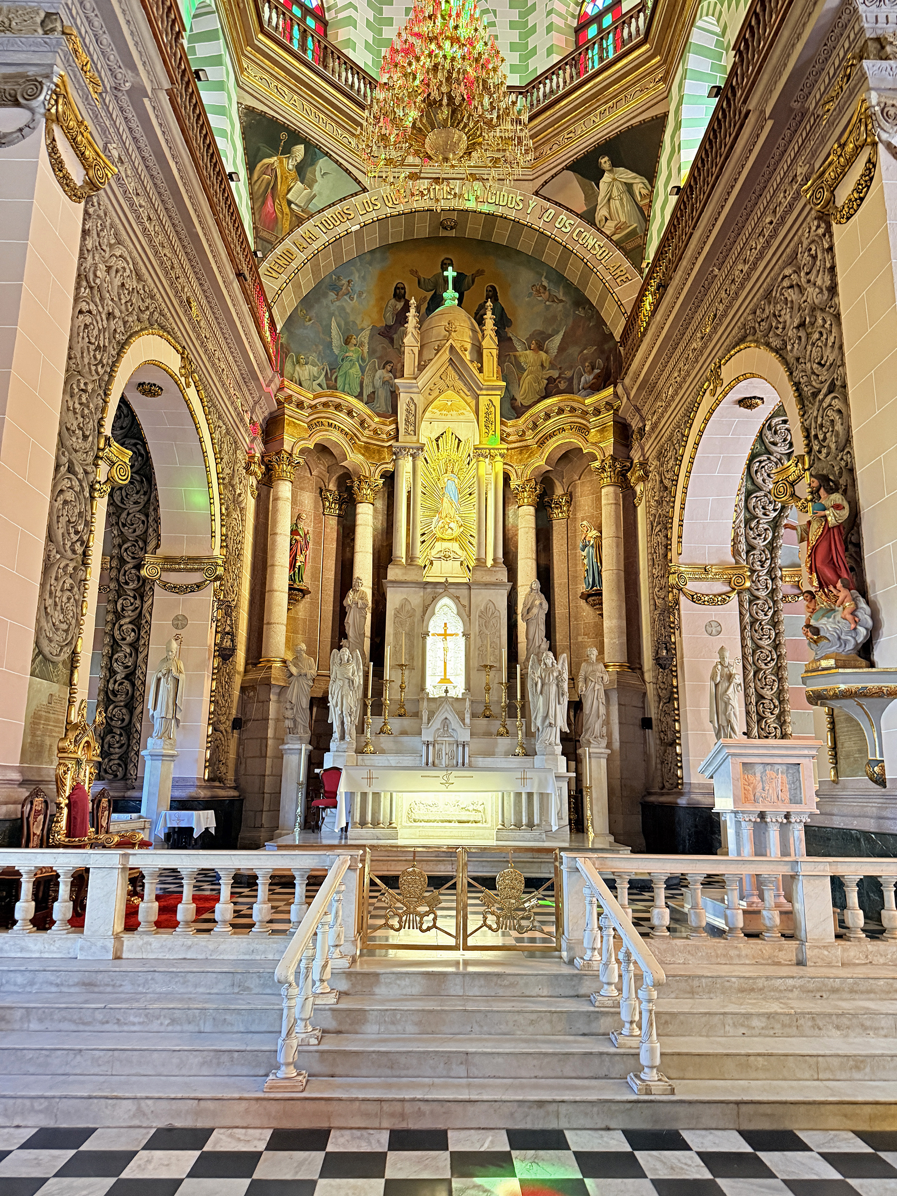
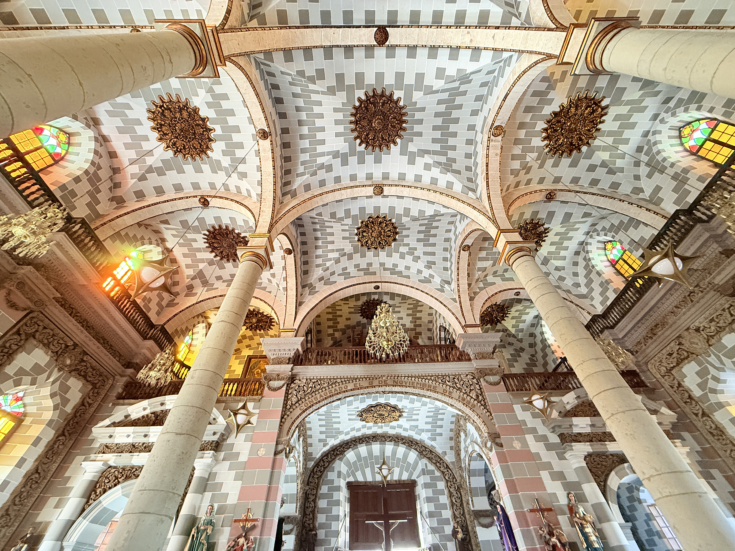
Here is a closer look at the Cathedral Basilica of the Immaculate Conception of Mazatlán (La Catedral Basílica de la Inmaculada Concepción en Mazatlán).
It is a Roman Catholic Church that was built in the Baroque-Revival style from 1856 to 1899. Approximately 78% of Mexico’s population identifies as Catholic, according to the 2020 Mexican government census.
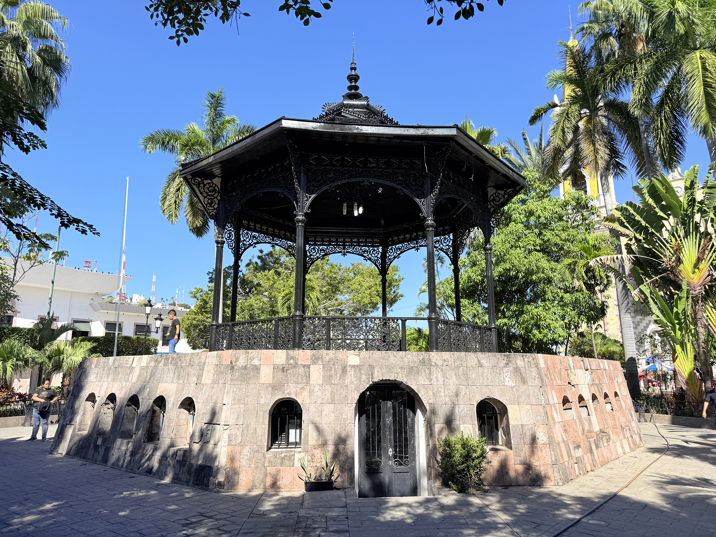
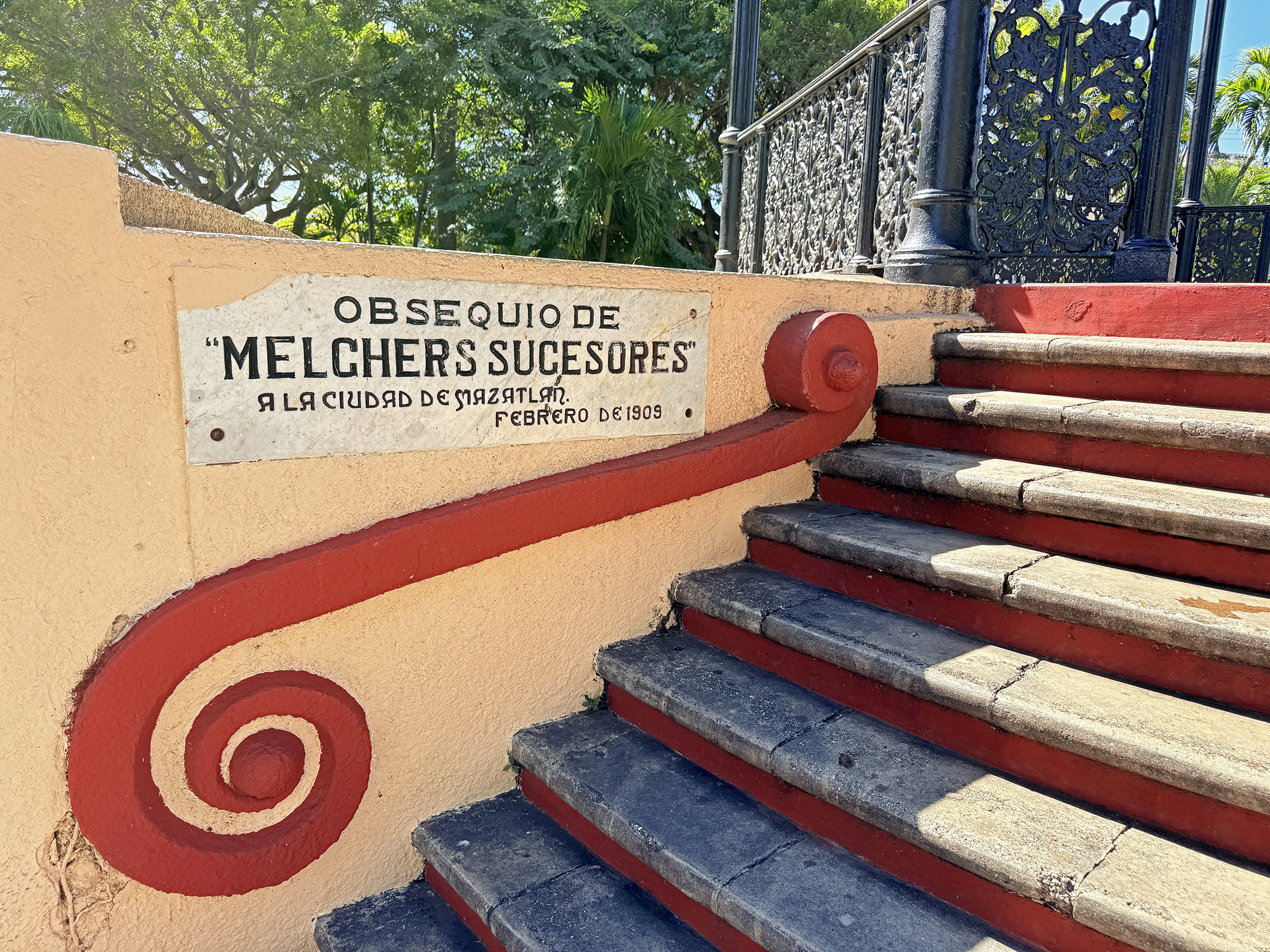
Based on available history for the city’s central public spaces, the notable iron gazebo located in the plaza directly in front of the Cathedral (Plaza República) was built around 1870.
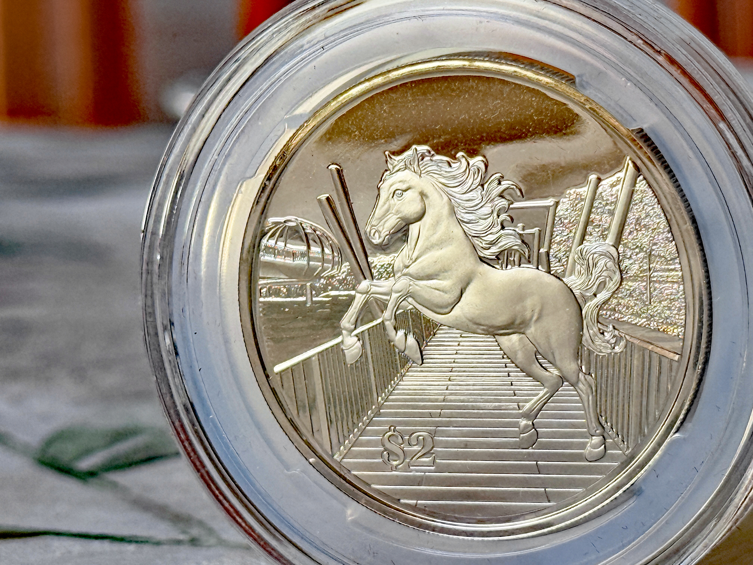
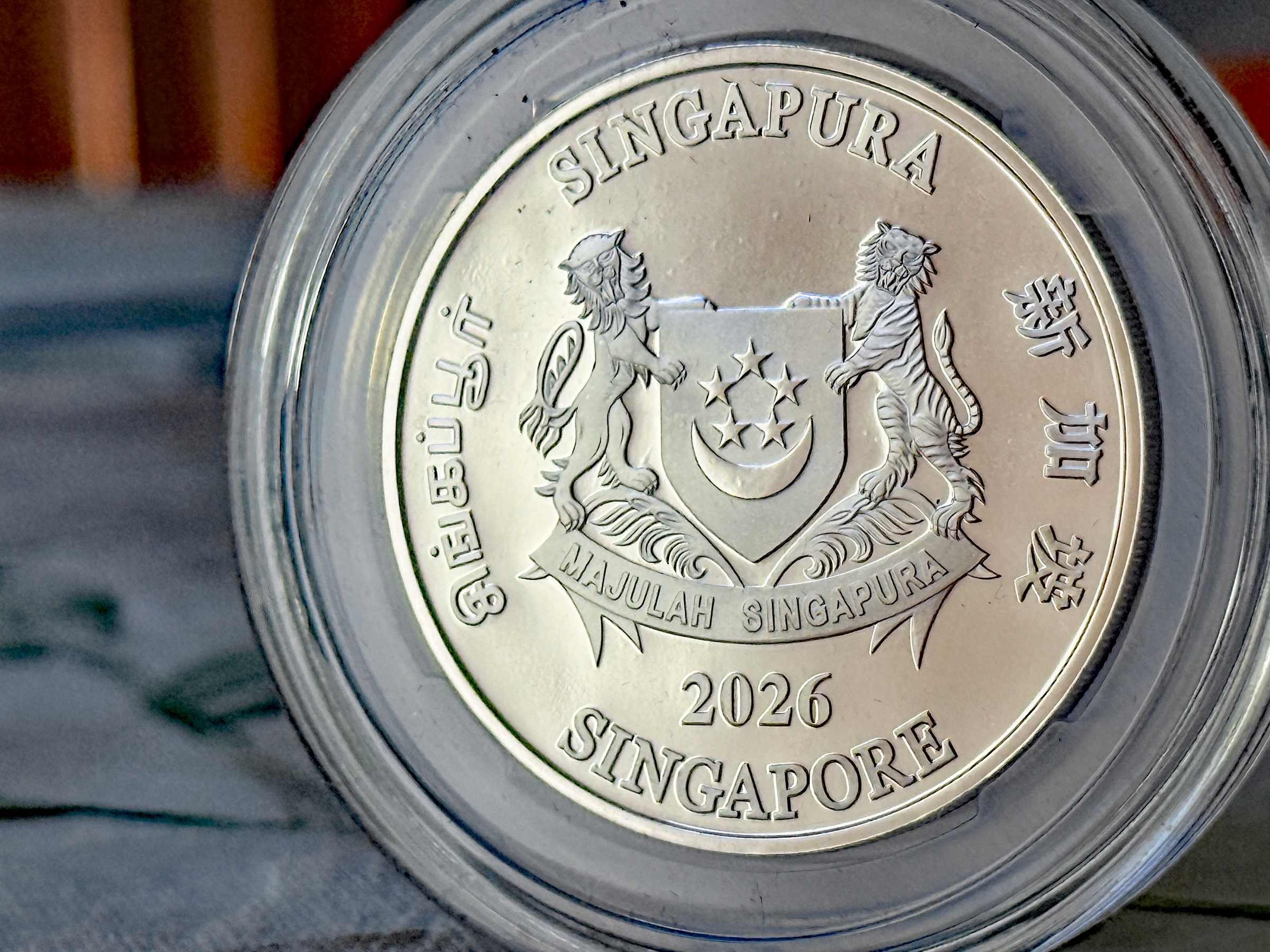
Happy Lunar New Year— the Year of the Horse.
I bought this coin recently while I was in Singapore from the Monetary Authority of Singapore (MAS), as a souvenir.
It is not silver, but a nickel-plated proof-like zinc coin.
Majulah Singapura (on the back of the coin) is a Malay phrase meaning ‘Onward Singapore’ or ‘Forward Singapore’.
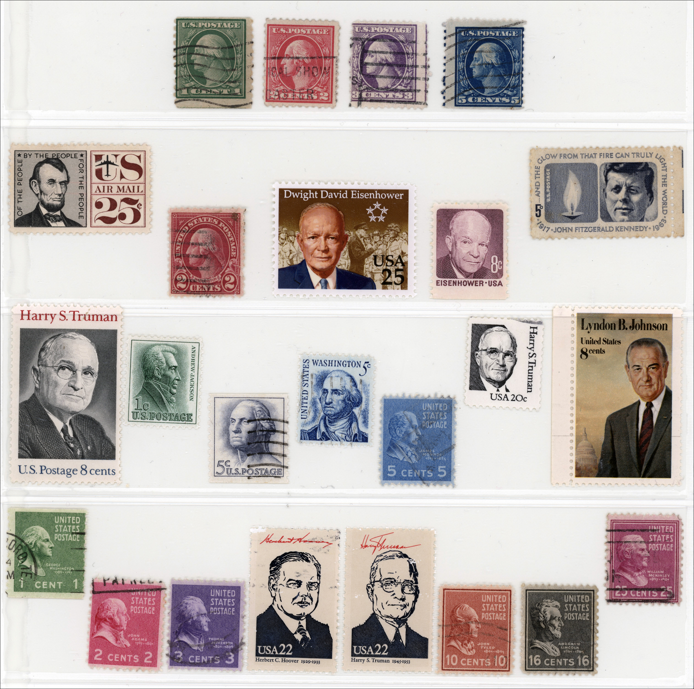
Happy Presidents’ Day.
This ensemble of US presidents on postage stamps issued by the U.S. Postal Service is from my modest collection of US stamps.
President George Washington appeared on one of the very first U.S. postage stamps issued in 1847 (a 10-cent stamp). He subsequently appeared on over 300 different U.S. postage stamps— more than any other individual in U.S. postal history, and more often than all other U.S. presidents combined.
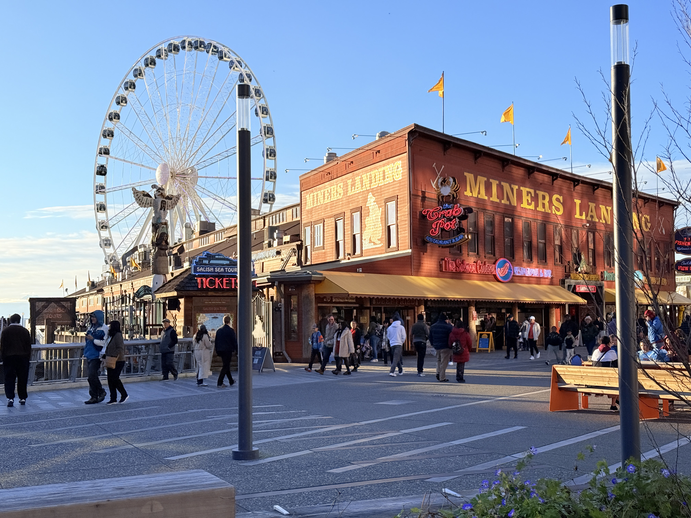
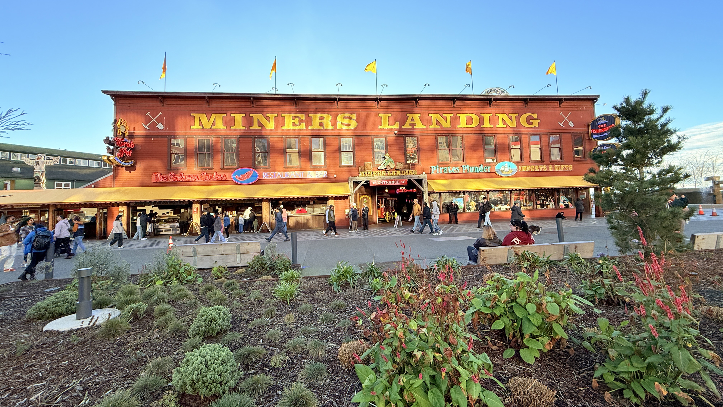
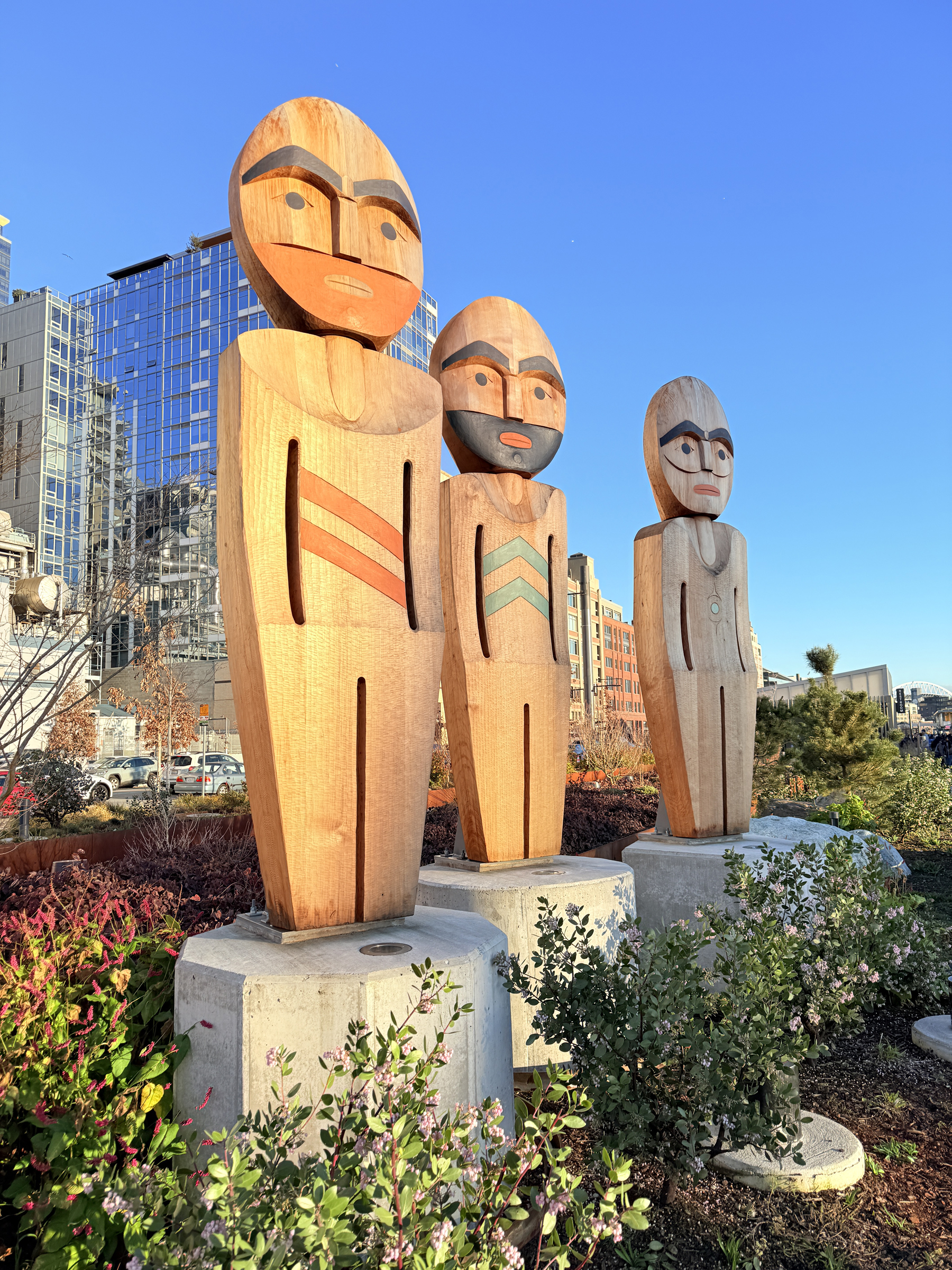
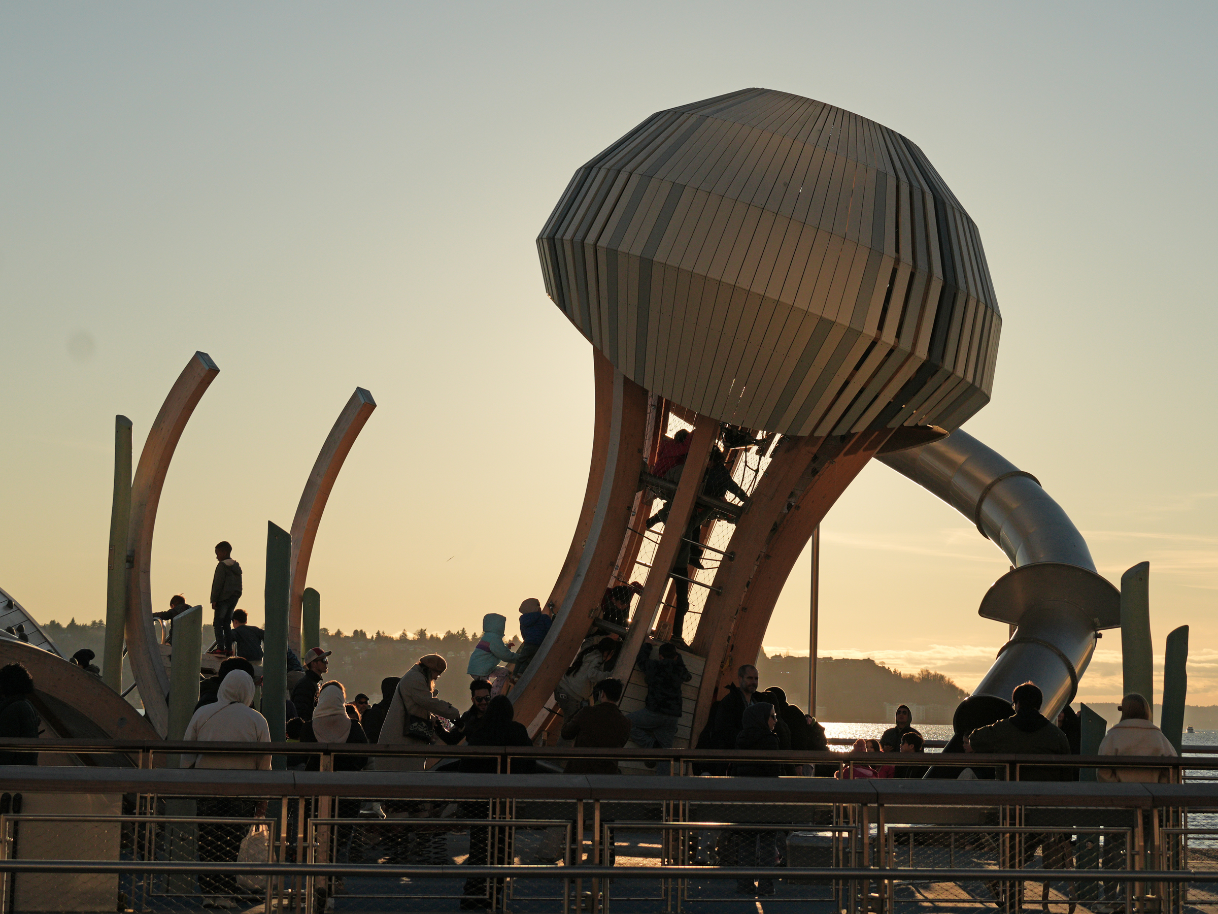
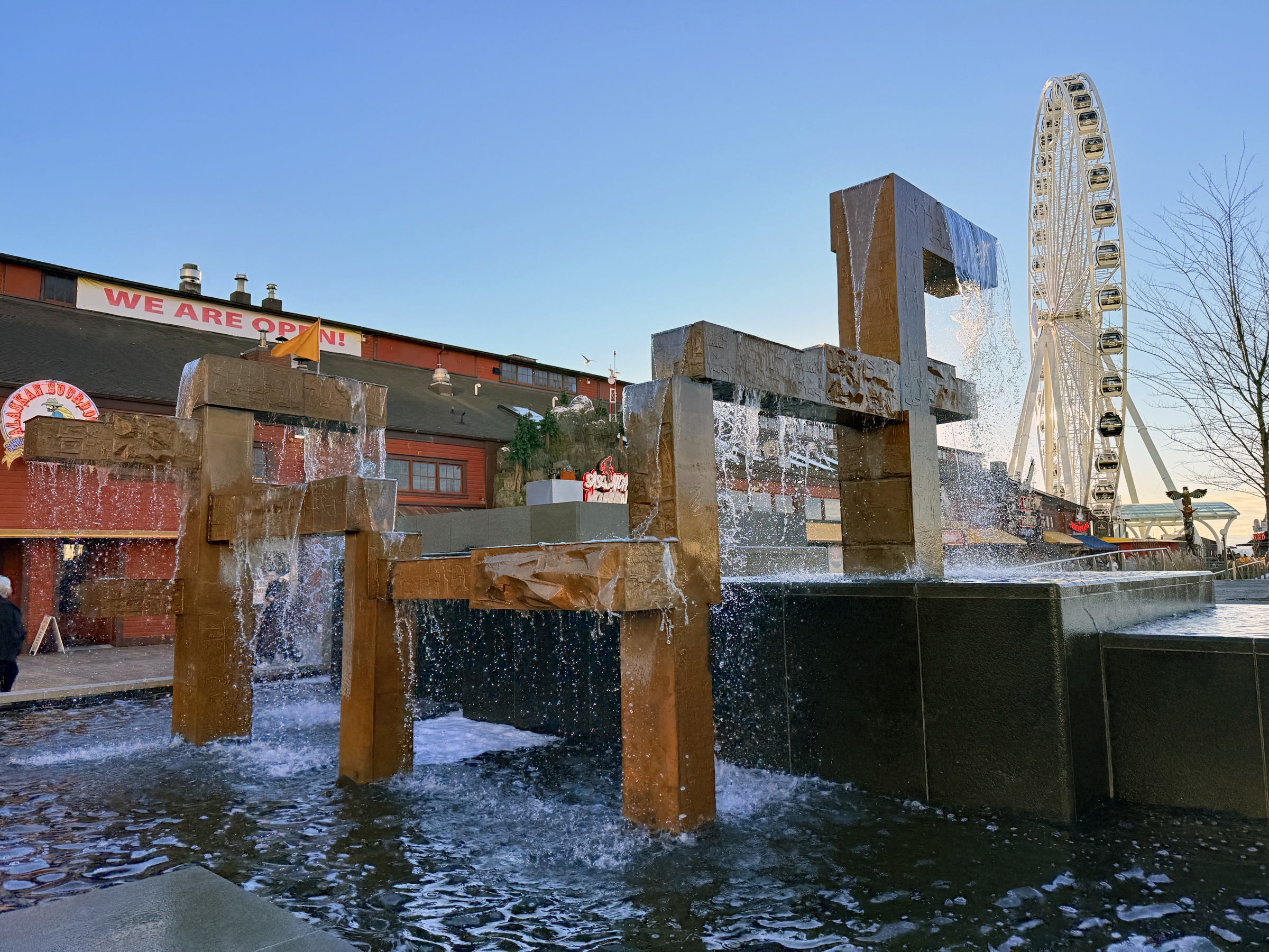
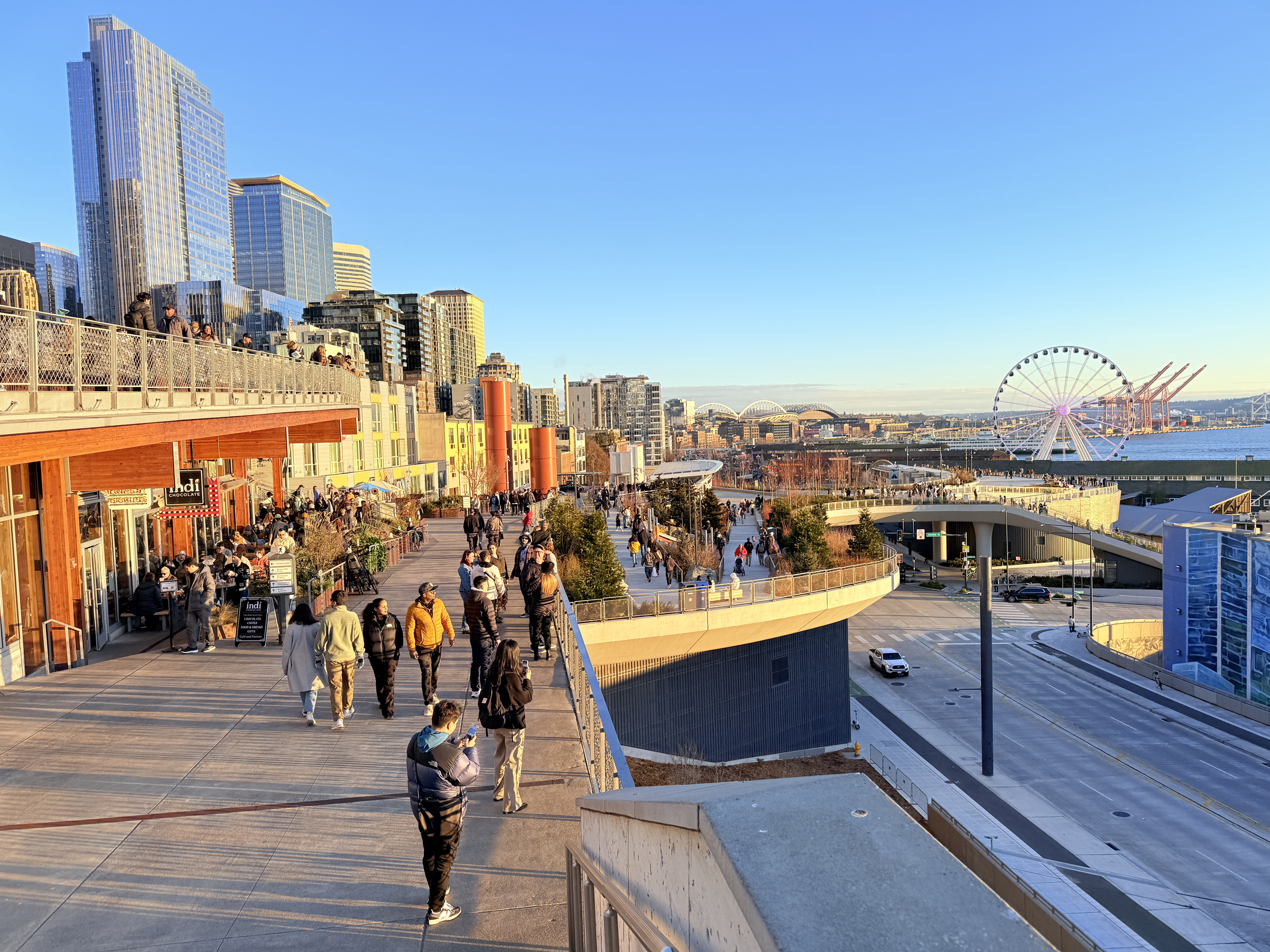
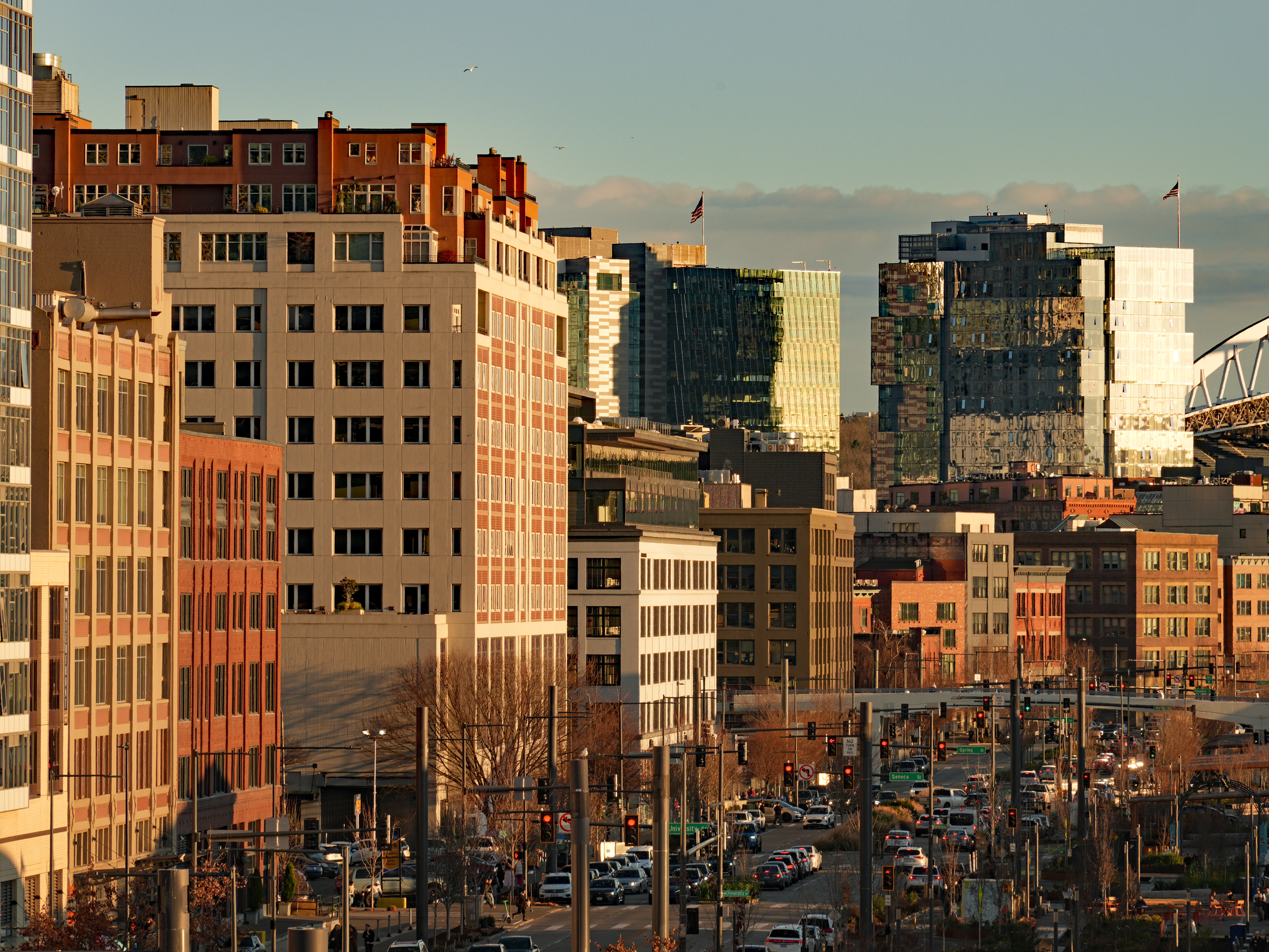
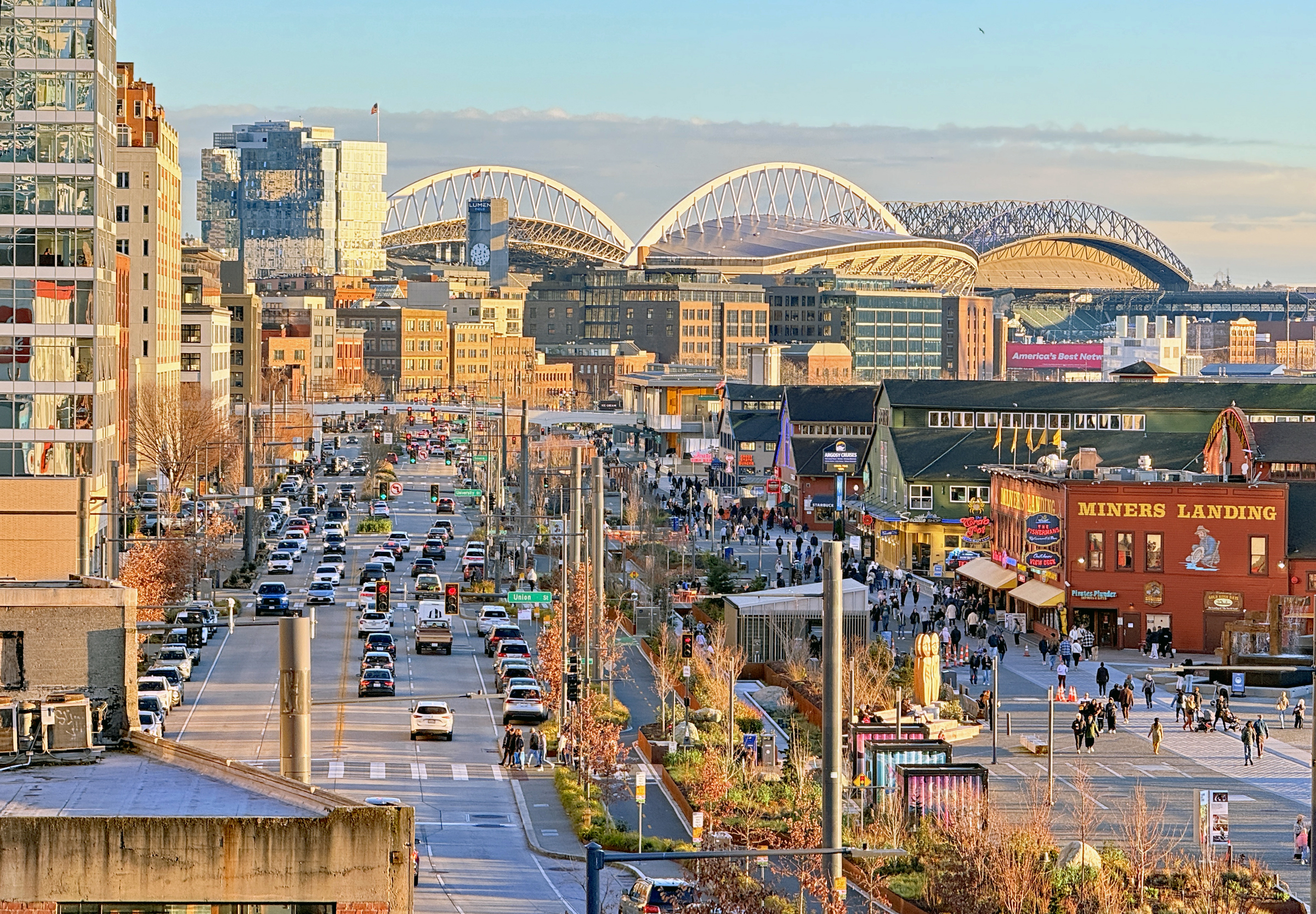
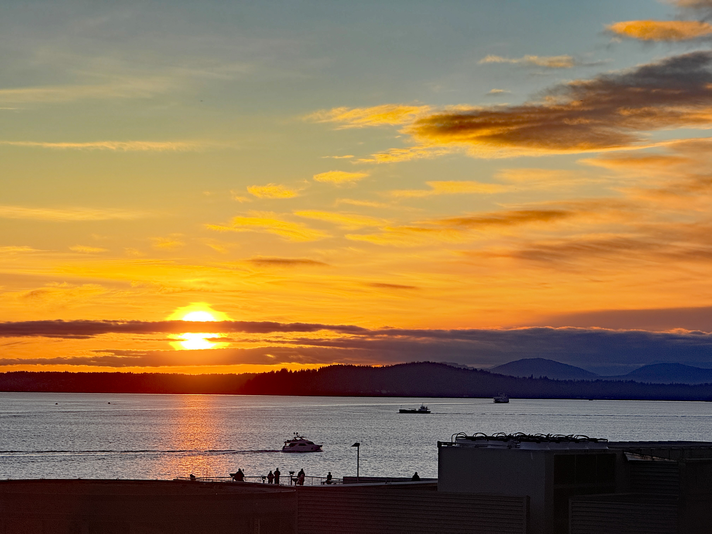
I made my way to the south end of the waterfront late this afternoon and walked up to Pike Place market.
The day was brilliant and bright out— but with the air temperature still sharp at 48°F/ 9°C.
I took the sunset picture from Elliot Avenue and Lenora Street.
Happy Friday The Thirteenth.
The postage stamps I had bought from an Ebay seller in Mumbai, India, made it into the mailbox on my porch this morning.
Here are some of my favorite ones.
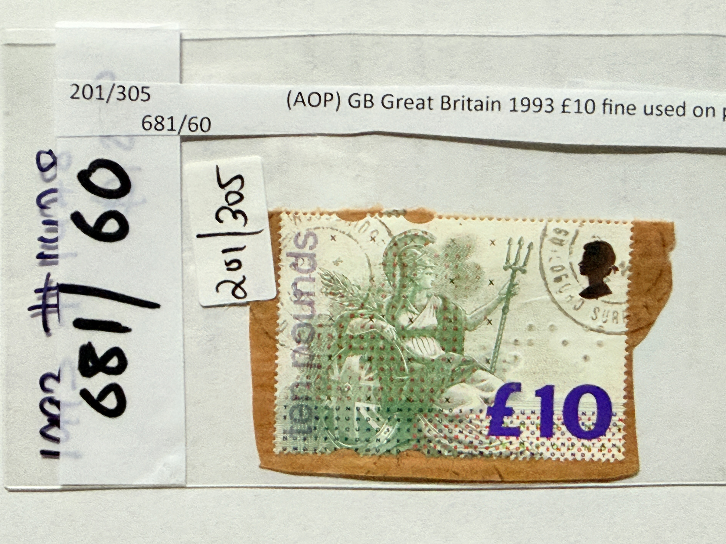
Issued by Royal Mail, Great Britain, Mar. 2, 1993 | Perf. 14 | Design B. Craddock | Lithography | Printer: House of Questa | Silver die-stamped w. Braille symbol for “10” embossed | Paper contains fluorescent colored fibers which, together with the ink on the shield, react under ultraviolet light
1658 1088| £10 Greenish grey, rosine, yellow, new blue, reddish violet, vermilion, violet, bright green and silver
[Source: Stanley Gibbons stamp catalogue Part 1, British Commonwealth 1997, Vol.1]
Britannia is the ancient Roman name for Great Britain and the national personification of the United Kingdom, often depicted as a helmeted woman with a trident and shield. Originating from the 1st century BC, it became a enduring symbol of British strength, power, and identity. It frequently appears on coins, on stamps and on artwork.
– Google AI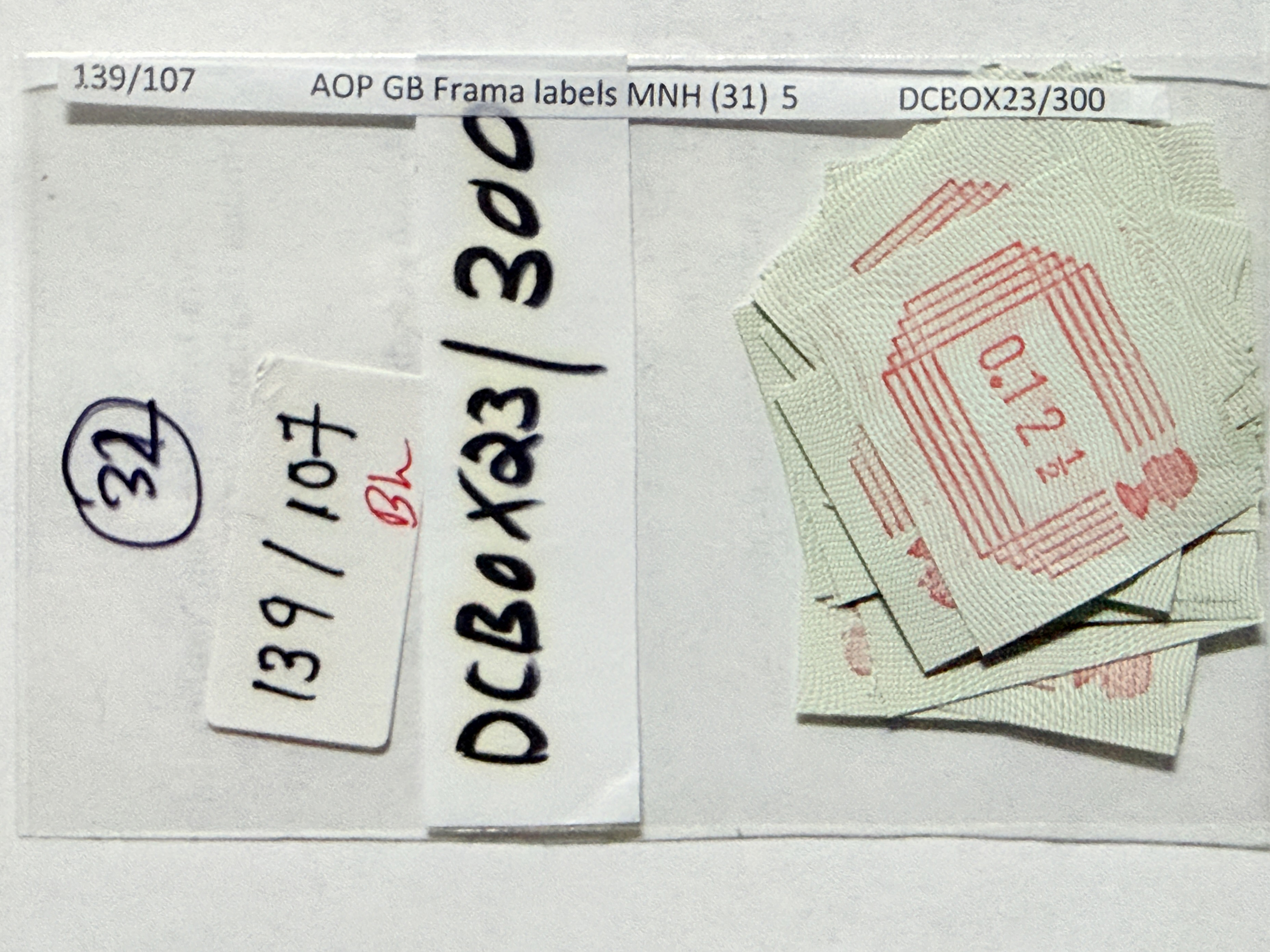
These imperforate labels, printed in red on phosphorized paper with grey-green background design, were first issued on 1 May 1984 as an experiment by the Post Office. Special microprocessor controlled machines were installed at post offices in Cambridge, London, Shirley, (Southampton) and Windsor to provide an after-hours sales service to the public.
The machines printed and dispensed the labels according to the coins inserted and the buttons operated by the customer.
Values were initially available in ½p steps to 16p.
In addition, the labels were sold at philatelic counters in two packs containing either 3 values (3½, 12½ or 16р) or 32 values (½p to 16p).
From 28 Aug. 1984 the machines were adjusted to provide values up to 17p.
After 31 Dec. 1984 labels ending in ½p values were withdrawn.
On 30 Apr. 1985, the machines were withdrawn from service.
P.S. I asked Google AI why these stamp labels were discontinued. The answer: Automated stamp label machines generally failed to achieve widespread success due to high operational costs, inconsistent print quality, and frequent technical failures.
[Source: Stanley Gibbons stamp catalogue Part 1, British Commonwealth 1997, Vol.1]
It is a time-honored tradition for countries and postal agencies over the world to issue postage stamps to commemorate the Olympic Games.
The Unites States Postal Service has not issued stamps for the 2026 Games, though.
Here is host country Italy’s stamps.
Very abstract— compared to say, the issue from Japan for the 1972 Winter Olympics in Sapporo.
From olympics.com:
Sapporo 1972 was significant for both Japanese and Asian winter sport.
As the first Winter Games held in Asia, they inspired people across the continent to watch, and take up, snow and ice disciplines.
The success of the Japanese ski jumpers– known as the Hinomaru Squadron– created national heroes and showed that Asian winter sports athletes could compete with the best from Europe and North America.
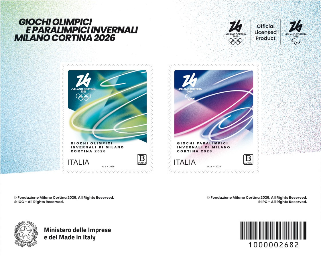
Issued by Poste Italiane, Jan. 21, 2026
Miniature sheet of 2 stamps | Perf. 11 Die Cut | Engraving by I.P.Z.S. S.p.A. – Roma | Self-adhesive | No watermark
4877 FLV | €3.35 Multi-colored shades of green, yellow-green | Milano Cortina 2026 “Futura” emblem
4878 FLW | €3.35 Multi-colored shades of dark blue, purple, violet | Milano Cortina 2026 “Futura” emblem
[Sources: stampworld.com, Google AI Overview]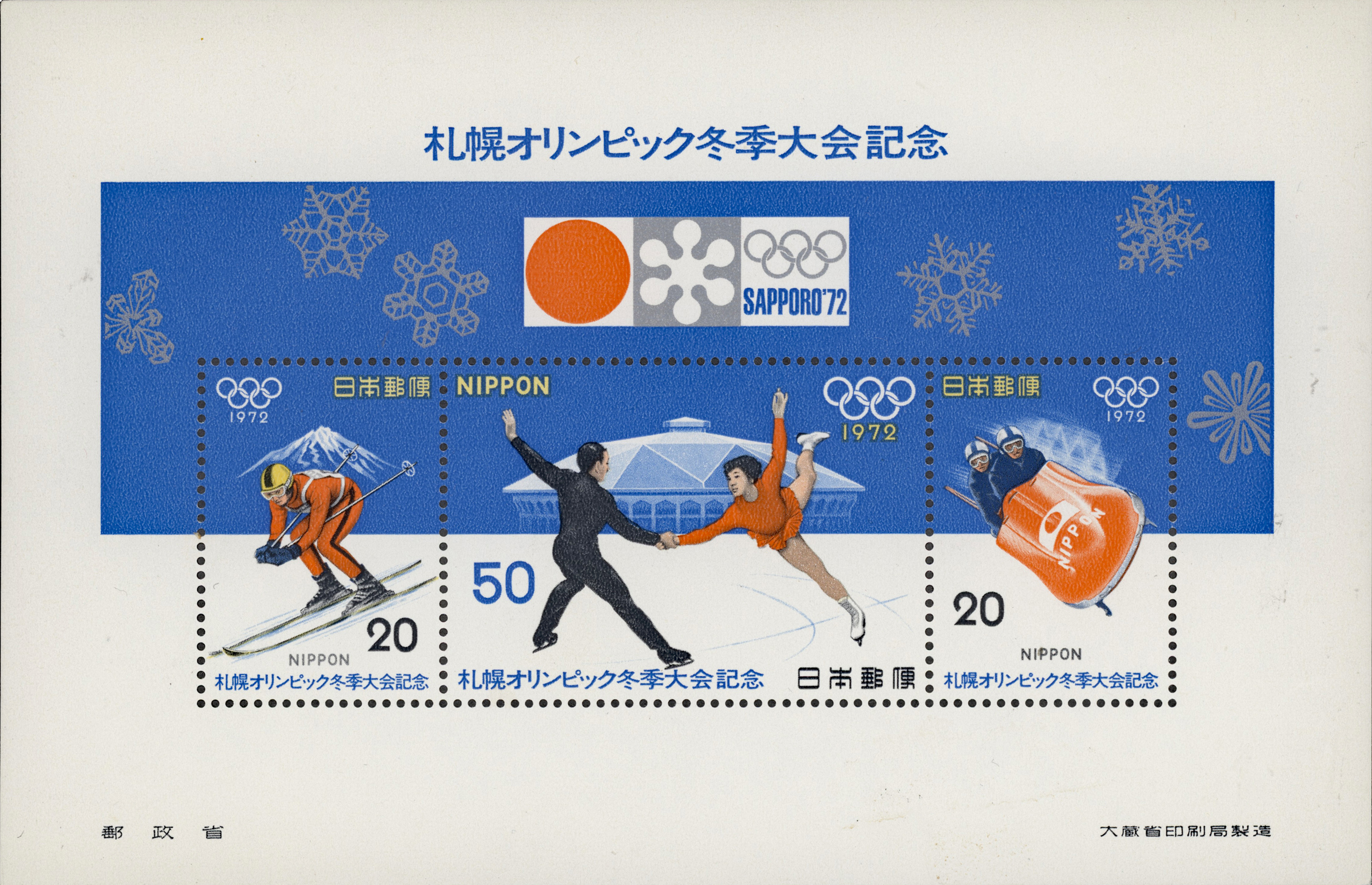
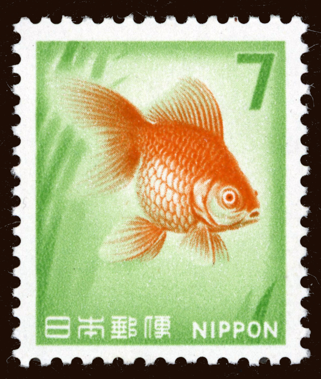
Issued by Japan Post, Feb. 3, 1972
Miniature sheet of 3 stamps | Perf. 13¼ | Photolithography | No watermark
1103 A730 | 20 yen Ultramarine & multi-colored |Downhill Skiing
1104 A730 | 20 yen Ultramarine & multi-colored |Bobsledding
1105 A730 | 50 yen Ultramarine & multi-colored |Figure skating, pairs and Makomanai Indoor Skating Rink (now known as the Makomanai Sekisui Heim Ice Arena)
[Sources: 2021 Scott Standard Postage Stamp Catalogue Vol. 4A, stampworld.com]
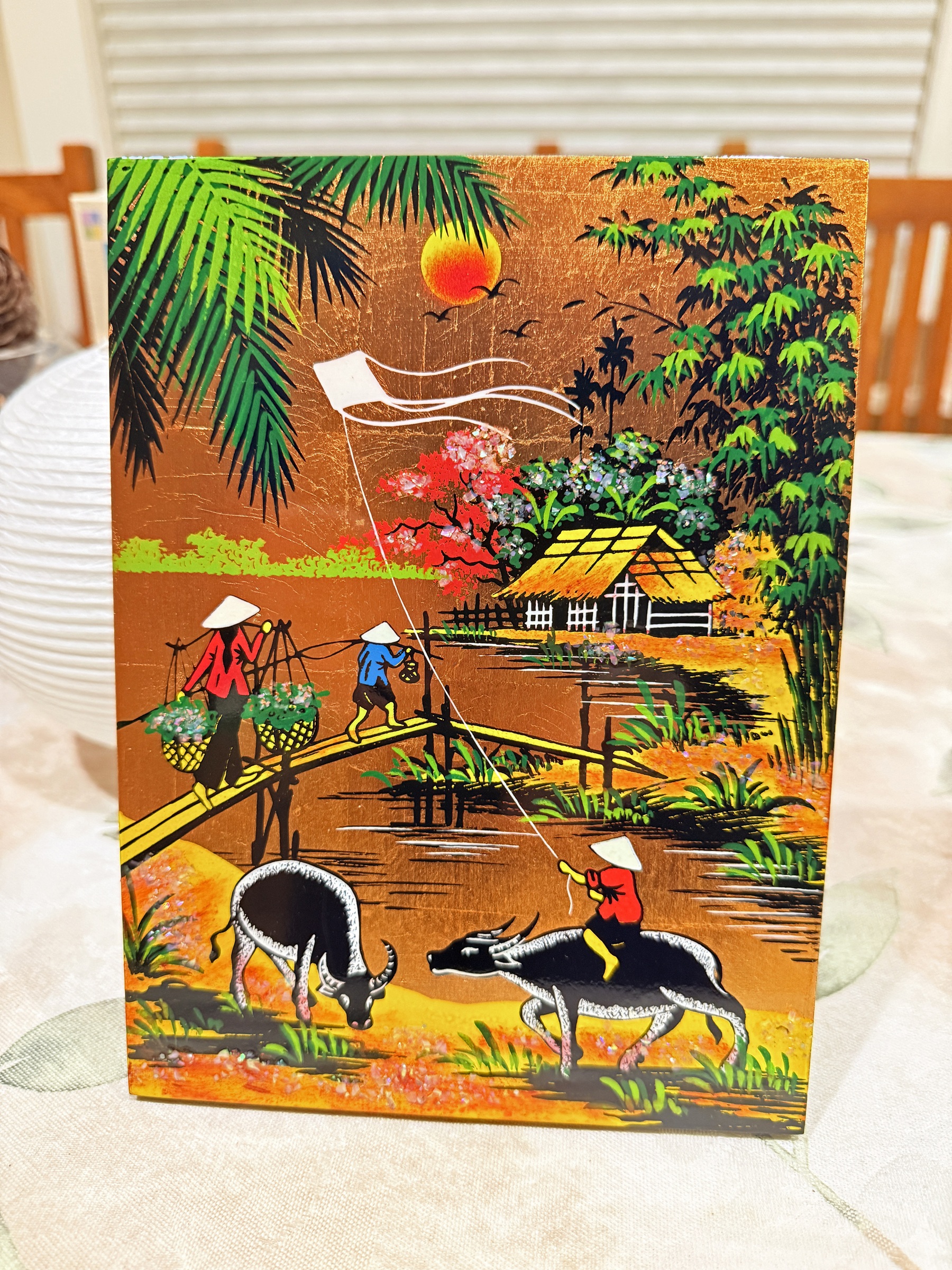
Here is the traditional Vietnamese lacquer artwork (called sơn mài) that I had bought in Ho Chi Minh City.
I love the bright colors and the gold background.
By the way: the Vietnamese have a long tradition of holding their wealth in gold. Vietnamese savers are estimated to have collectively socked away around 400 tons of gold items at home.
So what also happens is that a person building a home or starting a business, would borrow money from a relative in the form of gold— rather than taking out a loan at a bank.
The meteoric rise of the gold price has made a world of trouble for these borrowers, because they have to pay back their debts in gold, as well. They now have to buy it back at almost double what it was say, a year ago. The gold price has tumbled by 10% these last two trading days, but is still up by about 90% over the last 12 months.
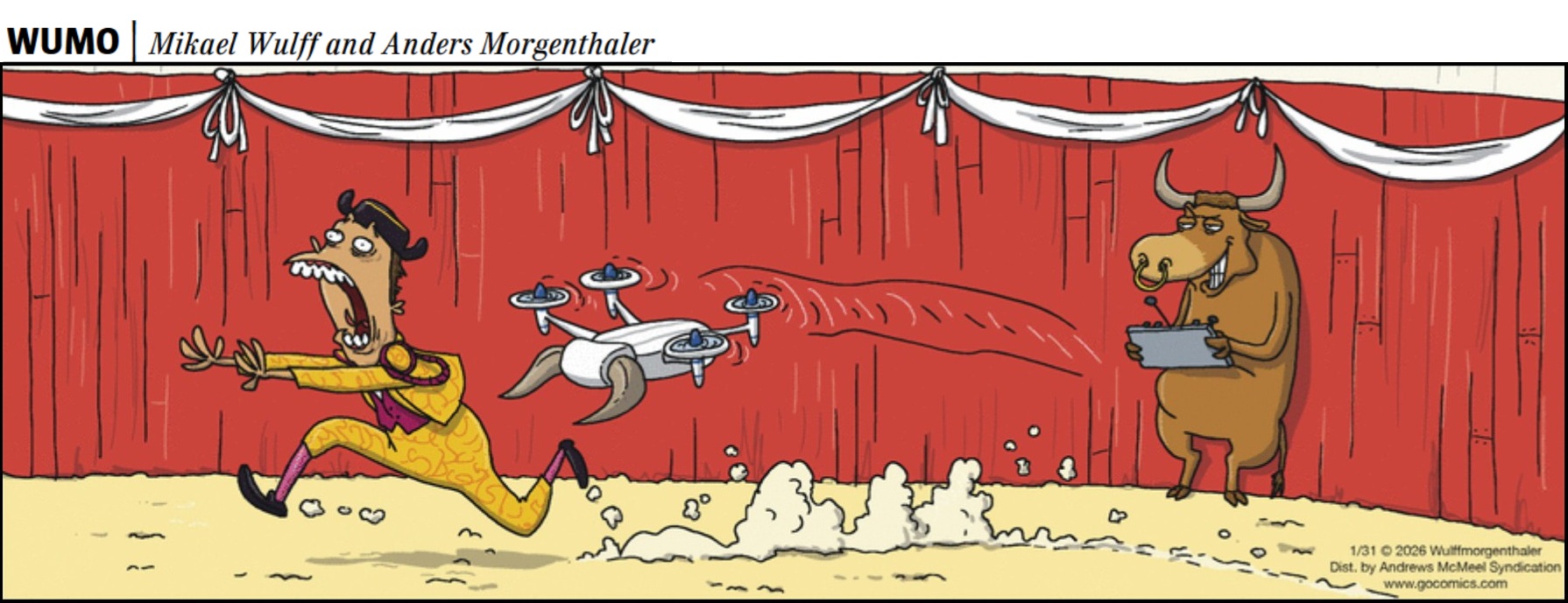
Here’s a cartoon from today’s Seattle Times.
(Yes, bullfighting is still legal and protected as part of the cultural heritage in most of Spain, although its popularity is declining and it is banned in specific regions like the Canary Islands.)
Happy Friday.
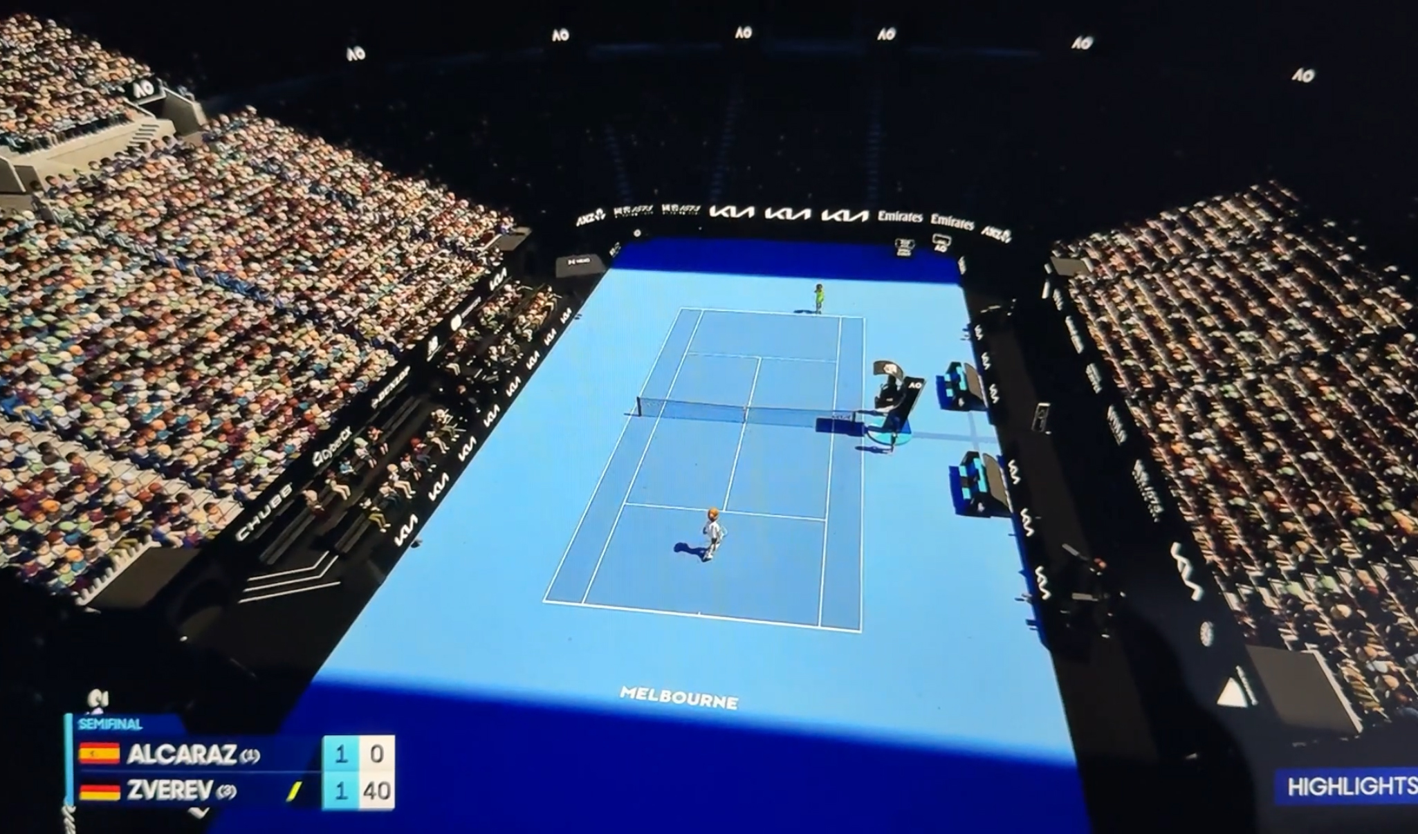
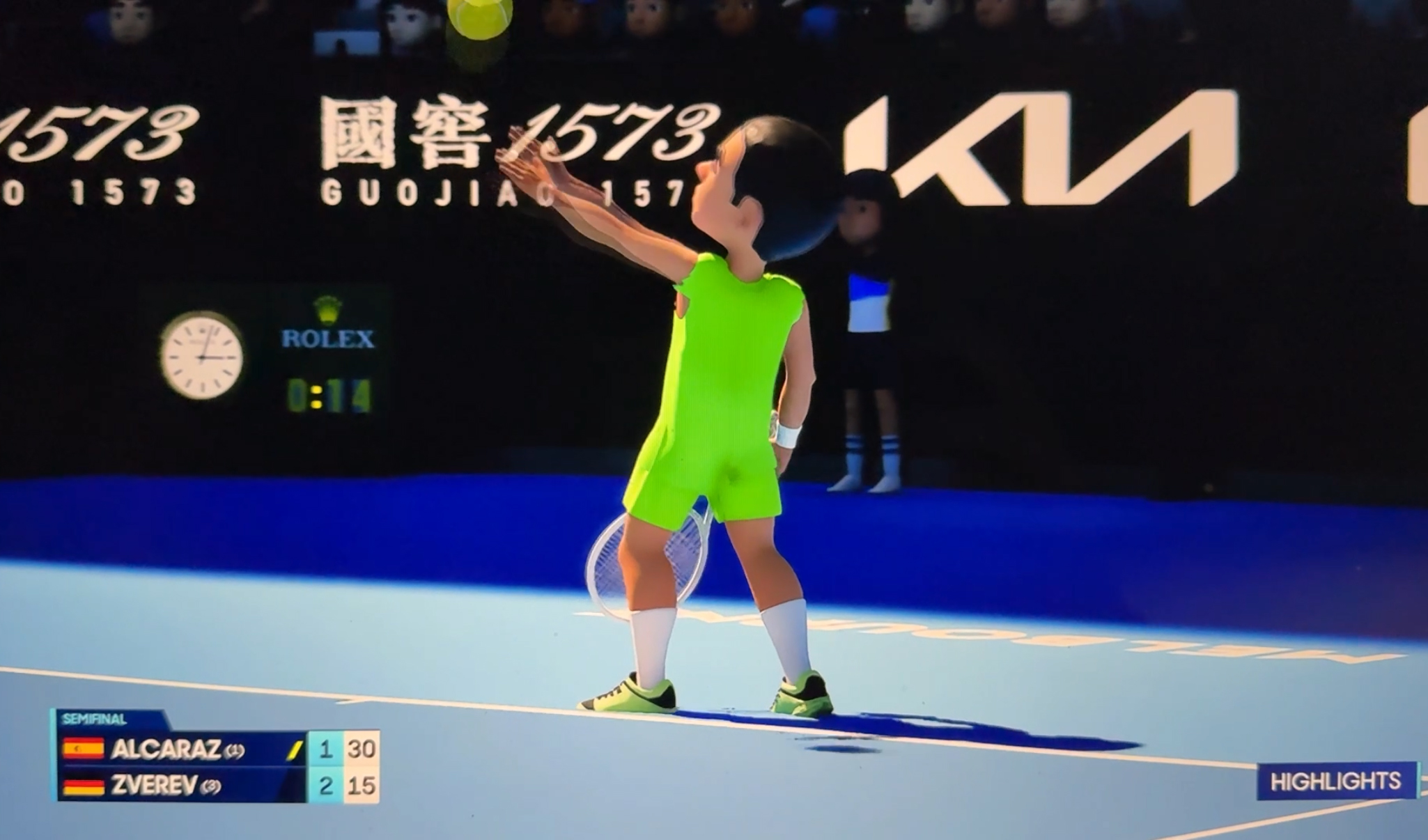
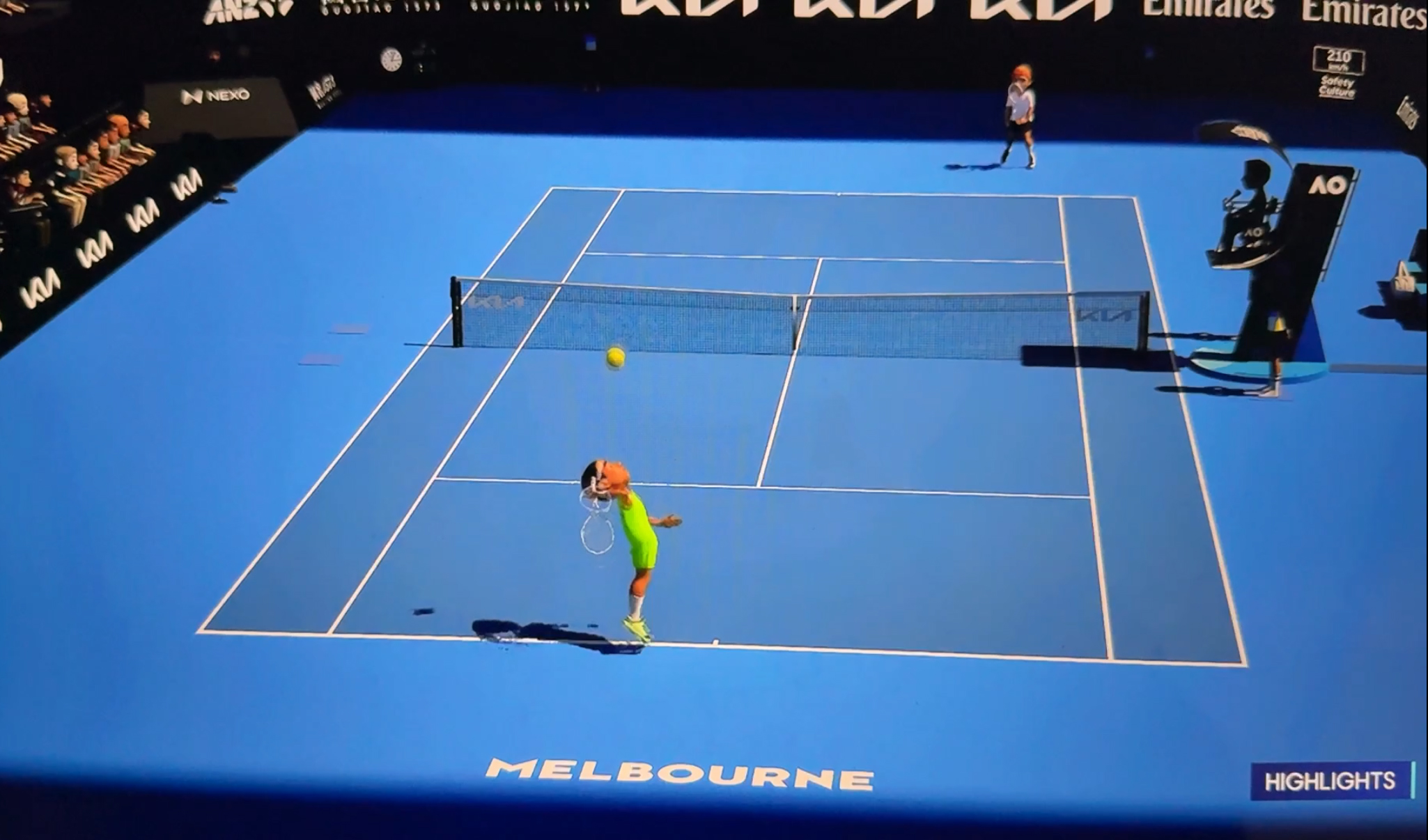
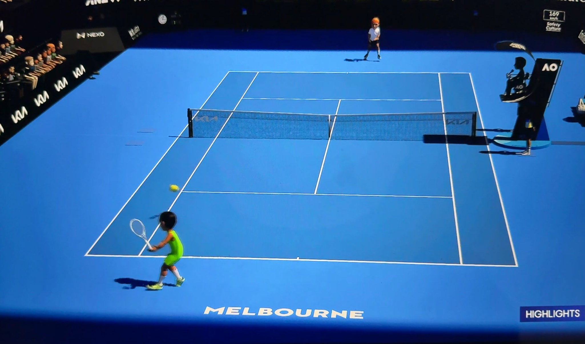
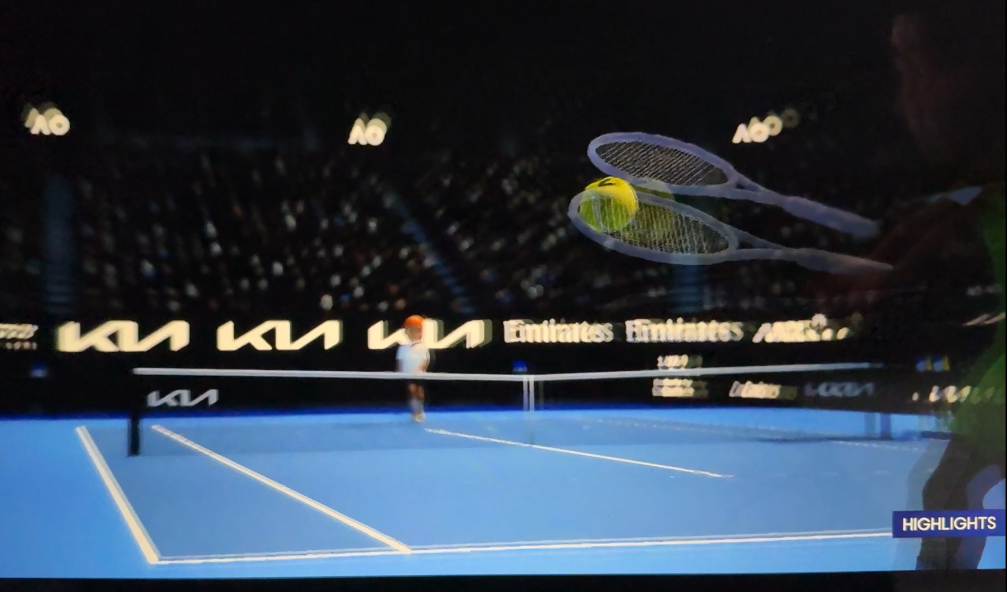
It’s finals weekend at the 2026 Australian Open.
World No 1 Carlos Alcaraz (22, 🇪🇸) survived his marathon 5½ hour 5-setter semifinal match against Alexander Zverev (28, 🇩🇪) 6-4, 7-6 (7-5), 6-7 (3-7), 6-7 (4-7), 7-5.
He will meet Novak Djokovic (38, 🇷🇸) in the final.
Djokovic was not supposed to beat world No 2 Jannik Sinner (24, 🇮🇹) in the semis, but he did: 3-6, 6-3, 4-6, 6-4, 6-4.
In the women’s final Aryna Sabalenka (27) will meet Elena Rybakina (26, 🇰🇿).
P.S. There are AI-animated versions of the matches posted on espn.com in addition to the real ones. Why? Just for fun, I guess. Alcaraz is in green.
The animated players play with an oversized tennis ball. The AI engine is still a work-in-progress when it comes to the finer detail, though— such as showing the hands of the players gripping the racquets.

Every time I look, the gold price is up by hundreds of dollars.
Is there an impending upheaval that buyers of gold expect and that the rest of us are unaware of?
Last year some traders predicted the gold price will cross $5,000 in 2026, and they were right.
It’s only January and it already sits at $5,313.30.
That was +192.70 today.
The stamp from Japan is just for fun.
Even the goldfish looks shocked 😲.
Happy Friday.
It is a major sports weekend for Seattle— the Seahawks face the Los Angeles Rams this Sunday for the NFC Championship and a spot in Super Bowl LX.
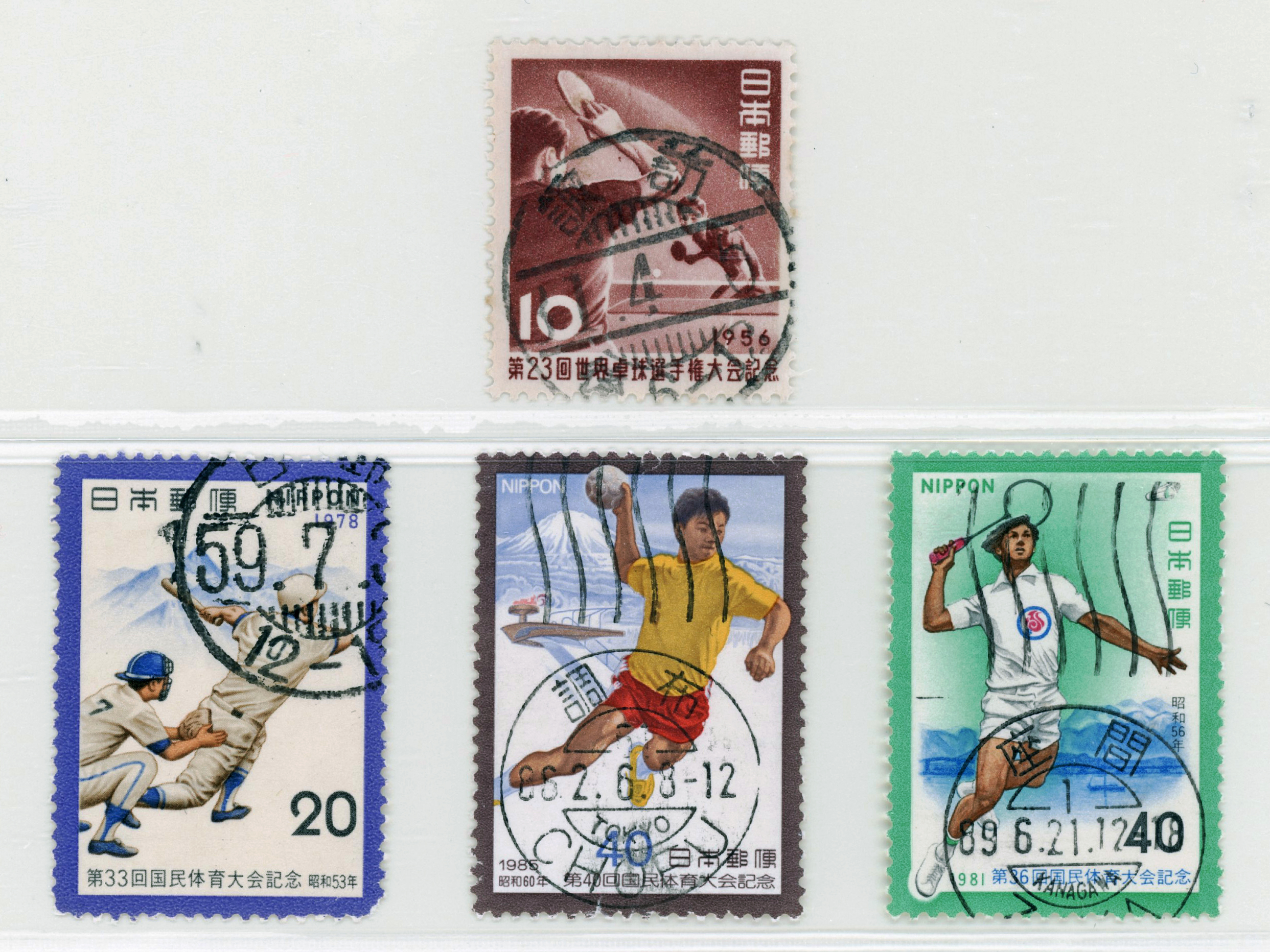
I spent a lot of time this week sorting the hundreds of loose stamps I had bought in Tokyo, by year. Here are some ones with nice postmarks and a sports theme.
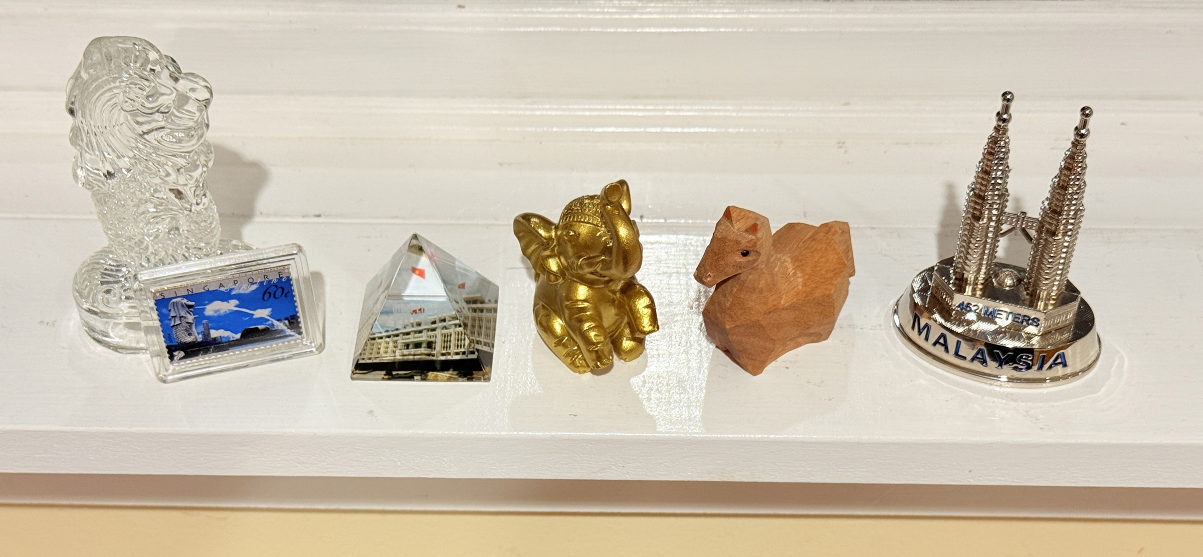
These little souvenirs out of my suitcase are doing duty on in the kitchen window for a week or two.
They will join the many others I already have, in the display cabinet.
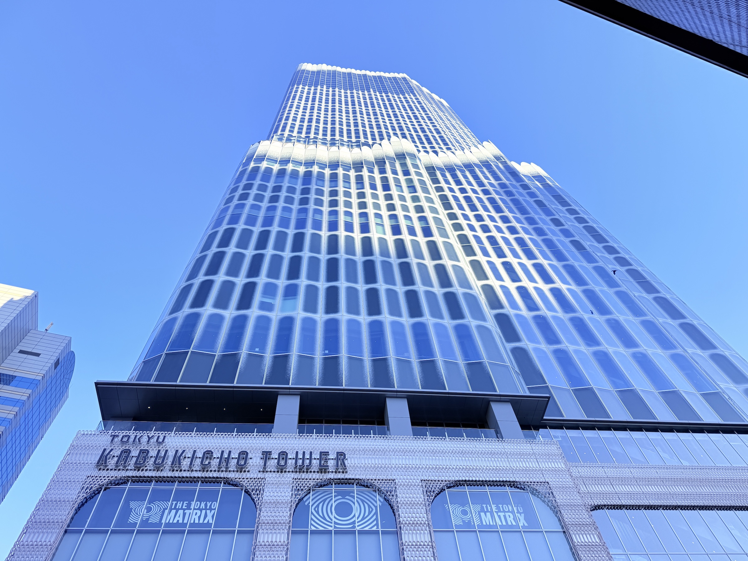
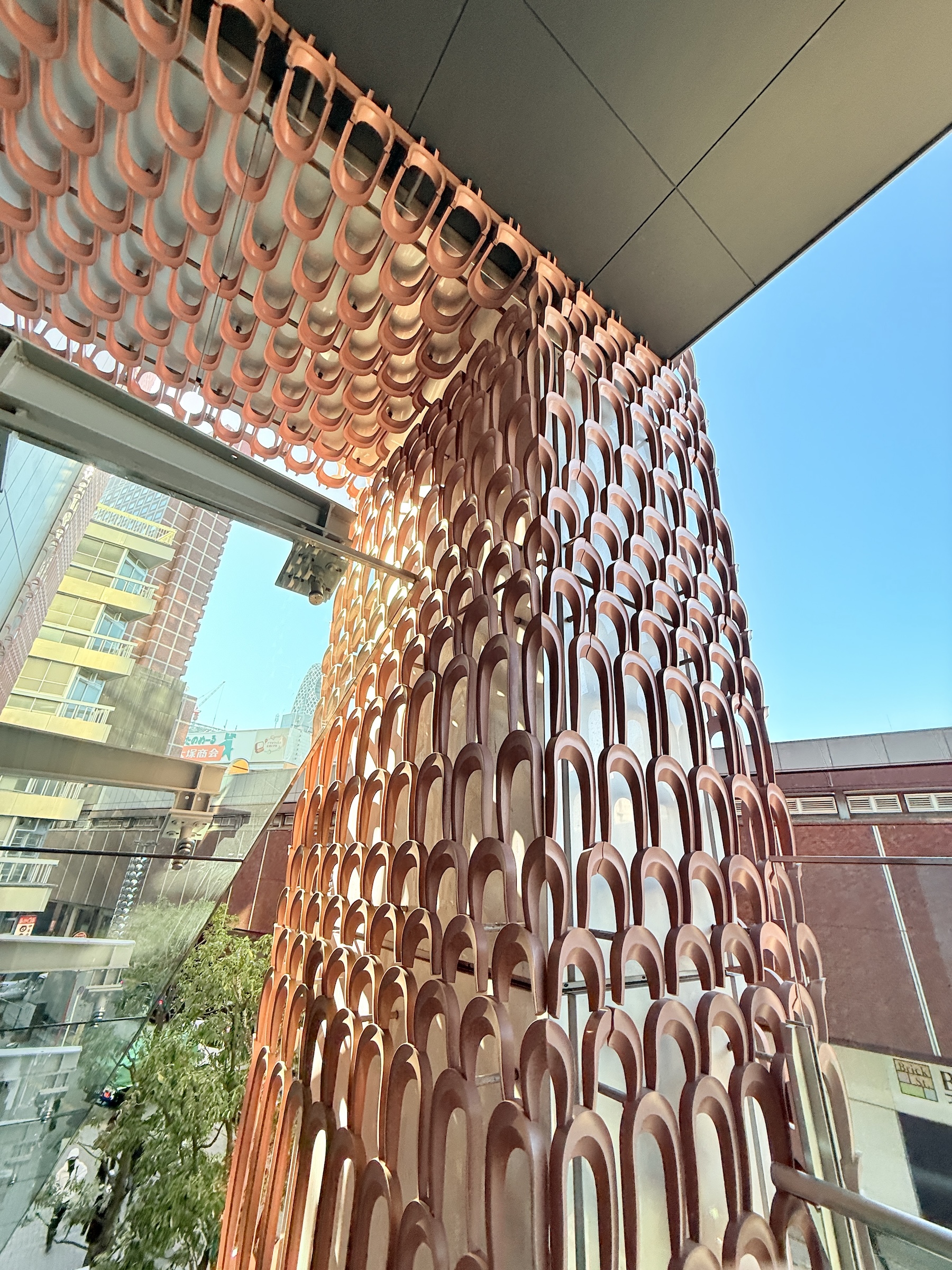
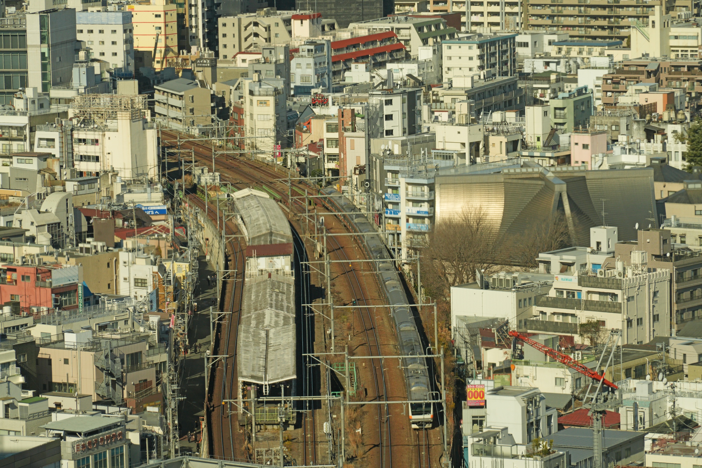
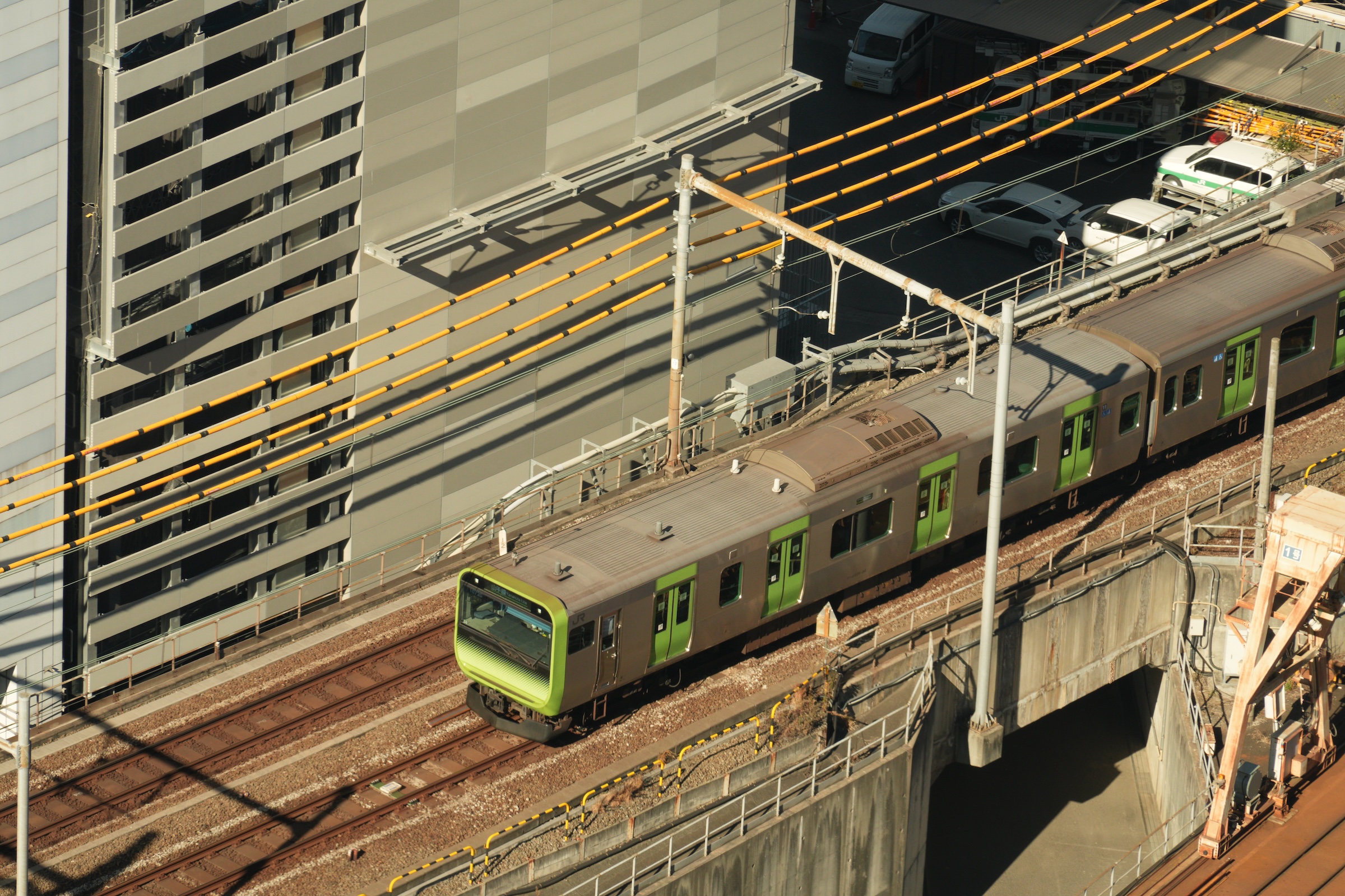
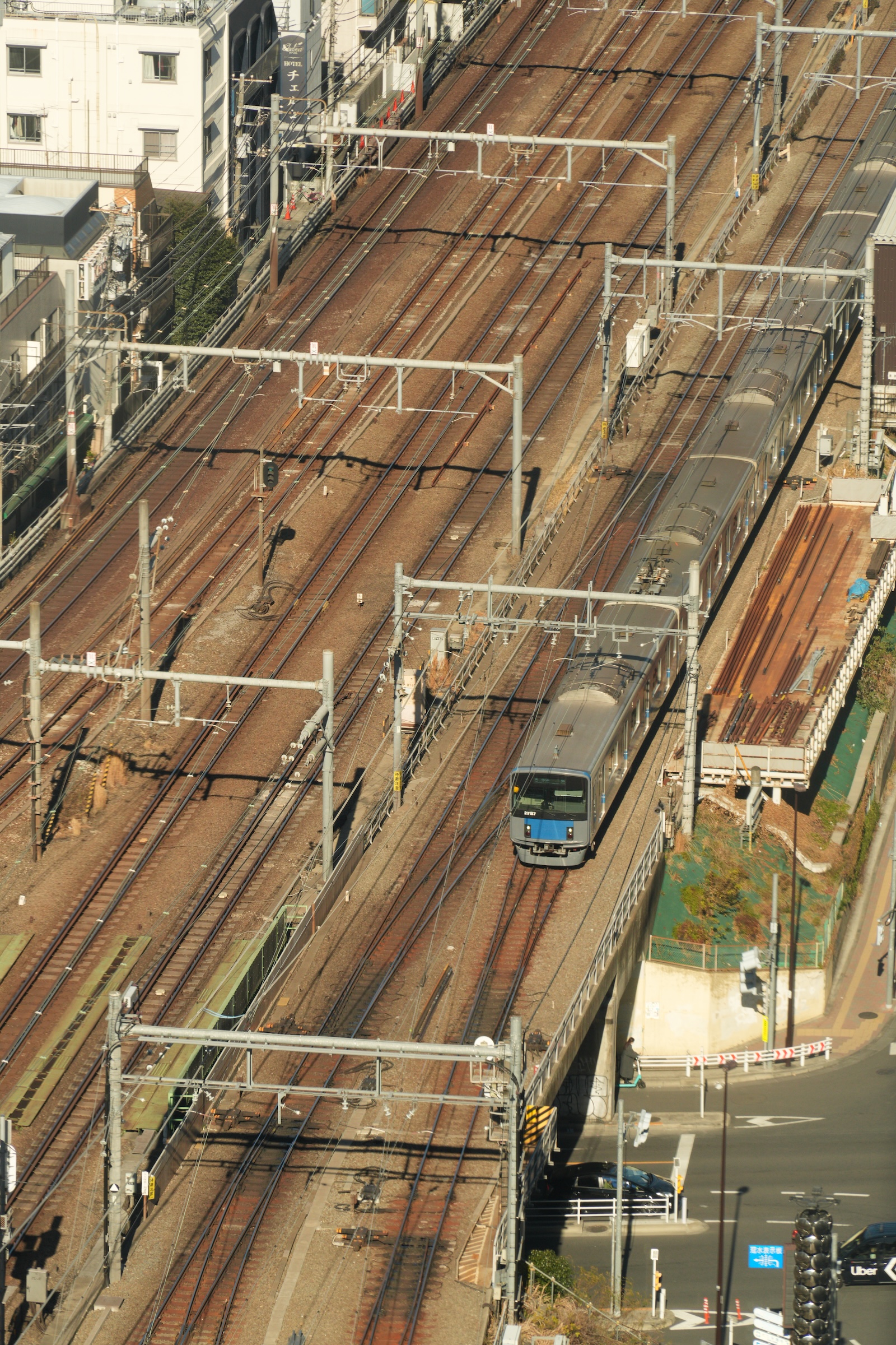
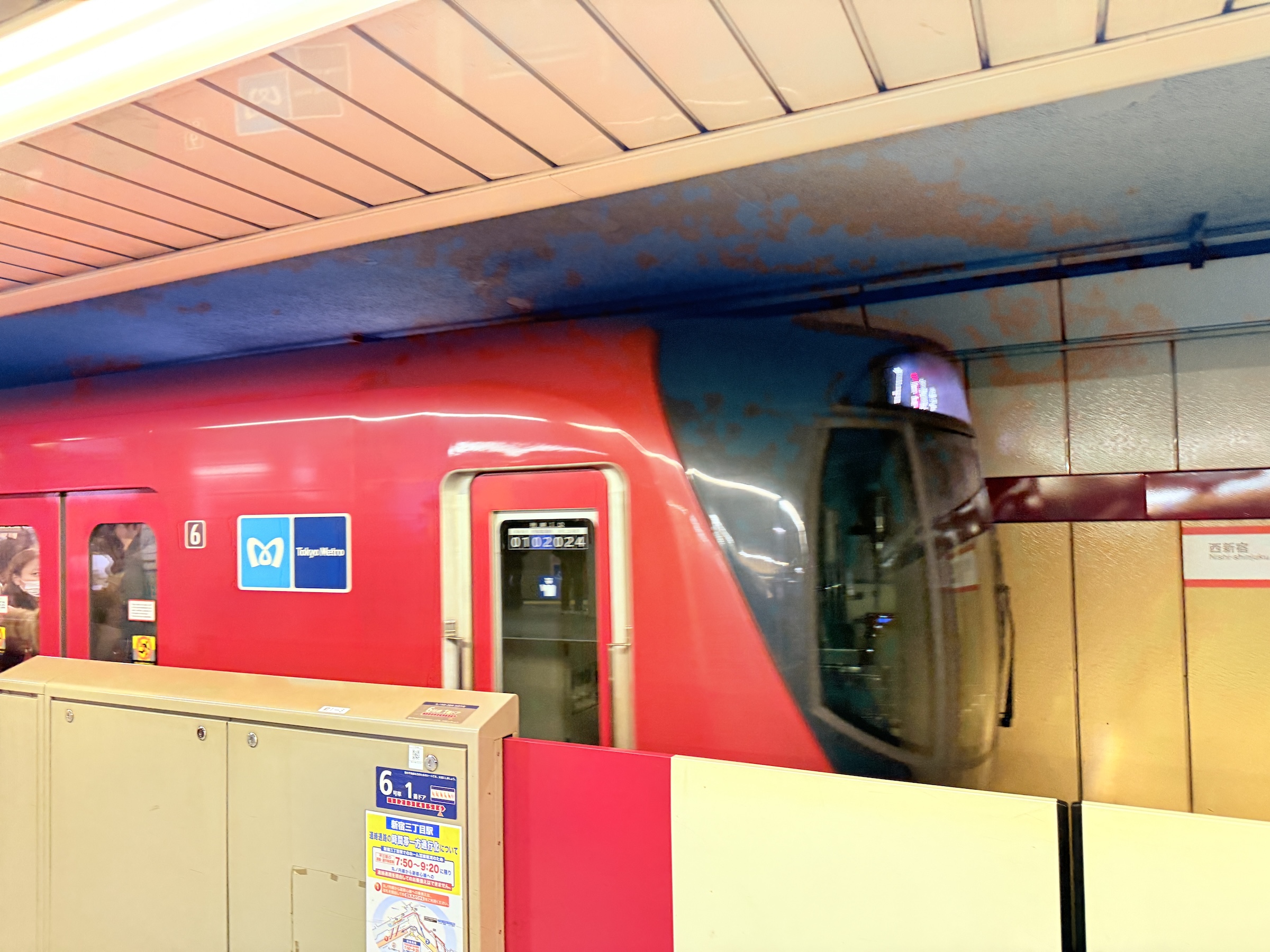
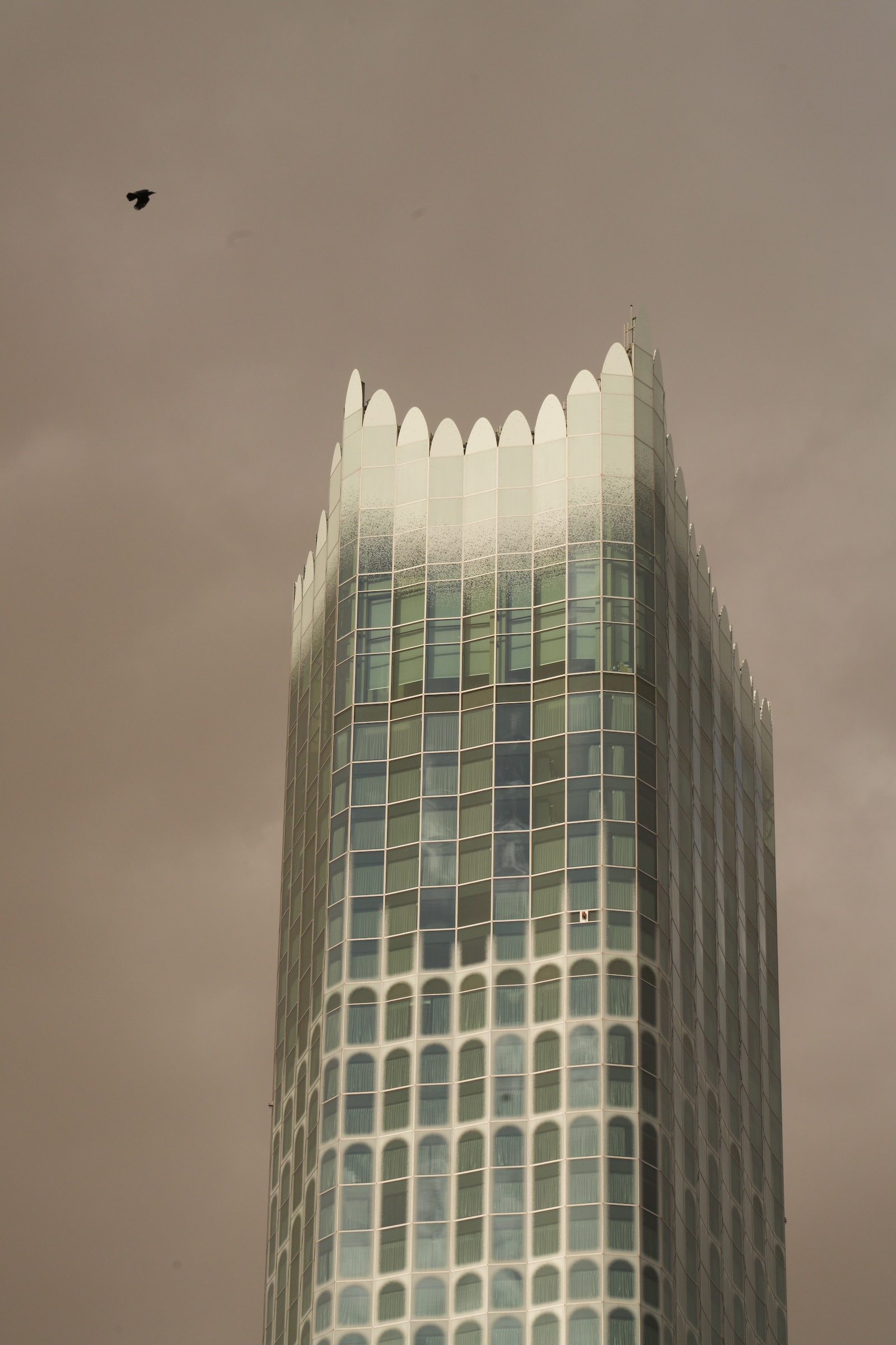
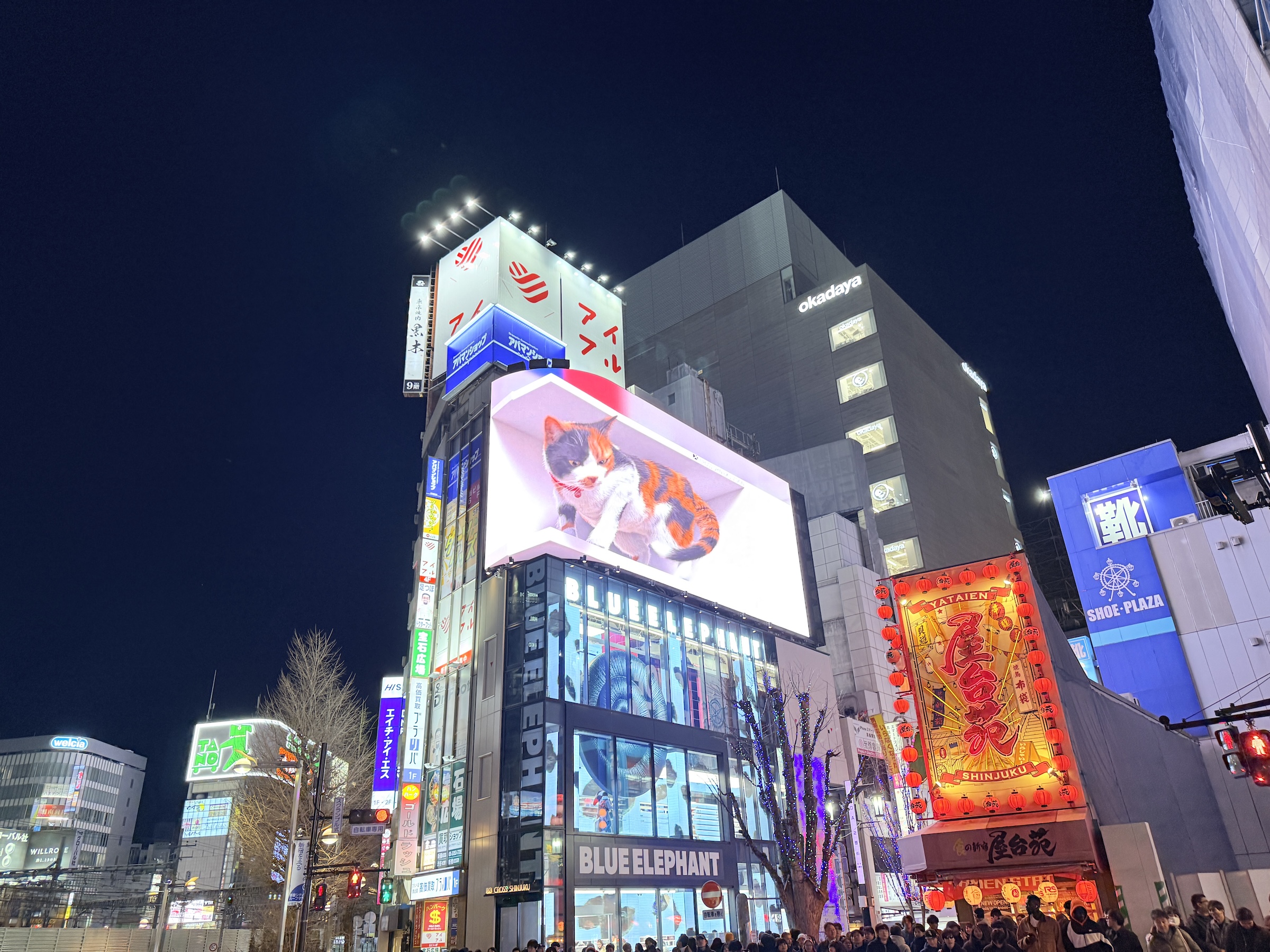
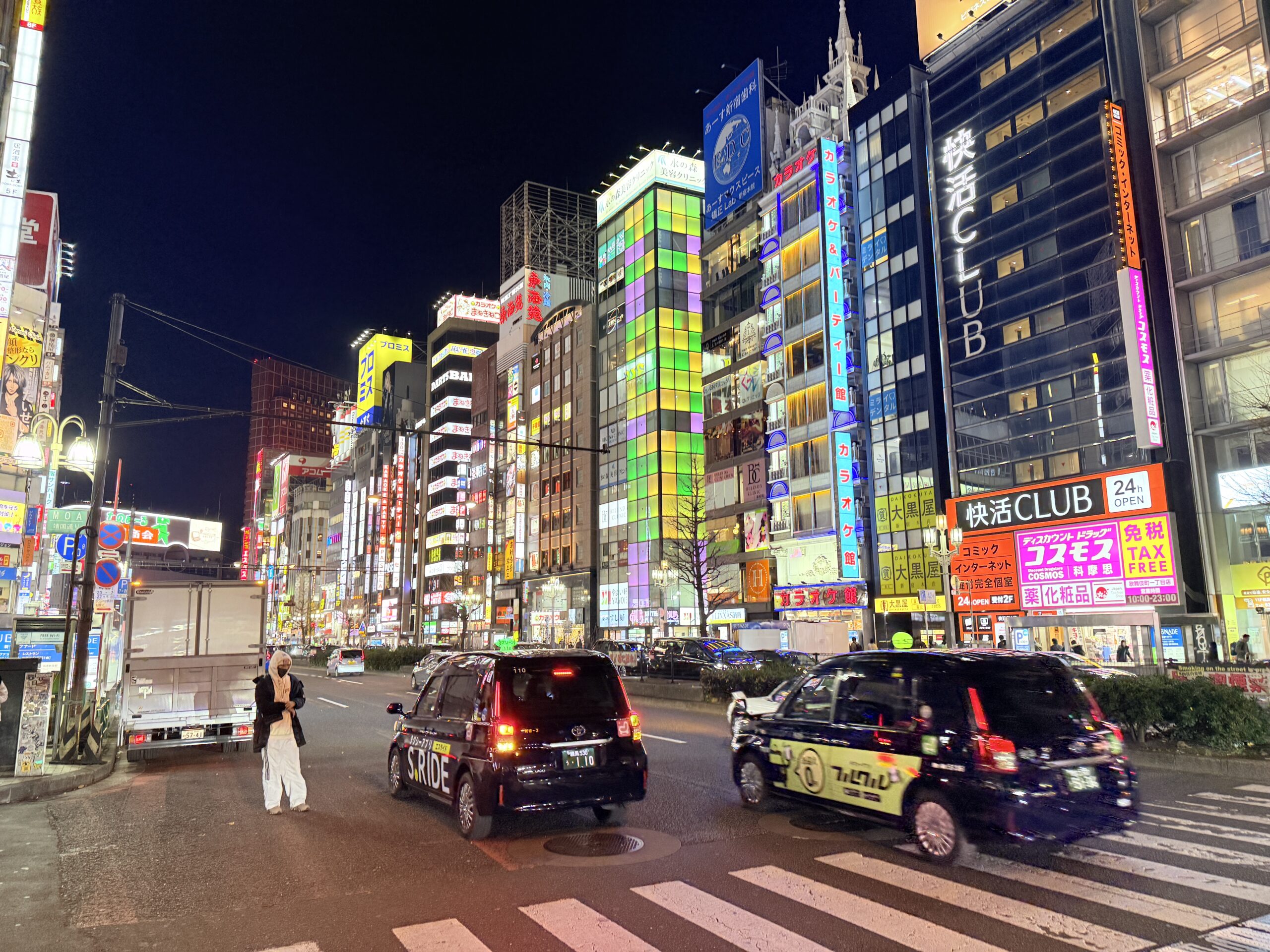
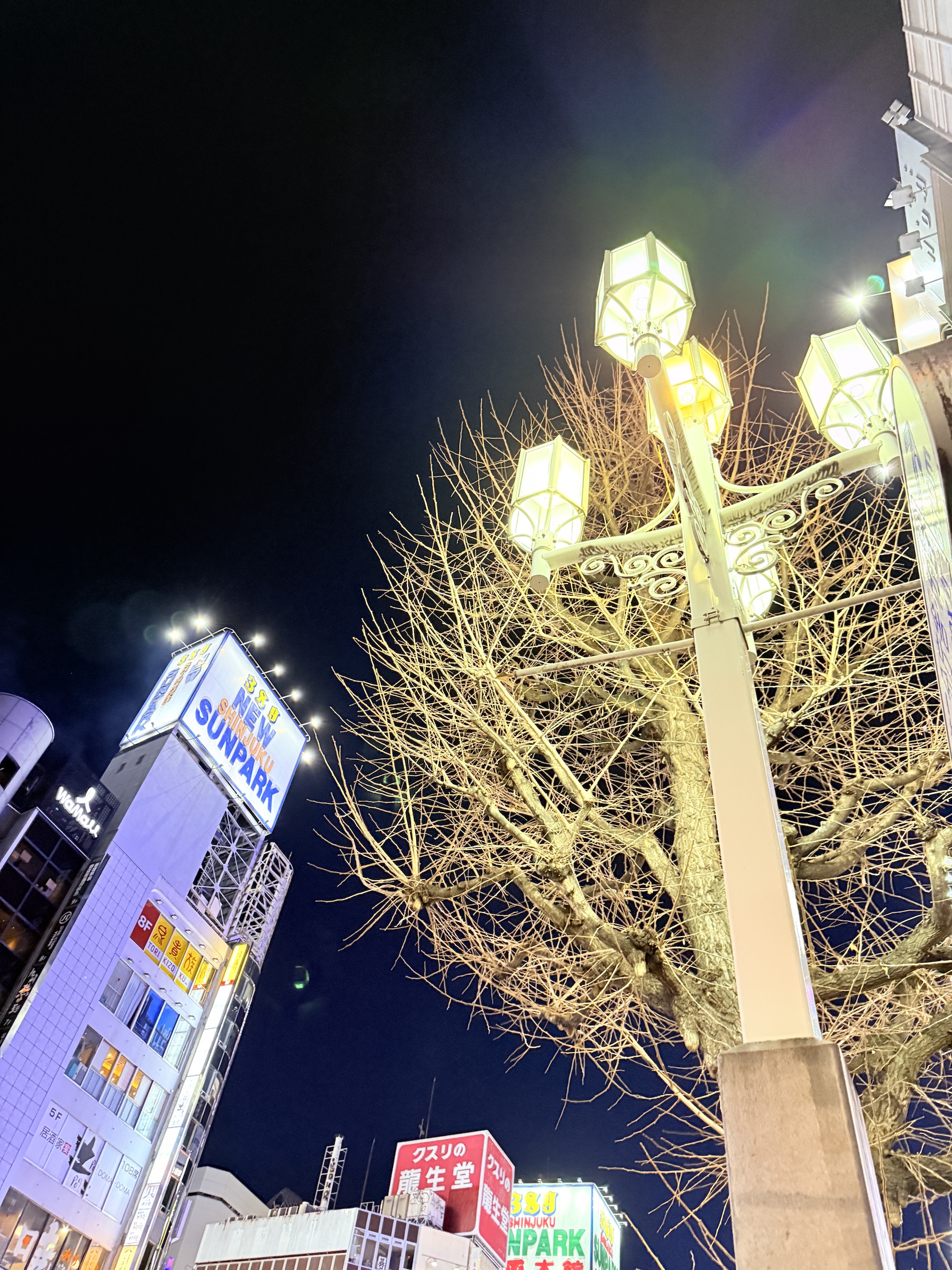
On Monday I went up to the 17th-floor observation deck of the Kabukicho Tower. It offers a nice view of the trains running into and out of Shinjuku station.
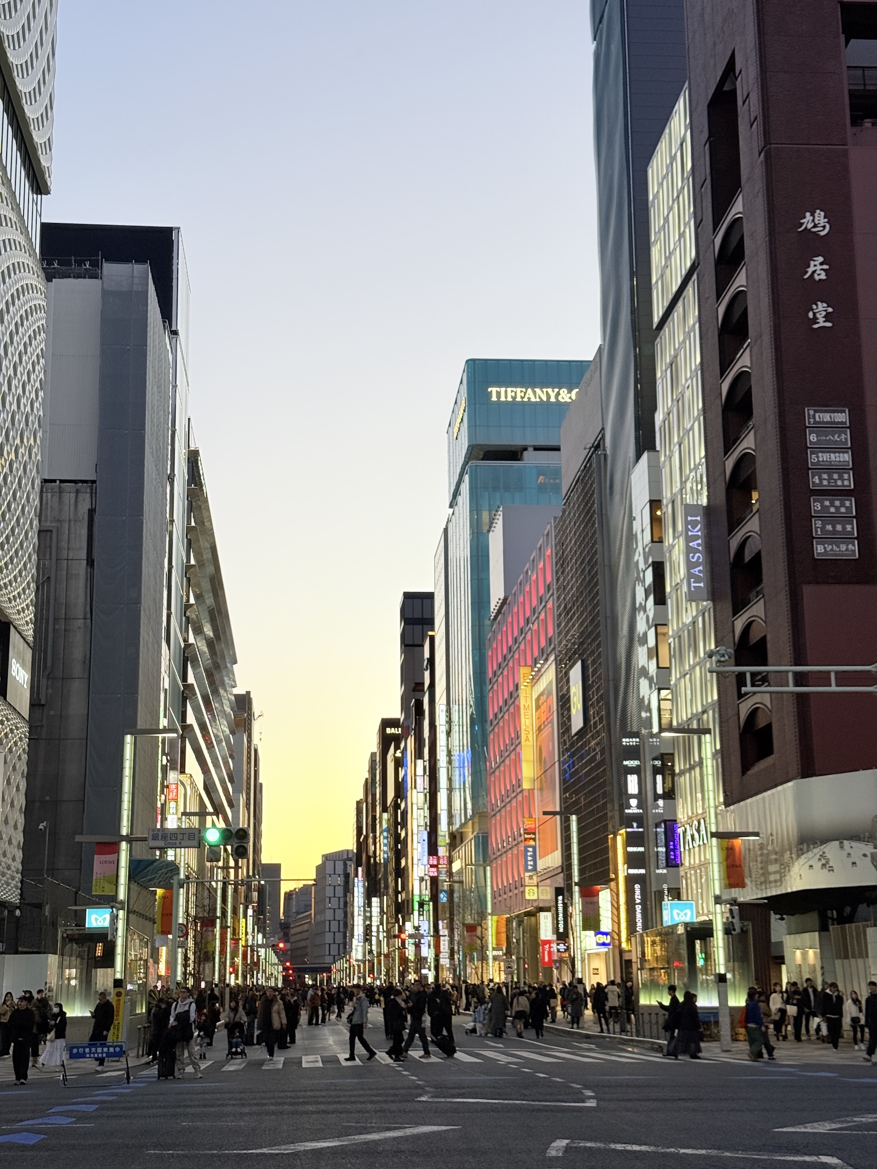
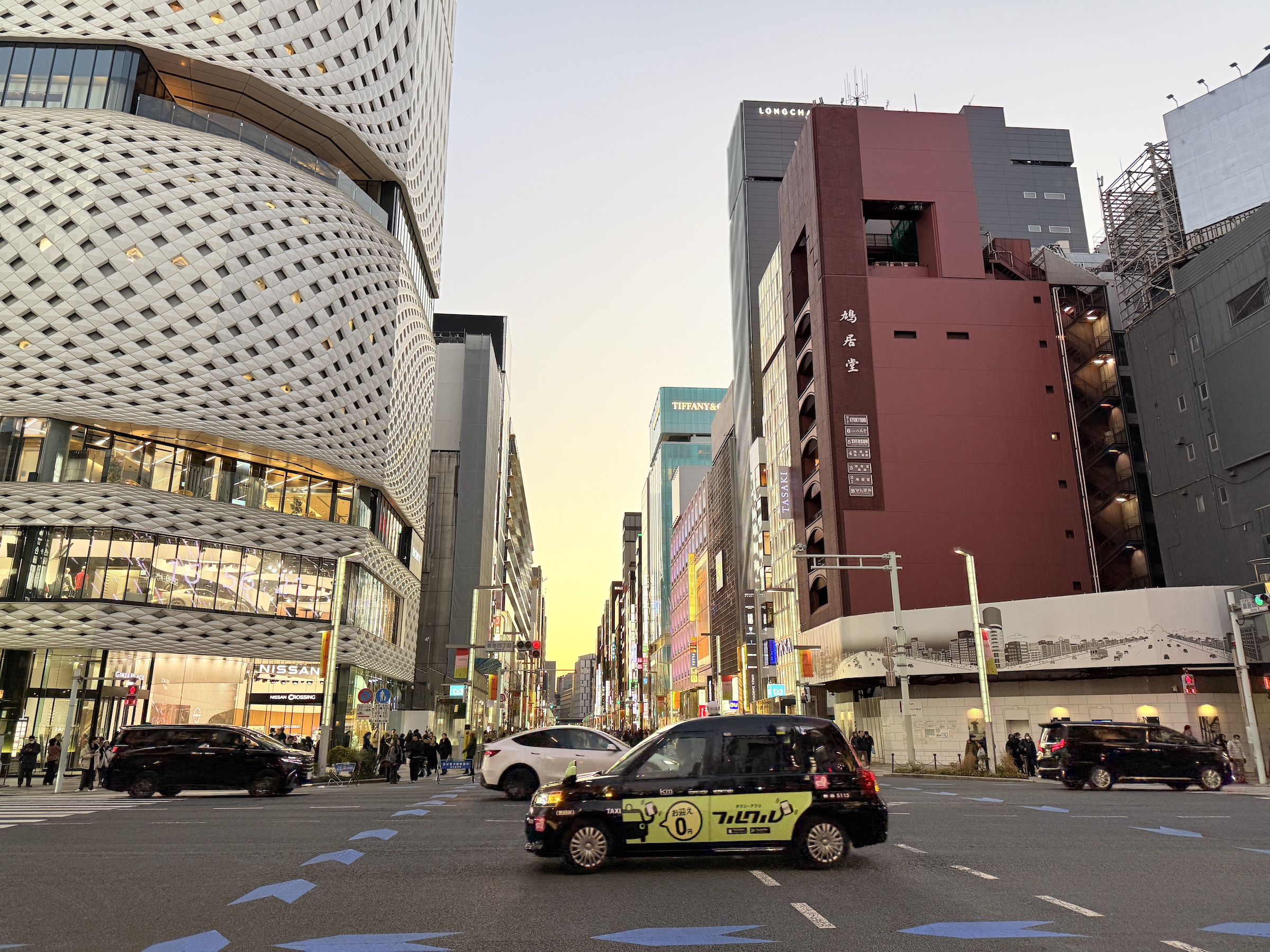
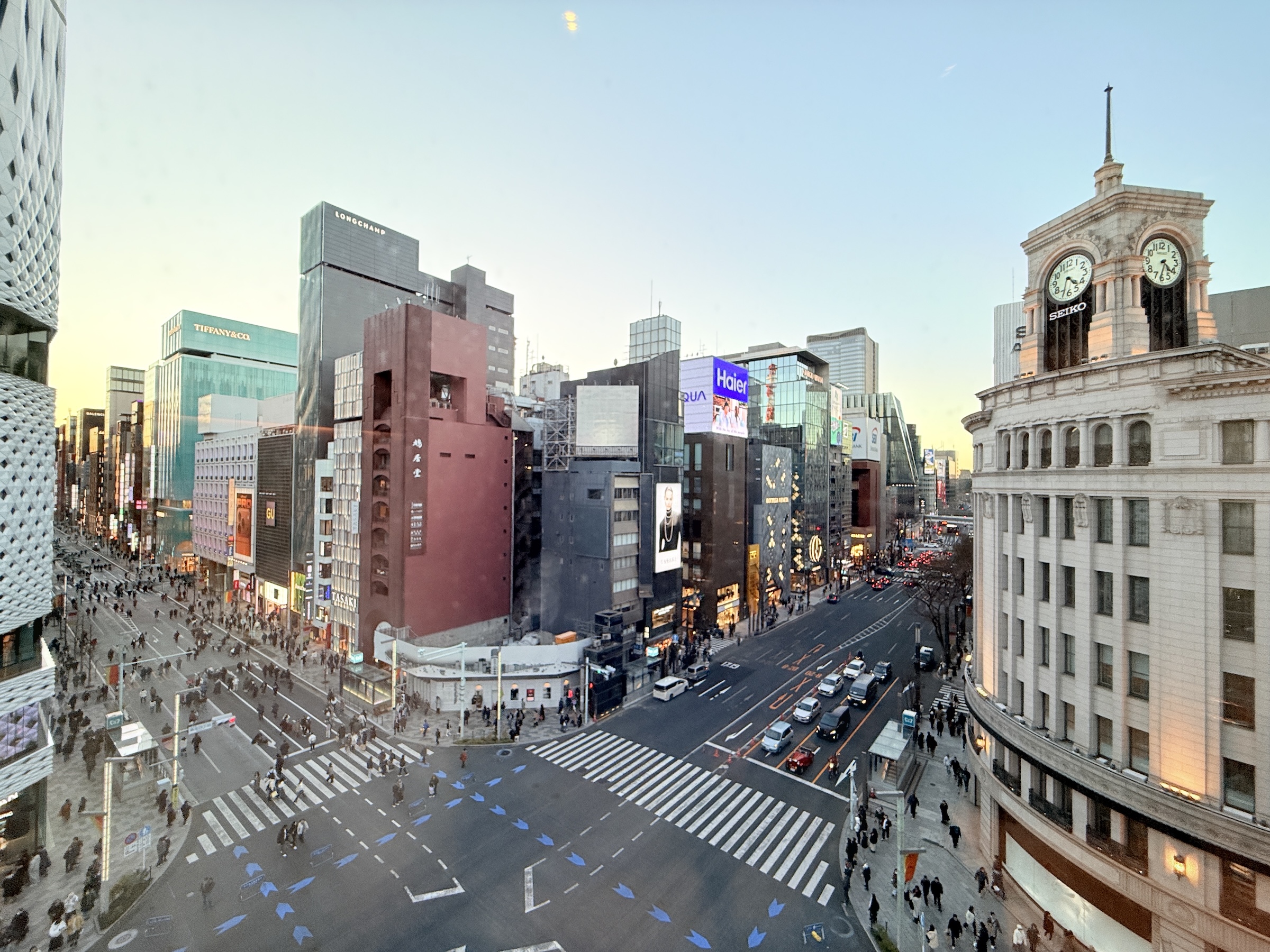
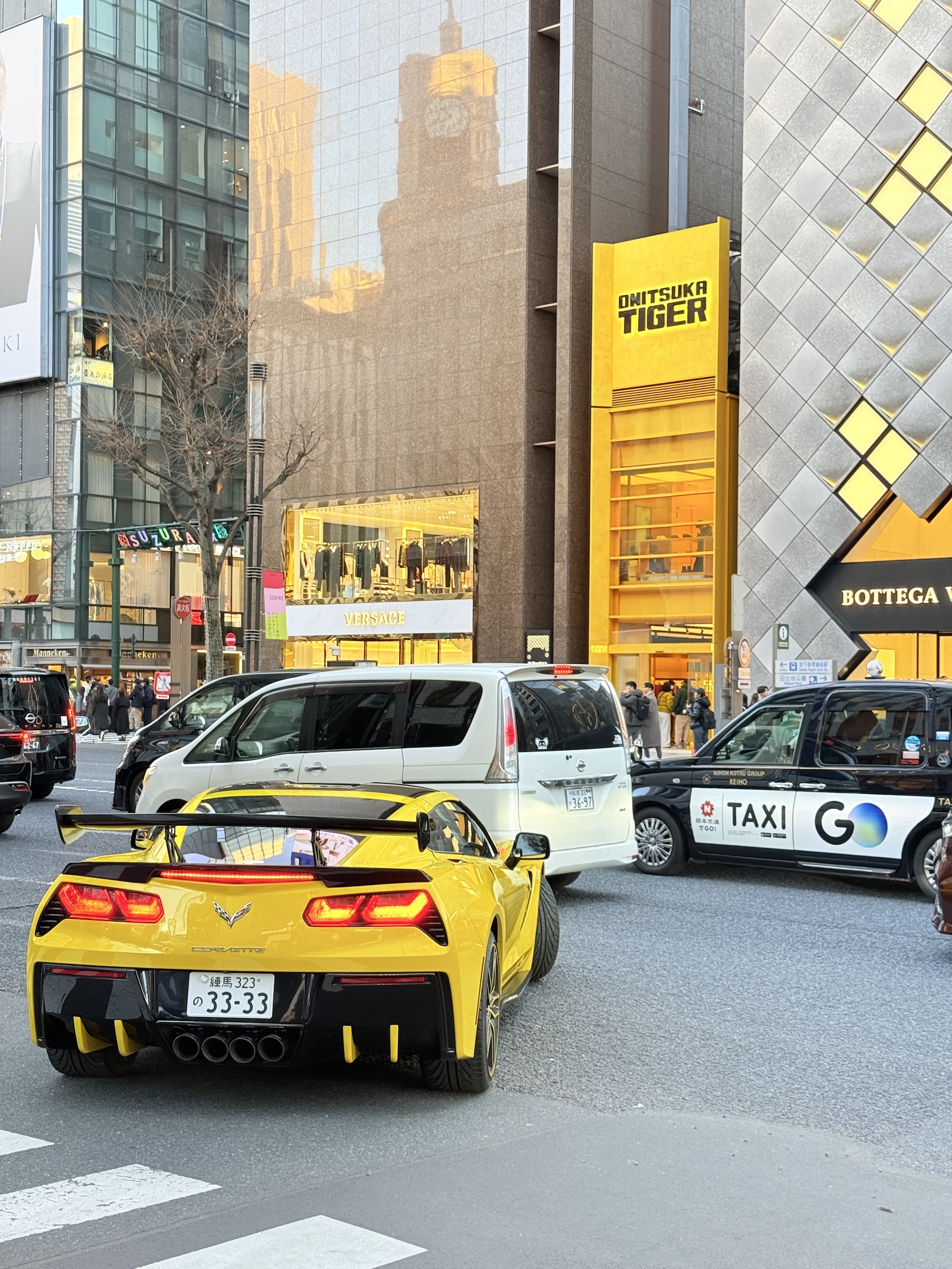
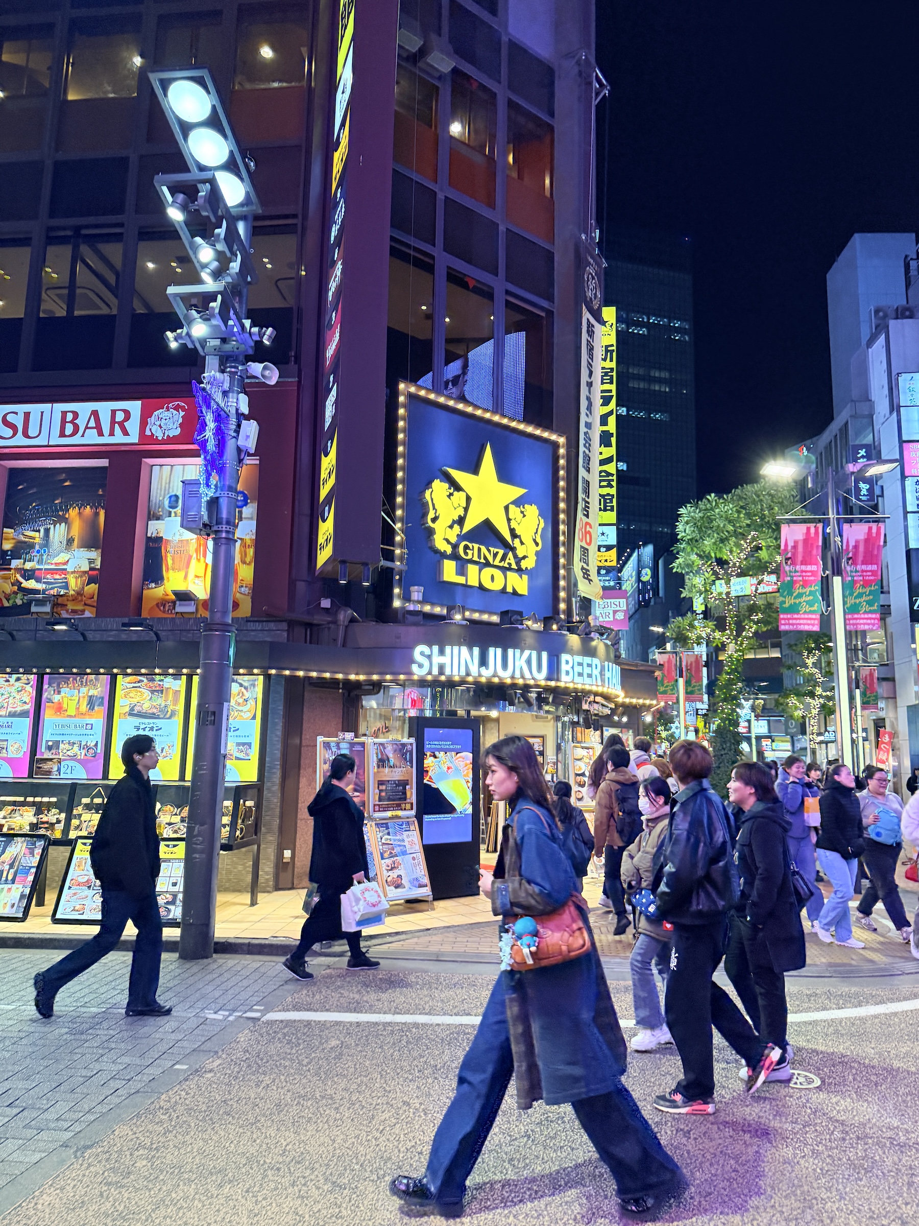
The other photos are from Ginza shopping district around sunset.
Everything in Ginza is art— the buildings, the lamp posts, the manhole covers in the pavement, all the way down to the metro stations below ground.
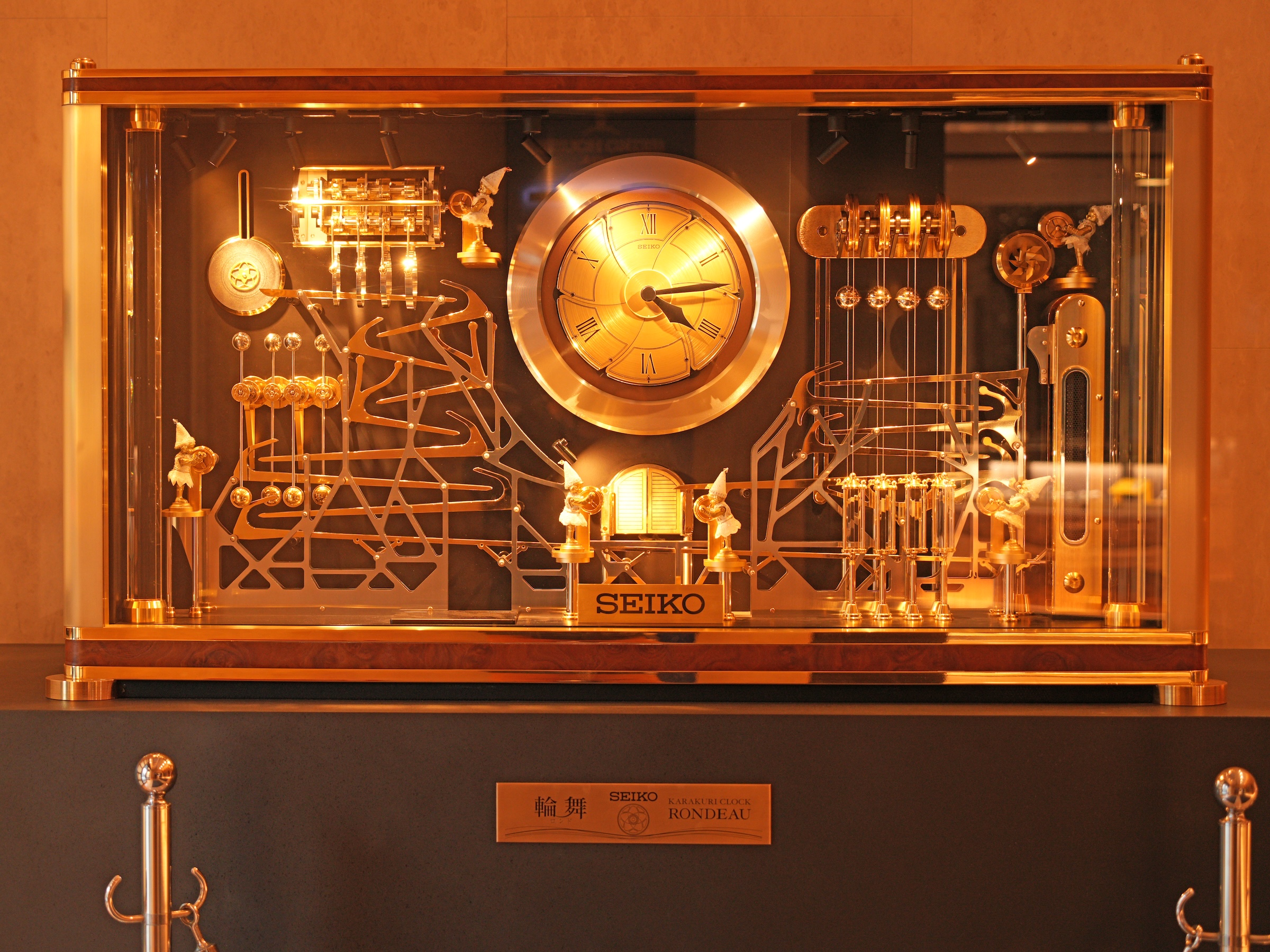
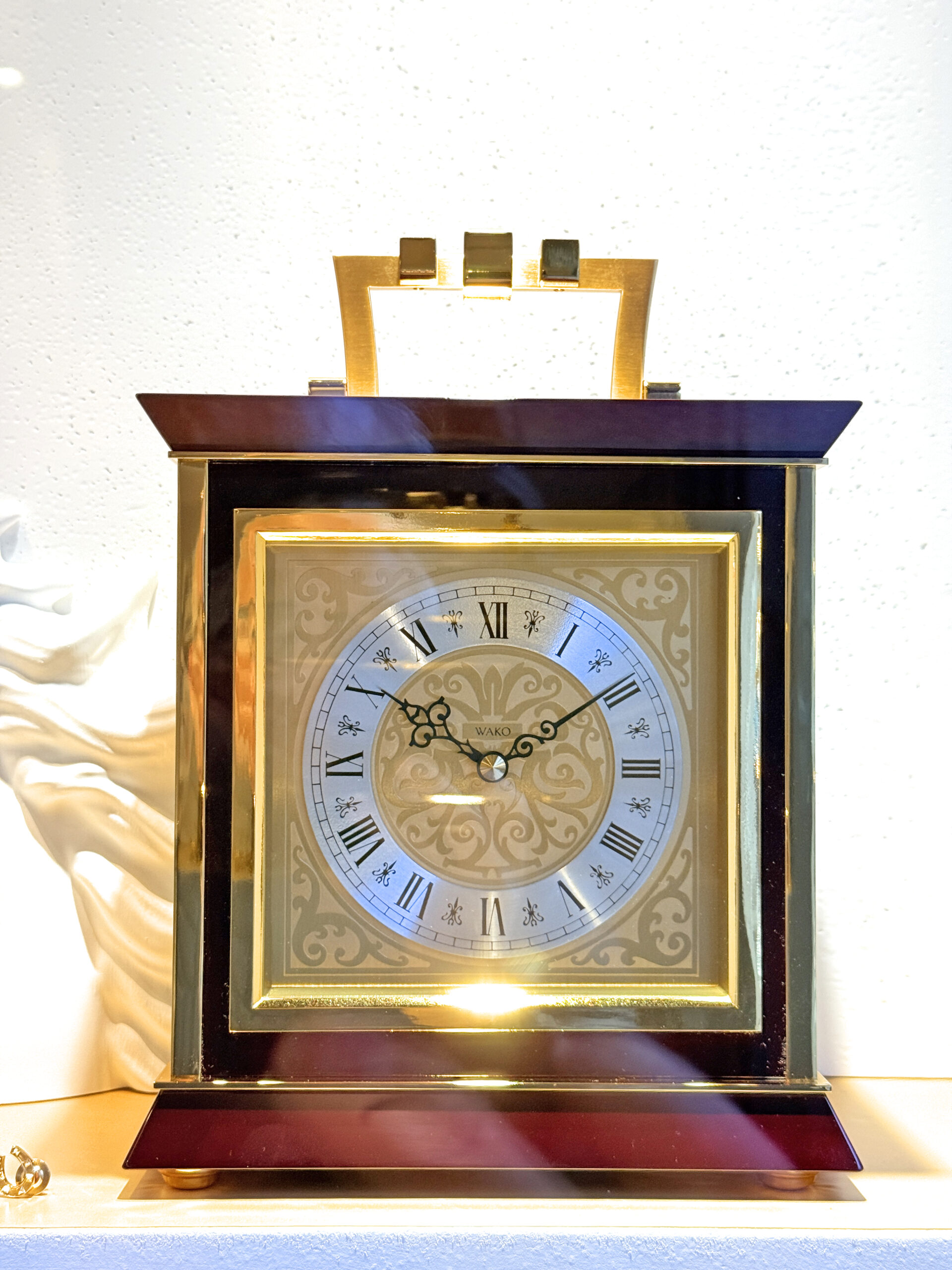
The clocks are from inside the Wako Building, owned by Seiko watch corporation.
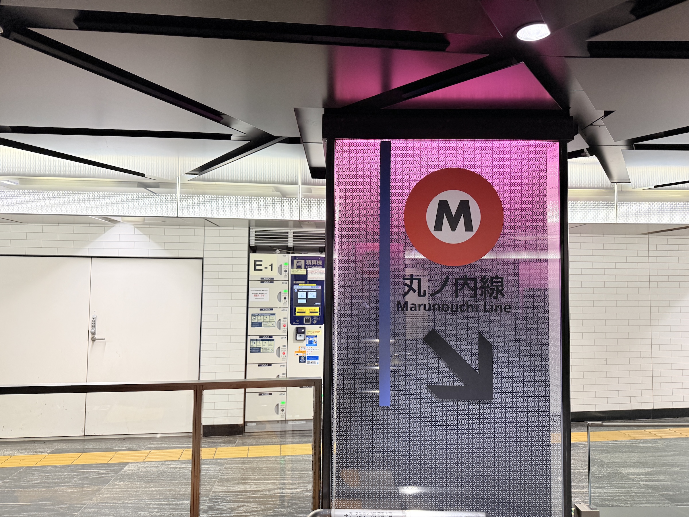
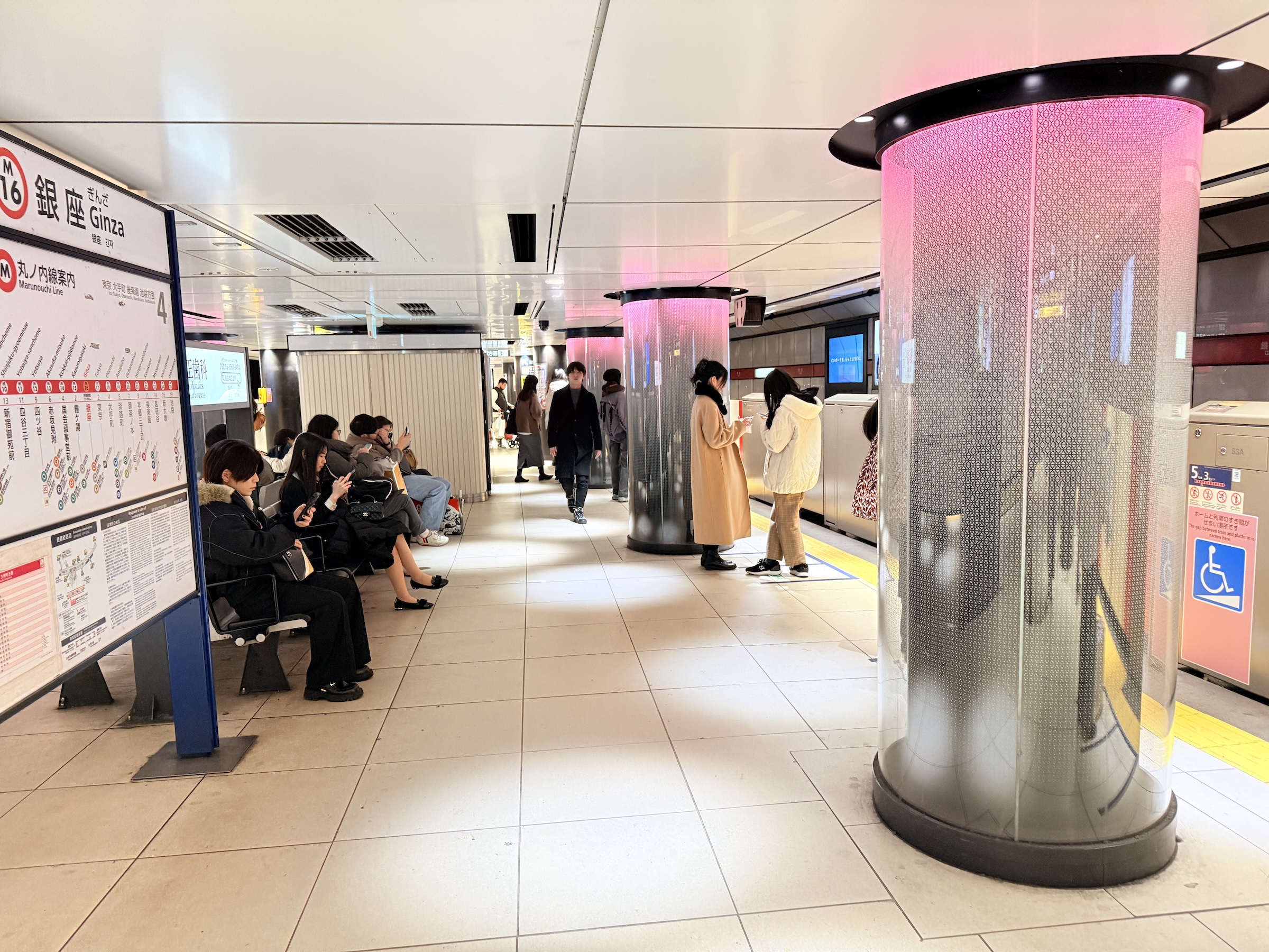
I took the Marounochi Line back to Shinjuku just before the onset of rush hour (rush hour starts at around 5.30 pm).

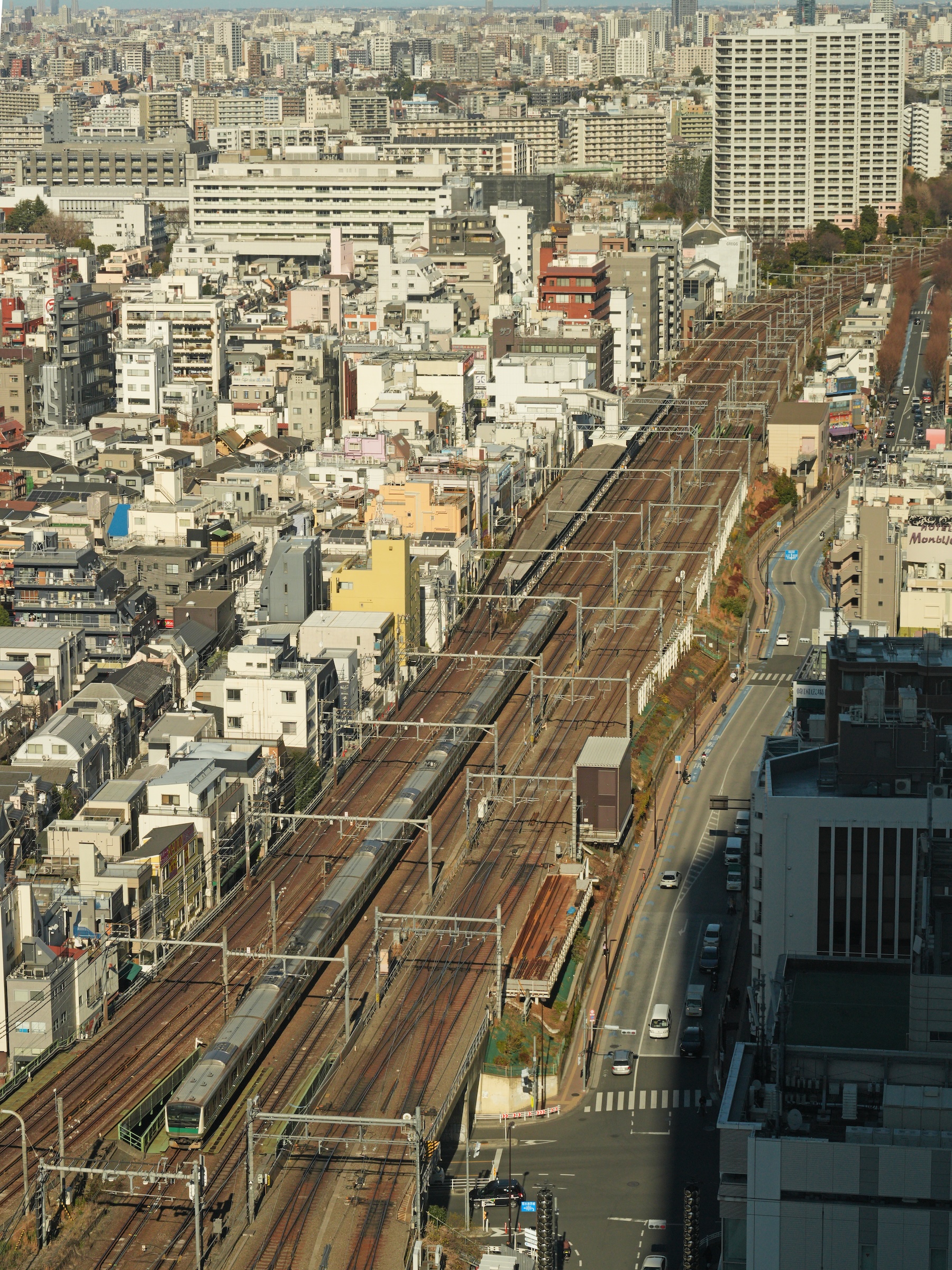

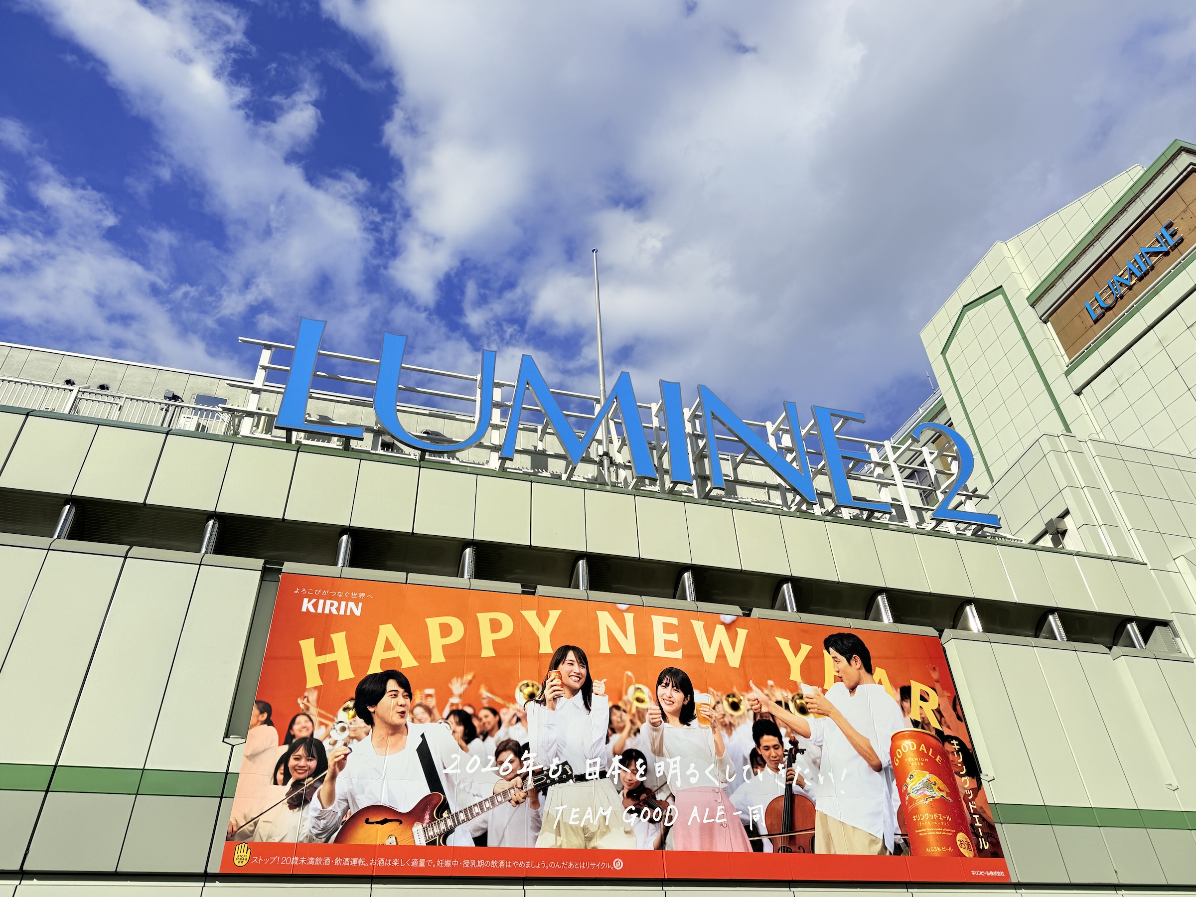
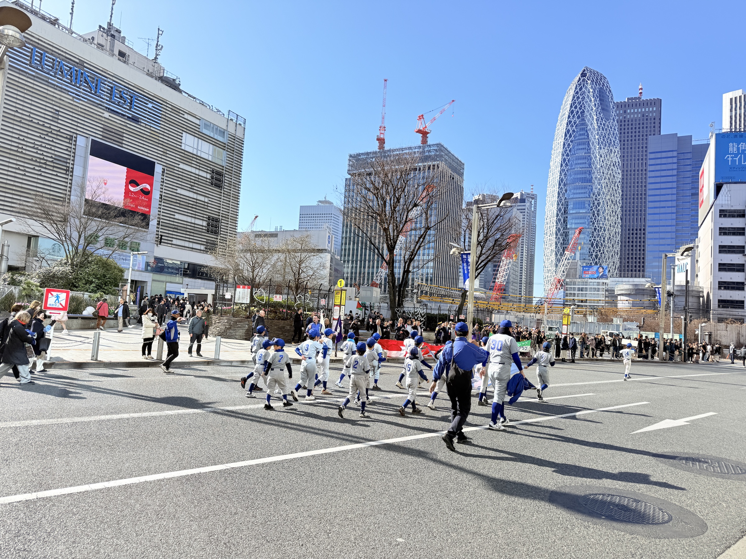
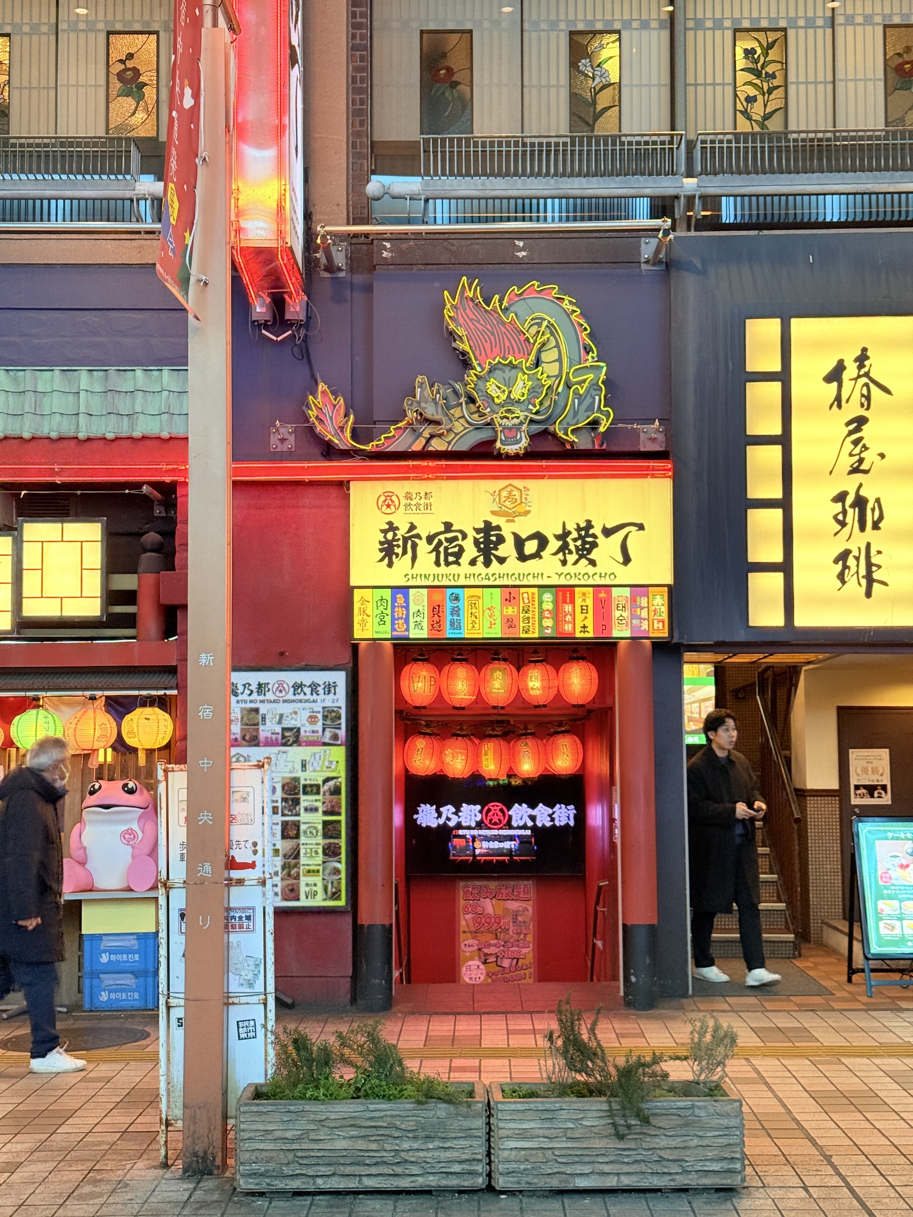
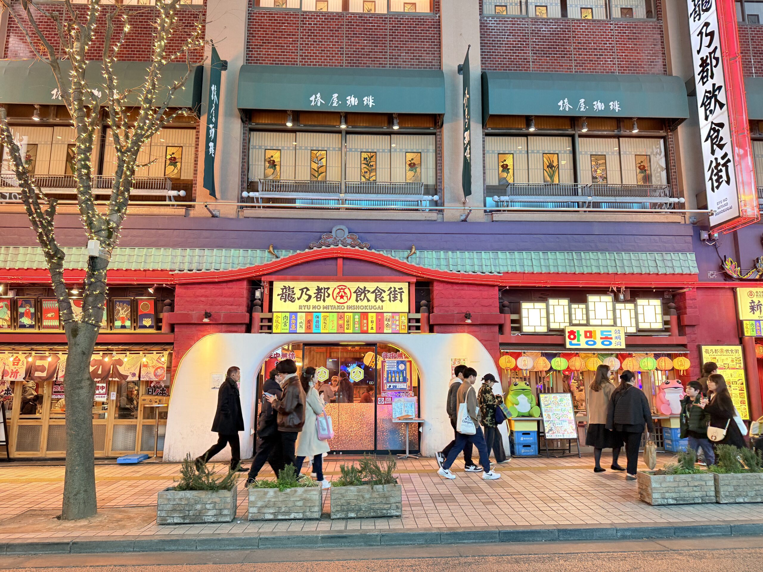
Sunday was bright and mild (57 °F/ 14 °C) here in Shinjuku.
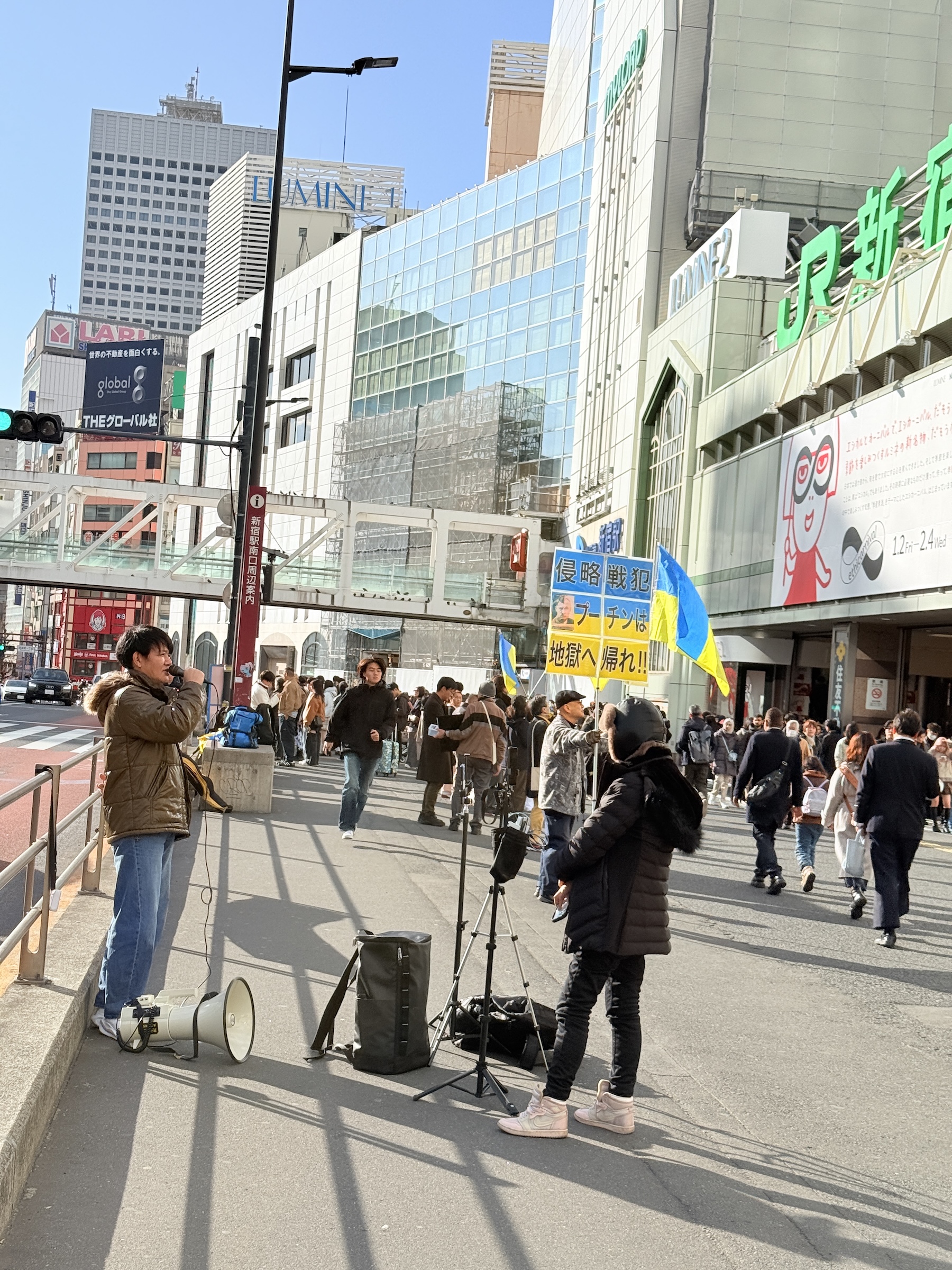
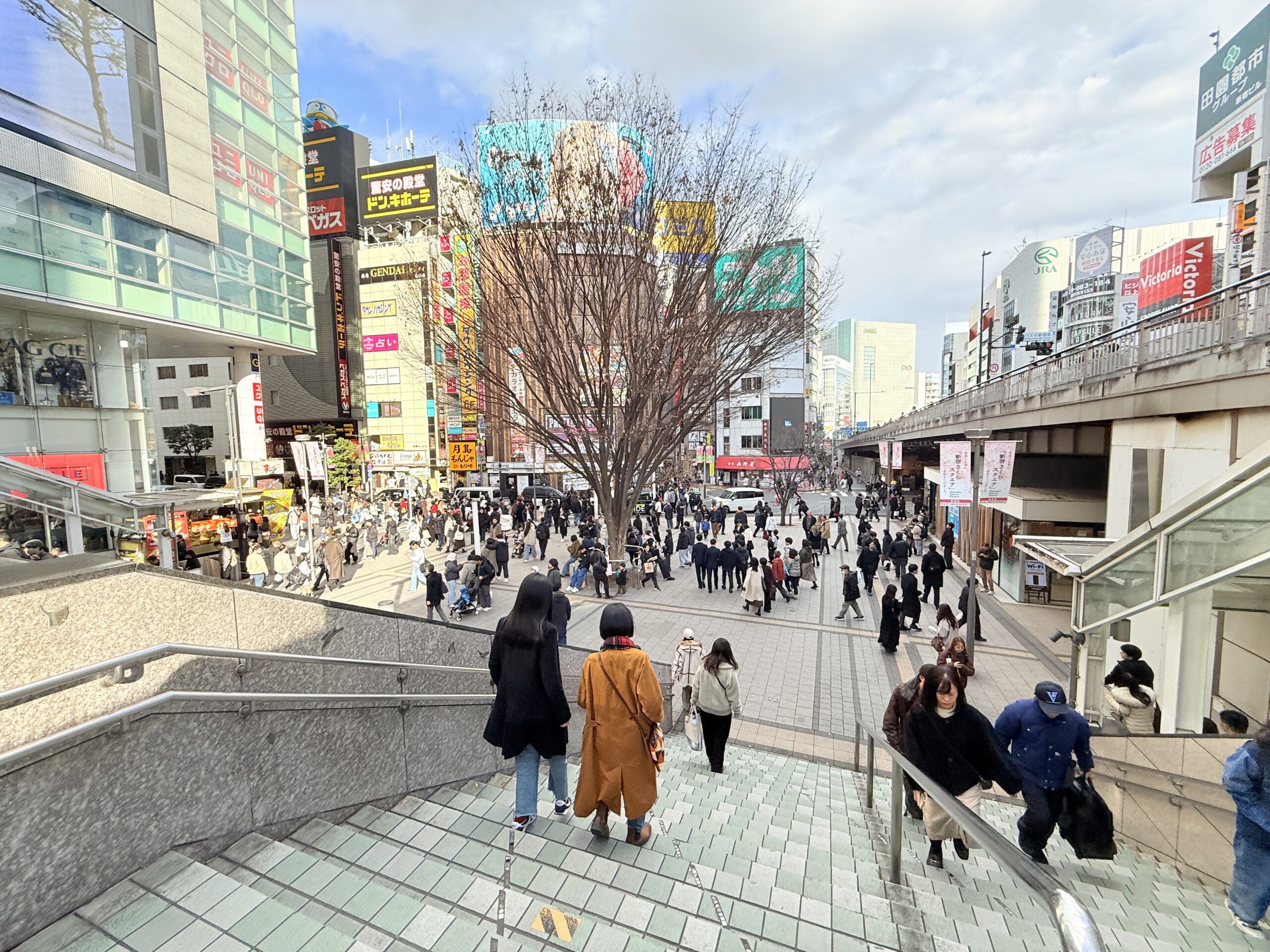
The streets around Shinjuku station were closed for traffic all day.
A little parade of sorts came by, featuring bands and groups for firefighter and disaster support, and little league baseball teams. Elsewhere there was a protest for the war in Ukraine (offering support for Ukraine).
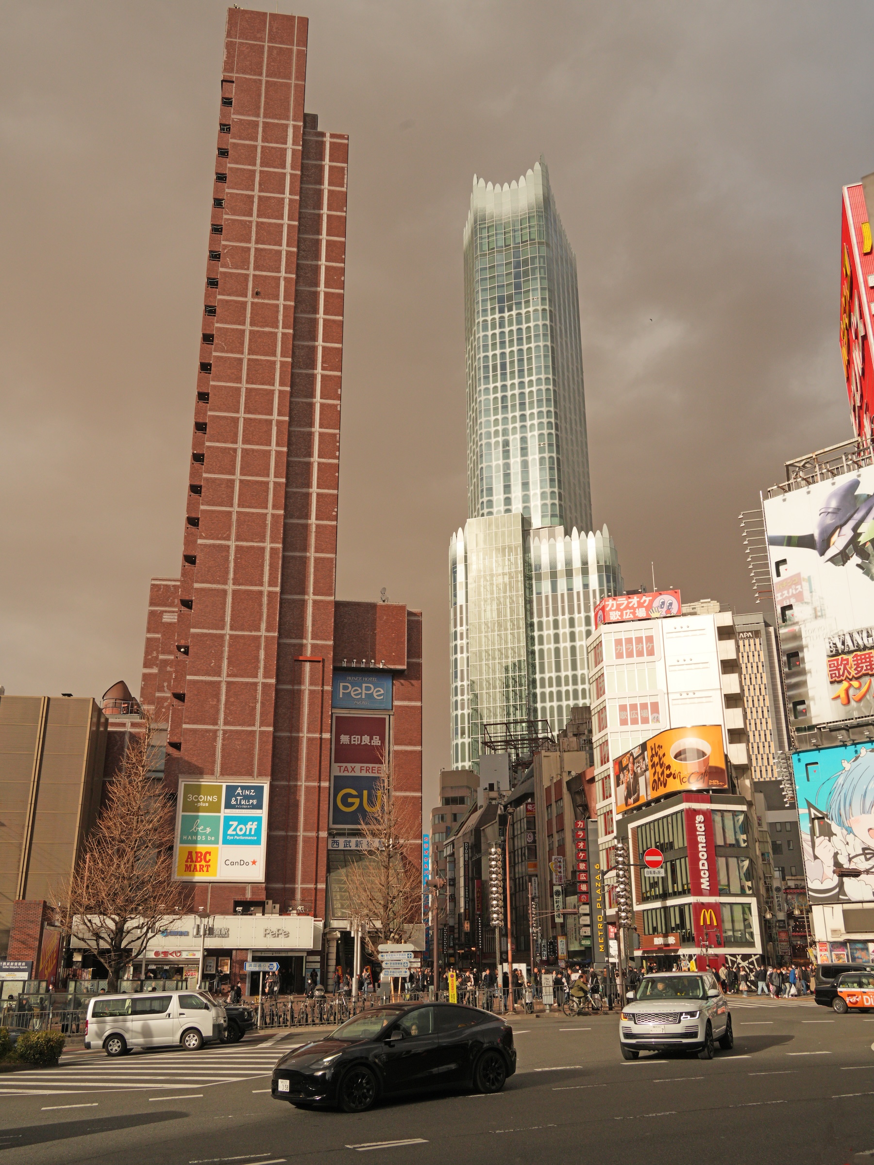
There are a Teslas on the streets, but not many. In the picture with the black Tesla, the hotel is on the left.
The beautiful building with the wavy top is Tokyu Kabukicho Towerー 48-story skyscraper completed in 2023. It was designed by Yuko Nagayama & Associates and developed by Shimizu Corporation. [Wikipedia]
At Shinjuku Station’s East Exit, the giant 3D cat is still there, entertaining crowds near the crosswalk for Studio Alta.
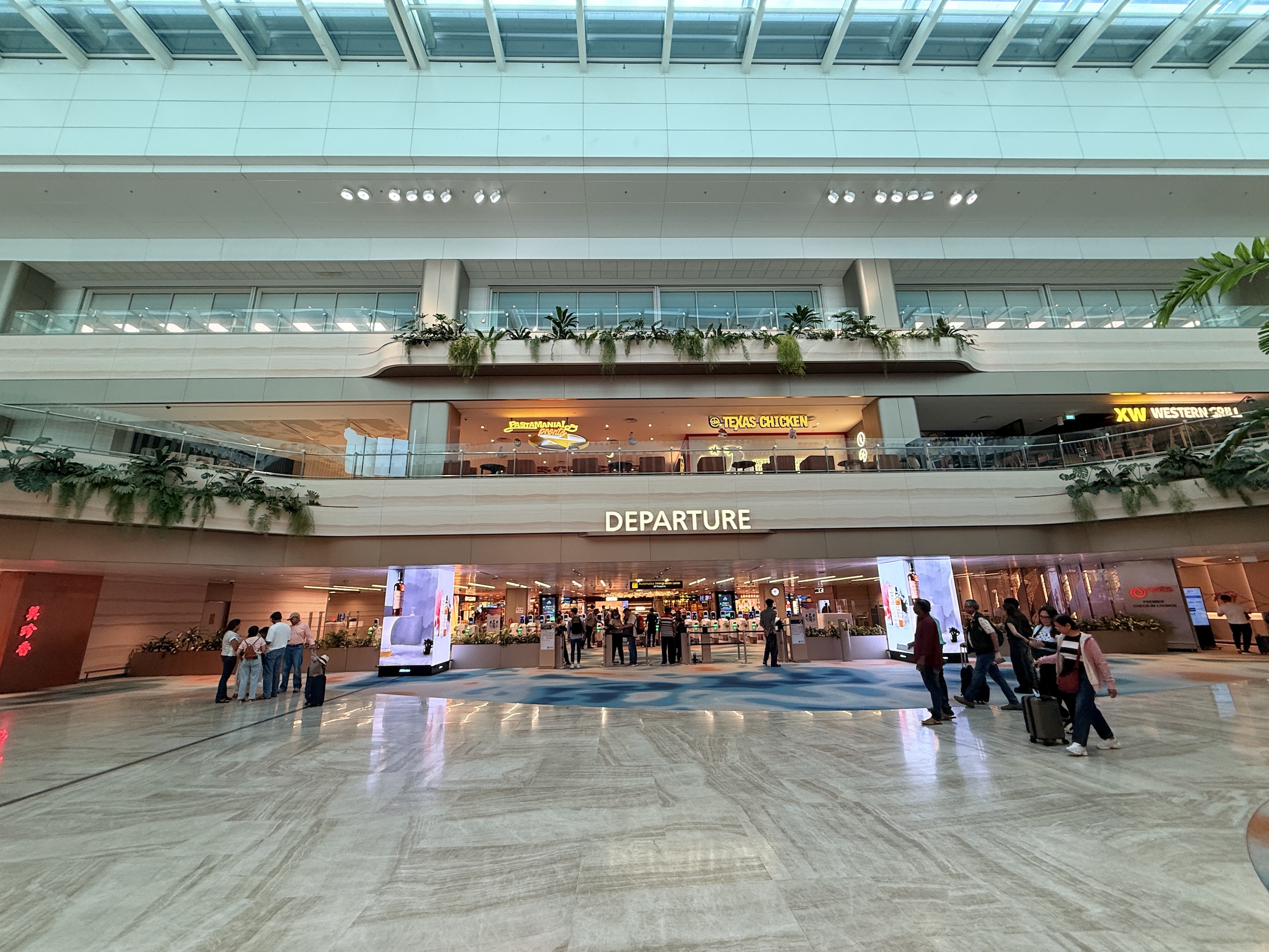
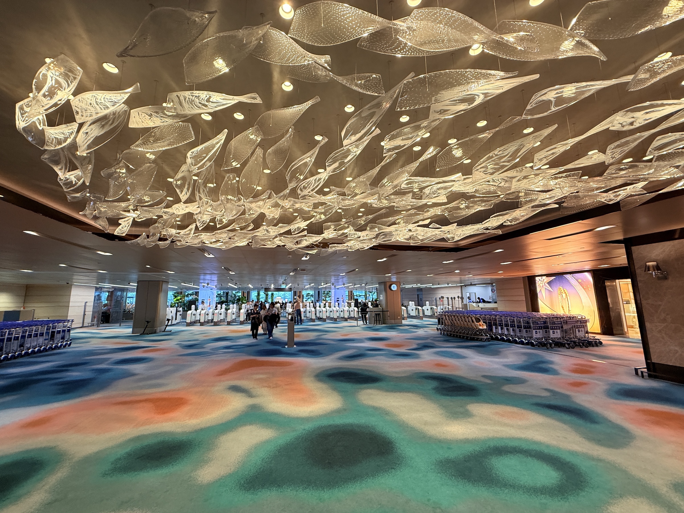
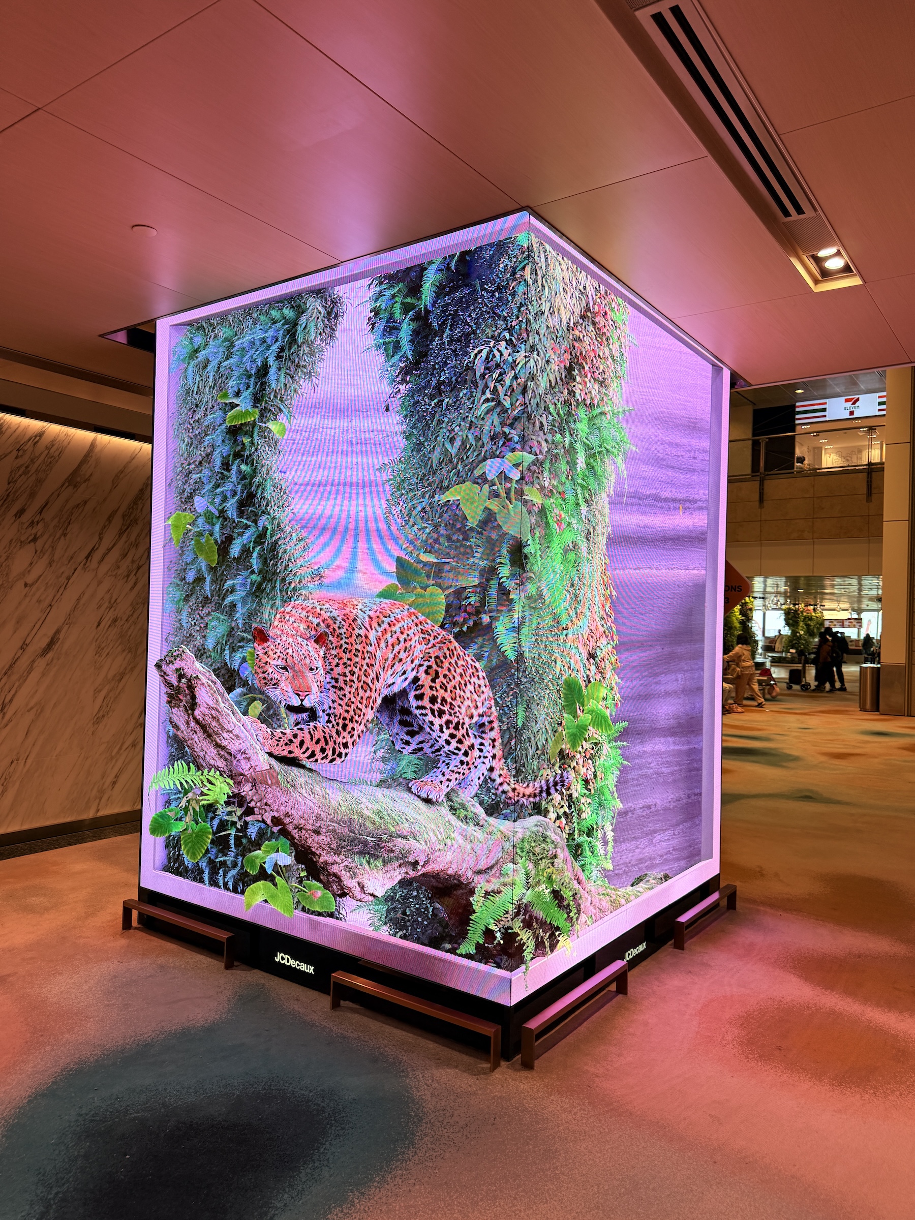
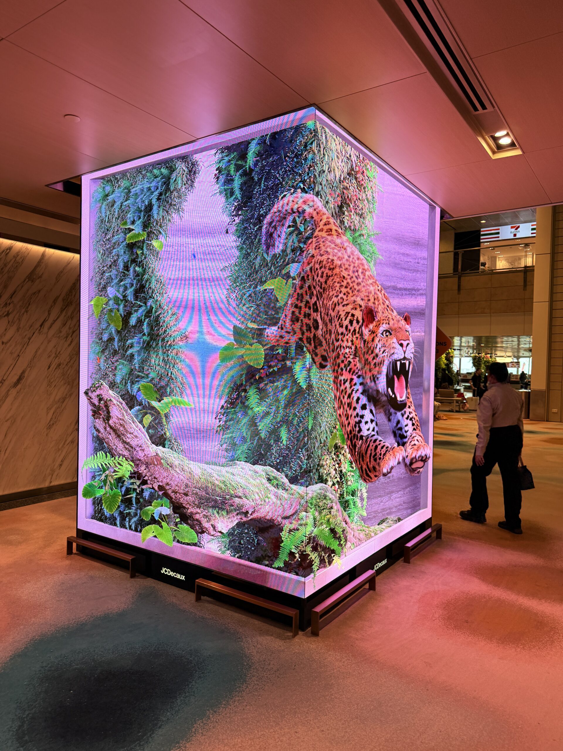
There’s a thundering (digital) waterfall in the check-in and departures area at Singapore’s Changi airport.
And watch out for the 3-D jaguar inside the secure area that will pounce on you!
Changi airport’s layout feels different than the standard airport floor layout.
There are no check-in counters, and I had to look around to find out where to take my tagged luggage for check-in.
(It is handled by fully automated stations with conveyor belts that swallow your bags.)
The security check is done right at the gate with its dedicated waiting area.
So no bottled water or other large liquids can be carried onto the plane. There are no toilets right by the gate’s waiting area as you wait to board.
(So what happens if it turns out there is a 30 min or 1 hr delay with the boarding process? Can you go out and come back in through the security check?)
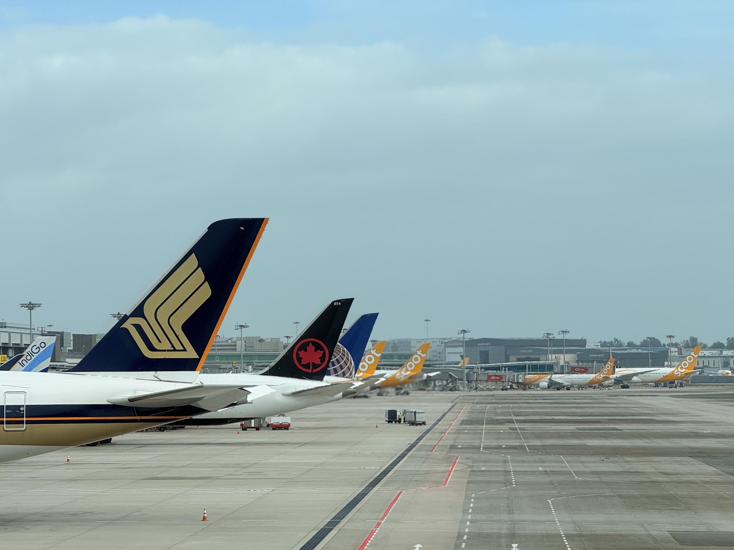
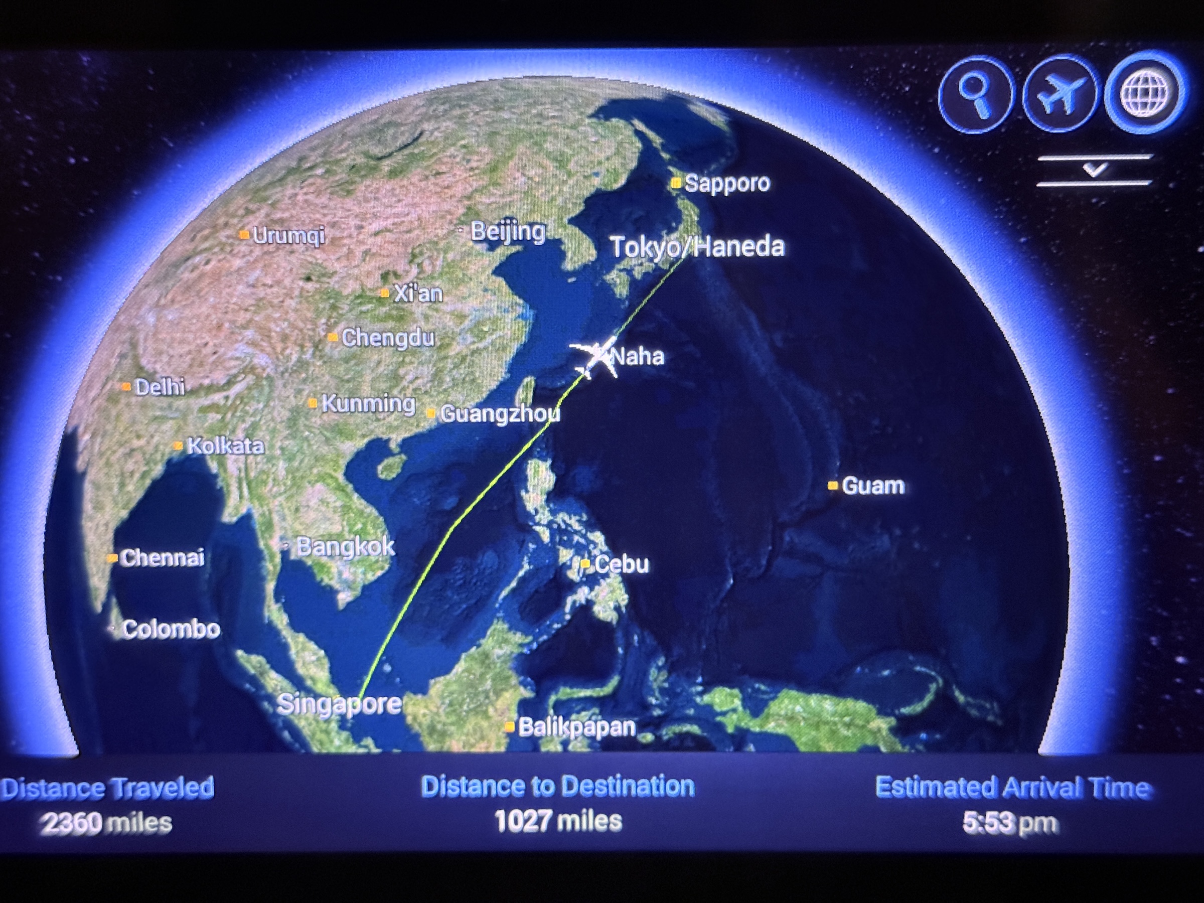
All went according to schedule, though, and off we were on the 6 hr 16 min flight to Tokyo’s Haneda airport.
We were northeast bound with a flight path that had Viet Nam to the west, and going between Taiwan to the north and the Philippines to the south.
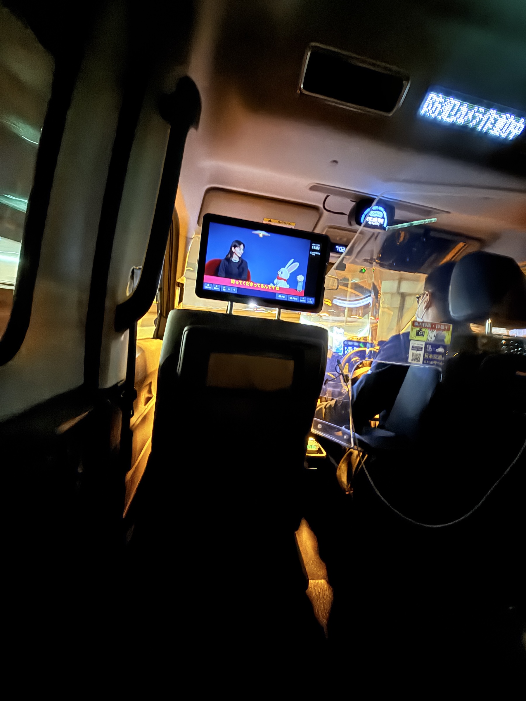
It was still Friday night rush hour on Tokyo’s trains upon my arrival, and I would have had to navigate my way out of Shinjuku station with bags in tow, the busiest of them all. (A station that handles 3.6 million passengers every day).
So Go Taxi it was, and the US $55 fare that brought me right to the entrance of the hotel was totally worth it.


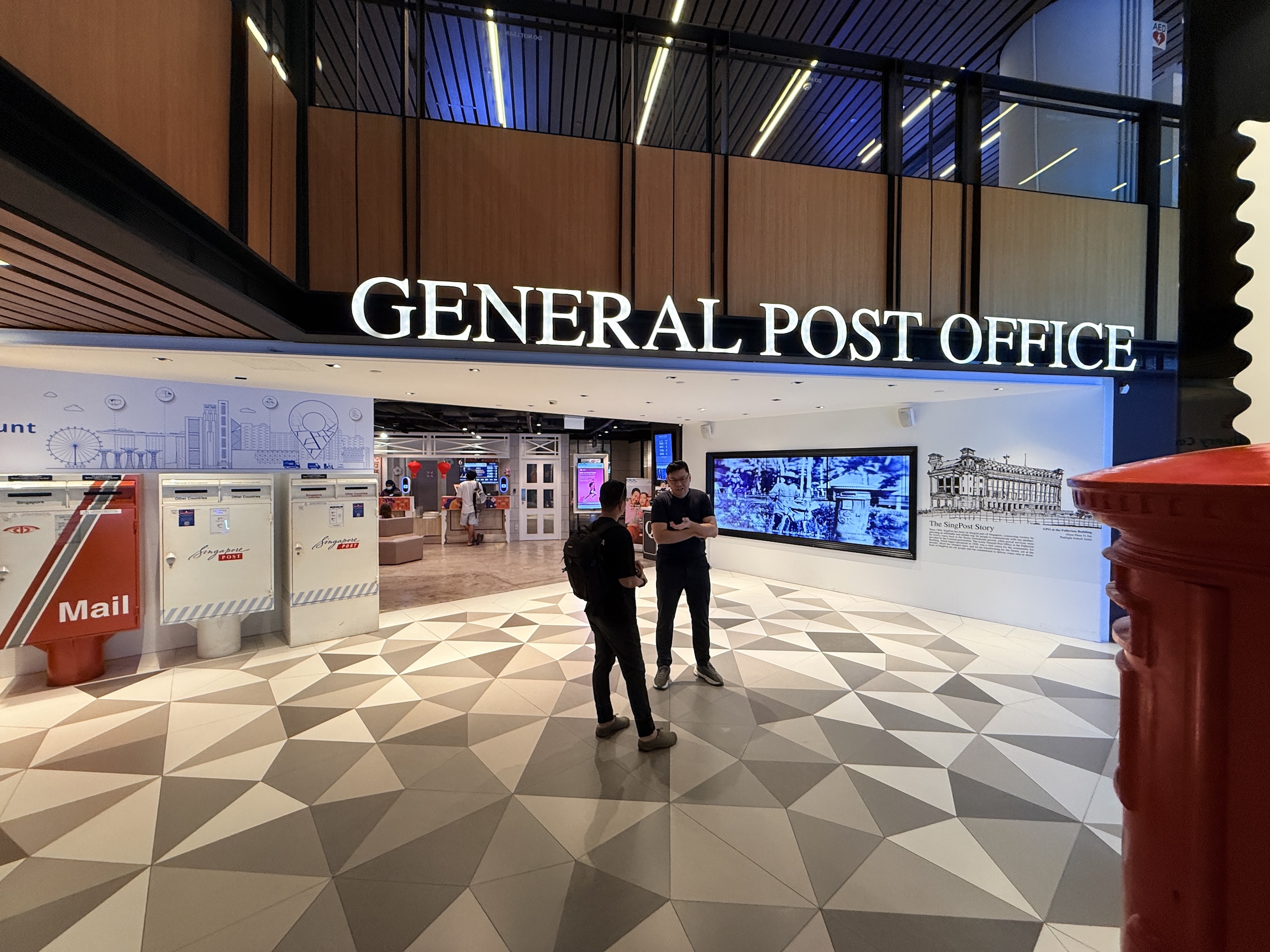
Today was my last day here on the tip of the Malay peninsula. I will travel to Tokyo in the morning.
I ran out to the Singapore main post office and a Singapore Mint store— for a souvenir or two in the form of stamps and coins, of course.
(Will post what I got, later. I bought a lot of stamps! )
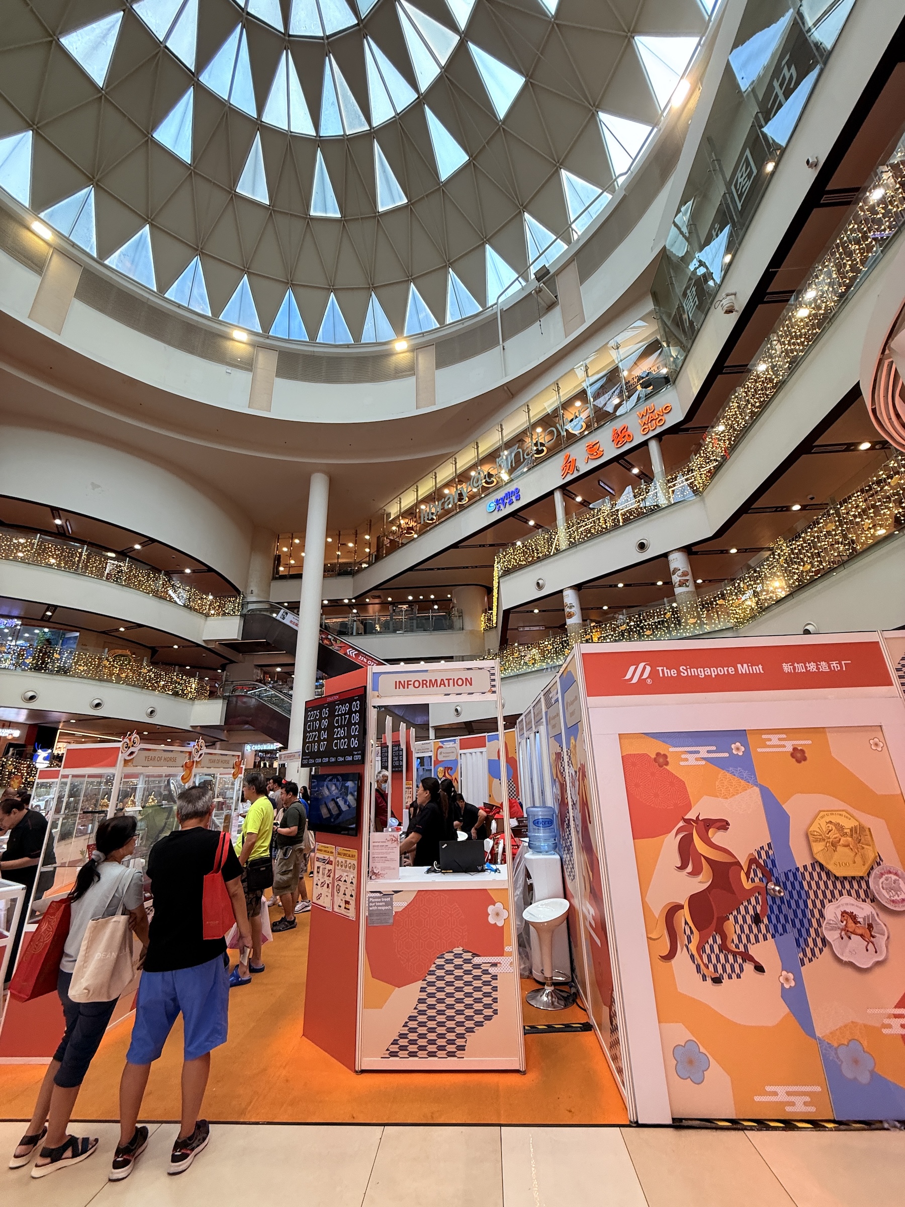
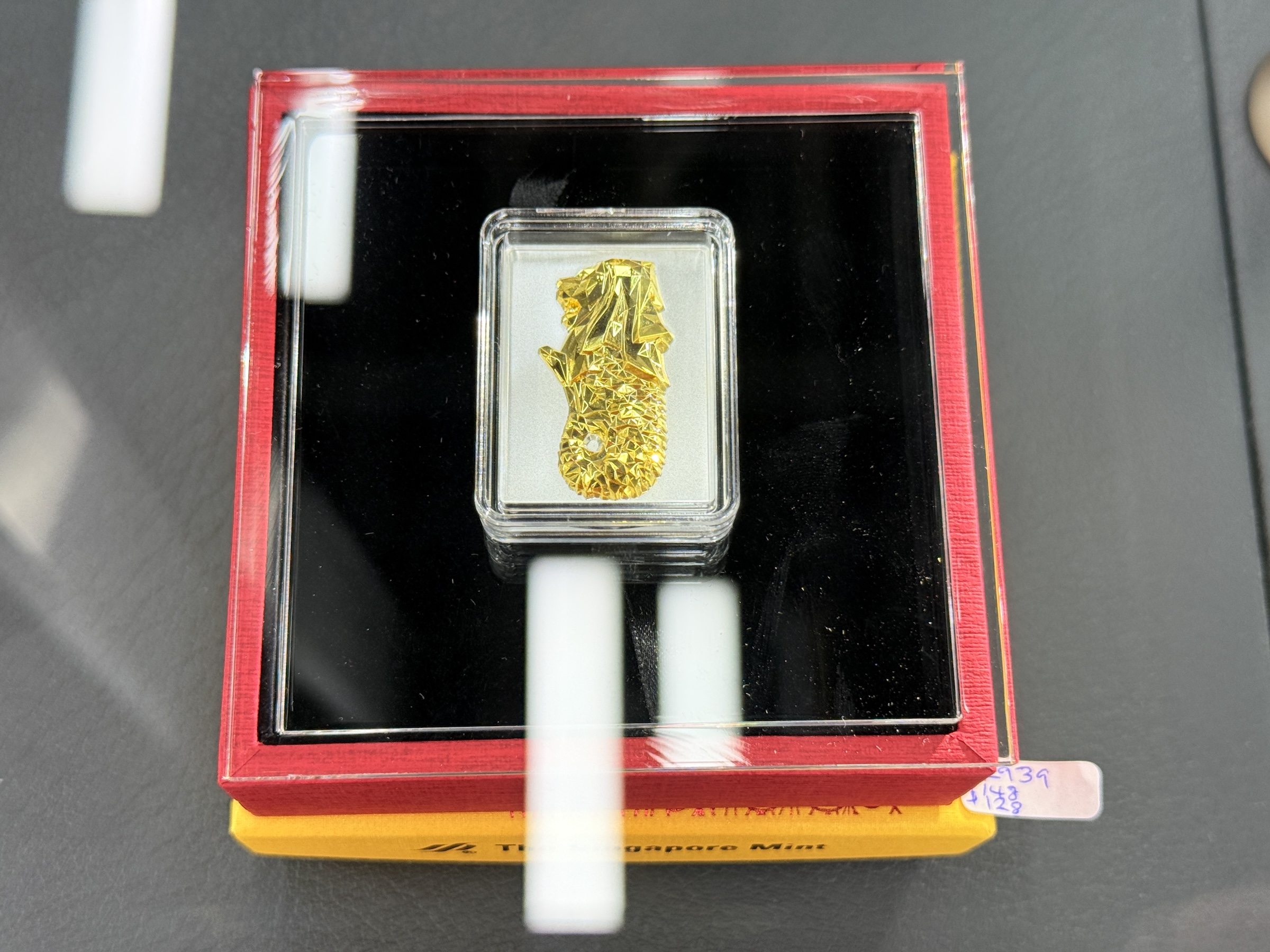
The lunar new year (the Year Of The Horse) is coming, so several Singapore Mint coins with horse motifs on were on offer.
I liked the shiny golden Merlion better— made of an one-ounce 999 (99.9%) fine silver proof ingot that is clad with pure gold.
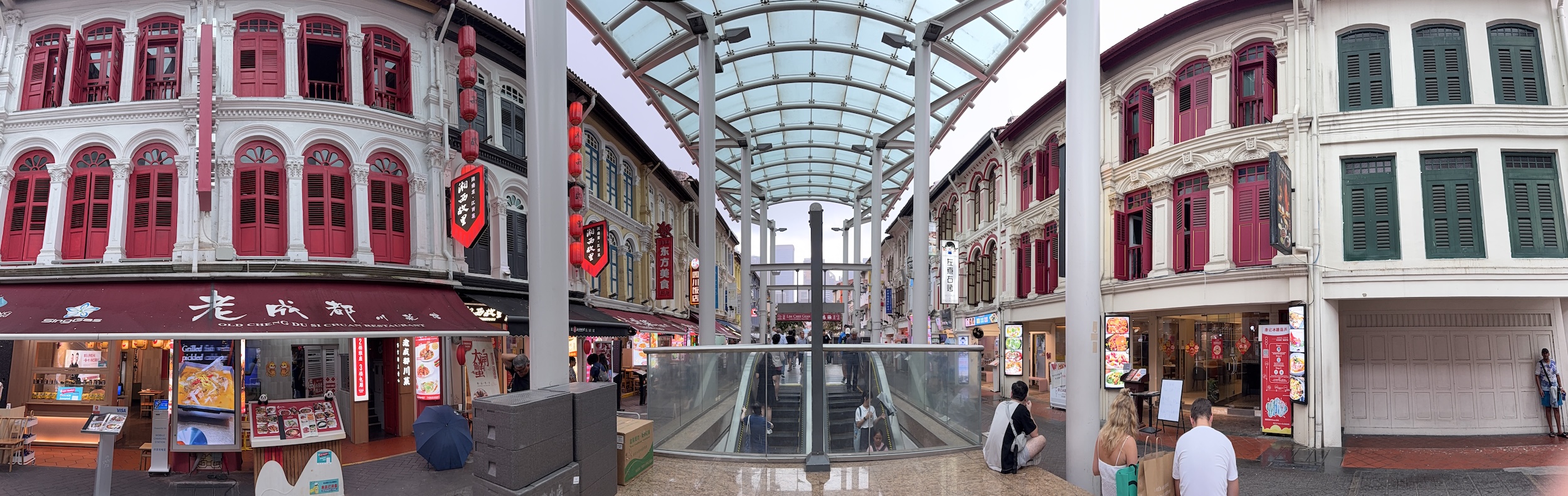
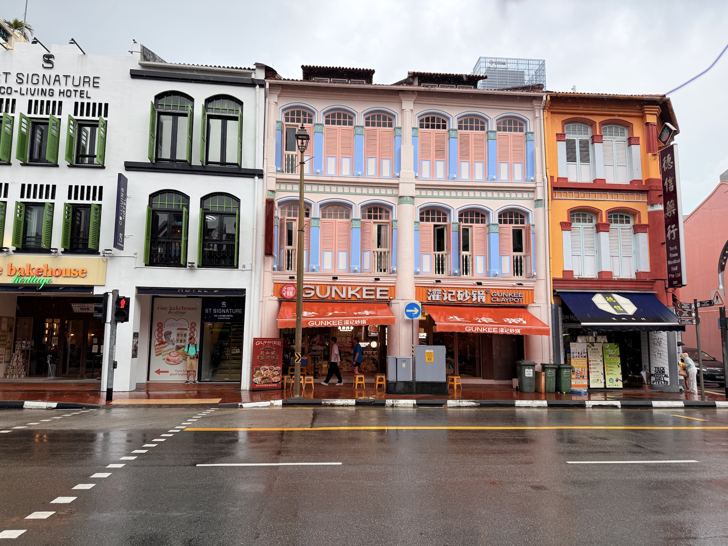
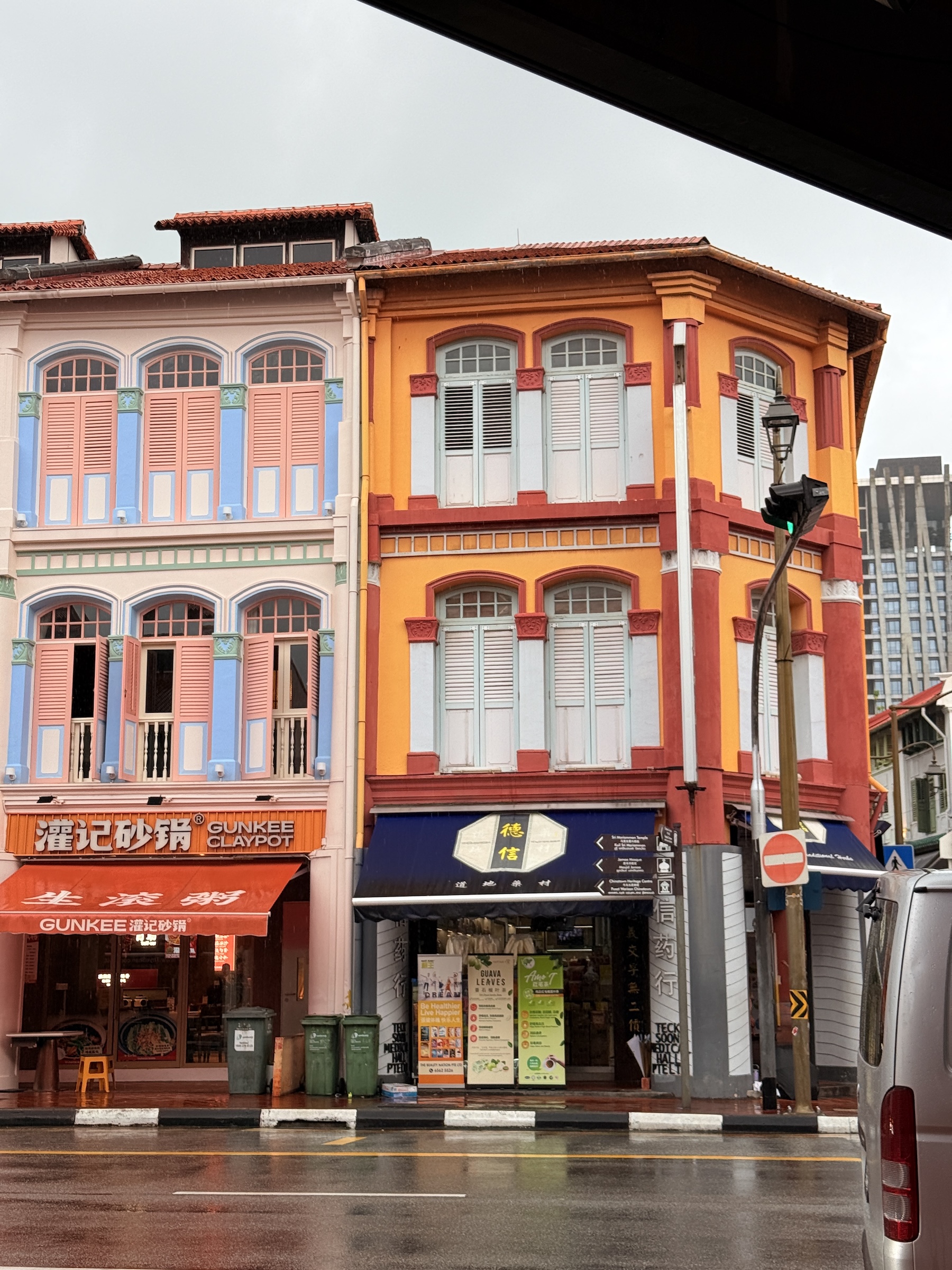
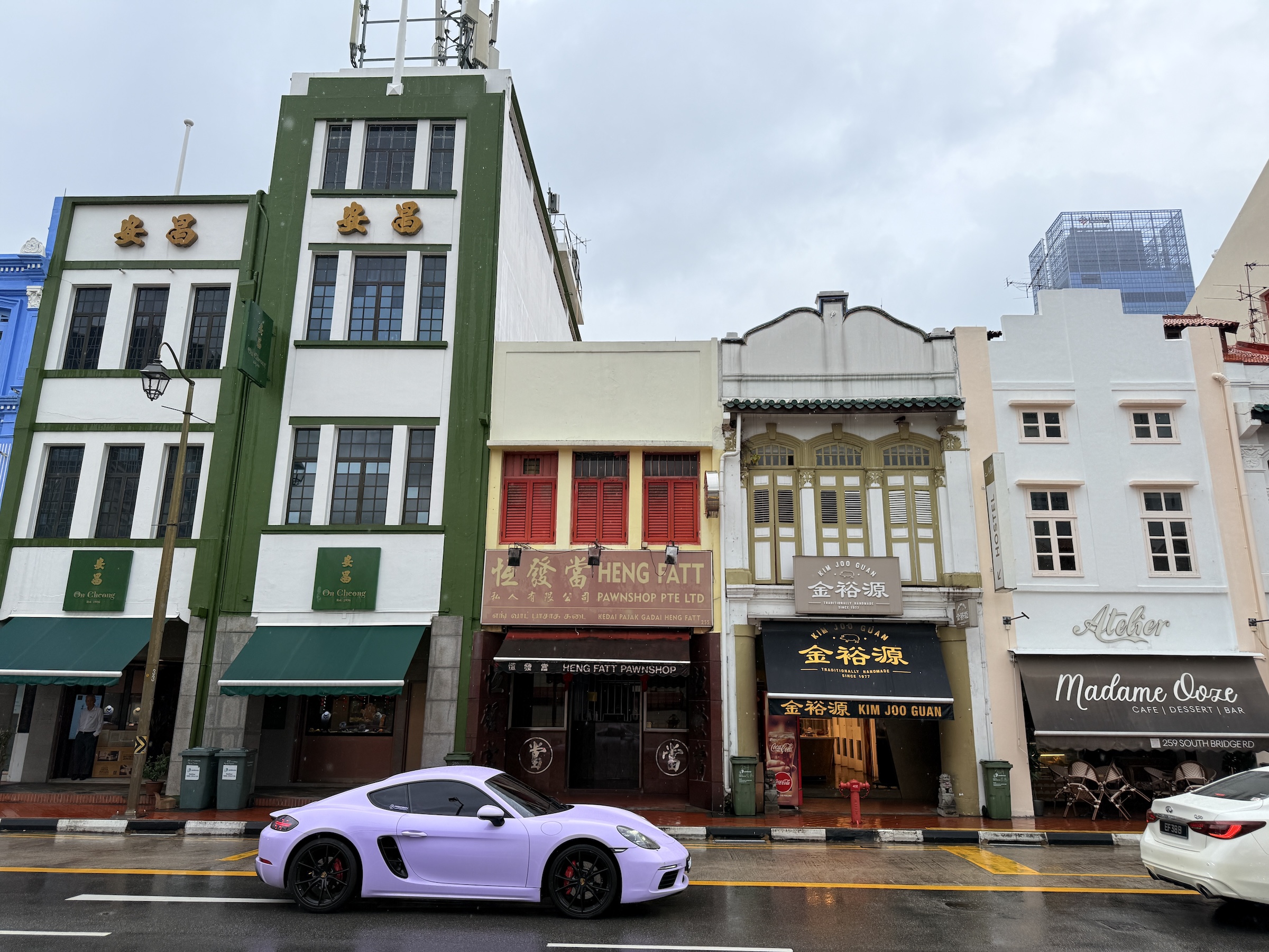
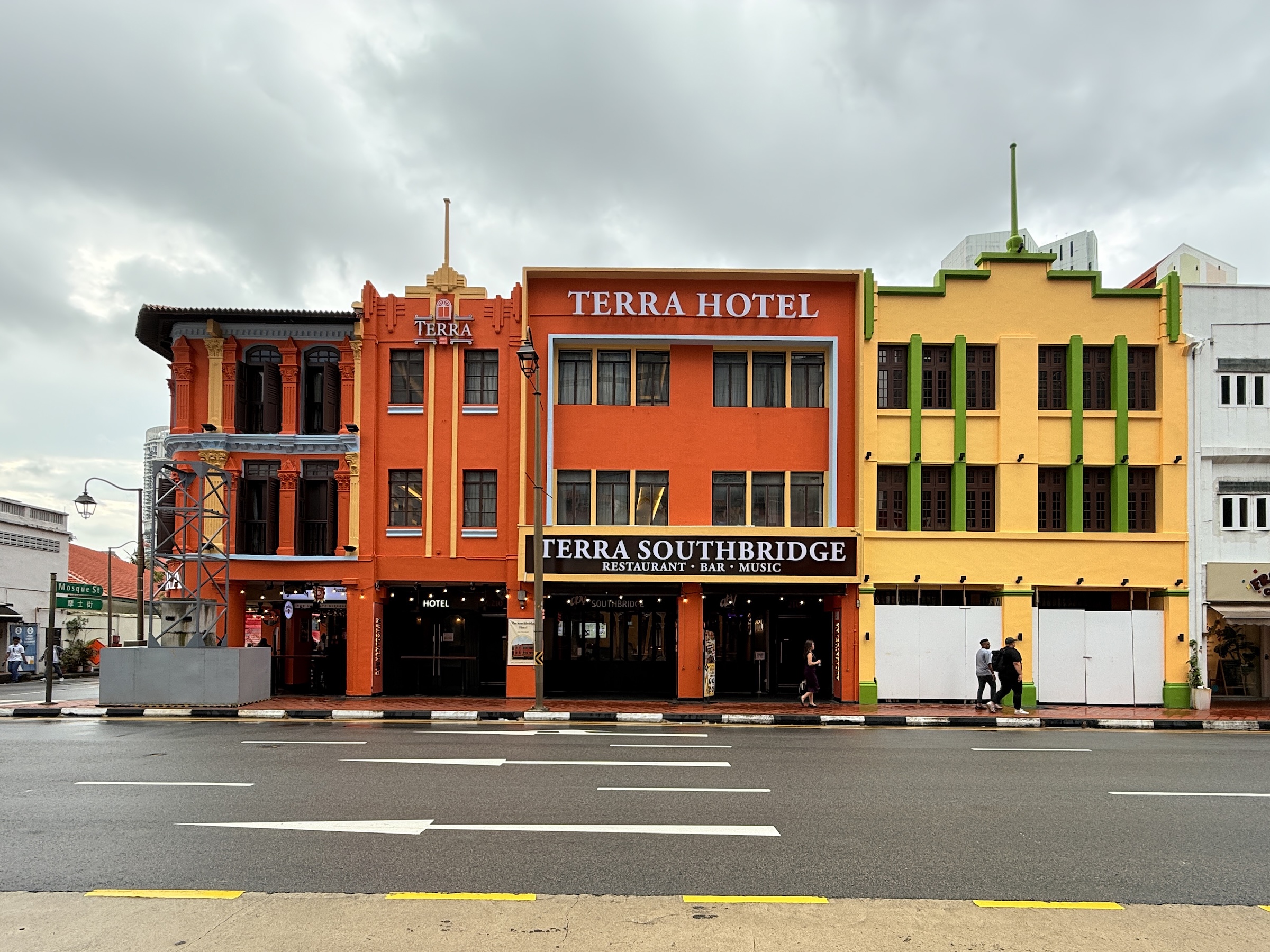
Singapore has one of the oldest Chinatowns in the world.
The area around Pagoda Street has been a hub for the Chinese immigrants in Singapore since 1330.
To this day it has traditional shophouses, but also modern stores and busy street markets.
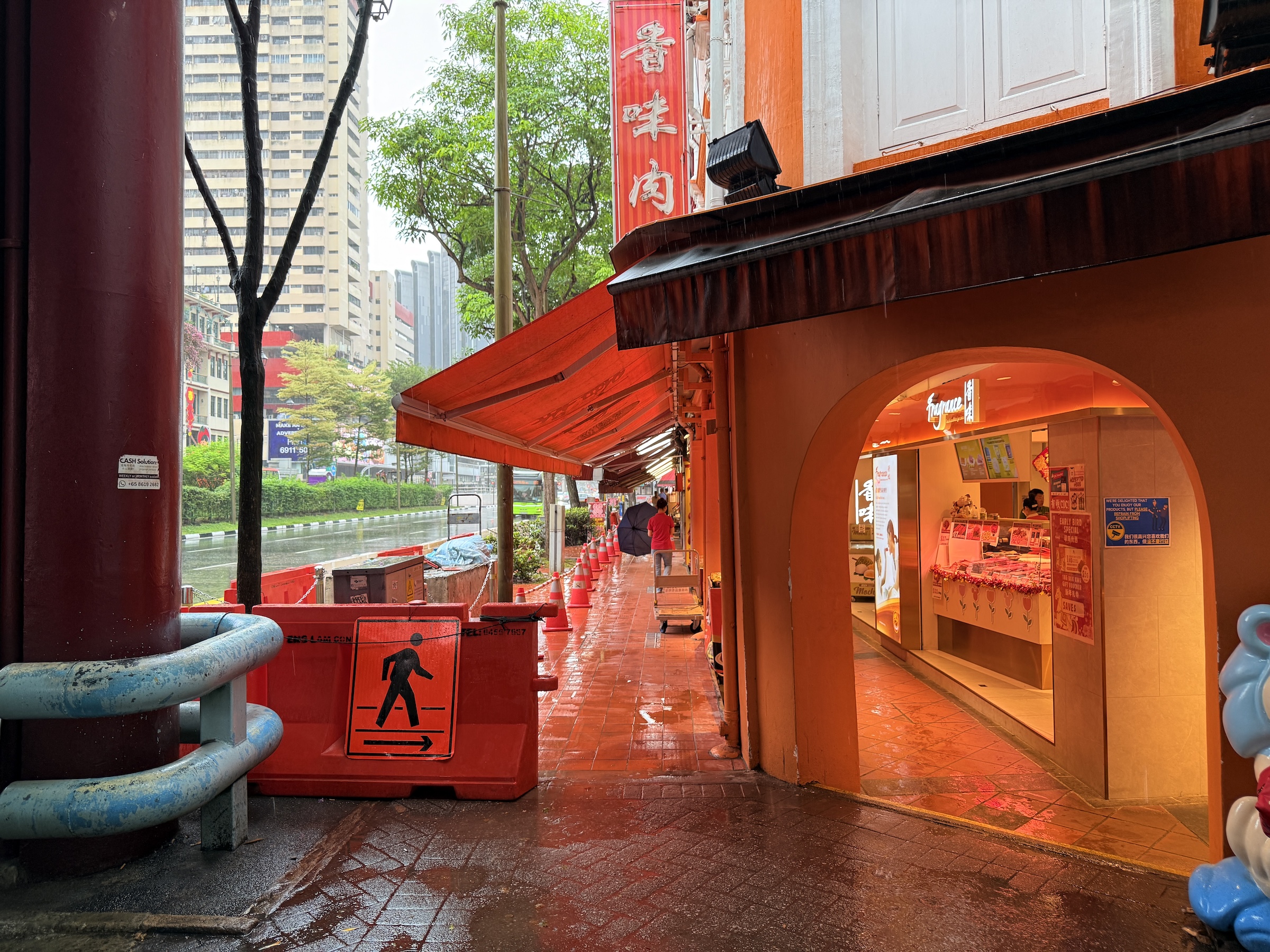
I sipped my coffee outside the Starbucks on Smith Street, while listening to a beautiful song in a language I will never understand or learn 😢, as the smell of freshly cut durian from a nearby vendor wafted through the air.
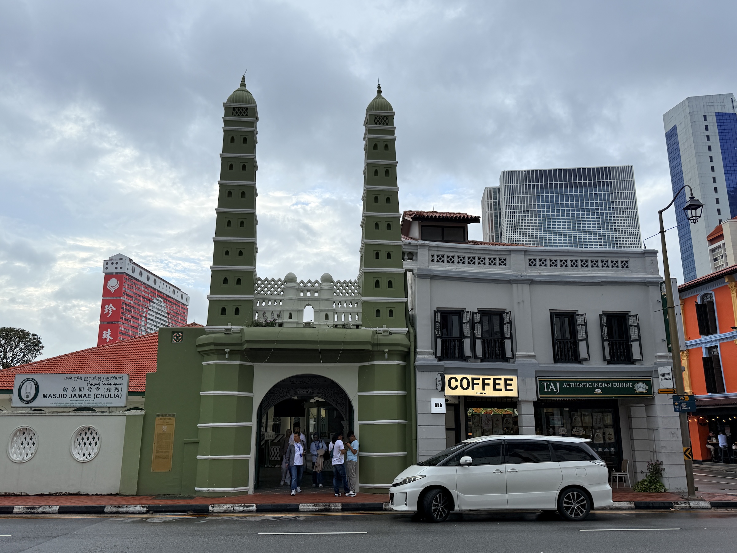
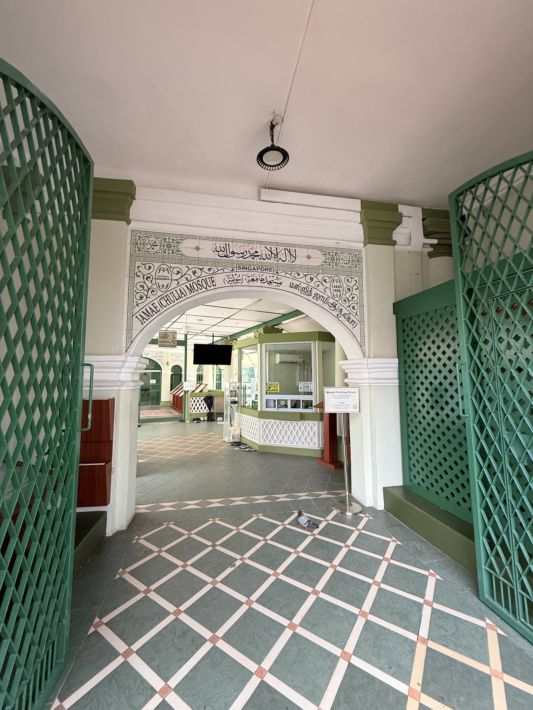
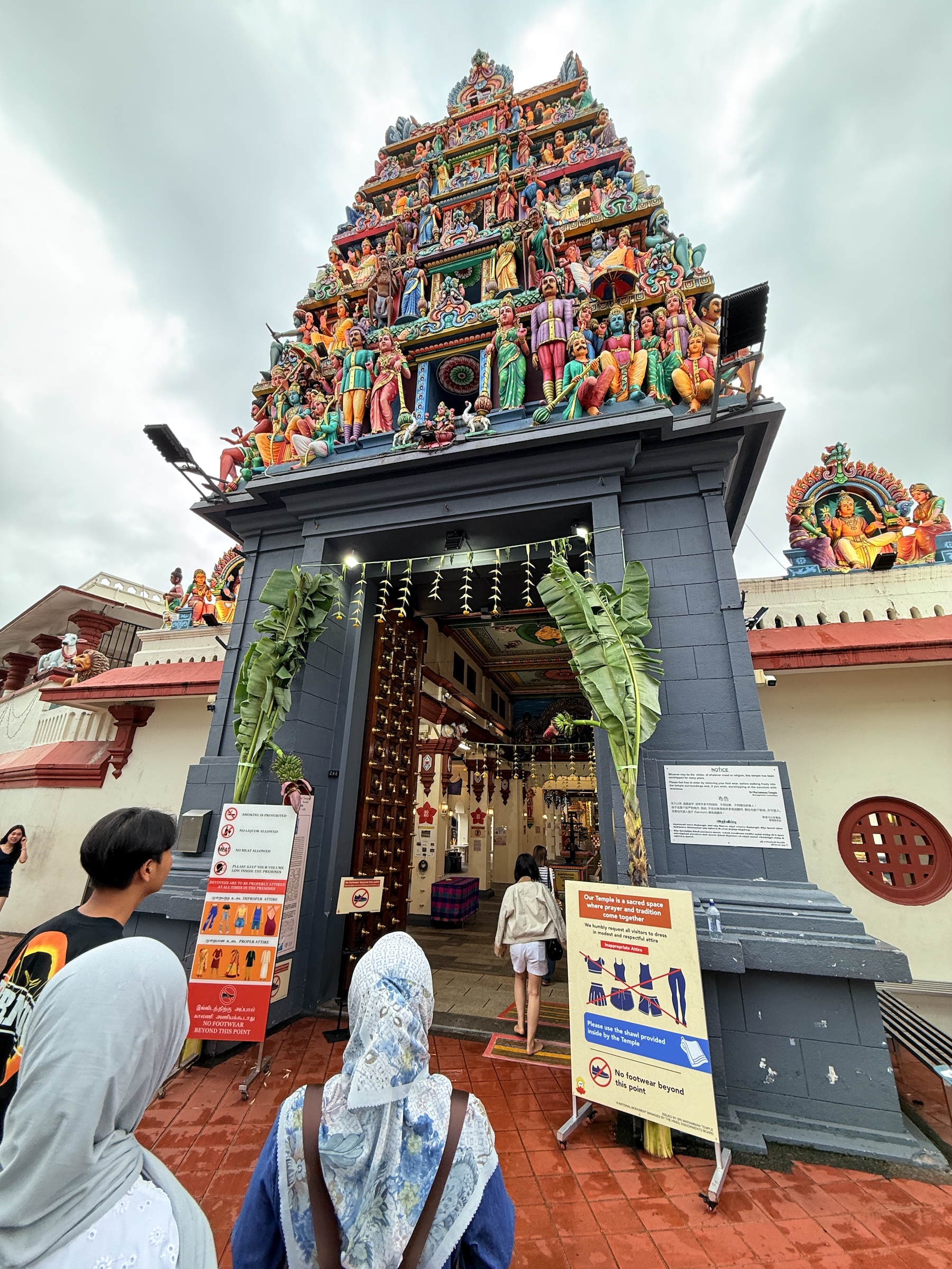
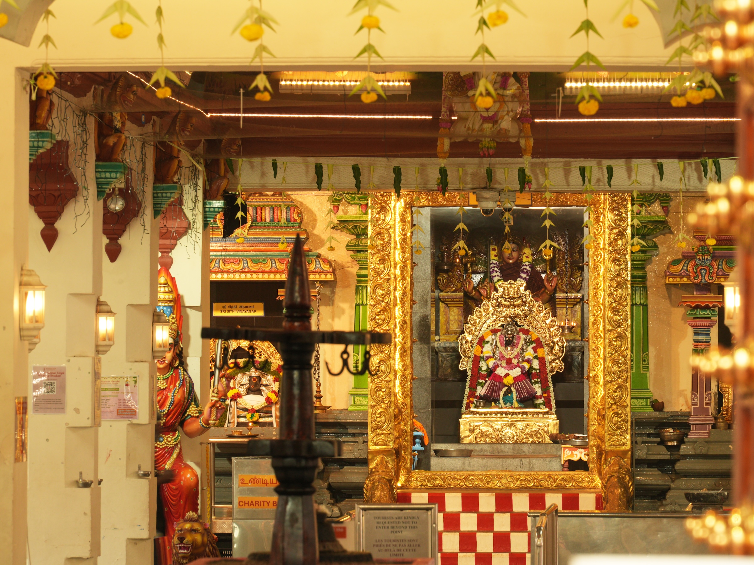
The mosque is Masjid Jamae (built in 1820), and the Hindu temple is Sri Mariamman. These are the sources of strange sounds—very, very strange to the Western ear— the calls to prayer from the mosque, and clanging and chants from the inside the Hindu temple.
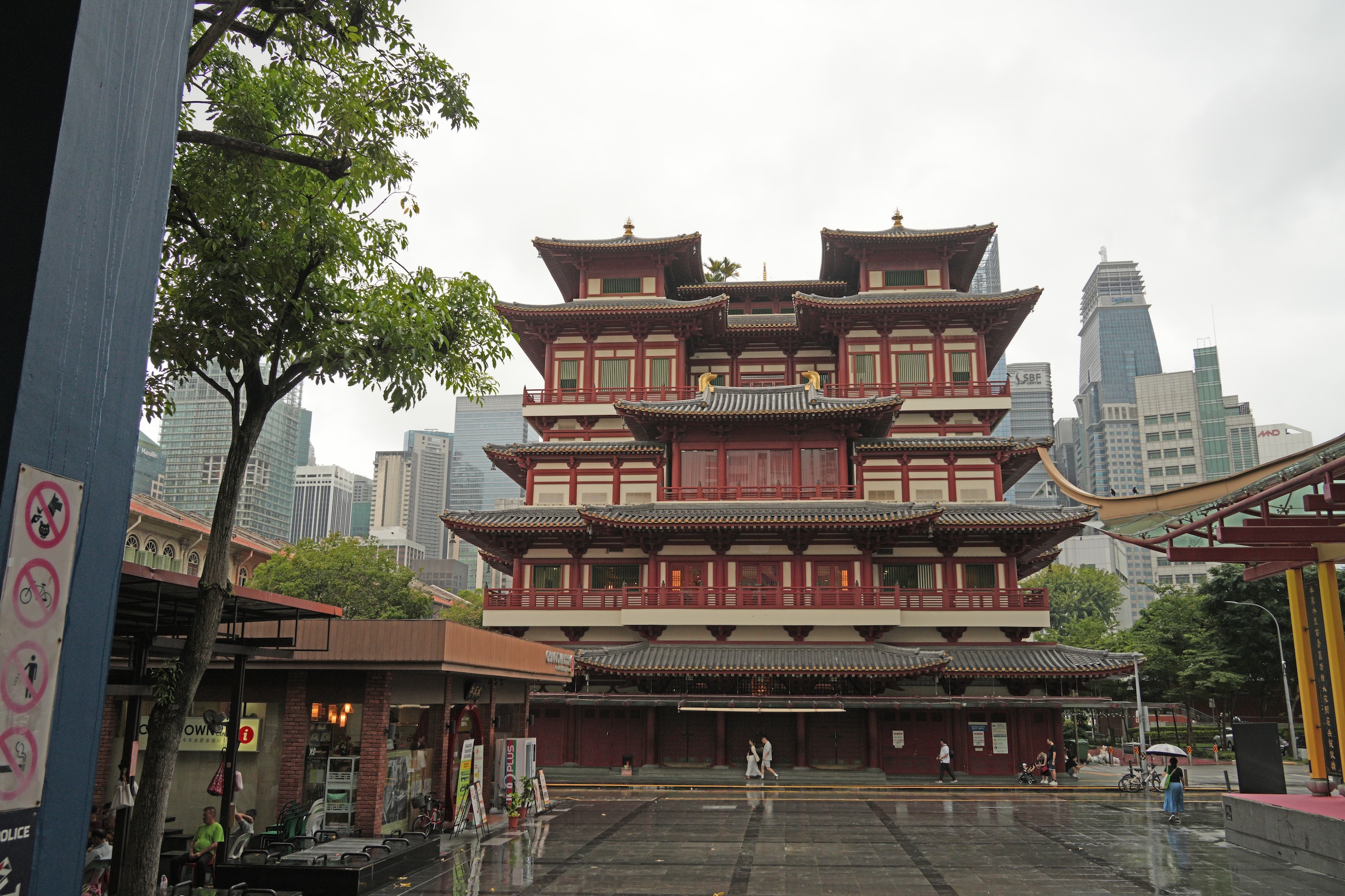
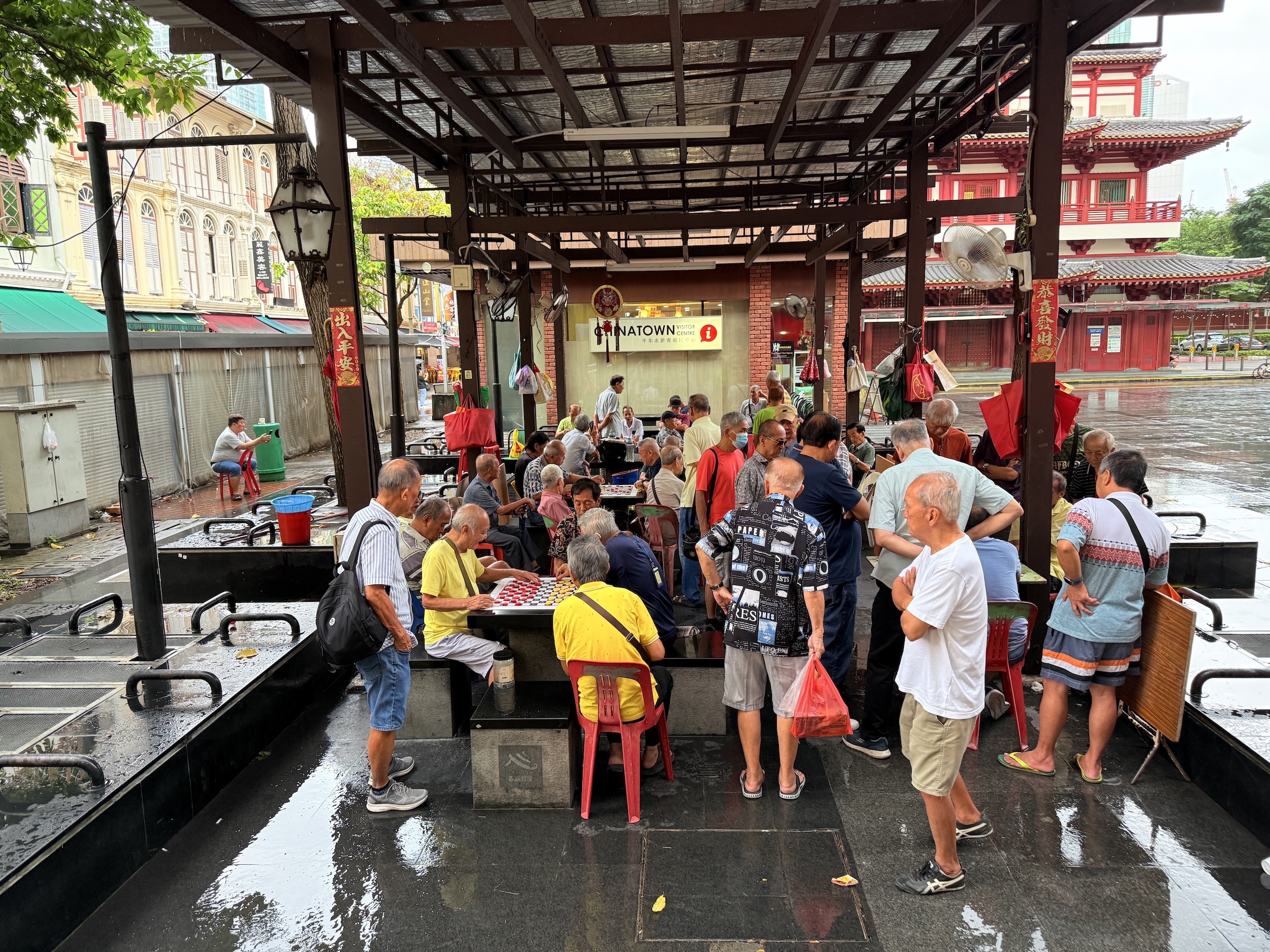
The last two pictures are is of the main plaza in Chinatown.
I love the public space with the old-timers that are there just to shoot the breeze, or to play a game of checkers.


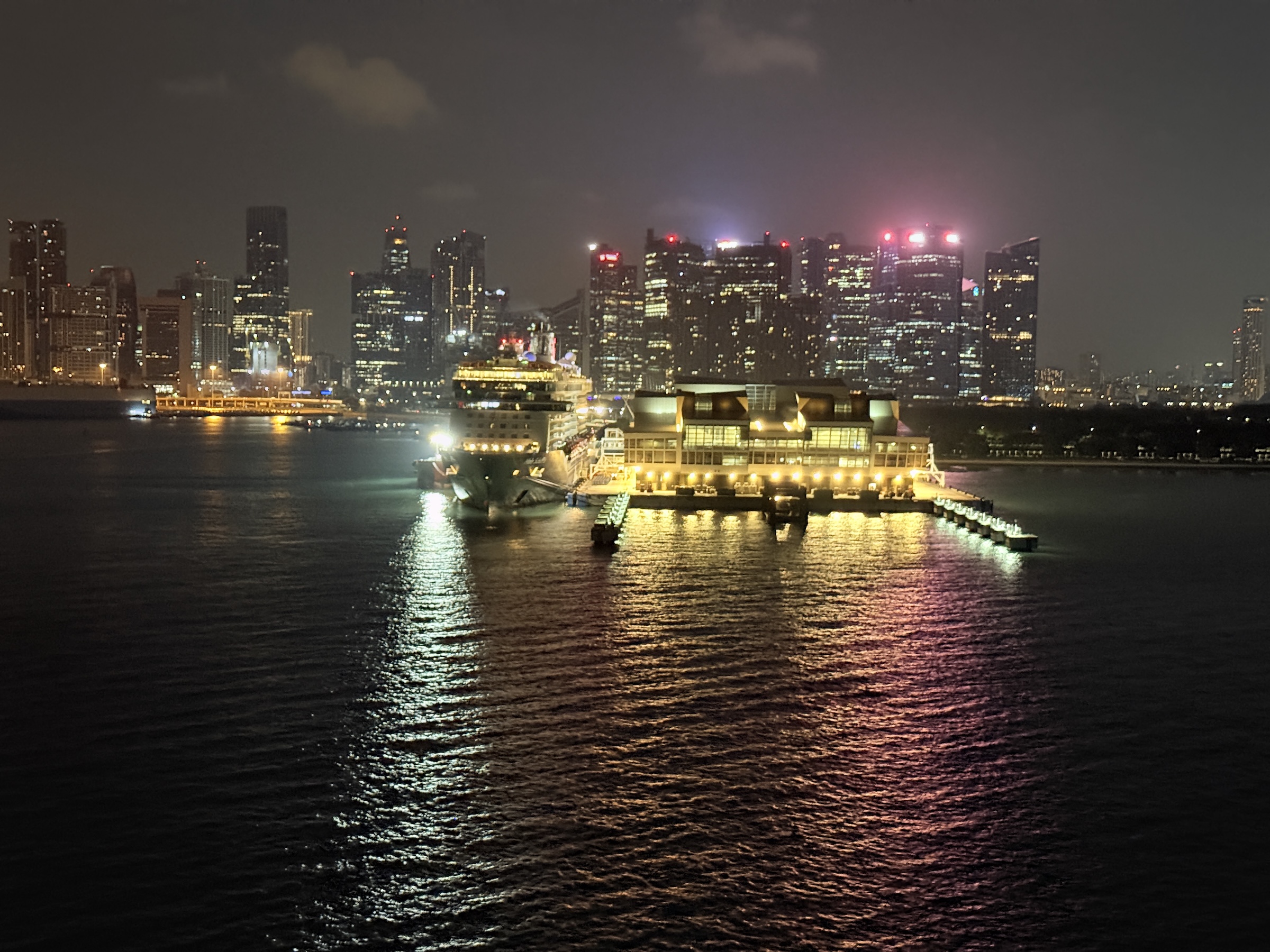
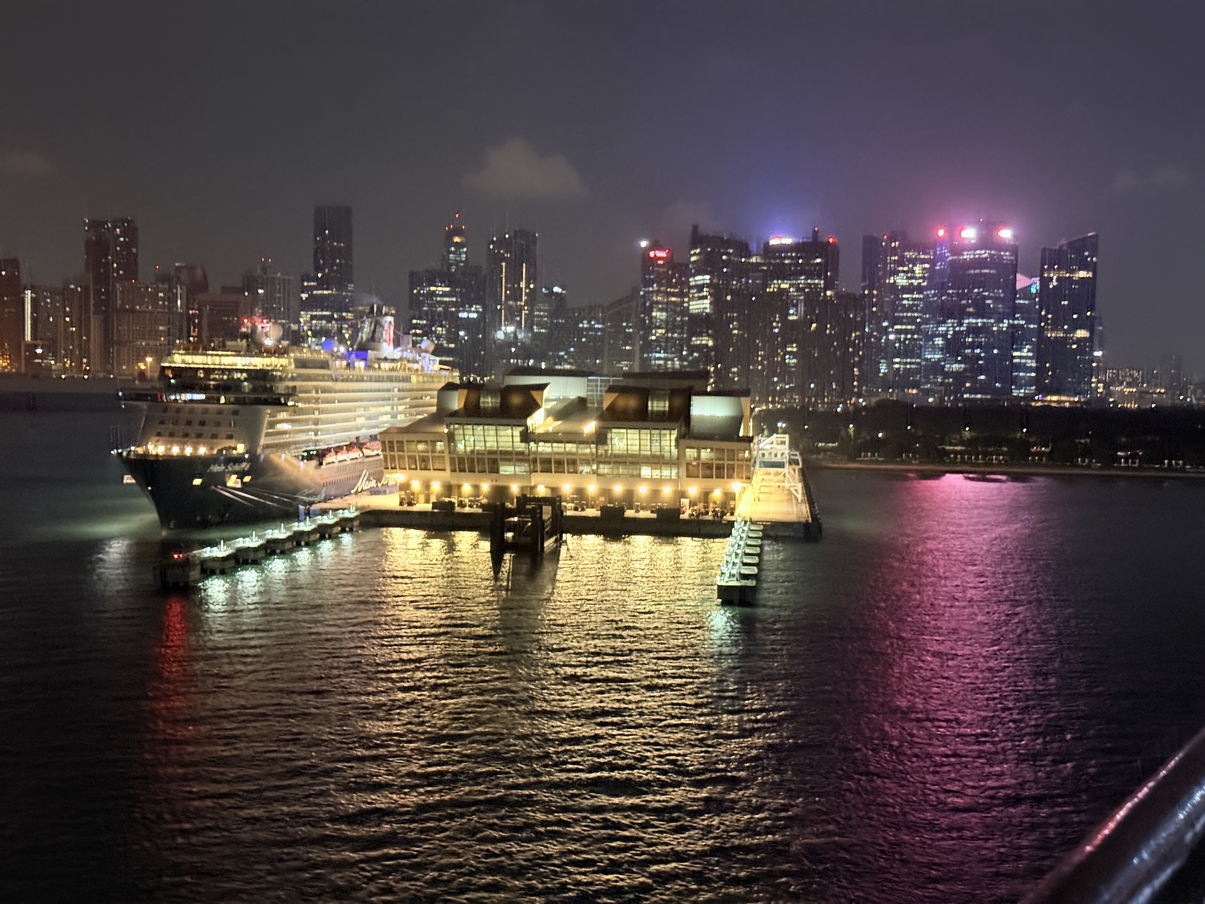
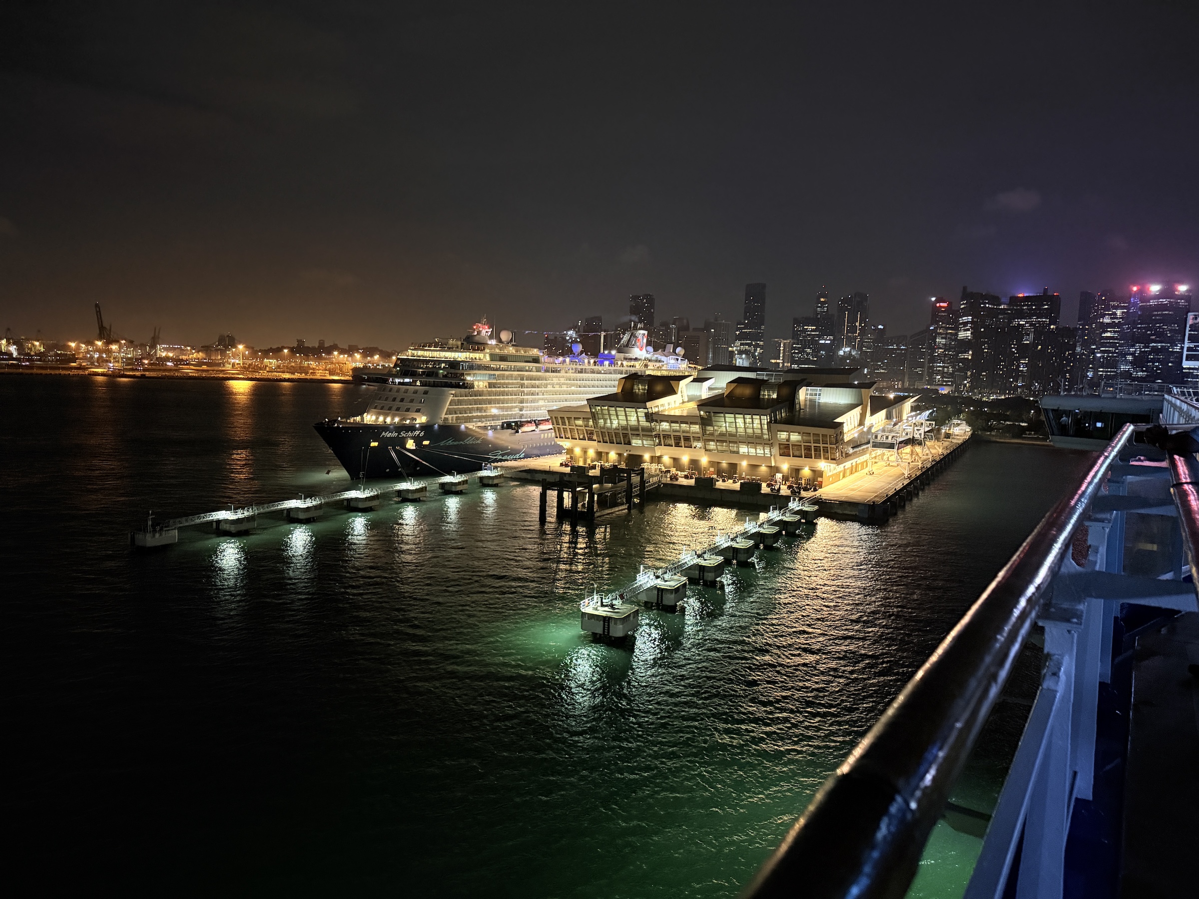
The Diamond Princess was back at Singapore’s Marina Bay Cruise Center at 7 am this morning.
Right then, a choreographed process of getting some 3,000 passengers and their luggage off the ship, through passport control and customs, and on their way to the airport or elsewhere, started.
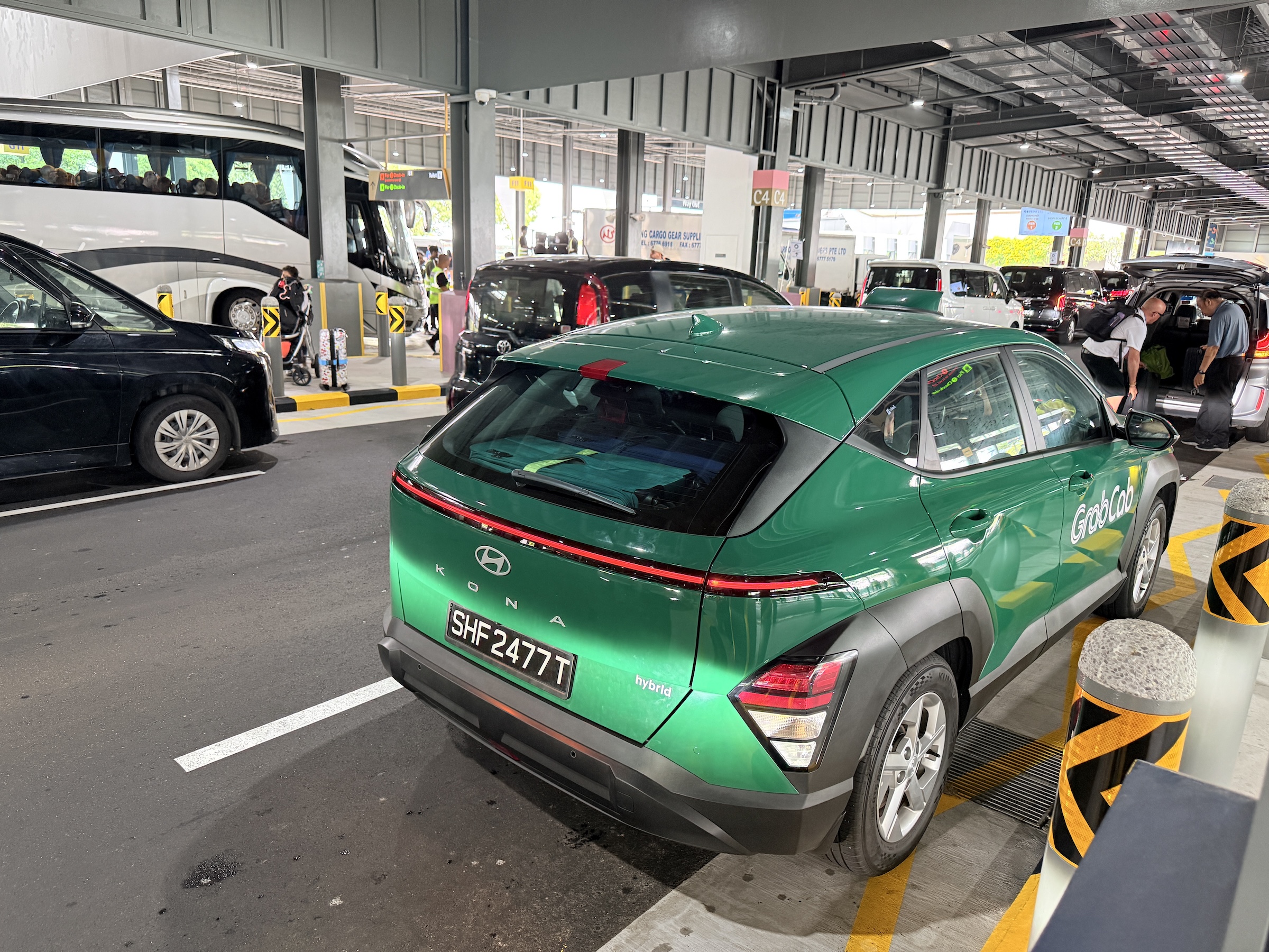
Grab is the Uber in Singapore* and we hopped into Grab cabs that we had reserved the night before to take us to the hotel. (My family heads out in the morning and I will stay in Singapore for a few days before making my way back to Seattle via Tokyo.)
*Grab acquired Uber’s Southeast Asian operations in 2018. Uber still has a 27.5% share as part of the deal.
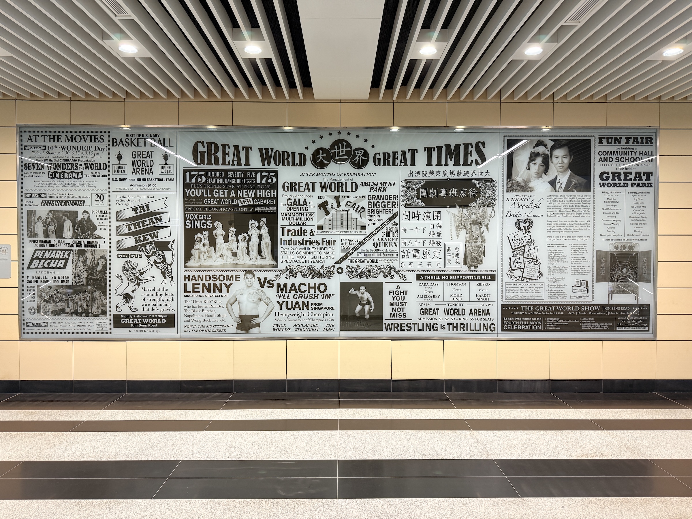
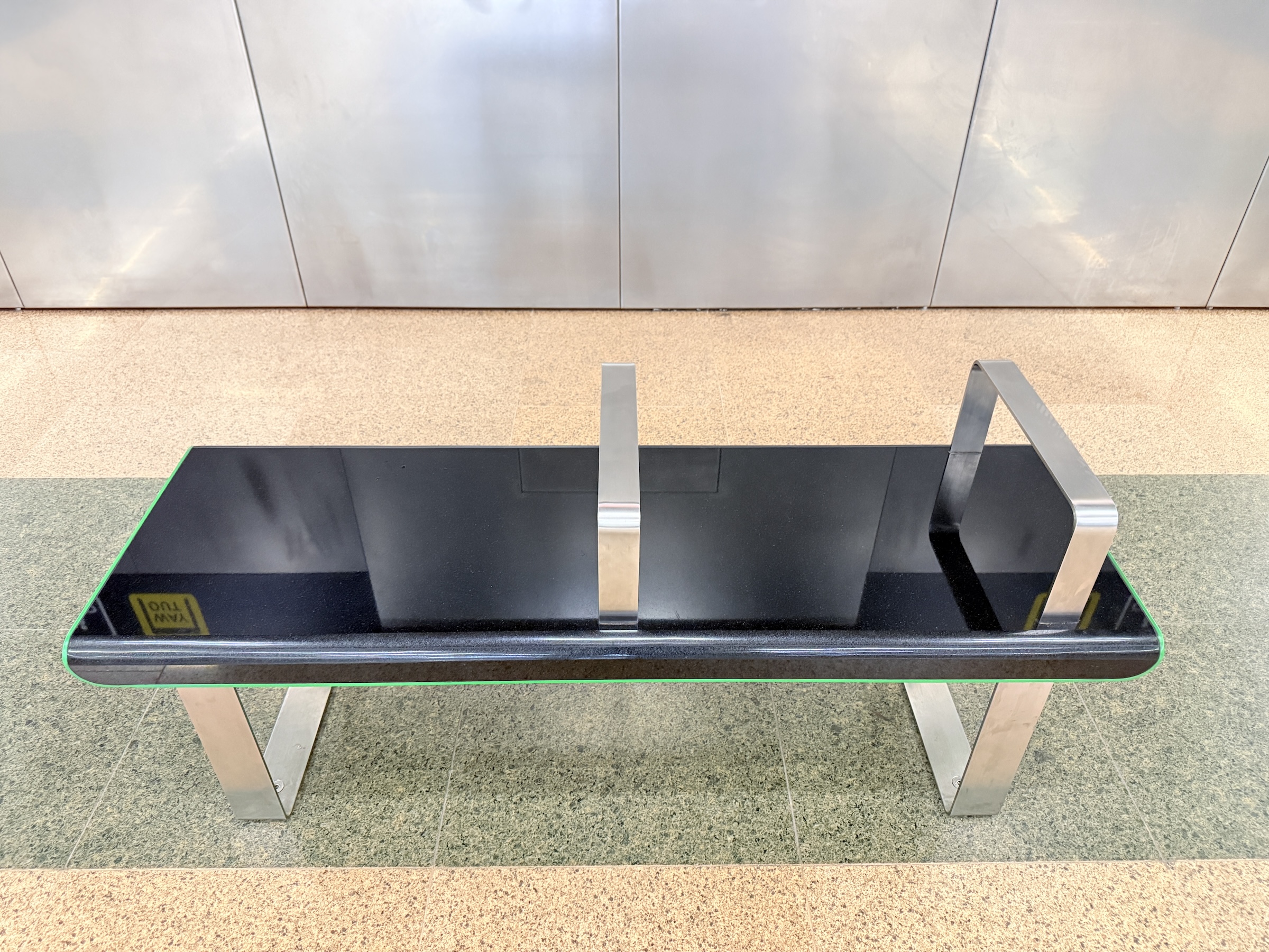
The wall poster is from the metro’s new brown line, the Thomson-East Coast Line (TEL). The benches down on the platforms are benches, and works of art, as well.
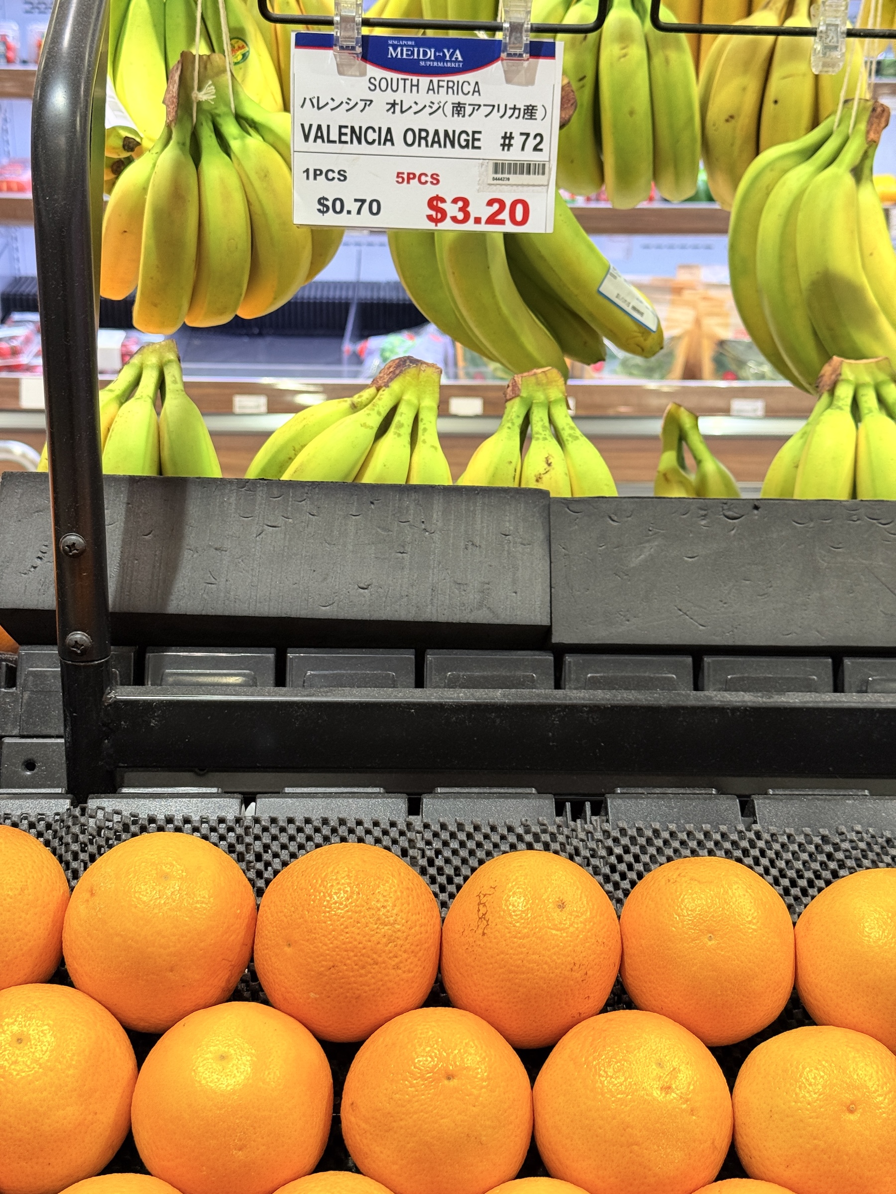
What a nice find in the grocery store: Valencia oranges from South Africa, for only SGD 3.20 (US$2.50) for five. Sweet and seedless.
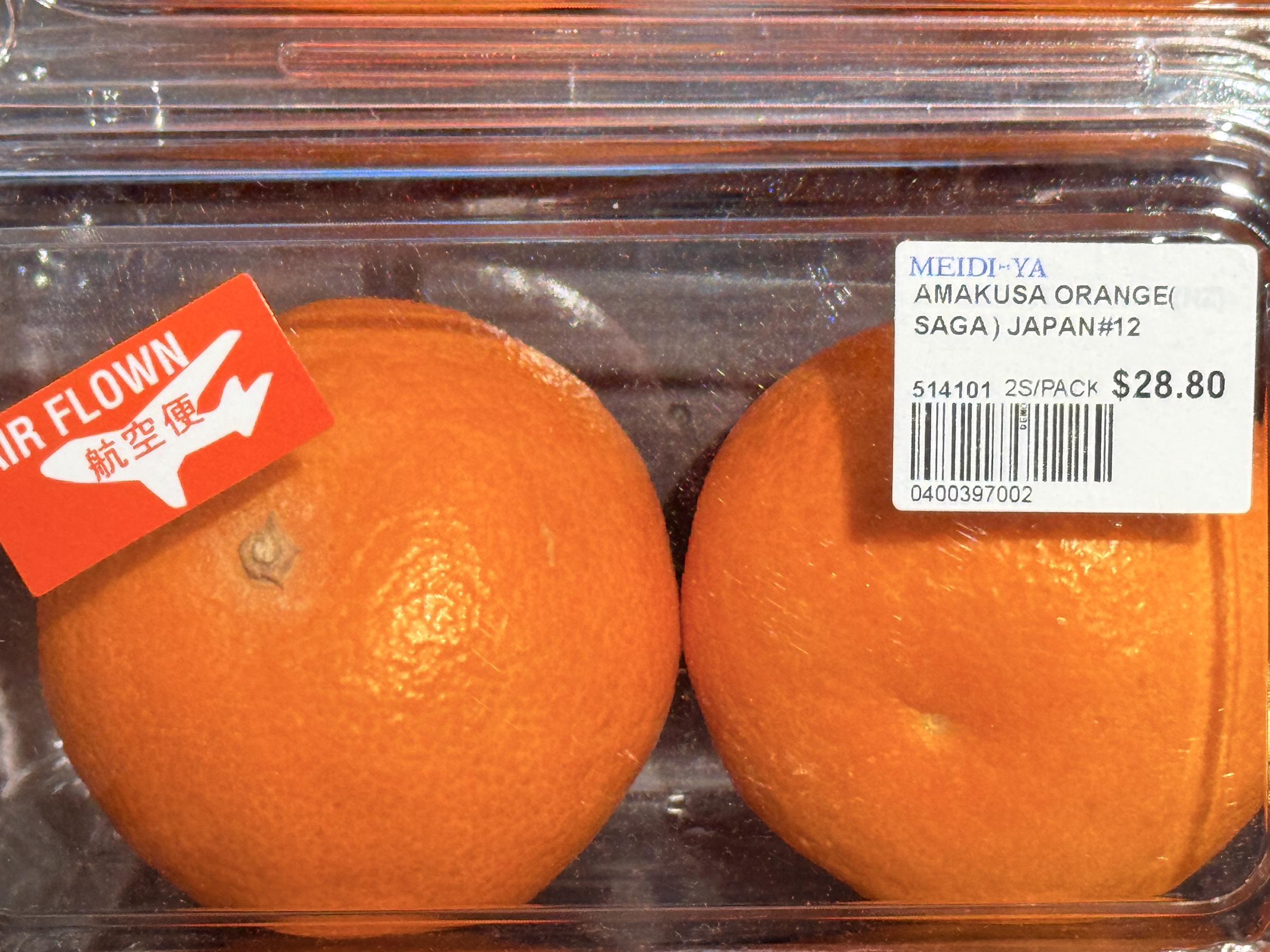
Right next to them were pairs of Amakusa oranges, ever so slightly larger, advertised as ‘Air Flown’ from Japan, for SGD 28.80 a pair, which comes to $11 for an orange. Eek 😱.