
The second wave of moisture from a strong atmospheric river filled in across western Washington last night.
All that water is flooding from the western slopes of the Cascade mountains into the streams and rivers below.
Greg Kim writes for the Seattle Times:
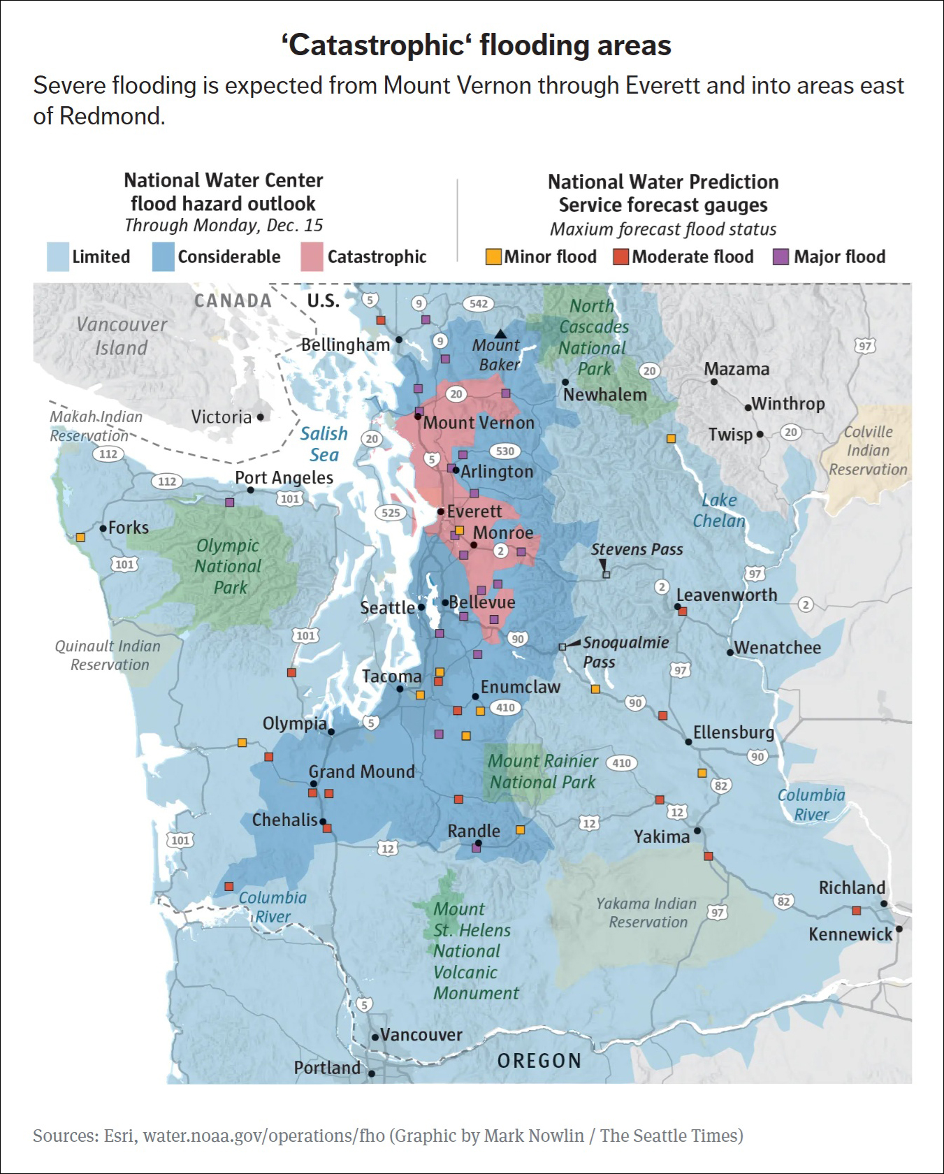
River flooding in parts of Western Washington is expected to be “catastrophic,” especially in the coastal lowlands near the Snohomish, Stillaguamish and Skagit rivers, according to a new assessment by the National Weather Service.
Areas facing “considerable” flooding stretch from Bellingham through south of Olympia.
Catastrophic flooding could bring significant risk to life and property, with a high risk of levees being topped and landslides expected in steep terrain, according to the National Weather Service. It could also mean record floods that destroy roads and structures and require evacuations or rescues of people and property, National Weather Service meteorologist Steve Reedy said.
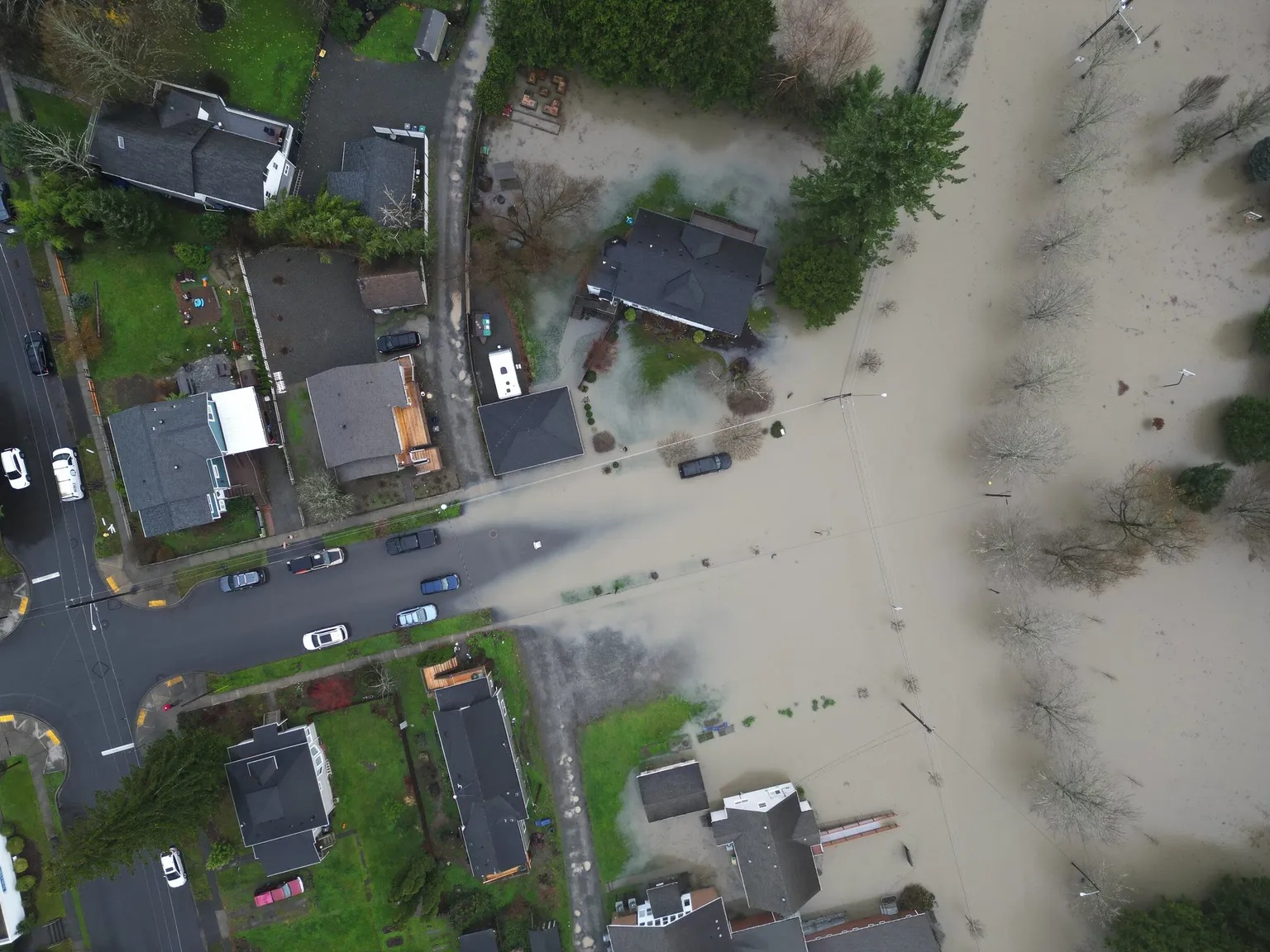
[Photo by Ken Lambert / The Seattle Times]
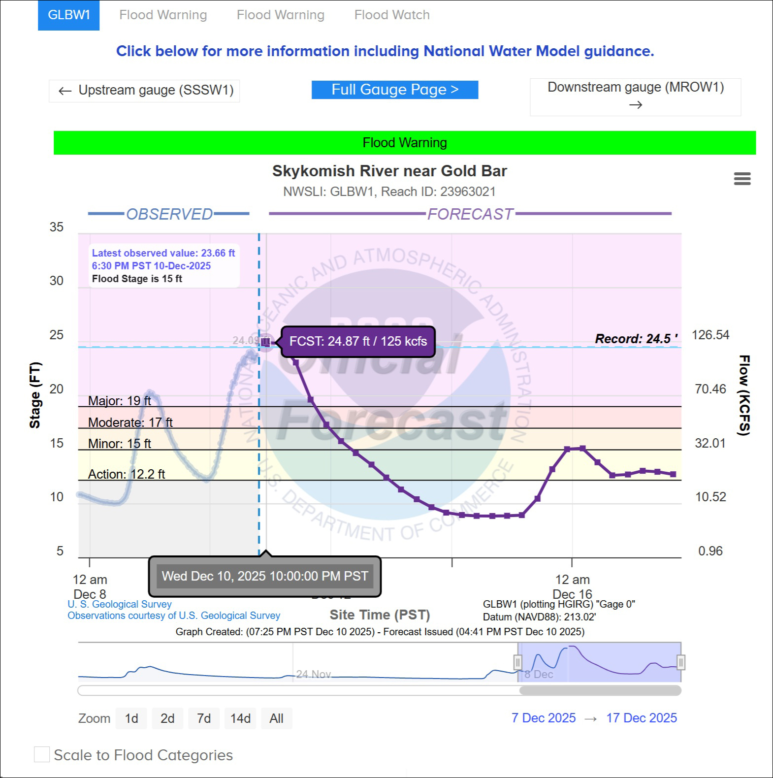
The river is projected to top out at its highest level ever, at 24.87 ft. Flood stage is 15 ft.
[Graphic from National Water Prediction Service at https://water.noaa.gov/]