Report from the Alaska Earthquake Center:
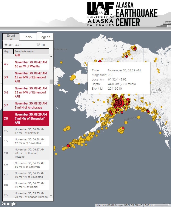
‘A magnitude 7.0 earthquake struck just seven miles north of Anchorage at 8:29 am on Friday morning, at a depth of about 27 mi (40 km). The earthquake caused power outages, damage to roads and buildings, and closures of schools, businesses and government offices. The extent of the damage is not yet clear, and we are still waiting for word on whether there were any casualties.
This is the largest earthquake to strike near Anchorage since the 2016 M7.1 Iniskin earthquake. Because this morning’s quake was so much closer, the impacts to Anchorage and Mat-Su are far more severe and widespread’.
The USGS aftershock forecast is as follows:
- Low (4%) probability of another earthquake equal or greater than magnitude 7.0;
- 27% chance of a magnitude 6+ aftershock, and it is most likely that 0-3 of these will occur;
- 78% chance of magnitude 5 or greater aftershocks, but likely no more than around 20 of these;
- Up to 2,200 aftershocks greater than magnitude 3 are possible.