Tuesday/ the Soberanos fire

3-D-Map-of-Soberanes-Fire-1-am-PDT-August-7-2016 sm
3-D Map of the Soberanes Fire showing the perimeter at 1 a.m. PDT August 7, 2016. MODIS, Google, USFS, Wildfire Today

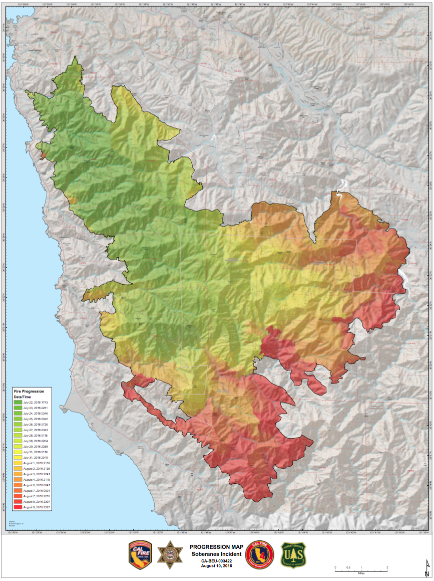
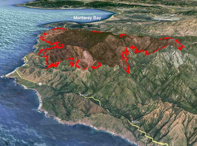
The massive Soberanos wildfire here in the mountains south of Monterey Bay was in day 19 on Tuesday and only 50% contained. The fire was caused by someone who lit an illegal campfire near a waterfall off the Soberanes Canyon Trail in Garrapata State Park).   It now covers almost 60,000 acres (93 square miles) over rugged, inaccessible terrain.

progression_map-2016-08-10
This progression map shows in green where the fire started and in the yellow and red (most recently), how it expanded.

Leave a Reply

Your email address will not be published. Required fields are marked *