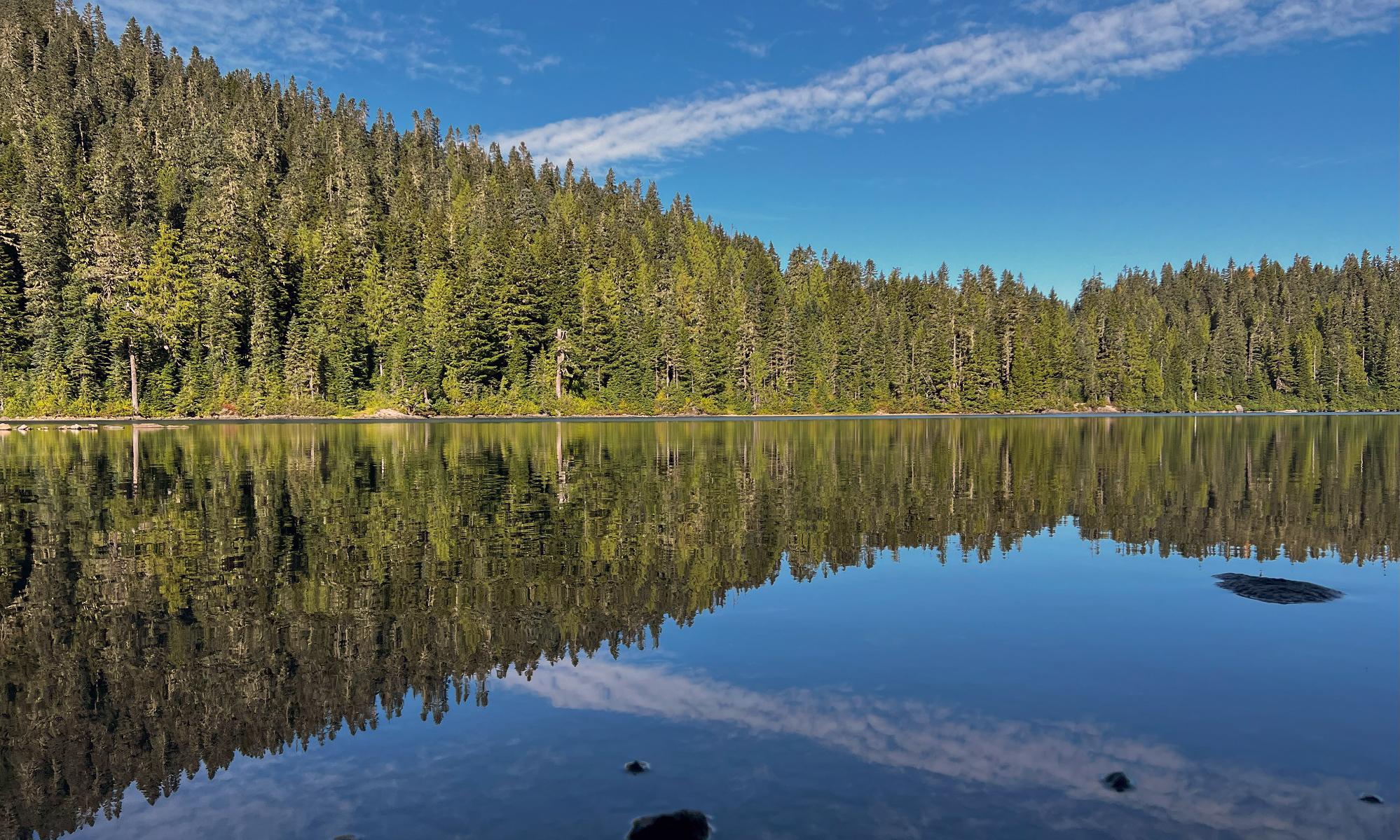
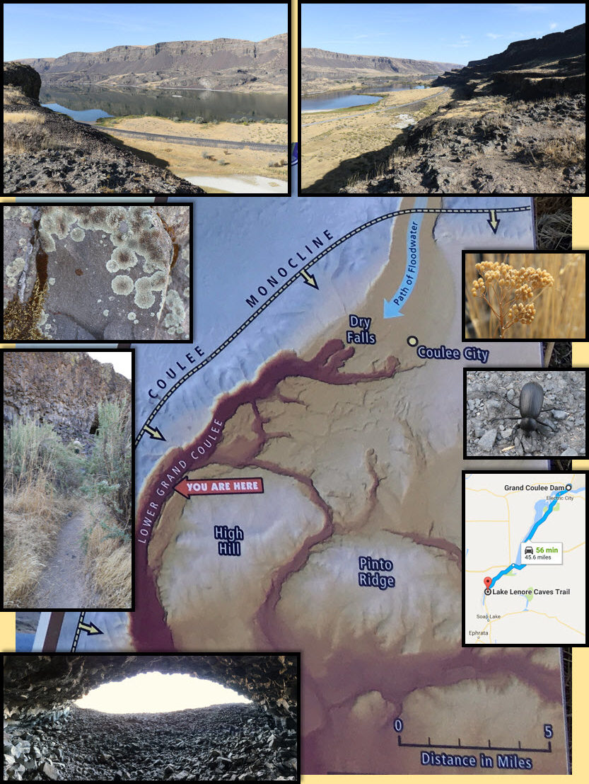
(These pictures are from Wednesday). We made a stop at Lake Lenore on Wednesday. Lake Lenore is a long, narrow lake (8 mi long, 15ft deep) formed by the Missoula Floods in the lower Coulee just north of the town of Soap Lake. There is a trail that leads up to caves in the basalt rock.
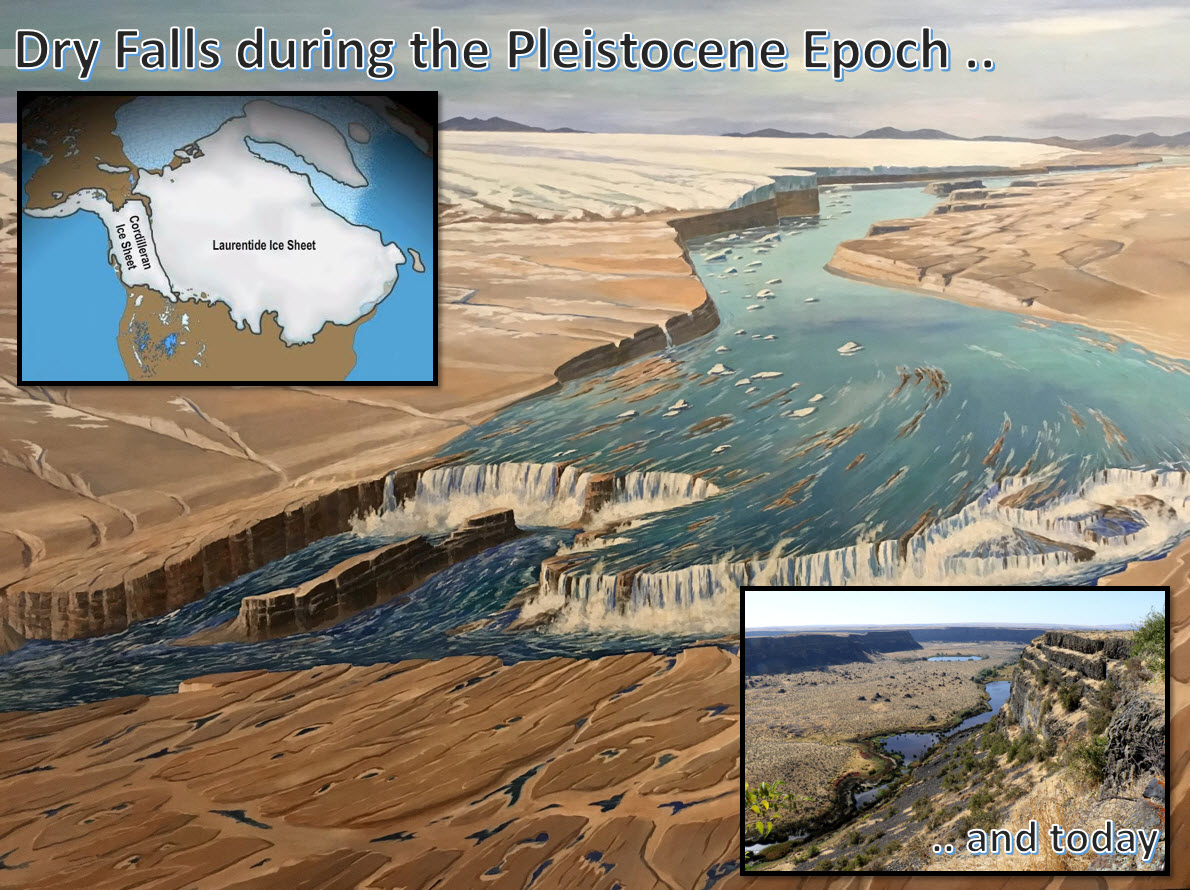
Driving further up north on Highway 17 brings one to Dry Falls, named for the massive waterfalls that existed there during the Pleistocene Epoch, when ice sheets and glaciers covered huge parts of Earth’s surface. This area was at the southern end of the Cordilleran ice sheet, and the melting of the glaciers carved out the coulees in the basalt rock that we see today.
Clockwise from the top: looking southwest & northwest toward the ‘coulee monocline’ bluffs over Lake Lenore, with Highway 17 below; dry vegetation and a black beetle; Lake Lenore lies alongside Highway 17; view from inside one of the caves formed by the plucking out of pieces of the basal rock by the rushing Missoula Flood waters; footpath to the caves; beautiful lichen. Lichens are composite organisms that emerge from algae or cyanobacteria living among the filaments of two fungi in a mutually beneficial symbiotic relationship.The main picture is from inside the visitor center at Dry Falls. The picture that I took (bottom right) is the view looking south, away from the cliffs of the Dry Falls. The Pleistocene Epoch began about 2.6 million years ago and lasted until about 11,700 years ago. The most recent Ice Age occurred then (there have been at least FIVE in Earth’s history). At the time of the Pleistocene, the continents had moved to their current positions. Large parts of the northern continents were covered by glaciers, but they did not just sit there. There was a lot of movement over time, and there were about 20 cycles when the glaciers would advance and retreat as they thawed and refroze.